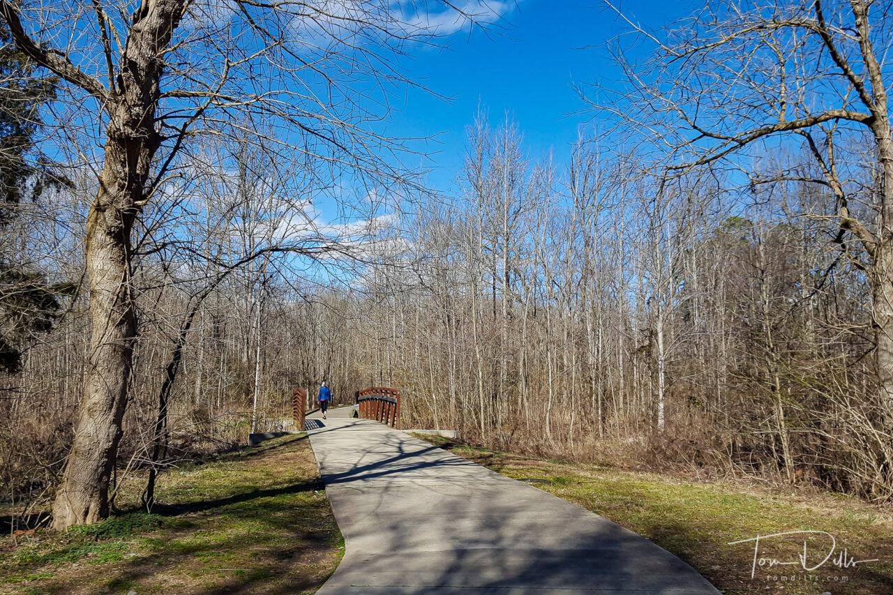
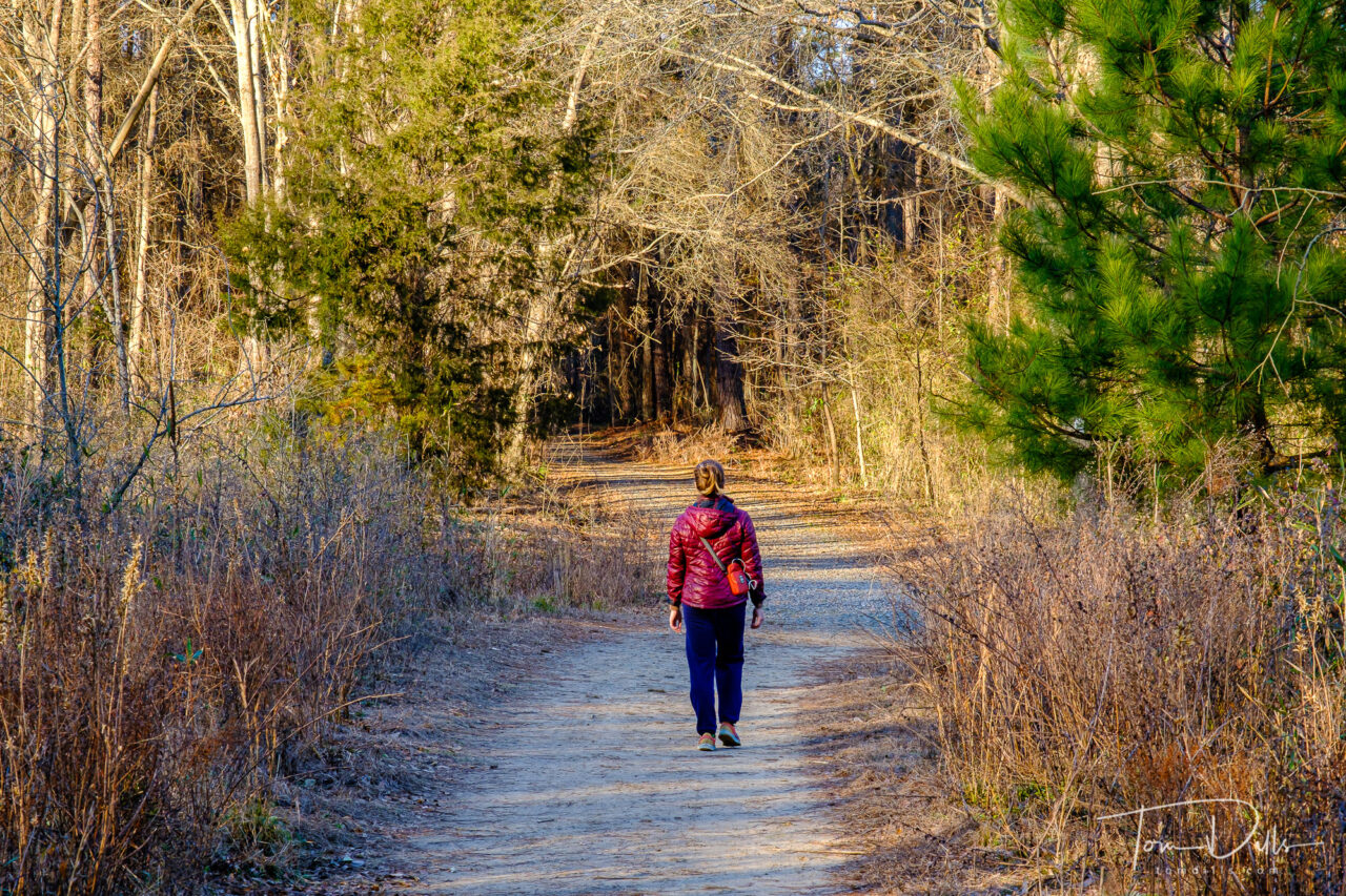
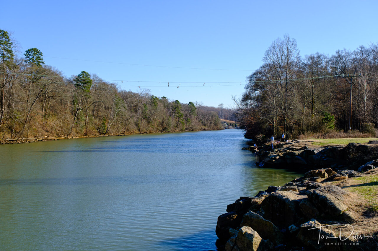
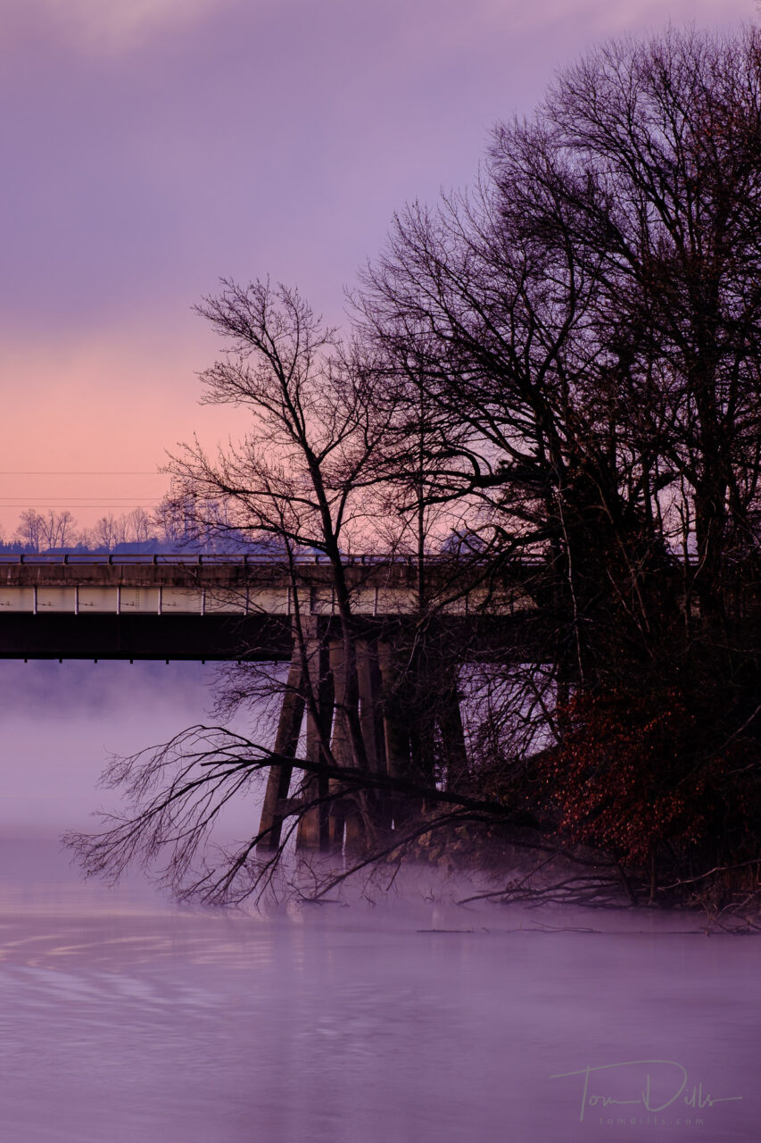
Torrence Creek Greenway in Huntersville, North Carolina
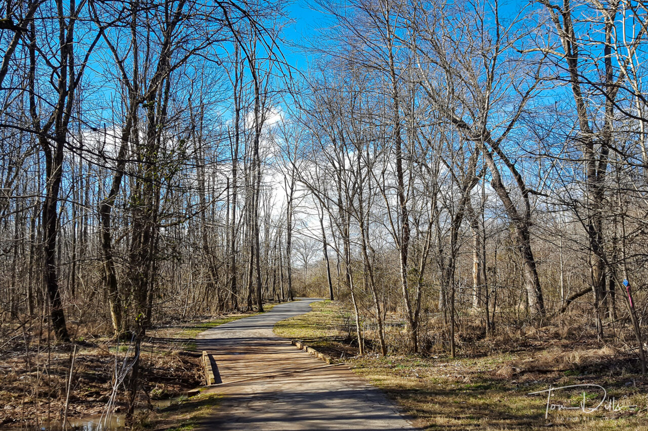
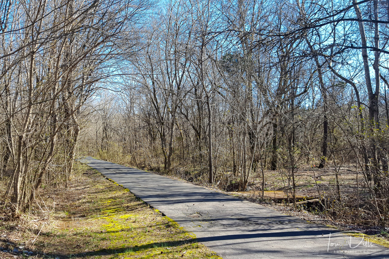
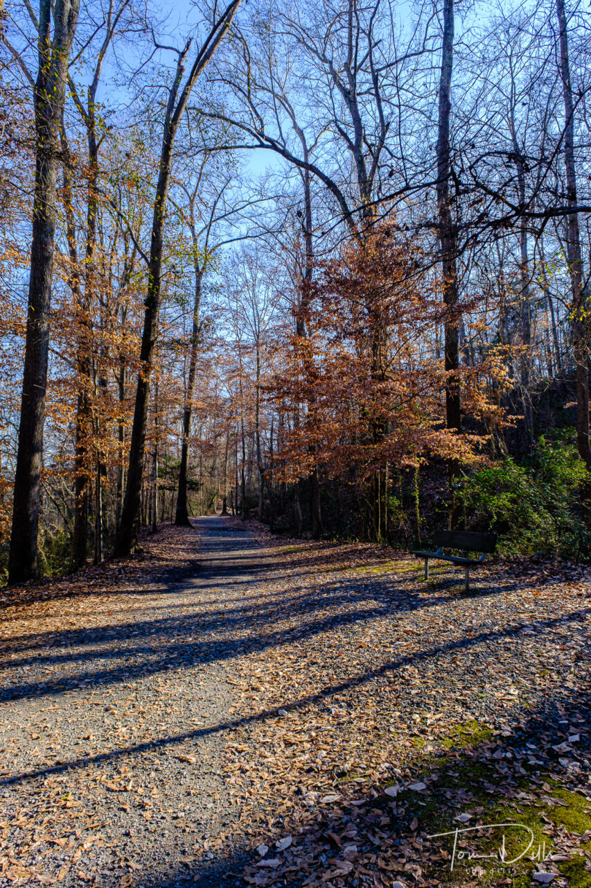
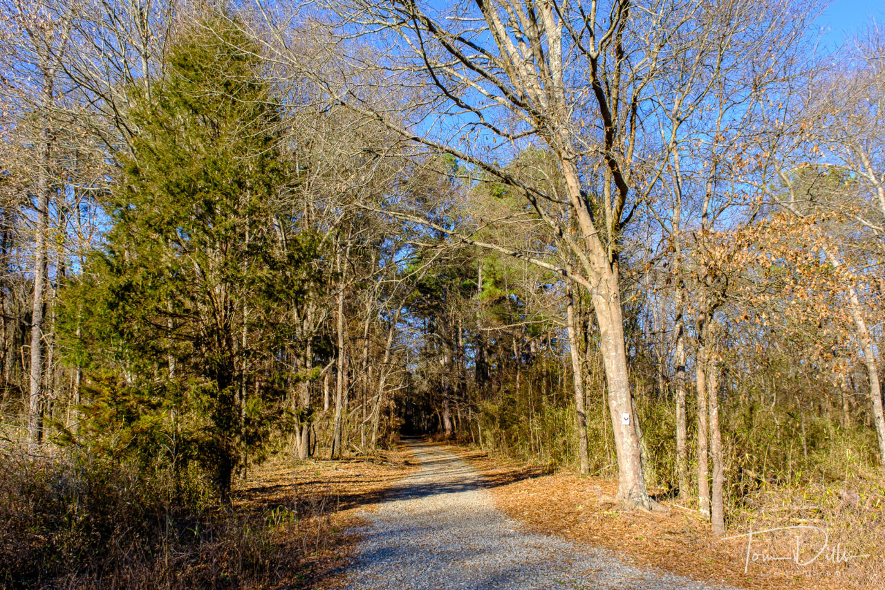
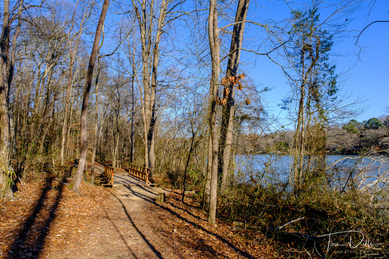
Kathy & I took advantage of today’s break in monsoon season with a 3-ish mile walk along the Torrence Creek Greenway in Huntersville. A portion of the trail runs along the edge of Cedarfield, our former neighborhood. In the years since we moved there have been some additional trails built. We know that portion quite well and I have taken hundreds of photographs of the area in all seasons. Today I had only my phone, but the photos will give a sufficient overview.
Torrence Creek Greenway in Huntersville, North Carolina
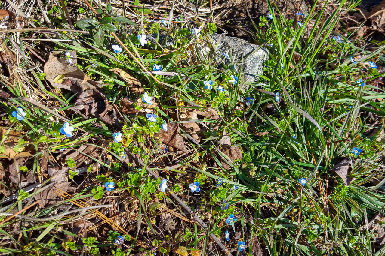
Water levels were high after last night’s rains, but other than some mud in low-lying places it was mostly dry. We spotted some early spring bluets and even a few dandelions along the trail, plus a pair of red-tailed hawks shadowed us on our walk back to the car.
Torrence Creek Greenway in Huntersville, North Carolina
There are a number of places to access the trail, but we parked along Bradford Hill Lane near the intersection with Gilead Road. It’s easy to find and about a 10-mile/20-minute drive from our neighborhood. The trail is all paved, mostly flat with lots of options for various routes and distances. The trails are well marked and numerous signboards with maps provide useful information.
Bluets along the Torrence Creek Greenway in Huntersville, North Carolina
I tried to add a link to the website for the Greenway, but both the Mecklenburg County and the Town of Huntersville pages have broken links. 🙁
Tom’s Trail Summary:
Length: From Bradford Hill Lane to Rosewood Meadow Lane is 1.6 miles, or 3.2 miles round trip. There are several options for shorter and longer loops, or out-back for a shorter distance is possible.
Terrain: Flat
Surface: Paved with a few muddy spots after heavy rains. Good walking shoes are sufficient.
Comments: The trail is shared with cyclists and dog walkers. No motorized vehicles. Pleasant walking along the Torrence Creek with some road noise from Gilead Road and barking dogs from nearby neighborhoods. Will be pretty in the spring as trees and plants green up. I tried to find a link to a trail map but the county and town links were broken!
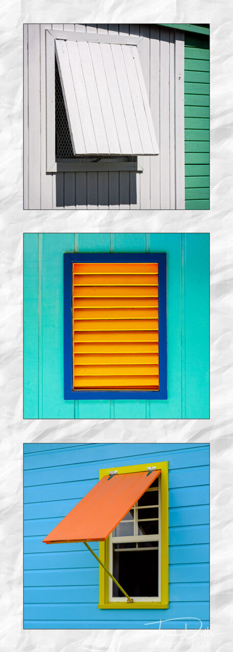
I mentioned in an earlier post how we had recently had our bathrooms and bedrooms repainted, and that I had been given the “assignment” of providing prints for the walls. I’ve been thinking for a few months about the proper theme and color palette for each room. I’m still cogitating on the bedroom and master bath, – actually waiting for a new chair and draperies to arrive – but I finally settled on a scheme for the hall bathroom.
Grid of 8-inch Squares on a 10×28 Gallery Wrap
I’ve always tried to stay away from using other photographer’s work in my bathrooms, not being sure how that would come across. 😉 I’ll admit to previously having a John Shaw print and a Les Saucier print in our master bath, but neither of those two gentlemen are ever likely to set foot in our house, let alone the bathroom.
20×30 Canvas Float Wrap
In general, Kathy & I are going for images that capture our sense of travel, showing a sense of the places we have visited without being “literal.” When we decorated our sunroom with prints from a St. Martin artist, we wanted it to “feel” tropical without sea shells and palm trees. The colors and fabrics express that well. For our bathroom we wanted a splash of color – ideally Caribbean-inspired. I think we got there with these three selections. We’ll then get to hunt for accessories to go with what we have and these prints. Another reason to get back on the road again soon!
For now these are just files – my print lab starts their “sample sales” soon and I’m hoping to save a little $$$ by waiting a few weeks! 🙂
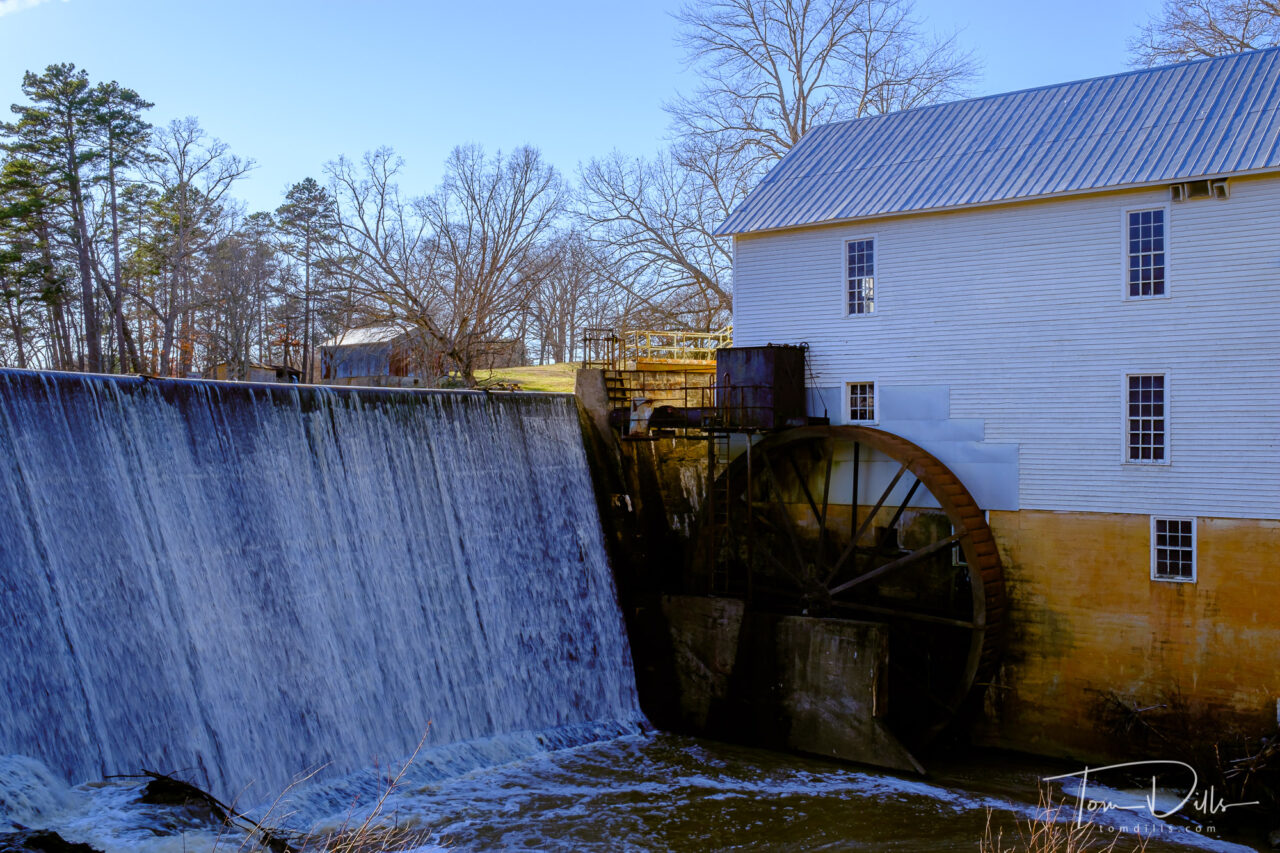
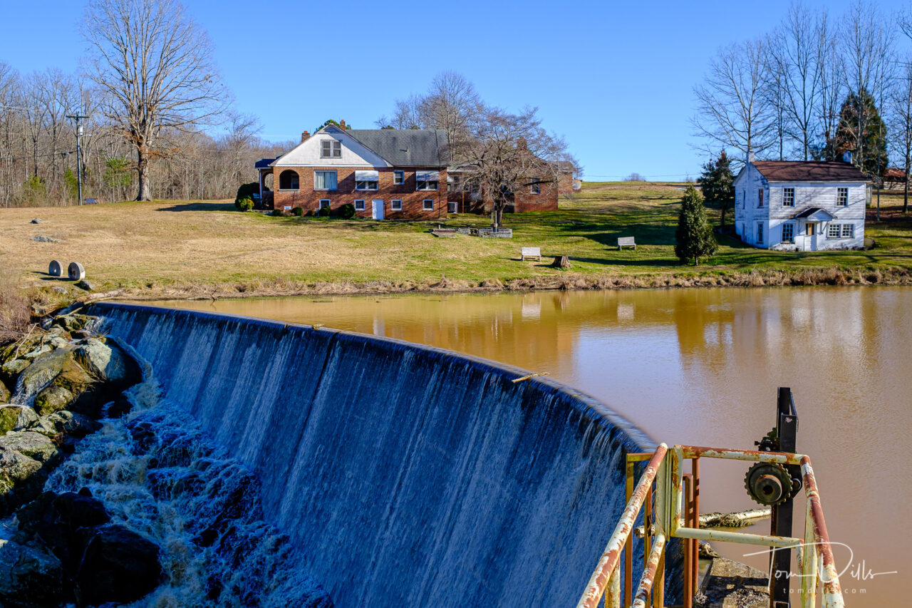
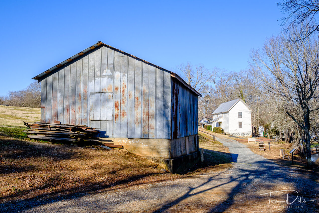
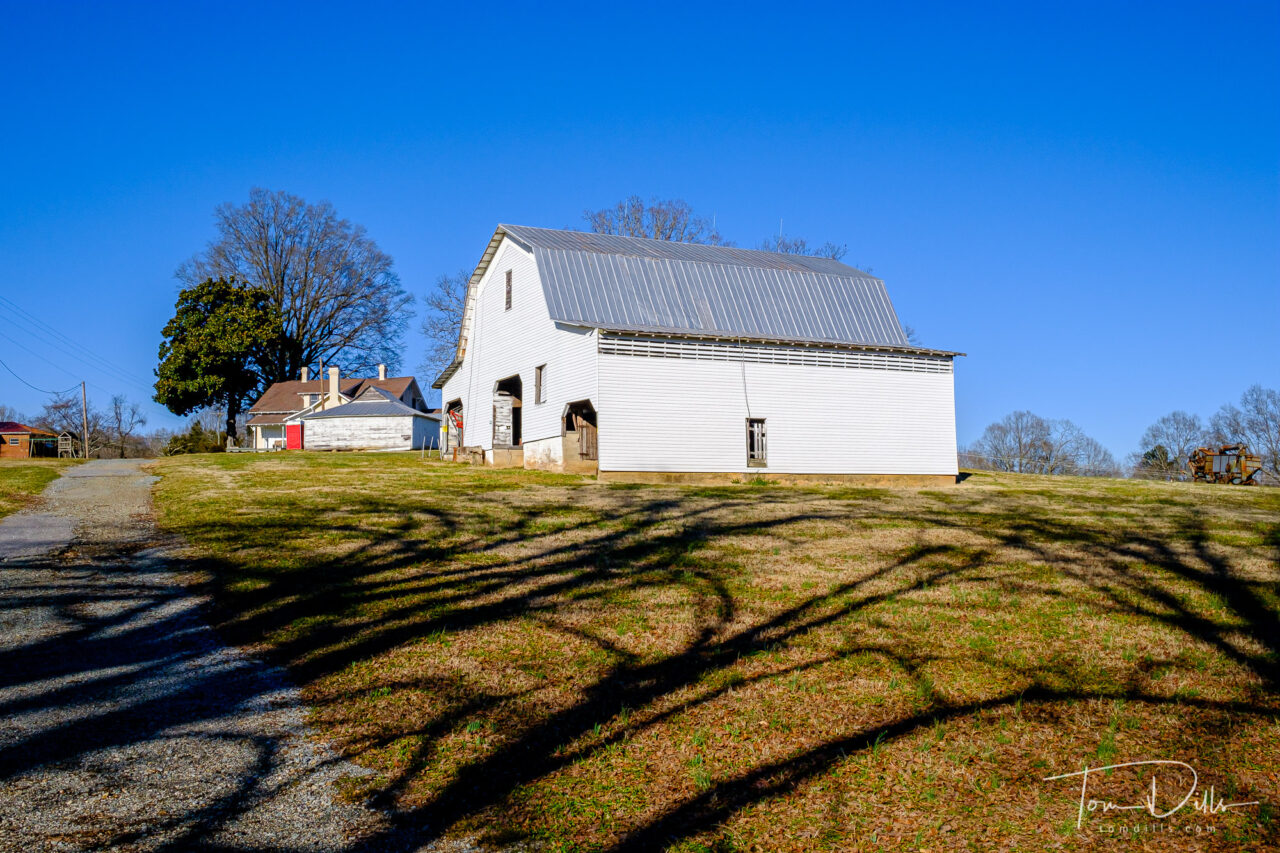
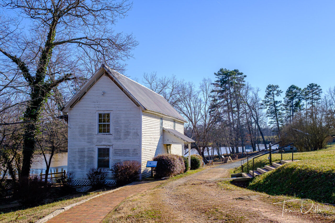
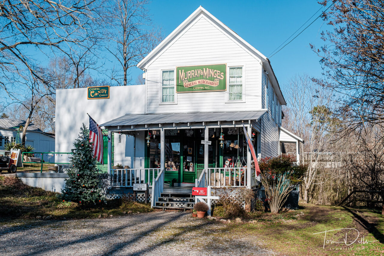
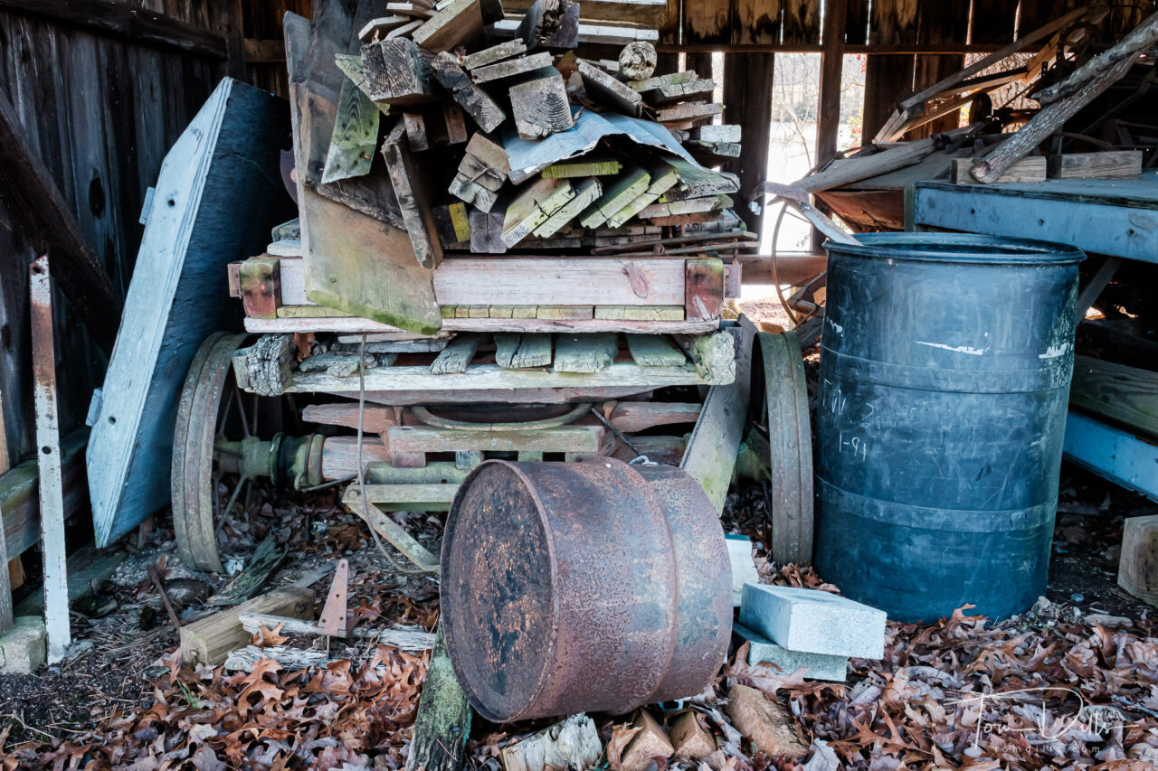
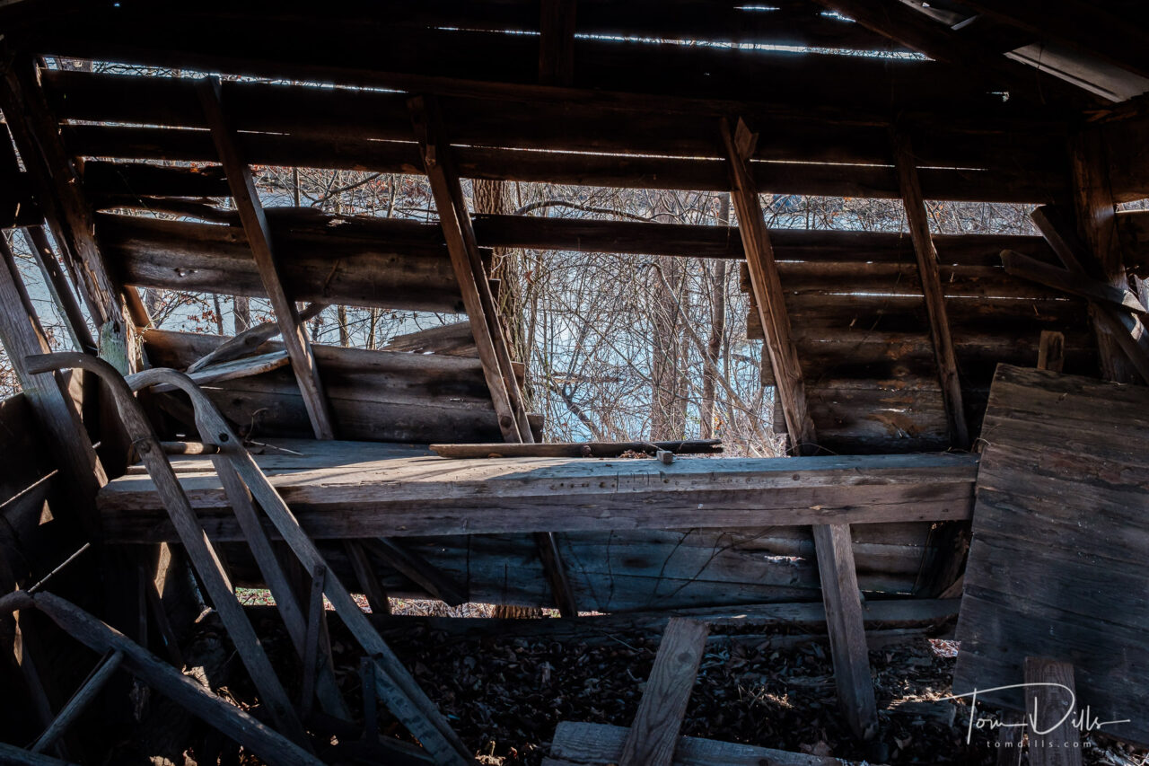
Murrays Mill Historic Site located in Catawba, North Carolina
Earlier this week, Kathy & I were itching to go somewhere. It was a chilly day and we didn’t want another 3-mile hike so we headed north to Murray’s Mill Historic site.
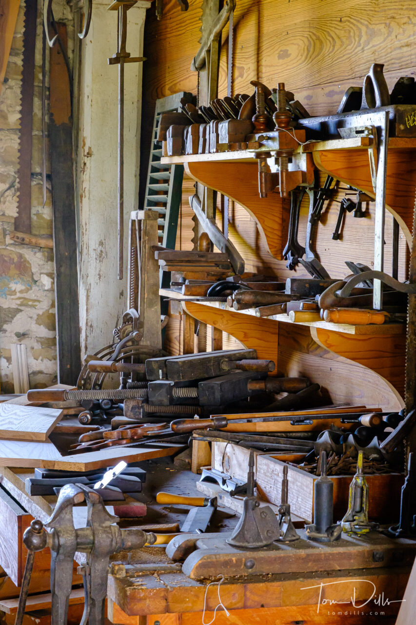
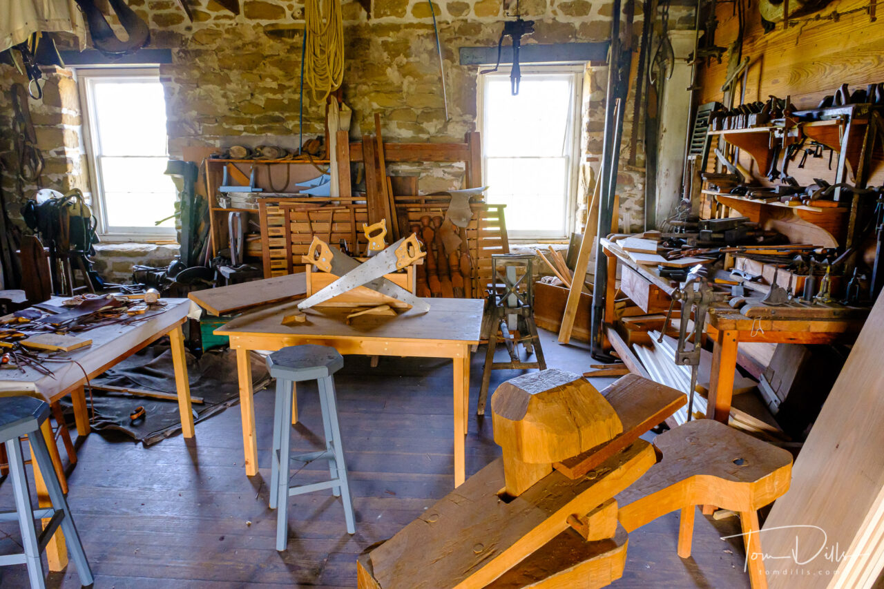
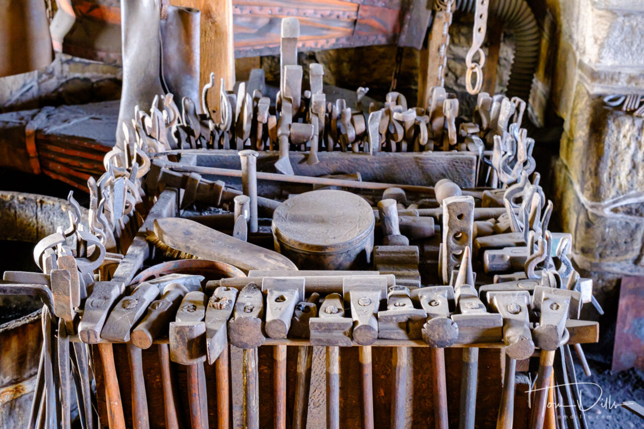
Murray’s Mill Historic Site is an easy 30-minute drive from our house and is operated by the Historical Society of Catawba County. The website says that the mill is open most days, but it did not appear to be open on the day of our visit. There are a number of interesting outbuildings including a blacksmith shop. A small general store there had a sign that said it was open, but we didn’t go in.
We walked around the grounds, and while it was a chilly day, the fresh air and scenery was nice. There is a “literacy trail” with signboards along a walkway describing a children’s book “Dragons Love Tacos.” In warmer weather they have other activities going on. Something to do on a nice day.
Spillway at Murrays Mill Historic SiteMurrays Mill Historic Site located in Catawba, North CarolinaMurrays Mill Historic Site located in Catawba, North CarolinaBarn on the grounds of Murrays Mill Historic Site located in Catawba, North CarolinaMurrays Mill Historic Site located in Catawba, North CarolinaGeneral Store at Murrays Mill Historic SiteMurrays Mill Historic Site located in Catawba, North CarolinaIs This What They Mean by ‘Lean In?’Christmas Is OverLens Flare, Anyone?
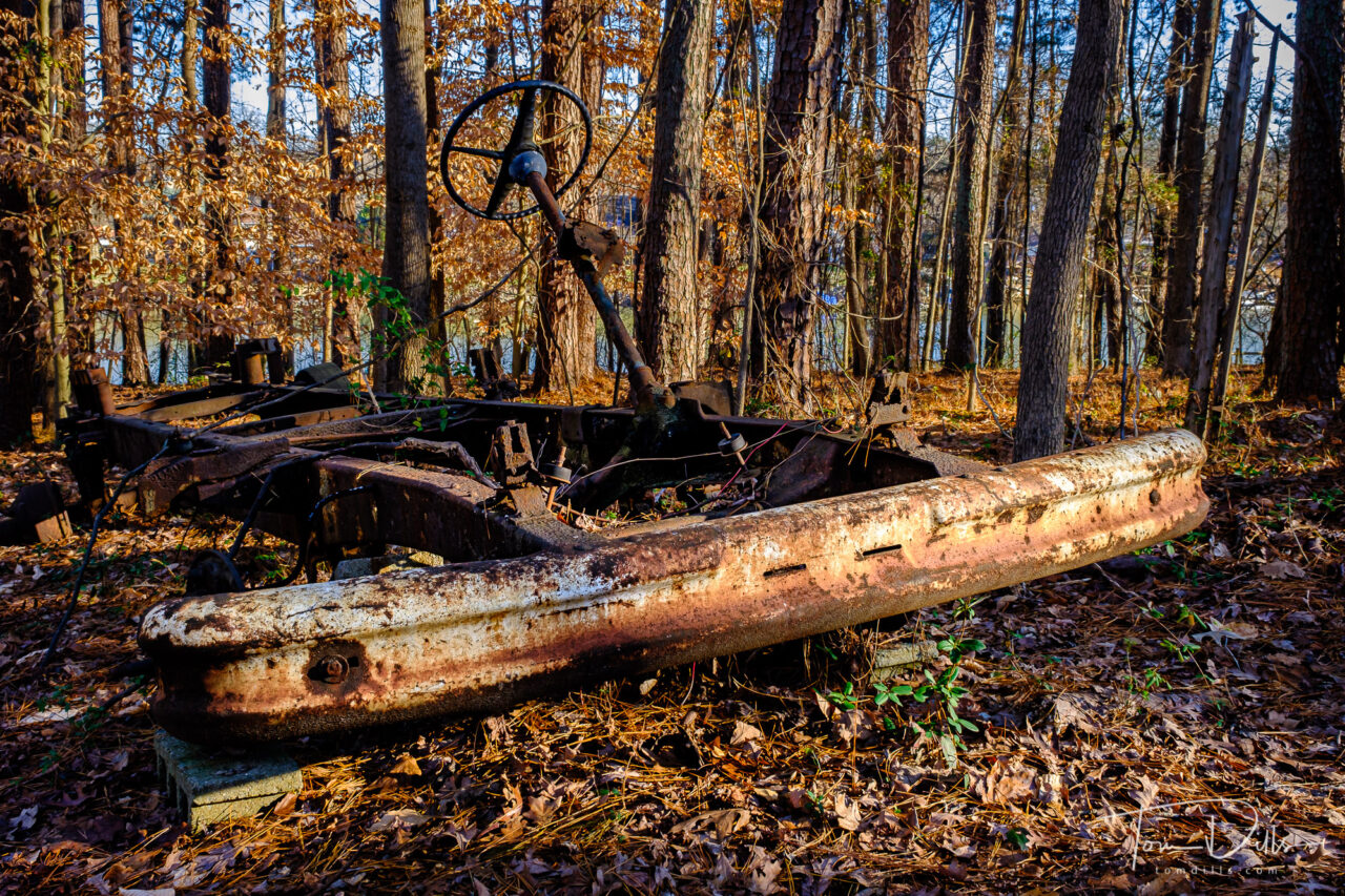
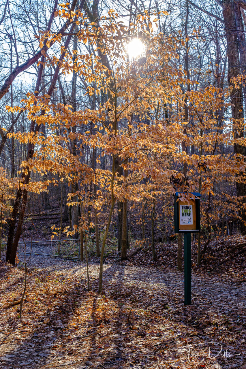
Long-abandoned truck chassis along the Mount Holly Trail
I spotted this old relic during our walk a few days ago. It might make for an interesting photo study, except for the fact that it sits at the very end of the 1.5-mile trail!
I keep thinking that this would make a decent black & white image, but I haven’t come up with a version I’m happy with. When I take the color out the tones are all the same and the image looks like a flat, jumbled mess. I’ll keep working with it to see what I can do, but in the meantime I like the color version just fine!
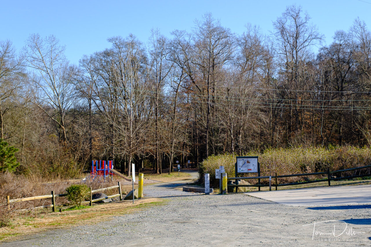
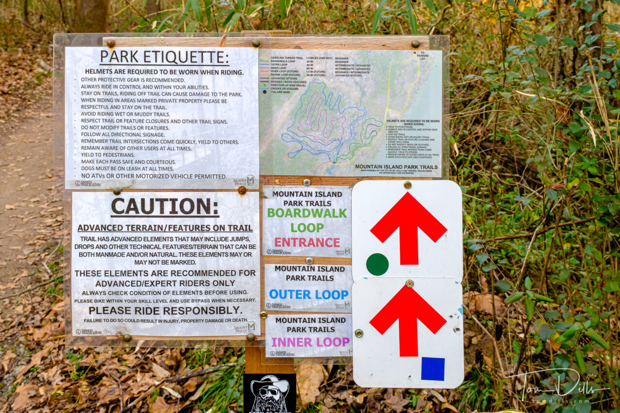
Mount Holly Trail at Mountain Island Park in Mount Holly, North Carolina
Kathy & I were recently looking for someplace different to walk besides the sidewalk between our neighborhood and the main drag, and decided to explore the Mount Holly Trail at nearby Mountain Island Park. Walmart and Micky D’s are only so scenic!
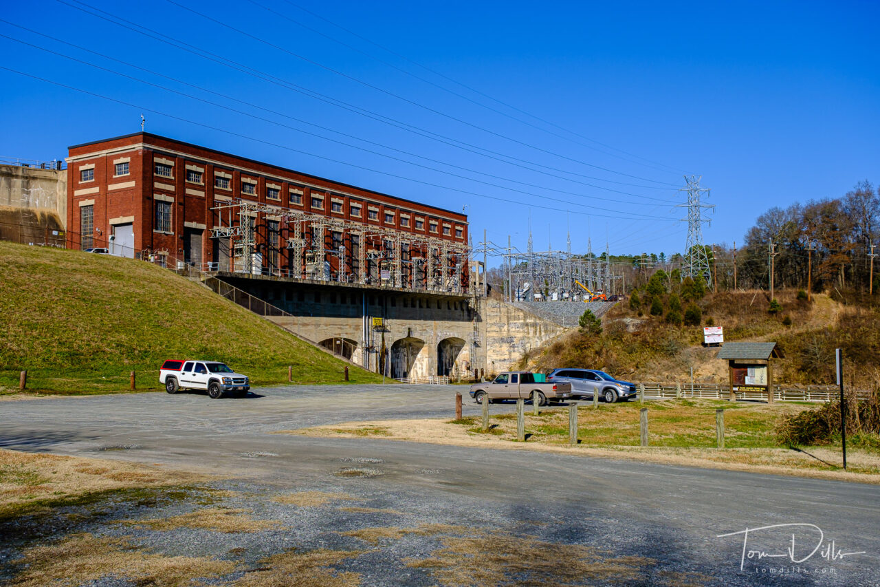
Parking area and playground for the Mount Holly Trail at Mountain Island Park in Mount Holly, North CarolinaMountain Island Hydroelectric Facility in Mount Holly, North Carolina
The park is located next to the Mountain Island Hydroelectric plant at the south end of Mountain Island Lake, just outside the town of Mount Holly and only about 8 miles from our neighborhood. The park contains a large parking lot with fishing area, small playground and hiking/biking trails. We walked the 1.6-mile trail to the end and back, which made for a nice afternoon.
Mount Holly Trail at Mountain Island Park in Mount Holly, North CarolinaMount Holly Trail at Mountain Island Park in Mount Holly, North Carolina
The trail is mostly an easy walk for anyone in reasonably good walking shape. There are a few hills, mostly on the far end from the parking area. A portion of the trail surface close to the parking area is pretty coarse gravel, which makes for rough walking for a bit. This area of the trail is close to the river, and I would guess it floods occasionally, thus the need for heavier base. We were there on a dry day without a lot of heavy preceding rain, and there were a few muddy places along the trail. Overall the trail is in very good shape, but I would suggest sturdy shoes. The woods should be very pretty as the trees and vegetation green up in the spring.
Mount Holly Trail at Mountain Island Park in Mount Holly, North CarolinaMount Holly Trail at Mountain Island Park in Mount Holly, North Carolina
We were there on a Wednesday in January, so there was not much traffic, mostly couples and people with dogs. We saw a few mountain bikers on main trail as well as the adjacent mountain bike trails as it got later in the day, but not too bad.
Mount Holly Trail at Mountain Island Park in Mount Holly, North CarolinaMount Holly Trail at Mountain Island Park in Mount Holly, North Carolina
We’re hoping to explore some more walking & hiking areas over the coming months, and I will report on them here for anyone who is interested. Or anyone who just wants to see the photos!
Tom’s Trail Summary:
Length: 1.6 miles to the end, or 3.2 miles round trip. There are several options for shorter loops, or out-back for a shorter distance is possible.
Terrain: Mostly flat with occasional hills
Surface: Mostly dirt with a few gravel places. Recommend sturdy shoes like hiking boots.
Comments: The trail is shared with mountain bikers and dog walkers. No motorized vehicles. Pleasant walking along the Catawba River. Should be pretty in the spring as trees and plants green up. I tried to find a link to a trail map but could only find a Google Map to the parking area!
Mount Holly Trail at Mountain Island Park in Mount Holly, North Carolina
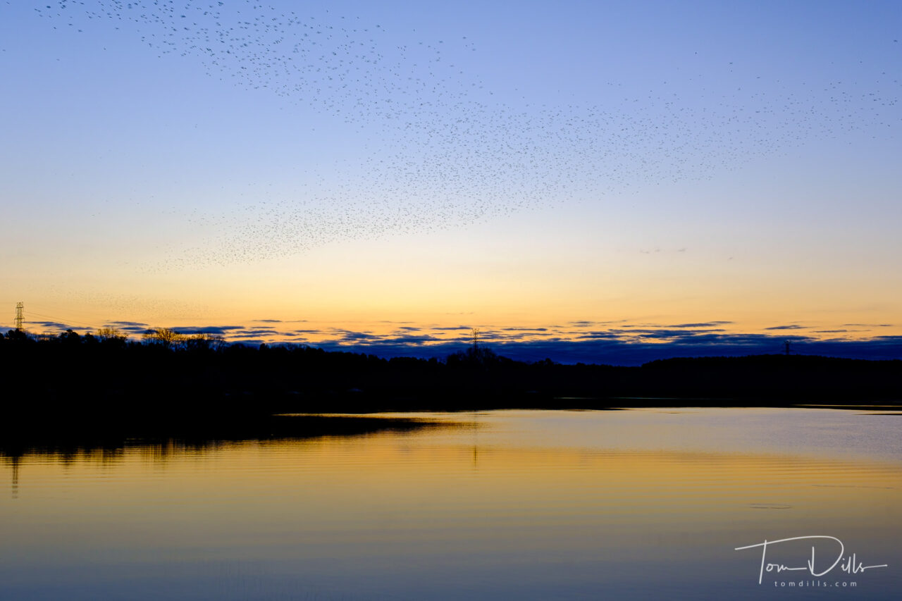
Aerial demonstration of birds over Mountain Island Lake
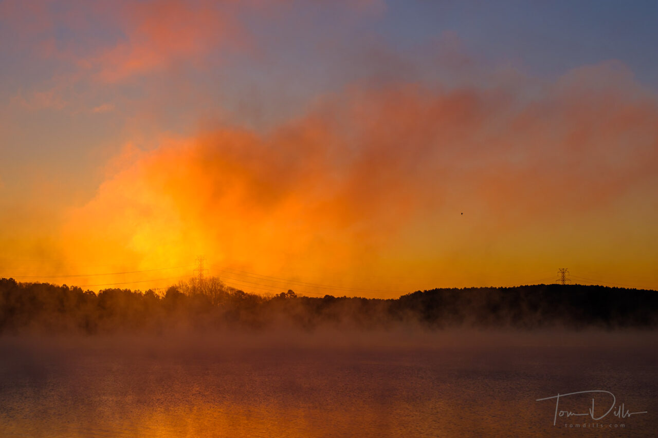
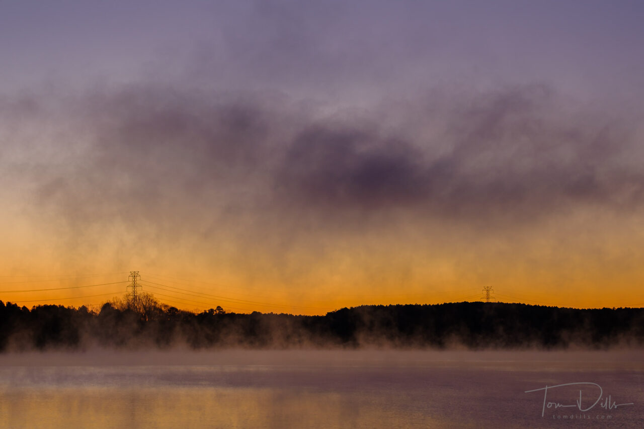
I had to wait until this morning to have my first sunrise opportunity of the year. The weather the last few days has basically been crap, but the forecast for this morning held promise. Rather than set an alarm I told myself that if I woke up in time I would head out to see what I might find. Usually when I try that approach I either wake up too early or too late, but this morning I woke up at 5:50 which was just about perfect.
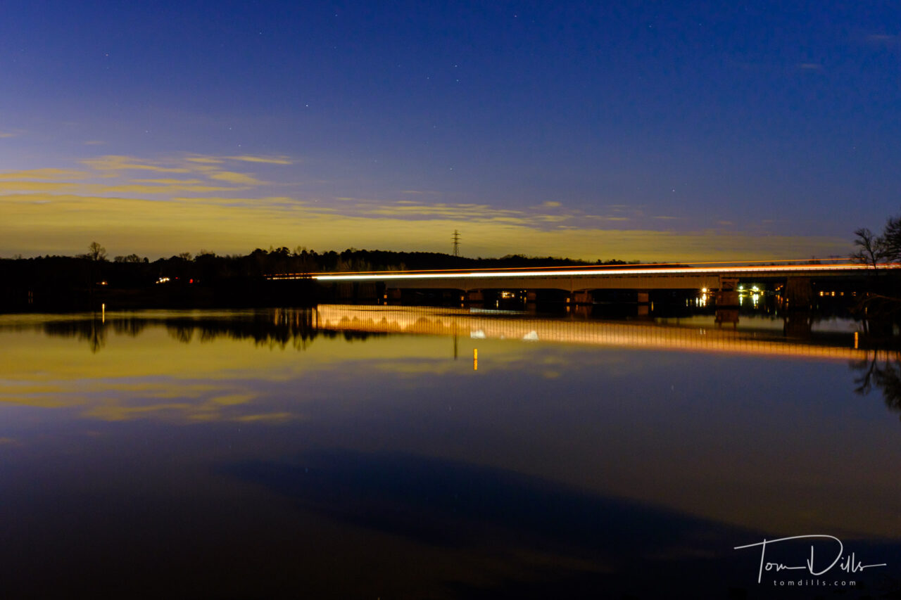
Clouds lit by city lights from Mountain Island Lake from the Riverbend Boat Launch. No, that’s not a fire – Christmas Lights!
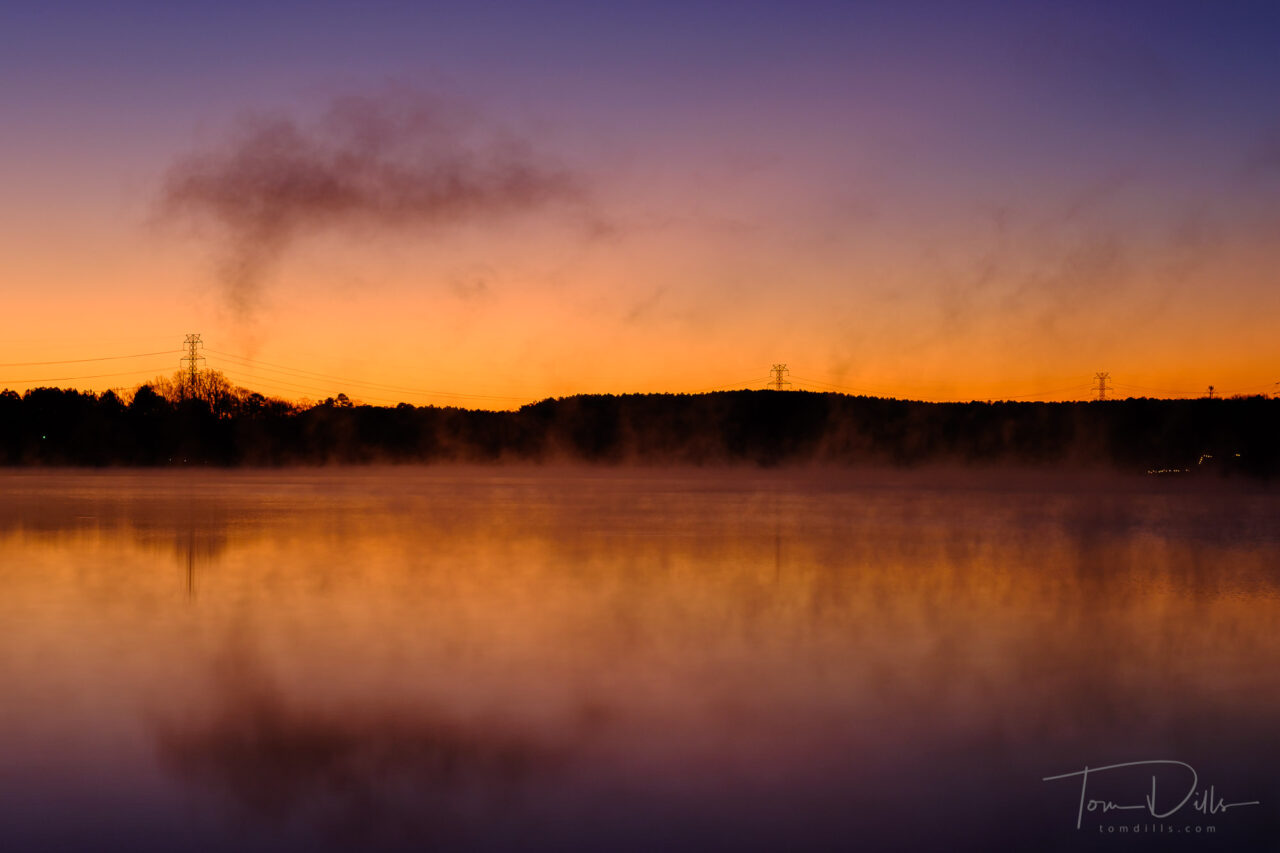
I arrived at the boat launch area right at 6:30 and was treated to some amber city-lit clouds low to the horizon and a clear sky with clouds above. Pretty sweet! No fog this time, but that was good for better reflections. I got a few shots of that then aimed my camera at the causeway to catch some light trails. There is a lot more traffic on a Monday morning than there was on the Sunday morning when I last visited!
Car trails on the causeway over Mountain Island Lake
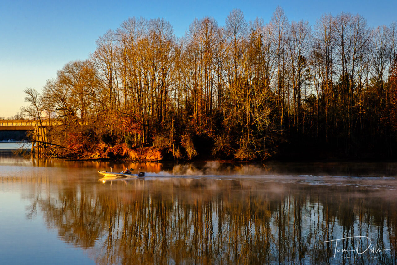
The parking lot was completely deserted when I arrived, but the first boater showed about about 6:45. He was well organized and put in quickly, but it was too dark to get anything usable. The second boater arrived about 7:15, took his time futzing around with this gear and finally left the dock just as the sun was coming up. That made for some good light on the boat as it putted through the No Wake zone.
Father-daughter morning fishing expeditionSunrise over Mountain Island Lake from the Riverbend Boat Launch
The bonus though was that, all of a sudden, I heard birds, lots of them. Then overhead came a huge cloud of some kind of small black birds, probably starlings, grackles or similar black birds – hundreds of them! And that cloud was followed by another, then another. I have no idea how many of them there were, but there were a bunch. Fortunately I had my camera set up for a wide angle shot of the water and sky, so I was able to catch a few frames with the birds, even though they were a bit blurry. They were moving fast!
Sunrise over Mountain Island Lake from the Riverbend Boat Launch
So in addition to a pretty sunrise I got an impromptu air show! All in all it was a worthwhile visit and I got a few shots to start off the new year. The weather looks like might deteriorate again the next few days but I’ll keep a lookout for another opportunity!
Sunrise over Mountain Island Lake from the Riverbend Boat Launch
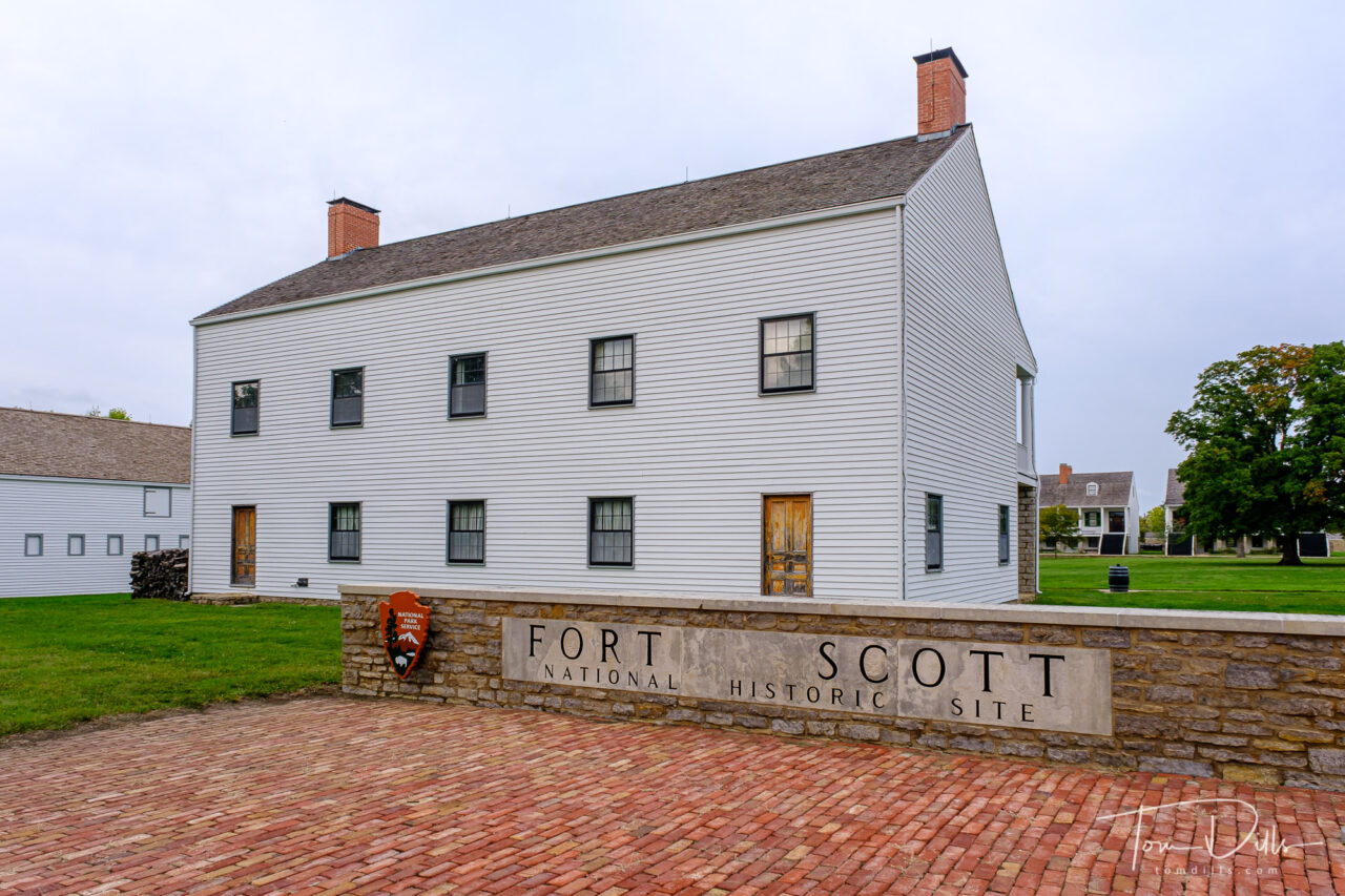
Fort Scott National Historic Site in Fort Scott, Kansas
I’ve finally finished processing all of my picks from our Pacific Northwest road trip!
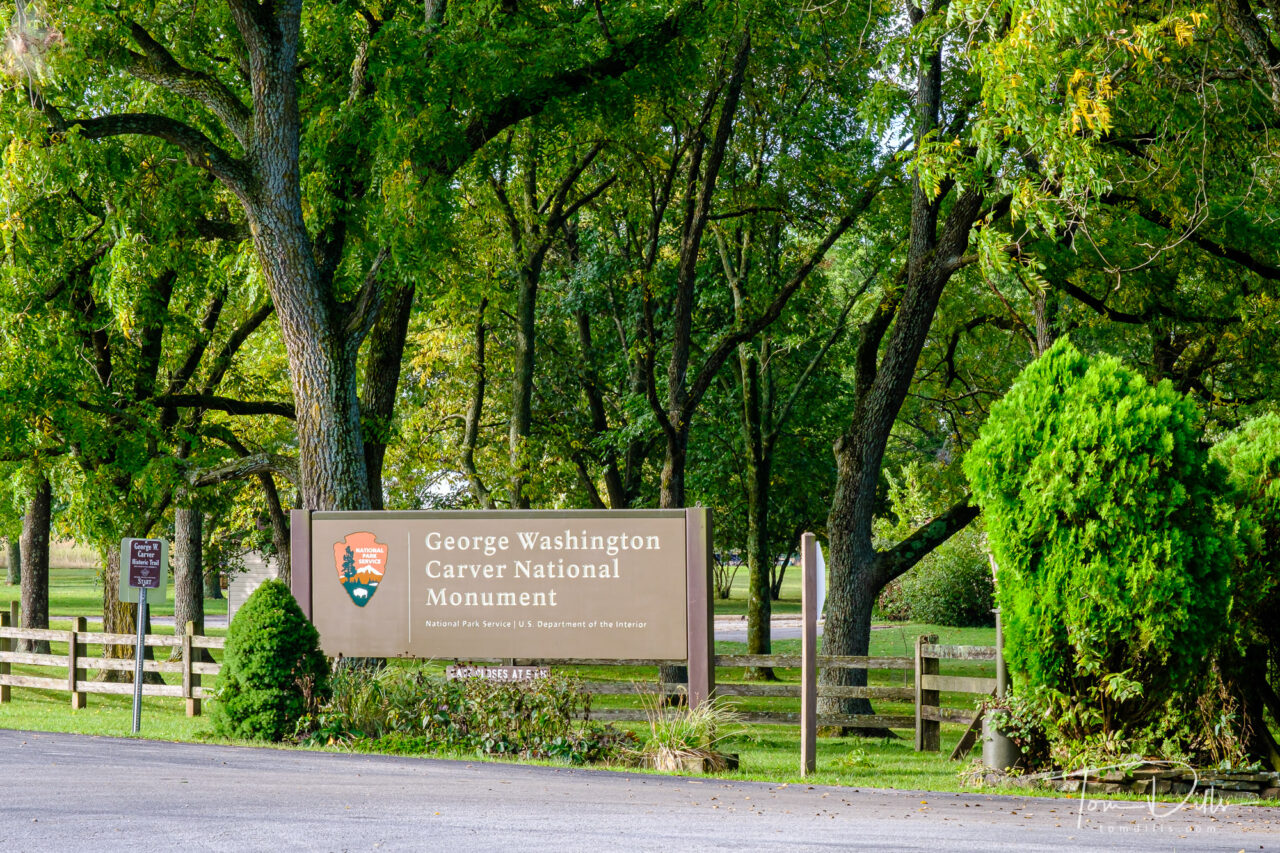
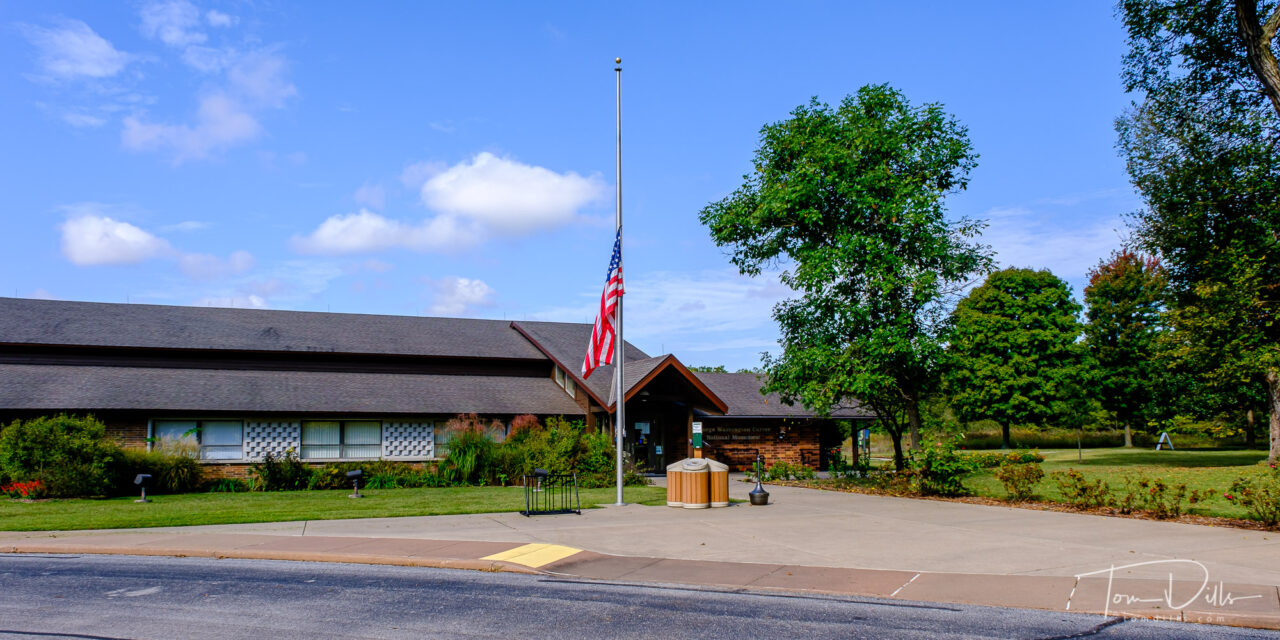
The last two stops were Fort Scott National Historic Site in Fort Scott, Kansas and George Washington Carver National Monument near Diamond, Missouri.
Fort Scott National Historic Site in Fort Scott, KansasFort Scott National Historic Site in Fort Scott, KansasFort Scott National Historic Site in Fort Scott, Kansas
The two things we most wanted to do in Fort Scott were (1) visit the fort and (2) visit the Gordon Parks Museum. The trip from Fort Larned took longer than we expected, so we arrived at the fort just as they were shutting down for the day. Fortunately, a kind ranger was able to arrange for Kathy to get her Passport book stamped, and we were only able to see the outsides of the buildings.
Fort Scott, Kansas
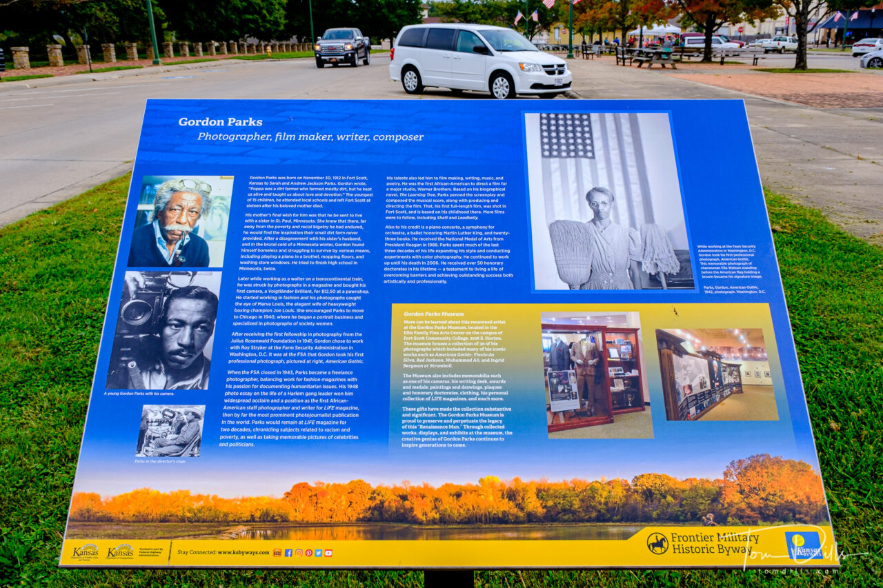
The Gordon Parks Museum is part of Fort Scott Community College, and the college was closed at the time we passed through. So that will need to be reserved for a future trip. The town of Fort Scott was very quaint with a number of interesting looking shops and restaurants, so it’s likely that we’ll make a point of getting back there at some point.
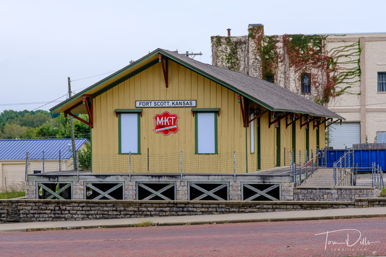
Old train station in Fort Scott, KansasFort Scott, Kansas
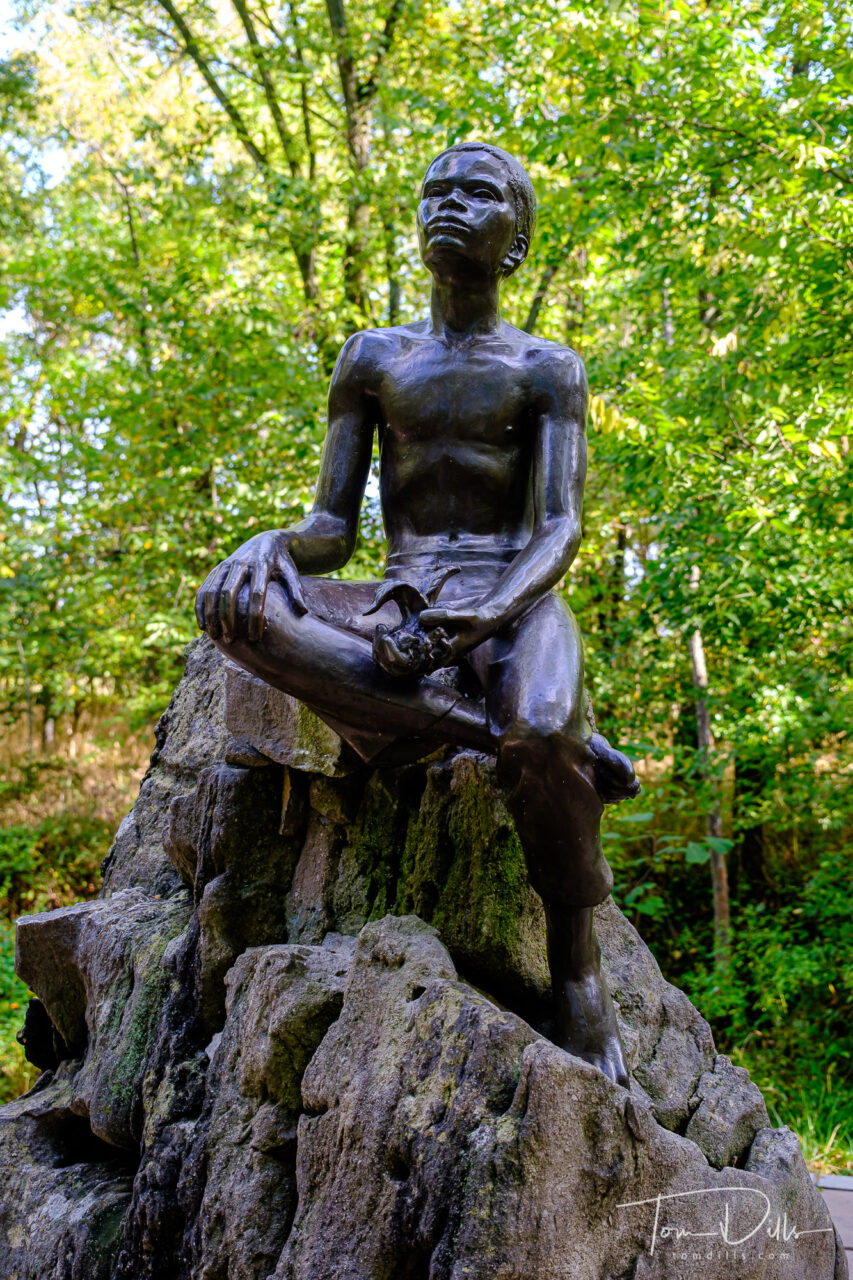
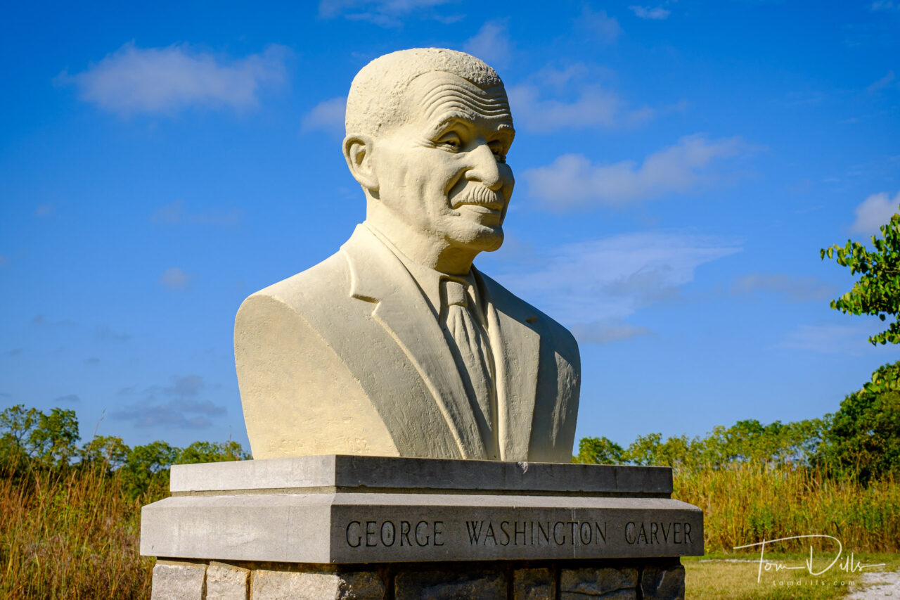
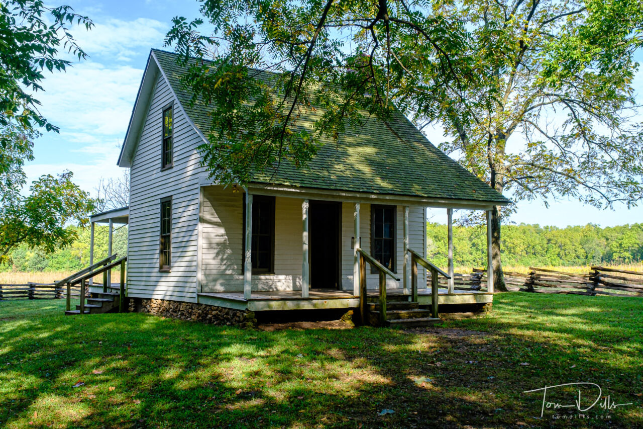
After spending the night in Joplin, MO we stopped at George Washington Carver National Monument the next day enroute to our last overnight in Clarksville, TN. We had always thought of Carver as the “peanut guy” but he did far more than that. It was another unexpectedly educational visit. After our night in Clarksville we “took the last train” and drove home through Tennessee while (unsuccessfully) dodging heavy thunderstorms!
George Washington Carver National Monument near Diamond, MissouriGeorge Washington Carver National Monument near Diamond, MissouriGeorge Washington Carver National Monument near Diamond, MissouriGeorge Washington Carver National Monument near Diamond, MissouriGeorge Washington Carver National Monument near Diamond, Missouri
All in all we drove a total of 8,230 miles over 25 days, and I took nearly 4,500 photos. My picks brought the total down to 1,745 and there are just over 800 photos in the 10 online galleries.
I now have a complete collection of photos from our road trip in my Adobe Portfolio page here.
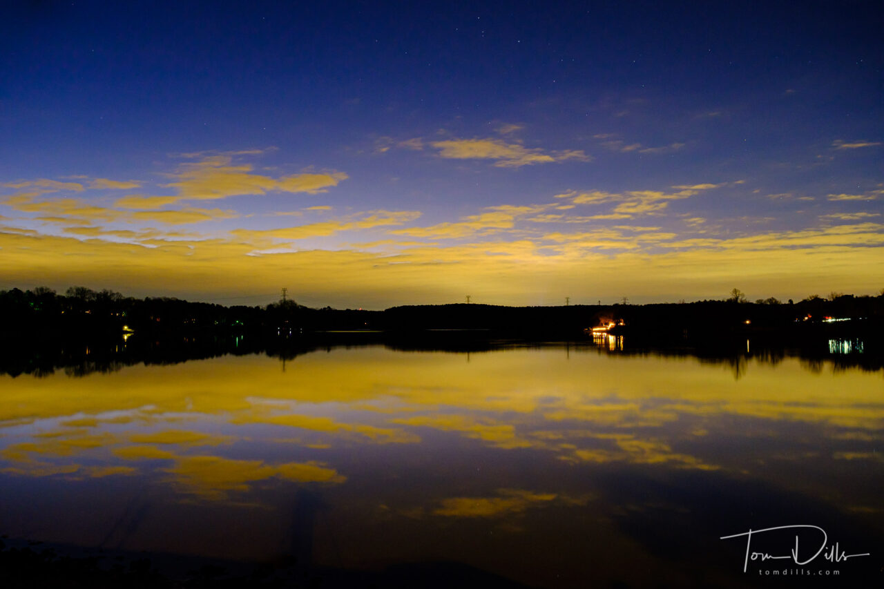
Sunrise over Mountain Island Lake from the Riverbend Boat Ramp
I woke up this morning about 5:45. A little early for me but not unusual. As I lay in bed listening to the furnace cranking out some welcome BTUs, I started hearing this voice. A voice that sounded hauntingly similar to the voice in a podcast I listen to. This voice was saying, “ya know, this might just be one of those mornings where you’ll be glad you went out to make photographs.”
Sunrise over Mountain Island Lake from the Riverbend Boat RampSunrise over Mountain Island Lake from the Riverbend Boat Ramp
I reluctantly crawled out from under the covers, wandered down the hall to my computer, where the Weather Service told me that it was 25 degrees. Ugh. I almost got back into bed. Reasoning that 25 degrees wasn’t any colder than Fort Collins, and remembering that the UP of Michigan is even colder, I resisted and got up.
Although I got rid of my down parka and Sorel boots when we left Ohio 26 years ago, I thankfully held on to some long underwear and wool socks, and I knew where to find them! So I got out my stuff, gathered my gear and headed out.
Sunrise over Mountain Island Lake from the Riverbend Boat RampSunrise over Mountain Island Lake from the Riverbend Boat Ramp
I arrived at my newly-found sunrise spot at right about 6:30, an hour before sunrise and my preferred time to start taking morning photos. The best color in the morning often happens long before anyone else has their camera ready, just like in the evenings the best color happens while most everyone has packed up and is heading off to dinner.
Sunrise over Mountain Island Lake from the Riverbend Boat RampSunrise over Mountain Island Lake from the Riverbend Boat Ramp
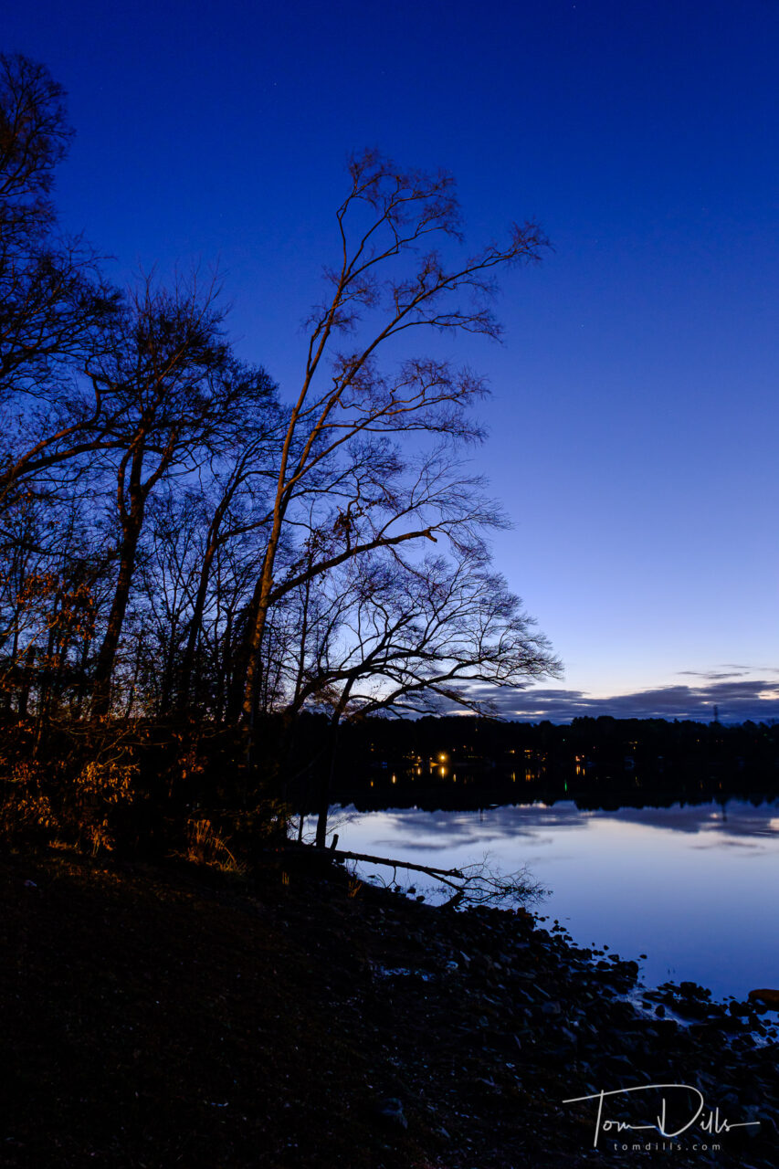
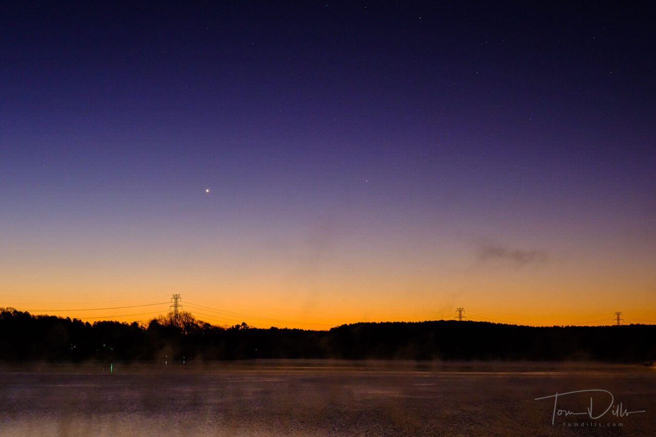
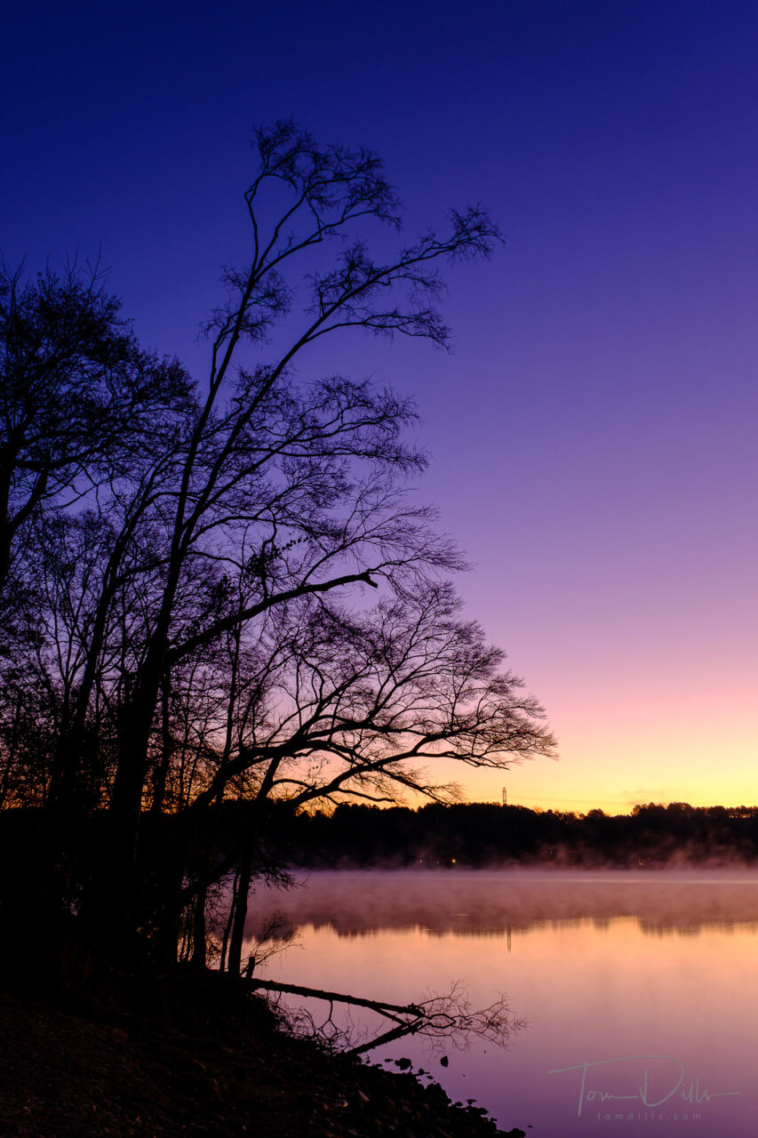
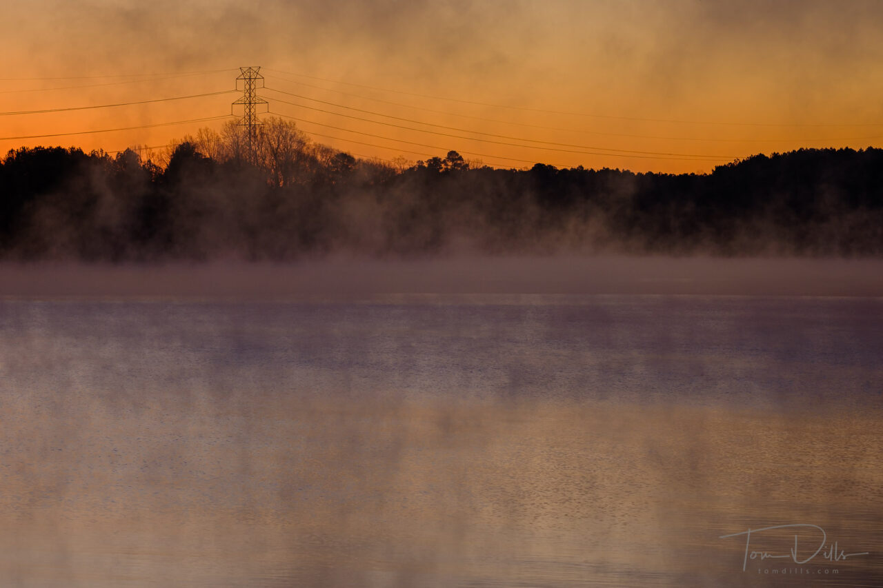
It was pretty dark when I got there, and the parking lot was empty except for one car. The sky was clear with plenty of stars, or as many as we can usually see here in the suburbs of Charlotte. As the light level came up I could see that there was some fog on the lake, and it was moving around in a very slight breeze.
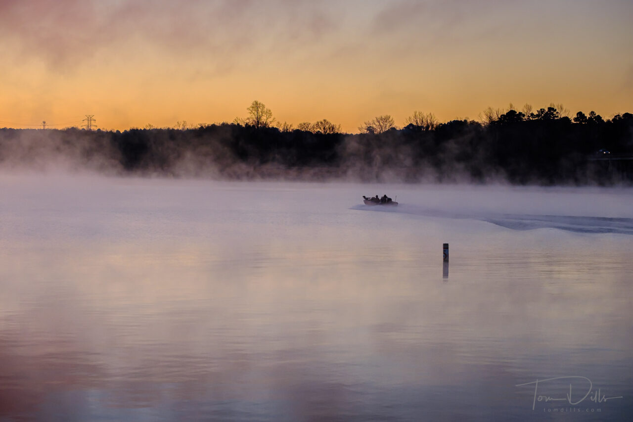
The first boater arrived about 7:00 – an even heartier soul than me. He offloaded his boat, nursed a sputtering outboard to life and headed off in search of some radioactive catfish. A second boater came a few minutes later and much better luck with his engine. He’s the one I was able to catch leading a wake out through the fog.
Sunrise over Mountain Island Lake from the Riverbend Boat RampSunrise over Mountain Island Lake from the Riverbend Boat Ramp
By the time the sun came up I had taken 144 frames and it was time to head home for coffee and a shower. As I was putting my camera back in the car I realized I had frost on my tripod. That’s about as cold as I’d like it to be, at least with my current gear!
Sunrise over Mountain Island Lake from the Riverbend Boat Ramp
Not bad for a winter Sunday morning. Weather permitting I hope to be getting back out there again, real soon!
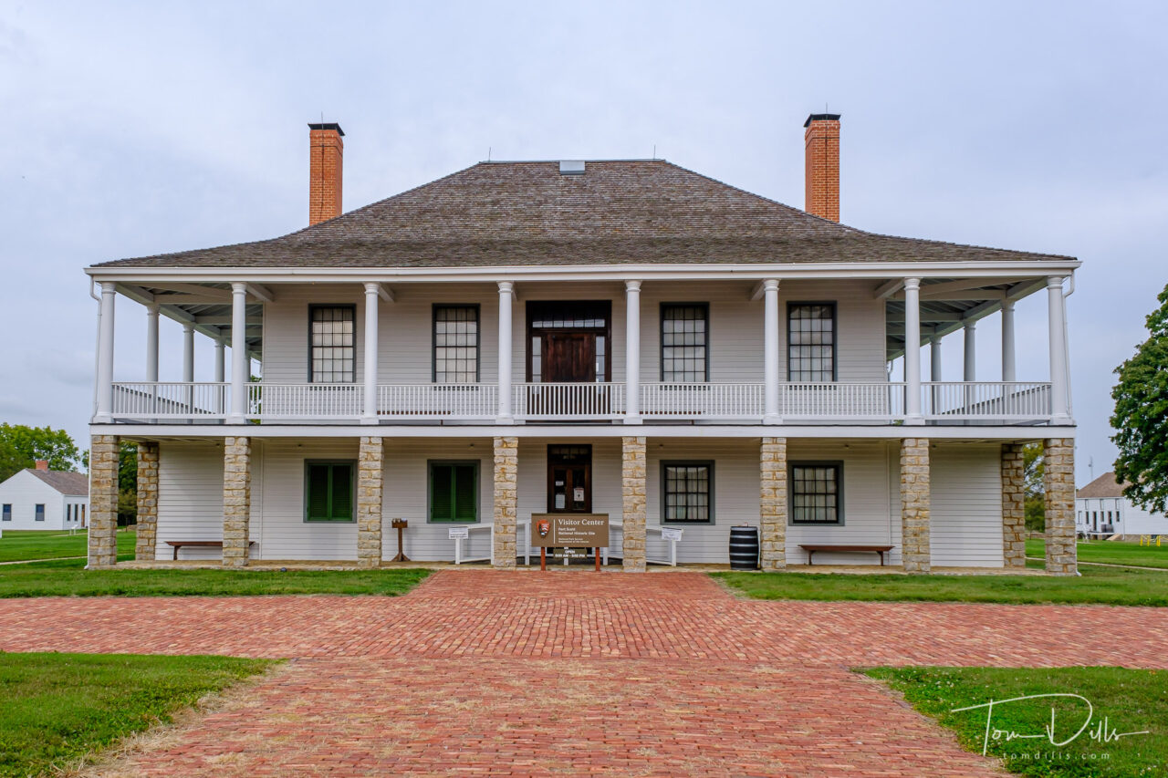
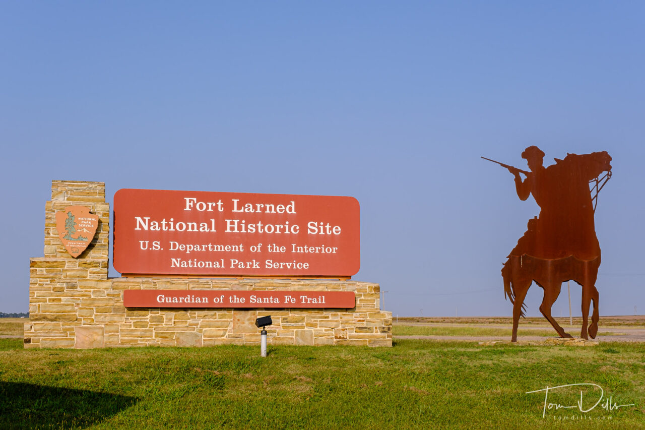
Entrance to Fort Larned National Historic Site near Larned, Kansas
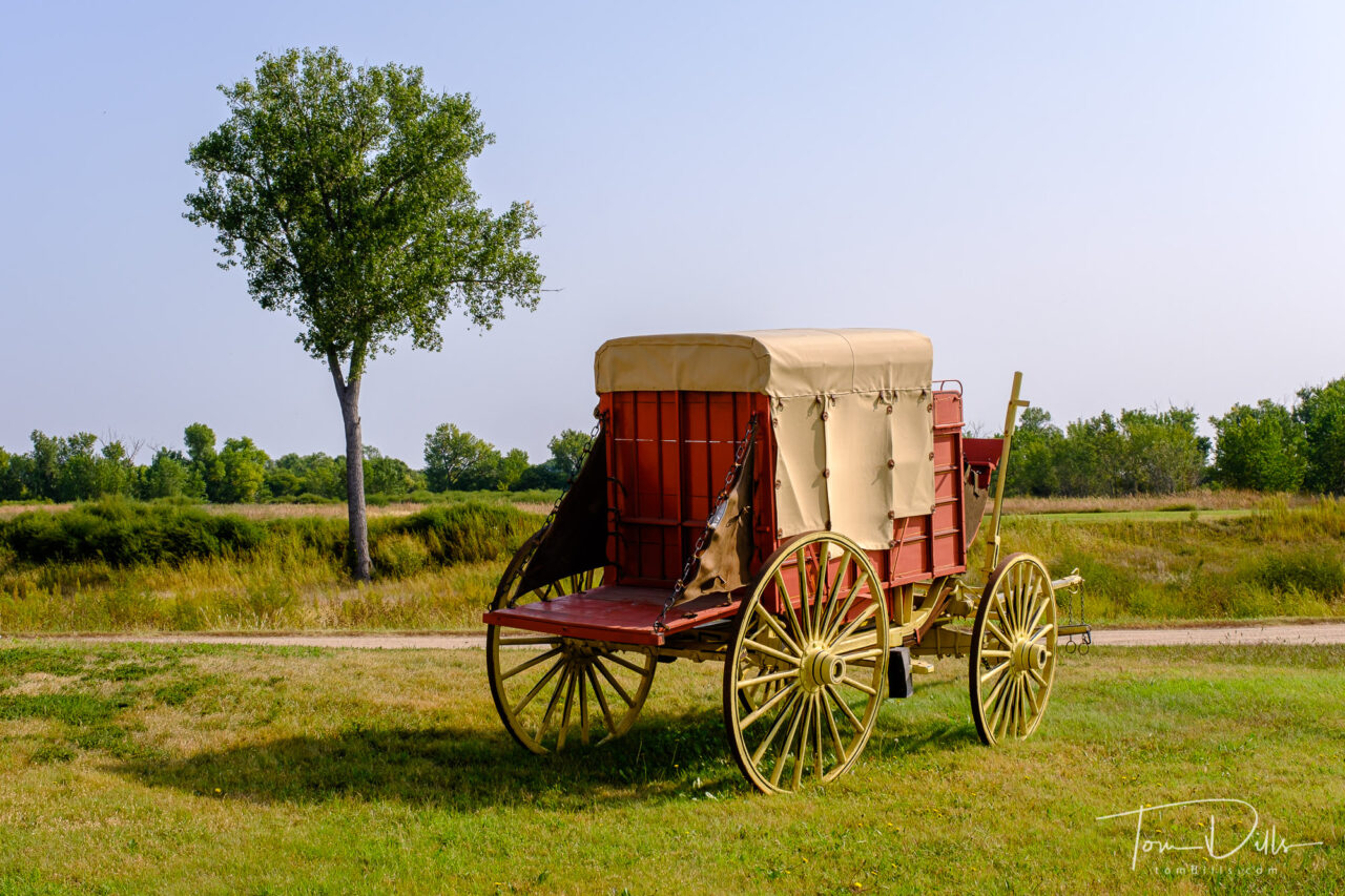
Fort Larned National Historic Site in Kansas was our final major stop on our way toward home from Fort Collins, CO. We had spent the previous night in Hays, Kansas and stopped for a picnic breakfast at the picnic area just outside the entrance to the park. While we were there, we only saw one car drive in, and it was a guy with a dog, both of whom needed to use the “facilities” but neither went to the fort.
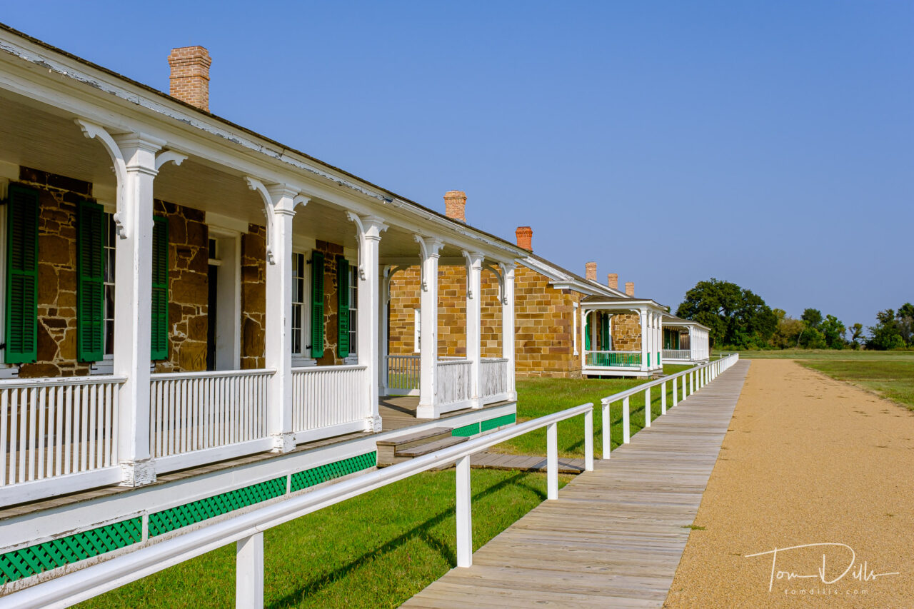
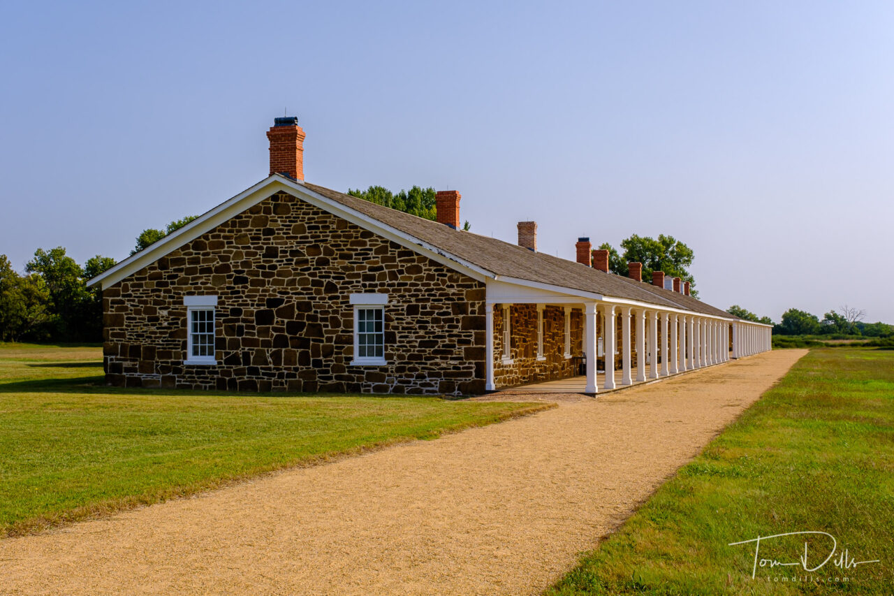
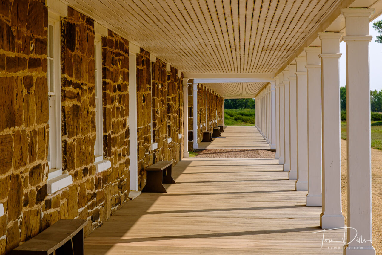
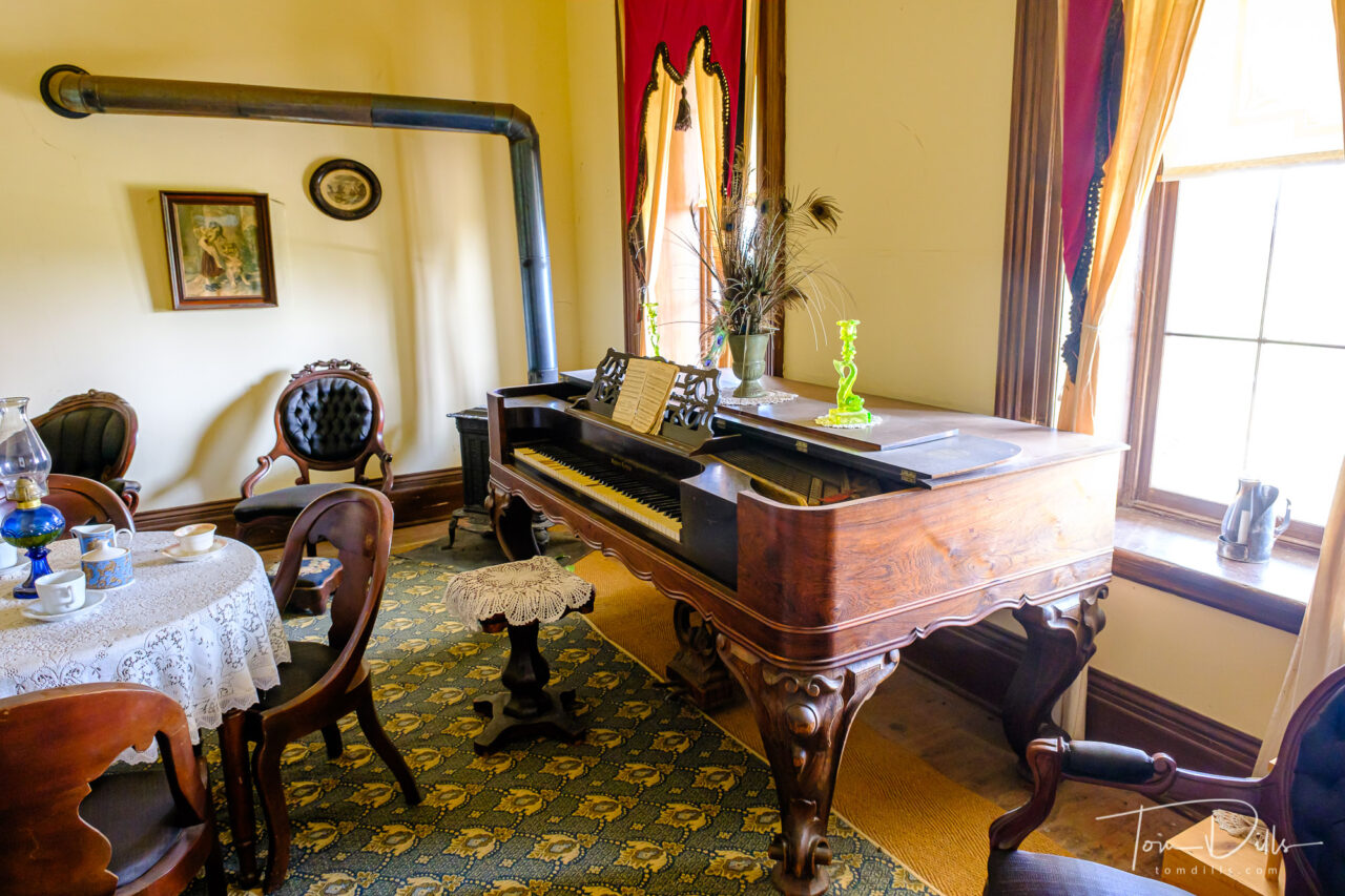
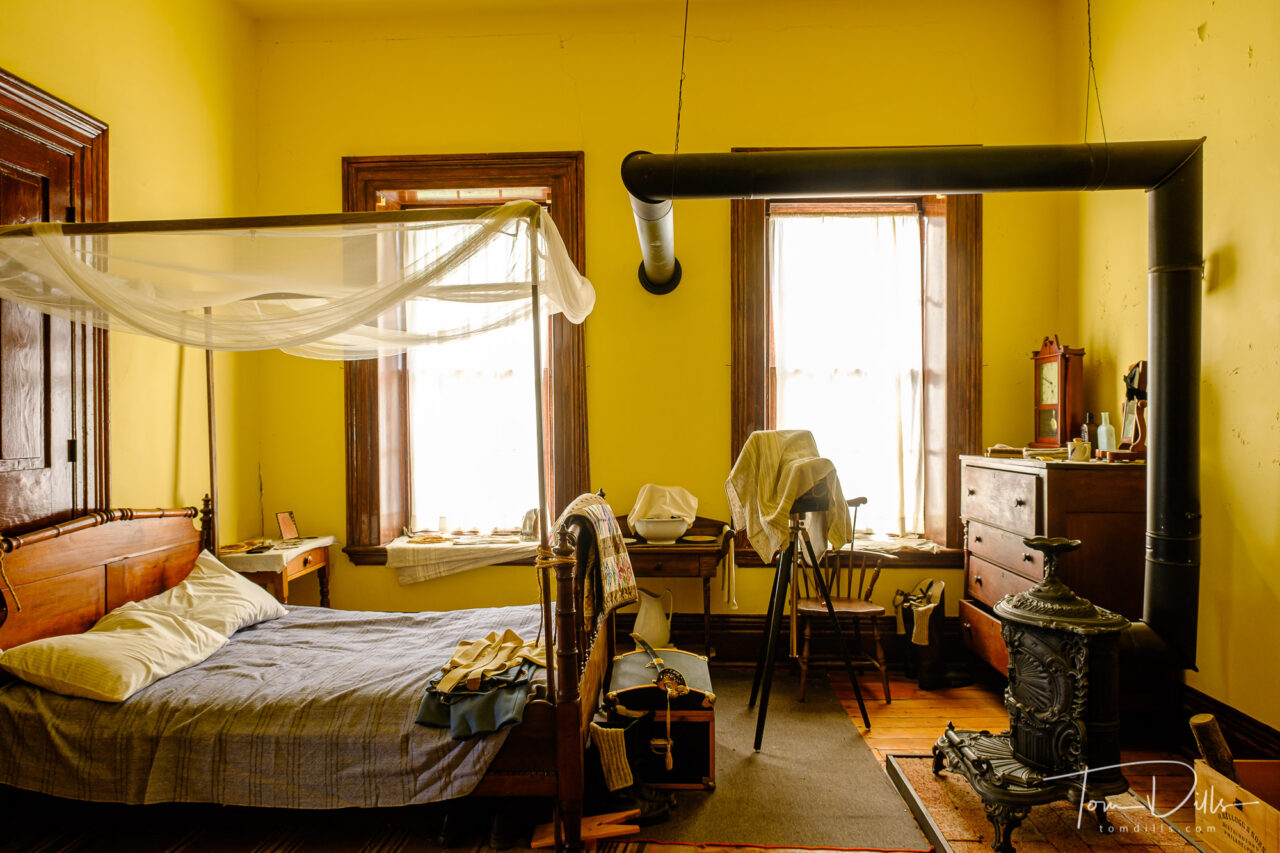
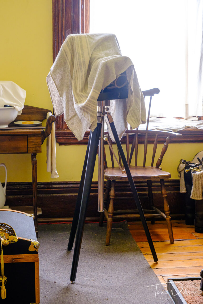
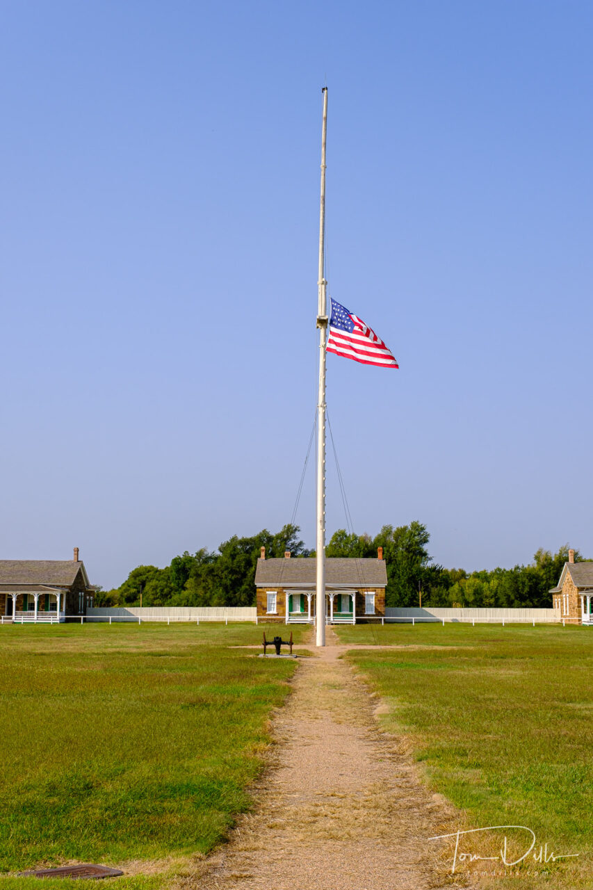
Fort Larned National Historic Site near Larned, Kansas. Flag was at half staff due to the recent passing of Supreme Court Justice GinsburgOfficers’ quarters at Fort Larned National Historic Site near Larned, KansasOfficers’ quarters at Fort Larned National Historic Site near Larned, KansasOfficers’ quarters at Fort Larned National Historic Site near Larned, Kansas
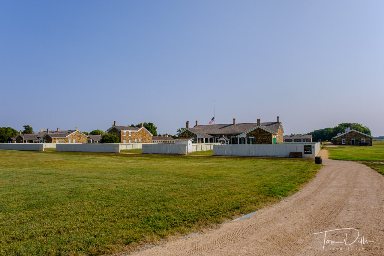
When we arrived in the parking lot for the fort, there were a few cars in the parking lot, but I have no idea who they belonged to. Other than a groundskeeper, who we only saw a few times and from a distance, we didn’t see another soul the whole time we were there. The metadata from my photos shows an hour and fifteen minutes between the first and last pictures. But all of the buildings were open for viewing, and the rangers had set up a little table to get stamps for our National Parks Passport.
Officers’ quarters at Fort Larned National Historic Site near Larned, KansasOfficers’ quarters at Fort Larned National Historic Site near Larned, KansasOfficers’ quarters at Fort Larned National Historic Site near Larned, Kansas
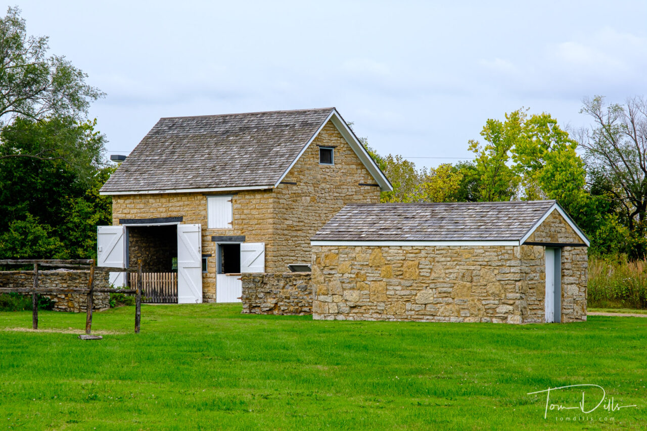
We visited a number of different historic sites on our western loop, and three of them were forts. Interestingly, all three of them were from different periods in our history, and each one served a unique purpose in its time. Fort Clatsop in Oregon was established by the Lewis and Clark Expedition in 1805 and was their quarters for the winter of 1805-1806. Fort Scott, which we visited later the same day as Fort Larned, was established in 1842 as one of a chain of forts intended to protect settlers from the Plains Indians, as well as to protect the Indians from the settlers’ encroachment.
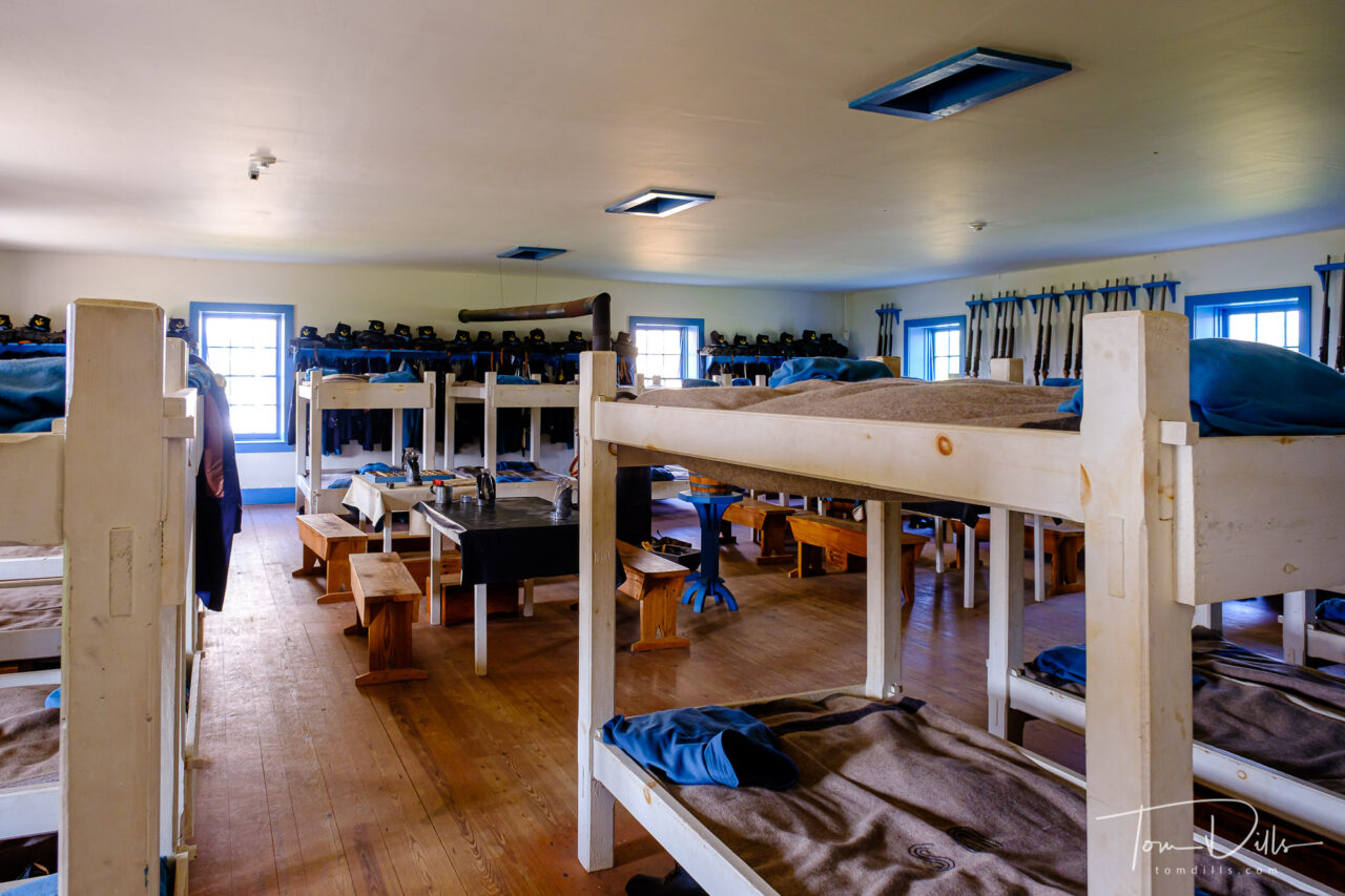
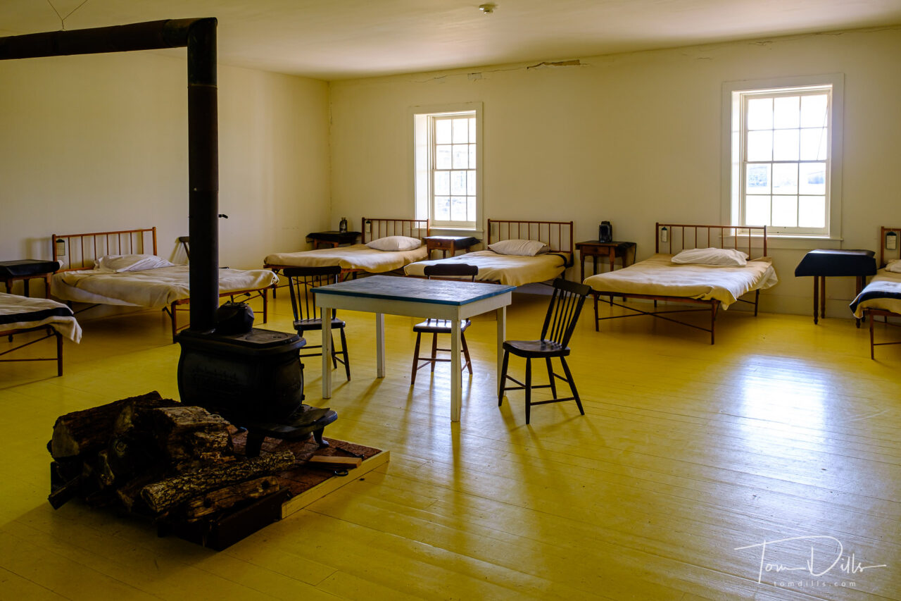
Troop barracks at Fort Larned National Historic Site near Larned, KansasMedical facilities and infirmary at Fort Larned National Historic Site near Larned, Kansas
Fort Larned was originally established in 1859 as The Camp on Pawnee Fork. It was renamed Camp Alert in 1860 then moved to the current location and renamed Fort Larned, after Colonel Benjamin F. Larned, the paymaster general of the United States Army at the time the post was established. Fort Larned’s purpose was to protect traffic along the Santa Fe Trail.
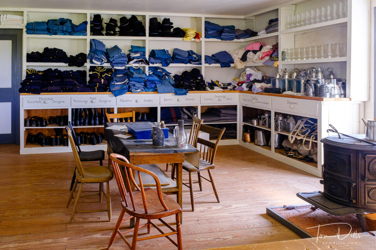
Shop areas at Fort Larned National Historic Site near Larned, KansasShop areas at Fort Larned National Historic Site near Larned, KansasShop areas at Fort Larned National Historic Site near Larned, Kansas
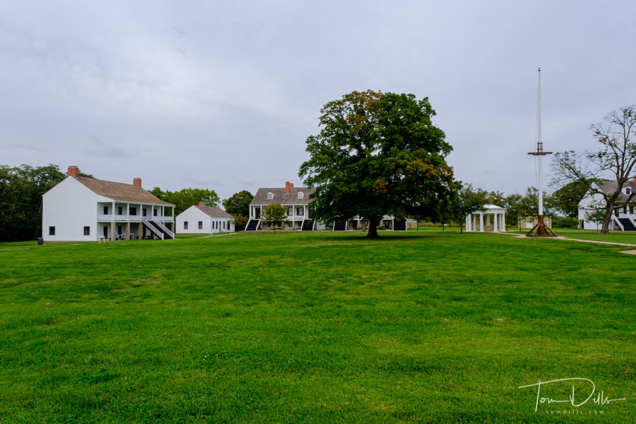
The park is very well done, with numerous buildings all restored and preserved in near-original condition and is a fine representation of a complete and authentic army post from the 1860s -1870s. This well-preserved fort on the Santa Fe Trail shares a tumultuous history of the Indian Wars era. The sandstone constructed buildings sheltered troops who were known as the Guardians of the Santa Fe Trail.
Food, clothing, supplies and munitions storage at Fort Larned National Historic Site near Larned, KansasFood, clothing, supplies and munitions storage at Fort Larned National Historic Site near Larned, Kansas
I’ve added a gallery of more photos from Fort Larned on my Adobe Portfolio site for anyone who wants to see more. Enjoy! 🙂
Fort Larned National Historic Site near Larned, KansasFort Larned National Historic Site near Larned, Kansas. Flag was at half staff due to the recent passing of Supreme Court Justice Ginsburg
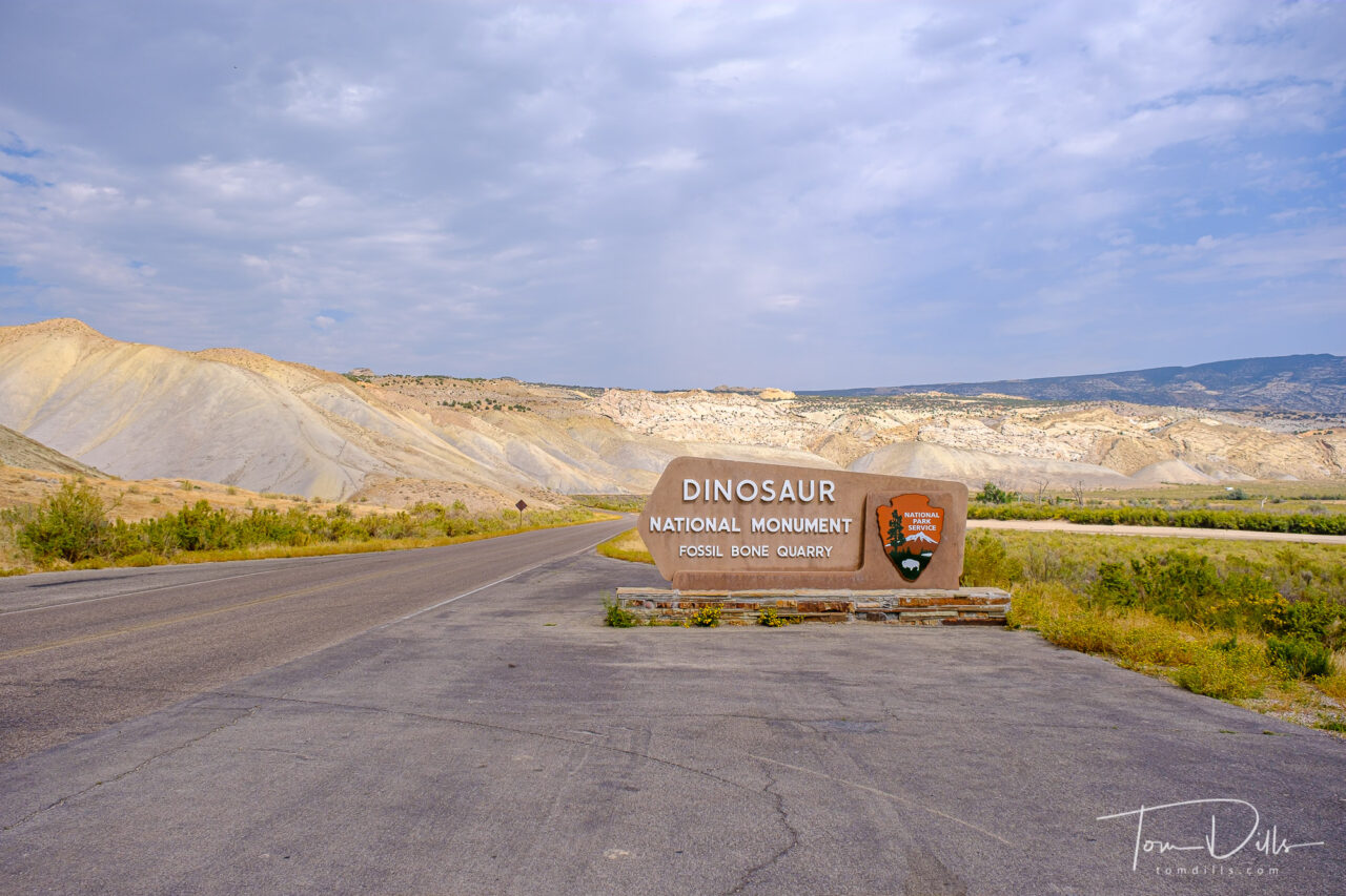
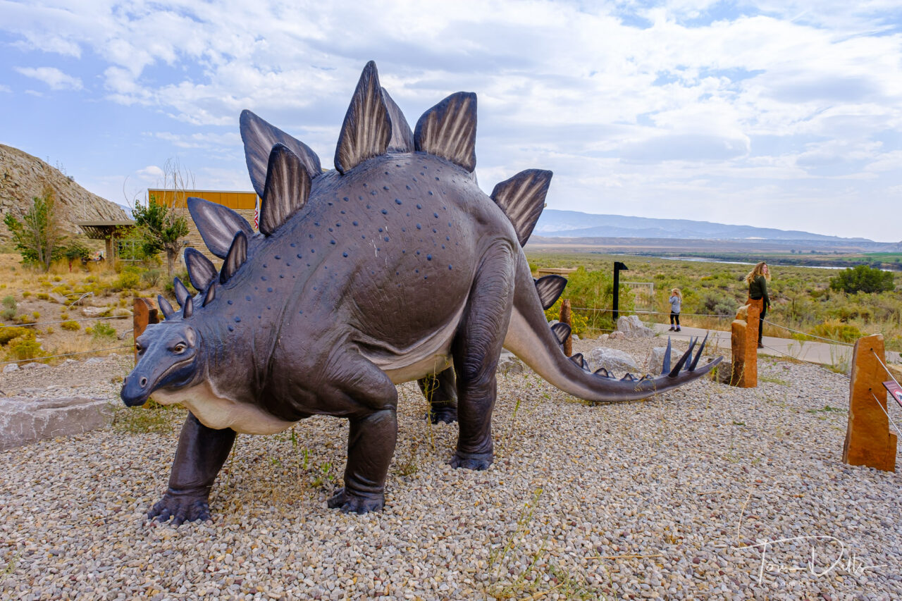
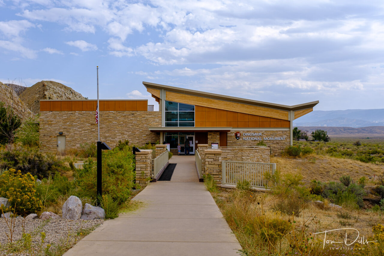
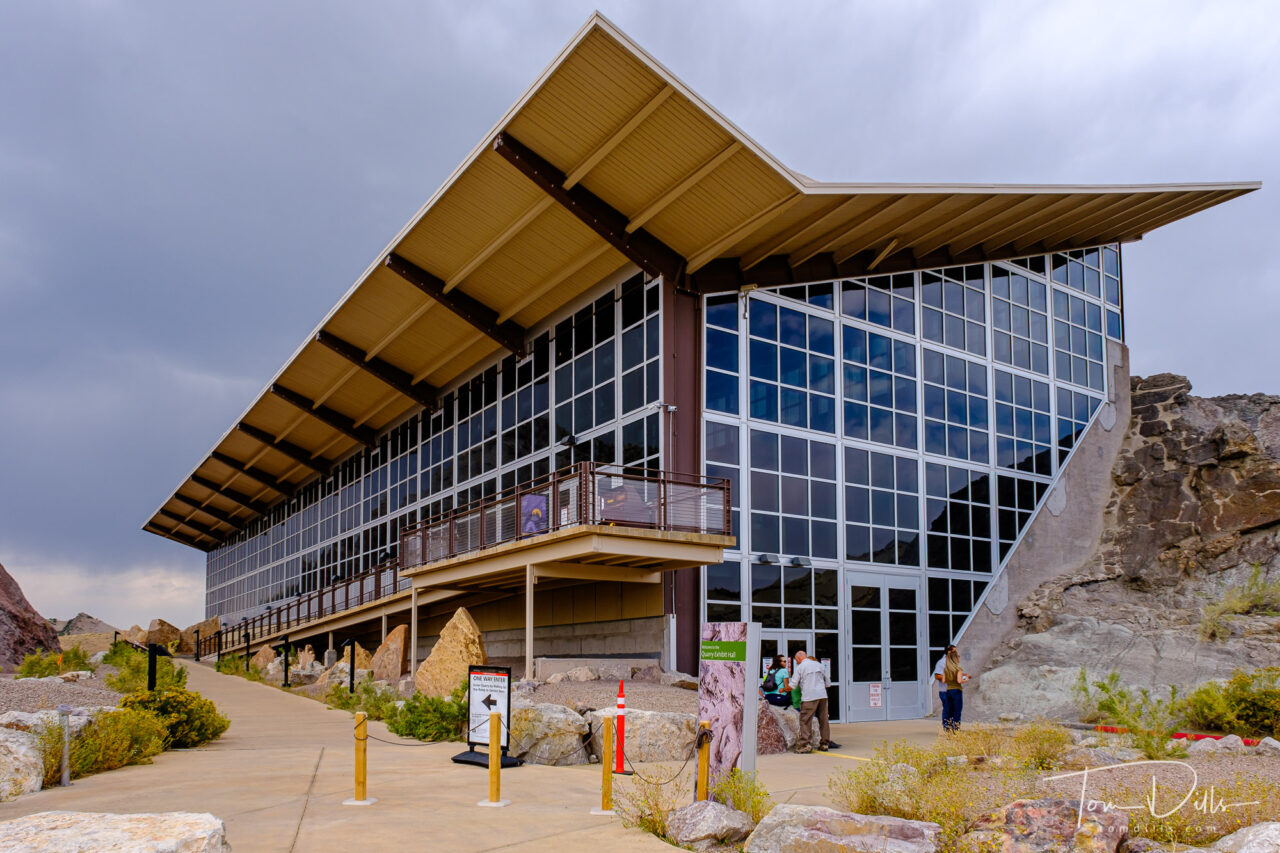
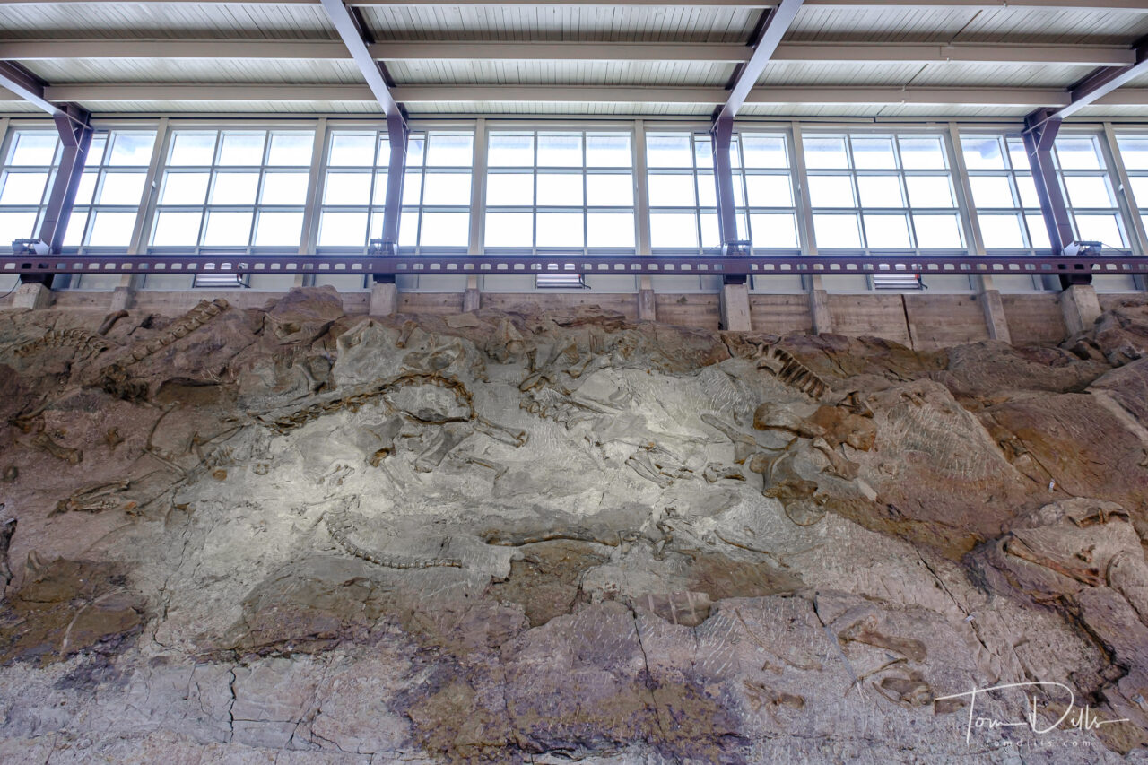
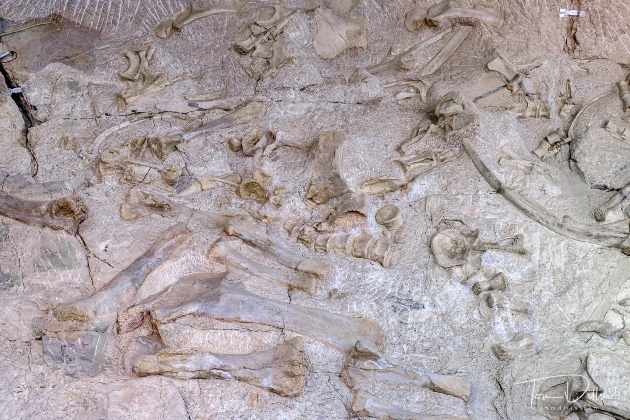
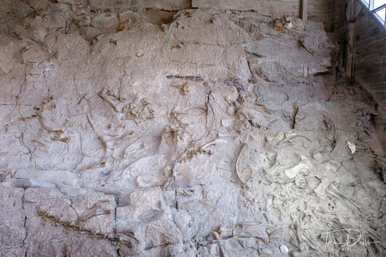
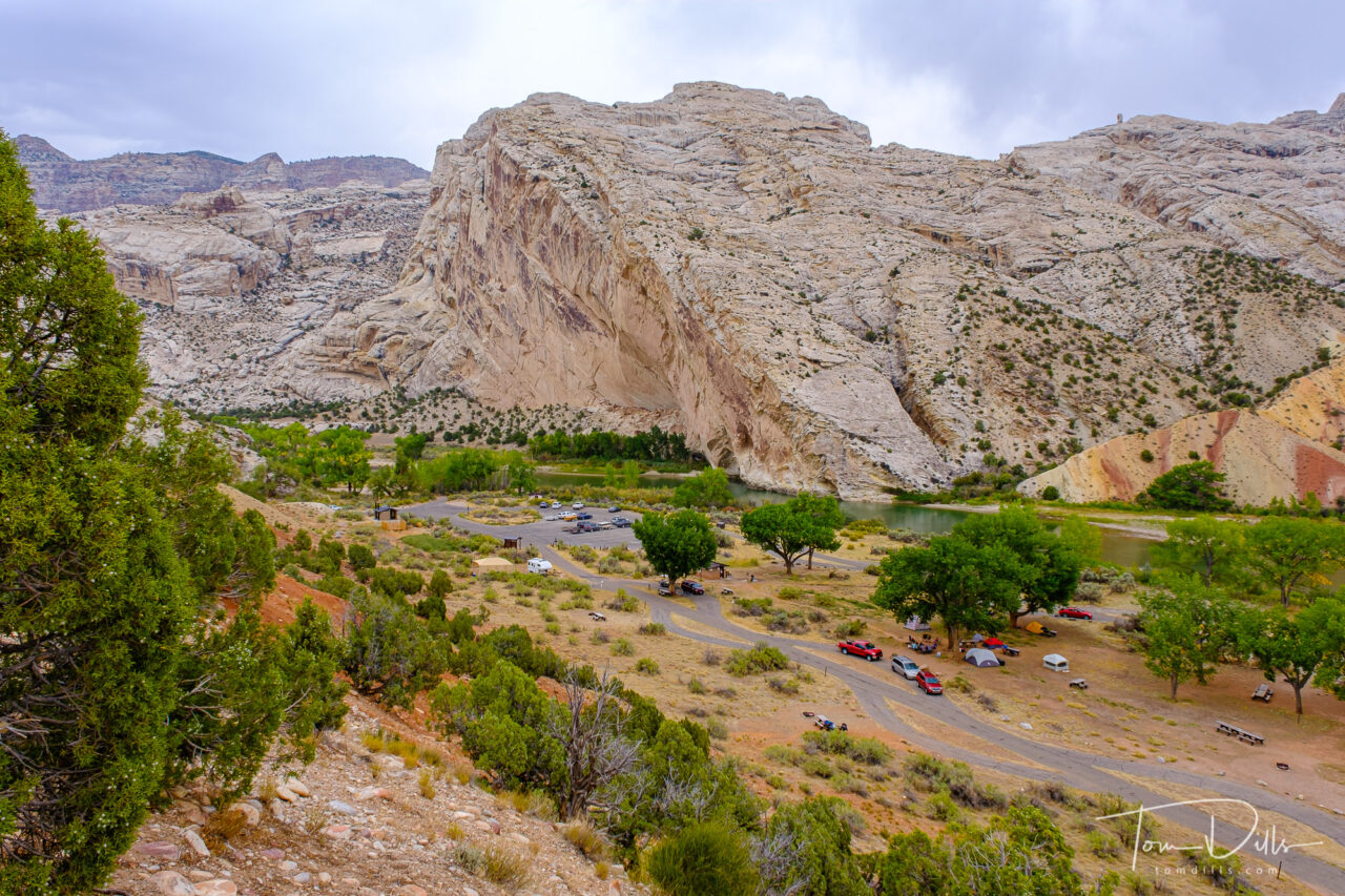
As we started our eastward return leg from Ogden toward Colorado, we had one more stop to make in Utah. Dinosaur National Monument straddles the eastern Utah and western Colorado border. The park’s primary claim to fame is the Fossil Quarry, located on the Utah side near the town of Jensen, UT. Jensen lies along US-40, roughly halfway between Park City, UT and Steamboat Springs, CO.
Quarry Visitor Center at Dinosaur National Monument near Jensen, UtahQuarry Visitor Center at Dinosaur National Monument near Jensen, Utah
The Quarry Visitor Center contains numerous exhibits about the history of the area, including the quarry wall itself that is now housed within an impressive building. The building itself was operating at a greatly reduced capacity with reservations required. We made our reservations several days in advance and had no trouble getting in. Interestingly no one actually asked us for documentation of our reservations, although I’m certain they are checked randomly.
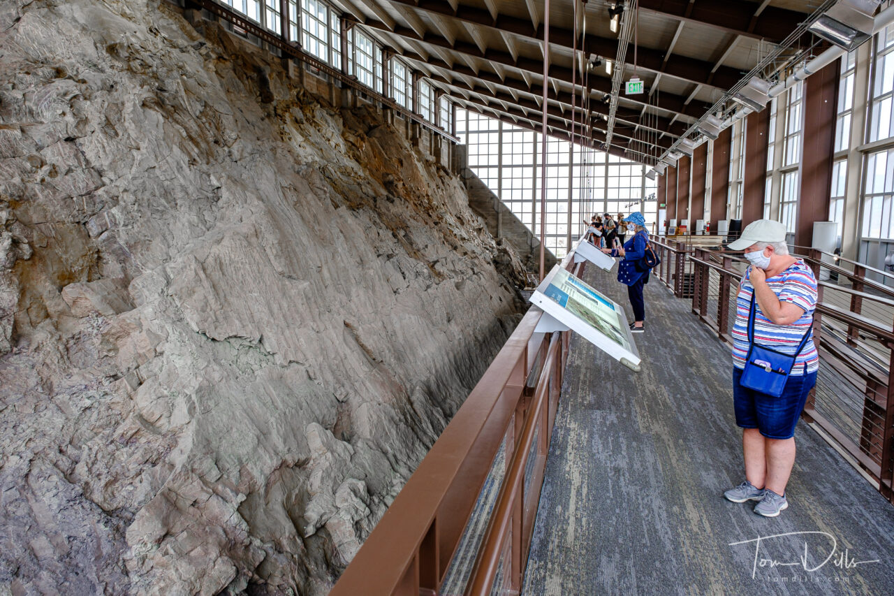
Quarry Exhibit Hall and the wall of dinosaur bones at Dinosaur National Monument near Jensen, UtahQuarry Exhibit Hall and the wall of dinosaur bones at Dinosaur National Monument near Jensen, UtahQuarry Exhibit Hall and the wall of dinosaur bones at Dinosaur National Monument near Jensen, UtahQuarry Exhibit Hall and the wall of dinosaur bones at Dinosaur National Monument near Jensen, UtahQuarry Exhibit Hall and the wall of dinosaur bones at Dinosaur National Monument near Jensen, Utah
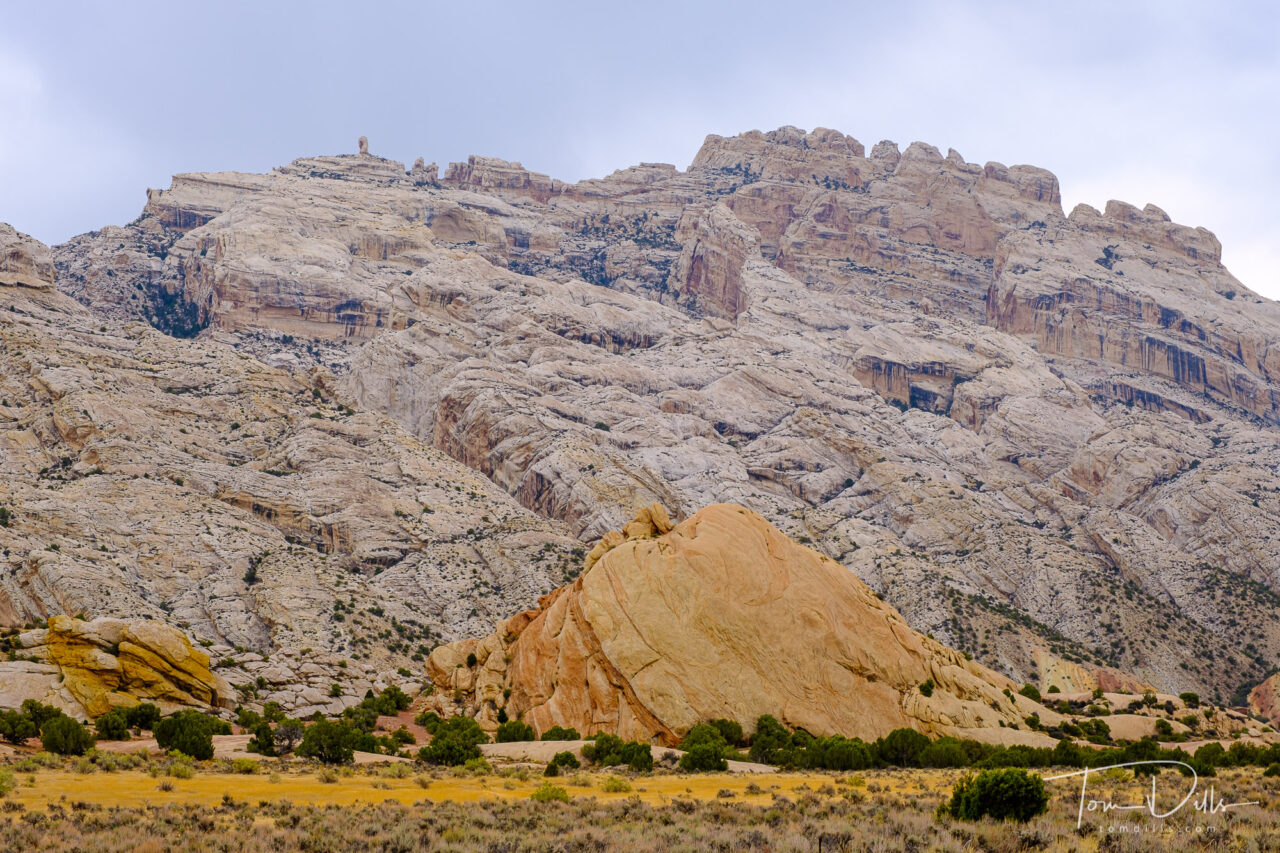
The dinosaur fossil beds were discovered in 1909 by Earl Douglass, a paleontologist working and collecting for the Carnegie Museum of Natural History. He and his crews excavated thousands of fossils and shipped them back to the museum in Pittsburgh, PA for study and display. President Woodrow Wilson proclaimed the dinosaur beds as Dinosaur National Monument in 1915. The monument boundaries were expanded in 1938 from the original 80 acres surrounding the dinosaur quarry in Utah, to 210,844 acres in Utah and Colorado, encompassing the river canyons of the Green and Yampa. It’s hard to believe that the fossils that remain today are the “leftovers,” as it still makes for a very impressive display.
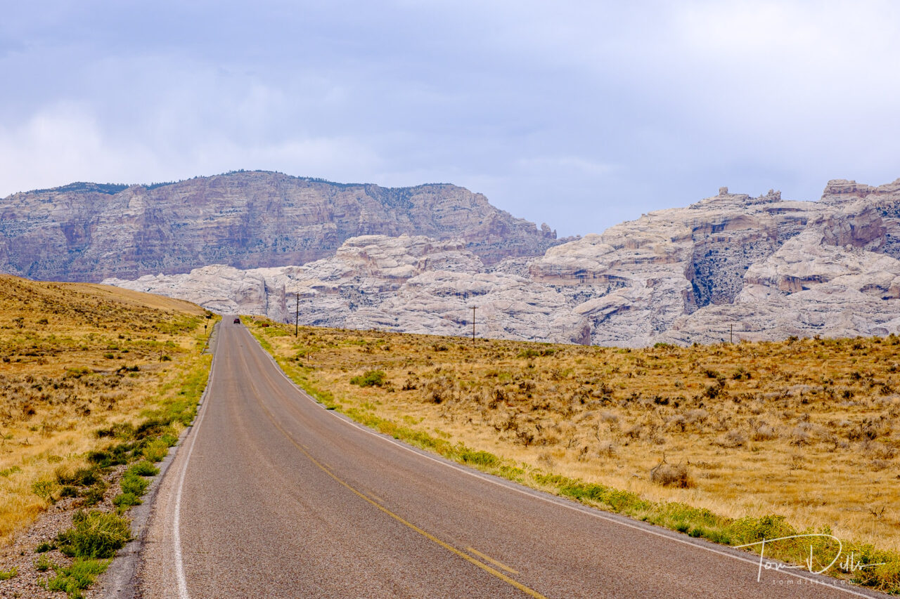
Scenic views from Cub Creek Road in Dinosaur National MonumentScenic views from Cub Creek Road in Dinosaur National MonumentScenic views from Cub Creek Road in Dinosaur National Monument
While the quarry is the main attraction, I was in many ways more impressed by the stunning scenery of the area surrounding the visitor center. We saw only a tiny portion of the 210+ thousand acres, and it would be quite easy to spend a lot more time exploring. But alas, we were on our way to Colorado and could only devote a few hours to the park. It’s not the kind of place you just happen to pass by, but we may decide to detour that way the next time we head west. The drive along US 40 is much more pleasant and scenic than I would expect I-70 or I-80 to be!
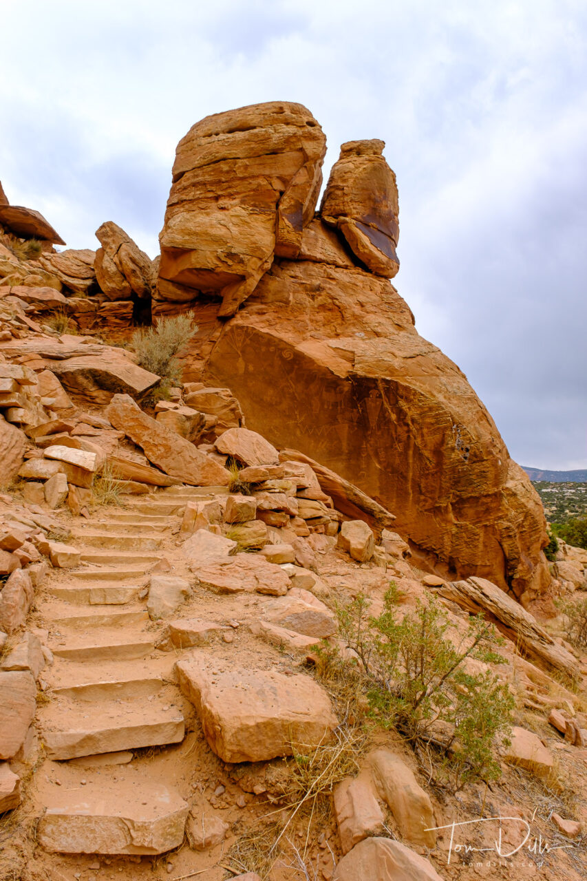
Petroglyphs at Dinosaur National Monument near Jensen, Utah
I’ll added a more complete gallery of photographs from Dinosaur on my Adobe Portfolio page.