Category Archives: Photo Projects

A Hidden Gem In Little Rock

The Old Mill in the T.R. Pugh Memorial Park in Little Rock, Arkansas

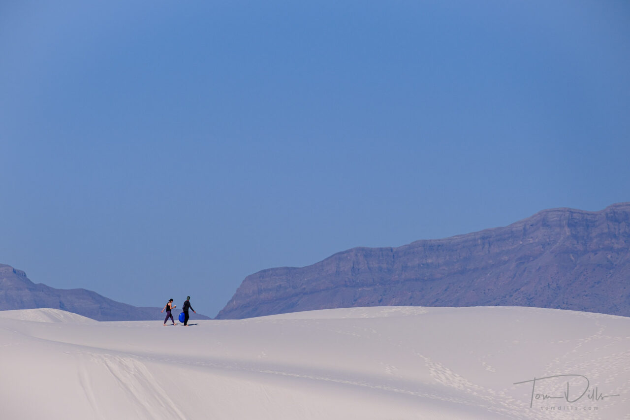
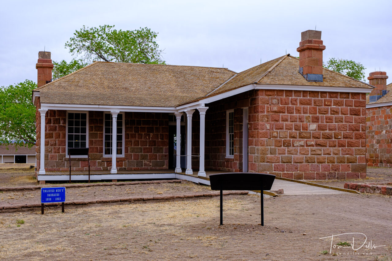
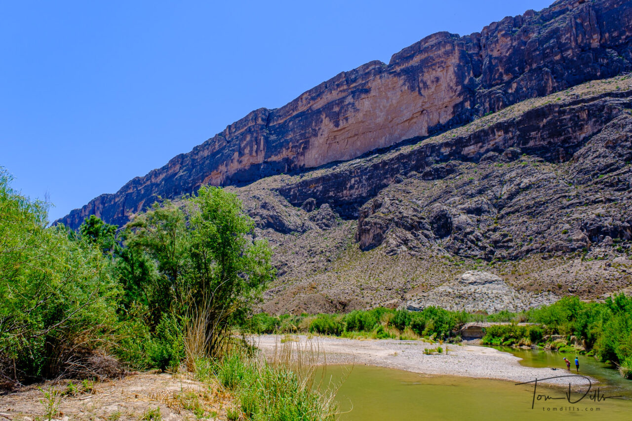
I took pictures at more places in Arkansas than this, but it was such a special morning that I wanted to do a separate post.

The Old Mill in the T.R. Pugh Memorial Park in Little Rock, Arkansas

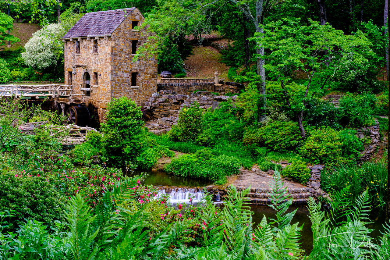
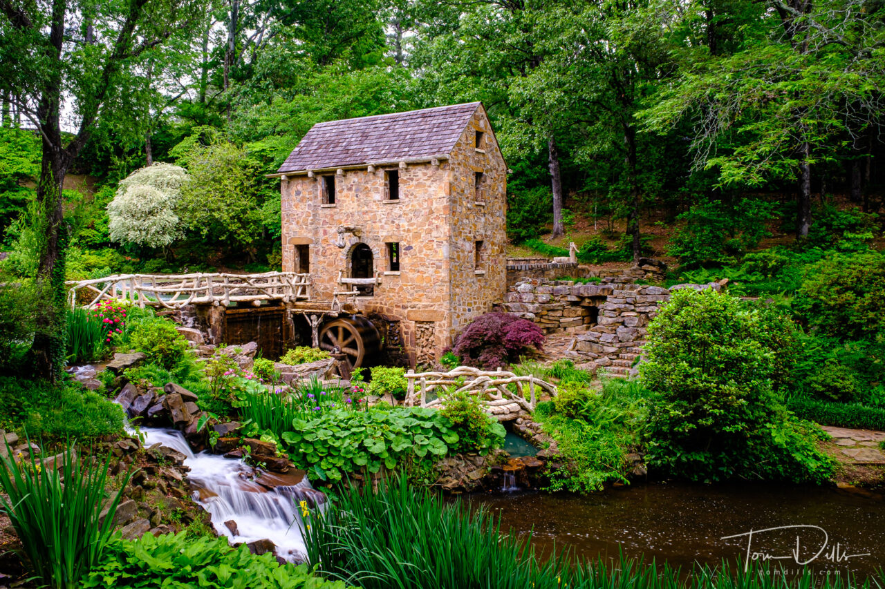
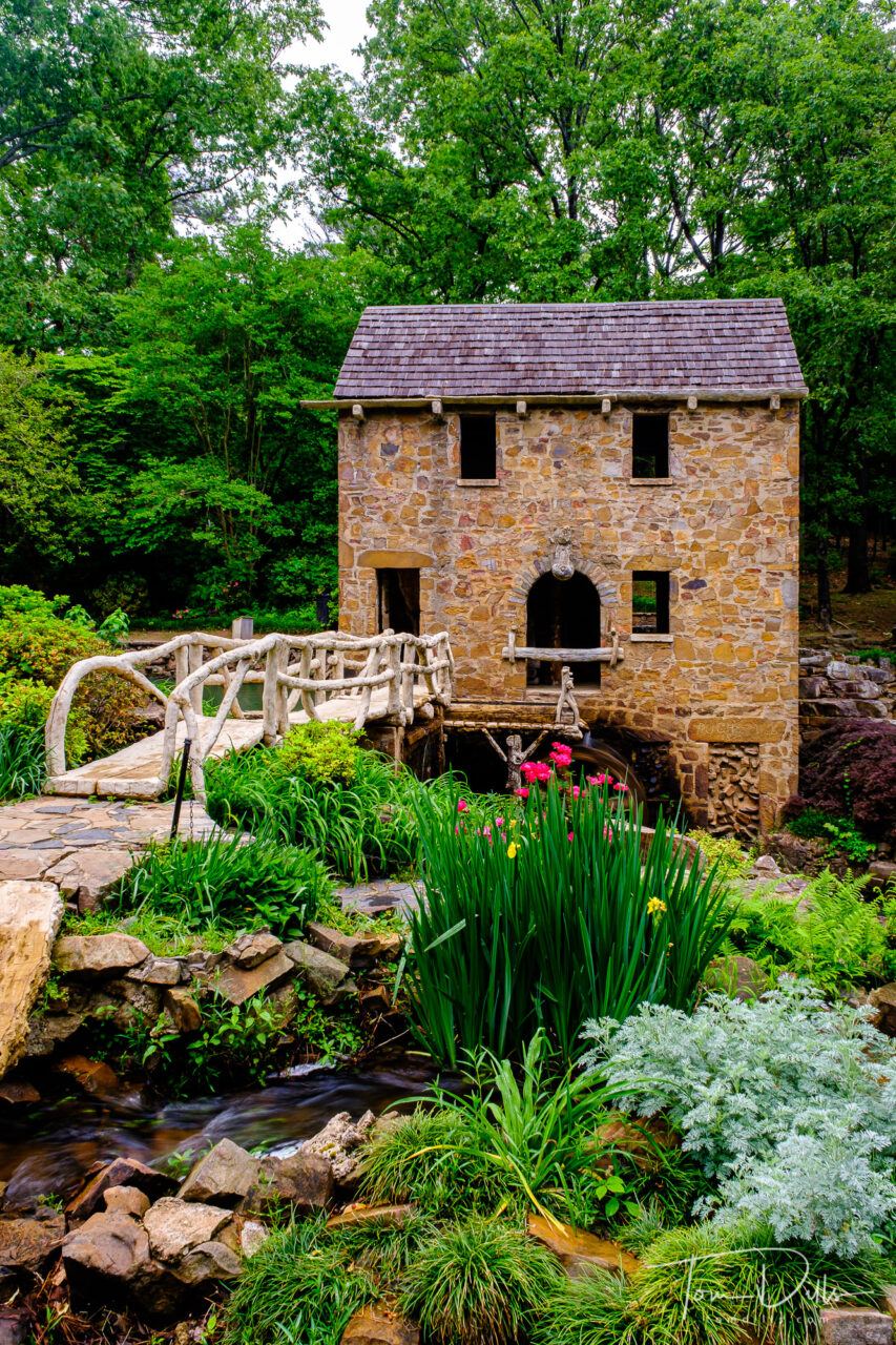
The Old Mill is a historic re-creation of an 1880’s water-powered grist mill located in T.R. Pugh Memorial Park in Little Rock, Arkansas.  I didn’t confirm this by watching, but it is reportedly featured in the opening scenes of the classic movie “Gone With The Wind.”  In addition to the mill and the beautiful gardens surrounding it, the park features sculptures by Senor Dionicio Rodriguez and is listed on the National Register of Historic Places.

The Old Mill in the T.R. Pugh Memorial Park in Little Rock, Arkansas

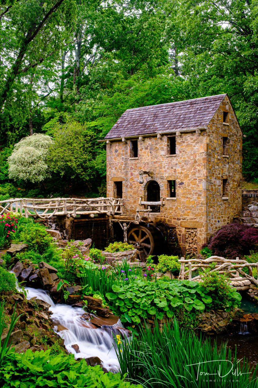
We lucked into a nearly perfect morning to photograph the mill.  It was fairly early on a Sunday, the air was a little misty with a nice overcast and the flowers were blooming nicely.  I don’t use a polarizer as much as I should, but as soon as I started composing I realized that I had better put it on.  It made all the difference, saturating the colors and cutting the reflections.

The Old Mill in the T.R. Pugh Memorial Park in Little Rock, Arkansas

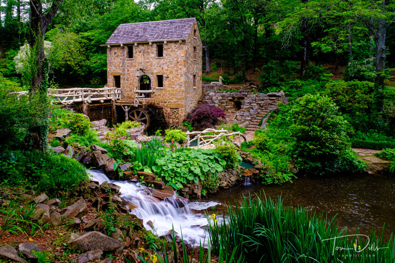
I had to work around some construction activity that was happening on the hillside to the left (my left) of the mill and a few people that wandered in.  The bare hillside and orange construction fencing limited my compositional choices, but I still came away with a few nice photos.  I took some photos with the hillside in the background anyway, and may one day soon try my hand at Photoshop to “repair” some of the damage.  My skills are pretty basic so we’ll see how that goes.

The Old Mill in the T.R. Pugh Memorial Park in Little Rock, Arkansas

I haven’t taken the time to make photographs like these too much lately, but it is a good reminder that I still know how and to get out and do more of them! 😉

Oklahoma is OK

“Yukon’s Best Flour” mill located on Historic Route 66 in Yukon, Oklahoma

One of the five new states we visited on our Southwest road trip was Oklahoma.  I’ll be the first to admit that we didn’t try real hard to find places to stop, but it was getting close to the end of the trip, it had been a long day, and we ended up losing a couple of hours due to their silly “exact change” toll road system (long story!).  Otherwise we might have spent a little more time in the Tulsa area, as what we saw from the freeway made it look pretty nice.

Oklahoma Route 66 Museum on Historic Route 66 in Clinton, Oklahoma

We did manage to drive through Yukon, famous for being the birthplace of Garth Brooks.  And we spent a little time in Catoosa, primarily to see the Blue Whale, a kitchsy Route 66 icon.  And we grabbed shots of a few other places just to prove we were in the state.  All in all we only ended up with 53 photos from Oklahoma, and that includes a few of Kathy’s “out the window” pictures.  Not exactly our best effort, but it got the job done.  We hope to make more trips out west to see more parks and visit our friends out there, so we’ll likely have more opportunity to visit the state.  In the mean time, we’ve placed a check mark next to Oklahoma! 🙂

Train station and post office in Catoosa, Oklahoma
The Blue Whale of Catoosa, a Route 66 roadside attraction in Catoosa, Oklahoma
Welcome to Oklahoma

If You’re Really Bored

Sunset Crater Volcano National Monument in Arizona

For those sweating out the latest heat wave or monsoon, or someone who just has some time on their hands, I’ve completed posting galleries from our recent Southwest US road trip to my Adobe Portfolio page.  There is some stuff there that I haven’t posted here (yet) but a lot of it just expands on photos I’ve already shared.  Just be aware that there are 1155 photos over 11 galleries! 🙂

The Crystal Bridges Museum of American Art in Bentonville, Arkansas
Frank Lloyd Wright’s Bachman-Wilson House at The Crystal Bridges Museum of American Art in Bentonville, Arkansas
Riding the Sandia Peak Tramway to an elevation of 10,378 feet.  Albuquerque, New Mexico

Truly Grand…The Canyon, That Is

Views from Mohave Point Overlook, Grand Canyon National Park, Arizona

It’s a bit of a paradox for me – it’s hard to make a bad picture of the Grand Canyon.  But yet, it’s hard to make a really good picture of the Grand Canyon.  Not because it is one of the most photographed places on Earth and has been done a bazillion times and a bazillion ways, but because it is so darned BIG!

View from Grand Canyon Village near the El Tovar Hotel, Grand Canyon National Park, Arizona
Desert View Watchtower area of Grand Canyon National Park, Arizona
View from Mohave Point Overlook, Grand Canyon National Park, Arizona

Of course it is impossible to imagine what something like the Grand Canyon will look like in person.  I’ve been to Niagara Falls, and it is big.  I’ve been to Alaska, and places like Glacier Bay, College Fjord, Denali?  Indescribable.  But the Grand Canyon?  I’ve seen it from the air and didn’t realize what it was, because it is so vast.  And down on the ground where you can only see a small part of it, while that part was so big, well.  Words fail me although it doesn’t stop me trying. 🙂

Views from Maricopa Point Overlook, Grand Canyon National Park, Arizona
Hermits Rest, Grand Canyon National Park, Arizona

We originally weren’t planning to stop at the Grand Canyon, figuring it would be overrun with people, with no place to park, overlooks and shuttle buses crowded with people.  But no.  We arranged our schedule to get there on a Monday in early May, which turned out to be a great choice.  We got a good place to park, never had to wait for the next shuttle, had very few people at the overlooks, and relatively light crowds in the Grand Canyon Village.  We even got a reservation for lunch at the El Tovar Hotel and a table with a canyon view.  Sweet!

Desert View Watchtower area of Grand Canyon National Park, Arizona
Desert View Watchtower at Grand Canyon National Park, Arizona

We only had a day, so we made the most of it.  We didn’t try to get there for sunrise or stay until sunset, partly because I knew that early and late in the day, when the canyon is all in shadow, is generally not the best time to photograph it.  The middle parts of the day provide good, even lighting, while the hours before and after can provide some dramatic shadows.  It’s also important (I think) to have some nice clouds to provide an interesting sky.  We sort of lucked out on all those counts.

Desert View Watchtower area of Grand Canyon National Park, Arizona

It was a good day and we were both very glad to have made the effort.  There are a lot more parks that we want to see, and once we finish up our 50 states project, getting to those parks is going to be one of our priorities.  The list is long! 🙂

As I’ve been doing, for those who are interested or just bored 😉 I’ve added a Grand Canyon gallery to my Adobe Portfolio site.

Desert View Watchtower area of Grand Canyon National Park, Arizona

Now THIS Is Oatman!

The town of Oatman, Arizona is famous for its wild burros (and tourists) roaming the streets. A Route 66 attraction.

Skipping ahead a bit because I’m processing photos faster than I can write about them.  If anyone is interested in seeing more of my “vacation photos,” head to my Adobe Portfolio page, where I’ve been adding galleries with more photos from places we visited.  I’ll keep adding more galleries as I go and will eventually have a whole album.

A little bit of everything in Oatman
Pretty sure it isn’t Burro Jerky
Shotgun Weddings?  Yeah!
It’s hard to tell the burro food from the burro poop, so watch your step.

The first stop on our Route 66 adventure was Oatman, Arizona.  We had no idea what to expect, but suffice it to say that we could never have imagined it!  We were expecting a sleepy little place with old buildings, a shop or two and some tumbleweeds blowing through town.  But no….  We got there late morning on a Sunday, and the place was jammed with people, cars, motorcycles and…burros!  Turns out it is a pretty happening place.

Security cameras?  Why?
The town of Oatman, Arizona is famous for its wild burros (and tourists) roaming the streets. A Route 66 attraction.
The Best Little Orehouse in Oatman
Someone is having an identity crisis

Our first concern was – oh, crap.  Is this what Route 66 is going to be like the whole way?  But no, I think we actually came across more people at one time in Oatman than we saw anywhere else on Route 66.  It was amazing!

Daily “gunfight” on the main street of Oatman, Arizona
The town of Oatman, Arizona is famous for its wild burros (and tourists) roaming the streets. A Route 66 attraction.

We didn’t stay long, only long enough to walk up and down the street, take in one of the “gunfights” that happens several times a day, then join the parade of vehicles out of town.  But once we left the town limits the road was deserted, pretty much from there to Kingman.

Not your typical Oatman transportation
Well, maybe
More likely….
The town of Oatman, Arizona is famous for its wild burros (and tourists) roaming the streets. A Route 66 attraction.
A must-have on Route 66.  Especially the leather….
The town of Oatman, Arizona is famous for its wild burros (and tourists) roaming the streets. A Route 66 attraction.

White Sands National Park

White Sands National Park, New Mexico

According to my metadata, I only photographed for about 30 minutes on our evening at White Sands.  But other than perhaps the evening I spent in The Palouse last fall, it was perhaps the most productive 30 minutes I’ve had with a camera in a long time.  The most fun, too!

White Sands National Park, New Mexico

I “only” took 43 photographs, but have marked 33 of them as “Picks” in Lightroom.  That’s a very high percentage for me. 🙂  Of course not all of them will end up on a wall or even on my website, but a few of my favorites definitely will.

White Sands National Park, New Mexico

White Sands is the kind of place where you can shoot for as long as you have.  And unless you really mess something up, you are likely to come back with something you like.  Interestingly, as huge as the park is, I only moved a total of about 100 yards (after trudging through the sand and scrub to get to the spot I had found) in that 30 minutes.  I shot exclusively with my 55-200 lens, on a tripod, in manual focus mode.  All of the scenes I found were that small.  For me the tripod is essential in situations like that, because in addition to allowing for critical focus, it is a must for precise composition.

White Sands National Park, New Mexico

The biggest issue in a park like White Sands is finding places that haven’t been covered with footprints and sled tracks.  In fact, there is one setup where I had only taken one frame before a head popped over the horizon, and some dude came sledding down the pristine slope I had been set up to shoot.  Luck of the draw.

White Sands National Park, New Mexico

When we returned the following morning, we found that we didn’t get the benefit of the wind that often “erases” the footprints and that results in pristine conditions.  But in a few places I was able to make use of the softened textures in the sand – still remains of footprints but worn down just a bit – superimposed against a crisp blue sky.  It was different from the evening before, but very nice.

White Sands National Park, New Mexico

White Sands is one of those places where you can get something interesting however long you are there.  Whether for an hour or two, a day or two, or a week or two.  Like The Badlands or The Palouse, it is a place I would love to revisit with more time.  But what I came home with is good until I have a chance to do that.

White Sands National Park, New Mexico

Fort Davis National Historic Site

Fort Davis National Historic Site in Fort Davis, Texas

Another one of our off the beaten path places to visit was Fort Davis, Texas.  We spent a couple of hours there on our way to a tour of McDonald Observatory, which is about 30 minutes “up the hill.”

Fort Davis National Historic Site in Fort Davis, Texas

Fort Davis is one of the best surviving examples of an Indian Wars’ frontier military post in the Southwest. From 1854 to 1891, Fort Davis was strategically located to protect emigrants, mail coaches, and freight wagons on the Trans-Pecos portion of the San Antonio-El Paso Road and on the Chihuahua Trail.

Fort Davis National Historic Site in Fort Davis, Texas

Many of the buildings have been restored to close to their original condition, and for others only the foundations remain. We’ve enjoyed visiting these different forts, understanding the role they played in American history and in the expansion and settlement of the west.

Fort Davis National Historic Site in Fort Davis, Texas

Big Bend National Park

Big Bend National Park in Texas

When people ask us what the highlight of our recent trip was, it is easy to respond that it was the Grand Canyon.  But Big Bend National Park was probably the most unexpected.  It is a beautiful park with rugged mountains, deep valleys and a wide variety of plant and animal life.

Big Bend National Park in Texas

Other than the scenery, we were not prepared for how dry it was there.  It’s a desert climate, and we knew that.  And while it was not hot – upper 80s to low 90s during our day there – the dew point was in the teens, and you could practically feel the moisture being sucked out of our bodies.  We had plenty of food and water with us, and we never strayed too far from the car.  But by the end of the day we were thirsty and exhausted.  It just wore us out!

Big Bend National Park in Texas
Views from the Sotol Vista Overlook at Big Bend National Park in Texas
Views along the trail to Lower Burro Mesa Pouroff at Big Bend National Park in Texas

The Rio Grande River runs along the southern border of the park, and it was interesting to look across and realize that it was another country – Mexico – on the other side.  Signs warned against crossing the border illegally, but that didn’t stop people from wading across to the other side for a photo.  The Rio Grande, after all, isn’t all that Grande.  At least for most of the year!

Big Bend National Park in Texas
The Rio Grande River near Santa Elena Canyon, Big Bend National Park in Texas

Big Bend is an example of a park where you really need multiple days to truly experience it.  And to do that ideally means staying in the park, either by camping or staying in one of the many privately operated lodges in and near the park.  We stayed in Alpine, TX which is about 1.5 hours away.  That was not a big deal since we only visited one day.  But if you wanted to see more, or photograph sunrise or sunset, it would be worthwhile to be closer.  On a return trip we may decide to do just that.  Although we probably wouldn’t consider camping.  That just isn’t our thing. 😉

Big Bend National Park in Texas
Views of Goat Mountain at Big Bend National Park in Texas
Big Bend National Park in Texas

The LBJ Ranch – Johnson City, Texas

Lyndon B. Johnson National Historical Park near Johnson City, Texas

Probably because I started to become “world aware” in the mid to late 60s I had always associated Texas with Lyndon Johnson and The Alamo.  I remember hearing references to the “Texas White House” on the news and it conjured up images of a place far away and quite foreign from western Pennsylvania.

Lyndon B. Johnson National Historical Park near Johnson City, Texas

We didn’t get to The Alamo this trip, but we did visit the LBJ Ranch, which is a National Historical Park, operated by the National Park Service.  None of the buildings were open, and we got there pretty late in the day, but we did have a chance to drive the loop road, stop at the house and view some of the exhibits, including a former aircraft nicknamed “Air Force One Half” because of its small size.  It was used to shuttle Johnson and company between the LBJ Ranch airport and Randolph Air Force Base in San Antonio.

“Air Force One Half” Lockheed Jetstar VC-140 used as a shuttle to the LBJ Ranch airport from Randolph Air Force Base in San Antonio. Lyndon B. Johnson National Historical Park near Johnson City, Texas
Runway at Lyndon B. Johnson National Historical Park near Johnson City, Texas
“Air Force One Half” Lockheed Jetstar VC-140 used as a shuttle to the LBJ Ranch airport from Randolph Air Force Base in San Antonio. Lyndon B. Johnson National Historical Park near Johnson City, Texas

Visiting the ranch gave us a little taste of US history, and made real something I had only heard about and had seen only on television.

Torrence Creek Greenway

Torrence Creek Greenway in Huntersville, North Carolina

Kathy & I took advantage of today’s break in monsoon season with a 3-ish mile walk along the Torrence Creek Greenway in Huntersville.  A portion of the trail runs along the edge of Cedarfield, our former neighborhood.  In the years since we moved there have been some additional trails built.  We know that portion quite well and I have taken hundreds of photographs of the area in all seasons.  Today I had only my phone, but the photos will give a sufficient overview.

Torrence Creek Greenway in Huntersville, North Carolina

Water levels were high after last night’s rains, but other than some mud in low-lying places it was mostly dry.  We spotted some early spring bluets and even a few dandelions along the trail, plus a pair of red-tailed hawks shadowed us on our walk back to the car.

Torrence Creek Greenway in Huntersville, North Carolina

There are a number of places to access the trail, but we parked along Bradford Hill Lane near the intersection with Gilead Road.  It’s easy to find and about a 10-mile/20-minute drive from our neighborhood.  The trail is all paved, mostly flat with lots of options for various routes and distances.  The trails are well marked and numerous signboards with maps provide useful information.

Bluets along the Torrence Creek Greenway in Huntersville, North Carolina

I tried to add a link to the website for the Greenway, but both the Mecklenburg County and the Town of Huntersville pages have broken links. 🙁

Tom’s Trail Summary:
Length: From Bradford Hill Lane to Rosewood Meadow Lane is 1.6 miles, or 3.2 miles round trip.  There are several options for shorter and longer loops, or out-back for a shorter distance is possible.
Terrain: Flat
Surface: Paved with a few muddy spots after heavy rains.  Good walking shoes are sufficient.
Comments: The trail is shared with cyclists and dog walkers.  No motorized vehicles.  Pleasant walking along the Torrence Creek with some road noise from Gilead Road and barking dogs from nearby neighborhoods.  Will be pretty in the spring as trees and plants green up.  I tried to find a link to a trail map but the county and town links were broken!