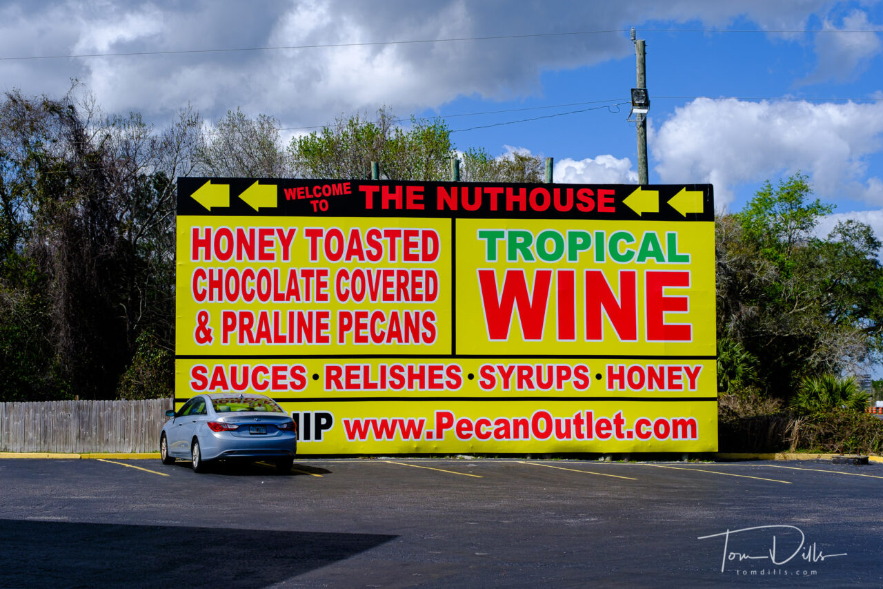
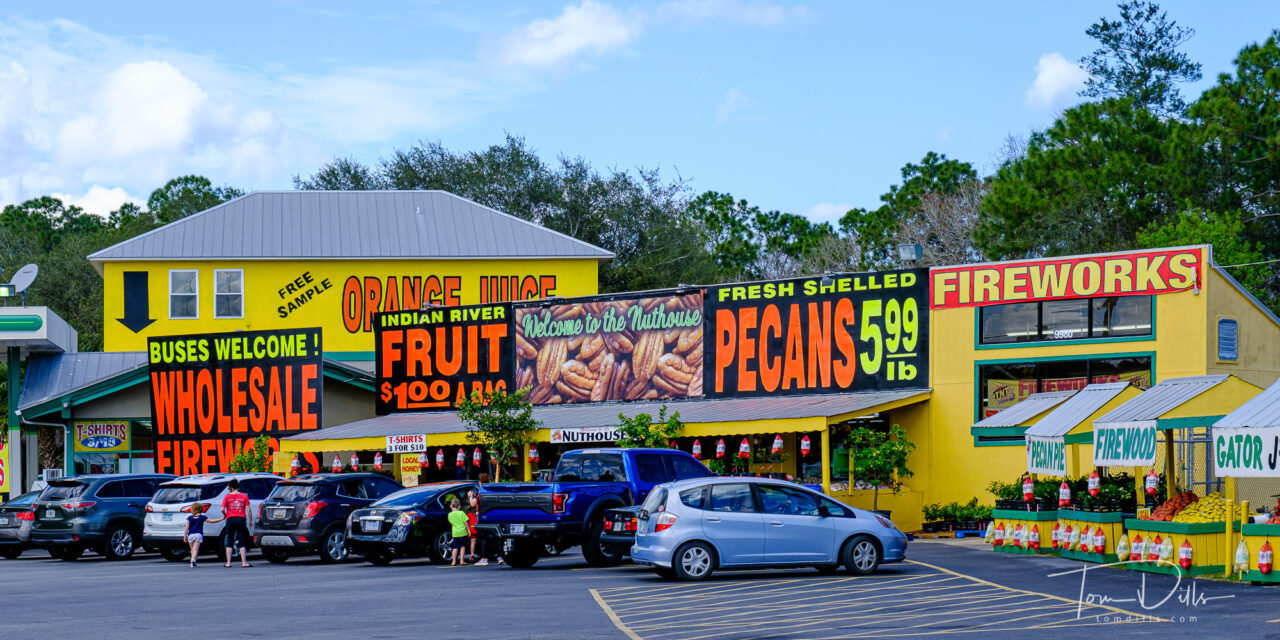
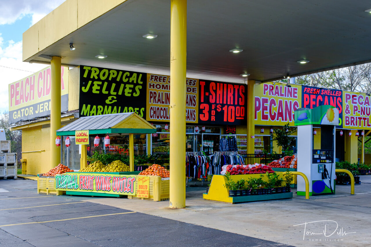
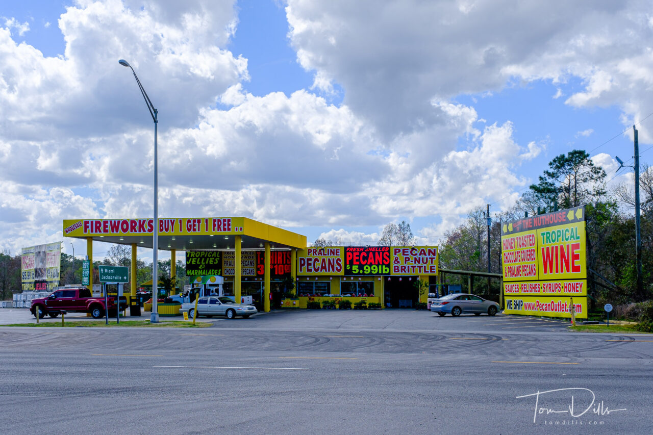
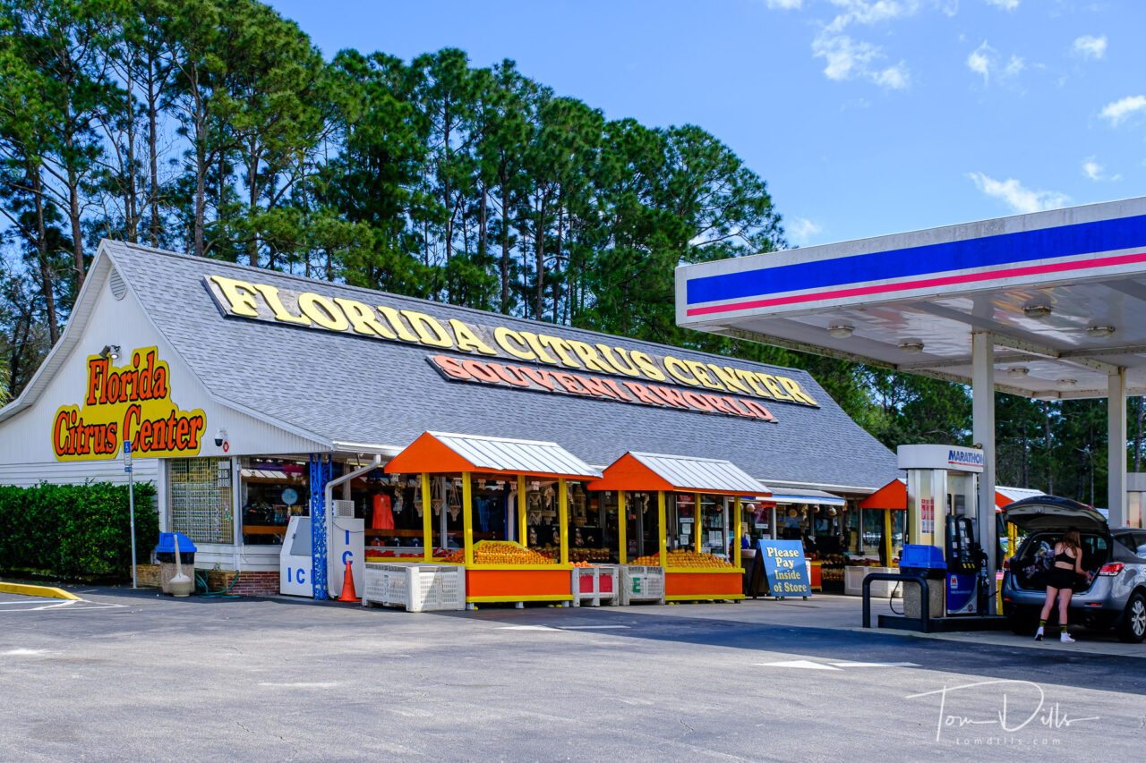
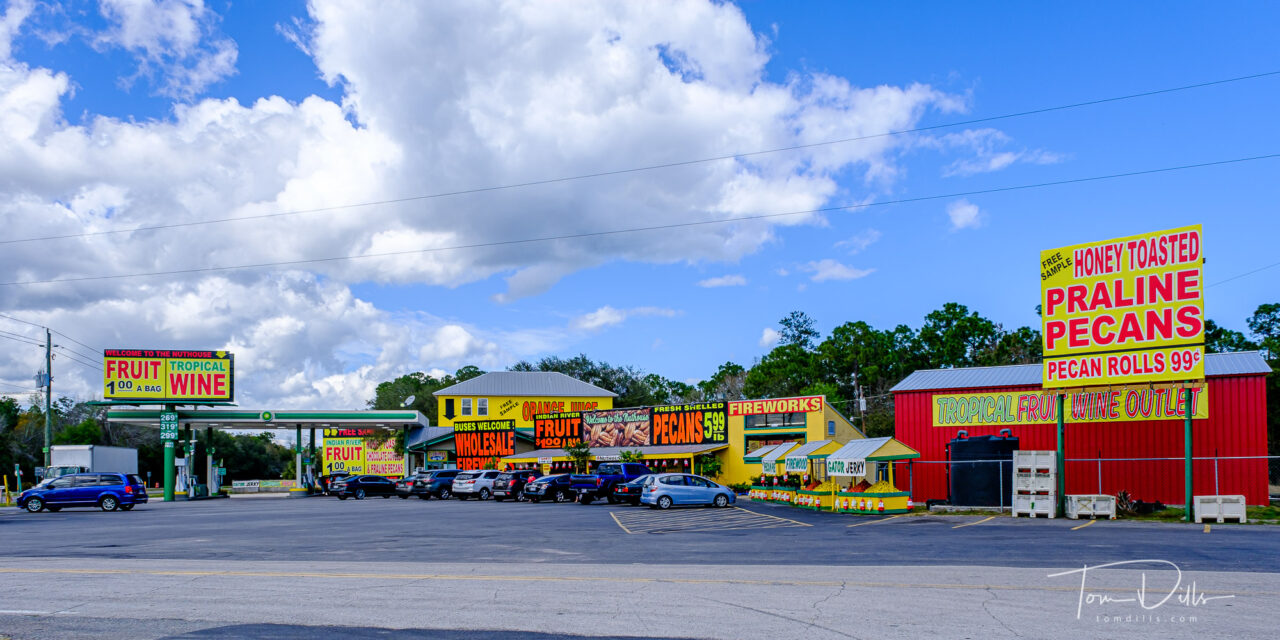
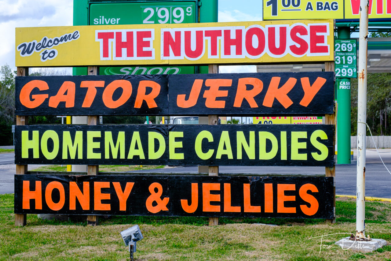
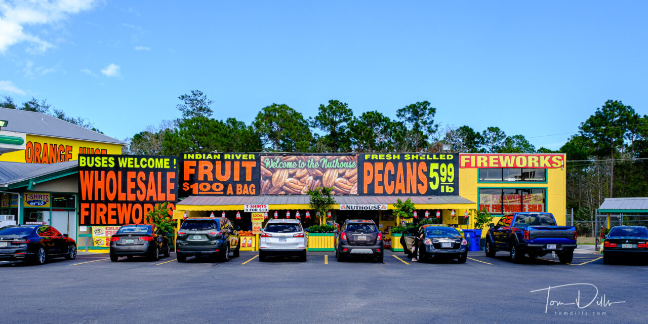
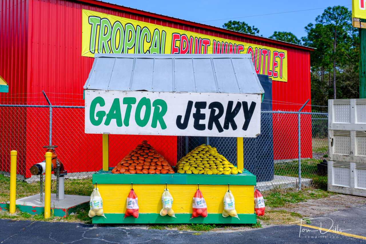
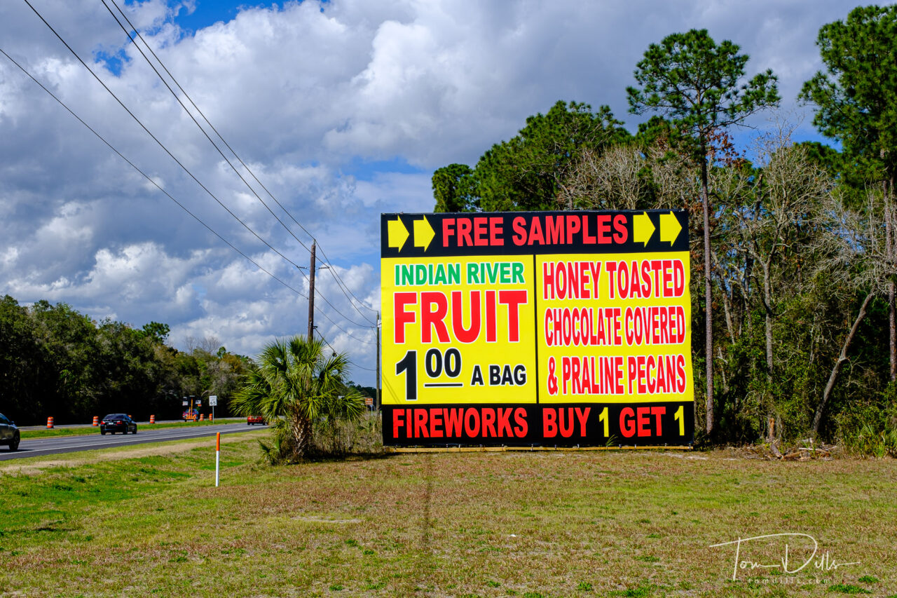
Roadside stands along I-95 offering all kinds of Florida items
On our way into St. Augustine a few days ago, we exited I-95 at an interchange that contains what I like to call “Floridiana.” It’s the oversize signs advertising all kinds of goodies to take back home and rot in the cupboard – Tropical Fruit Wine? Probably not. Gator Jerky? Don’t think so. Boiled peanuts? Tried ’em – pass. Also lots of things to tempt the kids and make them sick 20 miles up the road. I thought I would like to know what “Honey Toasted Chocolate Covered Praline Pecans” taste like until Kathy assured me that it is three different kinds and not just one. Oh, well.
Roadside stands along I-95 offering all kinds of Florida items
The story is that we didn’t stop there on the way in to town, and as often happens I kicked myself for not taking the time (it was late, we were tired and thirsty, etc.). So today we went into town to the fort to get a stamp on Kathy’s National Park Passport, and on the way back took the scenic route by way of this exit. Pretty interesting signage, although it didn’t tempt us enough to go inside.
Oh, and in case you wondered about all those oranges and grapefruits out roasting in the sun? They’re little concrete spheres. Wouldn’t make very good juice. 😉
Roadside stands along I-95 offering all kinds of Florida itemsRoadside stands along I-95 offering all kinds of Florida itemsRoadside stands along I-95 offering all kinds of Florida itemsRoadside stands along I-95 offering all kinds of Florida itemsRoadside stands along I-95 offering all kinds of Florida itemsRoadside stands along I-95 offering all kinds of Florida itemsRoadside stands along I-95 offering all kinds of Florida itemsRoadside stands along I-95 offering all kinds of Florida items
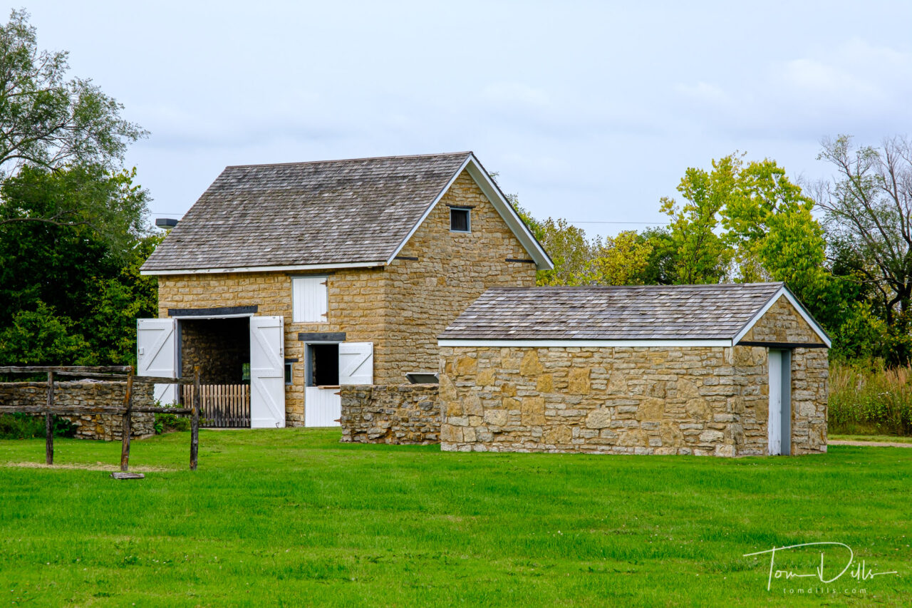
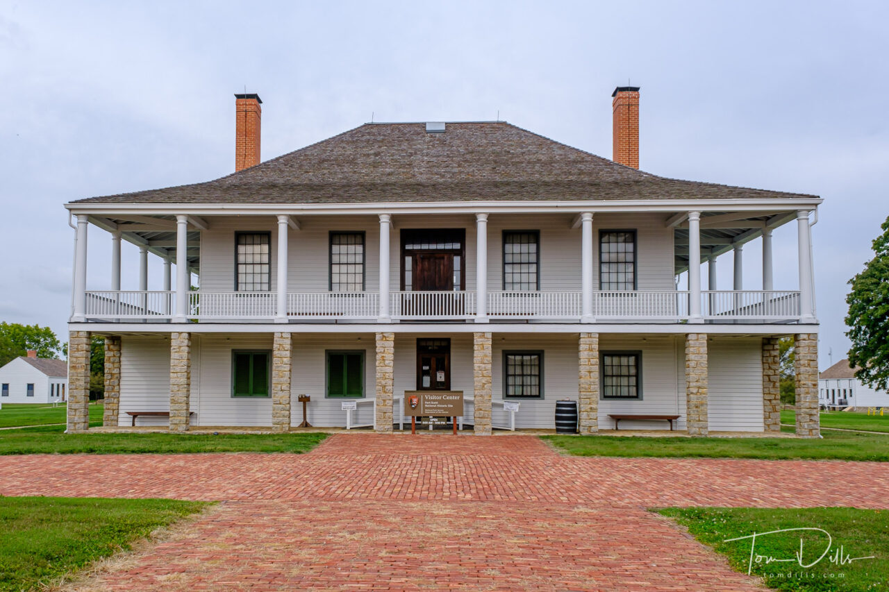
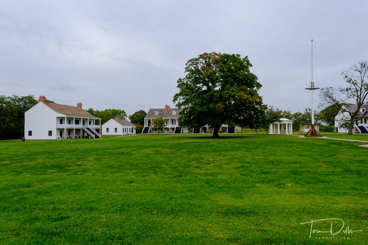
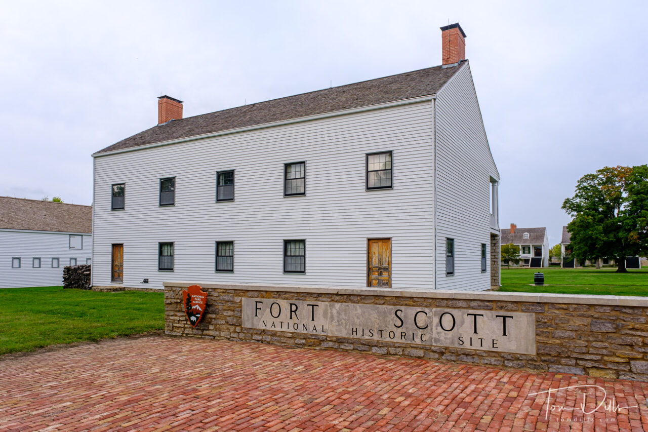
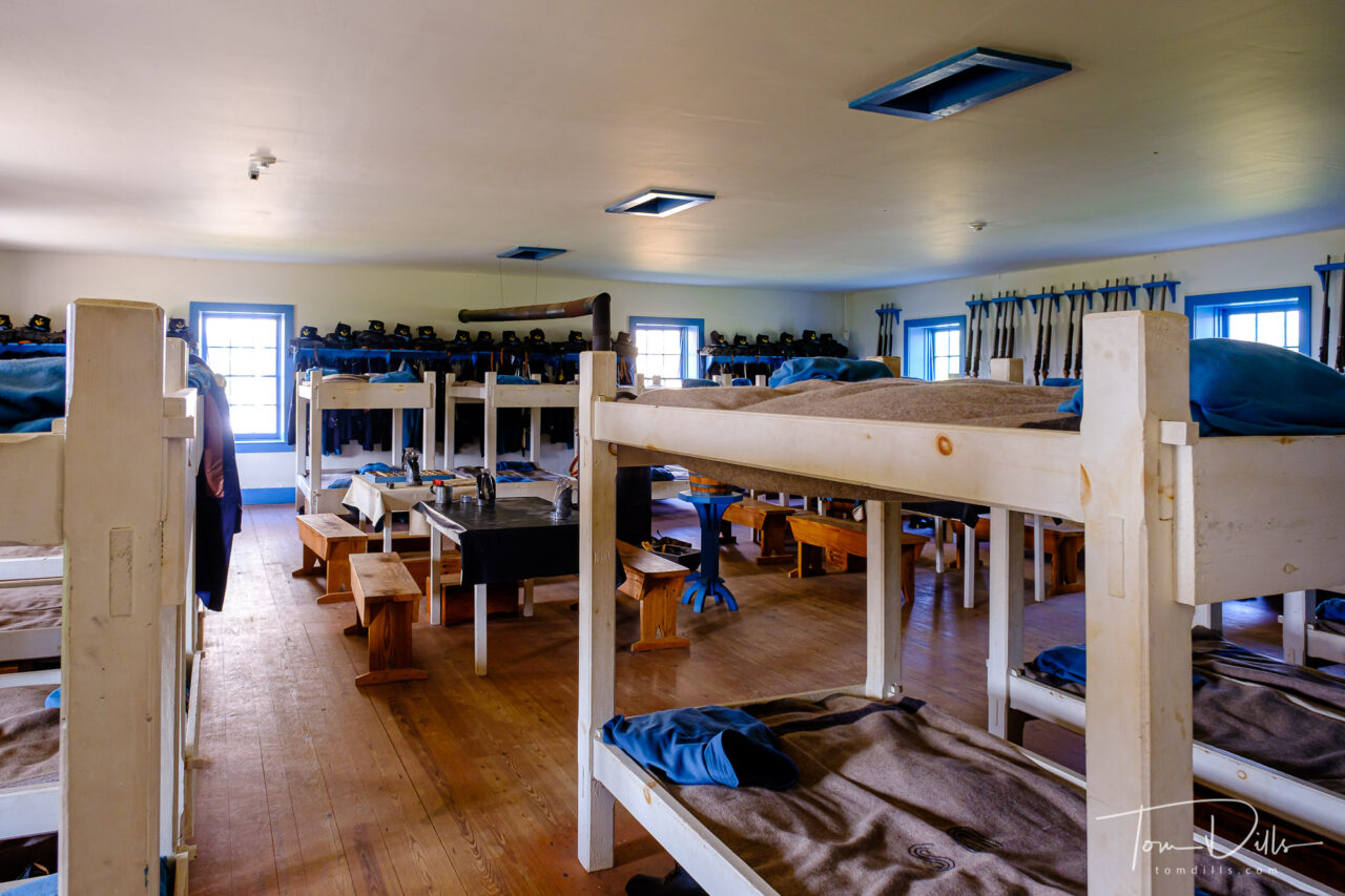
Fort Scott National Historic Site in Fort Scott, Kansas
I’ve finally finished processing all of my picks from our Pacific Northwest road trip!
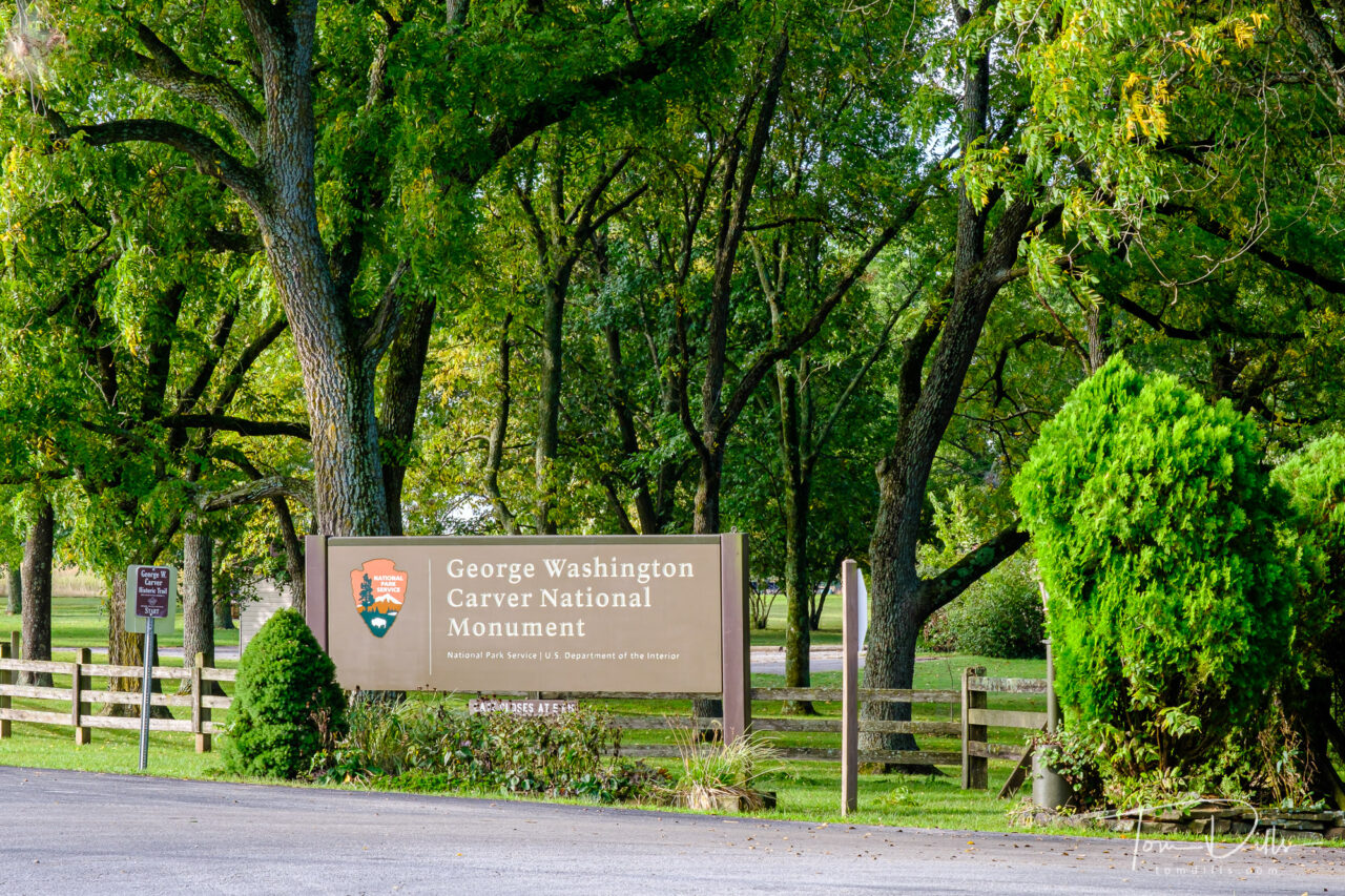
The last two stops were Fort Scott National Historic Site in Fort Scott, Kansas and George Washington Carver National Monument near Diamond, Missouri.
Fort Scott National Historic Site in Fort Scott, KansasFort Scott National Historic Site in Fort Scott, KansasFort Scott National Historic Site in Fort Scott, Kansas
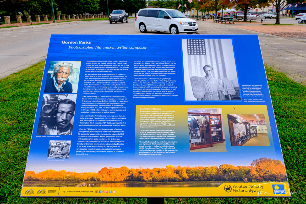
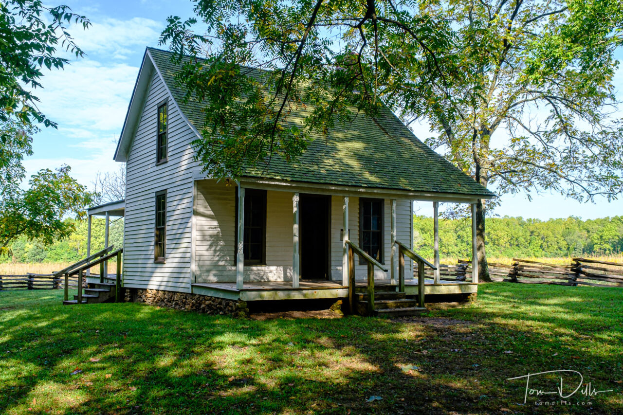
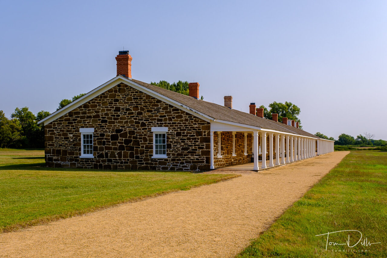
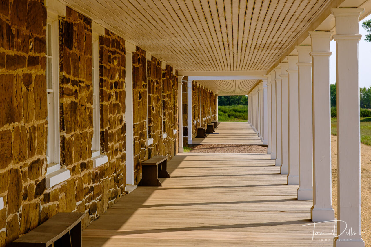
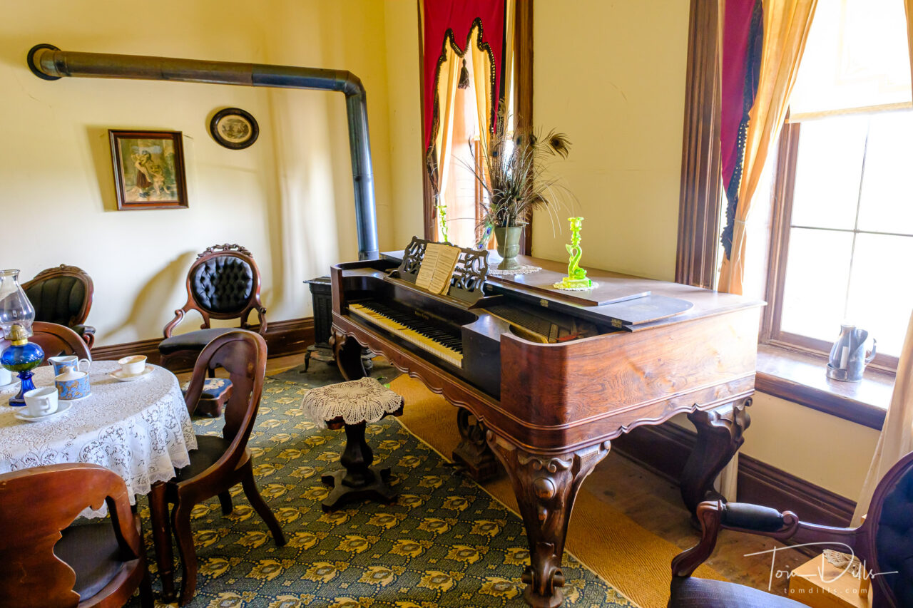
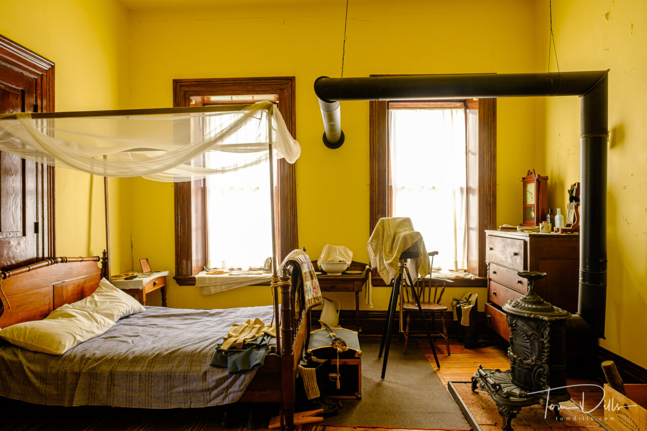
The two things we most wanted to do in Fort Scott were (1) visit the fort and (2) visit the Gordon Parks Museum. The trip from Fort Larned took longer than we expected, so we arrived at the fort just as they were shutting down for the day. Fortunately, a kind ranger was able to arrange for Kathy to get her Passport book stamped, and we were only able to see the outsides of the buildings.
Fort Scott, Kansas
The Gordon Parks Museum is part of Fort Scott Community College, and the college was closed at the time we passed through. So that will need to be reserved for a future trip. The town of Fort Scott was very quaint with a number of interesting looking shops and restaurants, so it’s likely that we’ll make a point of getting back there at some point.
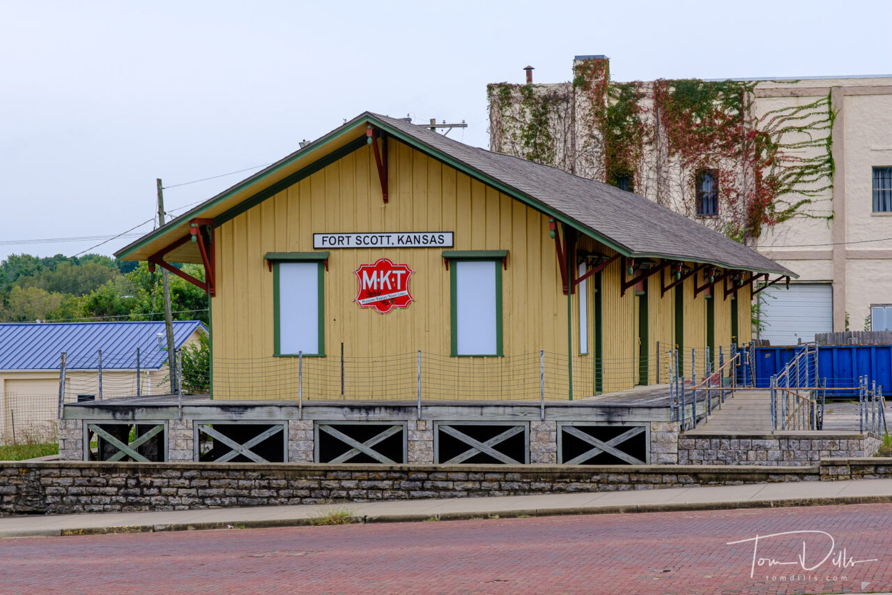
Old train station in Fort Scott, KansasFort Scott, Kansas
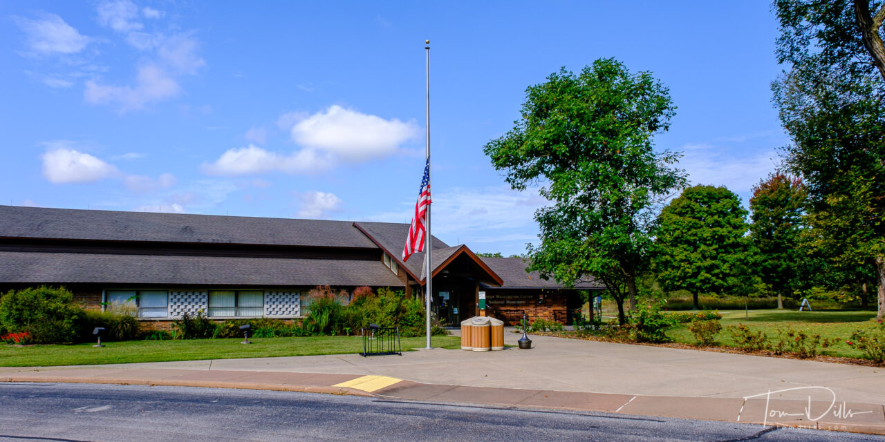
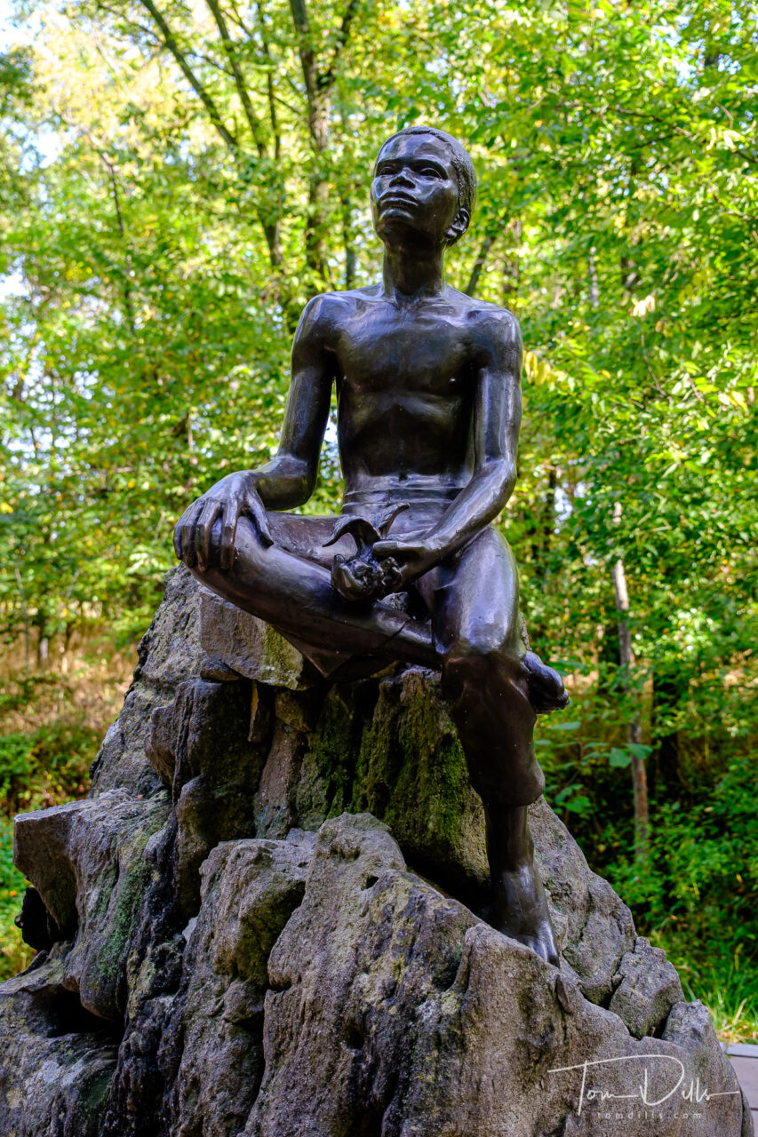
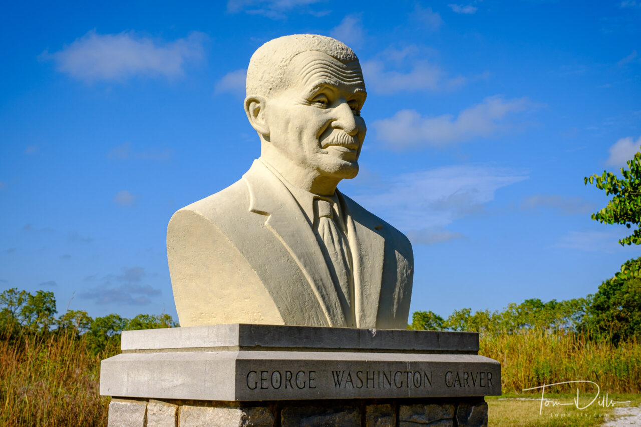
After spending the night in Joplin, MO we stopped at George Washington Carver National Monument the next day enroute to our last overnight in Clarksville, TN. We had always thought of Carver as the “peanut guy” but he did far more than that. It was another unexpectedly educational visit. After our night in Clarksville we “took the last train” and drove home through Tennessee while (unsuccessfully) dodging heavy thunderstorms!
George Washington Carver National Monument near Diamond, MissouriGeorge Washington Carver National Monument near Diamond, MissouriGeorge Washington Carver National Monument near Diamond, MissouriGeorge Washington Carver National Monument near Diamond, MissouriGeorge Washington Carver National Monument near Diamond, Missouri
All in all we drove a total of 8,230 miles over 25 days, and I took nearly 4,500 photos. My picks brought the total down to 1,745 and there are just over 800 photos in the 10 online galleries.
I now have a complete collection of photos from our road trip in my Adobe Portfolio page here.
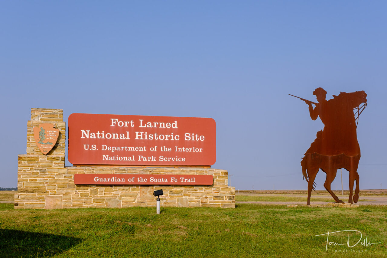
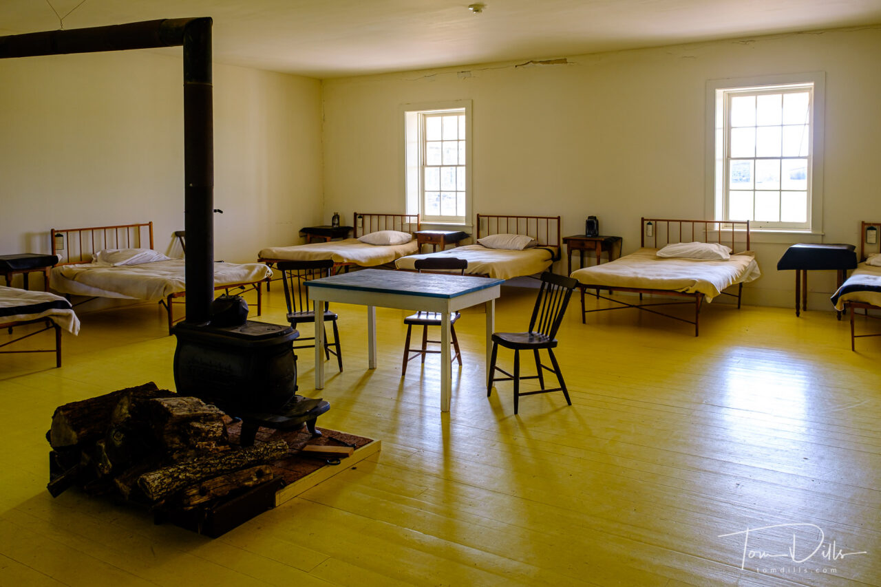
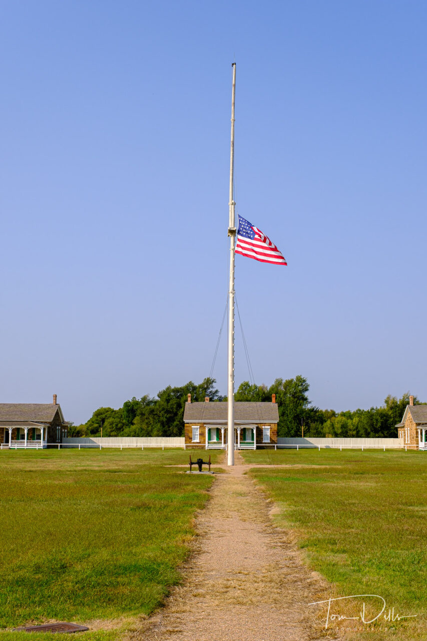
Entrance to Fort Larned National Historic Site near Larned, Kansas
Fort Larned National Historic Site in Kansas was our final major stop on our way toward home from Fort Collins, CO. We had spent the previous night in Hays, Kansas and stopped for a picnic breakfast at the picnic area just outside the entrance to the park. While we were there, we only saw one car drive in, and it was a guy with a dog, both of whom needed to use the “facilities” but neither went to the fort.
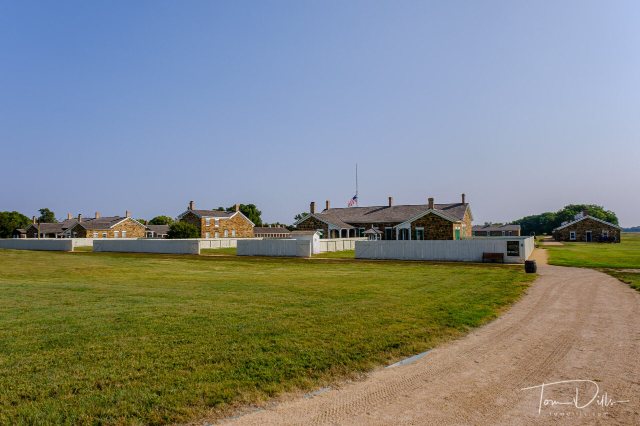
Fort Larned National Historic Site near Larned, Kansas. Flag was at half staff due to the recent passing of Supreme Court Justice GinsburgOfficers’ quarters at Fort Larned National Historic Site near Larned, KansasOfficers’ quarters at Fort Larned National Historic Site near Larned, KansasOfficers’ quarters at Fort Larned National Historic Site near Larned, Kansas
When we arrived in the parking lot for the fort, there were a few cars in the parking lot, but I have no idea who they belonged to. Other than a groundskeeper, who we only saw a few times and from a distance, we didn’t see another soul the whole time we were there. The metadata from my photos shows an hour and fifteen minutes between the first and last pictures. But all of the buildings were open for viewing, and the rangers had set up a little table to get stamps for our National Parks Passport.
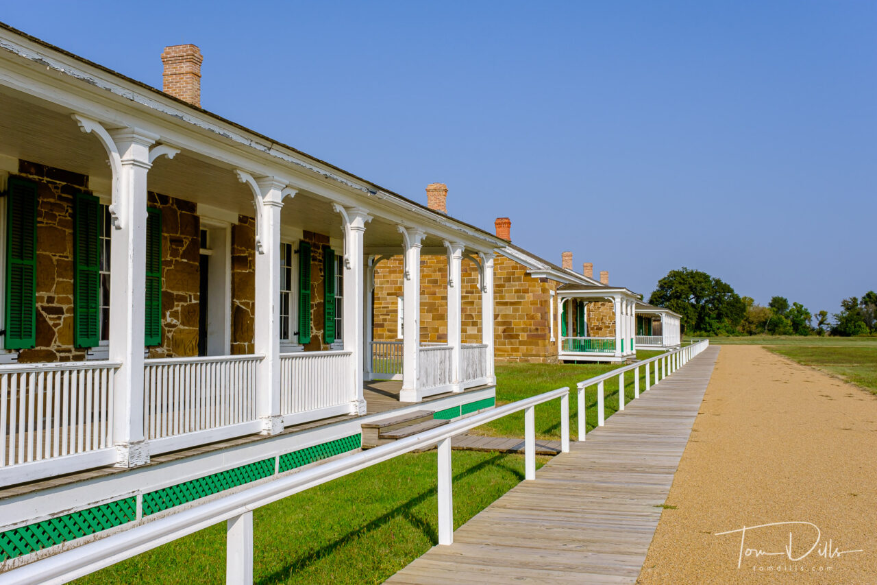
Officers’ quarters at Fort Larned National Historic Site near Larned, KansasOfficers’ quarters at Fort Larned National Historic Site near Larned, KansasOfficers’ quarters at Fort Larned National Historic Site near Larned, Kansas
We visited a number of different historic sites on our western loop, and three of them were forts. Interestingly, all three of them were from different periods in our history, and each one served a unique purpose in its time. Fort Clatsop in Oregon was established by the Lewis and Clark Expedition in 1805 and was their quarters for the winter of 1805-1806. Fort Scott, which we visited later the same day as Fort Larned, was established in 1842 as one of a chain of forts intended to protect settlers from the Plains Indians, as well as to protect the Indians from the settlers’ encroachment.
Troop barracks at Fort Larned National Historic Site near Larned, KansasMedical facilities and infirmary at Fort Larned National Historic Site near Larned, Kansas
Fort Larned was originally established in 1859 as The Camp on Pawnee Fork. It was renamed Camp Alert in 1860 then moved to the current location and renamed Fort Larned, after Colonel Benjamin F. Larned, the paymaster general of the United States Army at the time the post was established. Fort Larned’s purpose was to protect traffic along the Santa Fe Trail.
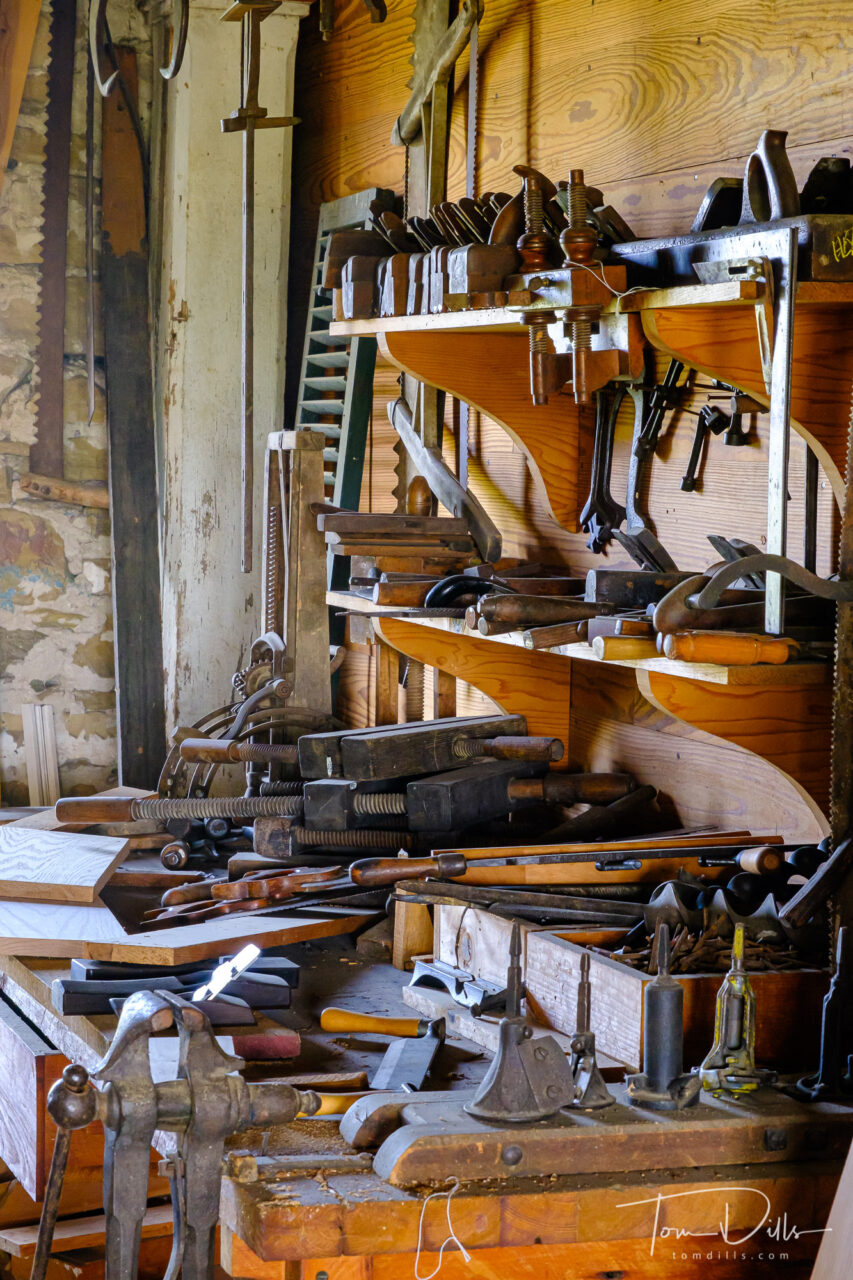
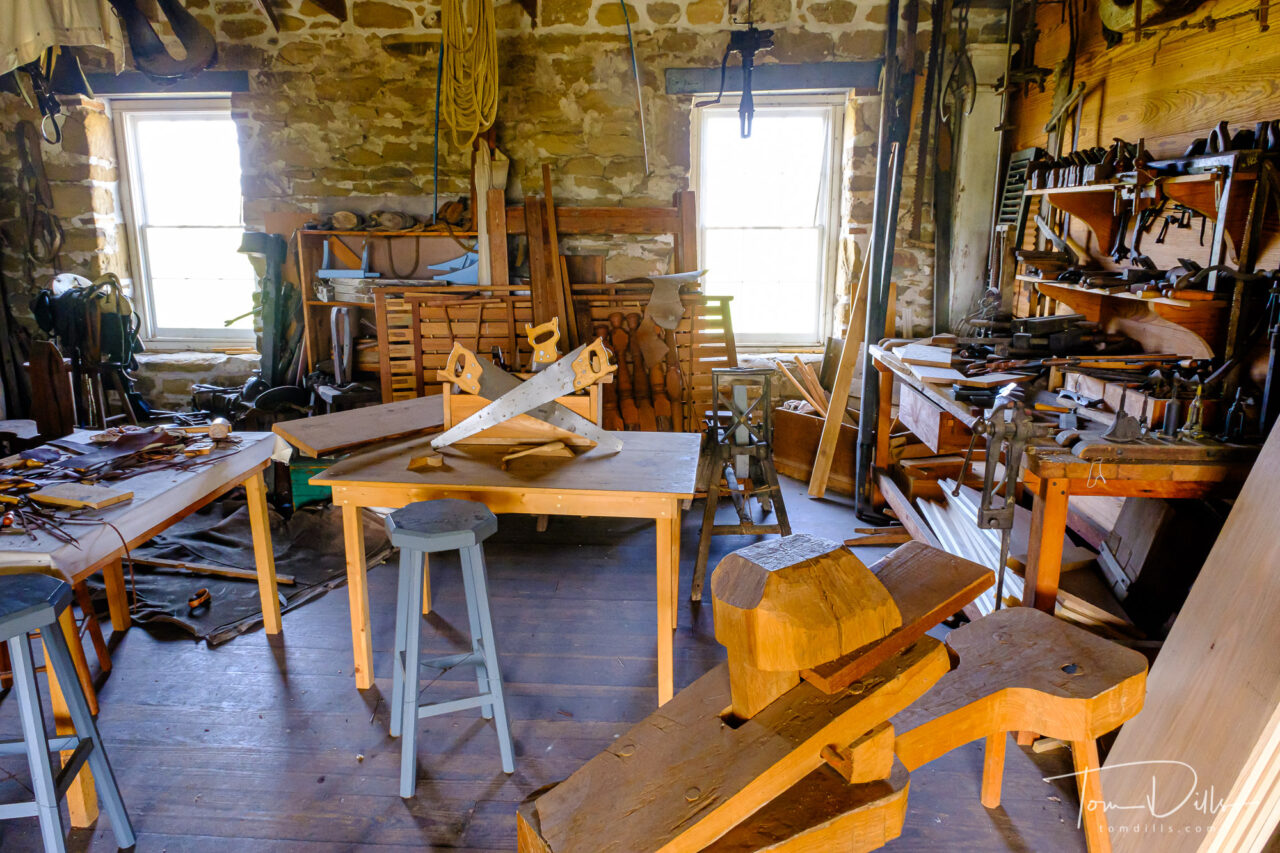
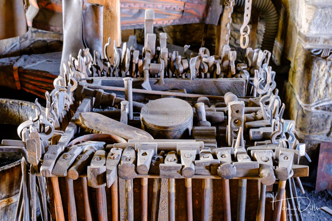
Shop areas at Fort Larned National Historic Site near Larned, KansasShop areas at Fort Larned National Historic Site near Larned, KansasShop areas at Fort Larned National Historic Site near Larned, Kansas
The park is very well done, with numerous buildings all restored and preserved in near-original condition and is a fine representation of a complete and authentic army post from the 1860s -1870s. This well-preserved fort on the Santa Fe Trail shares a tumultuous history of the Indian Wars era. The sandstone constructed buildings sheltered troops who were known as the Guardians of the Santa Fe Trail.
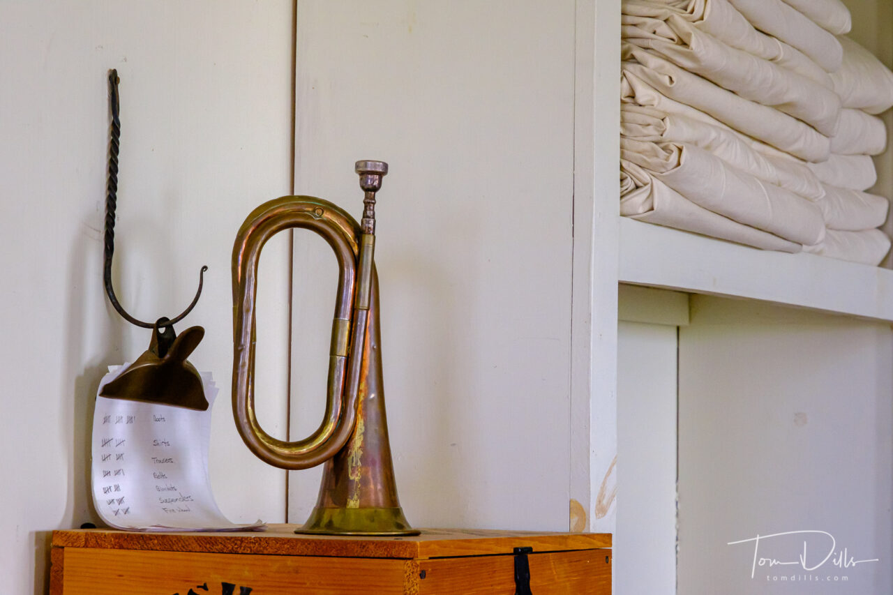
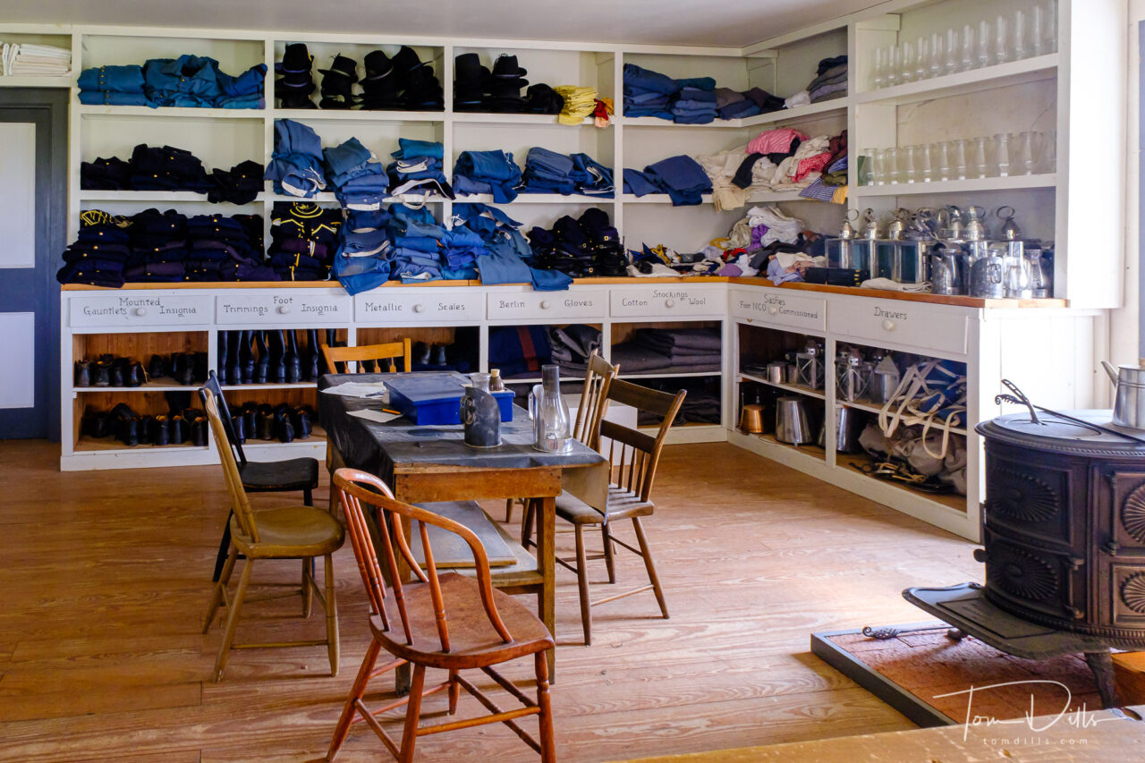
Food, clothing, supplies and munitions storage at Fort Larned National Historic Site near Larned, KansasFood, clothing, supplies and munitions storage at Fort Larned National Historic Site near Larned, Kansas
I’ve added a gallery of more photos from Fort Larned on my Adobe Portfolio site for anyone who wants to see more. Enjoy! 🙂
Fort Larned National Historic Site near Larned, KansasFort Larned National Historic Site near Larned, Kansas. Flag was at half staff due to the recent passing of Supreme Court Justice Ginsburg
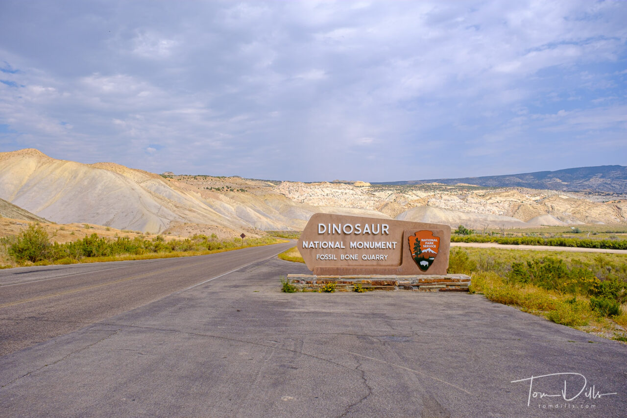
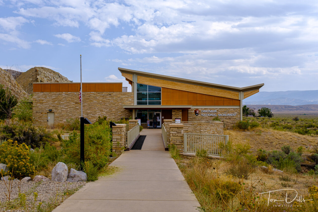
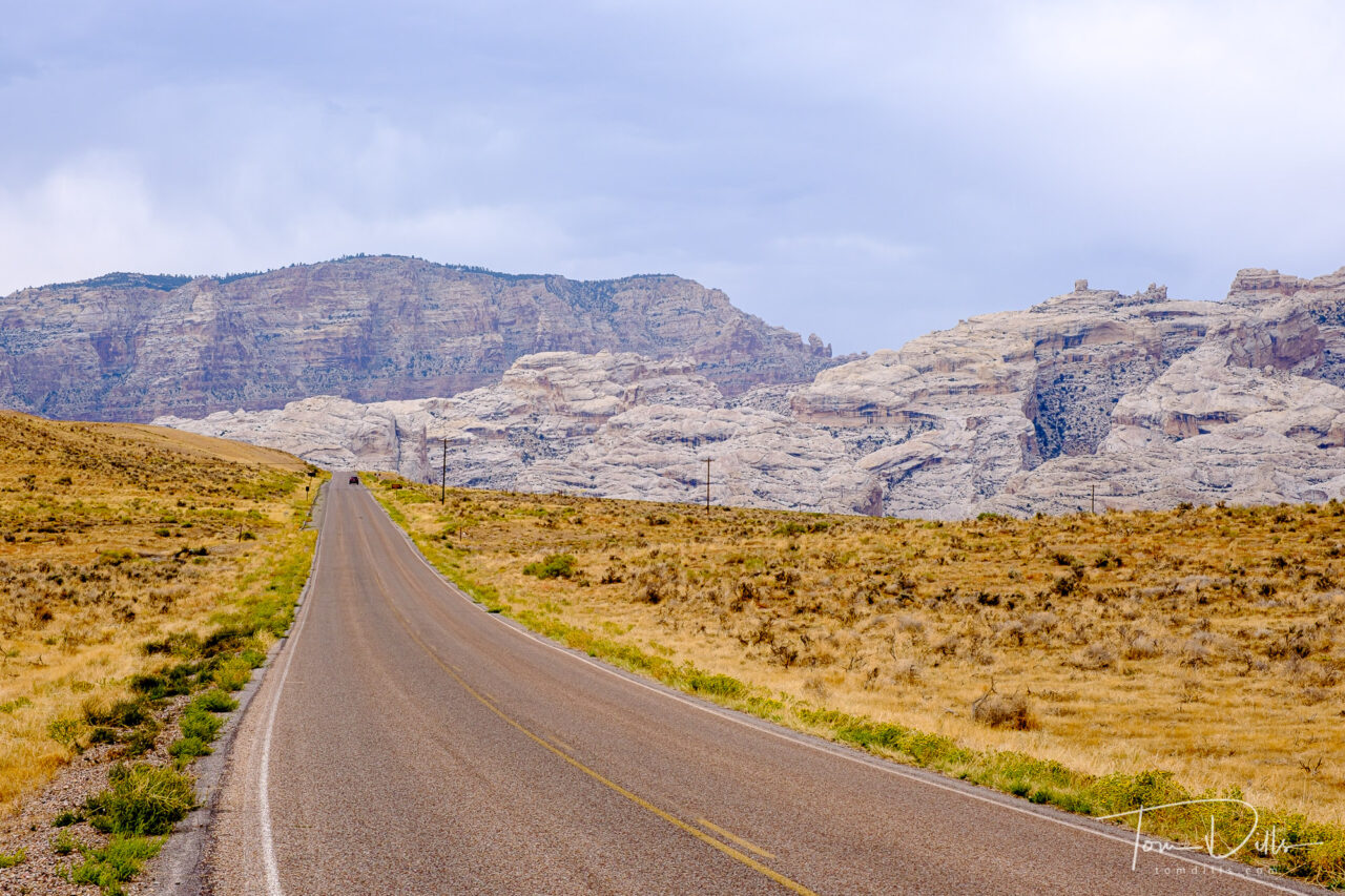
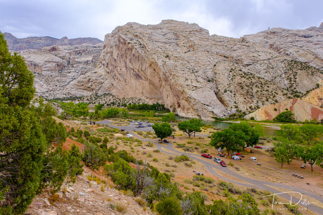
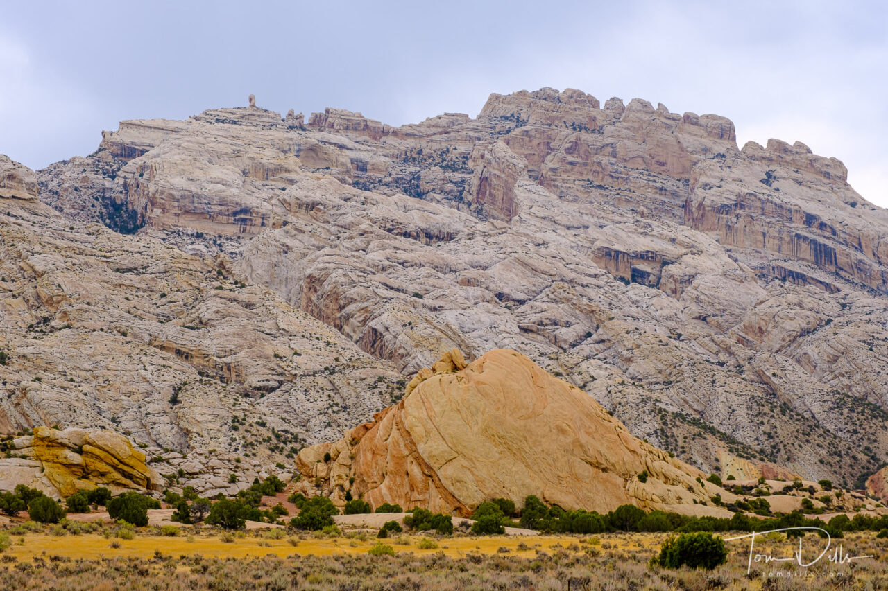
As we started our eastward return leg from Ogden toward Colorado, we had one more stop to make in Utah. Dinosaur National Monument straddles the eastern Utah and western Colorado border. The park’s primary claim to fame is the Fossil Quarry, located on the Utah side near the town of Jensen, UT. Jensen lies along US-40, roughly halfway between Park City, UT and Steamboat Springs, CO.
Quarry Visitor Center at Dinosaur National Monument near Jensen, UtahQuarry Visitor Center at Dinosaur National Monument near Jensen, Utah
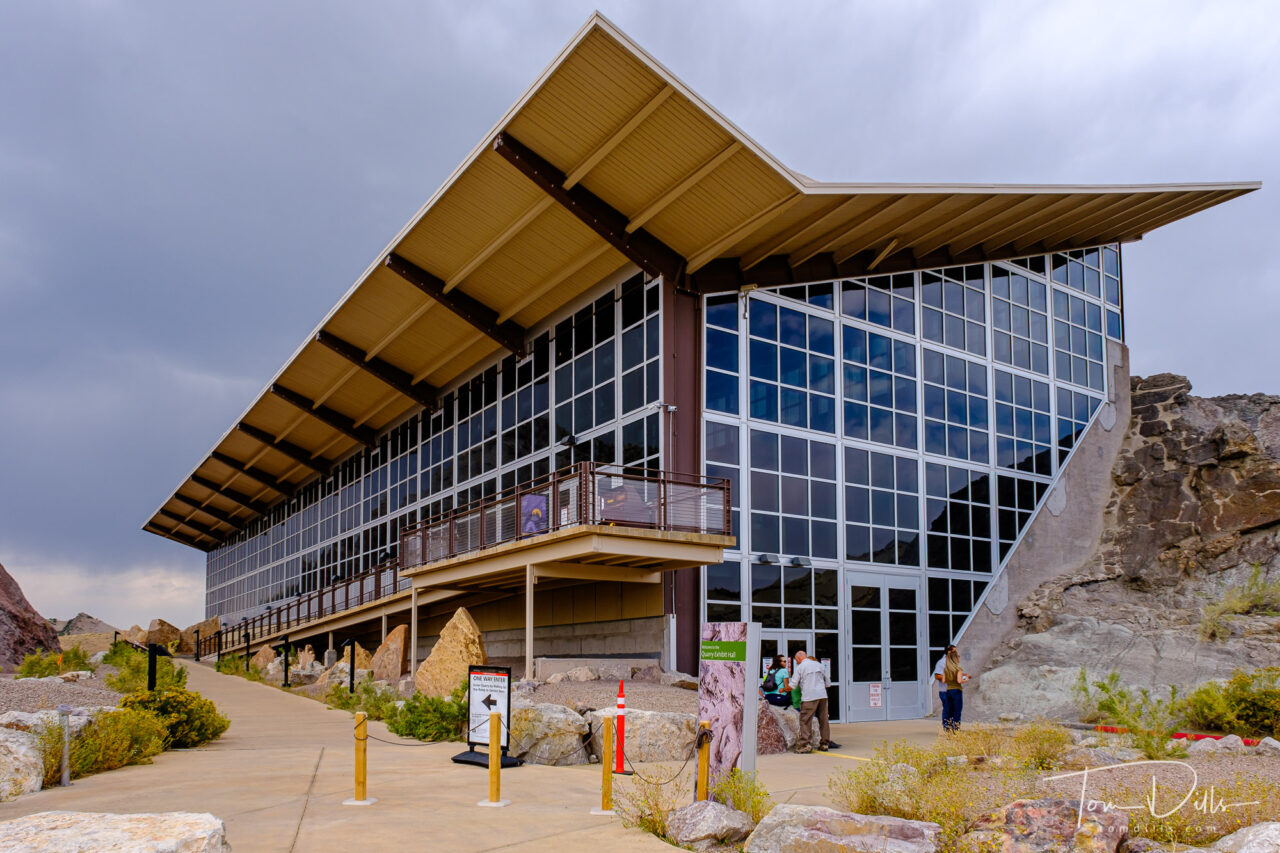
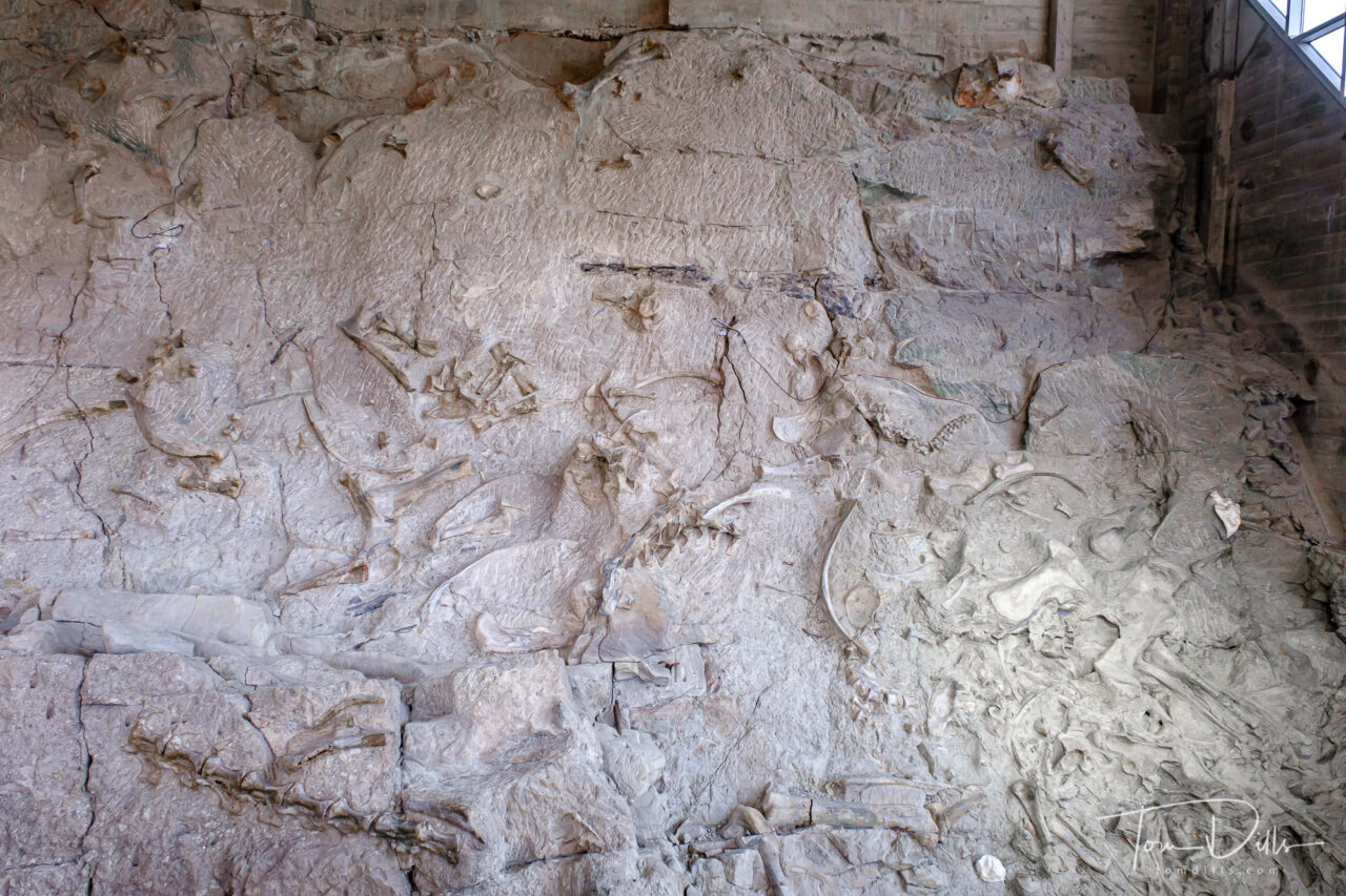
The Quarry Visitor Center contains numerous exhibits about the history of the area, including the quarry wall itself that is now housed within an impressive building. The building itself was operating at a greatly reduced capacity with reservations required. We made our reservations several days in advance and had no trouble getting in. Interestingly no one actually asked us for documentation of our reservations, although I’m certain they are checked randomly.
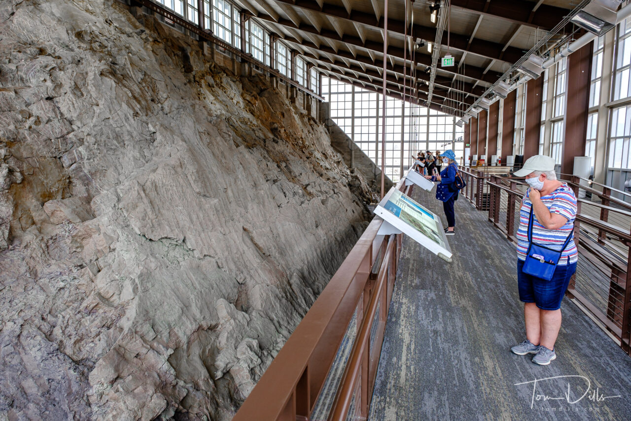
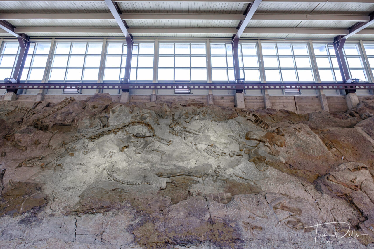
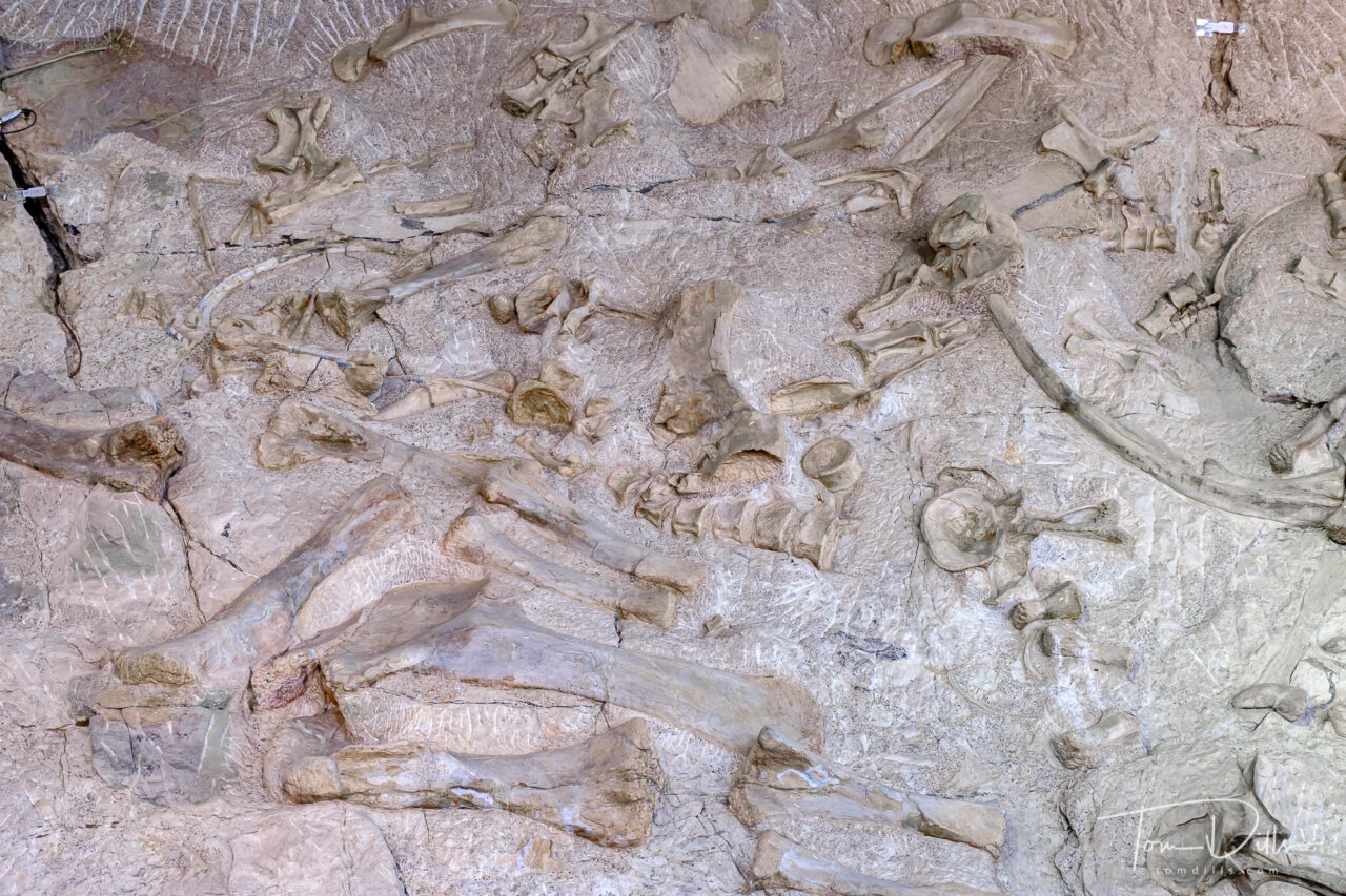
Quarry Exhibit Hall and the wall of dinosaur bones at Dinosaur National Monument near Jensen, UtahQuarry Exhibit Hall and the wall of dinosaur bones at Dinosaur National Monument near Jensen, UtahQuarry Exhibit Hall and the wall of dinosaur bones at Dinosaur National Monument near Jensen, UtahQuarry Exhibit Hall and the wall of dinosaur bones at Dinosaur National Monument near Jensen, UtahQuarry Exhibit Hall and the wall of dinosaur bones at Dinosaur National Monument near Jensen, Utah
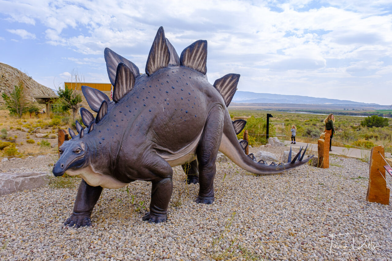
The dinosaur fossil beds were discovered in 1909 by Earl Douglass, a paleontologist working and collecting for the Carnegie Museum of Natural History. He and his crews excavated thousands of fossils and shipped them back to the museum in Pittsburgh, PA for study and display. President Woodrow Wilson proclaimed the dinosaur beds as Dinosaur National Monument in 1915. The monument boundaries were expanded in 1938 from the original 80 acres surrounding the dinosaur quarry in Utah, to 210,844 acres in Utah and Colorado, encompassing the river canyons of the Green and Yampa. It’s hard to believe that the fossils that remain today are the “leftovers,” as it still makes for a very impressive display.
Scenic views from Cub Creek Road in Dinosaur National MonumentScenic views from Cub Creek Road in Dinosaur National MonumentScenic views from Cub Creek Road in Dinosaur National Monument
While the quarry is the main attraction, I was in many ways more impressed by the stunning scenery of the area surrounding the visitor center. We saw only a tiny portion of the 210+ thousand acres, and it would be quite easy to spend a lot more time exploring. But alas, we were on our way to Colorado and could only devote a few hours to the park. It’s not the kind of place you just happen to pass by, but we may decide to detour that way the next time we head west. The drive along US 40 is much more pleasant and scenic than I would expect I-70 or I-80 to be!
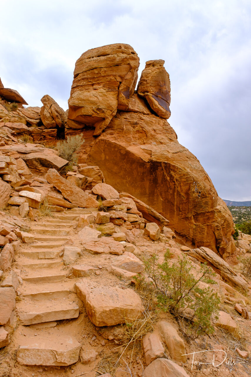
Petroglyphs at Dinosaur National Monument near Jensen, Utah
I’ll added a more complete gallery of photographs from Dinosaur on my Adobe Portfolio page.
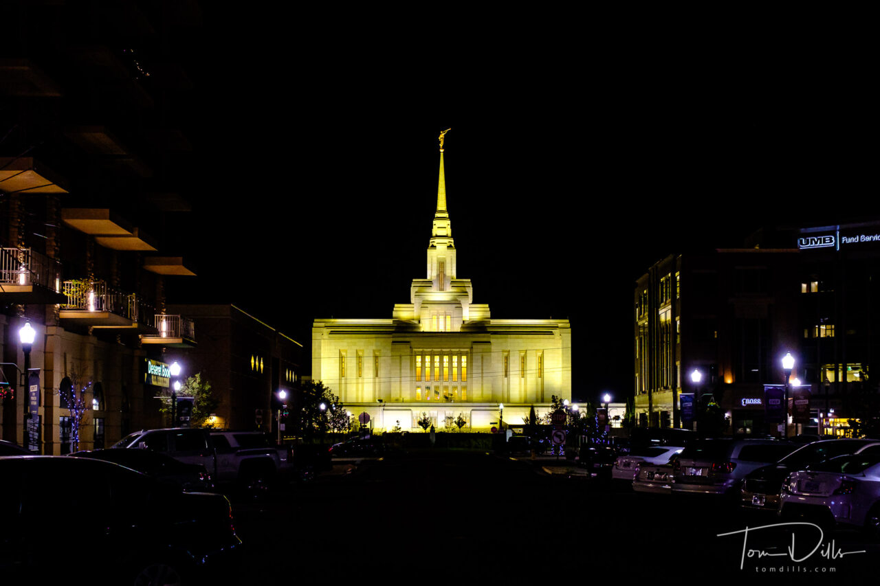
Ogden Utah Temple of JCLDS in downtown Ogden, Utah
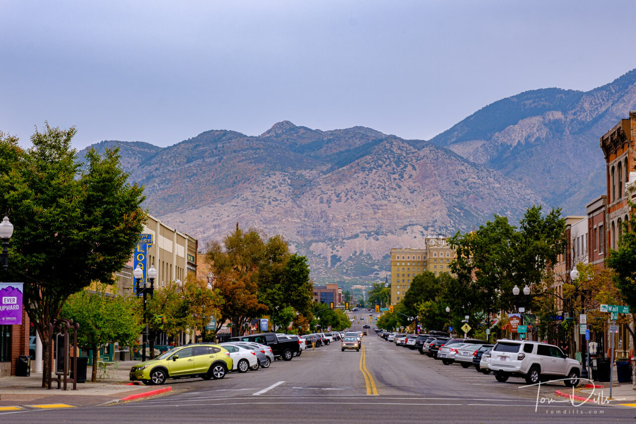
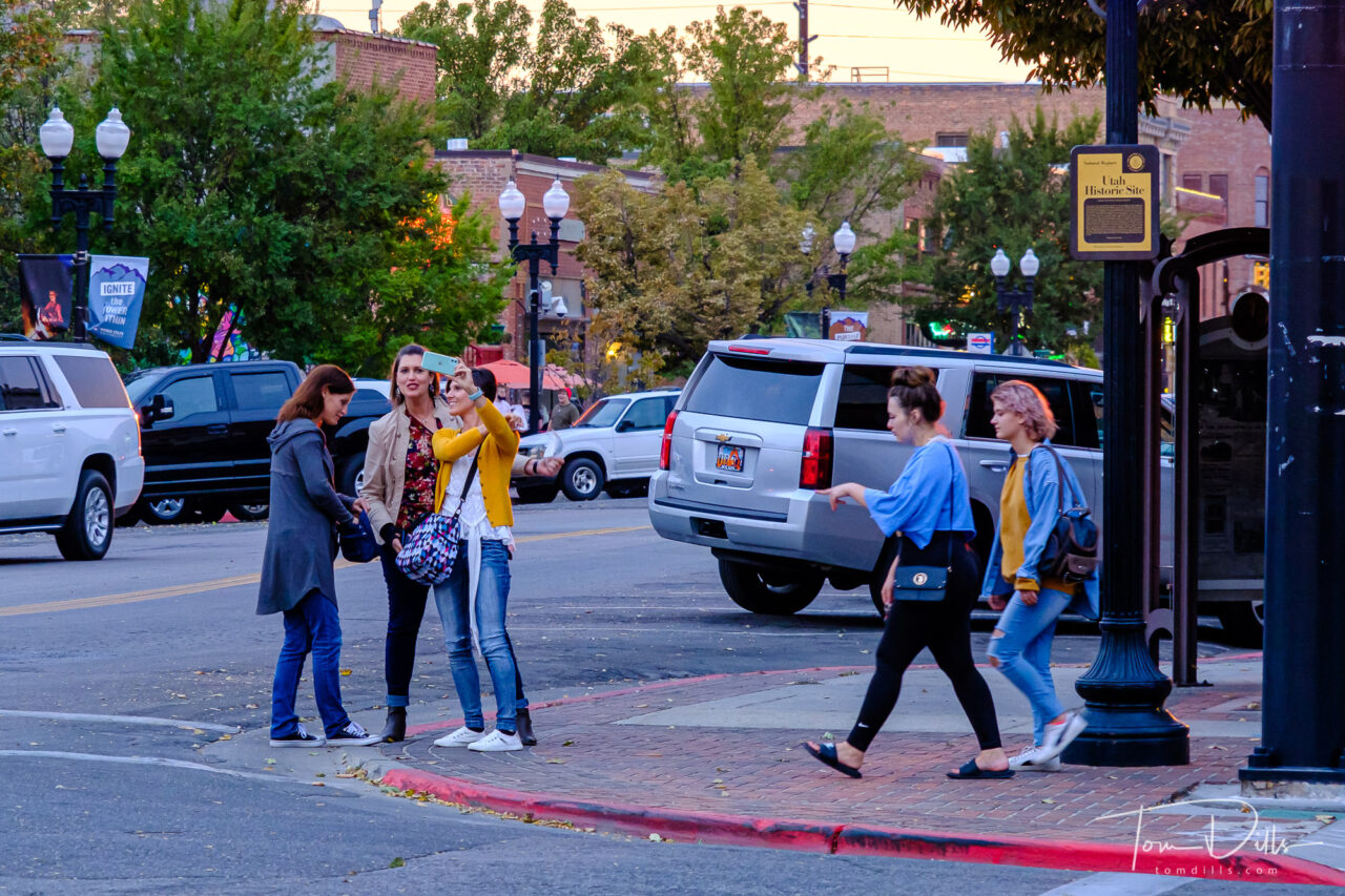
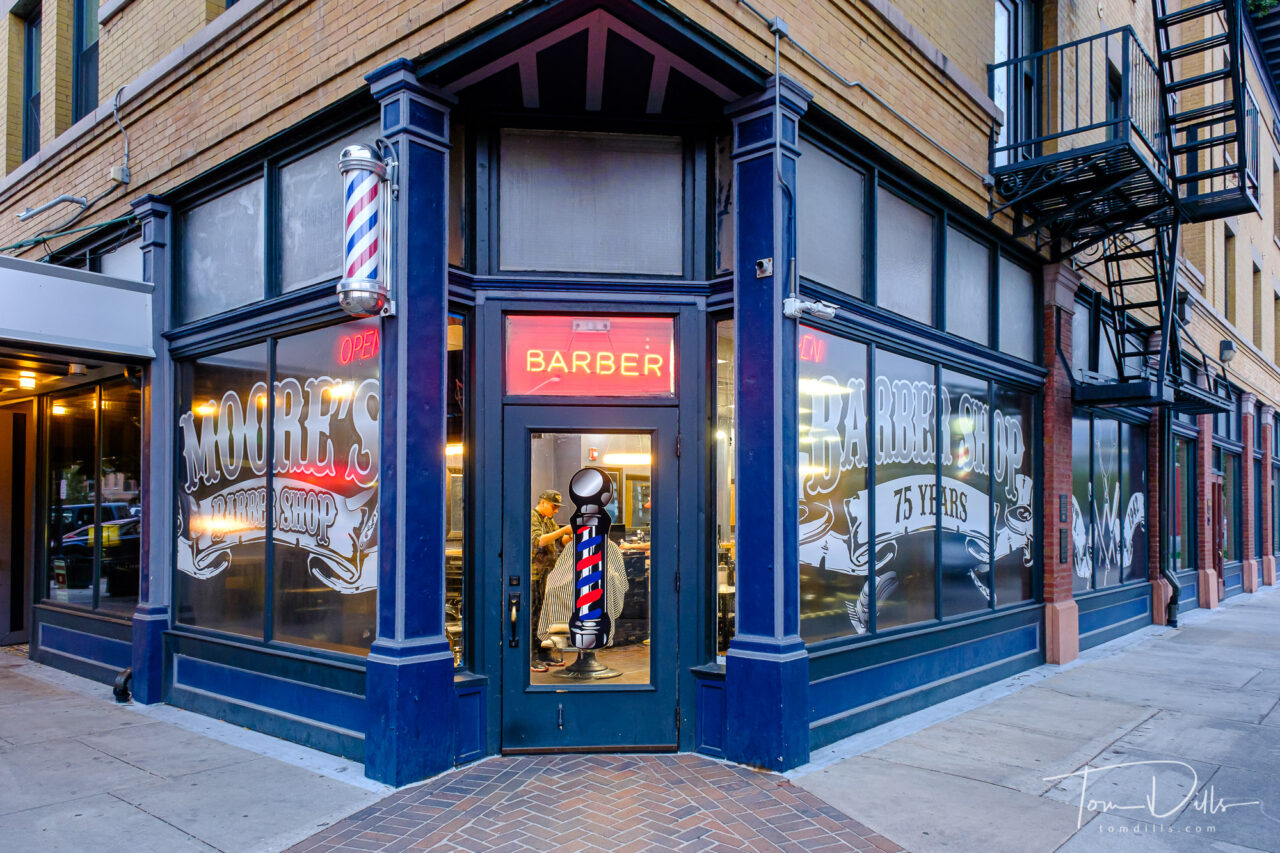
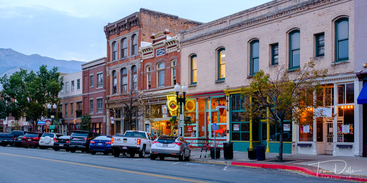
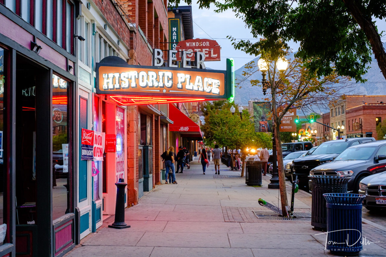
While Ogden has a long history as a railroad town, there is more in Ogden than trains. There’s food! And churches, shops, baseball and many other things. We didn’t have a lot of time to explore, having gotten to town late in the day the first day, then spending the following day at Golden Spike. But we did have time both evenings to walk around and explore the town a bit.
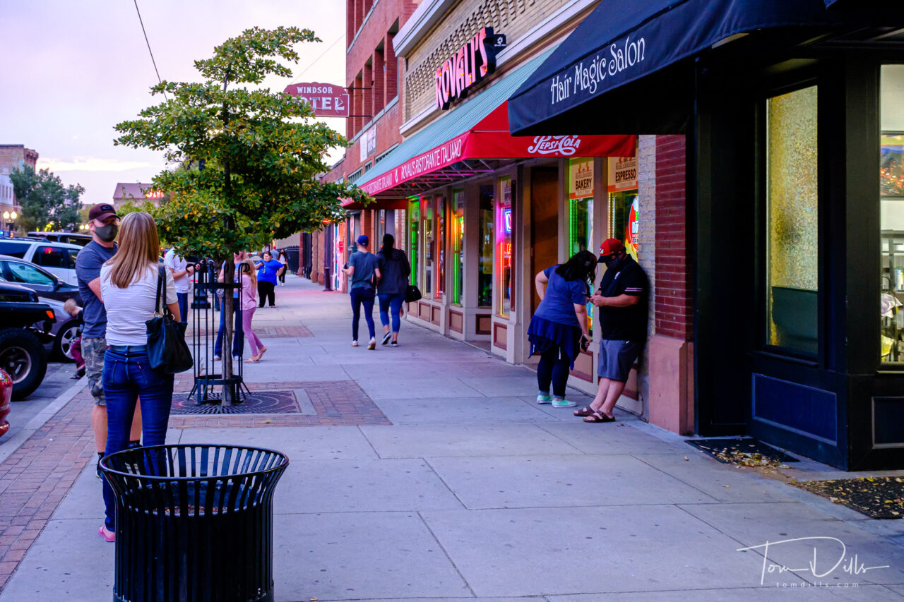
25th Street in downtown Ogden, UtahEvening in downtown Ogden, UtahEvening in downtown Ogden, Utah25th Street in downtown Ogden, Utah25th Street in downtown Ogden, Utah
25th Street is the epicenter of the historic district and home to many of the restaurants and bars in Ogden. And 25th street meets Wall Street just across Wall from the historic Ogden depot, so it was a nice destination on a beautiful evening. The mountain air made for a nice walk before and after dinner.
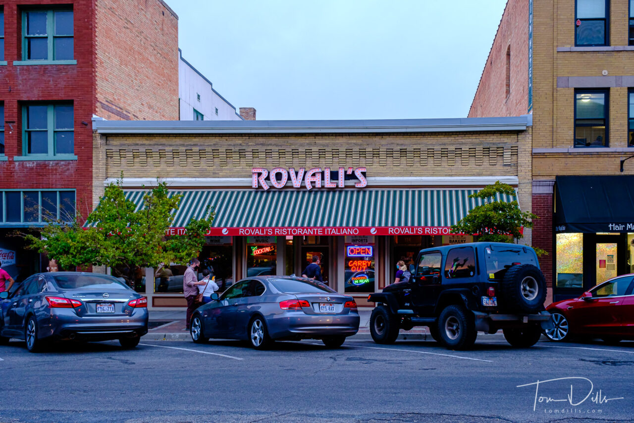
Rovali’s Italian Restaurant in downtown Ogden, UtahRovali’s Italian Restaurant in downtown Ogden, UtahMotion blur of cars while waiting for dinner in downtown Ogden, UtahMotion blur of cars while waiting for dinner in downtown Ogden, UtahMotion blur of cars while waiting for dinner in downtown Ogden, Utah
The second evening we had a bit of a wait for dinner at a highly-recommended Italian restaurant. I had my camera with me so I made some photos of the passing traffic while we waited. Between that and time to just chill, it was quite relaxing. Once our names were called, the owner himself seated us at a window table, sold us a nice bottle of wine and made a couple of recommendations for entrees. It was a nice dinner and we enjoyed it a lot.
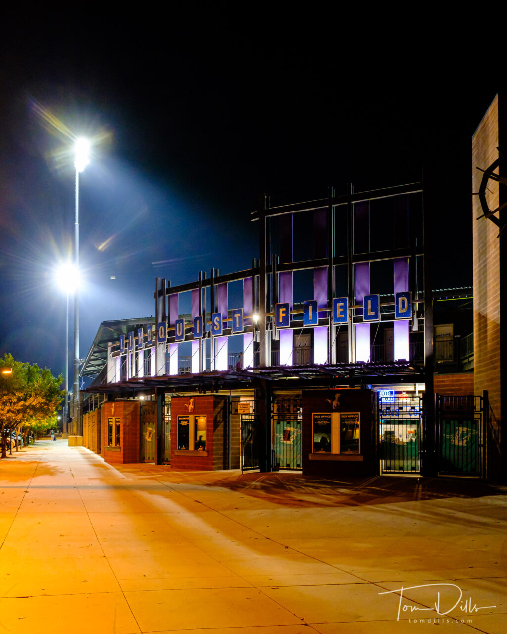
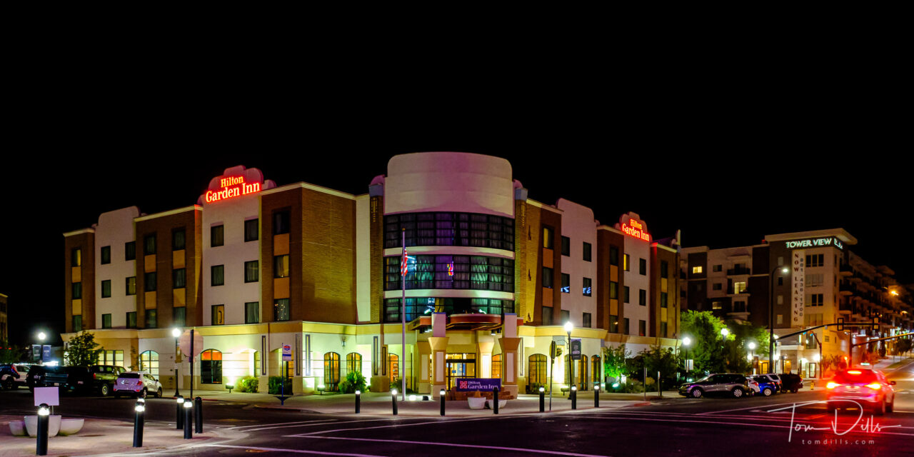
Lindquist Field, home of the Raptors minor league baseball team in Ogden, UtahHilton Garden Inn in downtown Ogden, UtahEvening in downtown Ogden, UtahEvening in downtown Ogden, Utah
Ogden is a vibrant town, plenty to do but not overwhelming like a lot of larger towns. That’s why we decided to stay there rather than in or closer to Salt Lake City. We had to navigate our way through SLC on our way to Colorado, and other than a wrong turn and eventually a stop at a neighborhood restaurant for breakfast, it was pretty uneventful.
I would like to return someday and actually visit Salt Lake City once the Tabernacle is open for tours and their daily organ recital. But for this time we made do with trains and traffic in Ogden.
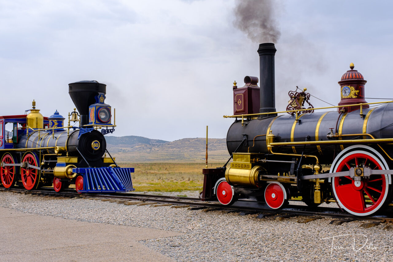
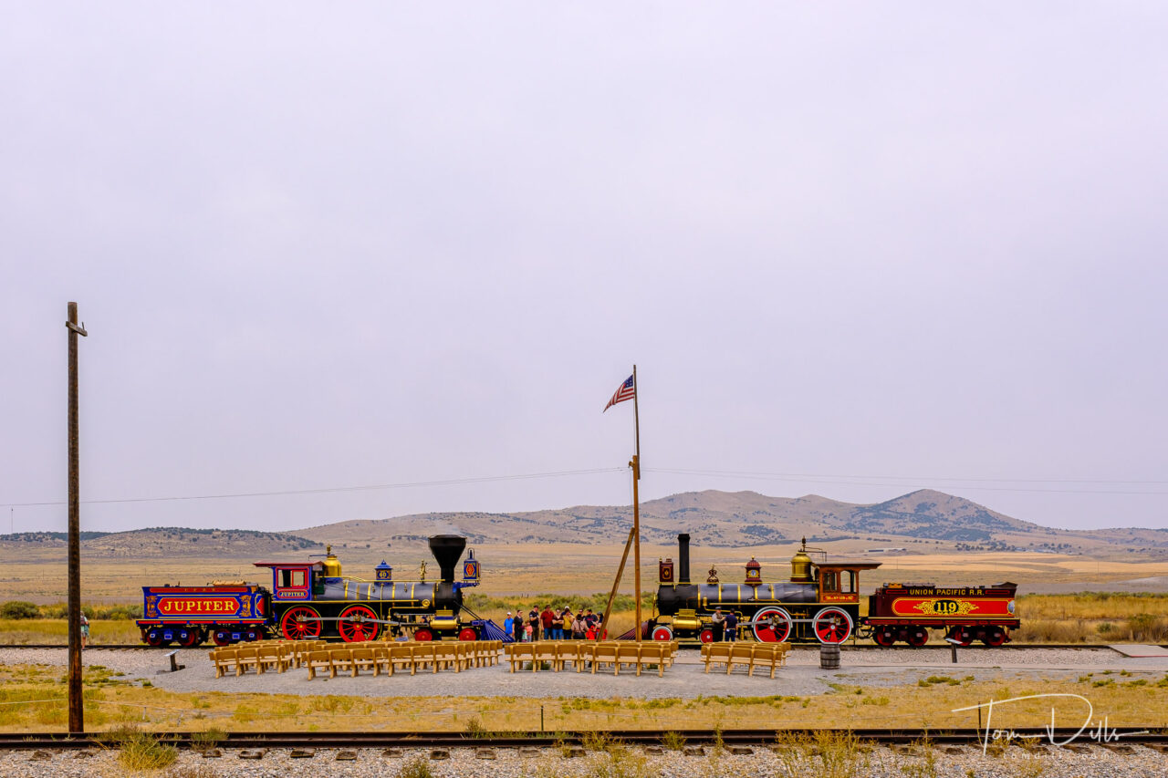
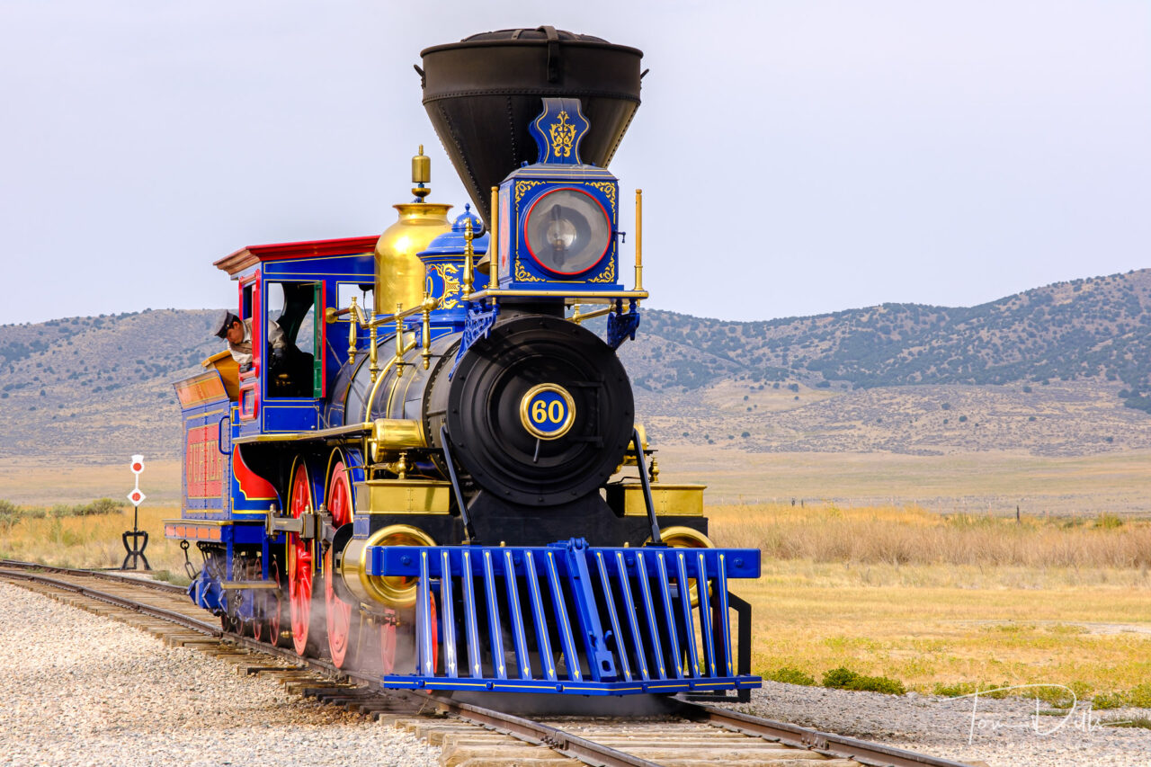
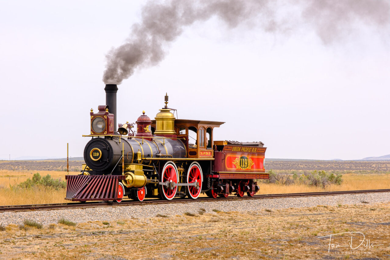
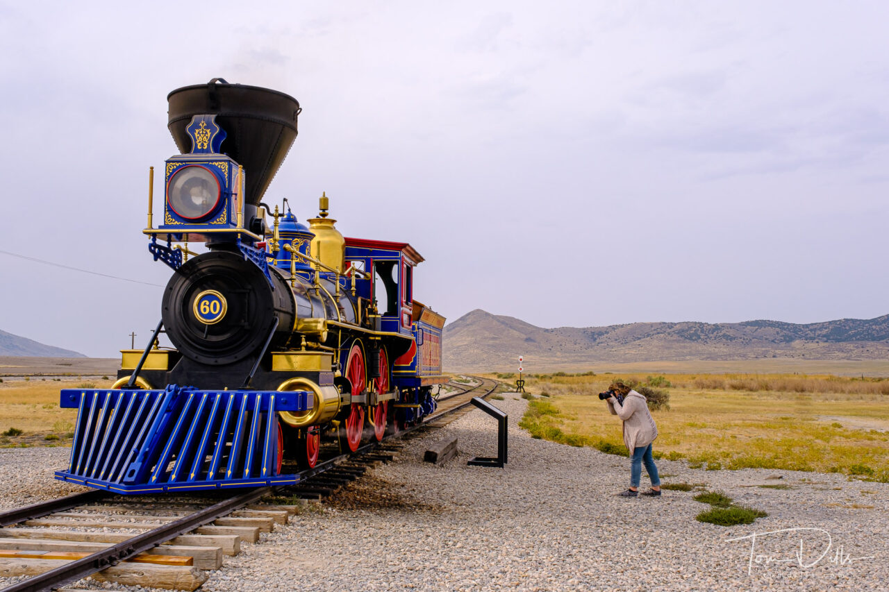
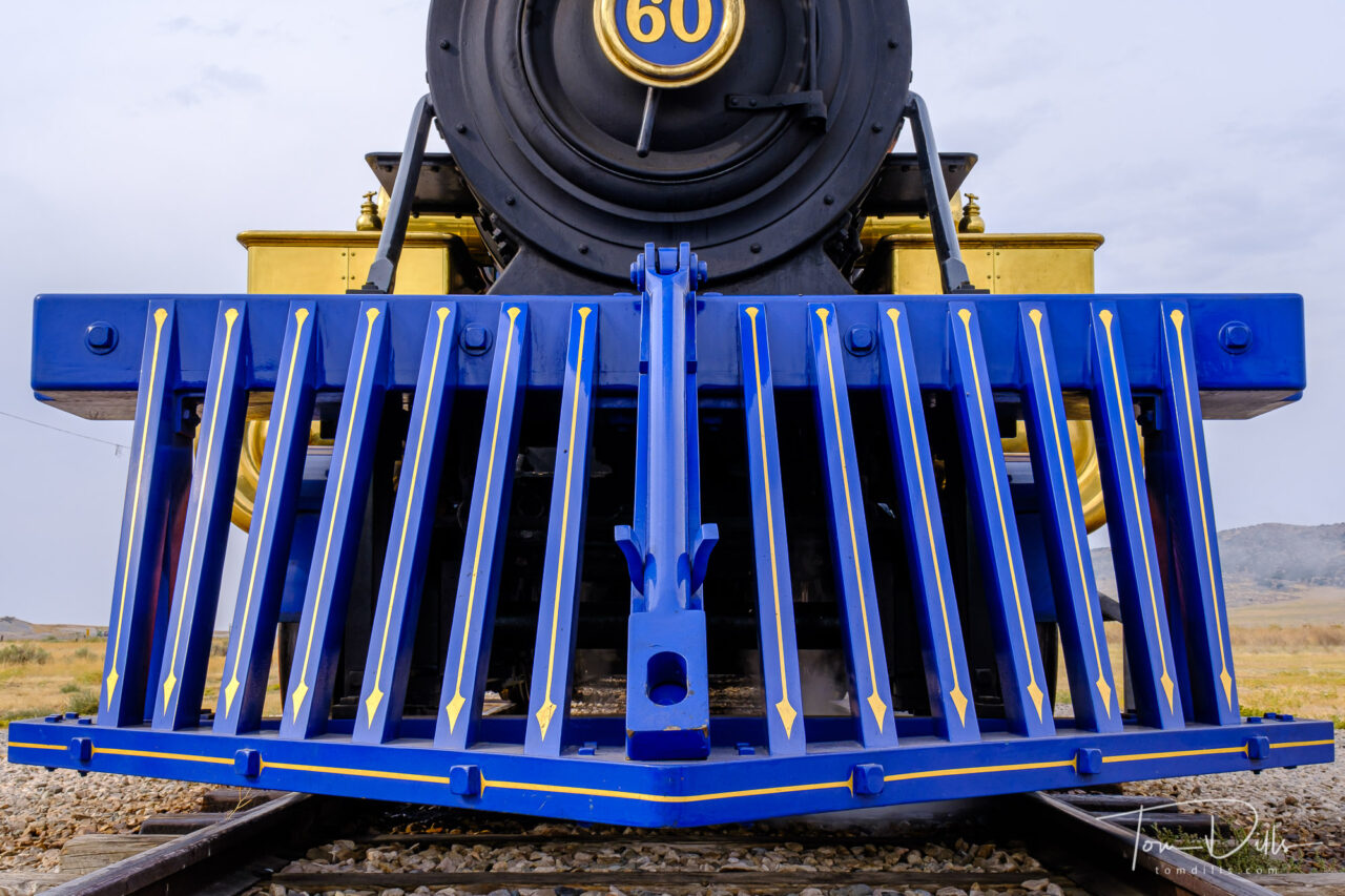
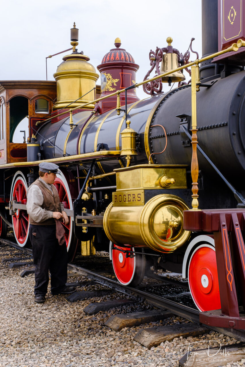
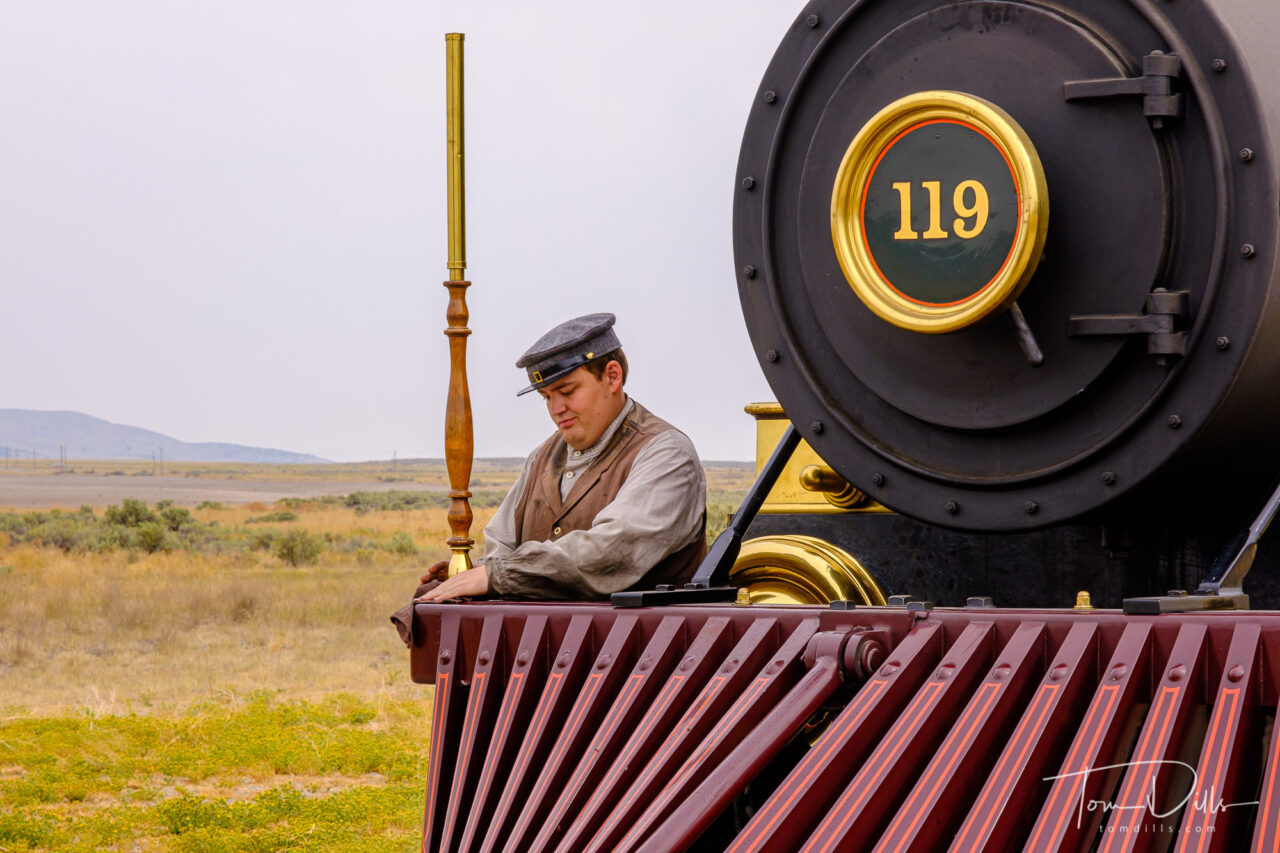
Demonstration runs of locomotives Jupiter and Number 119 at Golden Spike National Historical Park near Corinne, Utah
Another one of those historical place I learned about when I was a child was the story of The Transcontinental Railroad and The Golden Spike. The meeting of the railroad lines from the east coast and the west coast met at Promontory, UT on May 10, 1869.
Demonstration runs of locomotives Jupiter and Number 119 at Golden Spike National Historical Park near Corinne, Utah
As is often the case with history, the actual events leading up to and surrounding the eventual joining of the eastern and western routes is a lot more dramatic than we learned in grade school. Although the two railroads had agreed to meet somewhere in the western US, it literally took an act of Congress to actually get the tracks to meet. Instead, the two companies laid miles of track in opposite directions through the area, sometimes within sight of each other! Wikipedia has a pretty good summary and pretty much agrees with what we were told when we visited.
Demonstration runs of locomotives Jupiter and Number 119 at Golden Spike National Historical Park near Corinne, UtahDemonstration runs of locomotives Jupiter and Number 119 at Golden Spike National Historical Park near Corinne, UtahDemonstration runs of locomotives Jupiter and Number 119 at Golden Spike National Historical Park near Corinne, UtahDemonstration runs of locomotives Jupiter and Number 119 at Golden Spike National Historical Park near Corinne, UtahDemonstration runs of locomotives Jupiter and Number 119 at Golden Spike National Historical Park near Corinne, UtahDemonstration runs of locomotives Jupiter and Number 119 at Golden Spike National Historical Park near Corinne, Utah
At the visitor center, replicas of the two original trains make demonstration runs. These runs often occur daily but the schedule varies seasonally. We planned our visit to coincide with the runs, since seeing the trains in operation was one of the highlights of being there. The trains don’t actually run at the same time, as the same engineer and fireman operate both trains. At the end of the second run, the trains are parked nose-to-nose in front the observation area, making for a scene that is reminiscent of the original, albeit with people wearing much more modern clothes today!
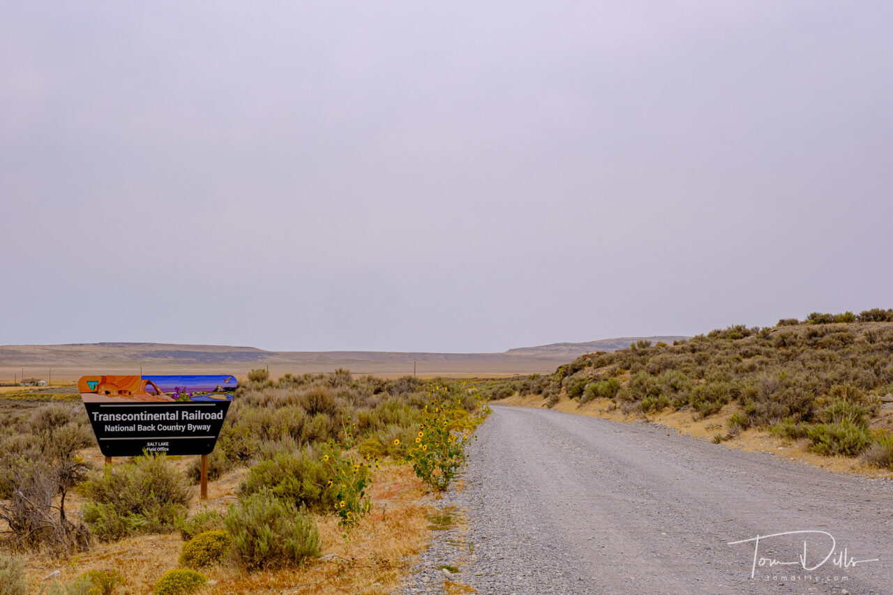
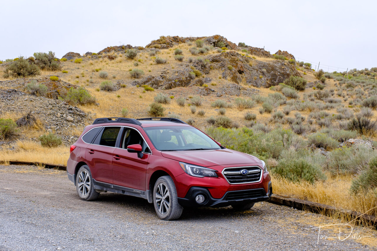
Auto tour on the Transcontinental Railroad National Back Country Byway at Golden Spike National Historical Park near Corinne, UtahThe Subie earns her next car wash. Auto tour on the Transcontinental Railroad National Back Country Byway at Golden Spike National Historical Park near Corinne, UtahAuto tour on the Transcontinental Railroad National Back Country Byway at Golden Spike National Historical Park near Corinne, UtahAuto tour on the Transcontinental Railroad National Back Country Byway at Golden Spike National Historical Park near Corinne, Utah
In addition to the trains, there is an auto tour route that traces a portion of the original railroad bed. The tracks are long gone, but there are places where the road travels through cuts made in the terrain to accommodate the tracks. In some areas it is easy to see both sets of parallel rail beds within sight of each other. Especially noteworthy is an area where 10 miles of track were laid in one day, in response to an unofficial challenge between the two crews to see who could reach the meeting place first.
Promontory is practically in the middle of nowhere in Utah, which makes it really out there! It was worth the time and effort, however. And it gave us a great way to document our visit to the state of Utah for our quest toward all 50 states!
For anyone wishing to see more photos, I have created a photo gallery on my Adobe Portfolio website.
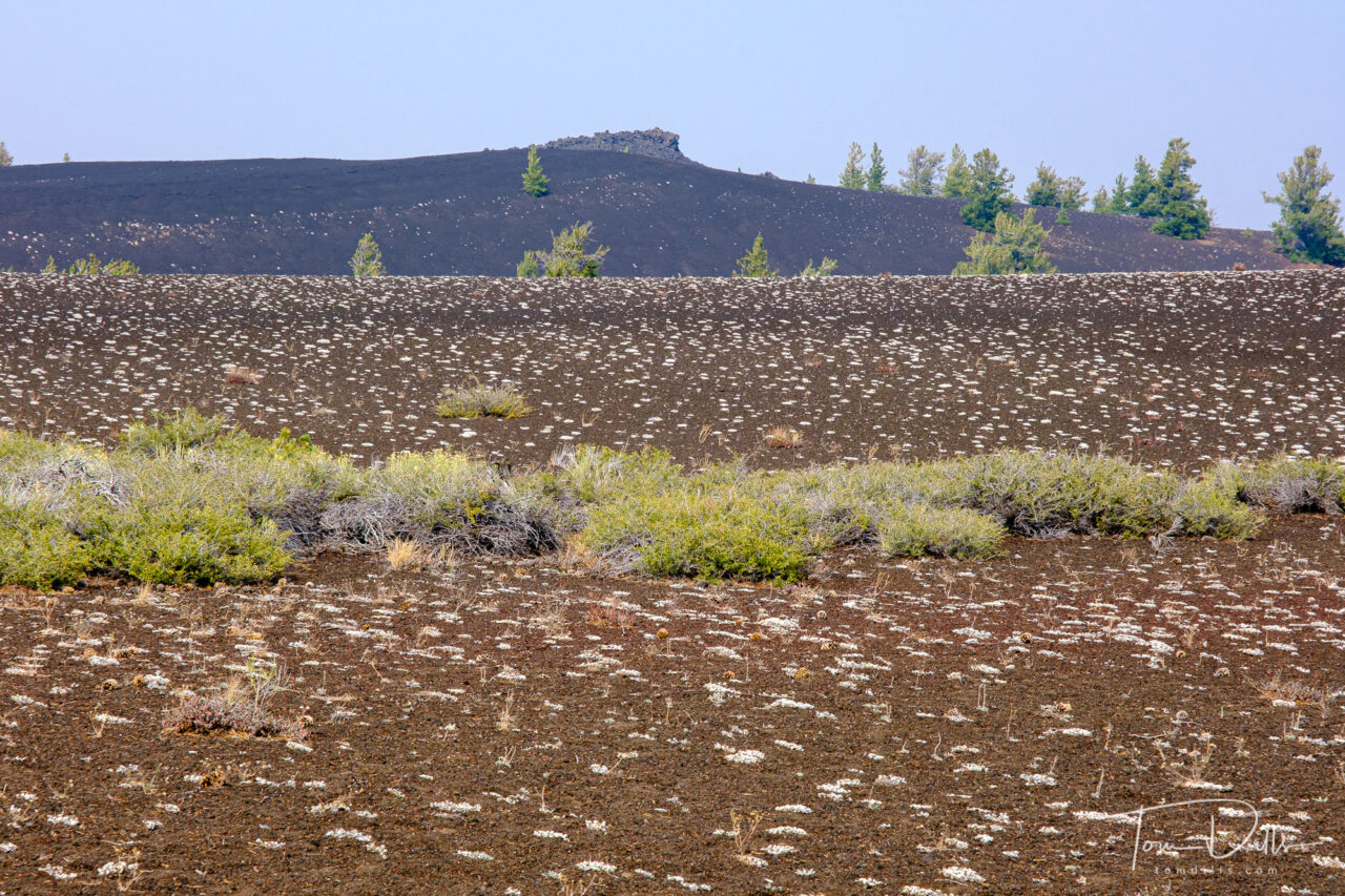
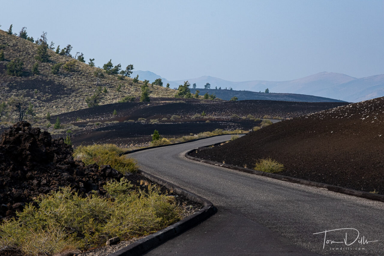
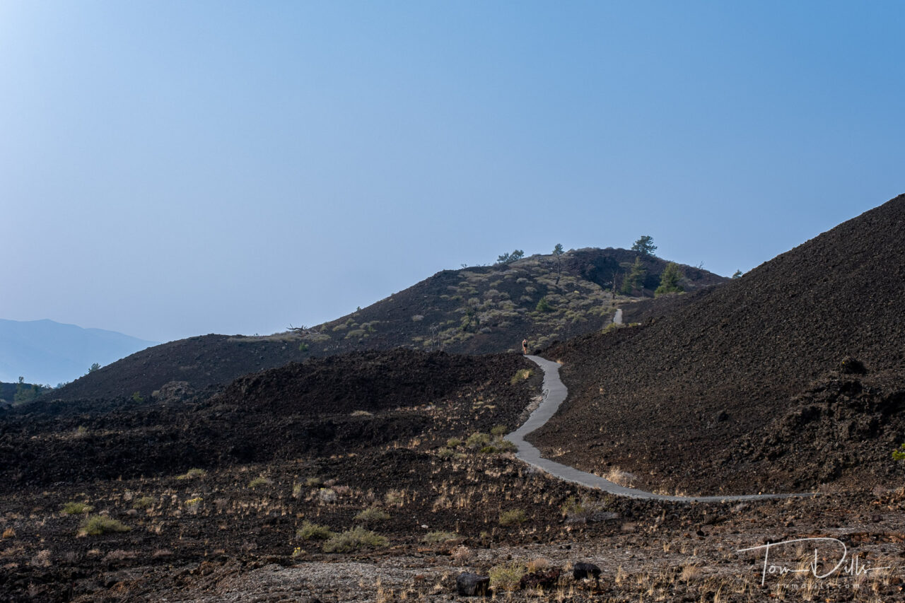
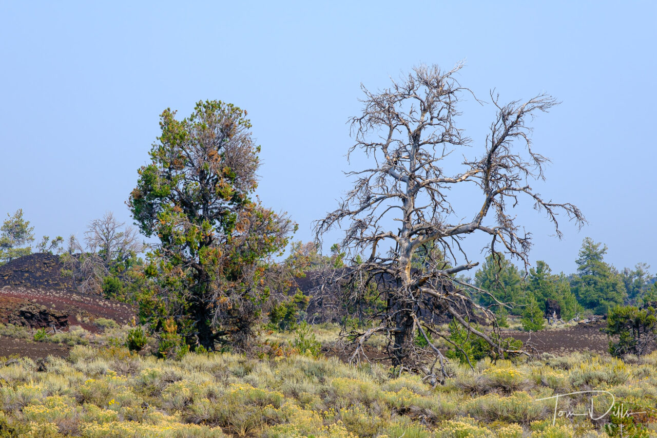
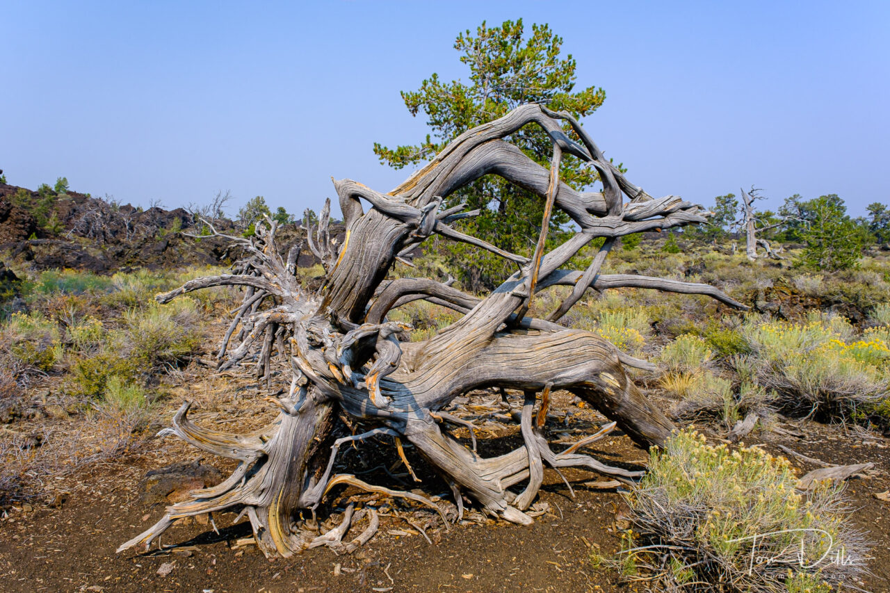
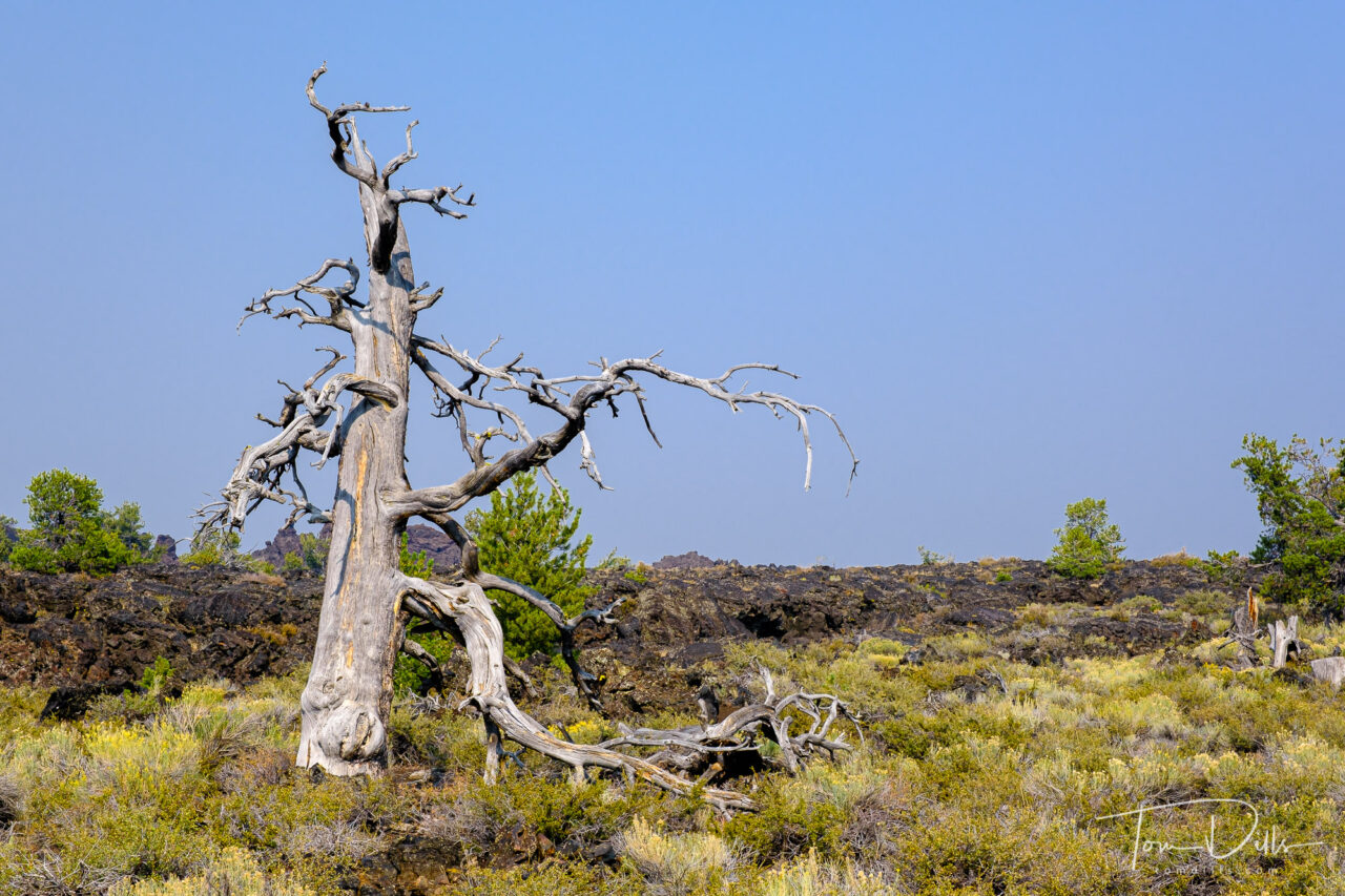
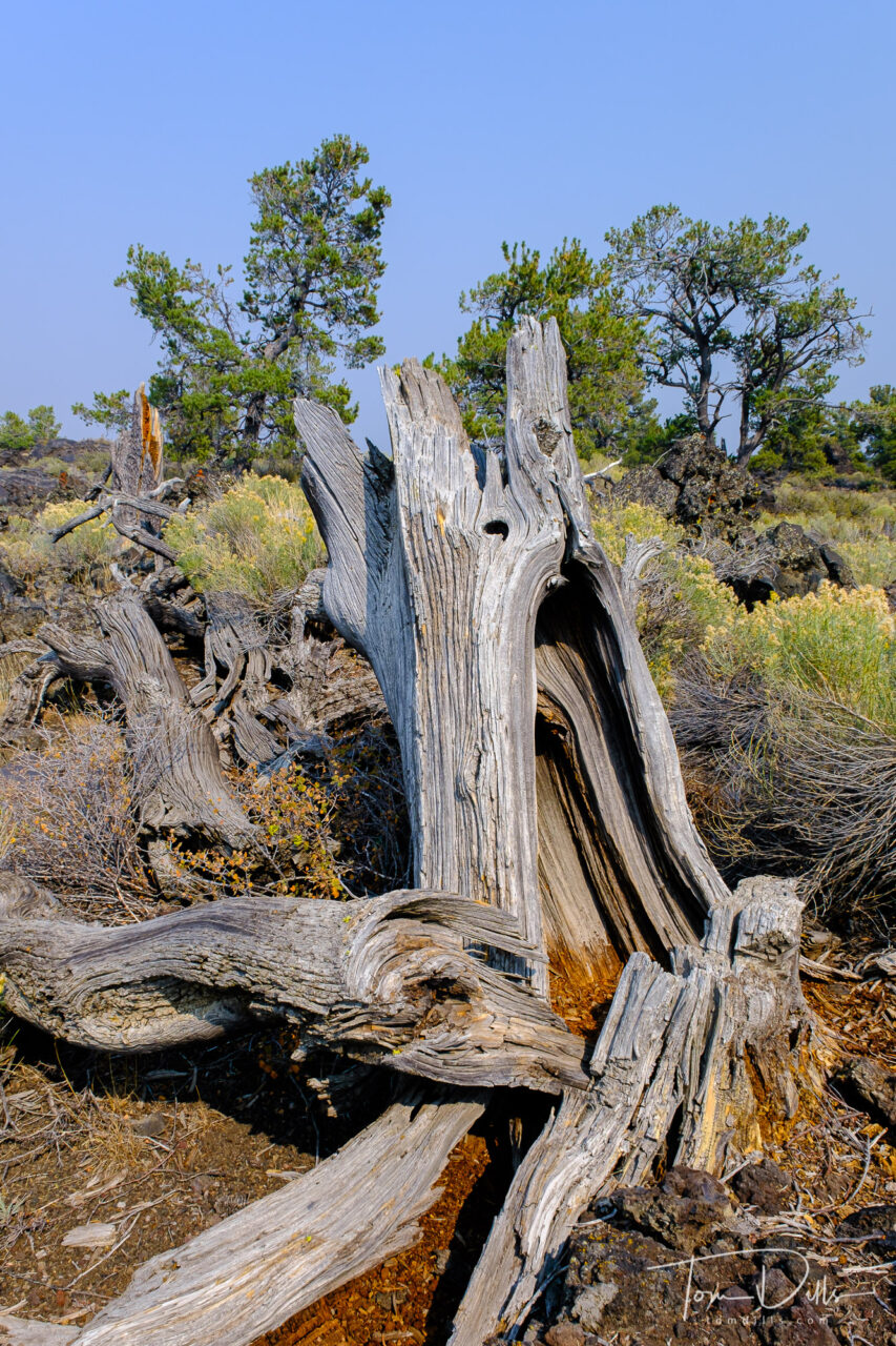
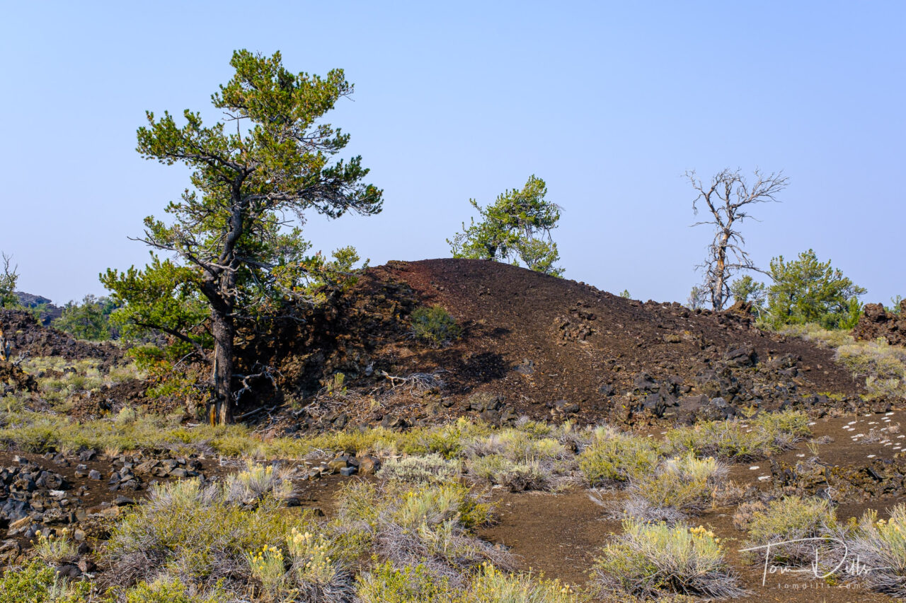
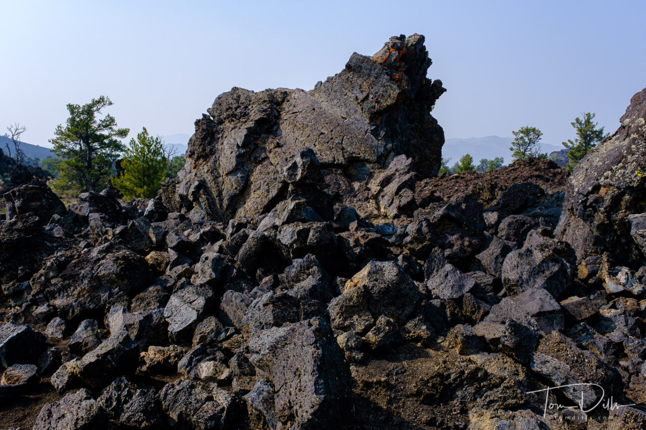
Craters of the Moon National Monument and Preserve near Arco, Idaho
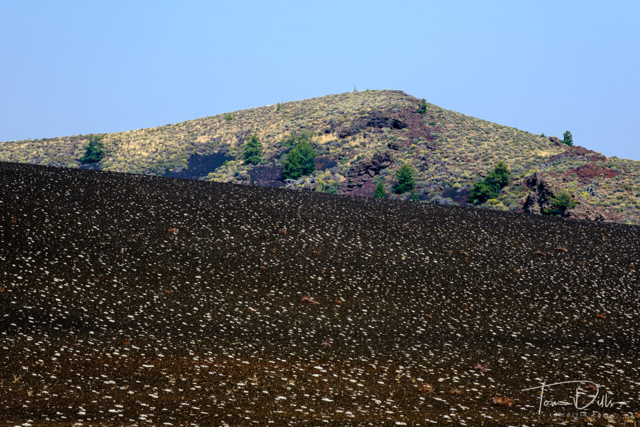
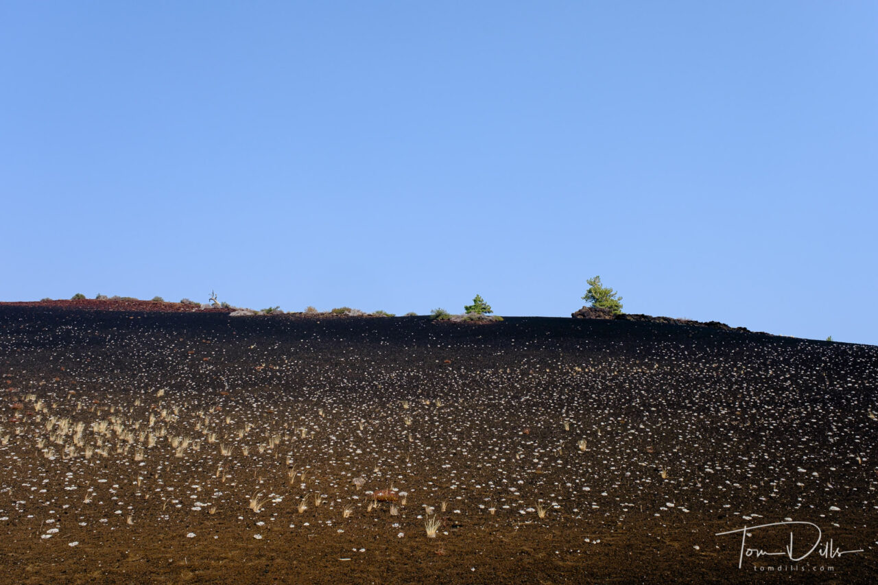
I wasn’t sure what to expect from our visit to Craters of the Moon National Monument in southern Idaho, but I could never have imagined what we saw there. The landscape is covered with fields of lava, from smooth lava domes to fields covered with huge chunks of lava rocks. We didn’t venture too far from the road, but there was plenty to see from just the overlooks.
Craters of the Moon National Monument and Preserve near Arco, IdahoCraters of the Moon National Monument and Preserve near Arco, IdahoCraters of the Moon National Monument and Preserve near Arco, IdahoCraters of the Moon National Monument and Preserve near Arco, Idaho
Craters of the Moon National Monument and Preserve is a U.S. national monument and national preserve in the Snake River Plain in central Idaho. It is along US 20 (concurrent with US 93 and US 26), between the small towns of Arco and Carey, at an average elevation of 5,900 feet (1,800 m) above sea level. The protected area’s features are volcanic and represent one of the best-preserved flood basalt areas in the continental United States.
The Monument was established on May 2, 1924. In November 2000, a presidential proclamation by President Clinton greatly expanded the Monument area. The 410,000-acre National Park Service portions of the expanded Monument were designated as Craters of the Moon National Preserve in August 2002. It spreads across Blaine, Butte, Lincoln, Minidoka, and Power counties. The area is managed cooperatively by the National Park Service and the Bureau of Land Management (BLM).
The Monument and Preserve encompass three major lava fields and about 400 square miles of sagebrush steppe grasslands to cover a total area of 1,117 square miles. The Monument alone covers 343,000 acres. All three lava fields lie along the Great Rift of Idaho, with some of the best examples of open rift cracks in the world, including the deepest known on Earth at 800 feet. There are excellent examples of almost every variety of basaltic lava, as well as tree molds (cavities left by lava-incinerated trees), lava tubes (a type of cave), and many other volcanic features.
Craters of the Moon National Monument and Preserve near Arco, IdahoCraters of the Moon National Monument and Preserve near Arco, IdahoCraters of the Moon National Monument and Preserve near Arco, IdahoCraters of the Moon National Monument and Preserve near Arco, Idaho
We had a crystal-clear blue sky on the day of our visit, with very little of the haze and smoke that we encountered in Oregon. It made for some challenging photography, although the blue sky is an interested contrast to the dark and mostly colorless lava.
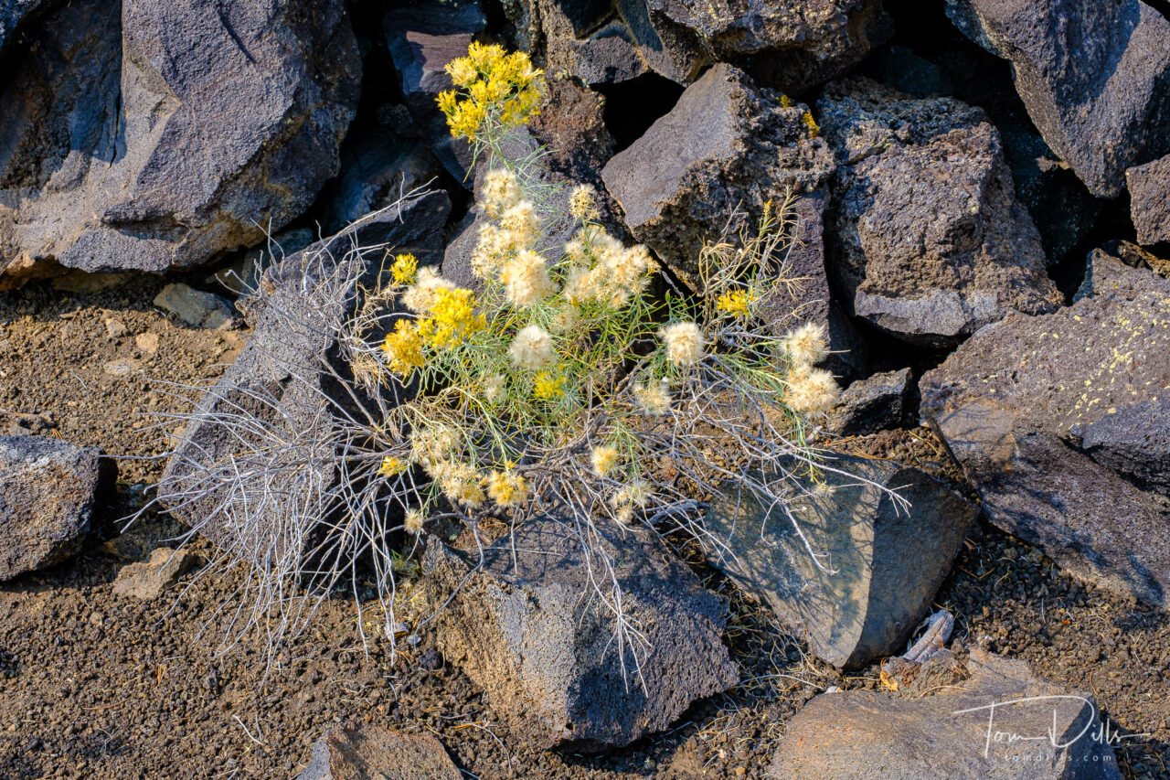
There were several places where there was little or no vegetation, and other places where the ground was covered with various plants growing up from holes and cracks in the lava that had captured more fertile soil over time. Many of the trees are dead, starved of moisture from the overall arid conditions and the inability of the porous lava to hold water. A number of fields were covered in what appeared to be small white flowers, which are in fact small clusters of a form of lichen that grows there.
Craters of the Moon National Monument and Preserve near Arco, IdahoCraters of the Moon National Monument and Preserve near Arco, IdahoCraters of the Moon National Monument and Preserve near Arco, Idaho
One point of interest is that when I went out to the NPS website for the park, the Current Conditions indicates that the loop road is currently “closed due to snow and ice!” We actually saw some ice in the bottom of some of the lava holes, but up on the surface it was very warm.
I’d heartily recommend Craters of the Moon to anyone looking for an interesting diversion from the usual. It isn’t far from Yellowstone and other western parks, and while it was pretty busy on the day of our visit, we encountered very few people up close.
As I’ve been doing, I have added a photo gallery on my Adobe Portfolio website with more photos for anyone who is interested.
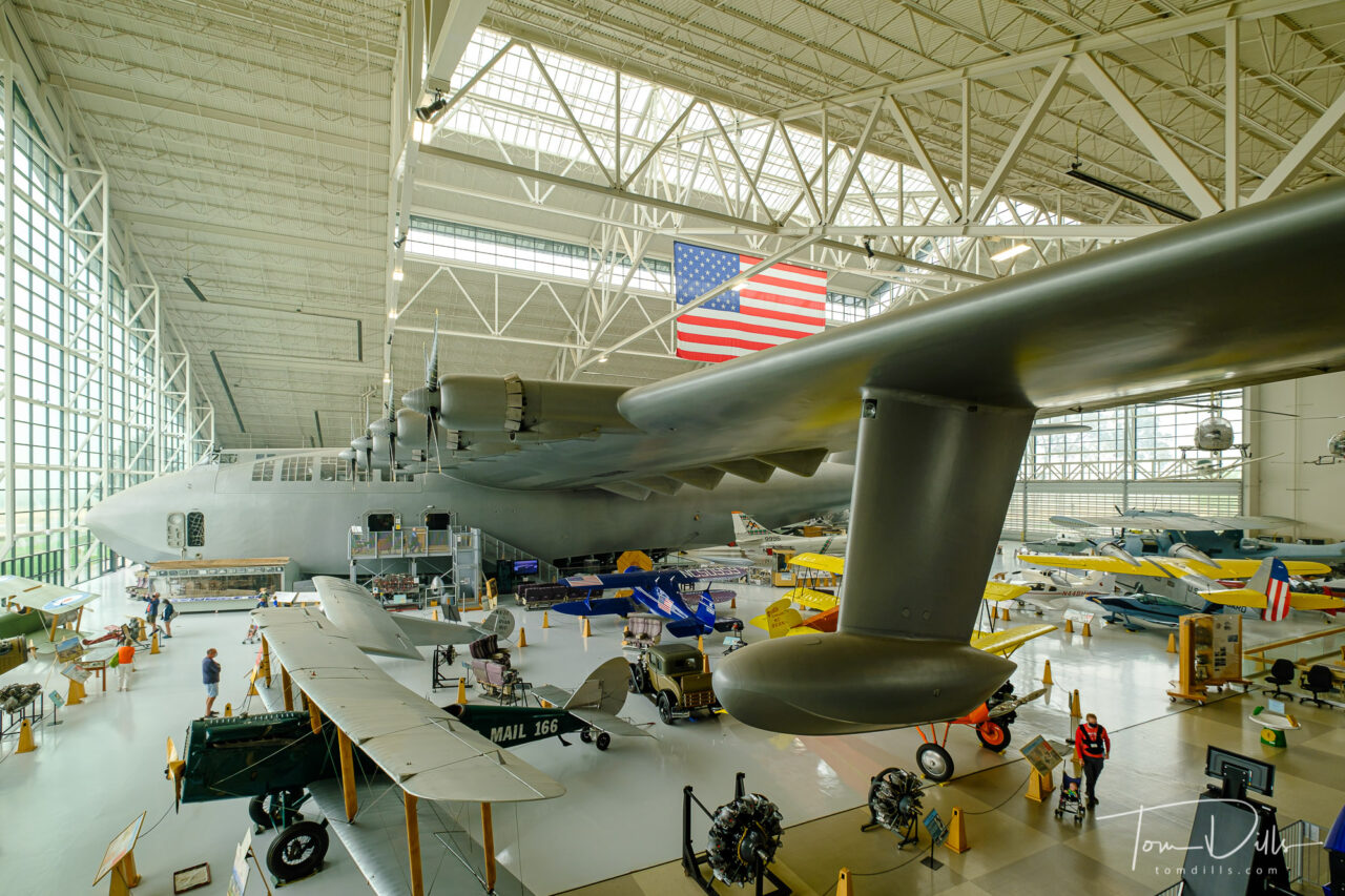
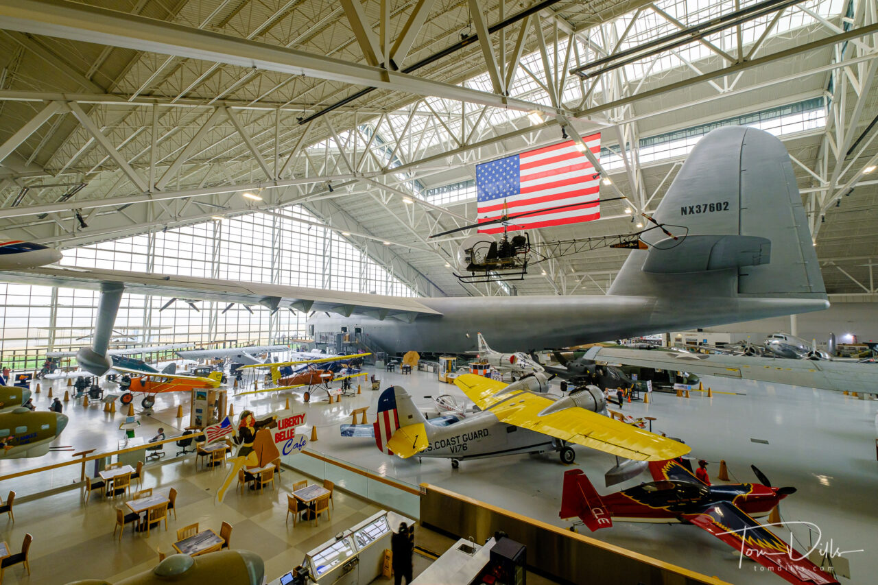
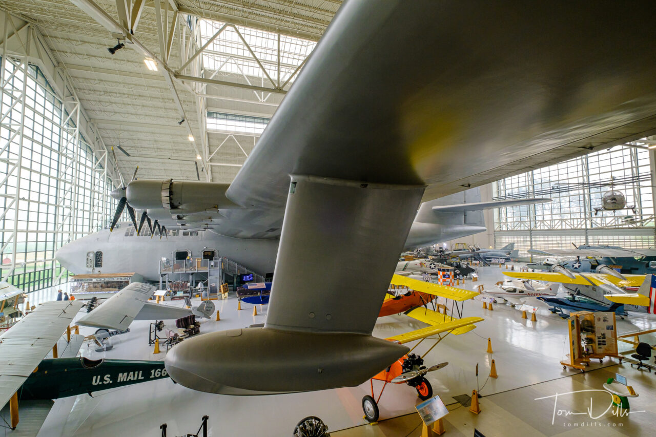
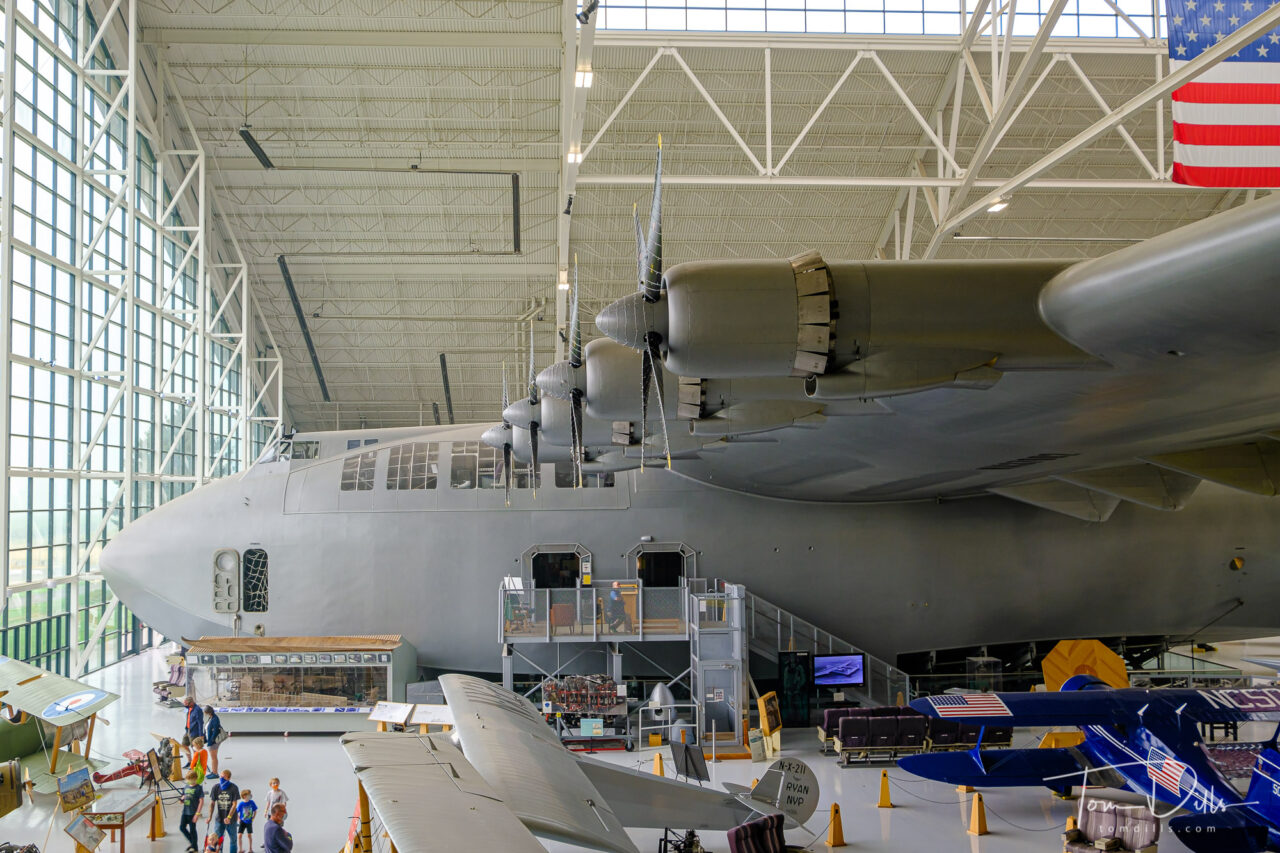
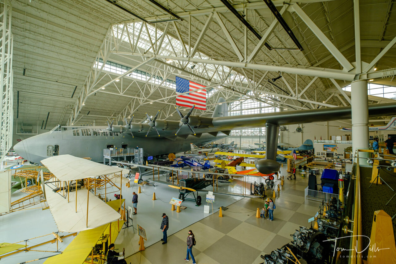
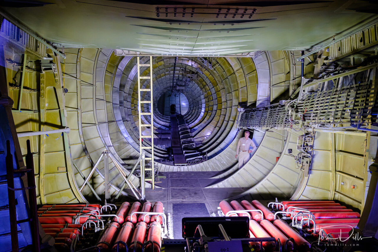
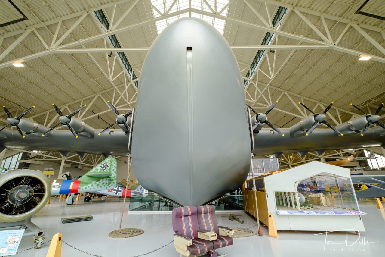
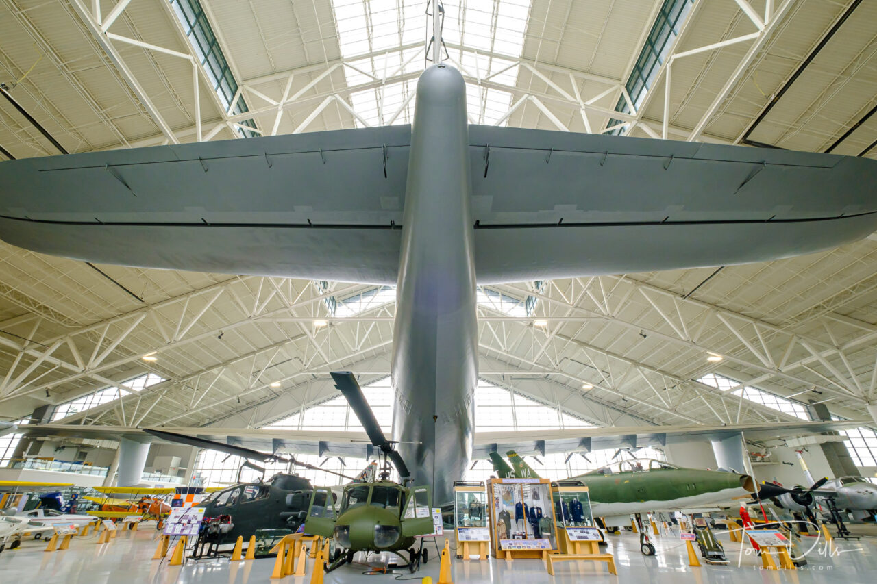
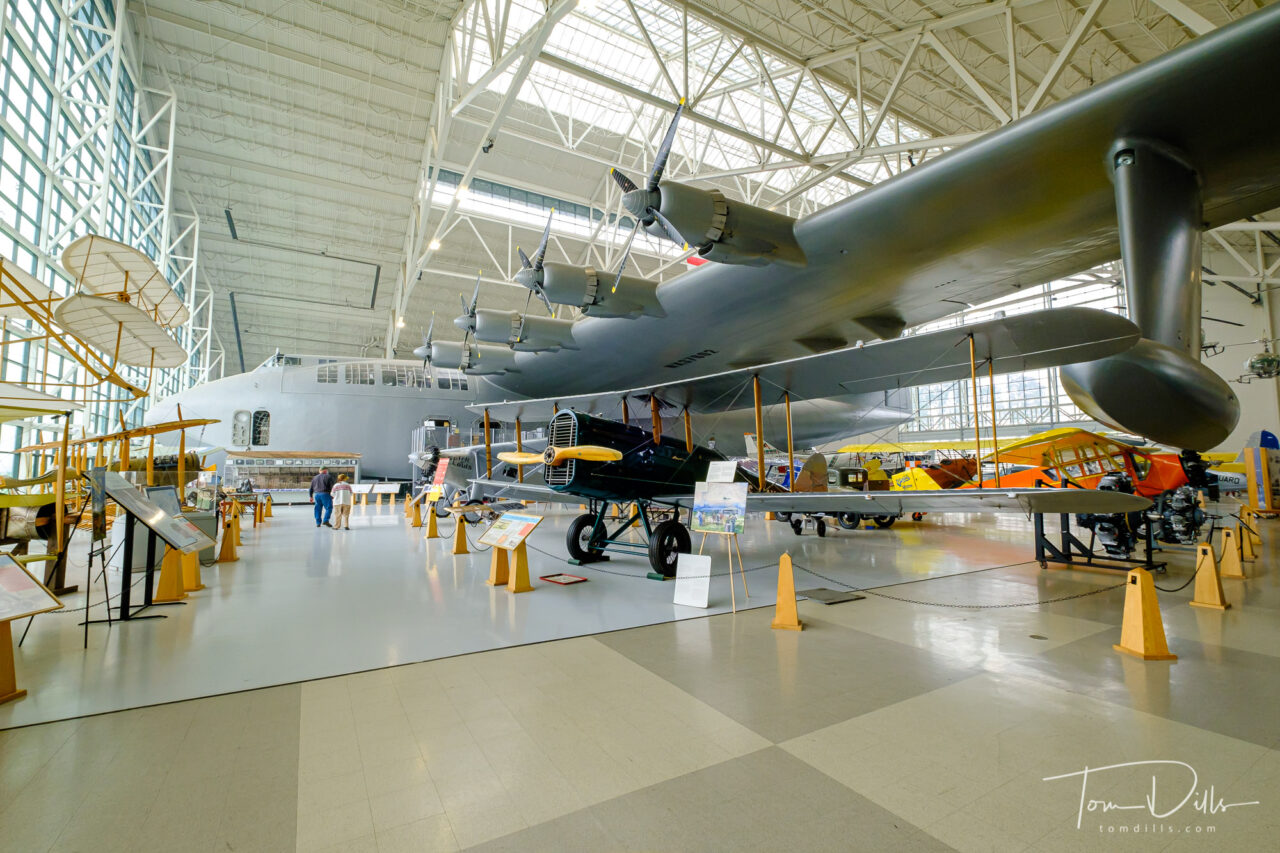
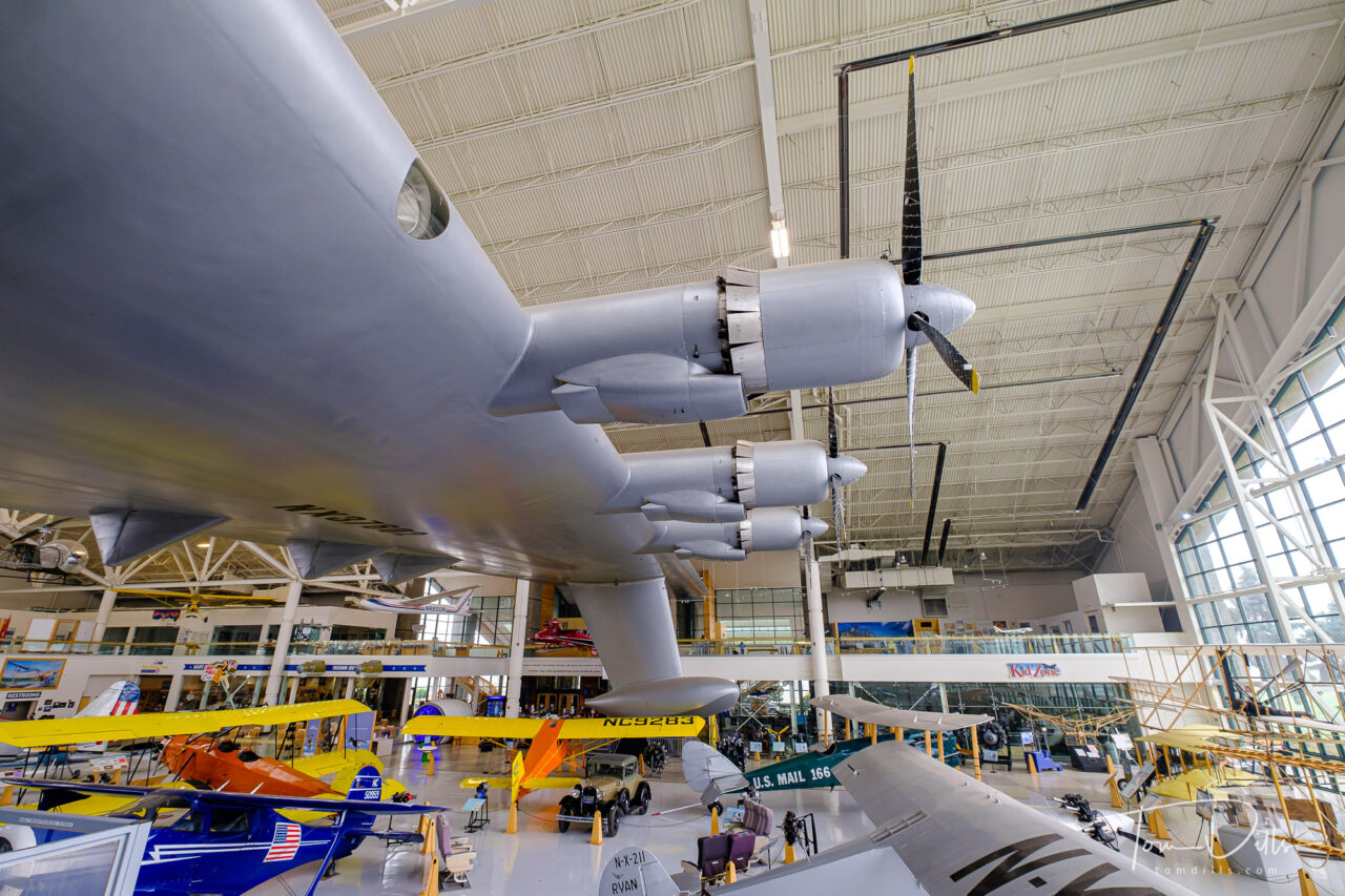
Howard Hughes’ “Spruce Goose” at the Evergreen Aviation & Space Museum in McMinnville, Oregon
Ever since I was a kid interested in airplanes, I remember reading about and seeing photos of Howard Hughes’ “Spruce Goose.” Officially known as the Hughes H-4 Hercules, the Spruce Goose was – at the time and for a while after – the largest aircraft to ever fly. The Wikipedia Page for the plane is a rabbit hole of more information for anyone wishing to delve deeper. After many stops on a long journey, the current home for the plane is the Evergreen Aviation and Space Museum in McMinnville, Oregon.
Howard Hughes’ “Spruce Goose” at the Evergreen Aviation & Space Museum in McMinnville, OregonHoward Hughes’ “Spruce Goose” at the Evergreen Aviation & Space Museum in McMinnville, OregonHoward Hughes’ “Spruce Goose” at the Evergreen Aviation & Space Museum in McMinnville, OregonHoward Hughes’ “Spruce Goose” at the Evergreen Aviation & Space Museum in McMinnville, Oregon
I didn’t realize that the Spruce Goose was in Oregon when we started making plans, but I came across a reference to it during our research. When I found out that we would be very close to McMinnville, a town in the heart of Oregon’s Willamette Valley wine region, stopping there was a no-brainer. Except…the museum had been closed during Oregon’s response to the Covid virus. Fortunately the conditions had improved enough for Oregon to allow museums to re-open shortly before we left home on our trip. Good timing – the state has recently re-entered a lockdown phase the the museum has closed again.
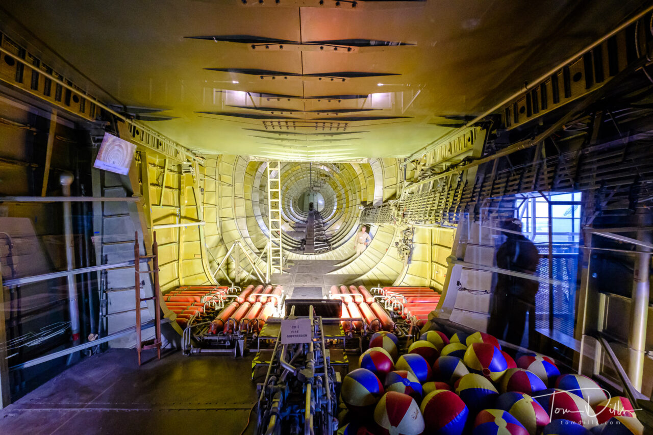
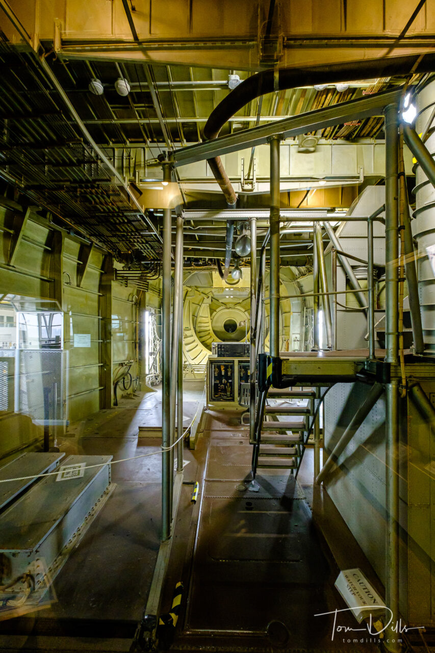
Cargo bay of Howard Hughes’ “Spruce Goose” at the Evergreen Aviation & Space Museum in McMinnville, OregonCargo bay of Howard Hughes’ “Spruce Goose” at the Evergreen Aviation & Space Museum in McMinnville, OregonCargo bay of Howard Hughes’ “Spruce Goose” at the Evergreen Aviation & Space Museum in McMinnville, Oregon
As you can see from the photos, the plane is simply enormous, dwarfing all of the other aircraft in the museum. For even more geekery, check out this article discussing the various calculations of “largest aircraft” along with a size comparison.
Howard Hughes’ “Spruce Goose” at the Evergreen Aviation & Space Museum in McMinnville, OregonHoward Hughes’ “Spruce Goose” at the Evergreen Aviation & Space Museum in McMinnville, OregonHoward Hughes’ “Spruce Goose” at the Evergreen Aviation & Space Museum in McMinnville, OregonHoward Hughes’ “Spruce Goose” at the Evergreen Aviation & Space Museum in McMinnville, Oregon
Seeing the Spruce Goose in person was a real treat. In fact the entire museum is really well done, with two separate buildings – one for aircraft and the other for space related displays. It was especially nice to have a good indoor thing to do, since all that haze you see in the outdoor photos is smoke. 🙁
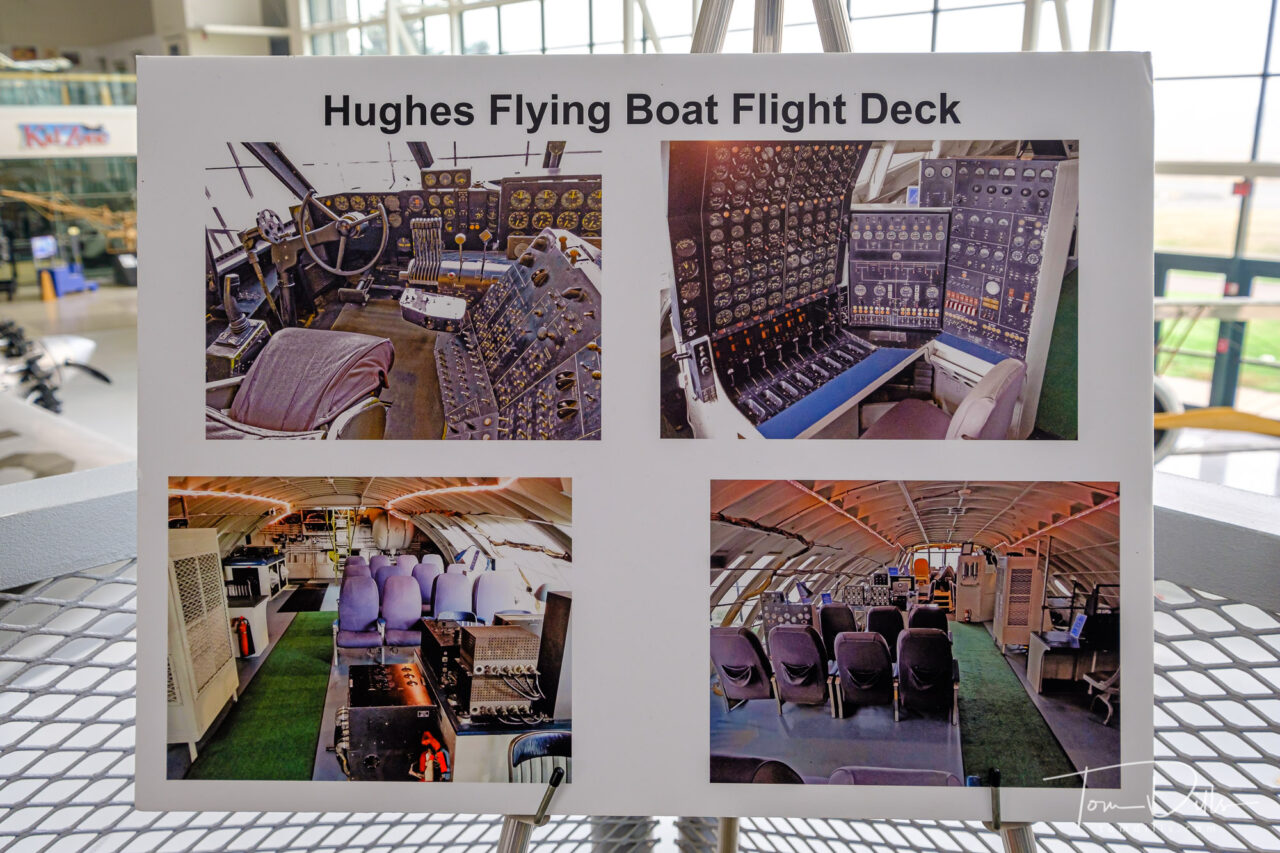
Photos of the flight deck of Howard Hughes’ “Spruce Goose” at the Evergreen Aviation & Space Museum in McMinnville, Oregon
For even more photos from the museum, I’ve created an Adobe Portfolio Page. Check it out!
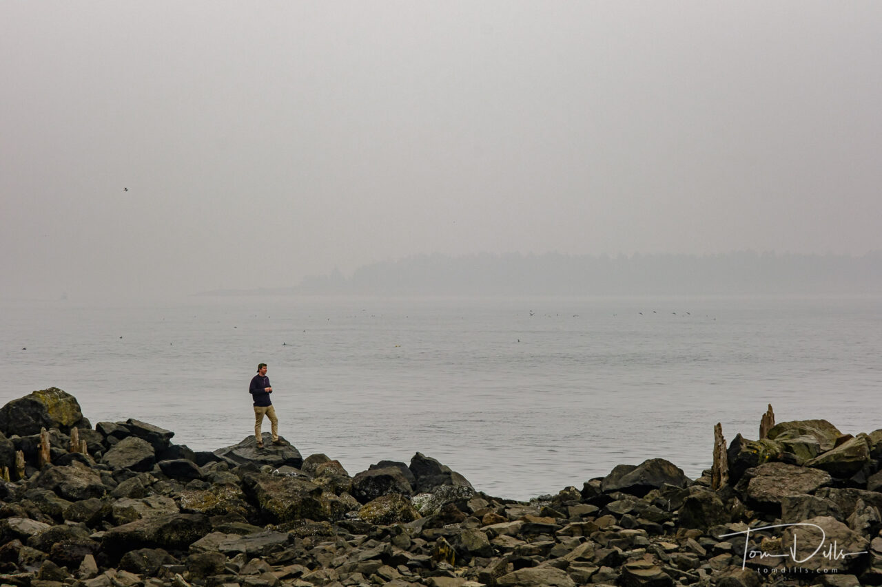
When we left Cannon Beach we headed down the coast, hoping to catch some views of the Pacific Ocean scenery before turning east toward McMinnville, a town in the heart of Oregon’s Willamette Valley wine region. We didn’t get many long-distance views, but we did manage to see some interesting things along the way, including the ferocious prehistoric creature I posted about previously. 🙂
Barview Jetty Park near Rockaway Beach, OregonRock formation known as “The Three Graces” along US-101/Oregon Coast Highway near Garibaldi, Oregon
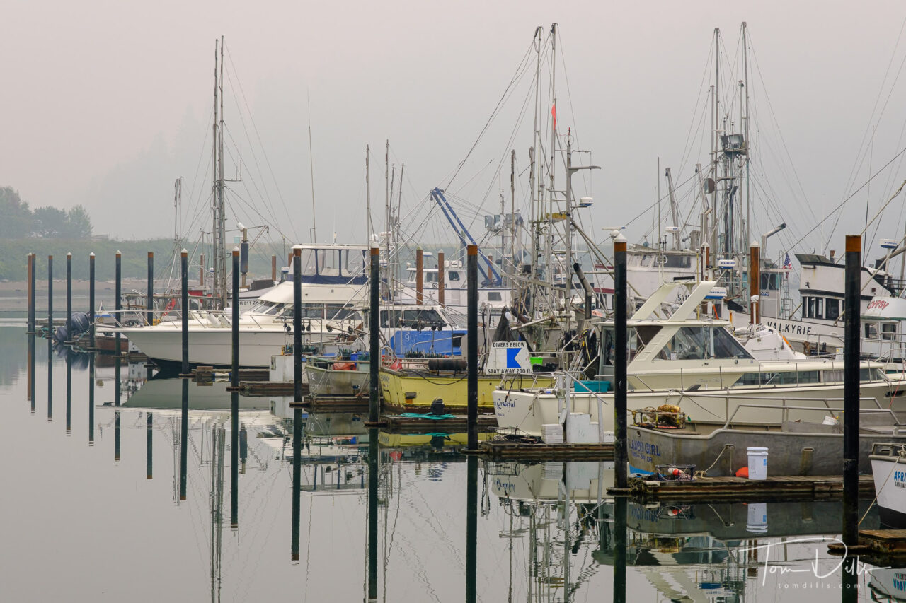
What looks like fog in these photos is a combination of actual fog and smoke from the wildfires farther inland and some drifting north from northern California. Thanks to the magic of white balance adjustment, these look mostly like fog, while the original files have more of an orangey-brown cast to them.
Views of the Port of Garibaldi and Garibaldi Marina in Garibaldi, OregonViews of the Port of Garibaldi and Garibaldi Marina in Garibaldi, OregonViews of the Port of Garibaldi and Garibaldi Marina in Garibaldi, OregonViews of the Port of Garibaldi and Garibaldi Marina in Garibaldi, OregonViews of the Port of Garibaldi and Garibaldi Marina in Garibaldi, Oregon
We spent a bit of time exploring the marina in Garibaldi, a small town of 800~ on Tillamook Bay along US 101. The marina provided us with some visual stimulation, and the addition of the smoke/fog allowed for some interesting photographs. Garibaldi is home to a scenic railway – which was not operating – a maritime history museum, also closed and a US Coast Guard station. It might make for a good destination on a return trip, as there appear to be a number of quaint looking inns nearby!
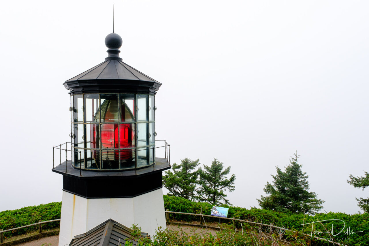
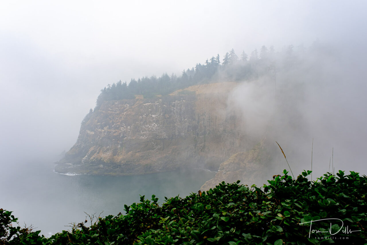
Cape Mears Lighthouse on Cape Mears, OregonFoggy views from Cape Mears, Oregon
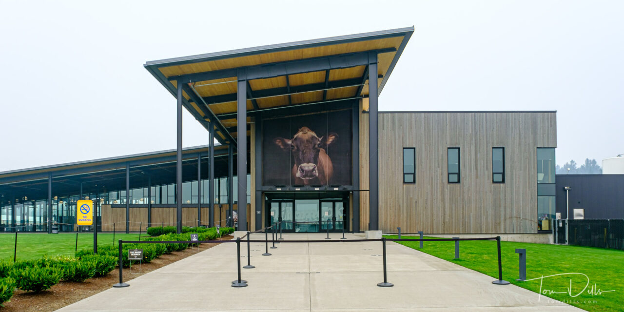
We had hoped to visit the Tillamook Creamery, but it had closed just prior to our arrival due to a combination of the virus and the heavy smoke. So we moved on to Cape Lookout (home of the dinosaur) and Cape Mears to check out the lighthouse before making our way to McMinnville.
Tillamook Cheese Visitor Center (closed) in Tillamook, Oregon
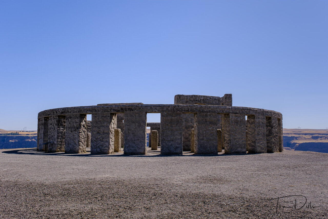
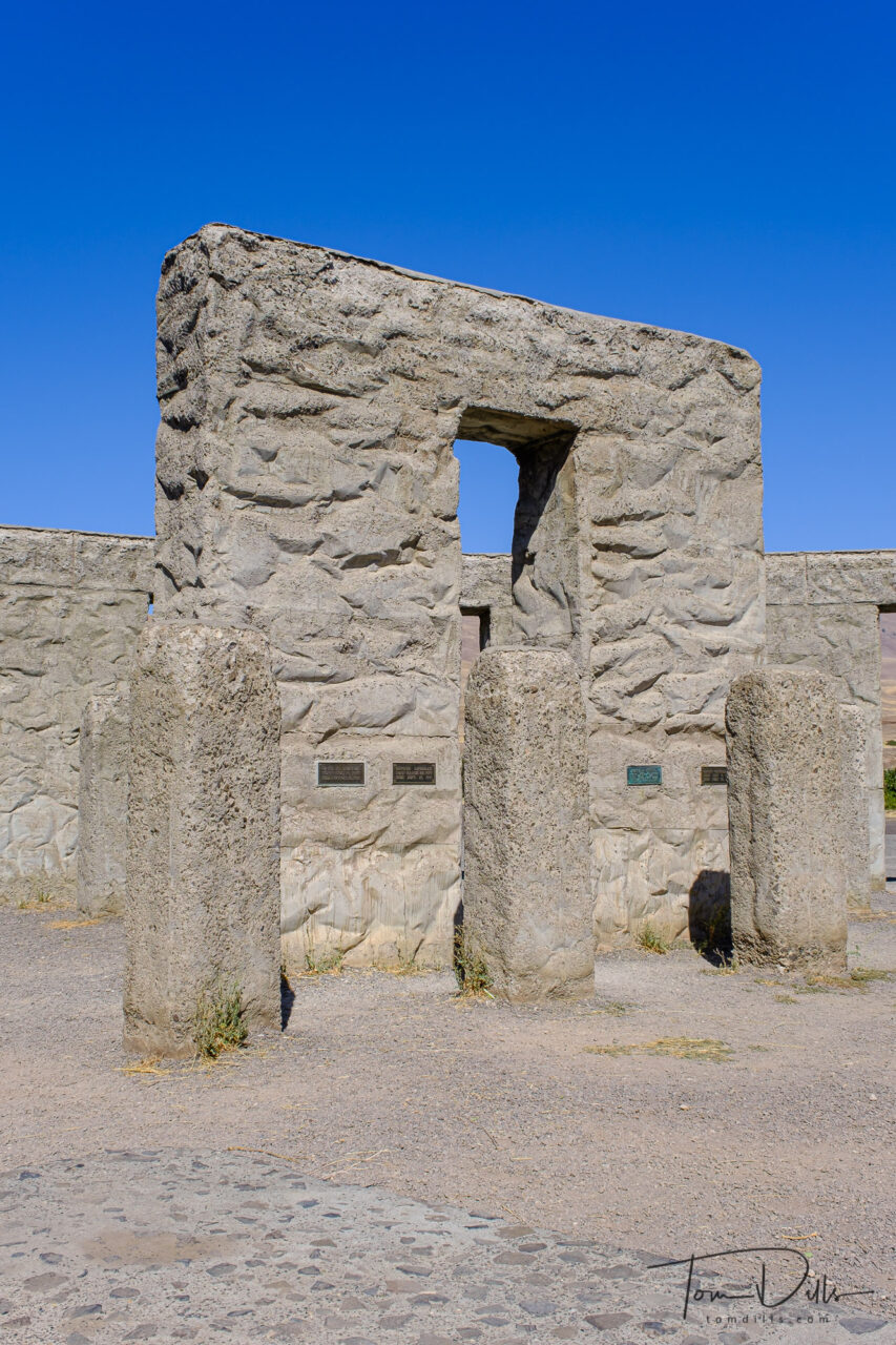
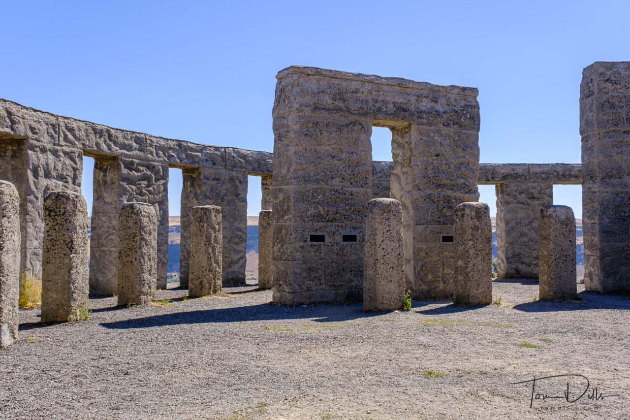
Stonehenge replica serving as a war memorial along SR-14 near Maryhill, Washington
One of the stops on our drive along the Columbia River from eastern Washington was Stonehenge. No, not the one in England, but the one in Washington. 😉
Stonehenge replica serving as a war memorial along SR-14 near Maryhill, Washington
The Washington Stonehenge is a replica of England’s Stonehenge located in Maryhill, Washington. It was commissioned in the early 20th century by the wealthy entrepreneur Sam Hill, and dedicated on 4 July 1918 as a memorial to the people who had died in World War I. The memorial is constructed of concrete, and construction was commenced in 1918 and completed in 1929.
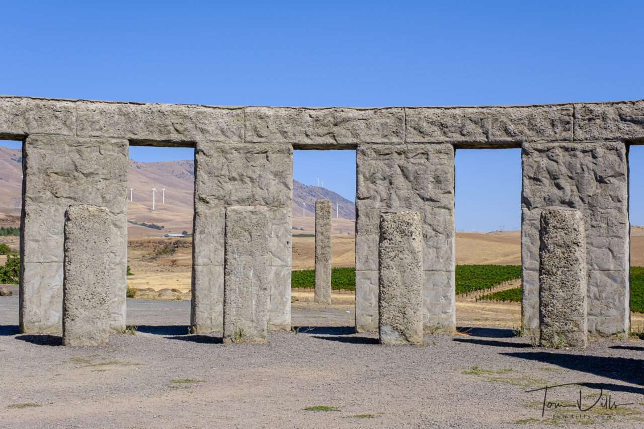
Stonehenge replica serving as a war memorial along SR-14 near Maryhill, WashingtonStonehenge replica serving as a war memorial along SR-14 near Maryhill, Washington
The dedication plaque on this Washington Stonehenge is inscribed:
“In memory of the soldiers and sailors of Klickitat County who gave their lives in defense of their country. This monument is erected in the hope that others inspired by the example of their valor and their heroism may share in that love of liberty and burn with that fire of patriotism which death can alone quench.”
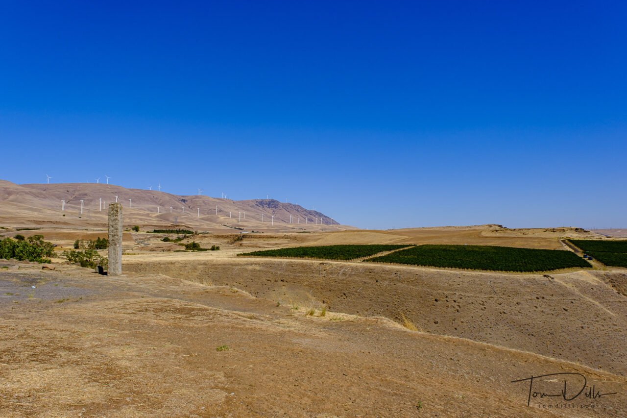
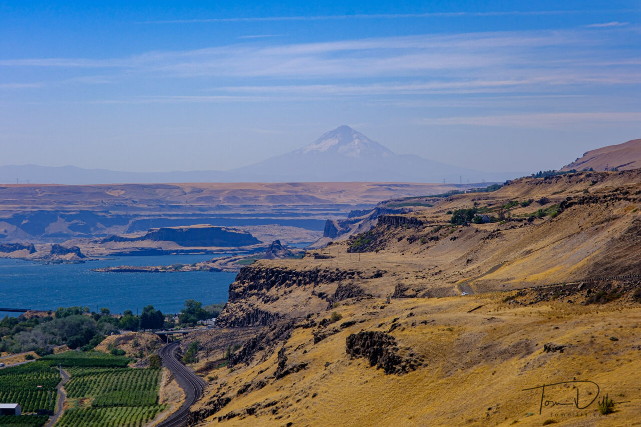
Vineyards in the Columbia River Valley from Stonehenge along SR-14 near Maryhill, WashingtonThe Columbia River Valley from Stonehenge along SR-14 near Maryhill, Washington. Mount Hood (Oregon) is in the distance.