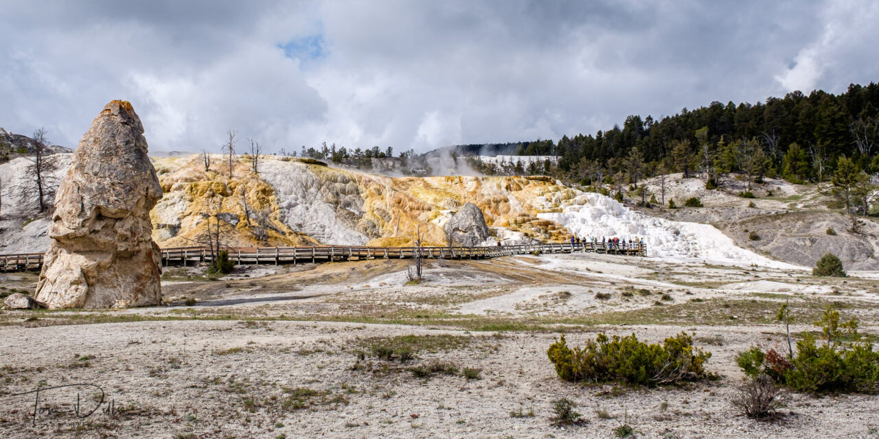
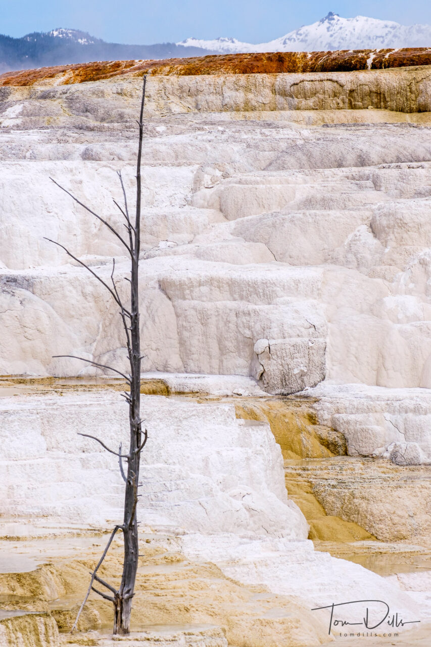
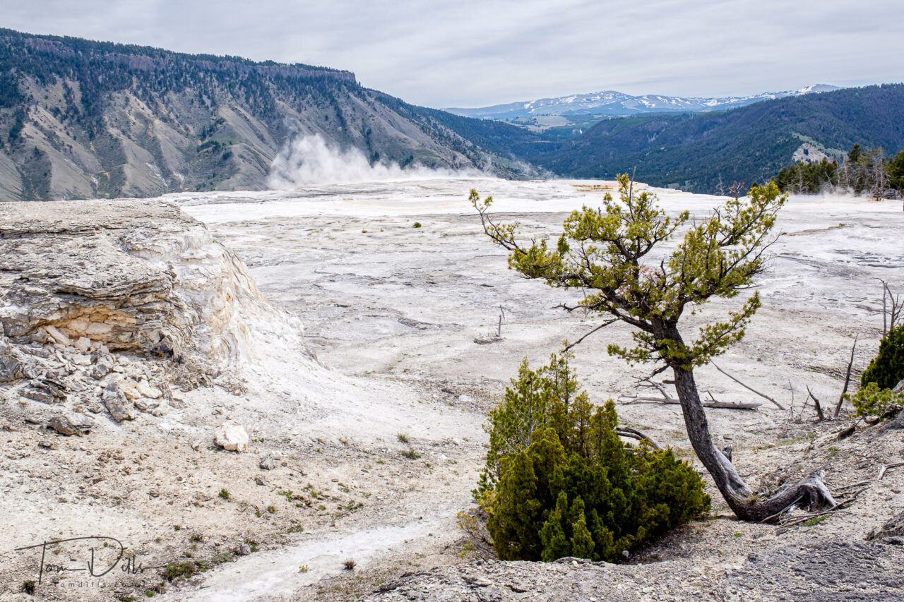
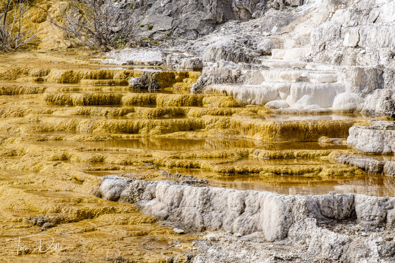
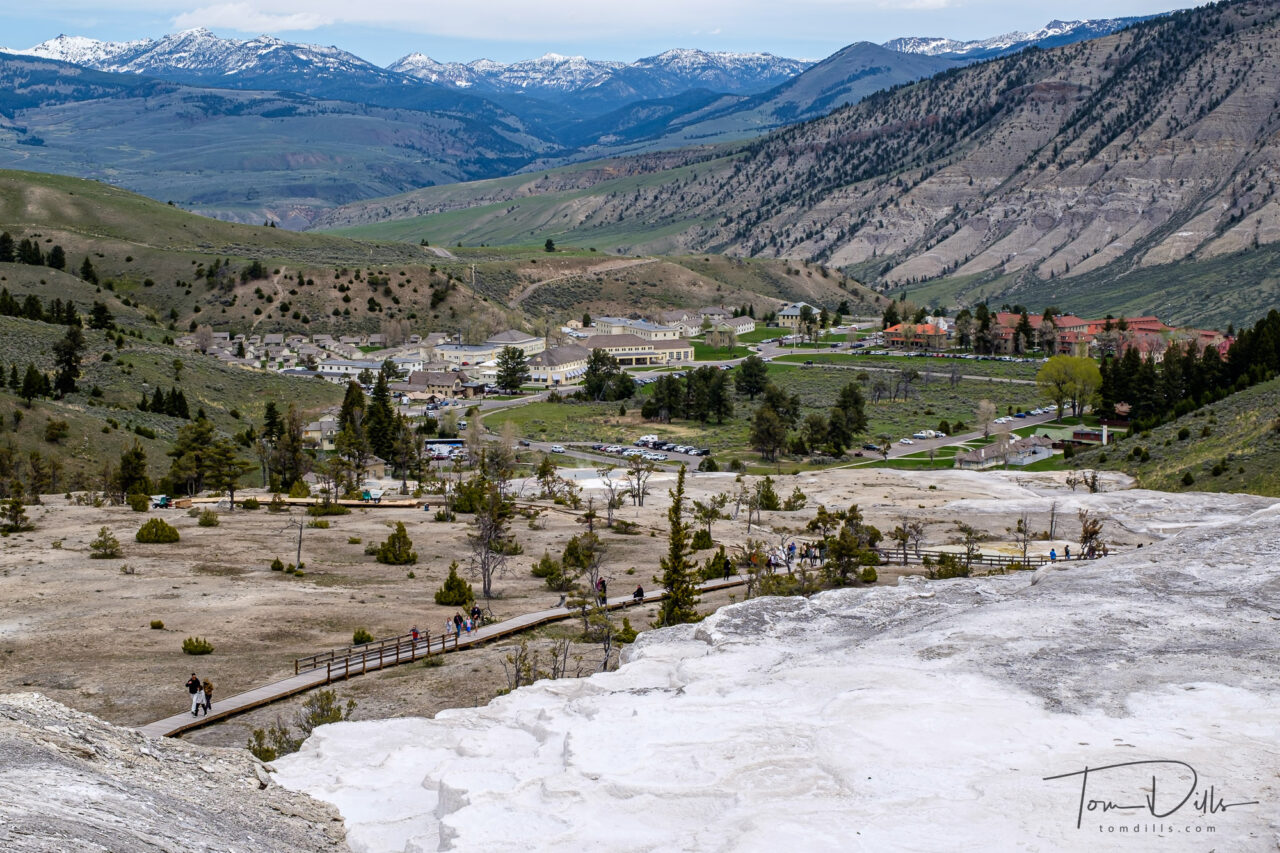
Lower Terraces at Mammoth Hot Springs, Yellowstone National Park
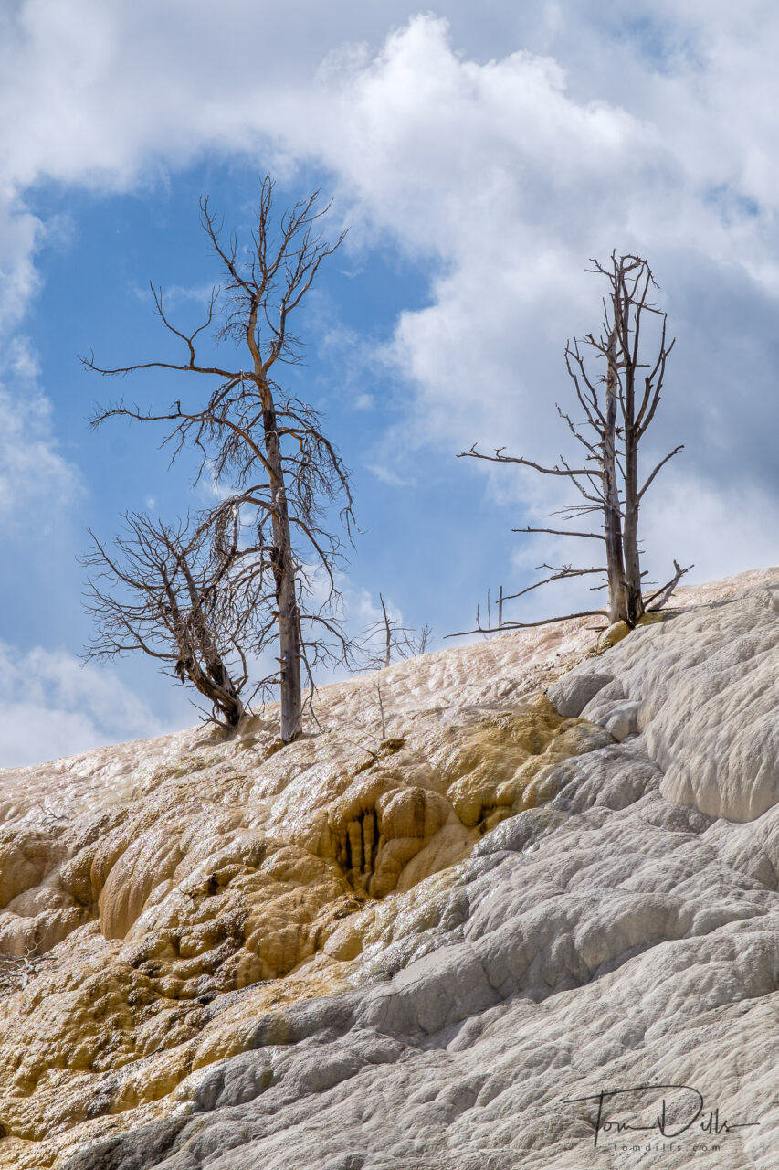
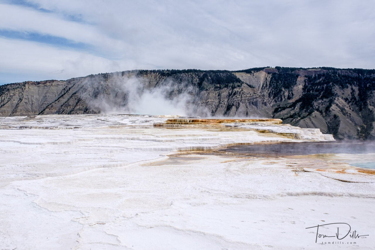
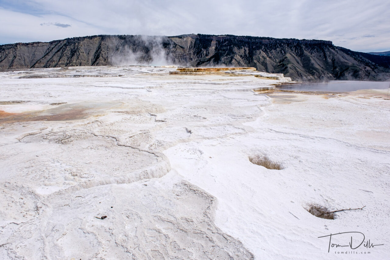
We thought we had a pretty good idea what to expect. But when we rounded a curve and caught our first glimpse of the formations of Mammoth Hot Springs, our first thoughts were “is that snow???”
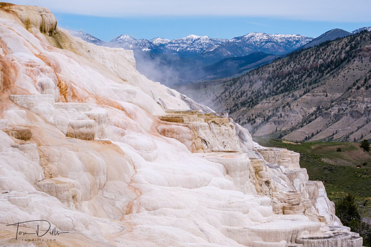
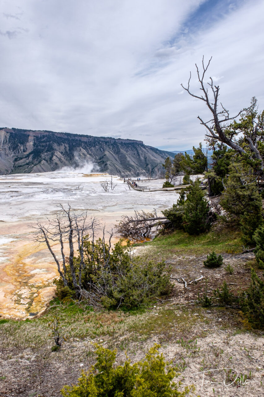
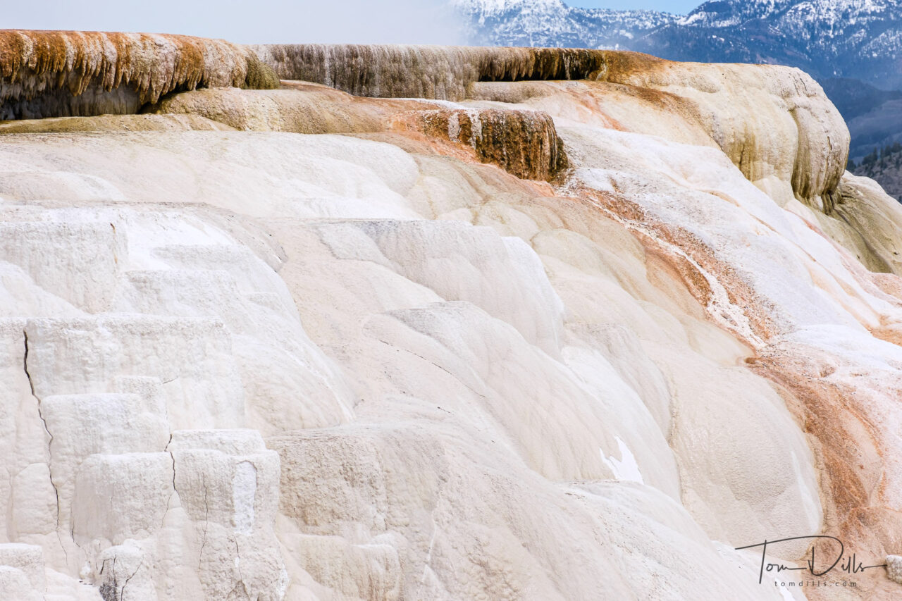
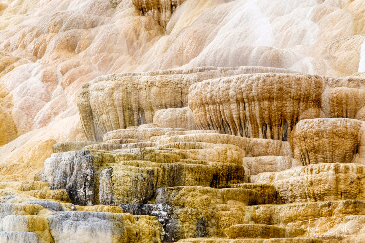
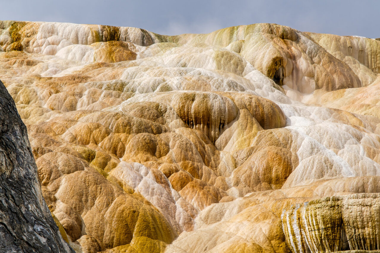
Canary Spring at Mammoth Hot Springs, Yellowstone National Park
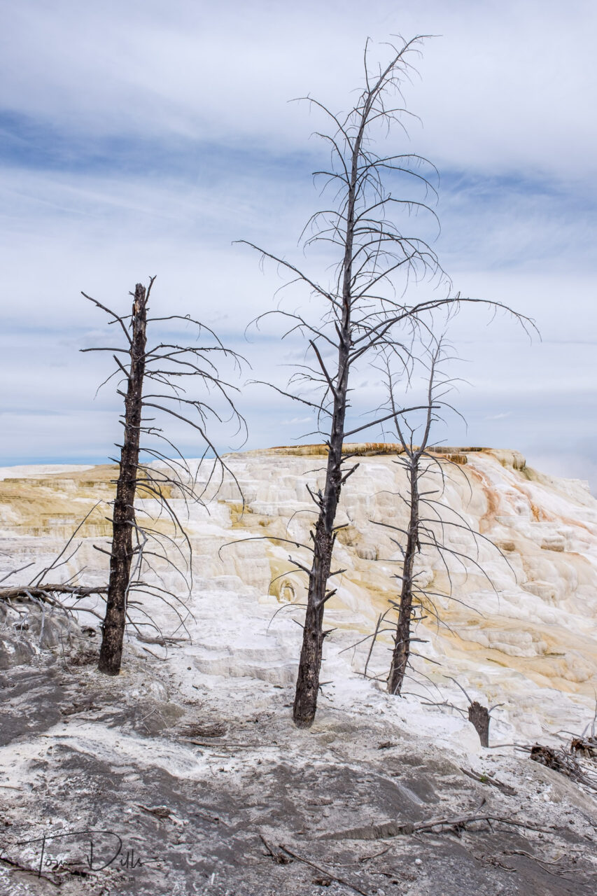
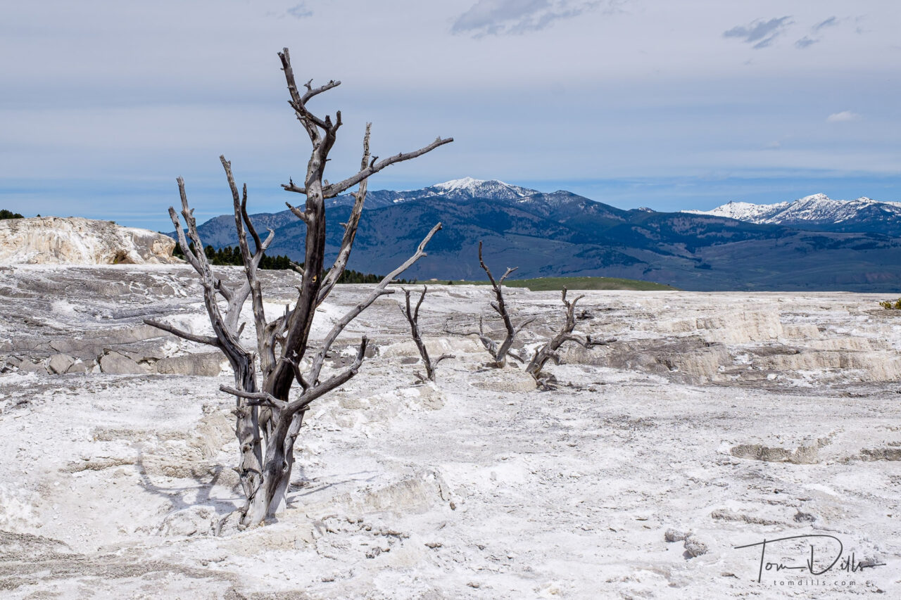
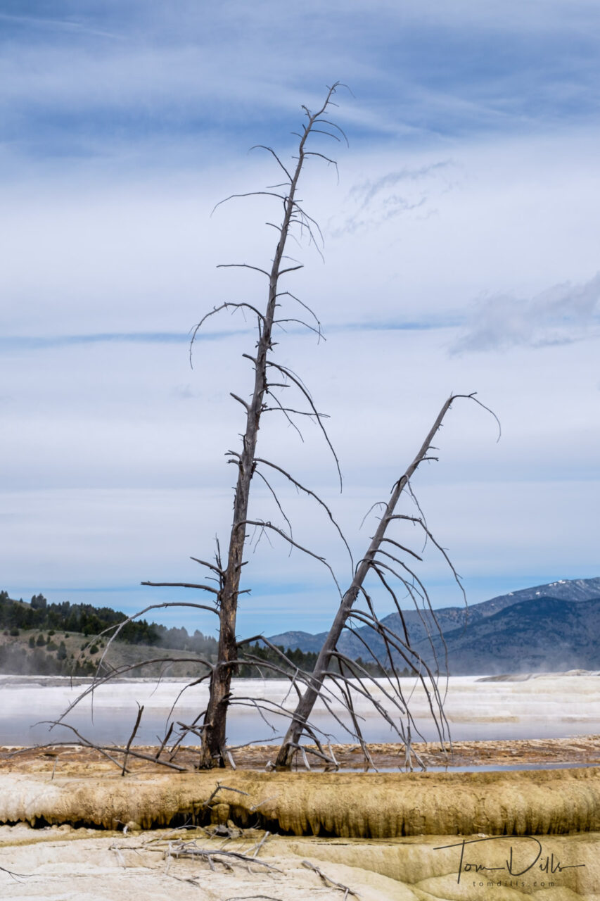
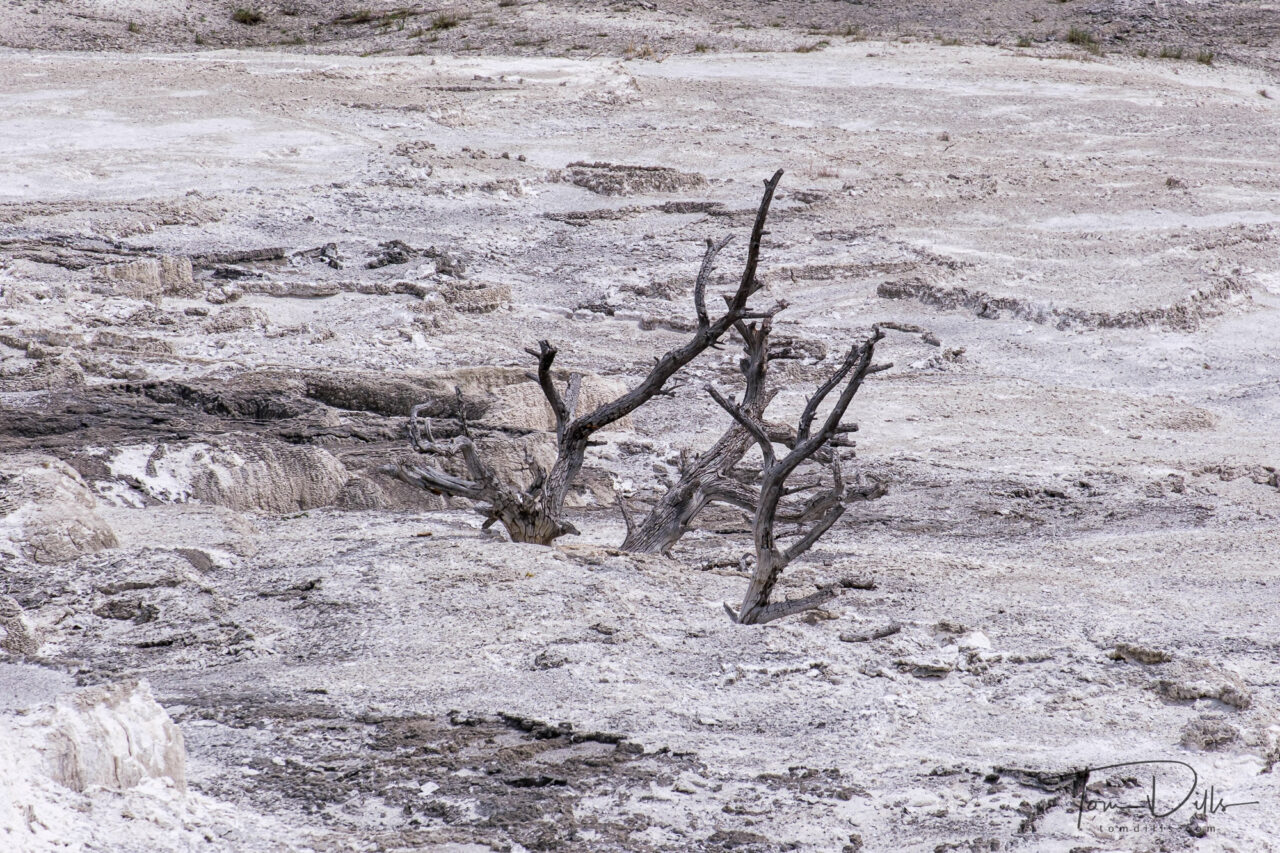
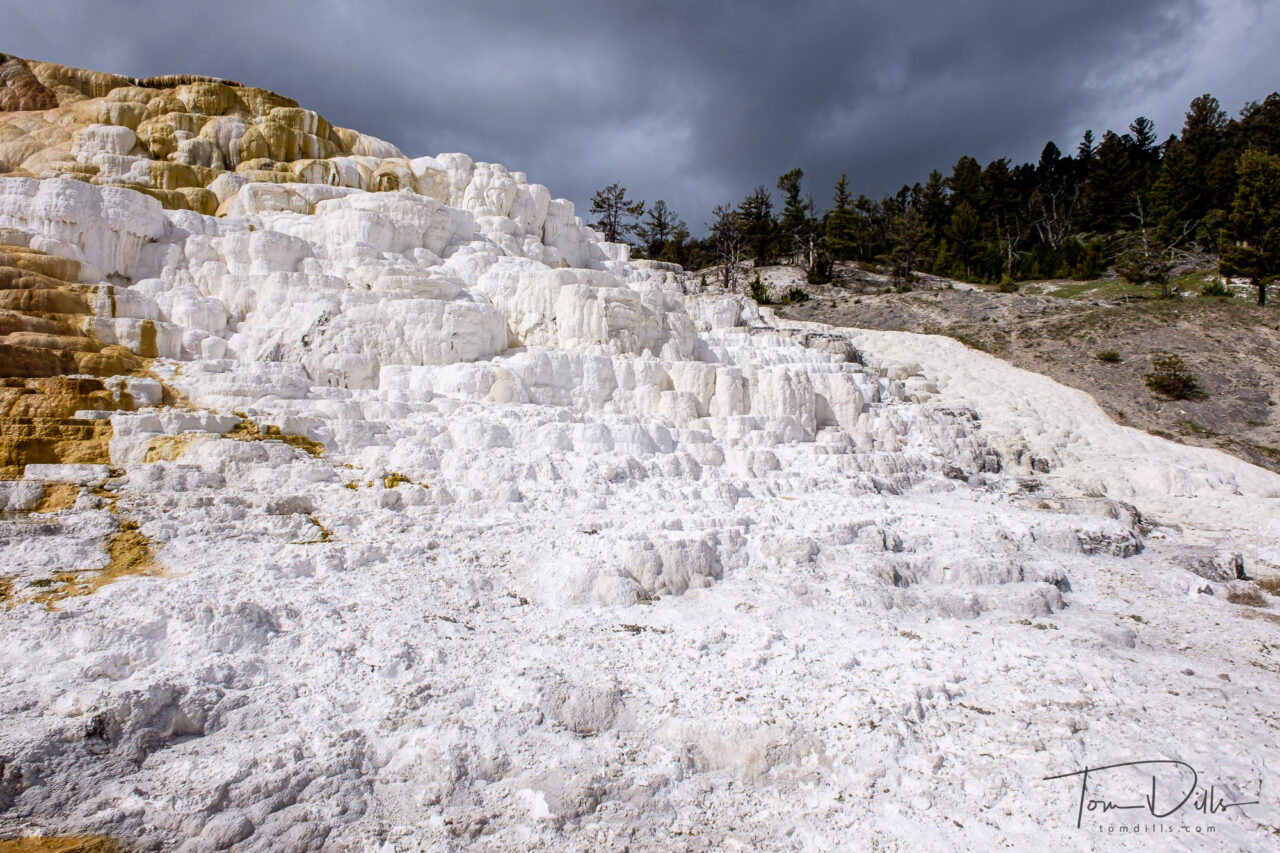
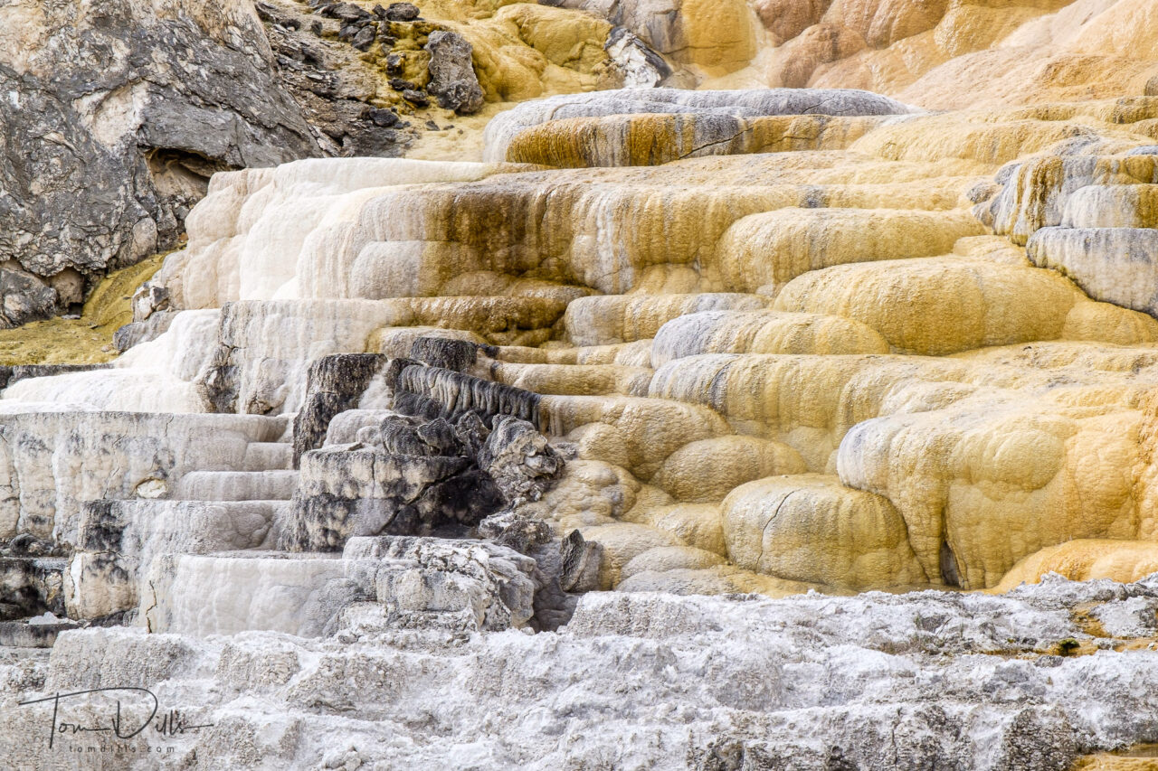
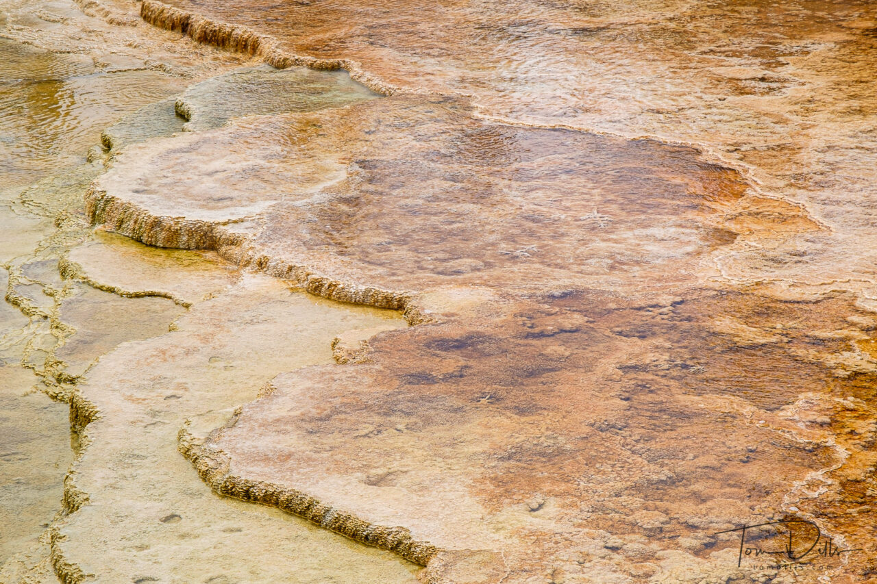
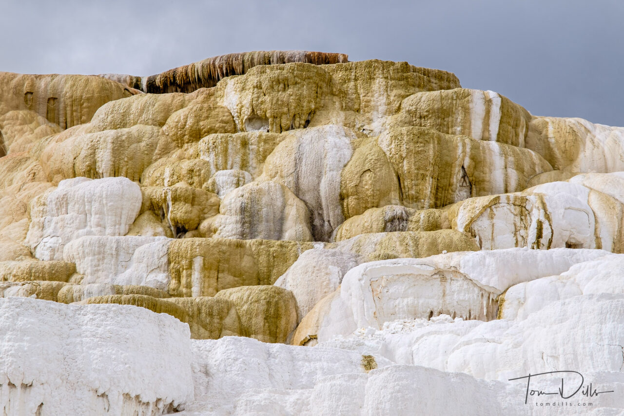
The first impression of Mammoth Hot Springs is that it can’t be real. It is so different from anything we’ve ever seen that it just doesn’t register. And when one gets closer it looks even stranger, as the patterns, colors and textures of the various deposits defy the logic of our memories.
Canary Spring at Mammoth Hot Springs, Yellowstone National Park
After spending a little time studying the springs, it becomes a little more clear what is happening and why. Eventually it begins to make a little sense, although looking at these photos a month later I still have a hard time comprehending what I saw. It was quite an experience and one I’ll remember for a long time.
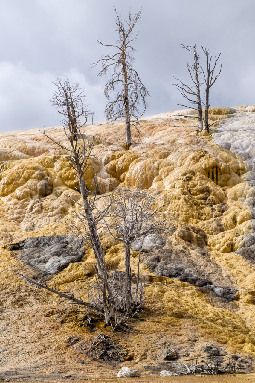
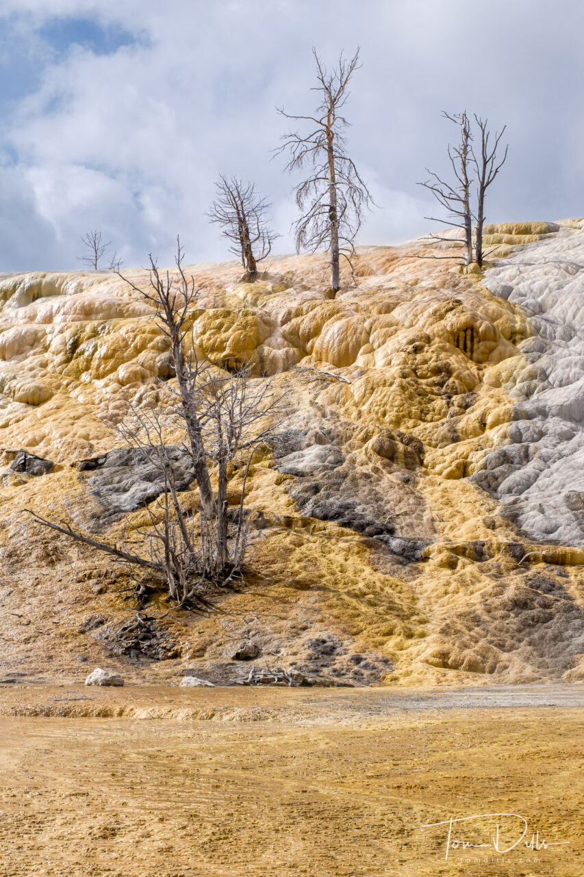
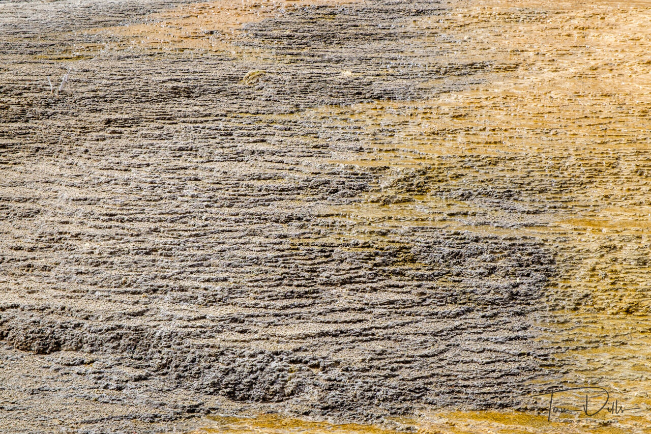
Canary Spring at Mammoth Hot Springs, Yellowstone National ParkCanary Spring at Mammoth Hot Springs, Yellowstone National ParkMinerva Trace. Lower Terraces at Mammoth Hot Springs, Yellowstone National ParkMinerva Trace. Lower Terraces at Mammoth Hot Springs, Yellowstone National ParkMinerva Trace. Lower Terraces at Mammoth Hot Springs, Yellowstone National ParkCanary Spring at Mammoth Hot Springs, Yellowstone National ParkDryad Spring at Mammoth Hot Springs, Yellowstone National ParkCanary Spring at Mammoth Hot Springs, Yellowstone National ParkMammoth Hot Springs, Yellowstone National ParkCanary Spring at Mammoth Hot Springs, Yellowstone National ParkPalette Spring. Lower Terraces at Mammoth Hot Springs, Yellowstone National ParkPalette Spring. Lower Terraces at Mammoth Hot Springs, Yellowstone National ParkPalette Spring. Lower Terraces at Mammoth Hot Springs, Yellowstone National ParkPalette Spring. Lower Terraces at Mammoth Hot Springs, Yellowstone National ParkMinerva Trace. Lower Terraces at Mammoth Hot Springs, Yellowstone National ParkMinerva Trace. Lower Terraces at Mammoth Hot Springs, Yellowstone National ParkCanary Spring at Mammoth Hot Springs, Yellowstone National ParkDryad Spring at Mammoth Hot Springs, Yellowstone National ParkGrassy Spring at Mammoth Hot Springs, Yellowstone National ParkPalette Spring. Lower Terraces at Mammoth Hot Springs, Yellowstone National ParkView of the Mammoth Hotel and visitor complex from the Main Terrace of Mammoth Hot Springs, Yellowstone National Park
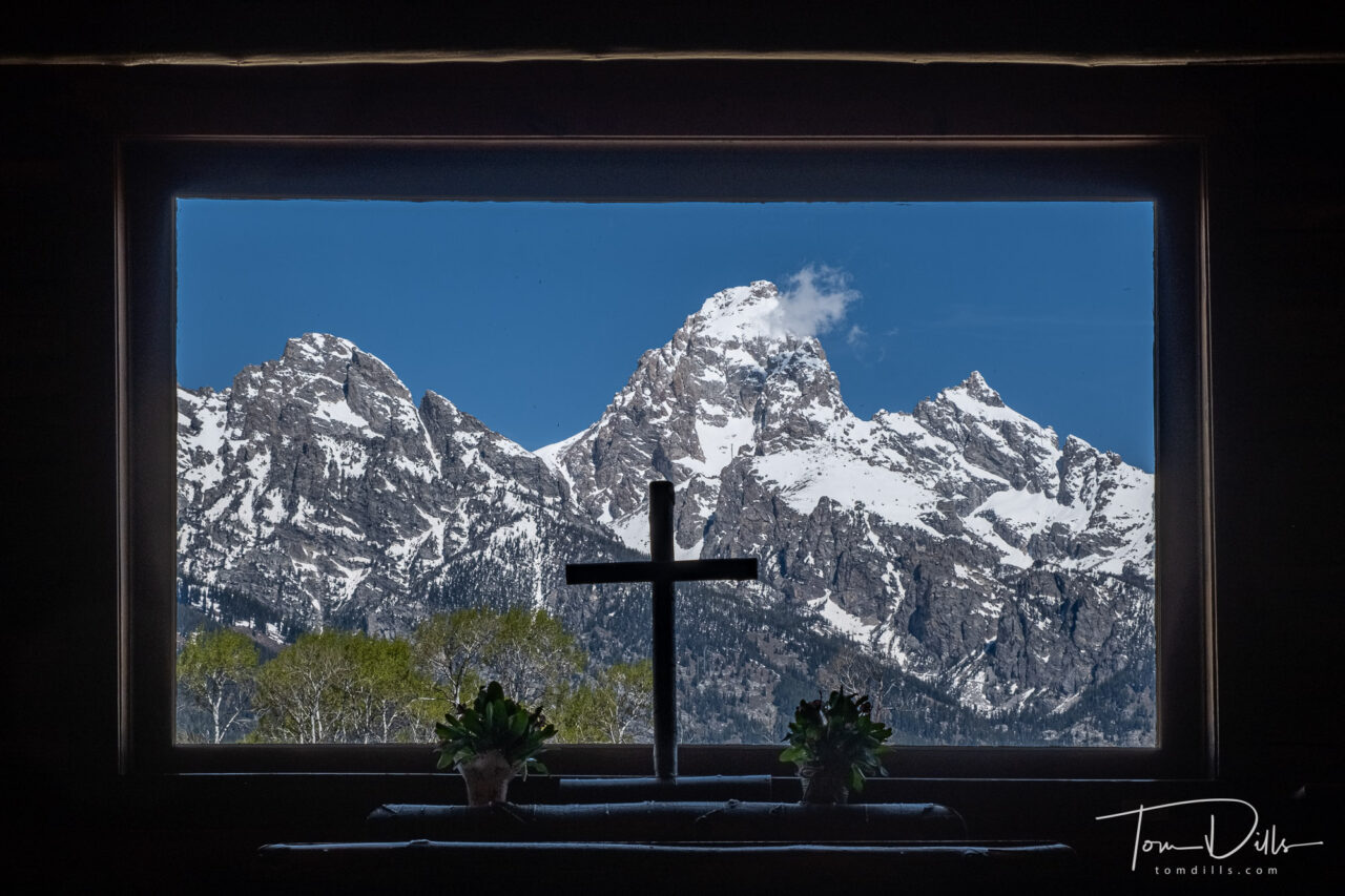
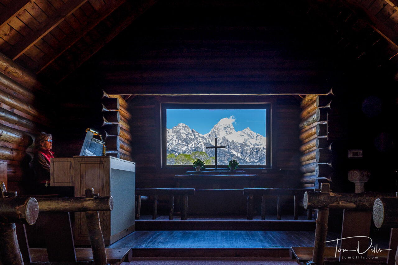
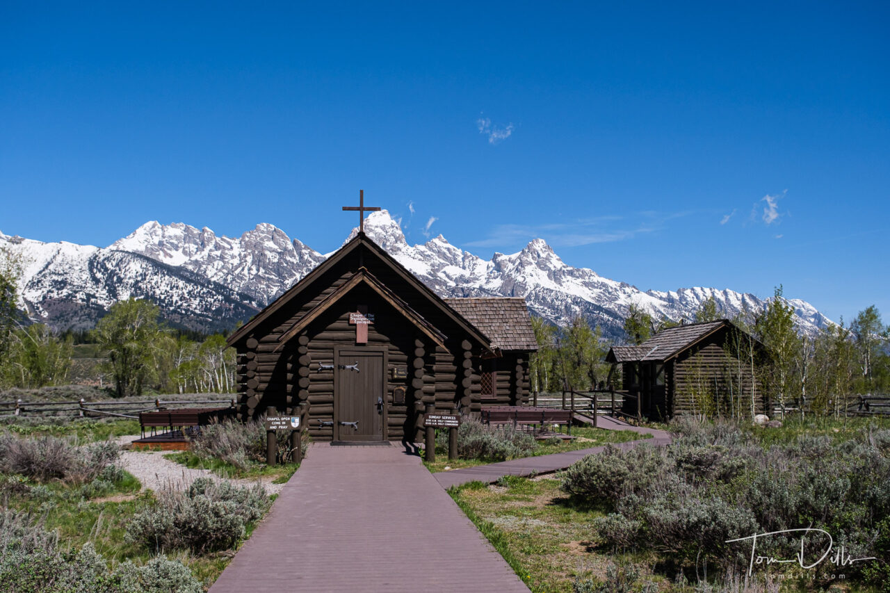
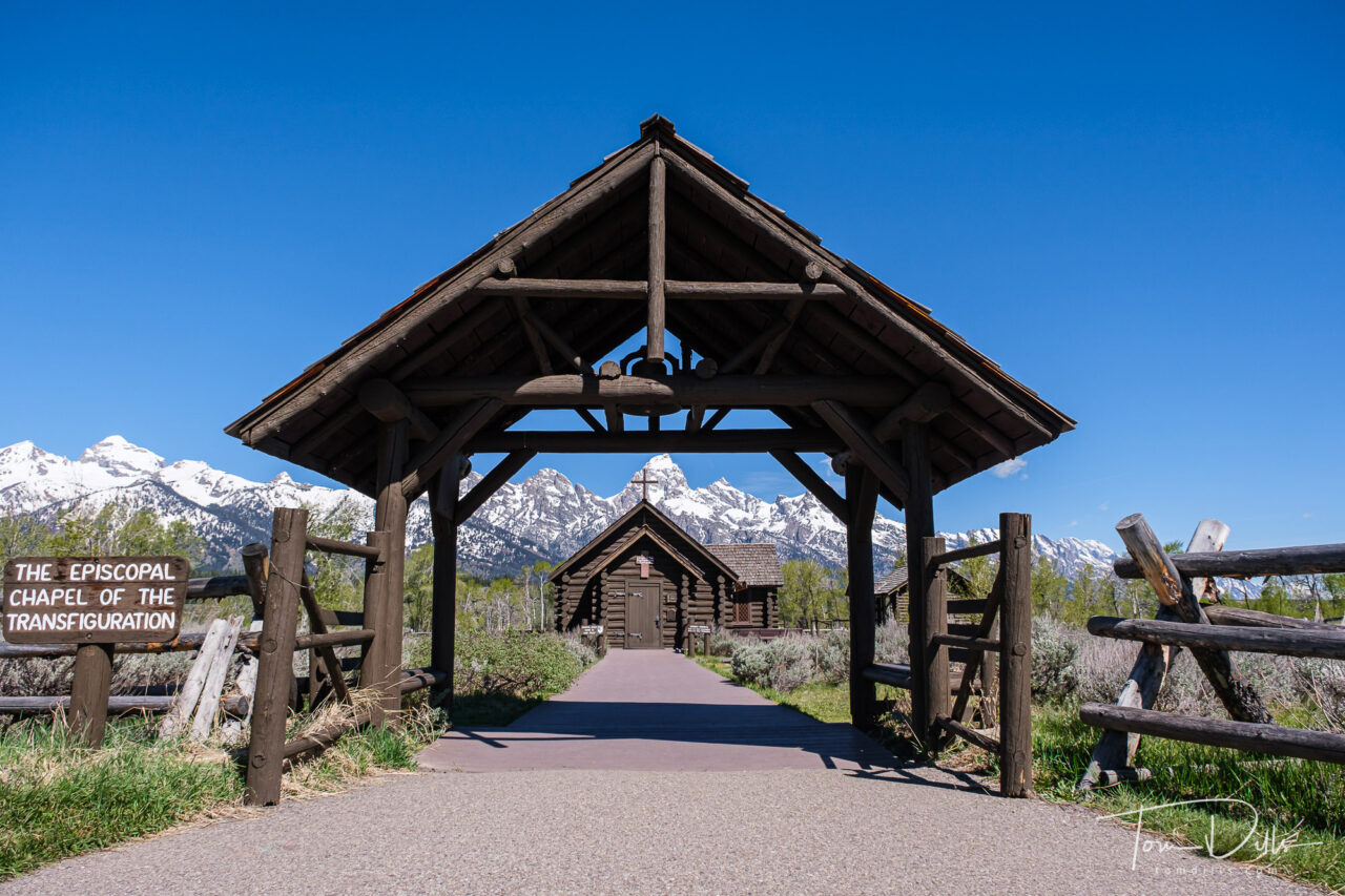
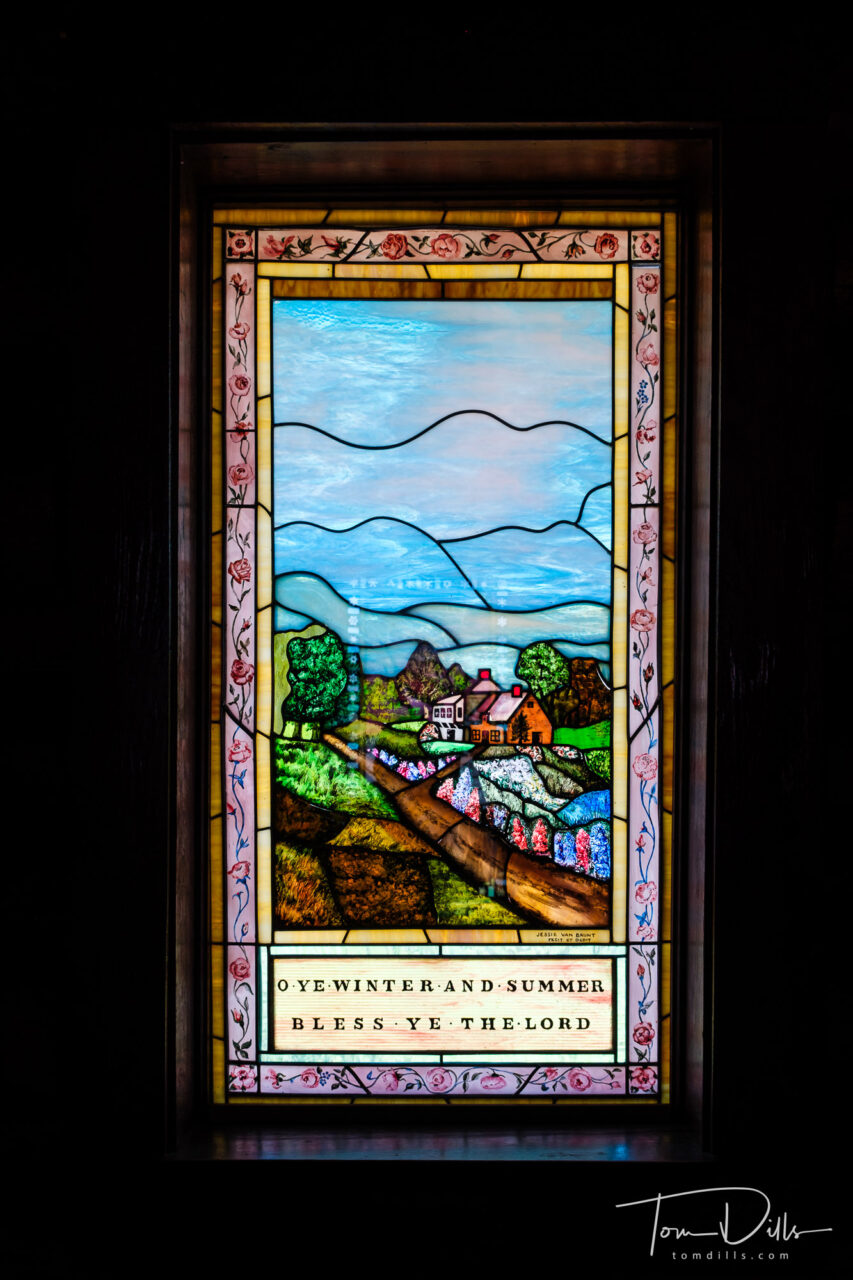
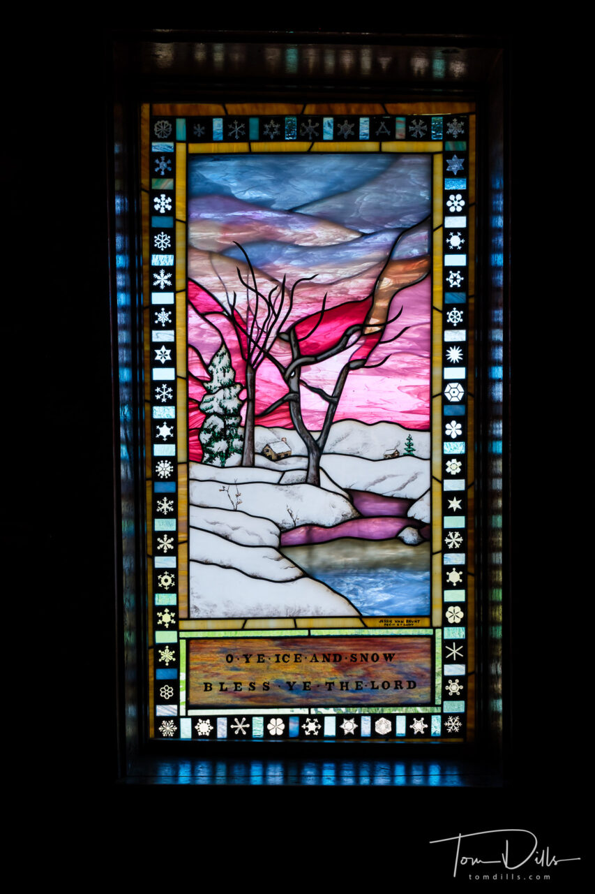
Chapel of the Transfiguration. Grand Teton National Park
The Chapel of the Transfiguration is a small log chapel in Grand Teton National Park, in the community of Moose. The chapel was sited and built to frame a view of the Cathedral Group of peaks in a large window behind the altar. The chapel, which was built in 1925, is owned and operated by St. John’s Episcopal Church in Jackson. The church is open daily, and still hosts services on Sunday. On the day of our visit, an organist was playing in the chapel.
Chapel of the Transfiguration. Grand Teton National Park
The chapel was built to serve guests and employees of the dude ranches that stretched north of Jackson along the base of the Teton Range. The land was donated by Maud Noble, owner of nearby Menor’s Ferry, predating the establishment of Grand Teton National Park in 1929 and its expansion into the Moose area in 1950. The chapel played a primary role in the movie Spencer’s Mountain, which was filmed in Jackson Hole in 1963, and featured Henry Fonda and Maureen O’Hara.
Chapel of the Transfiguration. Grand Teton National ParkChapel of the Transfiguration. Grand Teton National Park
The chapel was placed on the National Register of Historic Places on April 10, 1980.
Chapel of the Transfiguration. Grand Teton National ParkChapel of the Transfiguration. Grand Teton National Park
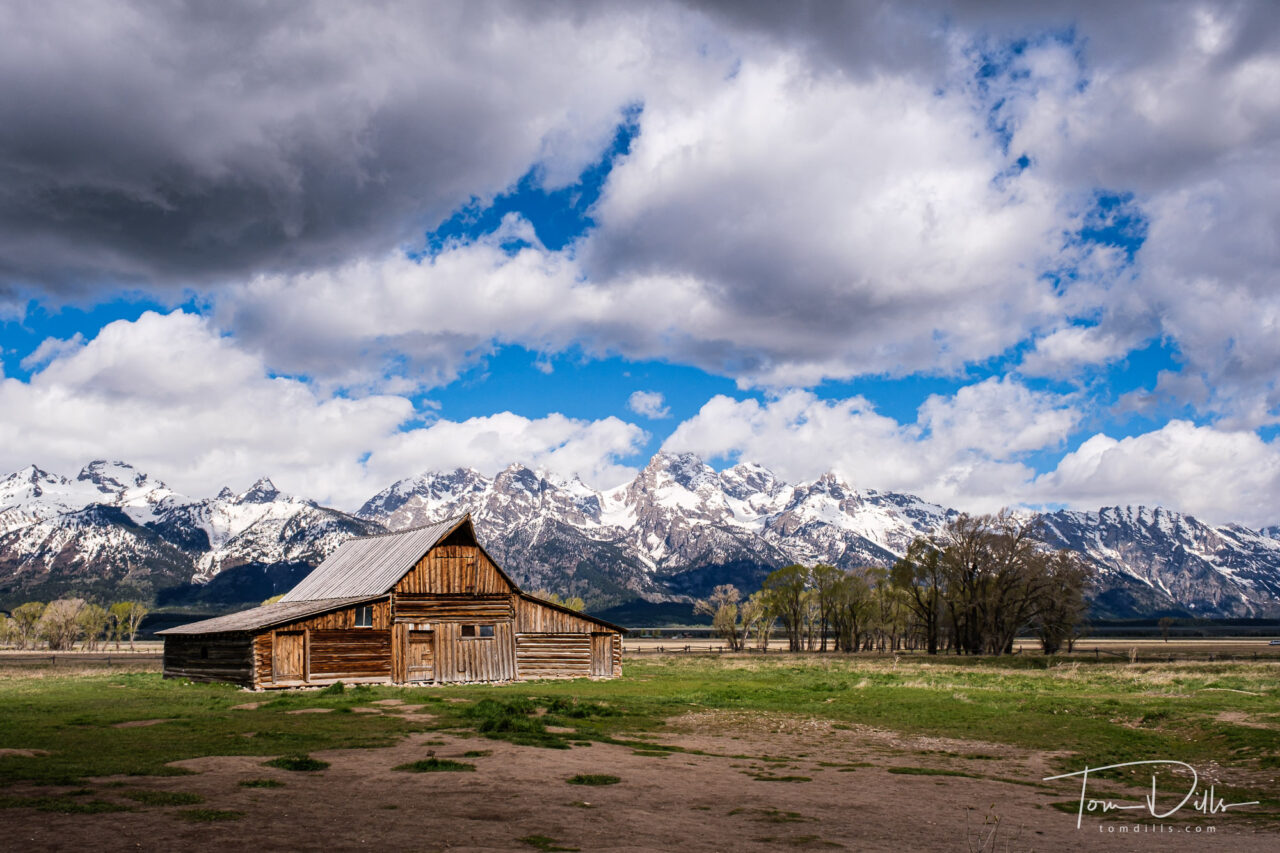
View of the Teton Range from Mormon Row Historic District, Grand Teton National Park
We wrapped up our western swing with a 2 day visit to Jackson, WY and Grand Teton National Park. This is a classic view of the Teton Range from an area called the Mormon Row Historic District. The photo is a bit of a cliche but I can’t imagine a photographer passing it by. Some photographs just need to be taken! We had some pretty nice clouds on this day, which helps a lot.
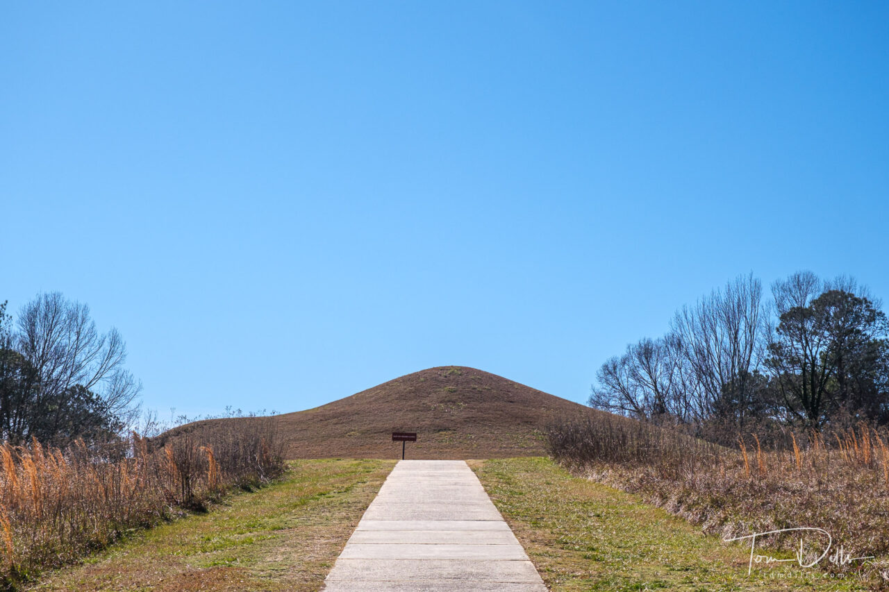
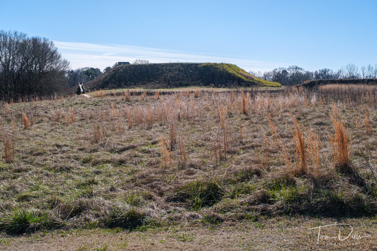
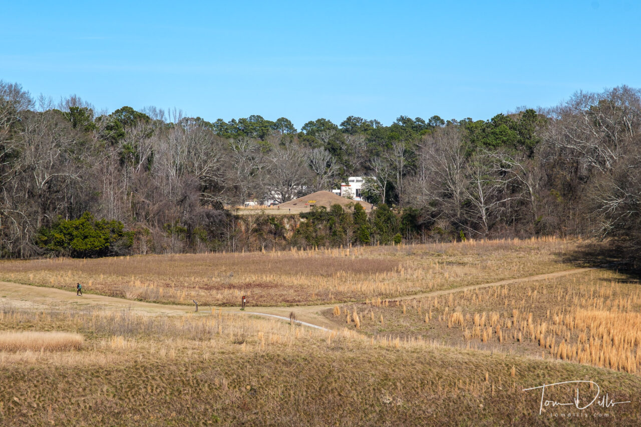
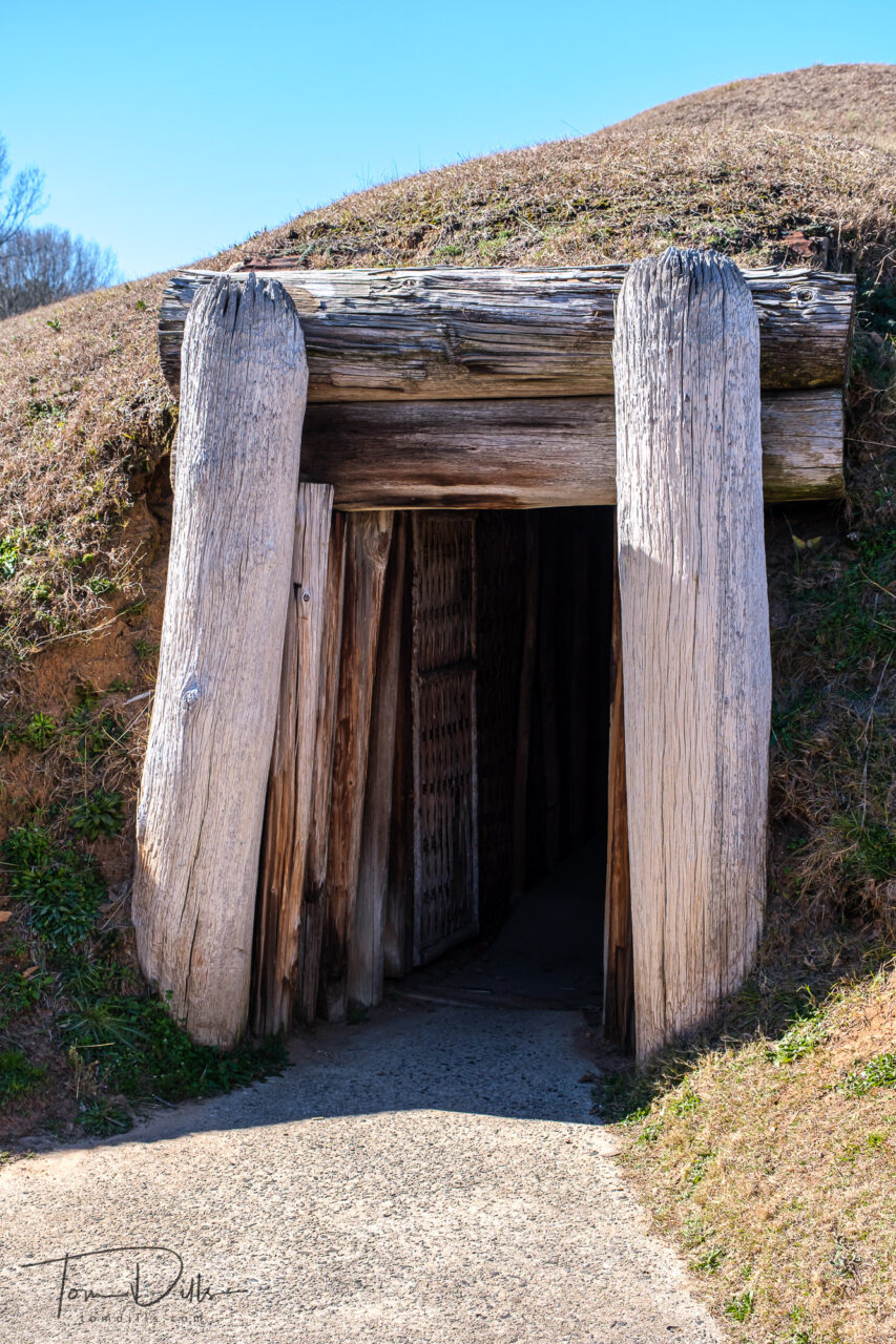
Ocmulgee Mounds National Historical Park near Macon, Georgia
On our recent trip to Texas, we made a stop at Ocmulgee Mounds National Historical Park near Macon, Georgia. We had intended to visit several years ago, but this was one of the many parks whose visitor centers had been closed during the Covid hysteria. We got to visit this time.
Ocmulgee Mounds National Historical Park near Macon, GeorgiaOcmulgee Mounds National Historical Park near Macon, Georgia
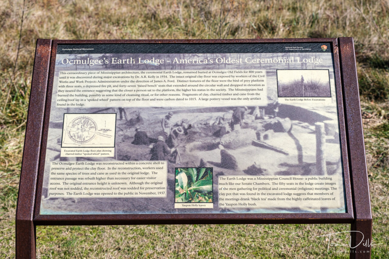
The park is a prehistoric American Indian site, boasting more than 12,000 years of continuous human habitation by many different American Indian cultures. American Indians first came here during the Paleo-Indian Period hunting Ice Age mammals. Around 900 CE, the Mississippian Period began, and people constructed mounds for their elite, which remain here today.
The site was also the scene of several Civil War battles.
Entrance to ceremonial mound. Ocmulgee Mounds National Historical Park near Macon, GeorgiaOcmulgee Mounds National Historical Park near Macon, Georgia
The largest dig ever conducted in this country occurred here at Ocmulgee and the surrounding area. Between 1933 and 1936, over 800 men in Roosevelt’s Works Progress Administration (WPA), Civil Works Administration (CWA), Federal Emergency Relief Administration (ERA & FERA), and later by the Civilian Conservation Corps excavated under the direction of Dr. Arthur R. Kelly from the Smithsonian Institute.
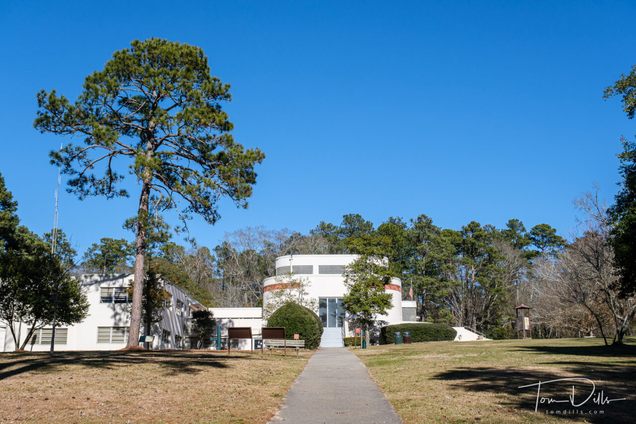
Visitor Center. Ocmulgee Mounds National Historical Park near Macon, Georgia
The site was declared a National Monument in 1936. In 1937 the National Park Service, along with U.S. Congressman Carl Vinson, General Walter Harris, and Dr. Charles C. Harrold, completed a list of needed development projects including construction of a museum, restoration of archeological features, access roads and parking, tree planting, and fence construction – all to include the detached Lamar Site, where a levee was also needed.
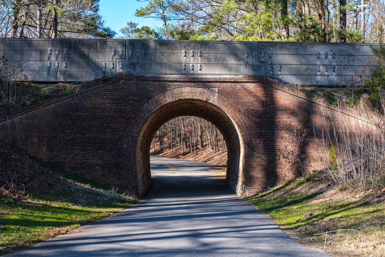
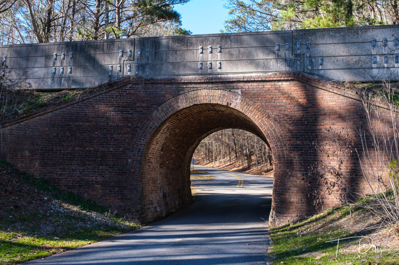
One Lane Tunnel. Perhaps the worlds’ smallest? Ocmulgee Mounds National Historical Park near Macon, GeorgiaOne Lane Tunnel. Perhaps the worlds’ smallest? Ocmulgee Mounds National Historical Park near Macon, Georgia
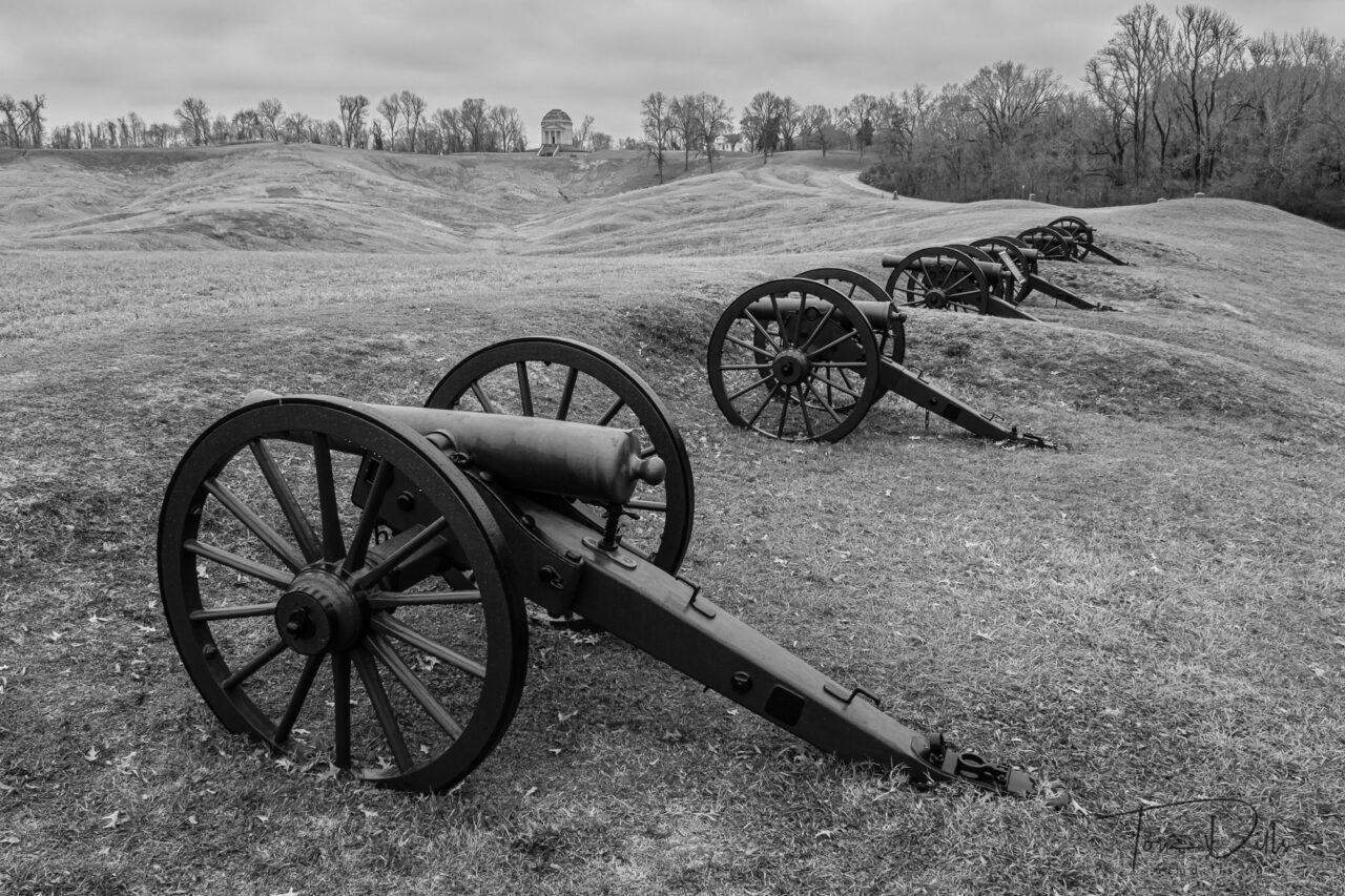
Cannons with the Illinois Memorial in the background. Vicksburg National Military Park, Mississippi
Kathy & I are enroute to Texas for the first leg of our winter travels. We made a long overdue stop in Vicksburg to visit the National Military Park there. It is a solemn reminder of the price many have paid over our nation’s history.
We visited on a cloudy and overcast day, but thankfully with no rain. The whole time I photographed there I was envisioning the photos in black & white, in an inadequate homage to the photographs that were made in the heat of the moment. The battlefields as they exist today are a distant reminder of the horrors of battle, but the tribute paid in the form of monuments and memorials is moving.
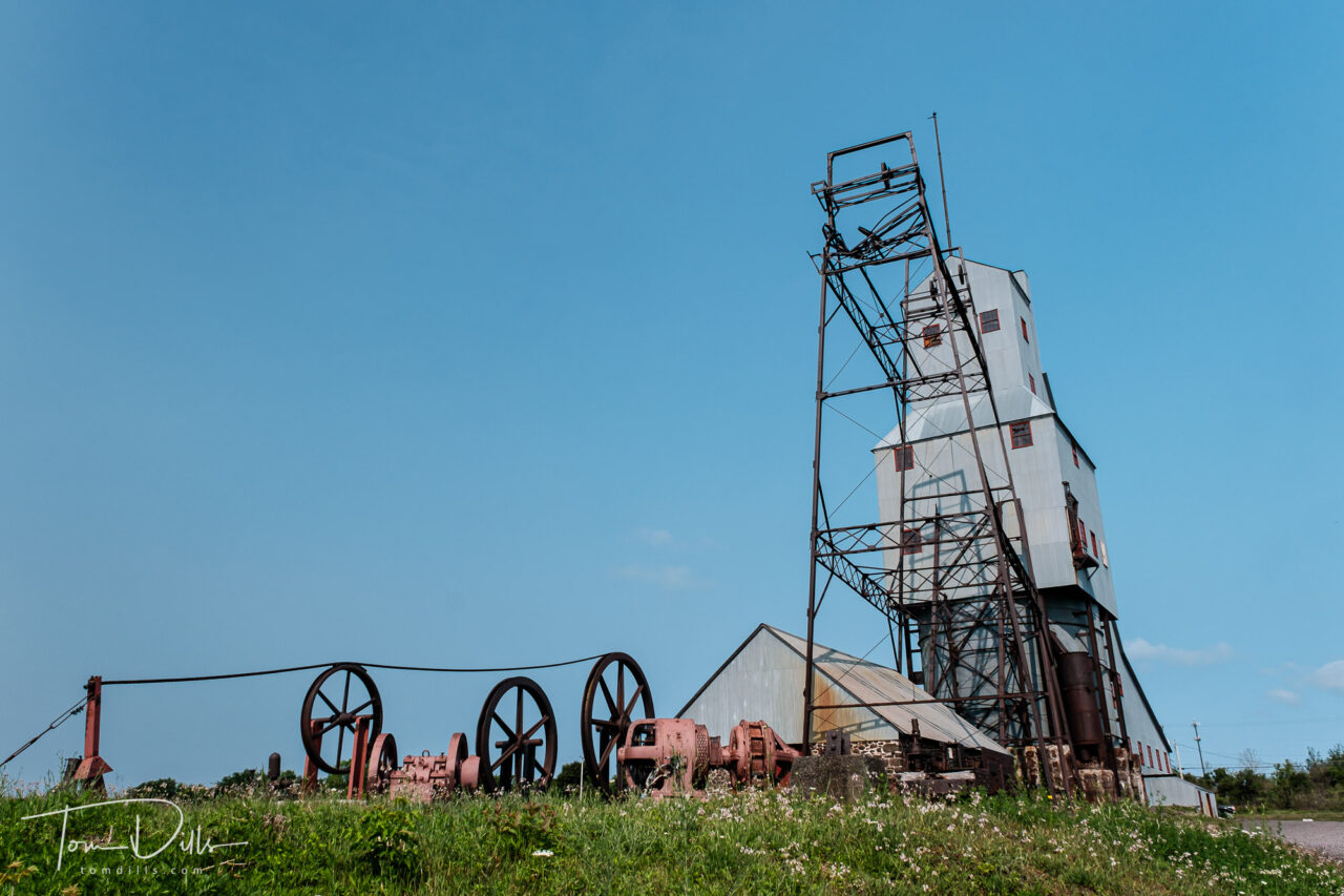
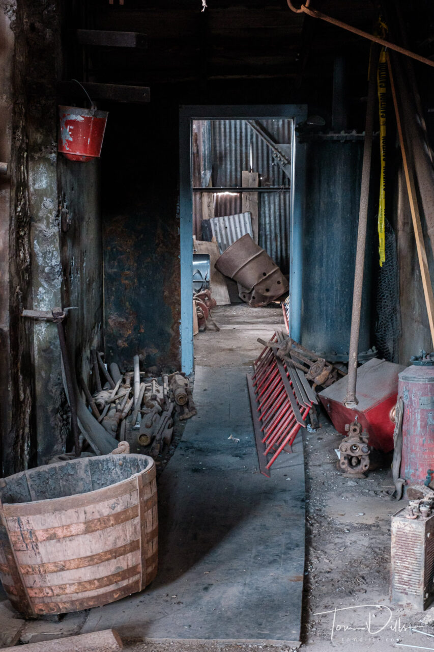
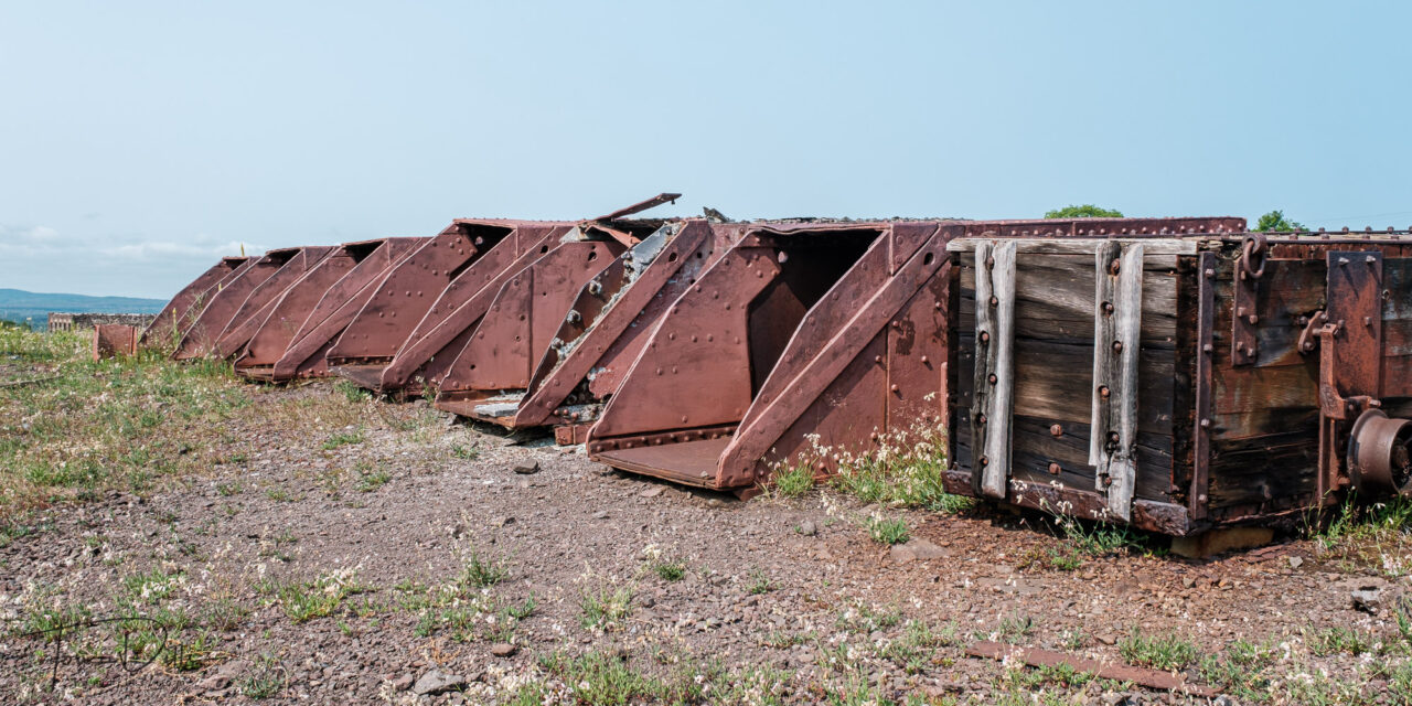
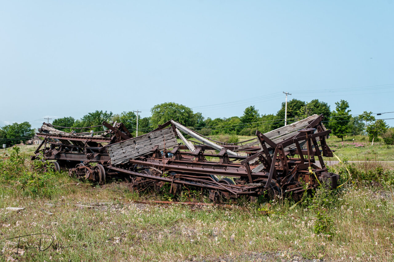
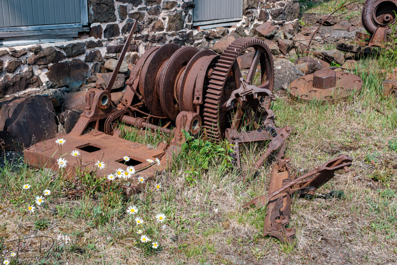
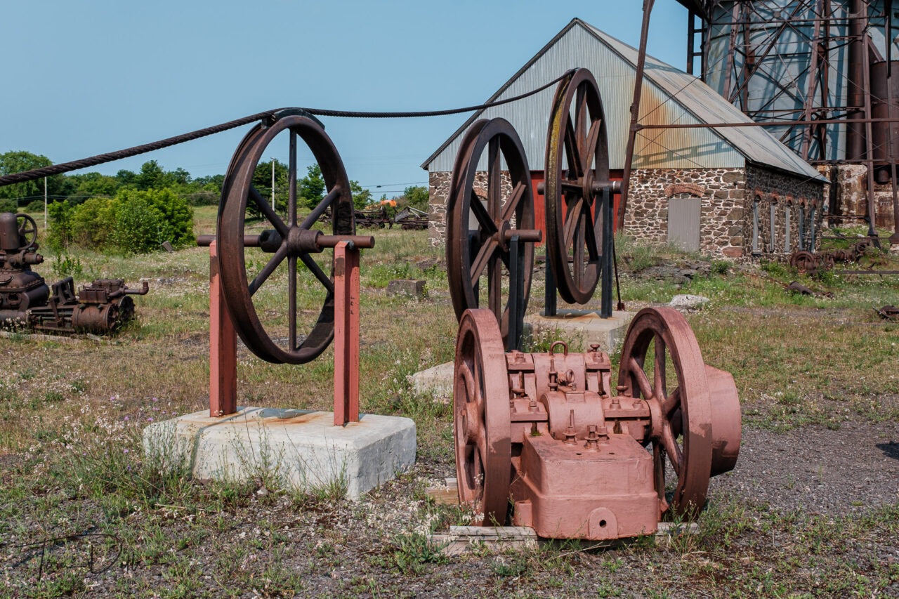
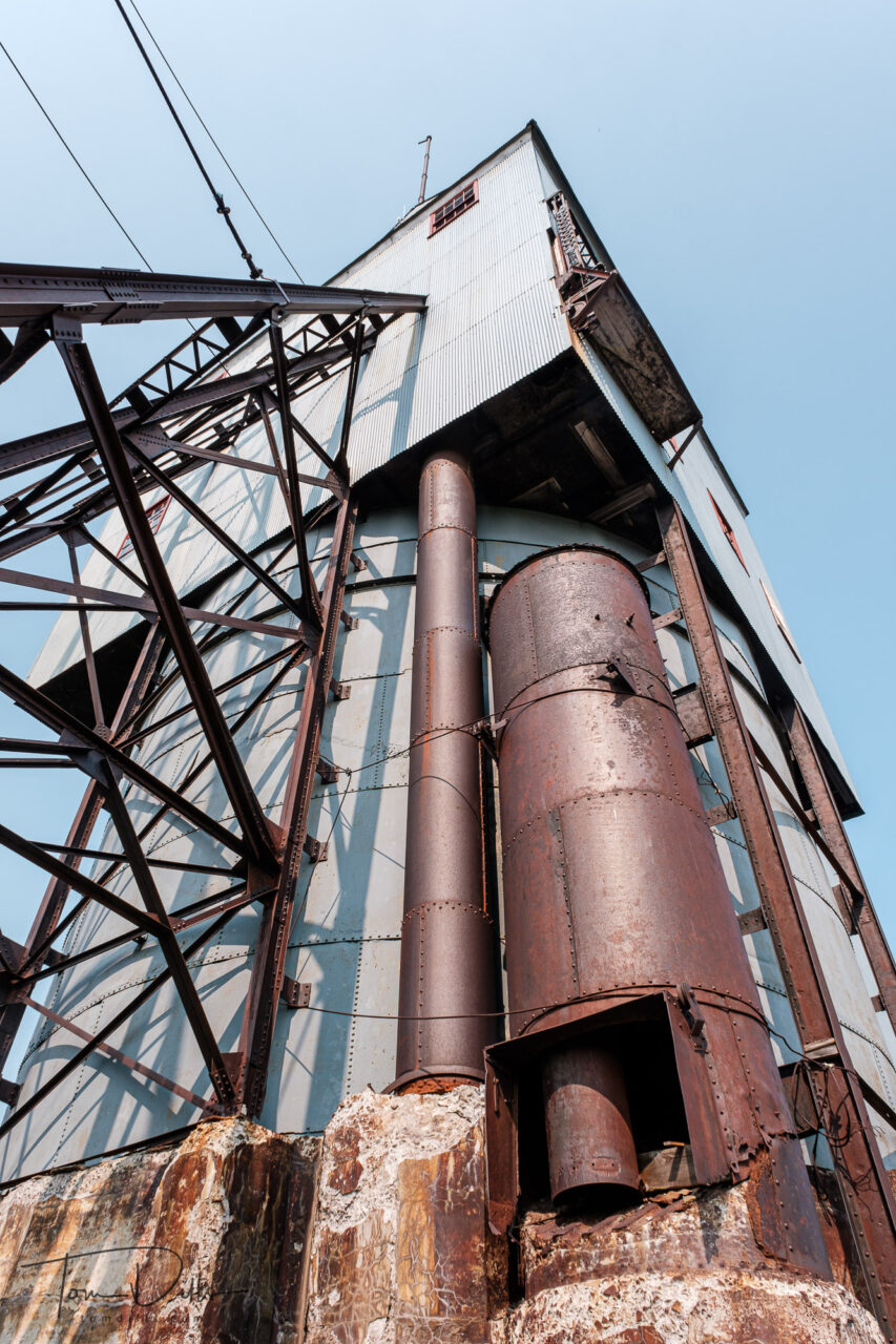
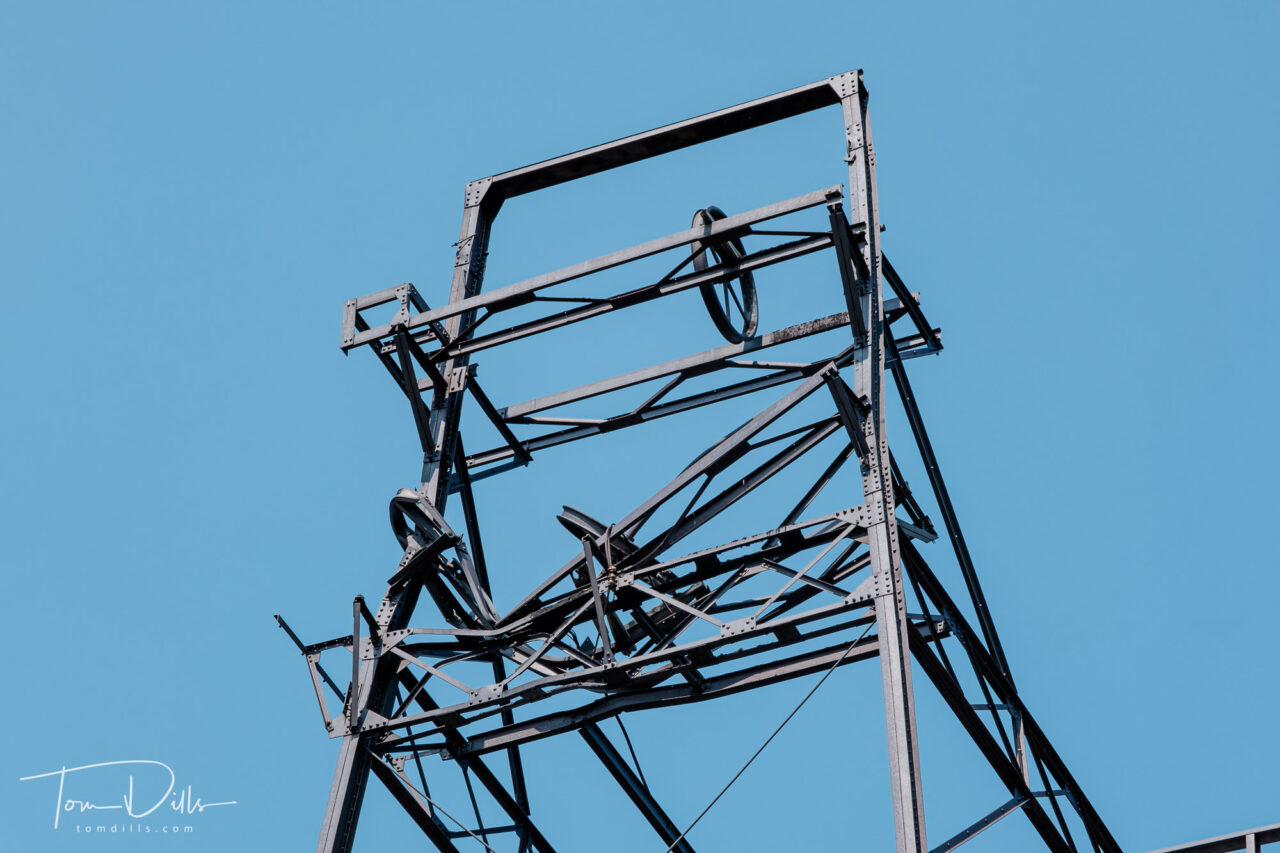
No. 2 Shaft-Rock House at The Quincy Mine, part of the Keweenaw National Historical Park in Houghton, Michigan
Copper mining plays an integral role in the history of the Keweenaw Peninsula, and there are remains of these mines scattered throughout the land. A few of them have been partially preserved for tourism, including the Quincy Mine, part of Keweenaw National Historical Park near Houghton.
No. 2 Shaft-Rock House at The Quincy Mine, part of the Keweenaw National Historical Park in Houghton, MichiganNo. 2 Shaft-Rock House at The Quincy Mine, part of the Keweenaw National Historical Park in Houghton, MichiganNo. 2 Shaft-Rock House at The Quincy Mine, part of the Keweenaw National Historical Park in Houghton, Michigan
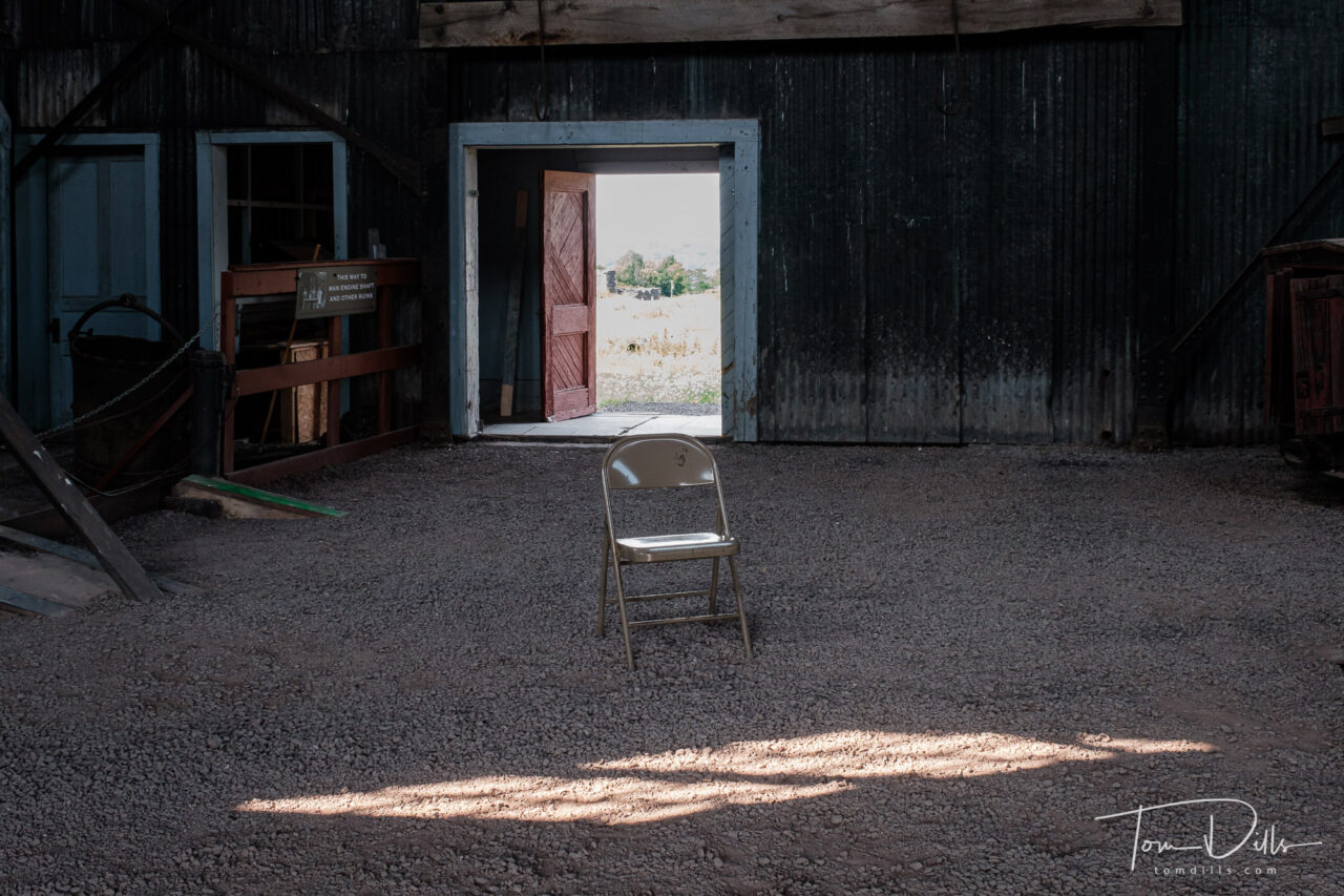
Kathy & I spent a few hours visiting the park and touring the buildings that are open to the public. They offer a tour into one of the mines using one of the former mining cars, but I’m a little squeamish about underground and enclosed spaces so we decided to pass. Perhaps another time, he says…. 🙂
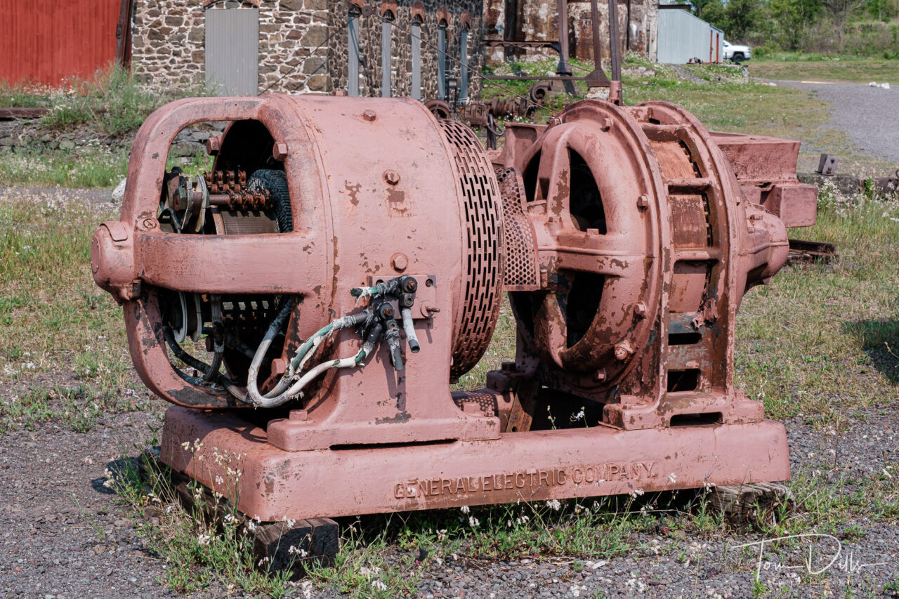
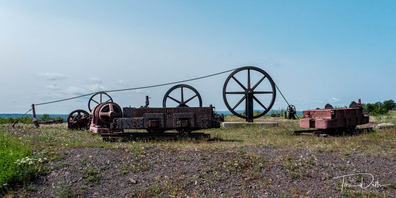
Abandoned mining equipment at The Quincy Mine, part of the Keweenaw National Historical Park in Houghton, MichiganAbandoned mining equipment at The Quincy Mine, part of the Keweenaw National Historical Park in Houghton, MichiganAbandoned mining equipment at The Quincy Mine, part of the Keweenaw National Historical Park in Houghton, MichiganAbandoned mining equipment at The Quincy Mine, part of the Keweenaw National Historical Park in Houghton, MichiganAbandoned mining equipment at The Quincy Mine, part of the Keweenaw National Historical Park in Houghton, Michigan
The most fascinating aspect is the size of the machinery that was used to move both man, equipment and materials in and out of the mine. But they produced a lot of copper over the years the mines were in operation. Once the copper ran out, the mines were abandoned and left to the elements. Fortunately there are a few of them still remaining, as reminders of the importance of copper to the area.
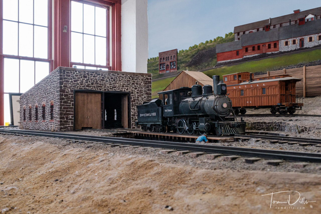
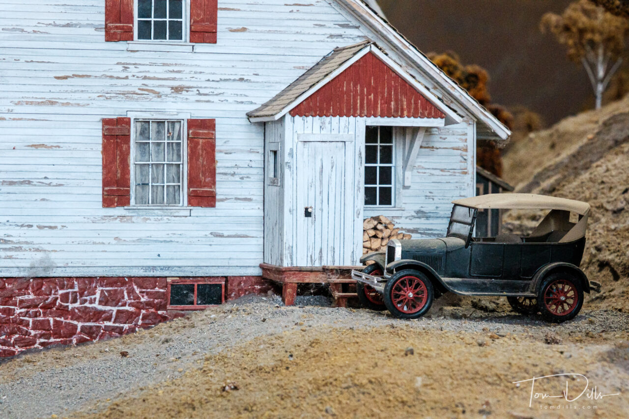
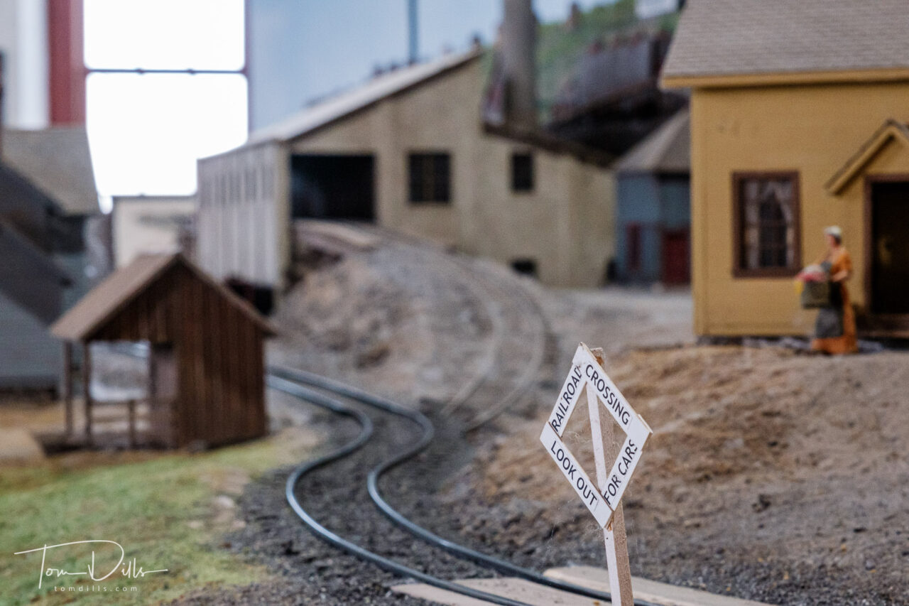
No. 2 Shaft-Rock House at The Quincy Mine, part of the Keweenaw National Historical Park in Houghton, MichiganAbandoned mining equipment at The Quincy Mine, part of the Keweenaw National Historical Park in Houghton, MichiganNo. 2 Shaft-Rock House at The Quincy Mine, part of the Keweenaw National Historical Park in Houghton, MichiganModel train layout at The Quincy Mine, part of the Keweenaw National Historical Park in Houghton, MichiganModel train layout at The Quincy Mine, part of the Keweenaw National Historical Park in Houghton, MichiganModel train layout at The Quincy Mine, part of the Keweenaw National Historical Park in Houghton, Michigan
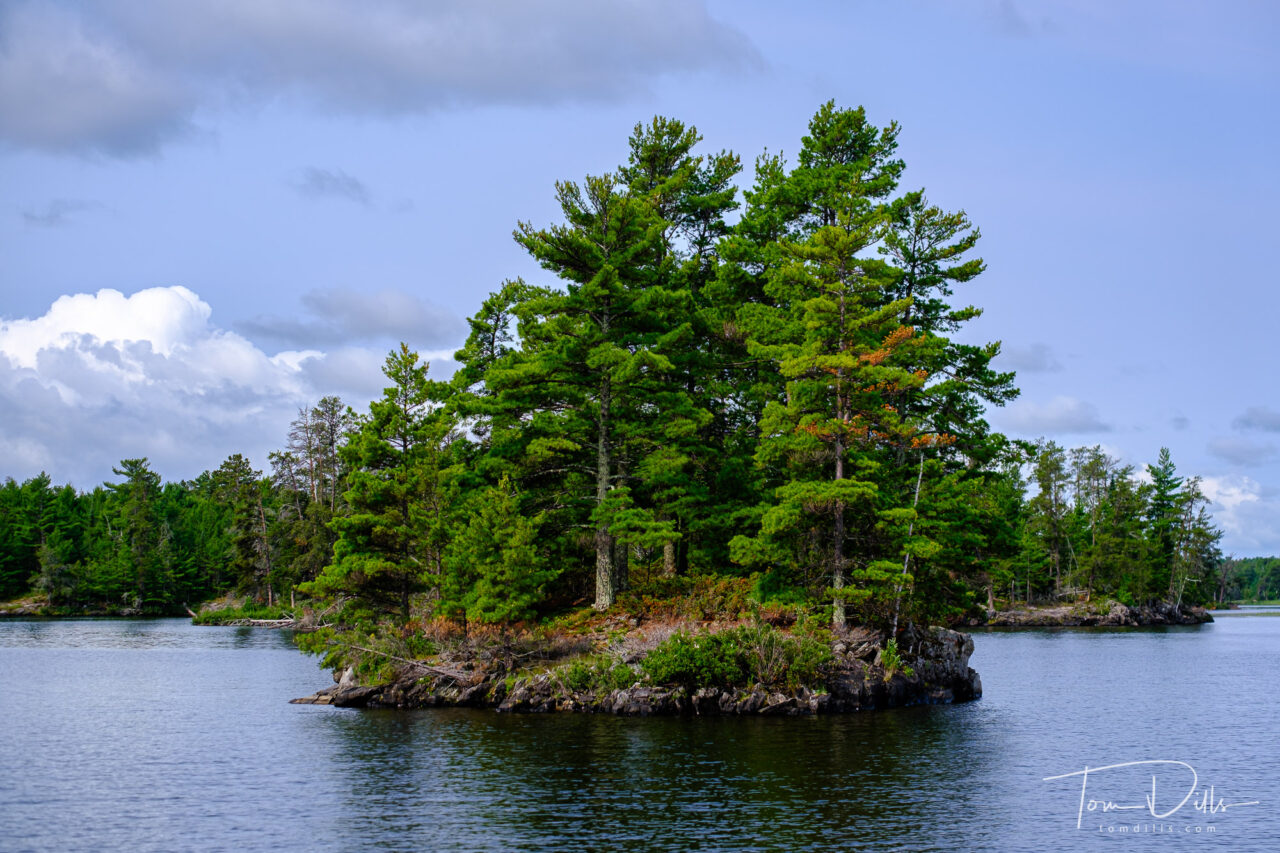
Cruise on Rainy Lake aboard The Voyageur. Voyageurs National Park, Minnesota
We capped off our road trip with an unplanned visit to Voyageurs National Park in Minnesota. Unplanned, because when I first thought about visiting the Northernmost Point I never even bothered to see what else there was to do near International Falls. Rookie mistake!
When we drove into International Falls and saw the signs for Voyageurs, I did a forehead slap and said “you dummy – how did you not remember this was here?!?!?” We were able to book a boat cruise on Rainy Lake and it turned out to be one of the highlights of the trip. Fortunately for us, Rainy Lake was not rainy on the day we visited, and I got a bunch of nice photos. We didn’t see much wildlife, but we did get to see lots of beautiful scenery. The lake is dotted with thousands of little islands like this one.
I’m posting way out of order, but we have begun our final leg toward home, so I wanted to post one final photo from the road. I’ll have more photos and stories once I get home and am catching up!
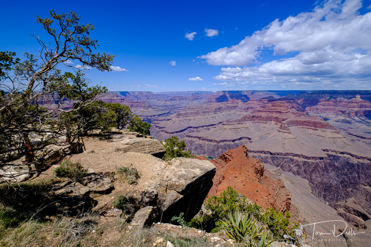
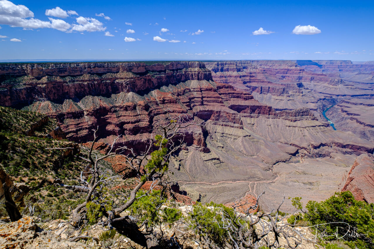
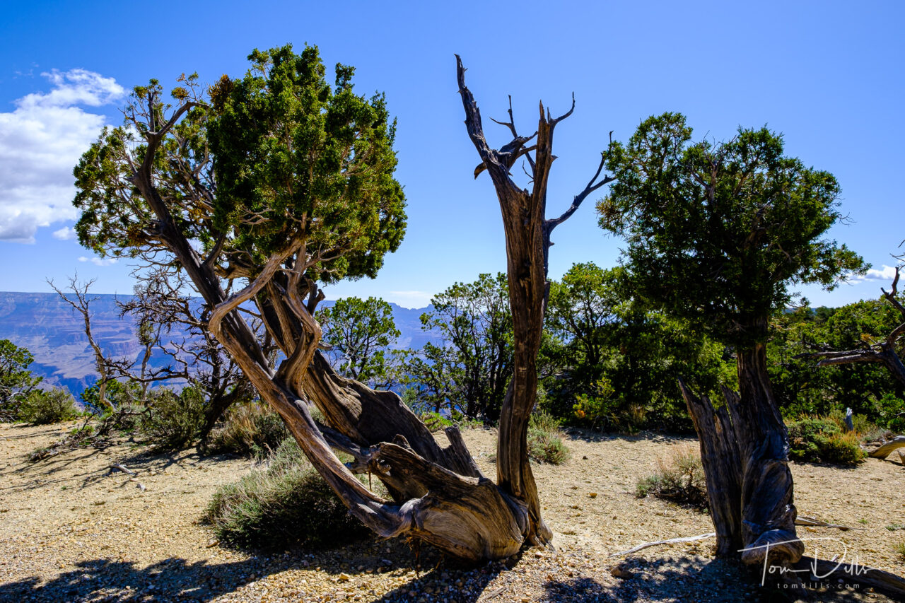
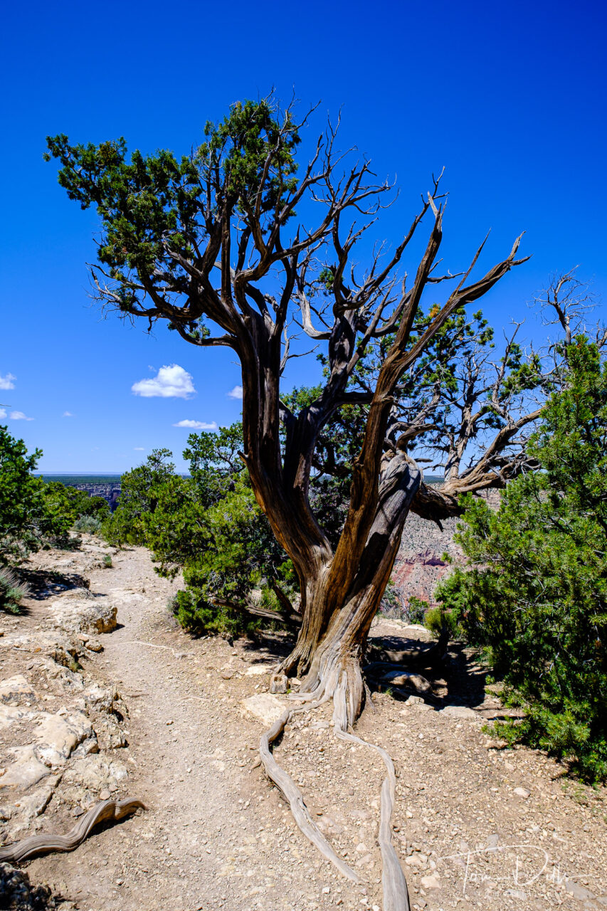
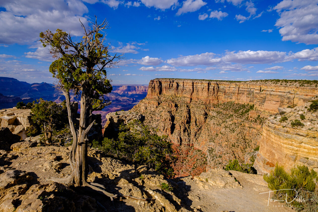
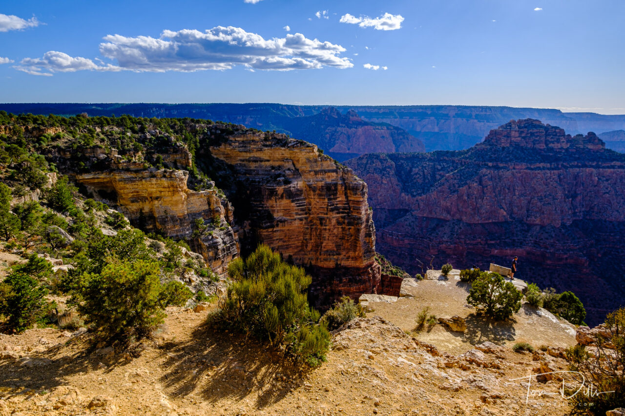
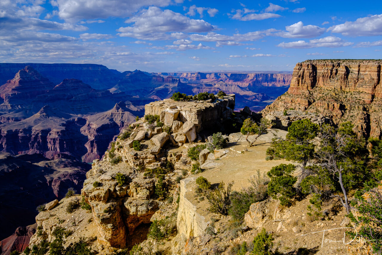
Views from Mohave Point Overlook, Grand Canyon National Park, Arizona
It’s a bit of a paradox for me – it’s hard to make a bad picture of the Grand Canyon. But yet, it’s hard to make a really good picture of the Grand Canyon. Not because it is one of the most photographed places on Earth and has been done a bazillion times and a bazillion ways, but because it is so darned BIG!
View from Grand Canyon Village near the El Tovar Hotel, Grand Canyon National Park, ArizonaDesert View Watchtower area of Grand Canyon National Park, ArizonaView from Mohave Point Overlook, Grand Canyon National Park, Arizona
Of course it is impossible to imagine what something like the Grand Canyon will look like in person. I’ve been to Niagara Falls, and it is big. I’ve been to Alaska, and places like Glacier Bay, College Fjord, Denali? Indescribable. But the Grand Canyon? I’ve seen it from the air and didn’t realize what it was, because it is so vast. And down on the ground where you can only see a small part of it, while that part was so big, well. Words fail me although it doesn’t stop me trying. 🙂
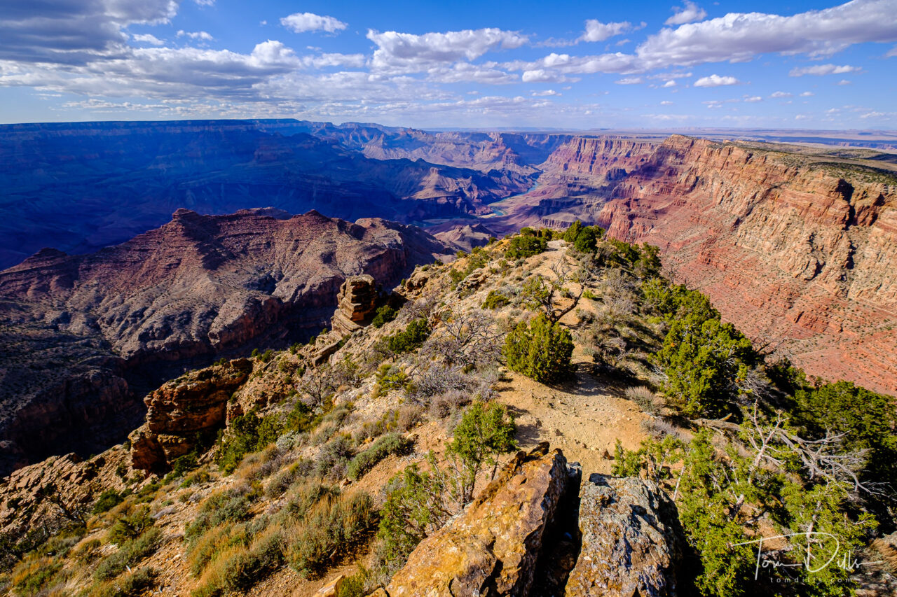
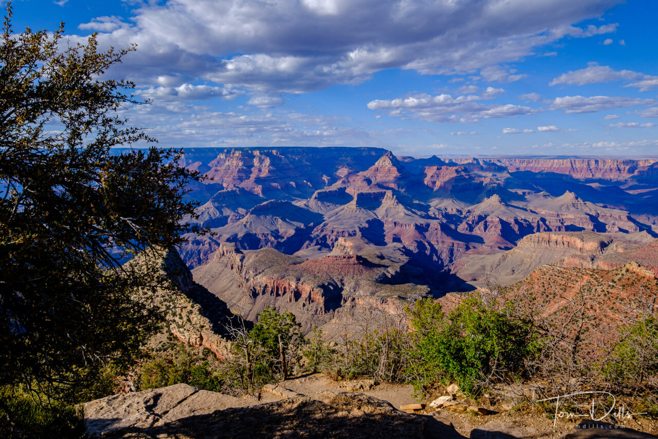
Views from Maricopa Point Overlook, Grand Canyon National Park, ArizonaHermits Rest, Grand Canyon National Park, Arizona
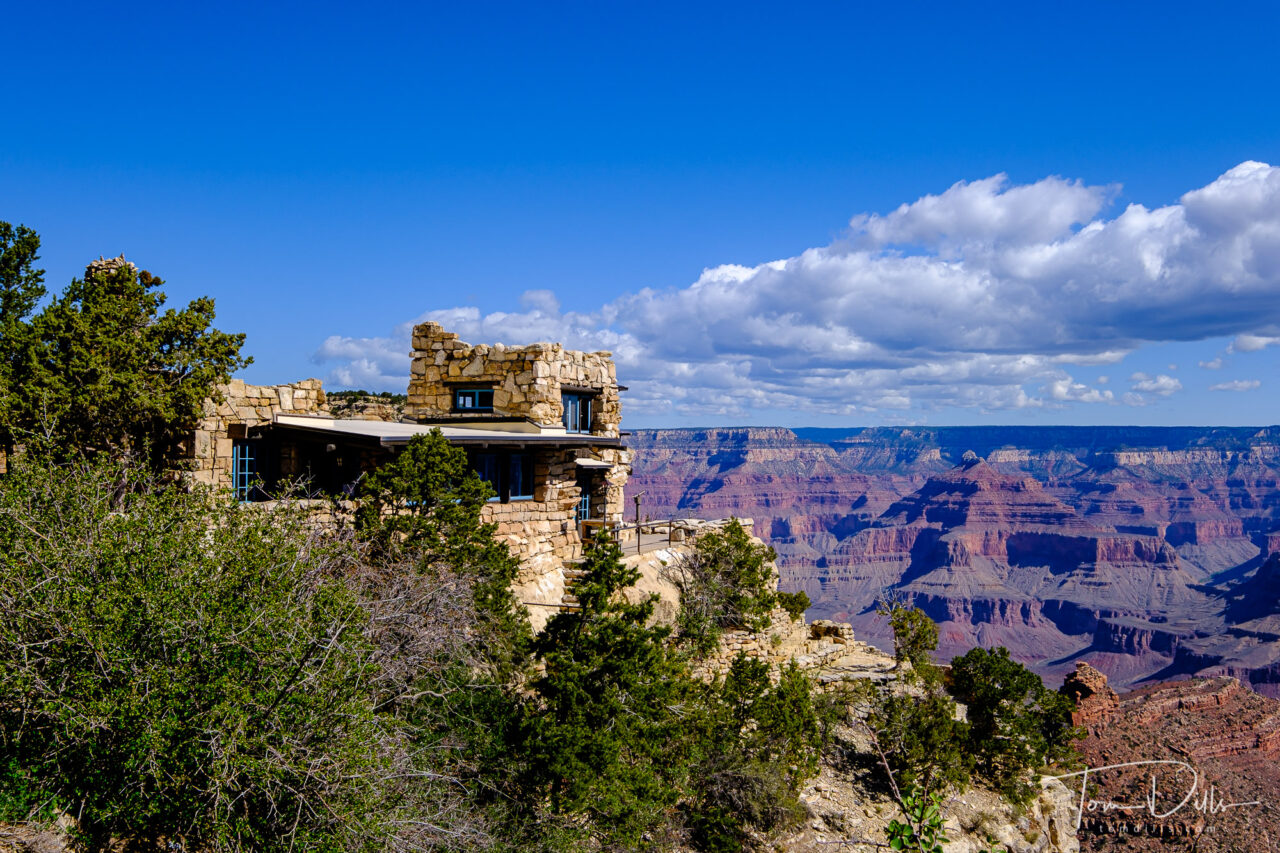
We originally weren’t planning to stop at the Grand Canyon, figuring it would be overrun with people, with no place to park, overlooks and shuttle buses crowded with people. But no. We arranged our schedule to get there on a Monday in early May, which turned out to be a great choice. We got a good place to park, never had to wait for the next shuttle, had very few people at the overlooks, and relatively light crowds in the Grand Canyon Village. We even got a reservation for lunch at the El Tovar Hotel and a table with a canyon view. Sweet!
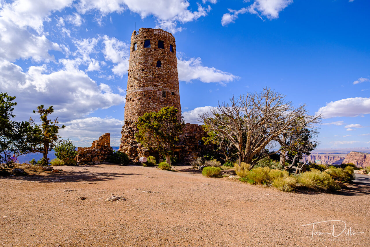
Desert View Watchtower area of Grand Canyon National Park, ArizonaDesert View Watchtower area of Grand Canyon National Park, ArizonaDesert View Watchtower at Grand Canyon National Park, Arizona
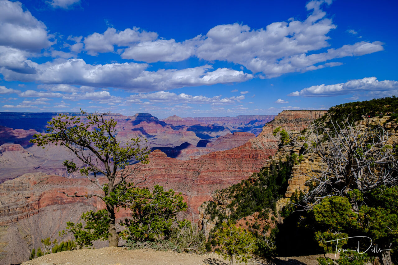
We only had a day, so we made the most of it. We didn’t try to get there for sunrise or stay until sunset, partly because I knew that early and late in the day, when the canyon is all in shadow, is generally not the best time to photograph it. The middle parts of the day provide good, even lighting, while the hours before and after can provide some dramatic shadows. It’s also important (I think) to have some nice clouds to provide an interesting sky. We sort of lucked out on all those counts.
Desert View Watchtower area of Grand Canyon National Park, ArizonaDesert View Watchtower area of Grand Canyon National Park, Arizona
It was a good day and we were both very glad to have made the effort. There are a lot more parks that we want to see, and once we finish up our 50 states project, getting to those parks is going to be one of our priorities. The list is long! 🙂
As I’ve been doing, for those who are interested or just bored 😉 I’ve added a Grand Canyon gallery to my Adobe Portfolio site.
Desert View Watchtower area of Grand Canyon National Park, Arizona
I’m back at the computer and trying to finish up my photos from our visit to the southwest. I’ve recently posted new galleries to my Adobe Portfolio site and am continuing to add more as I go. It feels like I’m only halfway, but I think I’m a little further along than that!
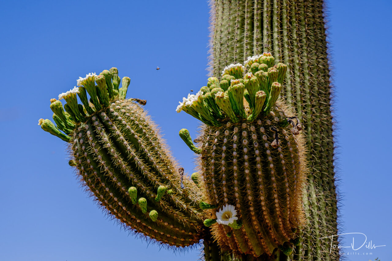
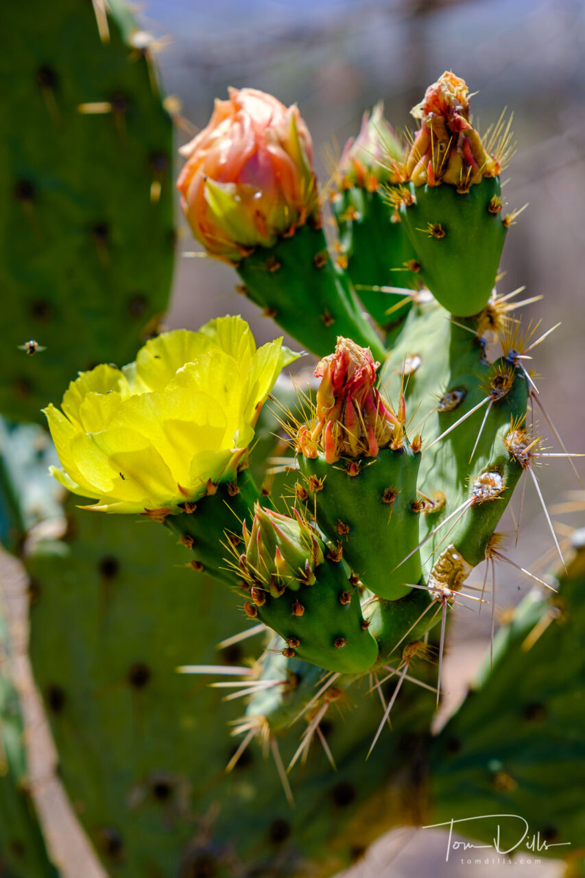
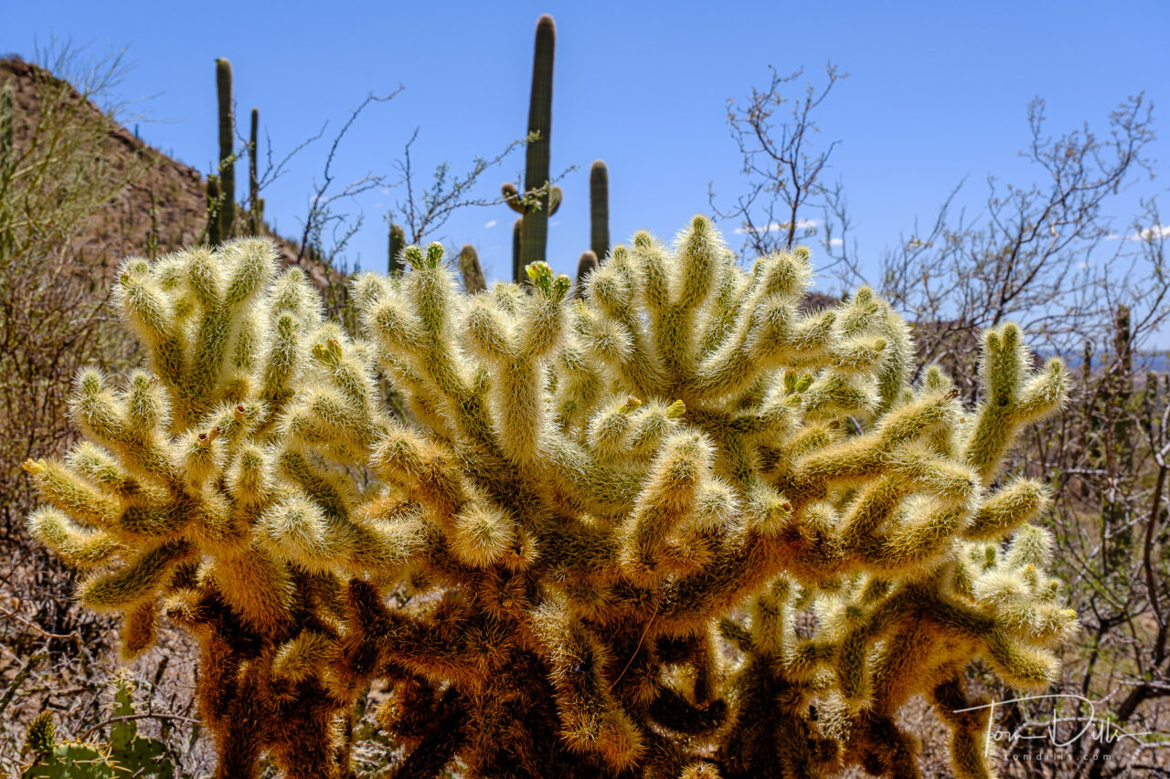
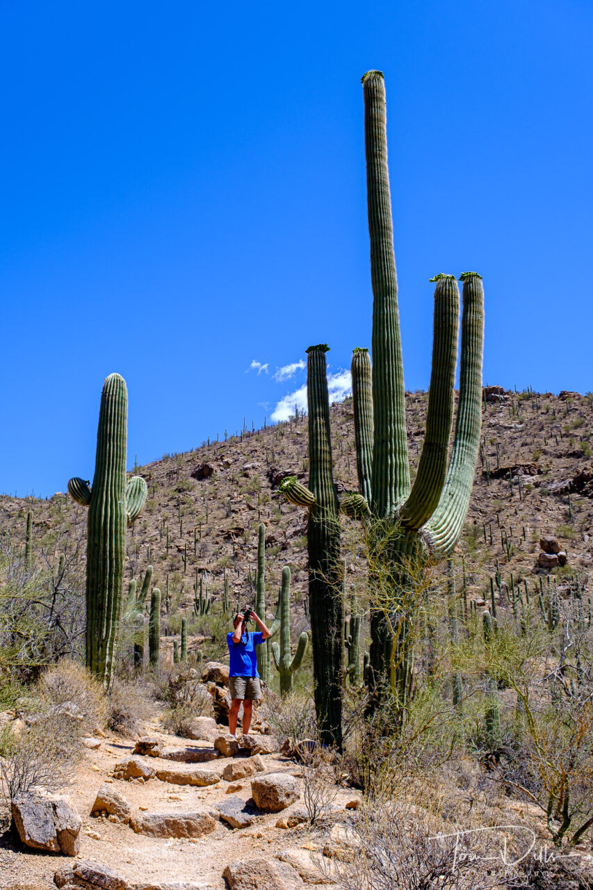
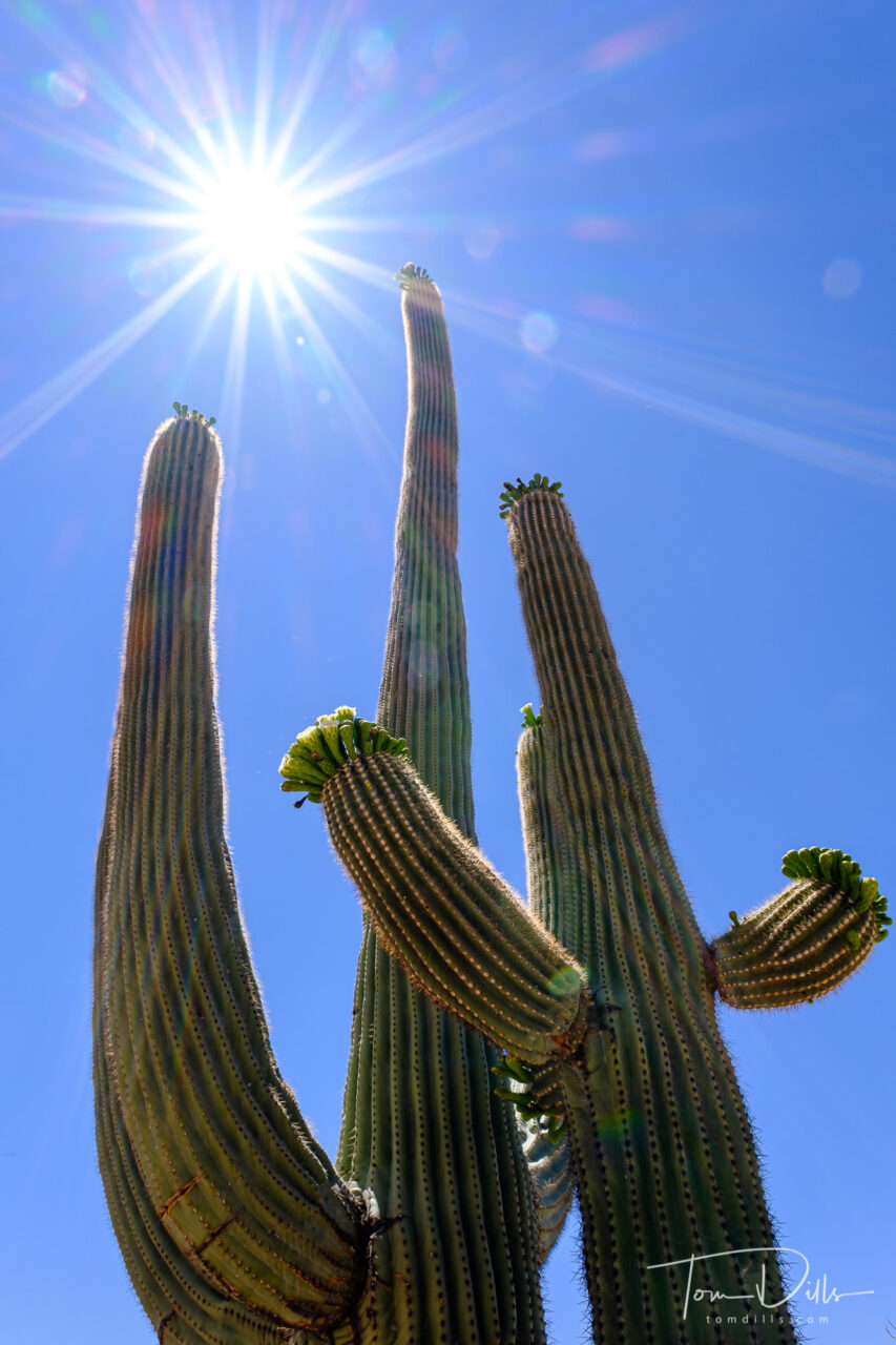
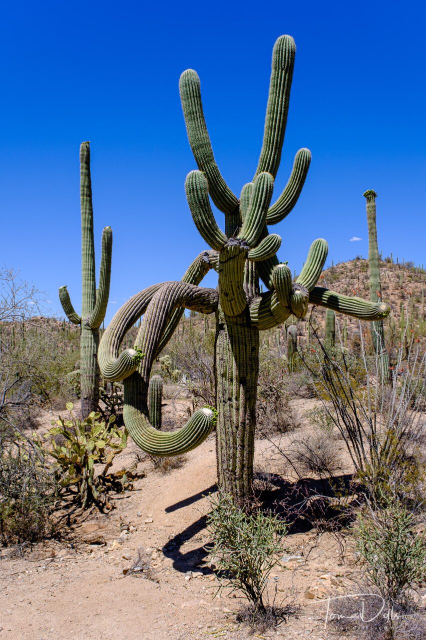
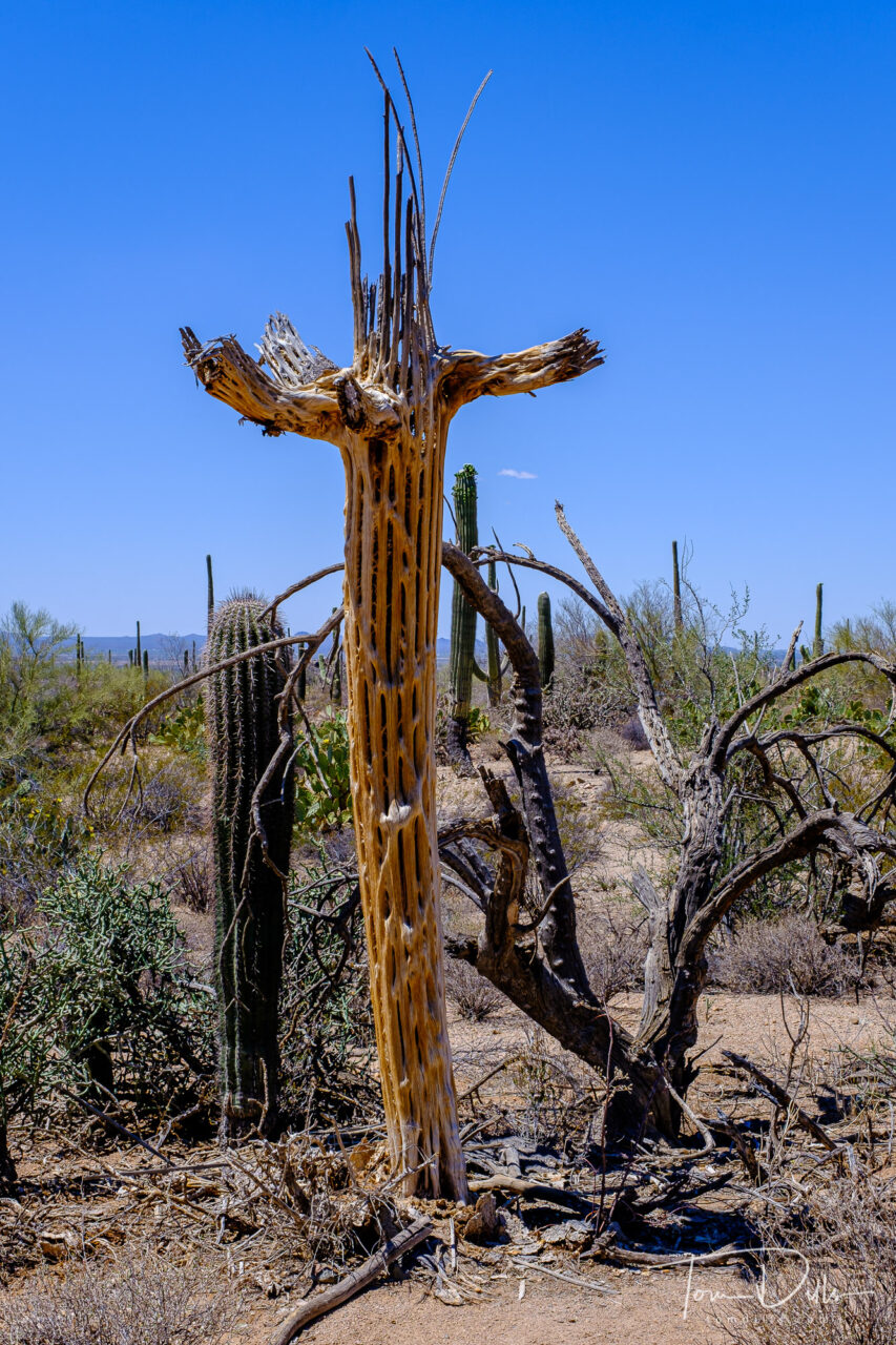
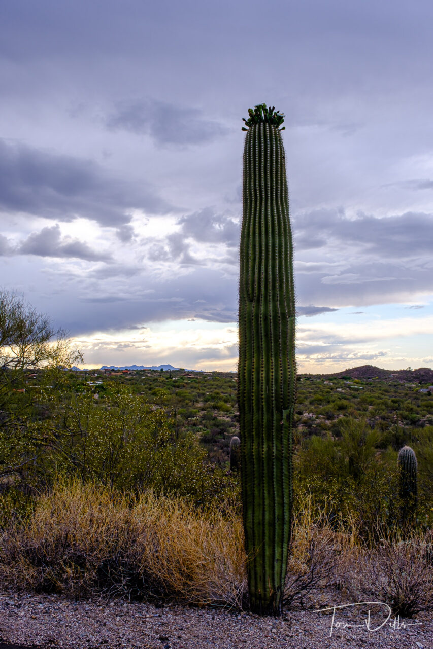
Saguaro National Park near Tucson, Arizona
We visited Saguaro with our friends Cheryl & Mike, over the course of two days. The park is divided into the West and the East, and we visited the East on a cloudy afternoon, and the West the following day with sunshine and blue-sky. The sunshine and blue sky made all the difference in the world in appearance, quality of images, and not least, the heat! It gets warm in the desert, although not nearly as warm in April as later in the summer!
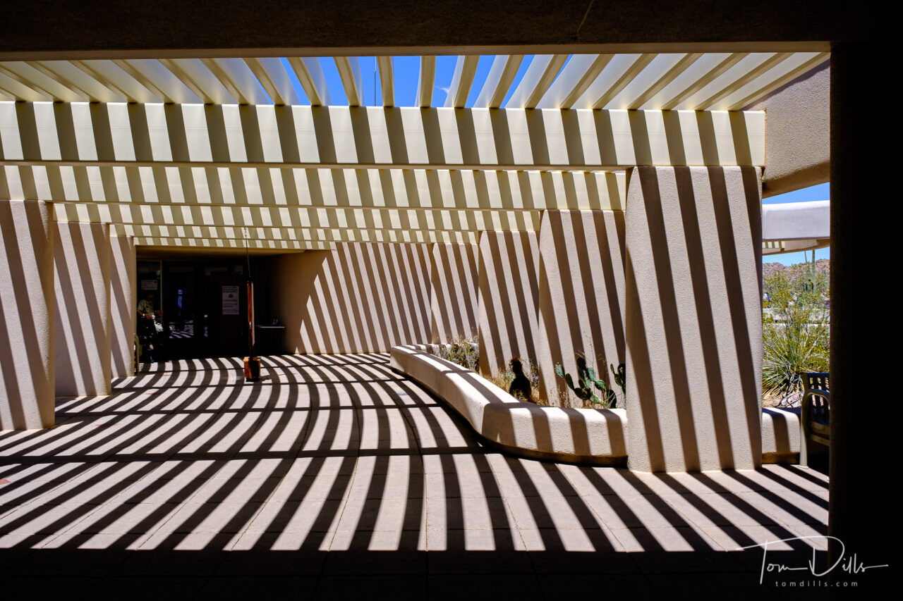
Red Hills Visitor Center at Saguaro National Park near Tucson, Arizona
The Red Hills Visitor Center in Saguaro East was especially picturesque, with the lattice roof casting dramatic shadows at mid-day. Interestingly, I’ve seen very few photos of this, although I managed to make more than a few of my own! Maybe I just didn’t look in the right place.
Saguaro National Park near Tucson, ArizonaSaguaro National Park near Tucson, ArizonaSaguaro National Park near Tucson, ArizonaSaguaro National Park near Tucson, Arizona
Anyway, here is a sampling of my photos from our visit. There are more to be found on my Adobe Portfolio site.
Saguaro National Park near Tucson, ArizonaDead cactus at Saguaro National Park near Tucson, ArizonaSaguaro National Park near Tucson, Arizona
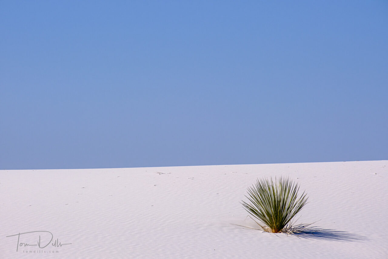
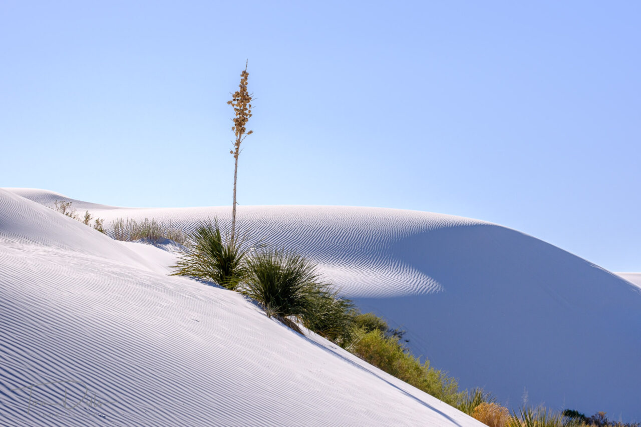
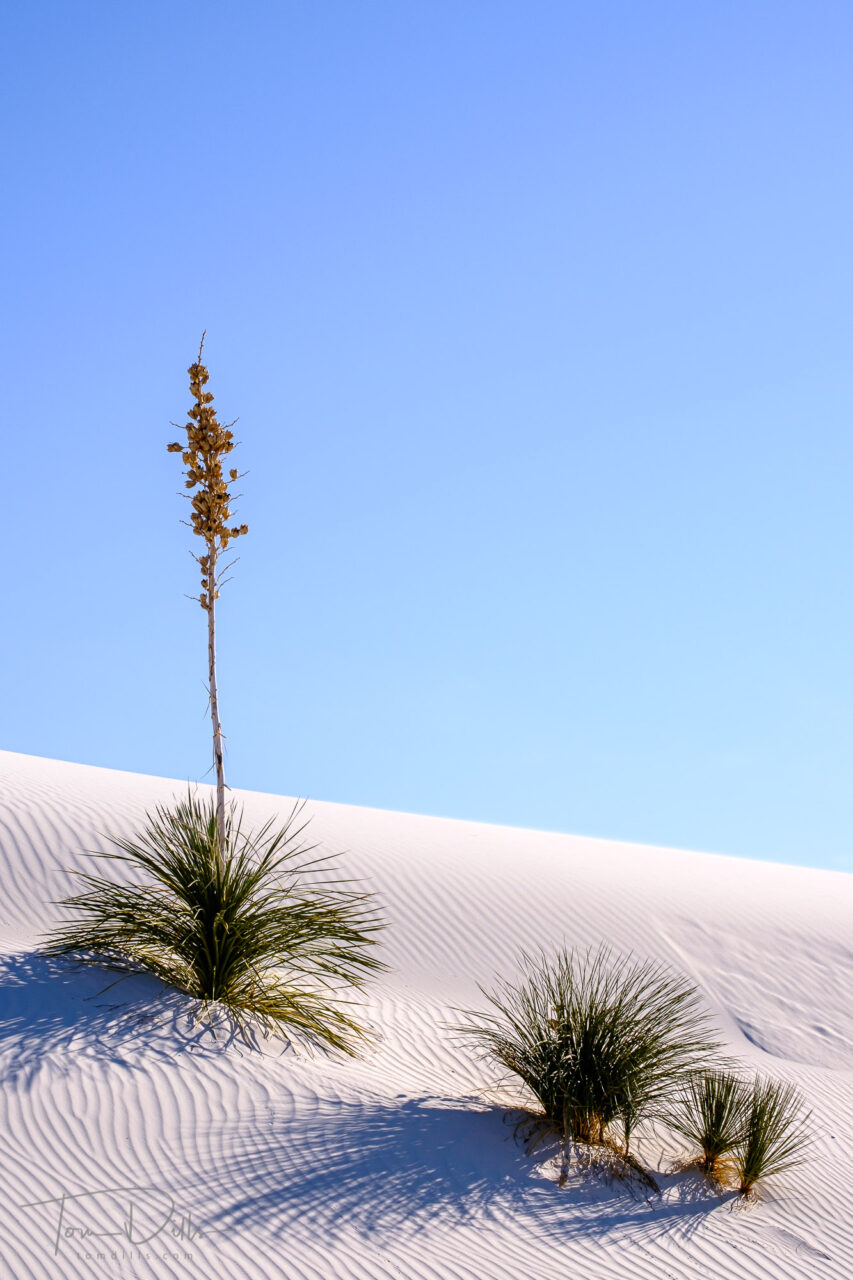
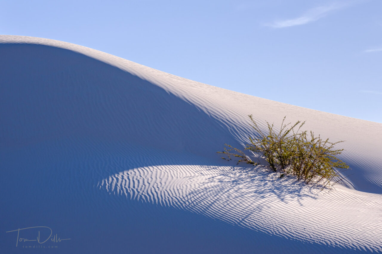
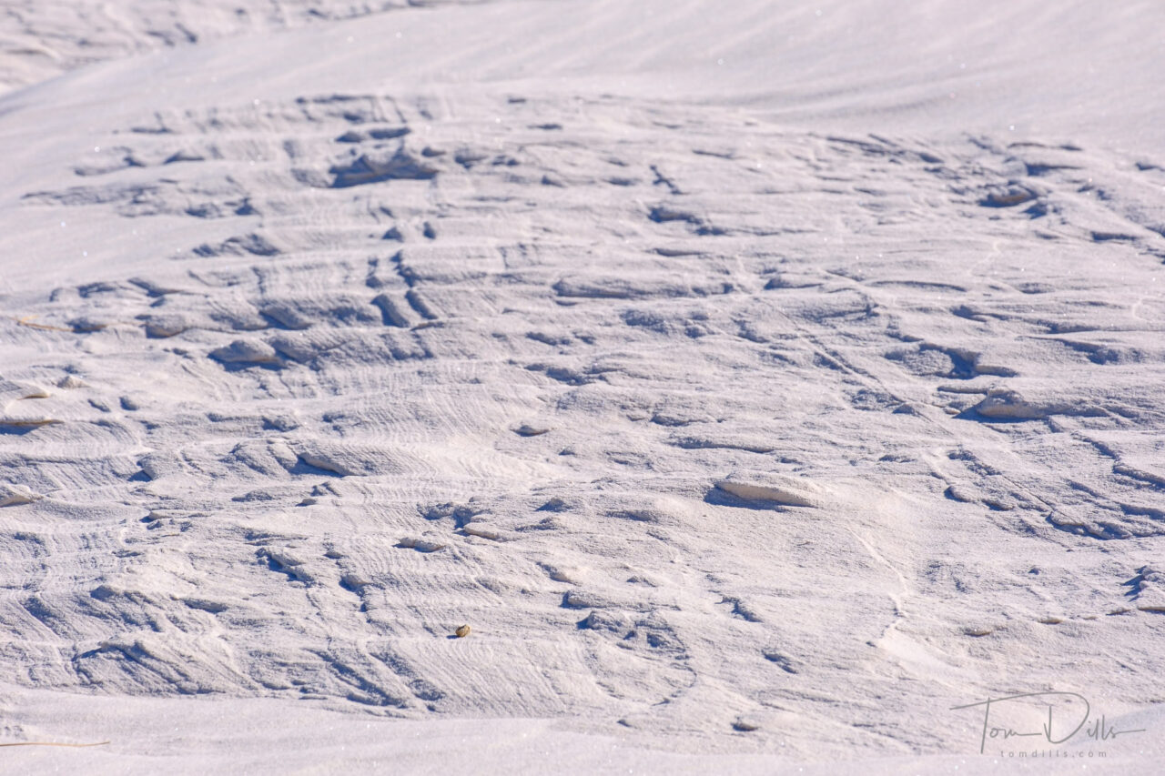
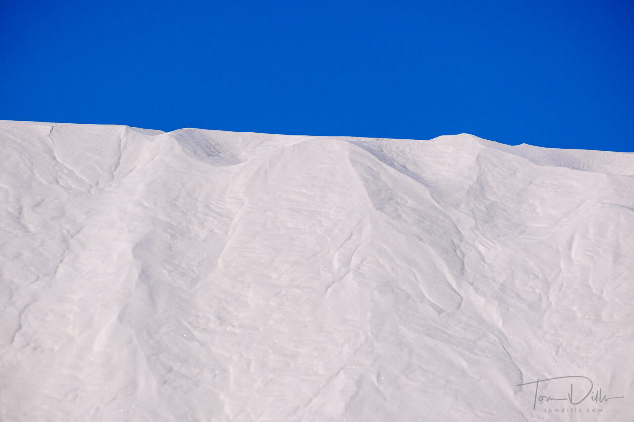
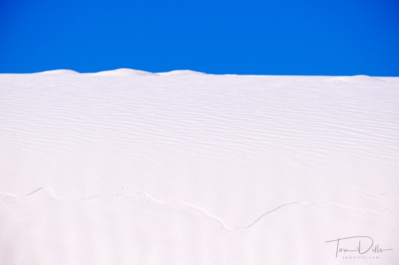
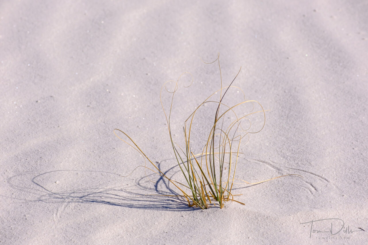
According to my metadata, I only photographed for about 30 minutes on our evening at White Sands. But other than perhaps the evening I spent in The Palouse last fall, it was perhaps the most productive 30 minutes I’ve had with a camera in a long time. The most fun, too!
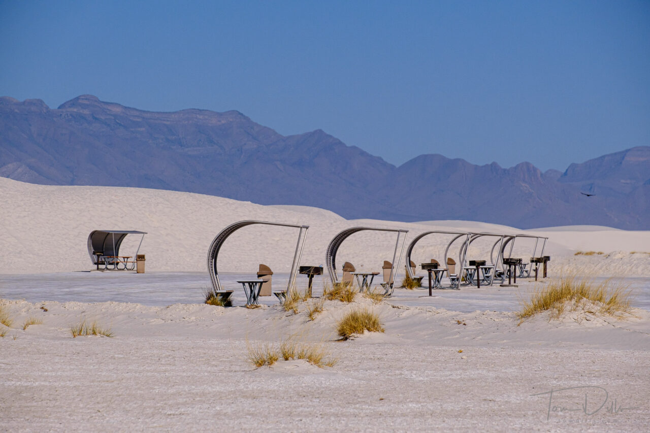
White Sands National Park, New MexicoWhite Sands National Park, New MexicoWhite Sands National Park, New MexicoWhite Sands National Park, New Mexico
I “only” took 43 photographs, but have marked 33 of them as “Picks” in Lightroom. That’s a very high percentage for me. 🙂 Of course not all of them will end up on a wall or even on my website, but a few of my favorites definitely will.
White Sands National Park, New MexicoWhite Sands National Park, New Mexico
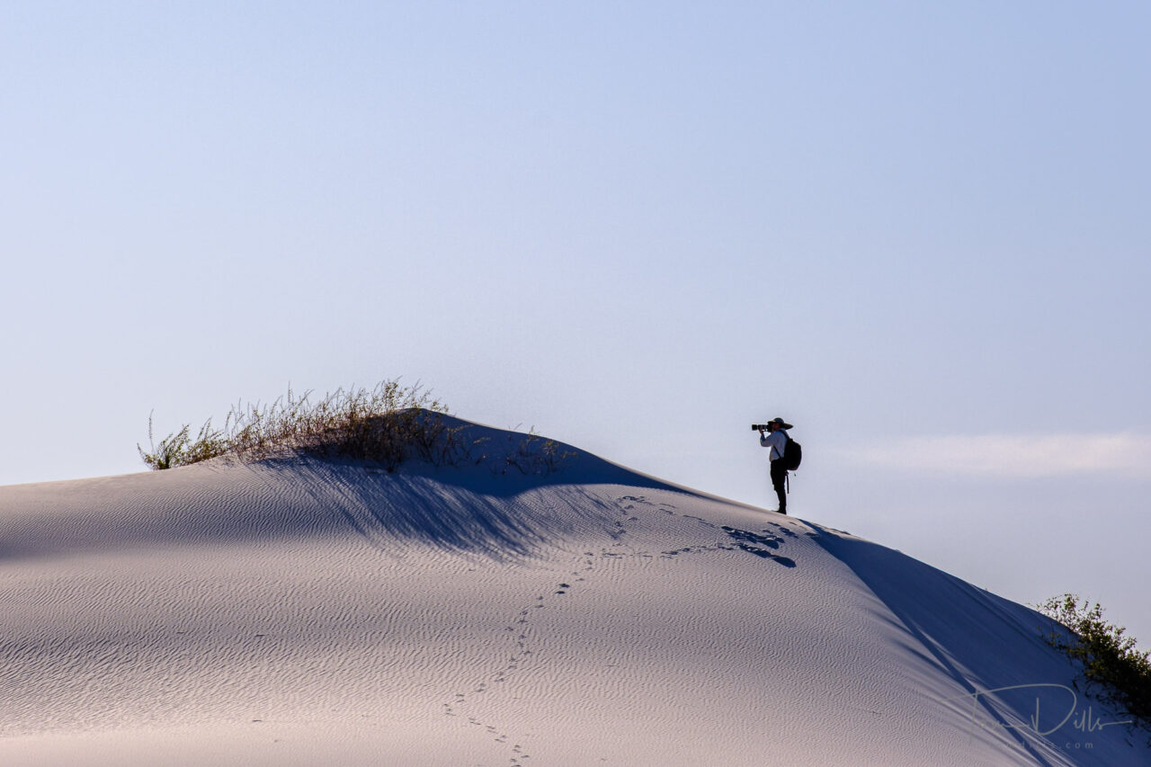
White Sands is the kind of place where you can shoot for as long as you have. And unless you really mess something up, you are likely to come back with something you like. Interestingly, as huge as the park is, I only moved a total of about 100 yards (after trudging through the sand and scrub to get to the spot I had found) in that 30 minutes. I shot exclusively with my 55-200 lens, on a tripod, in manual focus mode. All of the scenes I found were that small. For me the tripod is essential in situations like that, because in addition to allowing for critical focus, it is a must for precise composition.
White Sands National Park, New MexicoWhite Sands National Park, New Mexico
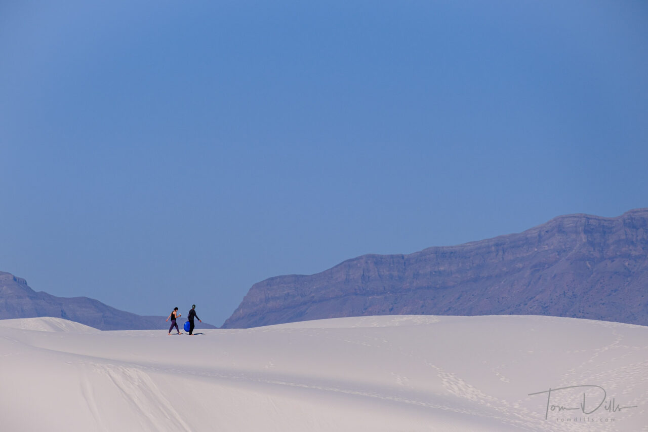
The biggest issue in a park like White Sands is finding places that haven’t been covered with footprints and sled tracks. In fact, there is one setup where I had only taken one frame before a head popped over the horizon, and some dude came sledding down the pristine slope I had been set up to shoot. Luck of the draw.
White Sands National Park, New MexicoWhite Sands National Park, New MexicoWhite Sands National Park, New Mexico
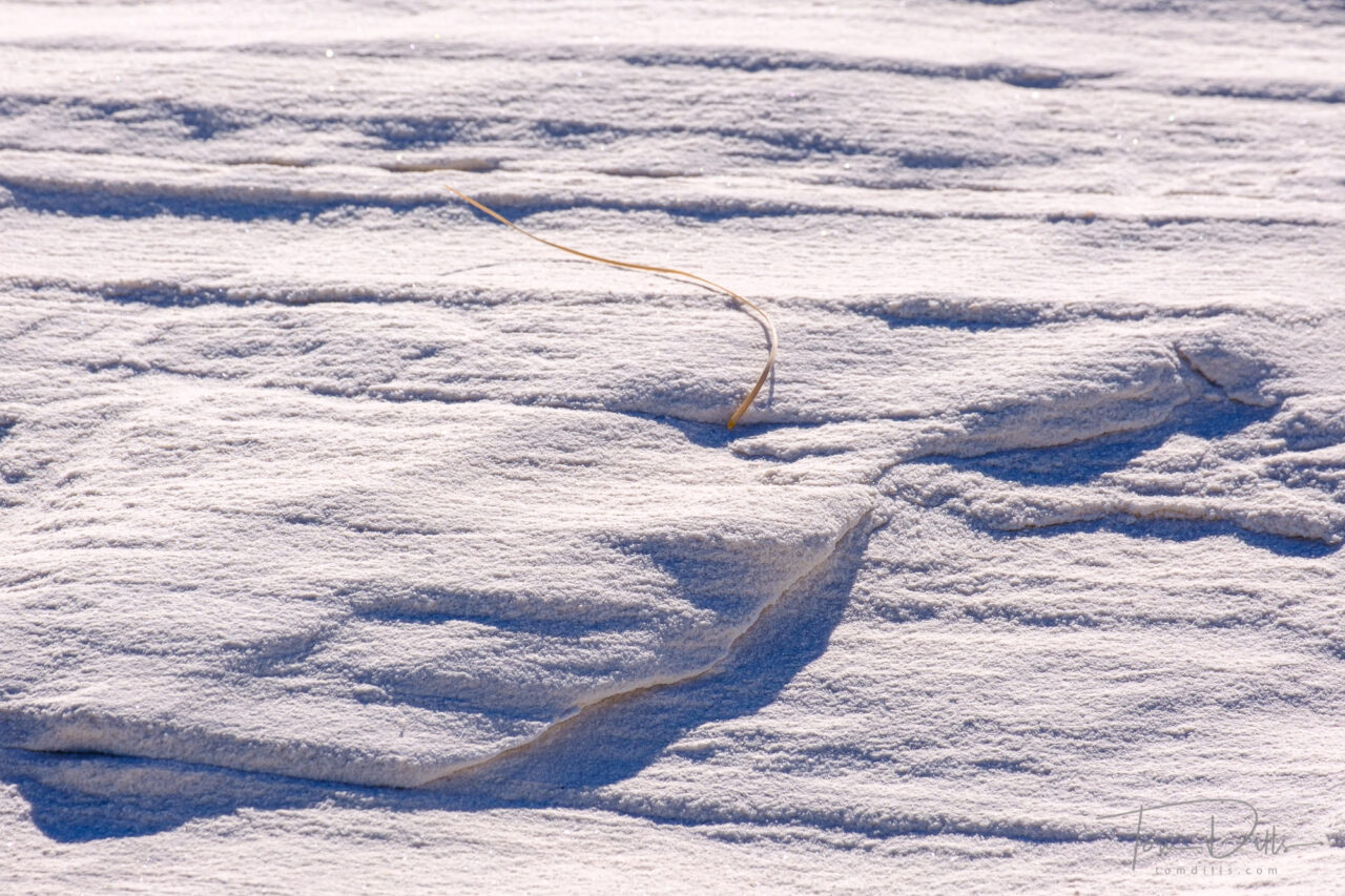
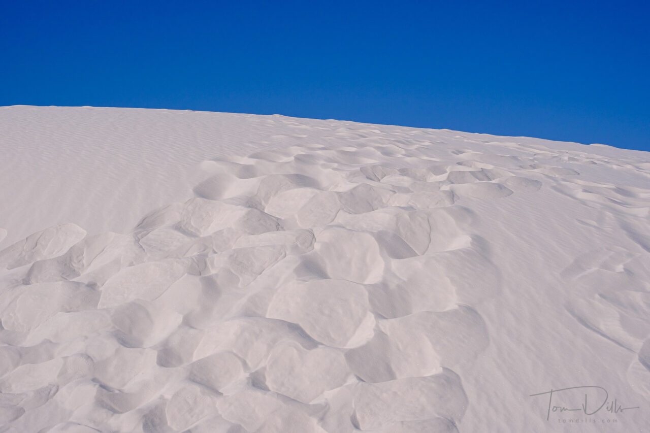
When we returned the following morning, we found that we didn’t get the benefit of the wind that often “erases” the footprints and that results in pristine conditions. But in a few places I was able to make use of the softened textures in the sand – still remains of footprints but worn down just a bit – superimposed against a crisp blue sky. It was different from the evening before, but very nice.
White Sands National Park, New MexicoWhite Sands National Park, New Mexico
White Sands is one of those places where you can get something interesting however long you are there. Whether for an hour or two, a day or two, or a week or two. Like The Badlands or The Palouse, it is a place I would love to revisit with more time. But what I came home with is good until I have a chance to do that.