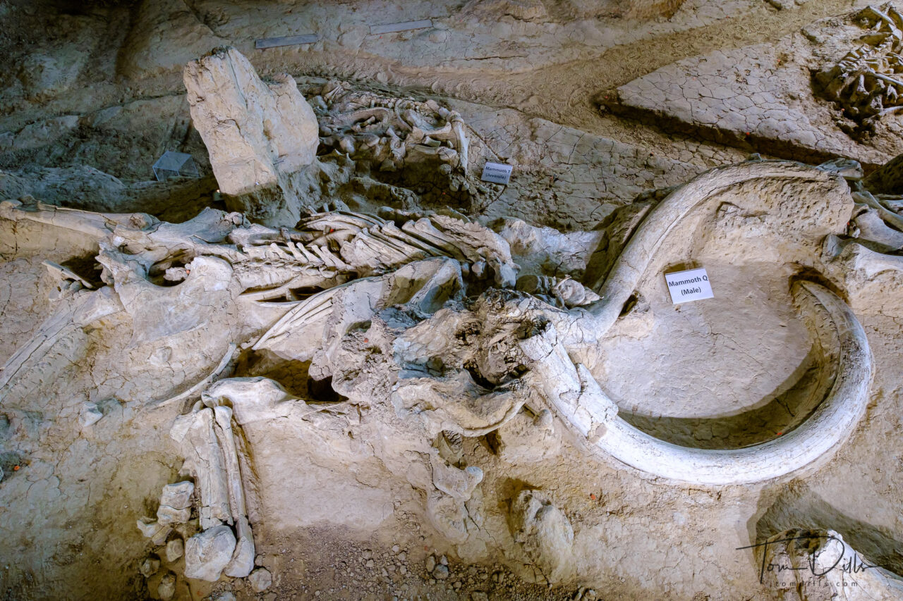
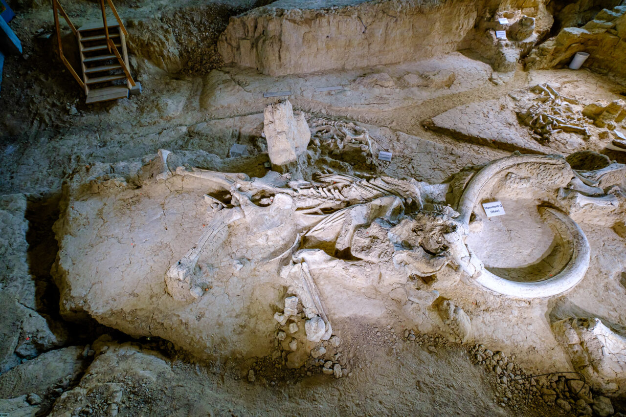
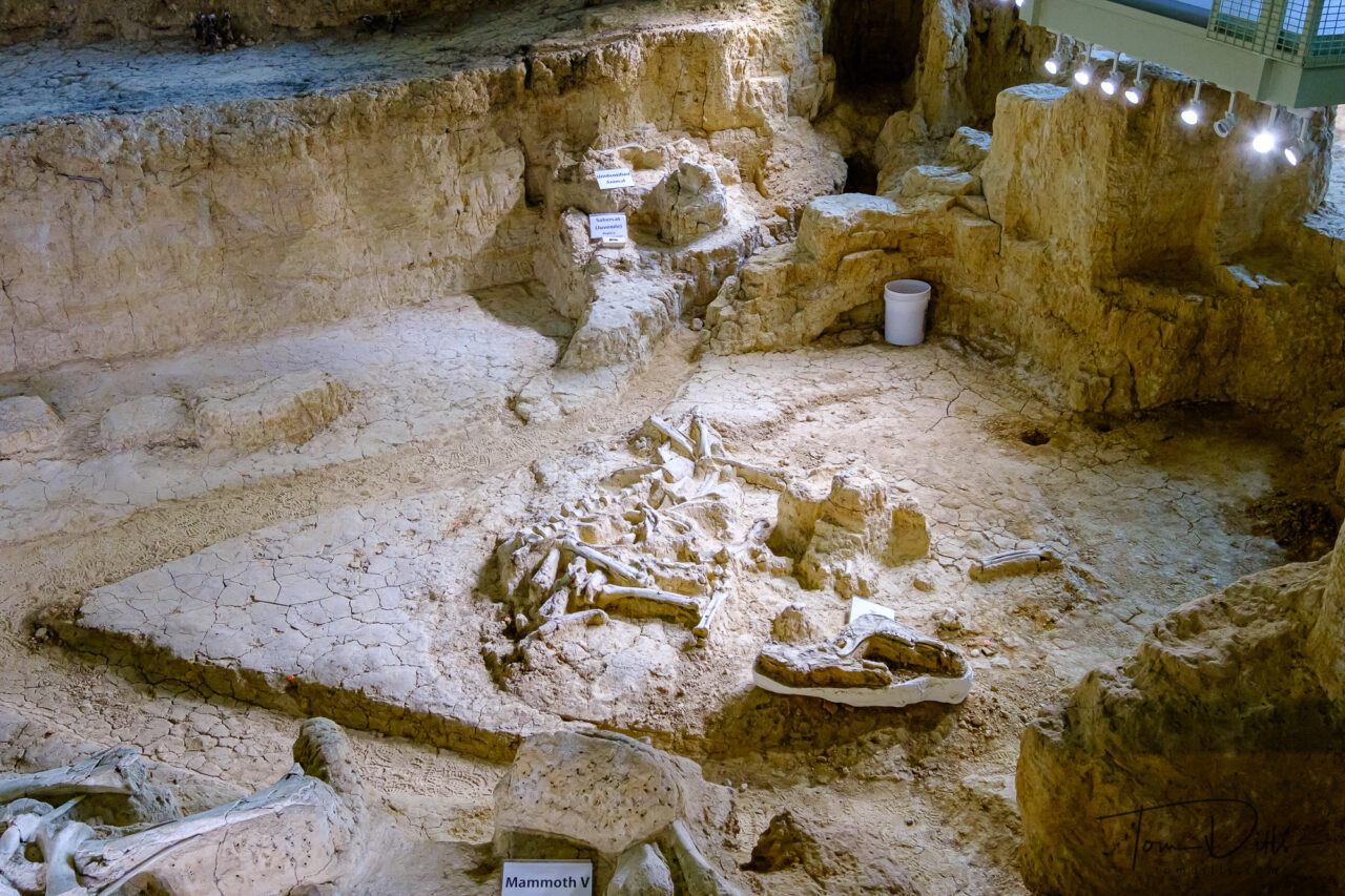
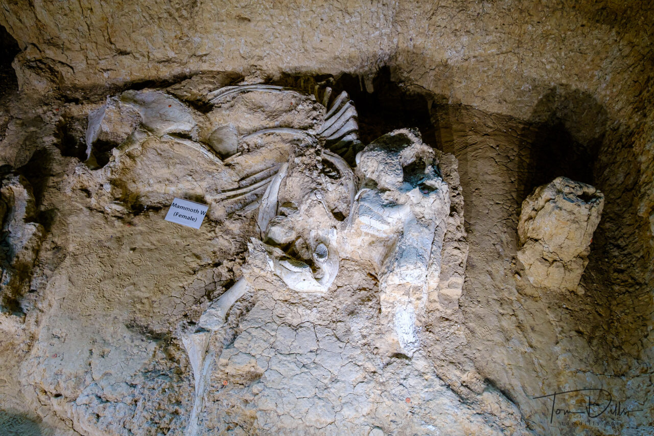
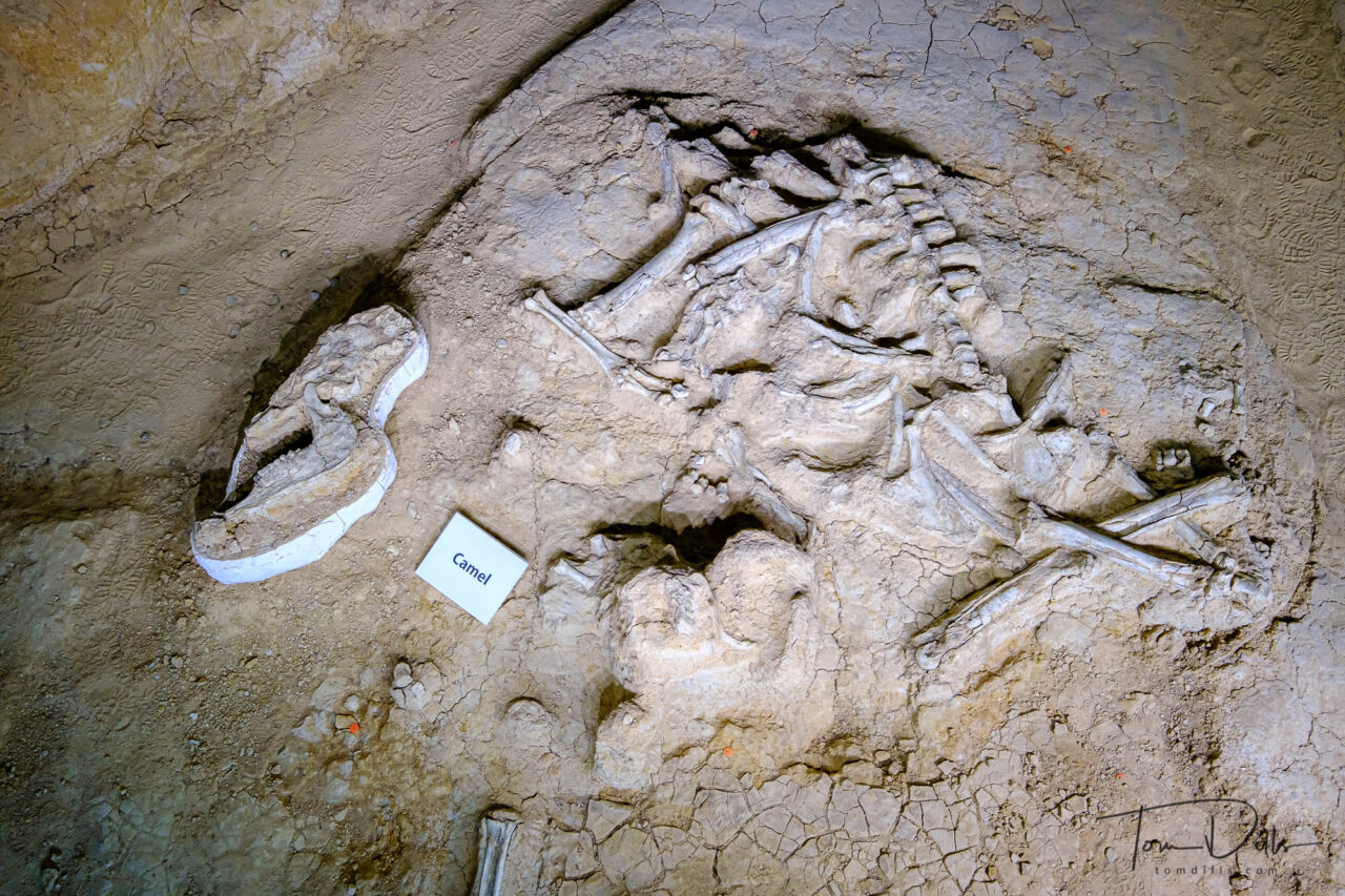
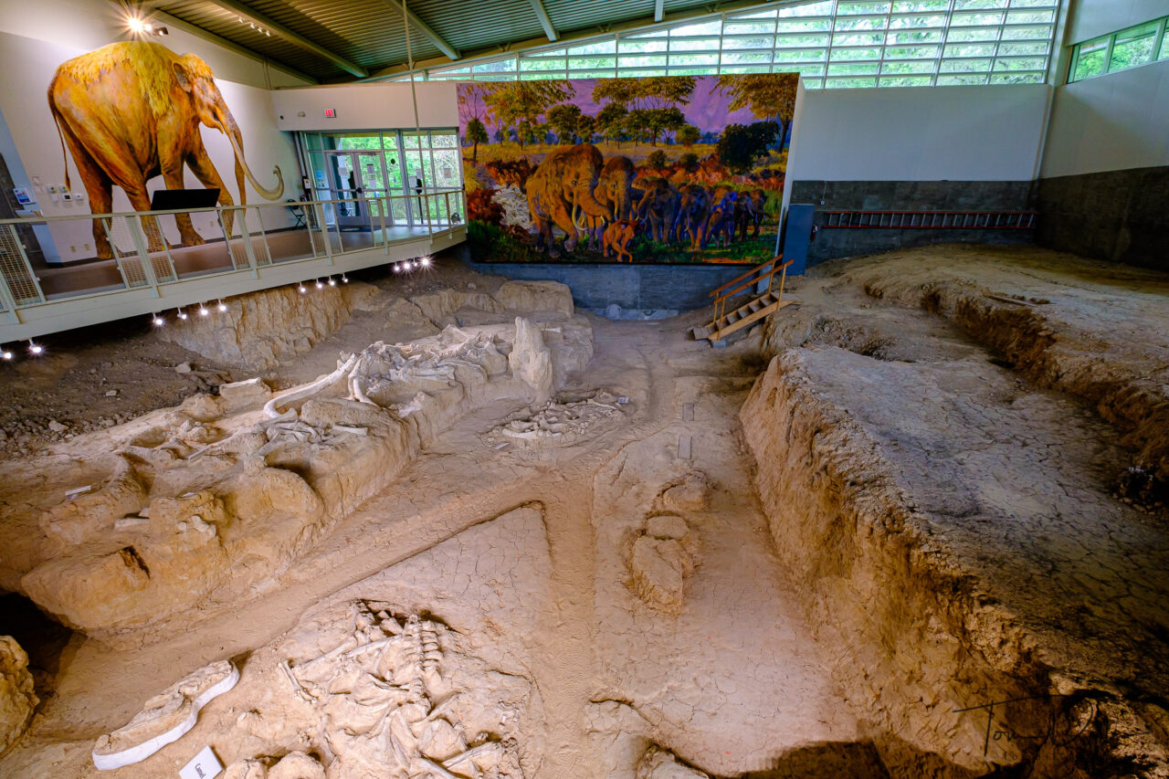
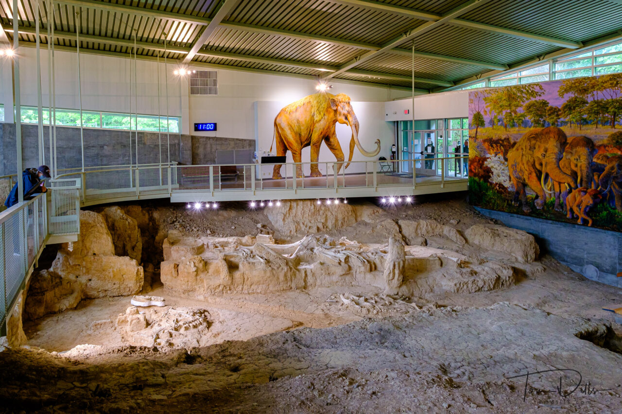
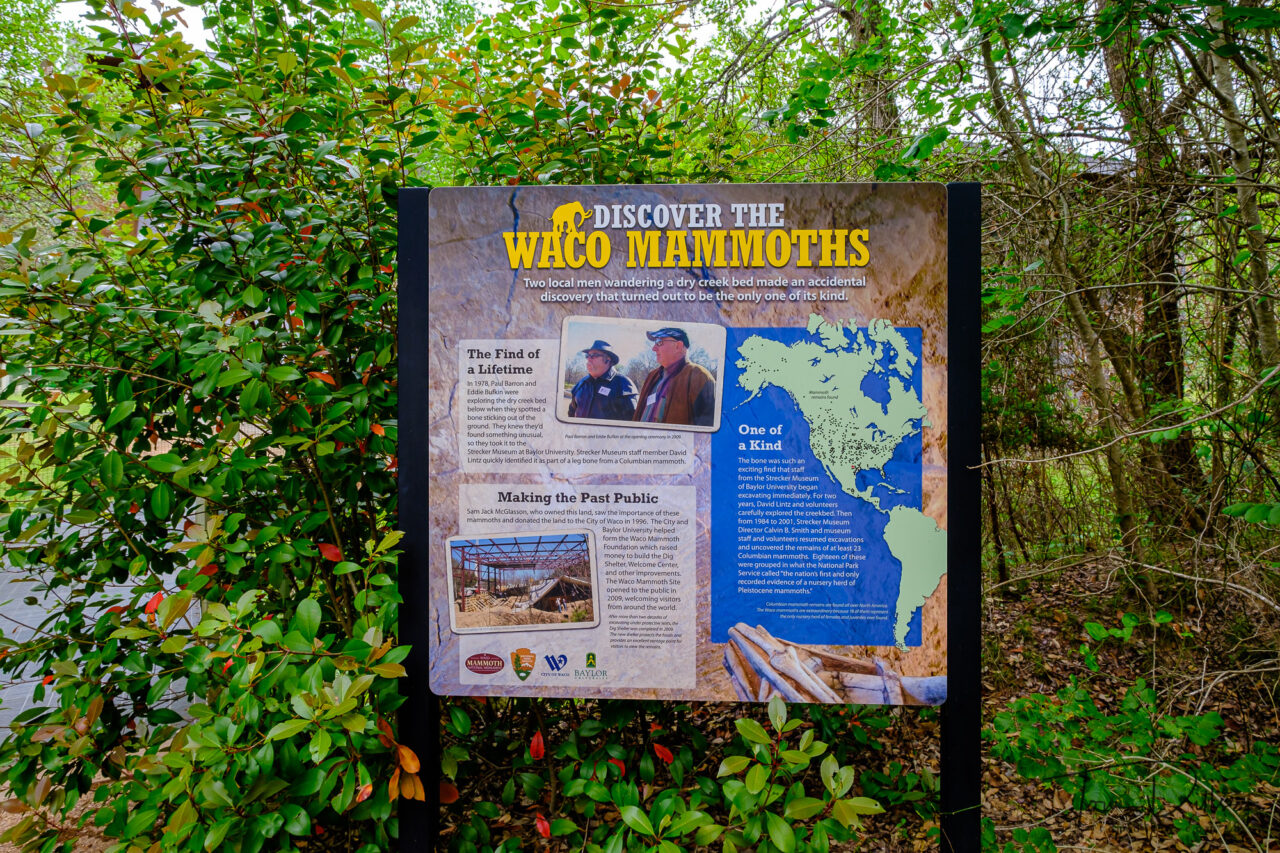
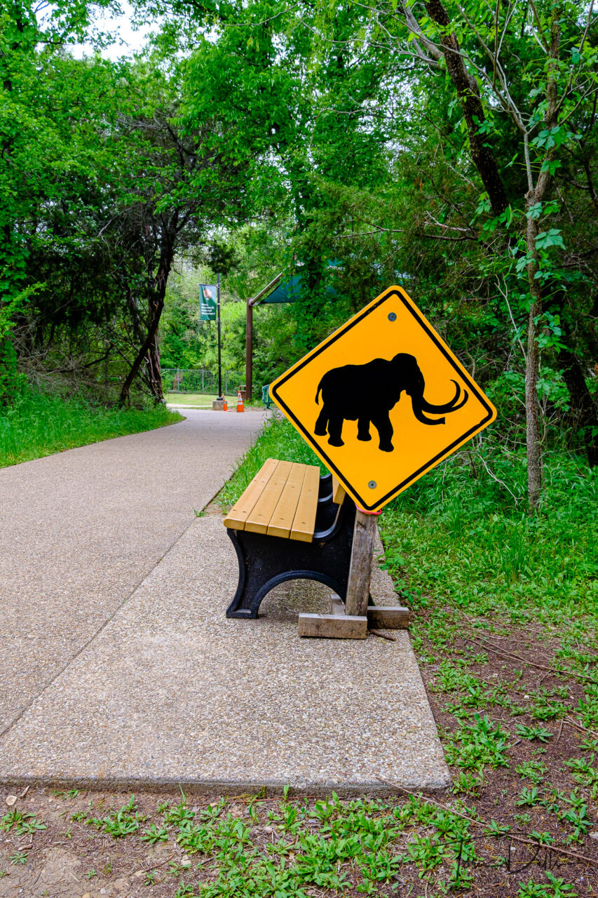
In 1978 a couple of Waco, Texas locals were searching for arrowheads and came across a large bone. They took the bone to a scientist at Baylor University, who identified it as a mammoth bone. A Baylor undergraduate started an archeological exploration of the site in 1979, uncovering 5 mammoths over a 2.5 year period. In the following years, another 16 mammoths were discovered.
Waco Mammoth National Monument in Waco, TexasWaco Mammoth National Monument in Waco, TexasWaco Mammoth National Monument in Waco, TexasWaco Mammoth National Monument in Waco, Texas
The area is managed by the National Park Service in cooperation with the City of Waco and Baylor University, and became a National Monument in 2015 under President Obama.
Waco Mammoth National Monument in Waco, TexasWaco Mammoth National Monument in Waco, TexasWaco Mammoth National Monument in Waco, TexasWaco Mammoth National Monument in Waco, Texas
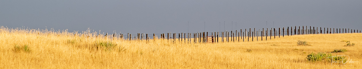
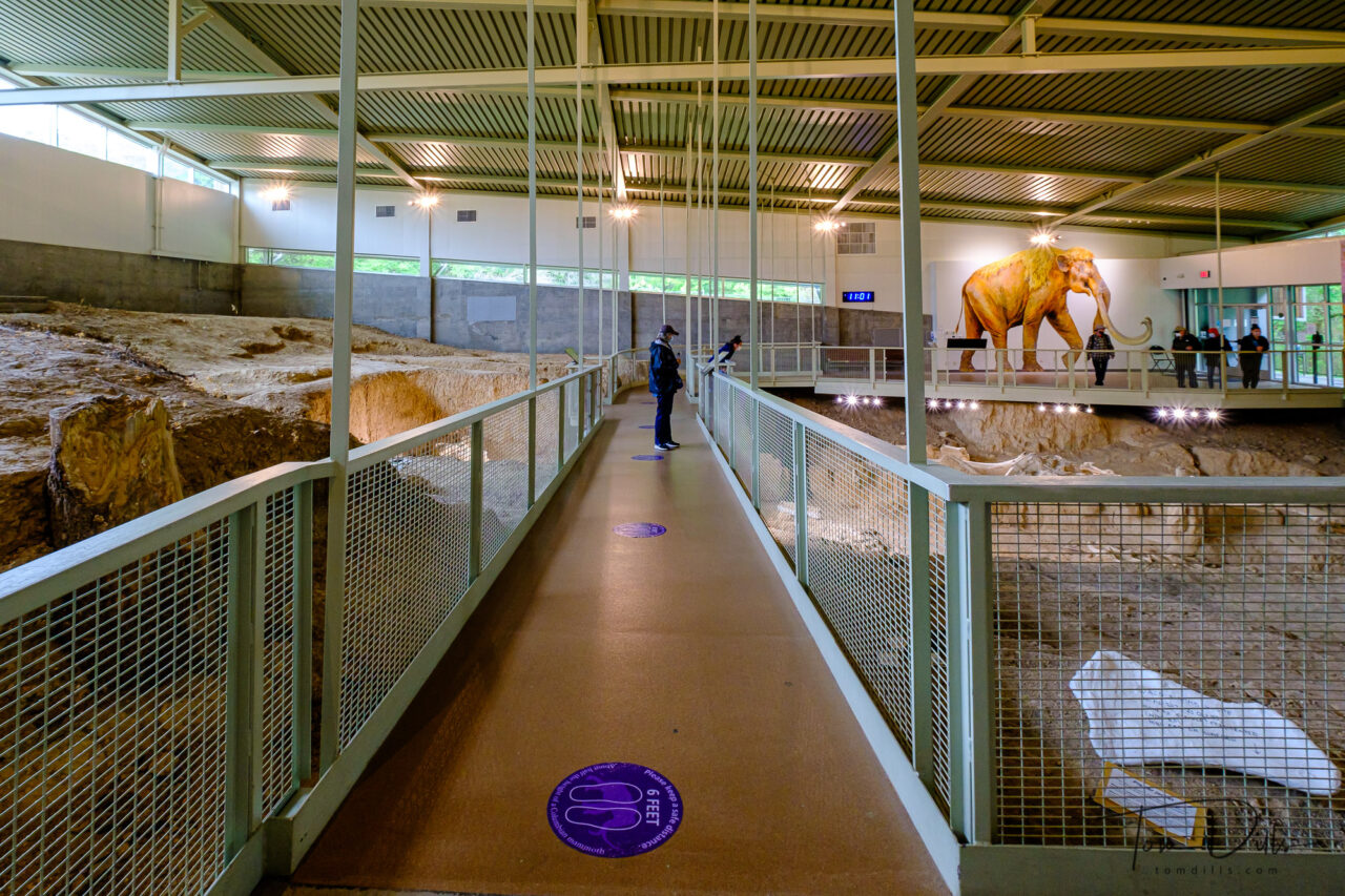
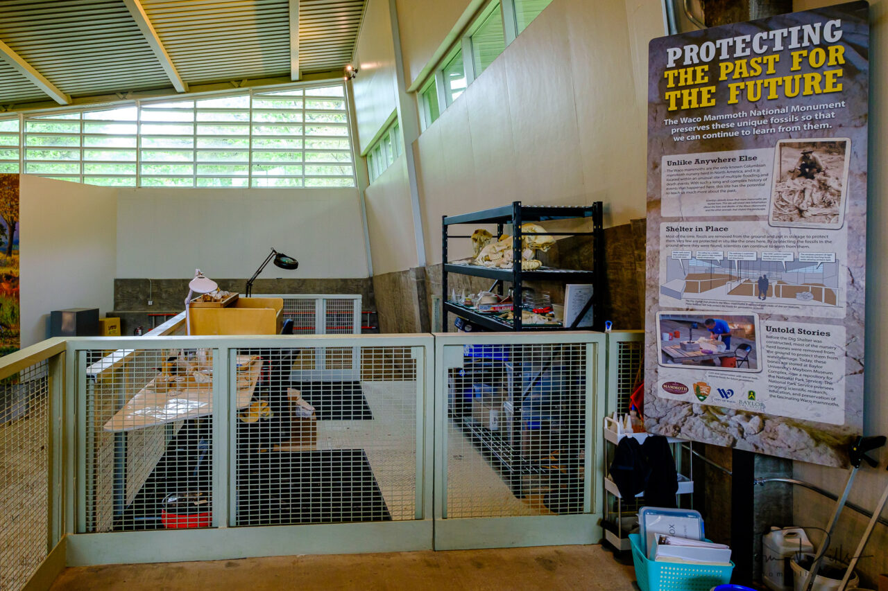
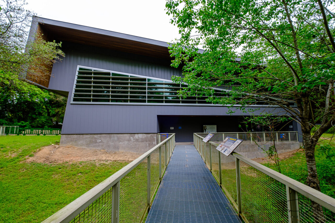
The site is much smaller and much less dramatic than Dinosaur National Monument in Utah that we visited last fall, but interesting nevertheless in that it is one of only a few places where prehistoric remains in situ can be easily viewed by the public. A building erected over the site provides viewing access while providing access to students and scientists for further study of the area.
Waco Mammoth National Monument in Waco, TexasWaco Mammoth National Monument in Waco, Texas
The place was also practically deserted on the day of our visit, making it even more attractive to us! 😉
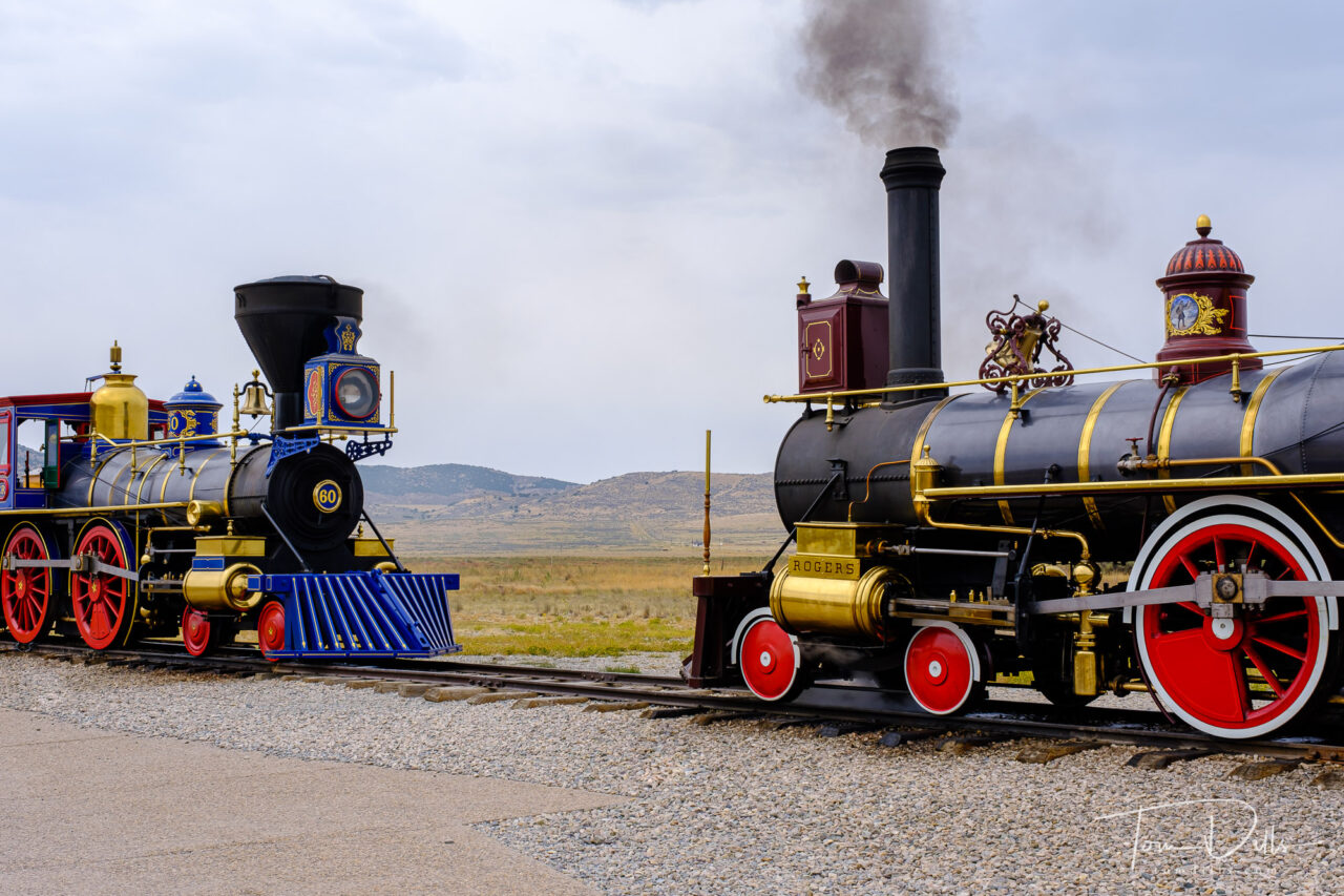
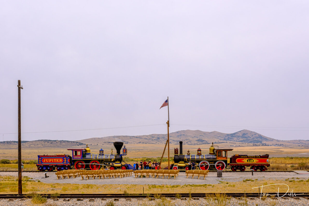
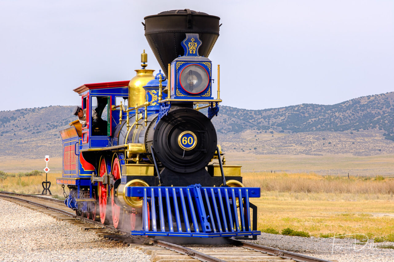
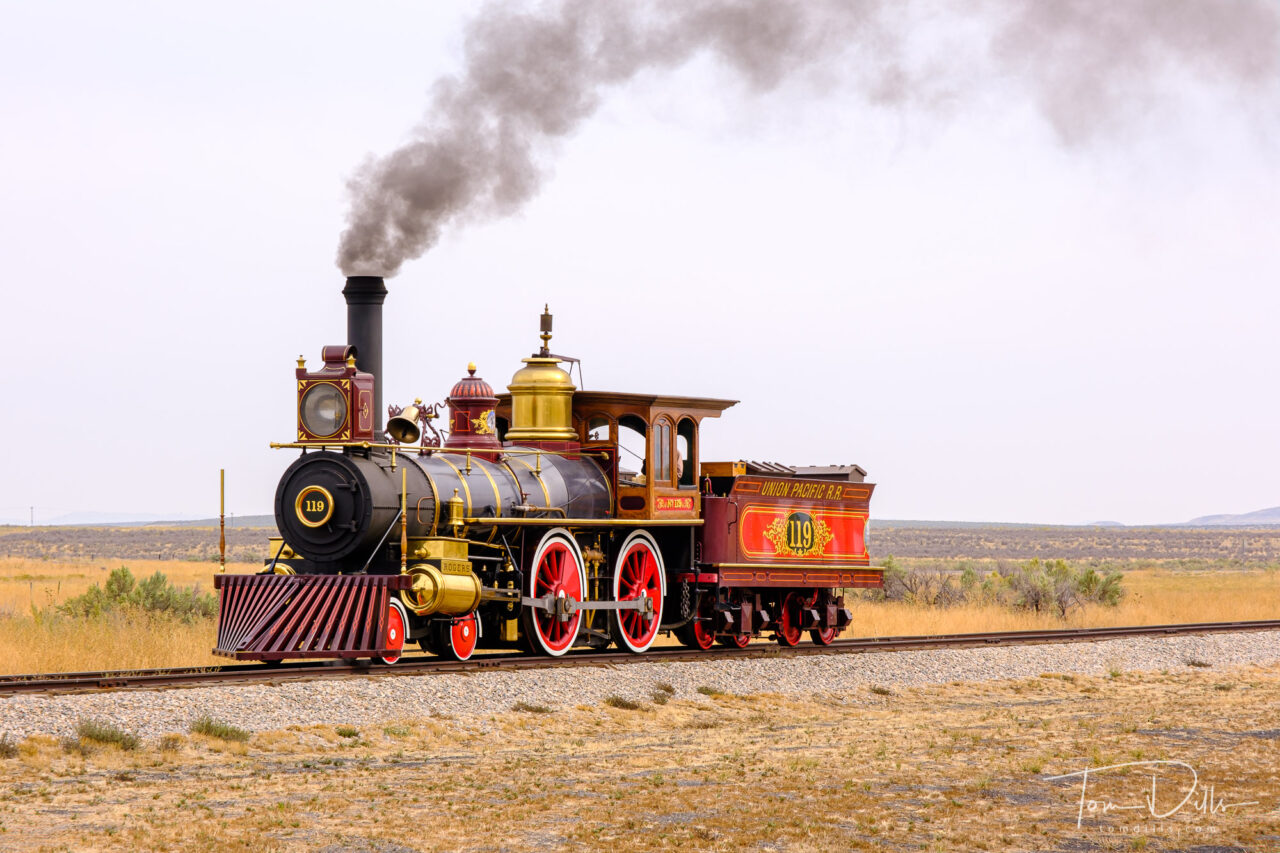
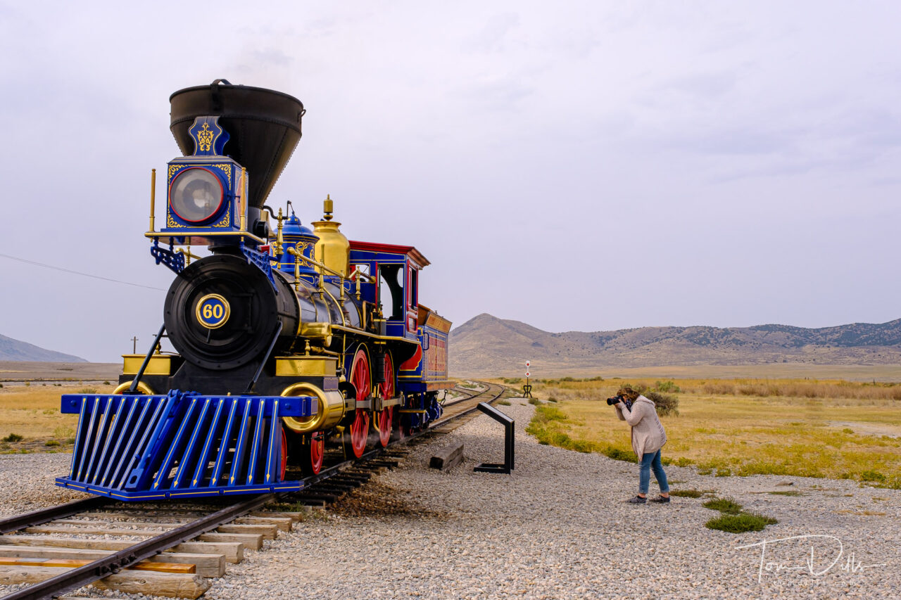
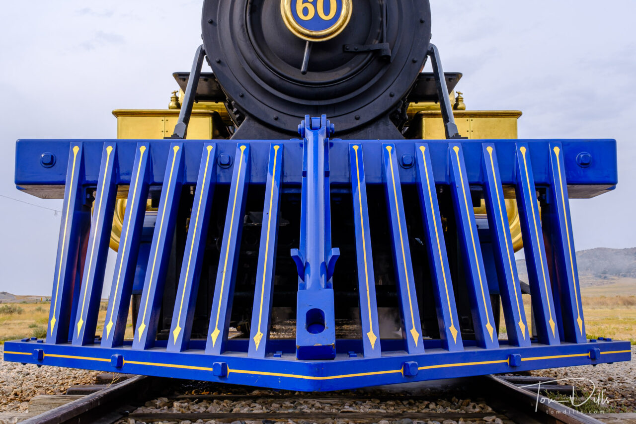
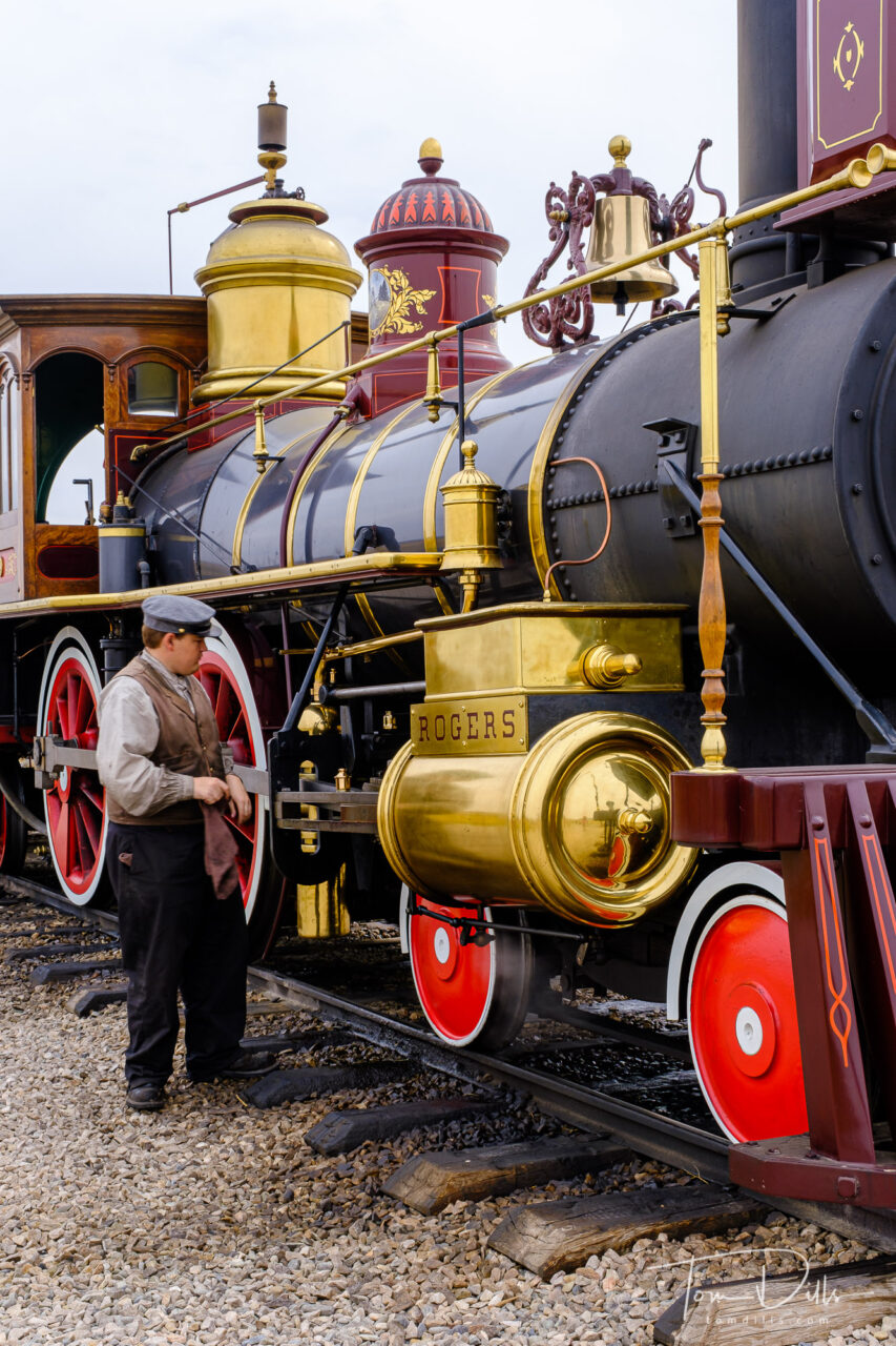
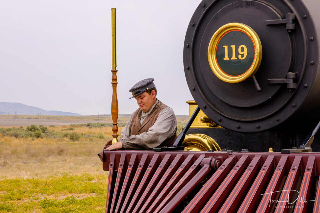
Demonstration runs of locomotives Jupiter and Number 119 at Golden Spike National Historical Park near Corinne, Utah
Another one of those historical place I learned about when I was a child was the story of The Transcontinental Railroad and The Golden Spike. The meeting of the railroad lines from the east coast and the west coast met at Promontory, UT on May 10, 1869.
Demonstration runs of locomotives Jupiter and Number 119 at Golden Spike National Historical Park near Corinne, Utah
As is often the case with history, the actual events leading up to and surrounding the eventual joining of the eastern and western routes is a lot more dramatic than we learned in grade school. Although the two railroads had agreed to meet somewhere in the western US, it literally took an act of Congress to actually get the tracks to meet. Instead, the two companies laid miles of track in opposite directions through the area, sometimes within sight of each other! Wikipedia has a pretty good summary and pretty much agrees with what we were told when we visited.
Demonstration runs of locomotives Jupiter and Number 119 at Golden Spike National Historical Park near Corinne, UtahDemonstration runs of locomotives Jupiter and Number 119 at Golden Spike National Historical Park near Corinne, UtahDemonstration runs of locomotives Jupiter and Number 119 at Golden Spike National Historical Park near Corinne, UtahDemonstration runs of locomotives Jupiter and Number 119 at Golden Spike National Historical Park near Corinne, UtahDemonstration runs of locomotives Jupiter and Number 119 at Golden Spike National Historical Park near Corinne, UtahDemonstration runs of locomotives Jupiter and Number 119 at Golden Spike National Historical Park near Corinne, Utah
At the visitor center, replicas of the two original trains make demonstration runs. These runs often occur daily but the schedule varies seasonally. We planned our visit to coincide with the runs, since seeing the trains in operation was one of the highlights of being there. The trains don’t actually run at the same time, as the same engineer and fireman operate both trains. At the end of the second run, the trains are parked nose-to-nose in front the observation area, making for a scene that is reminiscent of the original, albeit with people wearing much more modern clothes today!
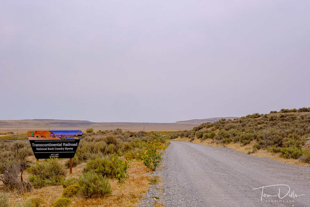
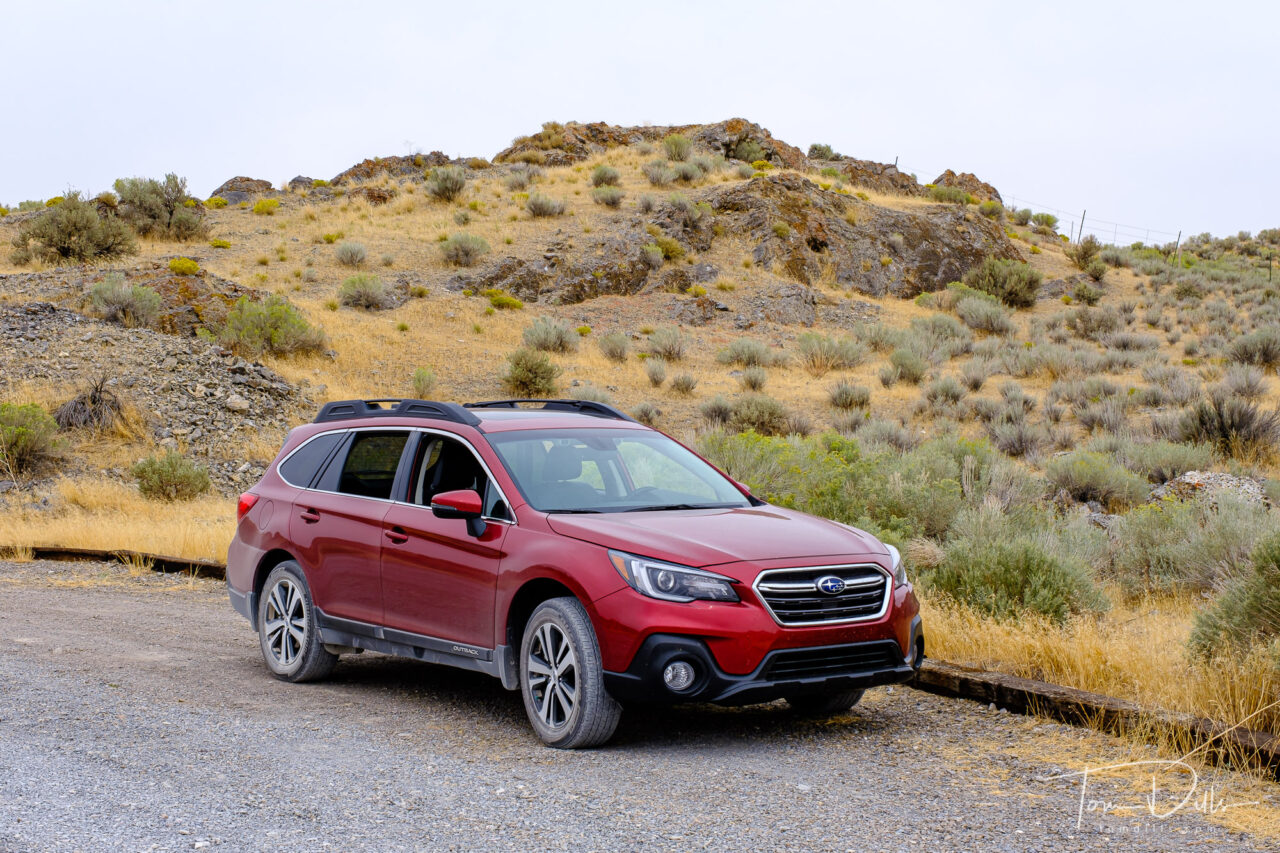
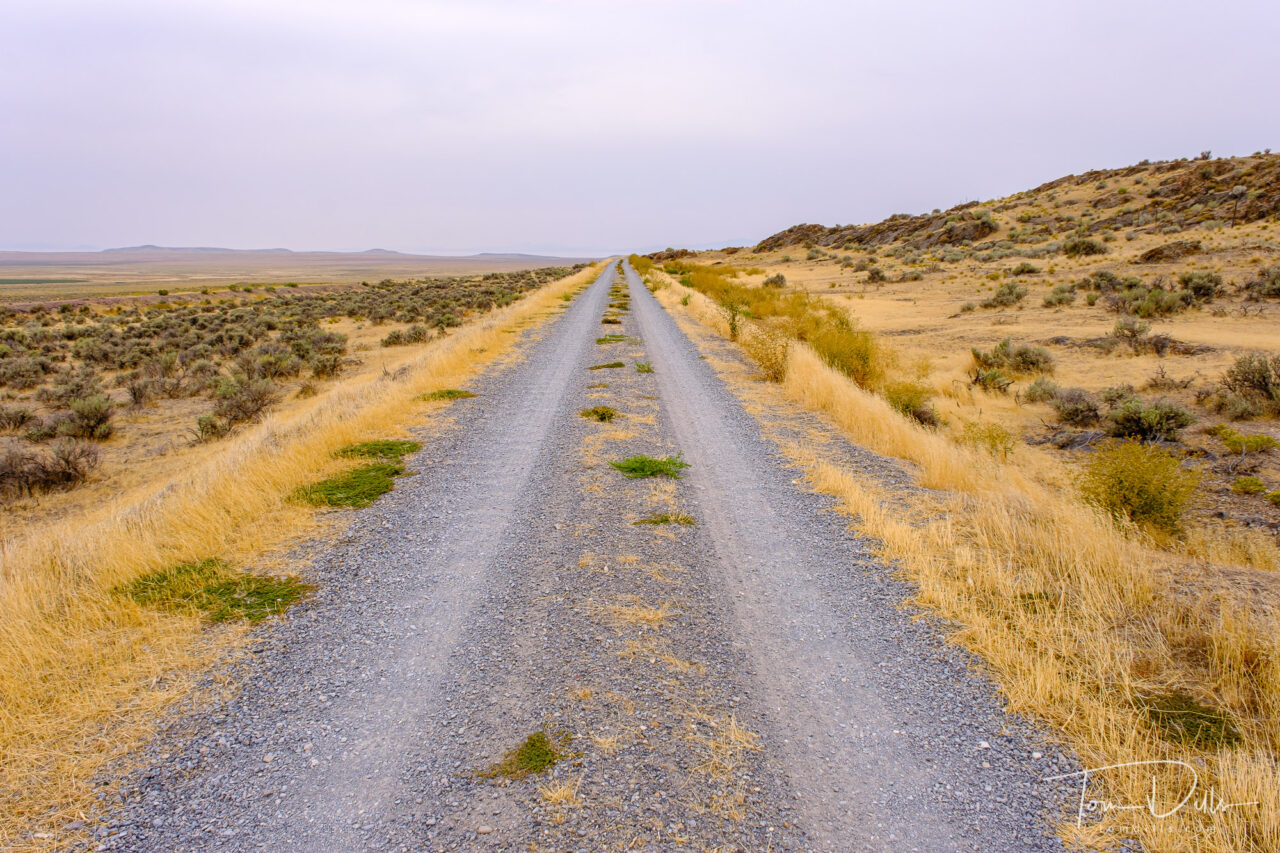
Auto tour on the Transcontinental Railroad National Back Country Byway at Golden Spike National Historical Park near Corinne, UtahThe Subie earns her next car wash. Auto tour on the Transcontinental Railroad National Back Country Byway at Golden Spike National Historical Park near Corinne, UtahAuto tour on the Transcontinental Railroad National Back Country Byway at Golden Spike National Historical Park near Corinne, UtahAuto tour on the Transcontinental Railroad National Back Country Byway at Golden Spike National Historical Park near Corinne, Utah
In addition to the trains, there is an auto tour route that traces a portion of the original railroad bed. The tracks are long gone, but there are places where the road travels through cuts made in the terrain to accommodate the tracks. In some areas it is easy to see both sets of parallel rail beds within sight of each other. Especially noteworthy is an area where 10 miles of track were laid in one day, in response to an unofficial challenge between the two crews to see who could reach the meeting place first.
Promontory is practically in the middle of nowhere in Utah, which makes it really out there! It was worth the time and effort, however. And it gave us a great way to document our visit to the state of Utah for our quest toward all 50 states!
For anyone wishing to see more photos, I have created a photo gallery on my Adobe Portfolio website.
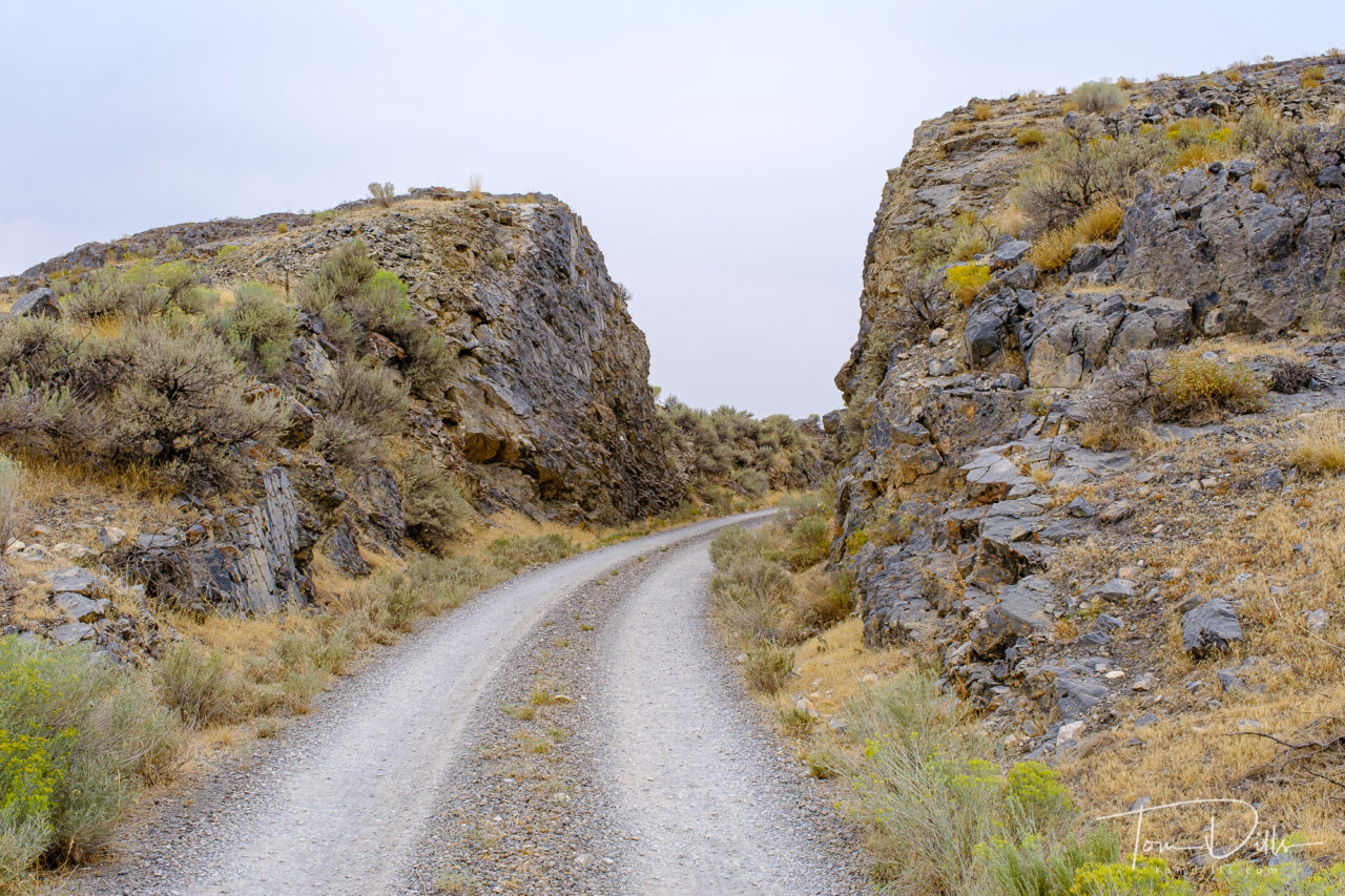
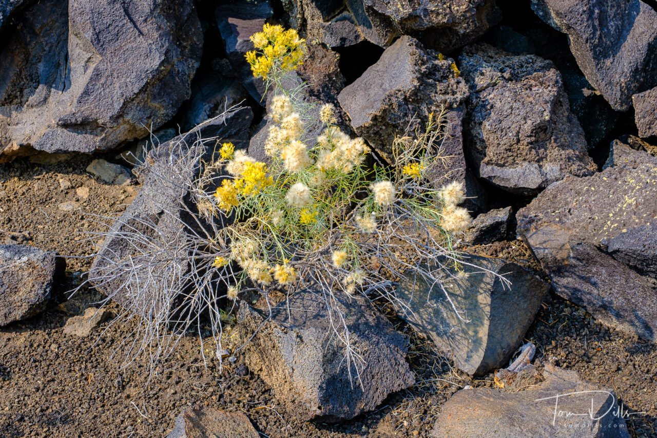
Craters of the Moon National Monument and Preserve near Arco, Idaho
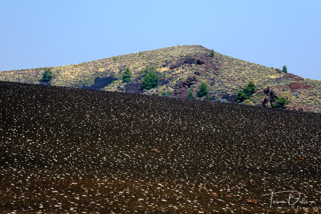
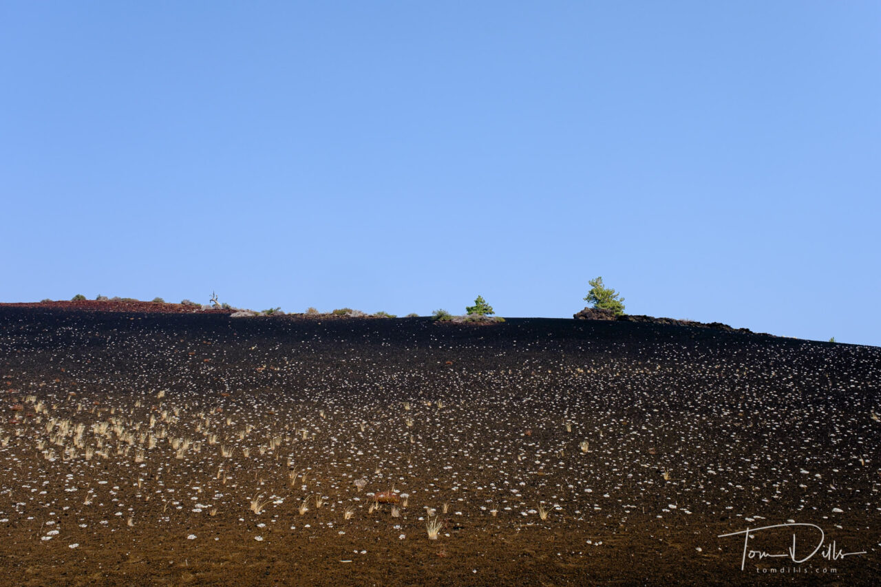
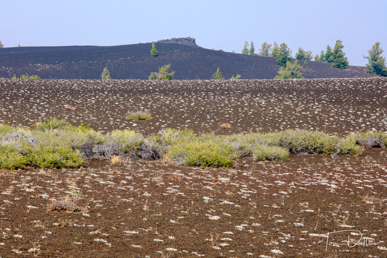
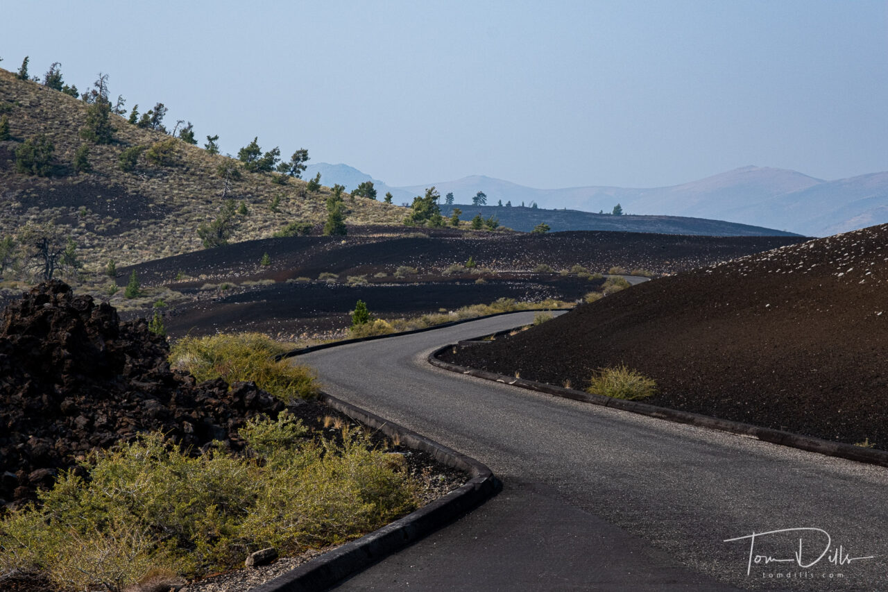
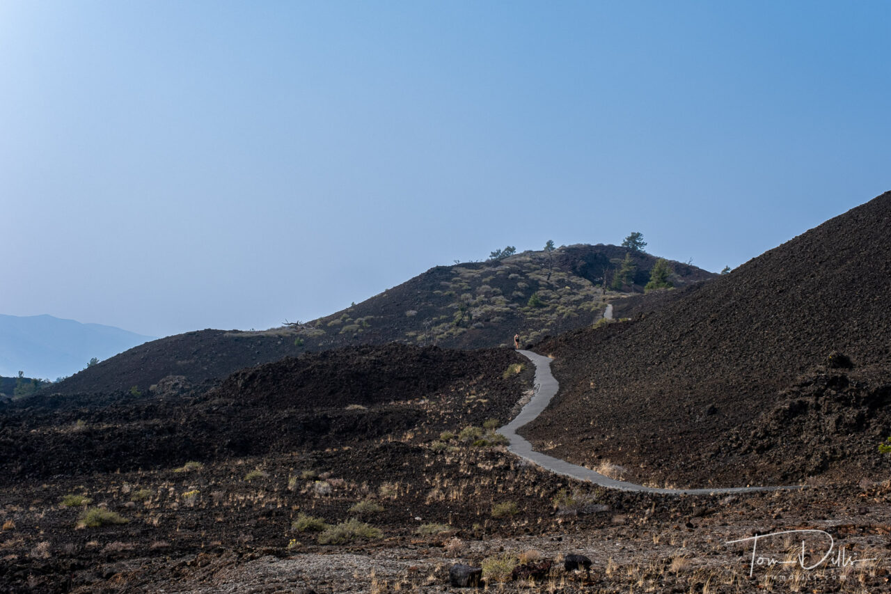
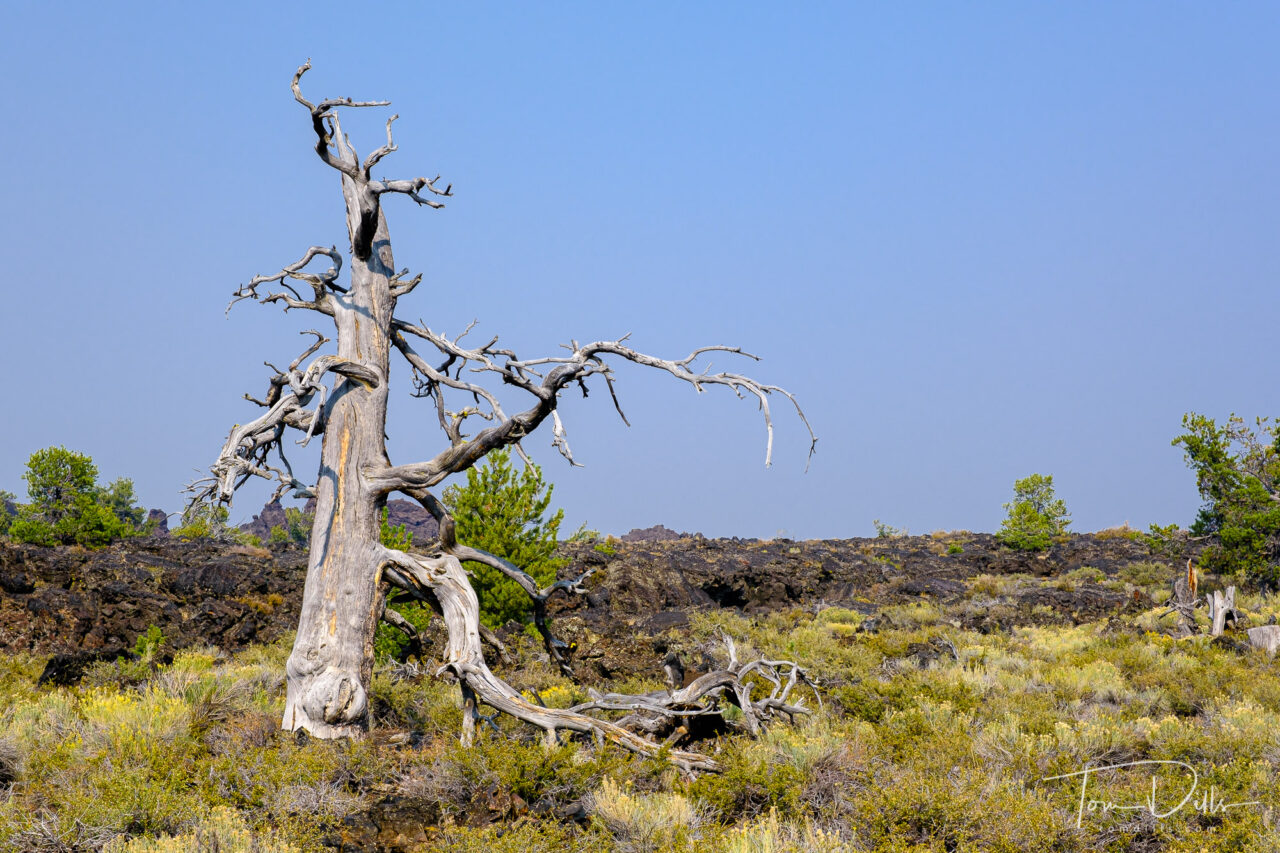
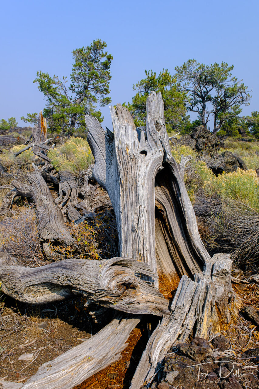
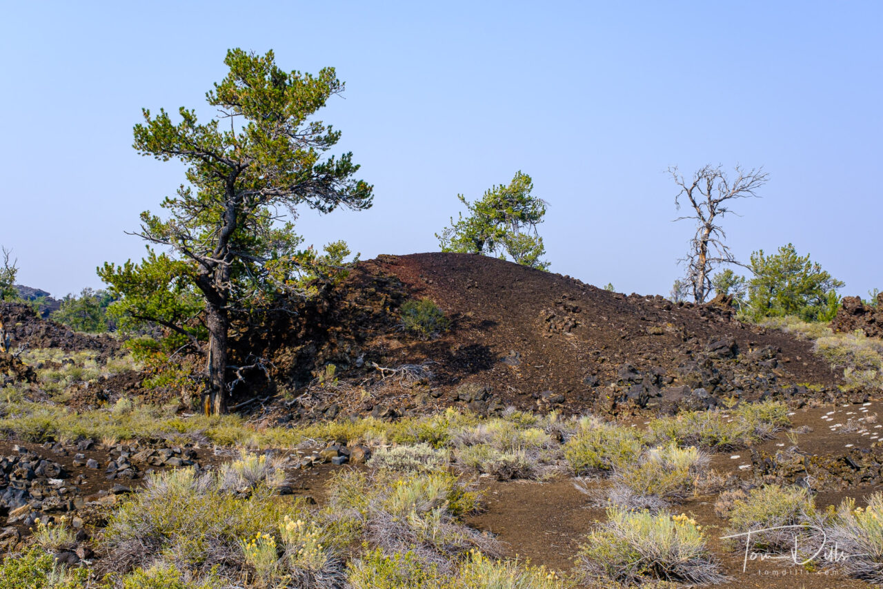
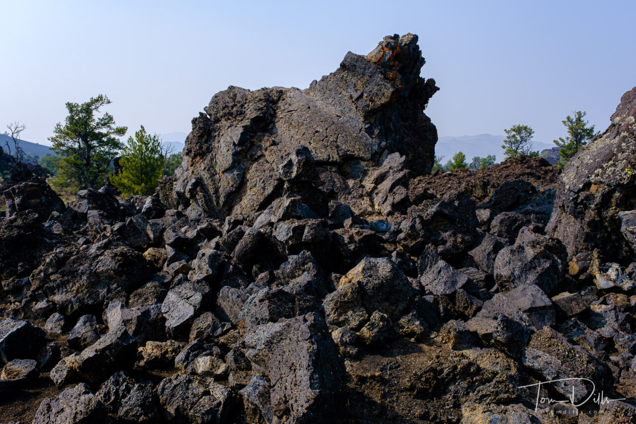
I wasn’t sure what to expect from our visit to Craters of the Moon National Monument in southern Idaho, but I could never have imagined what we saw there. The landscape is covered with fields of lava, from smooth lava domes to fields covered with huge chunks of lava rocks. We didn’t venture too far from the road, but there was plenty to see from just the overlooks.
Craters of the Moon National Monument and Preserve near Arco, IdahoCraters of the Moon National Monument and Preserve near Arco, IdahoCraters of the Moon National Monument and Preserve near Arco, IdahoCraters of the Moon National Monument and Preserve near Arco, Idaho
Craters of the Moon National Monument and Preserve is a U.S. national monument and national preserve in the Snake River Plain in central Idaho. It is along US 20 (concurrent with US 93 and US 26), between the small towns of Arco and Carey, at an average elevation of 5,900 feet (1,800 m) above sea level. The protected area’s features are volcanic and represent one of the best-preserved flood basalt areas in the continental United States.
The Monument was established on May 2, 1924. In November 2000, a presidential proclamation by President Clinton greatly expanded the Monument area. The 410,000-acre National Park Service portions of the expanded Monument were designated as Craters of the Moon National Preserve in August 2002. It spreads across Blaine, Butte, Lincoln, Minidoka, and Power counties. The area is managed cooperatively by the National Park Service and the Bureau of Land Management (BLM).
The Monument and Preserve encompass three major lava fields and about 400 square miles of sagebrush steppe grasslands to cover a total area of 1,117 square miles. The Monument alone covers 343,000 acres. All three lava fields lie along the Great Rift of Idaho, with some of the best examples of open rift cracks in the world, including the deepest known on Earth at 800 feet. There are excellent examples of almost every variety of basaltic lava, as well as tree molds (cavities left by lava-incinerated trees), lava tubes (a type of cave), and many other volcanic features.
Craters of the Moon National Monument and Preserve near Arco, IdahoCraters of the Moon National Monument and Preserve near Arco, IdahoCraters of the Moon National Monument and Preserve near Arco, IdahoCraters of the Moon National Monument and Preserve near Arco, Idaho
We had a crystal-clear blue sky on the day of our visit, with very little of the haze and smoke that we encountered in Oregon. It made for some challenging photography, although the blue sky is an interested contrast to the dark and mostly colorless lava.
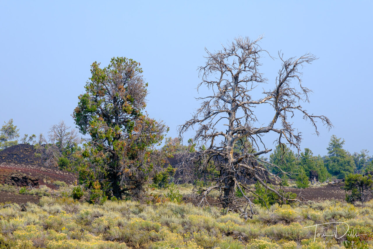
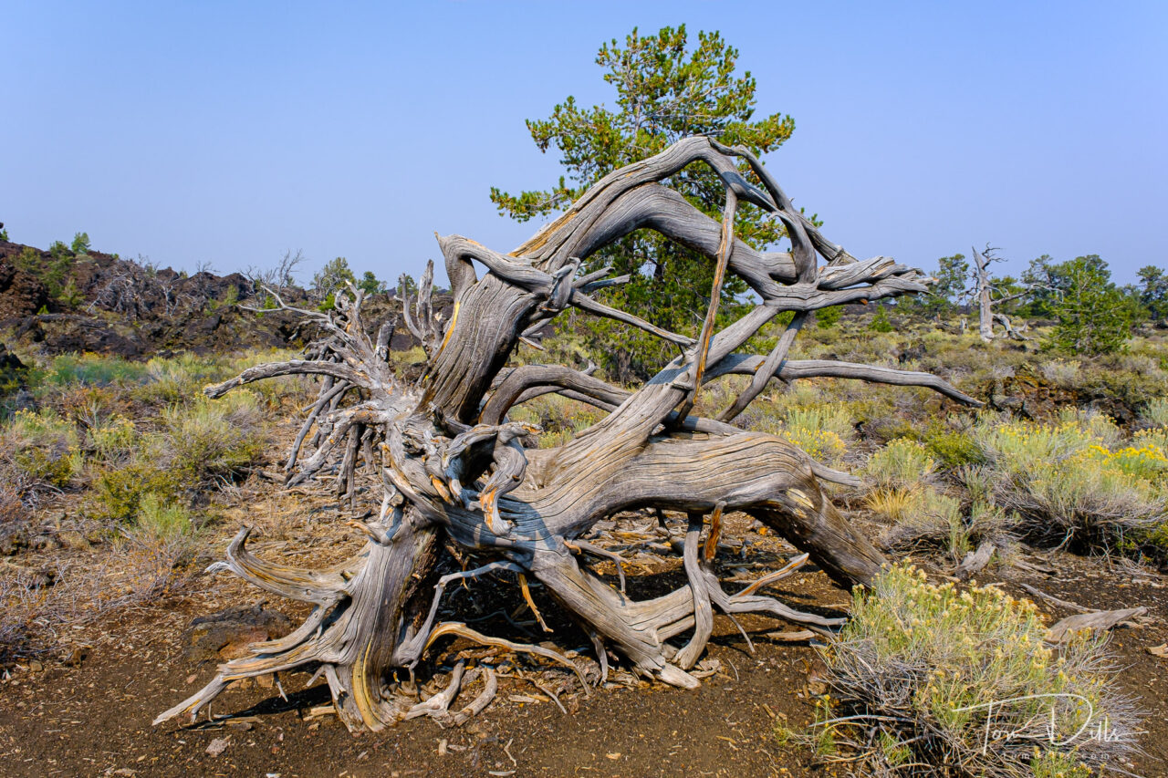
There were several places where there was little or no vegetation, and other places where the ground was covered with various plants growing up from holes and cracks in the lava that had captured more fertile soil over time. Many of the trees are dead, starved of moisture from the overall arid conditions and the inability of the porous lava to hold water. A number of fields were covered in what appeared to be small white flowers, which are in fact small clusters of a form of lichen that grows there.
Craters of the Moon National Monument and Preserve near Arco, IdahoCraters of the Moon National Monument and Preserve near Arco, IdahoCraters of the Moon National Monument and Preserve near Arco, Idaho
One point of interest is that when I went out to the NPS website for the park, the Current Conditions indicates that the loop road is currently “closed due to snow and ice!” We actually saw some ice in the bottom of some of the lava holes, but up on the surface it was very warm.
I’d heartily recommend Craters of the Moon to anyone looking for an interesting diversion from the usual. It isn’t far from Yellowstone and other western parks, and while it was pretty busy on the day of our visit, we encountered very few people up close.
As I’ve been doing, I have added a photo gallery on my Adobe Portfolio website with more photos for anyone who is interested.
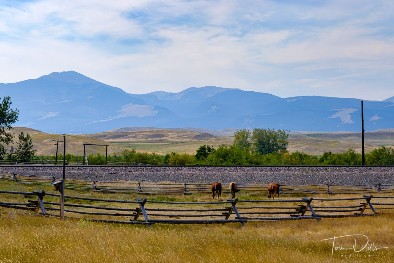
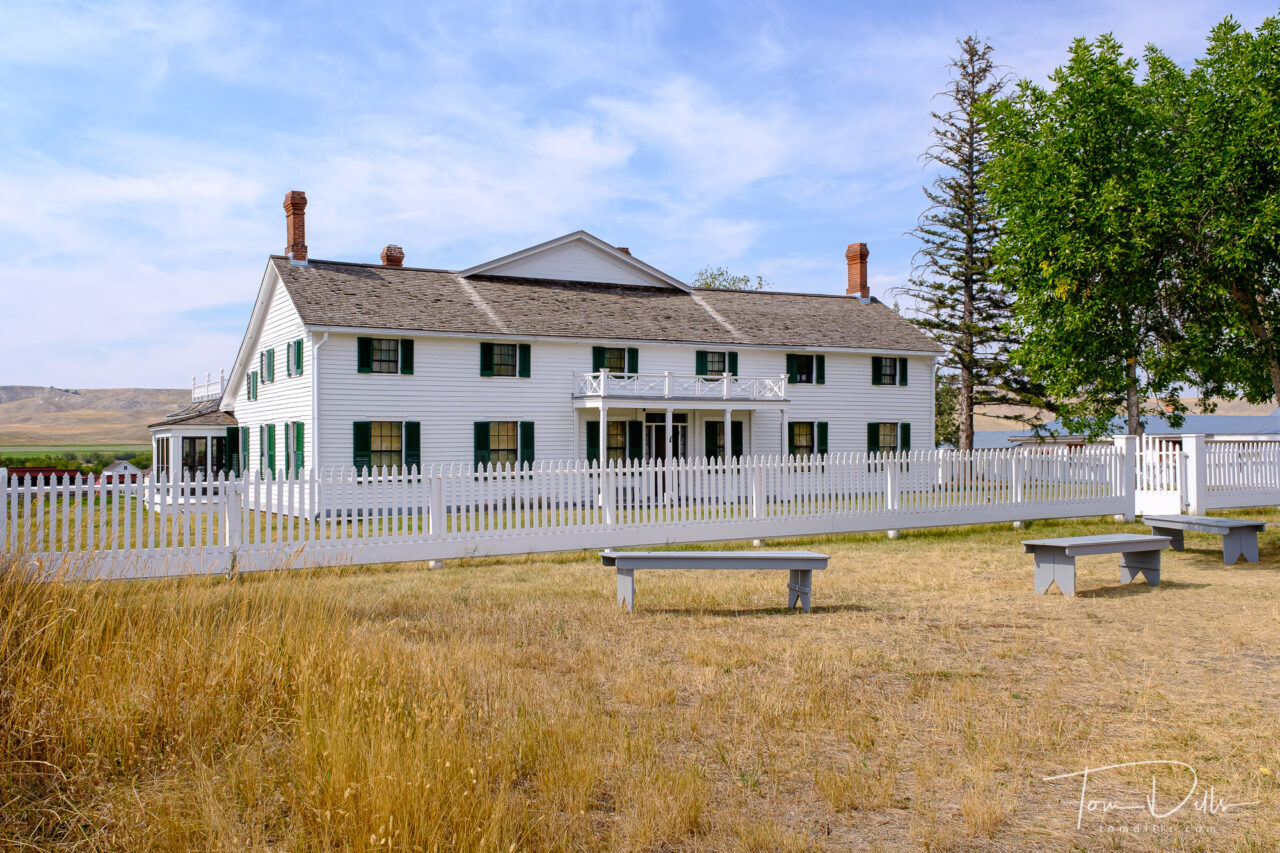
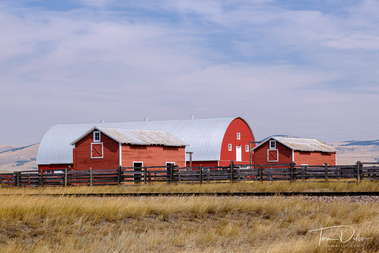
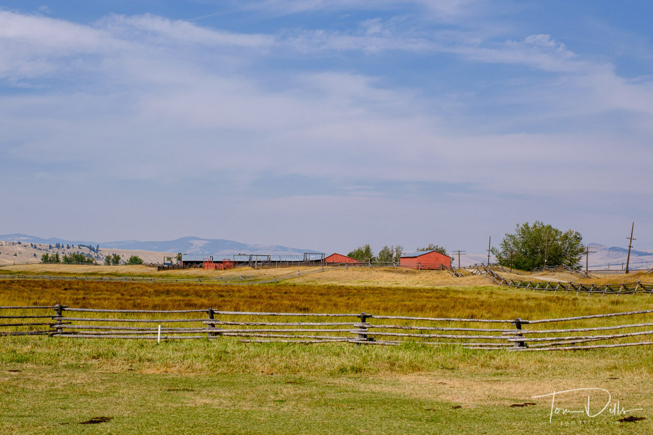
Grant-Kohrs Ranch National Historic Site near Deer Lodge, Montana
I got waylaid in my processing with a few projects around the house, but I’m back in the photo processing groove again and re-living our visit to Montana. 🙂
Grant-Kohrs Ranch National Historic Site near Deer Lodge, Montana
On our drive from Billings to Missoula we stopped by Grant-Kohrs Ranch National Historic Site, near the town of Deer Lodge. That’s not as remote as it sounds, as Deer Lodge lies within sight of I-90, not too far from Helena.
Grant-Kohrs Ranch National Historic Site near Deer Lodge, MontanaGrant-Kohrs Ranch National Historic Site near Deer Lodge, Montana
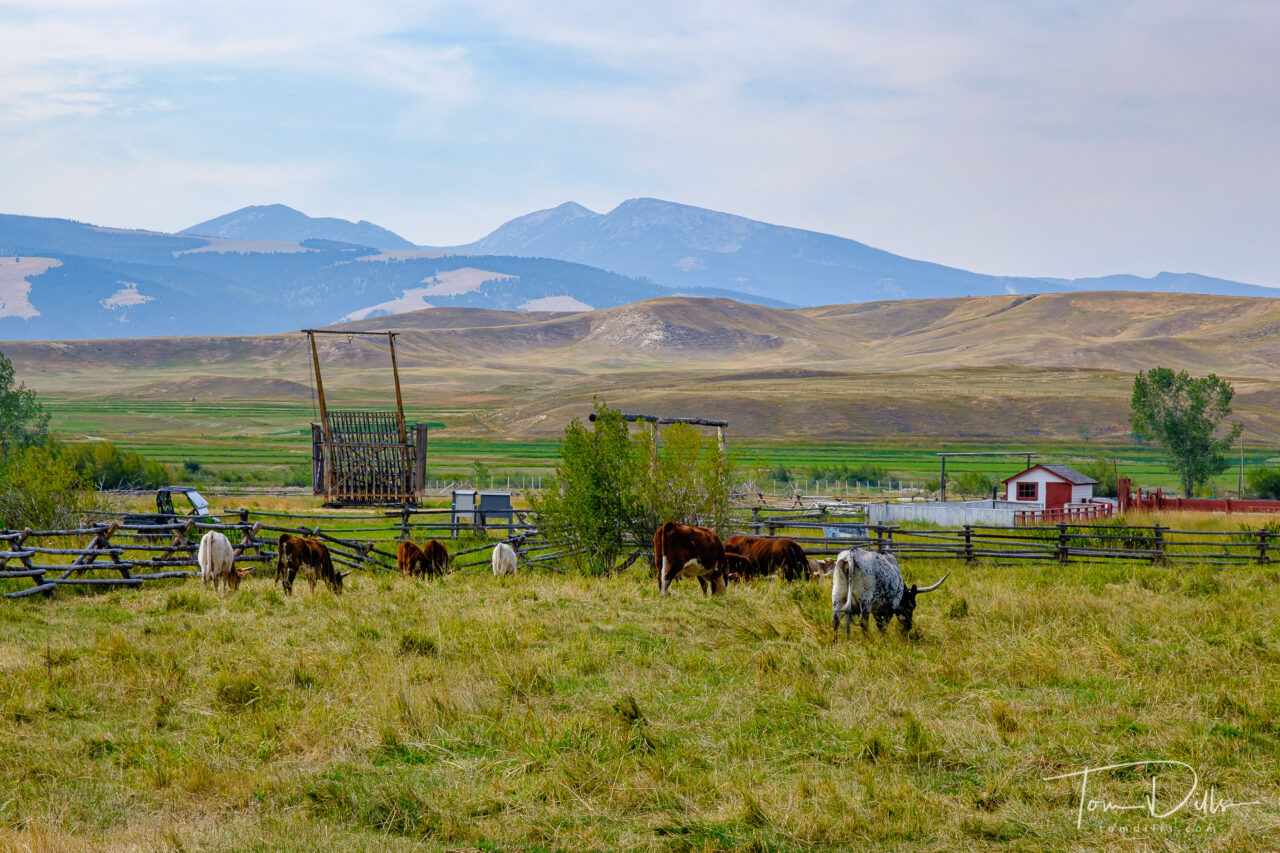
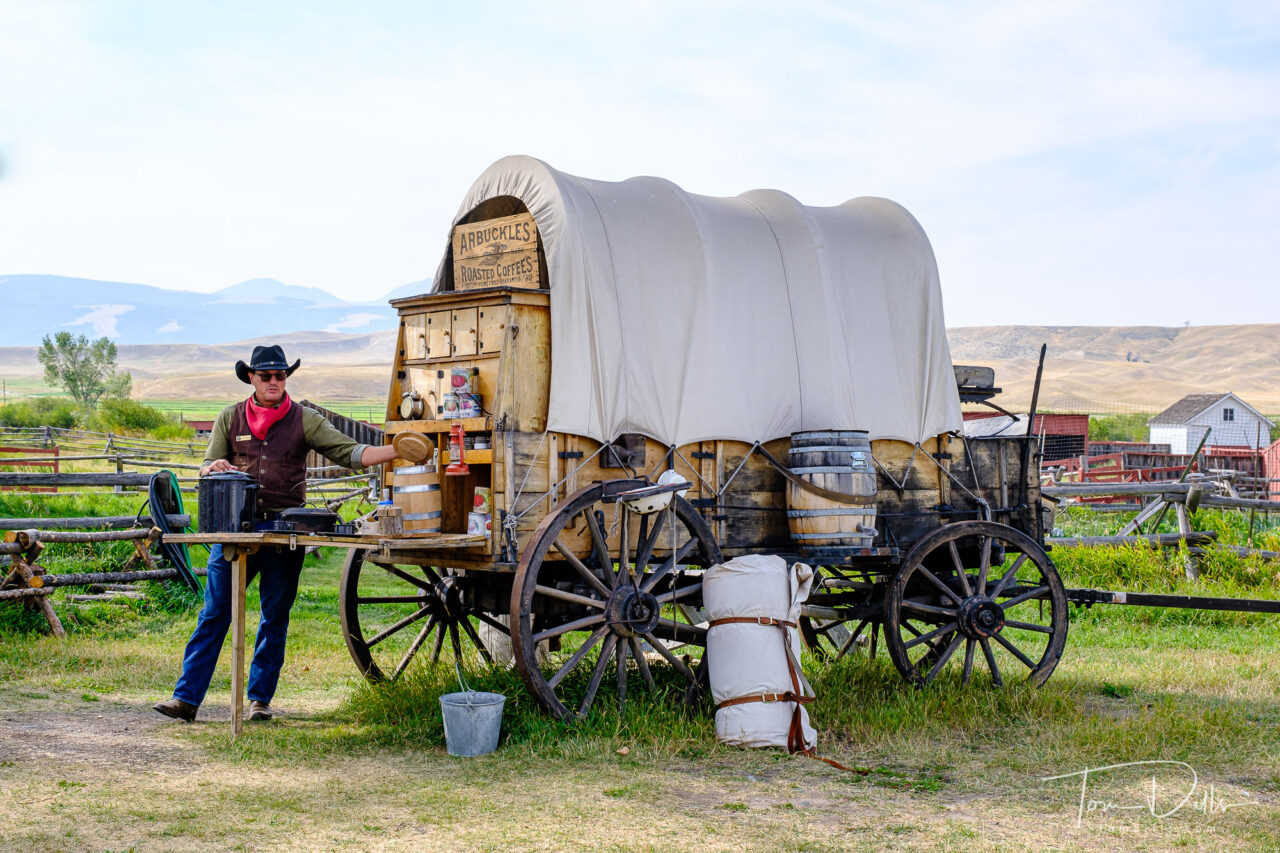
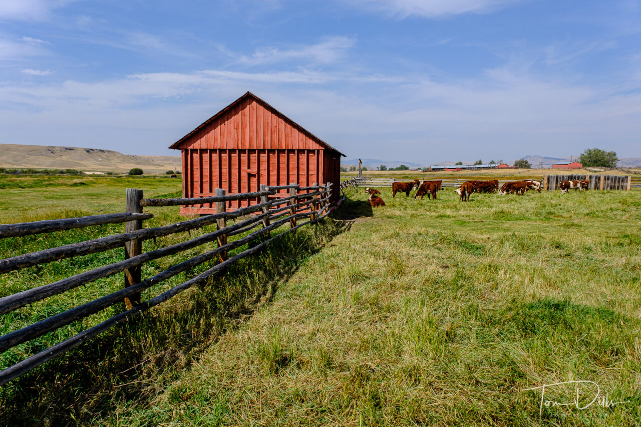
Grant-Kohrs Ranch has an interesting history, dating to the 1860s when the open-range cattle industry had its heyday. Many of the herds were built through trade with westward-bound emigrants, who gladly swapped two or more trail-worn cows for a single well-fed one.
Ranger talks about living and cooking on the range
From the NPS website:
“By 1885, cattle raising was the biggest industry on the High Plains, and foreign investors and eastern speculators rushed to get in on the bonanza. As ranches multiplied and the northern herds grew, there came a predictable consequence: overgrazing. This and the fierce winter of 1886-87 caused enormous losses, estimated at one-third to one-half of all the cattle on the northern plains. Many cattlemen never recovered.
If the snows of ’86-87 foreshadowed the end of open range ranching, the homesteaders, with their barbed wire and fenced-in 160 acre claims, finished it off.
The open-range cattle industry lasted only three decades. Few of its pioneering men and women made their fortunes or are remembered today. But from their beginnings has evolved the more scientific ranching of today, with its own risks and uncertainties. That is the legacy of the Grants and the Kohrs, whose pioneer ranch, complete with original furnishings, is a reminder of an important chapter in the history of the West.”
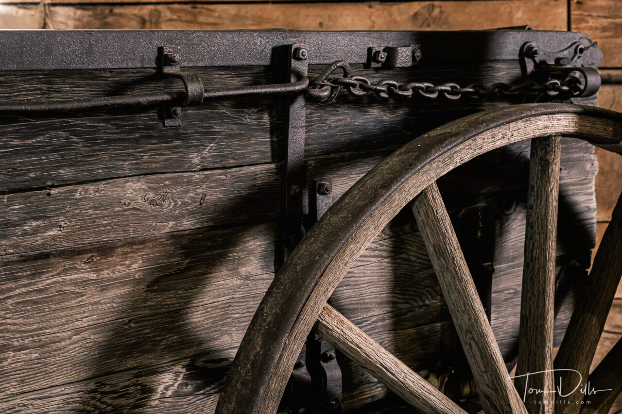
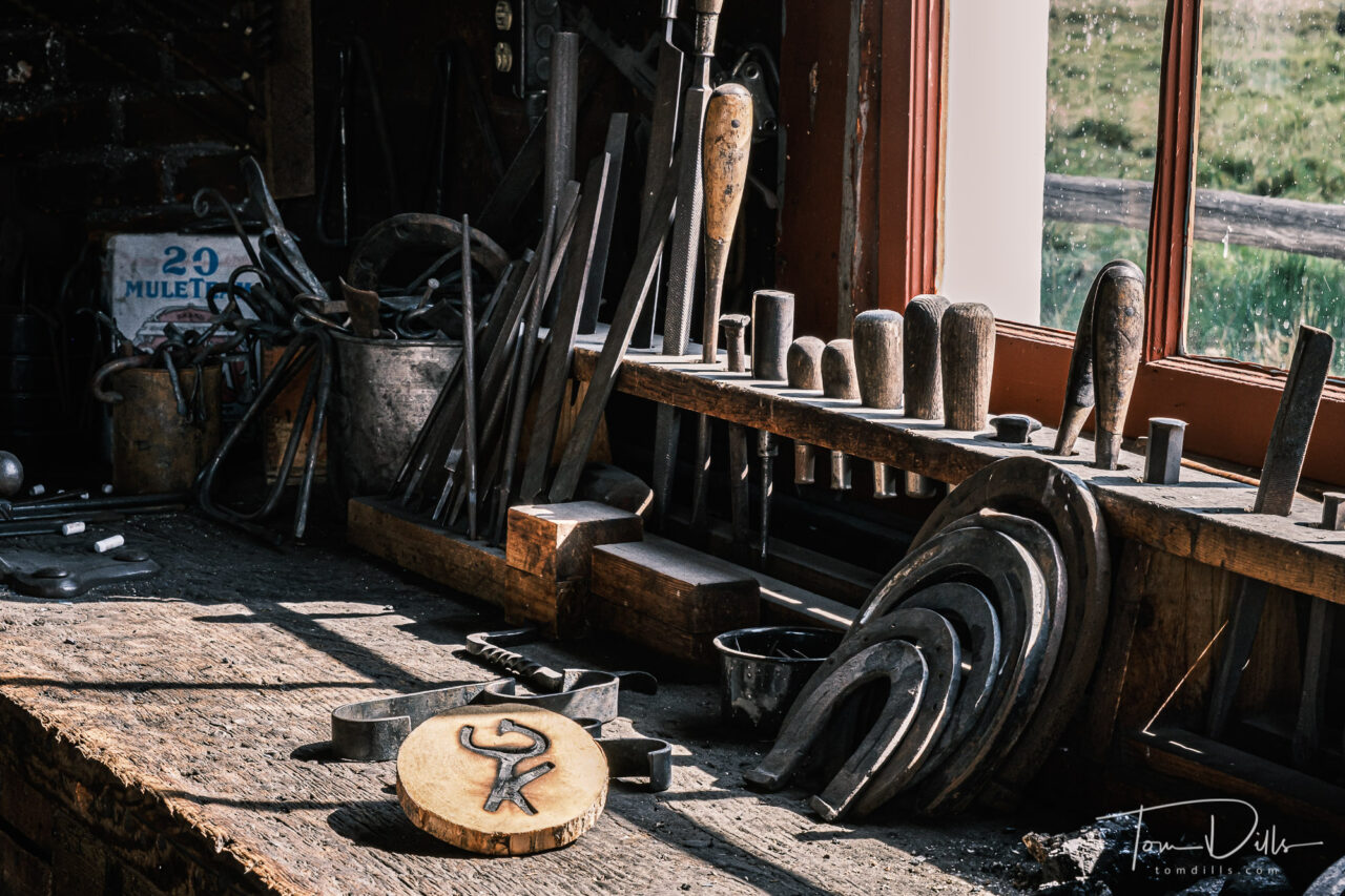
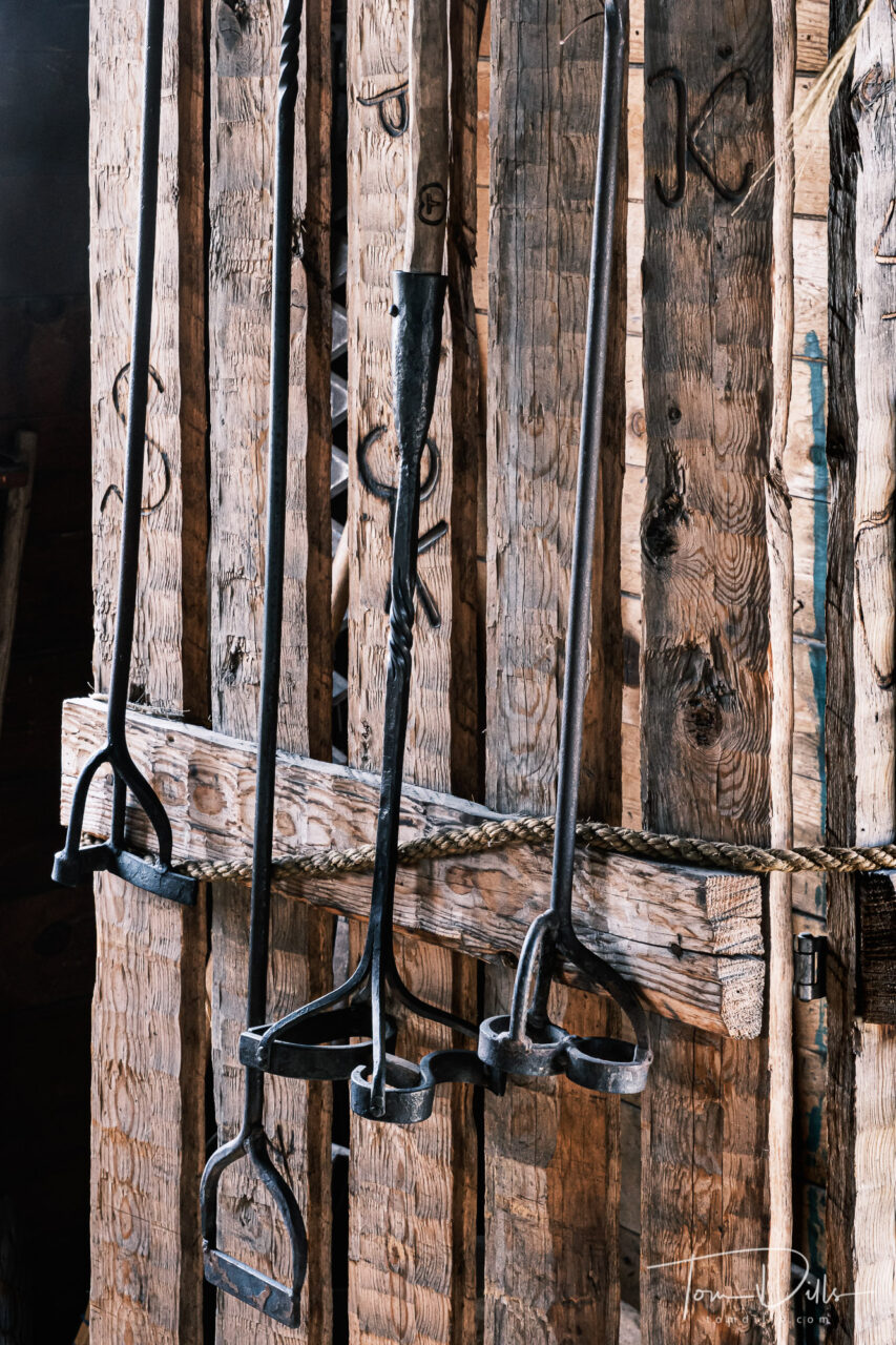
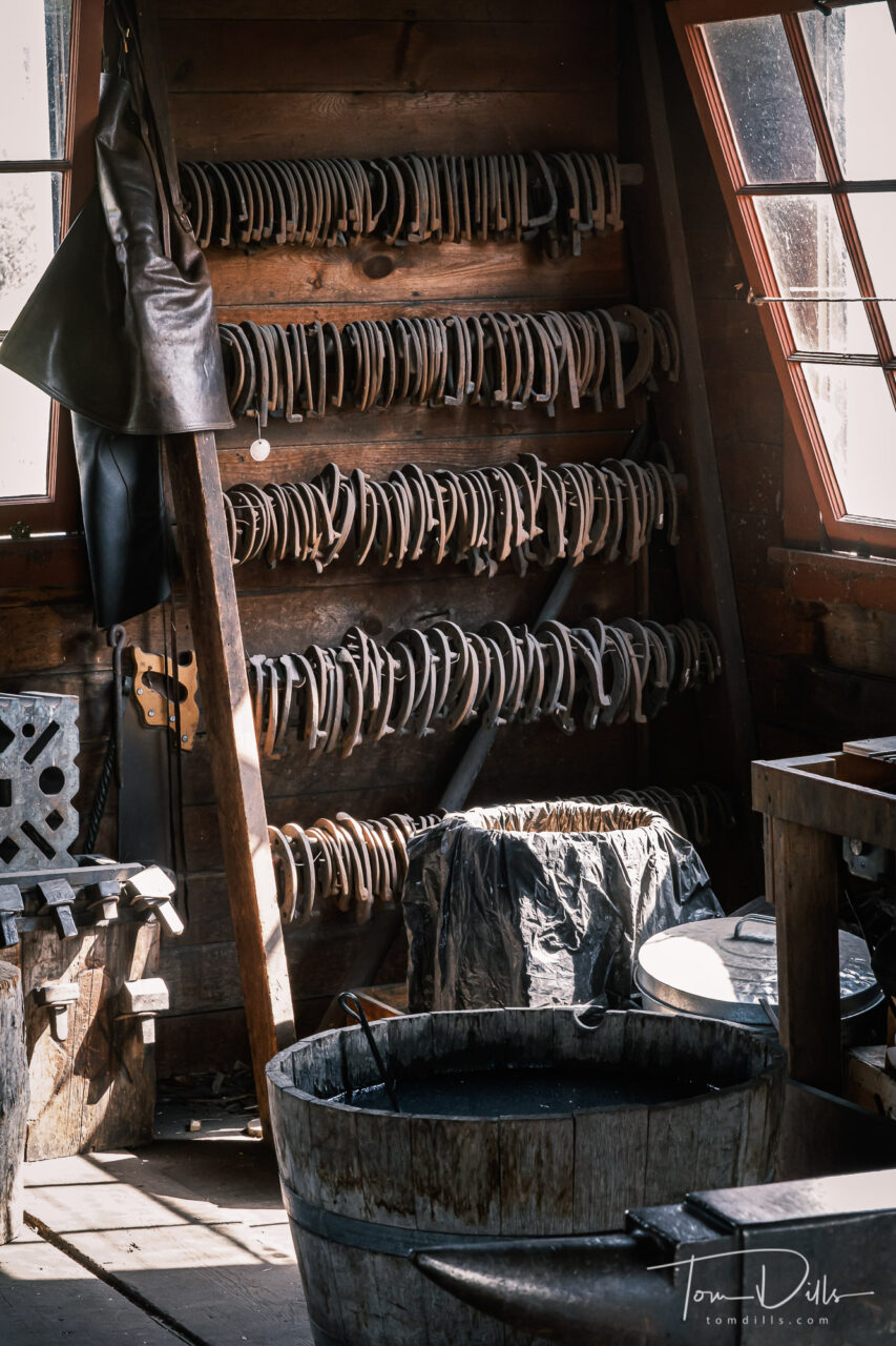
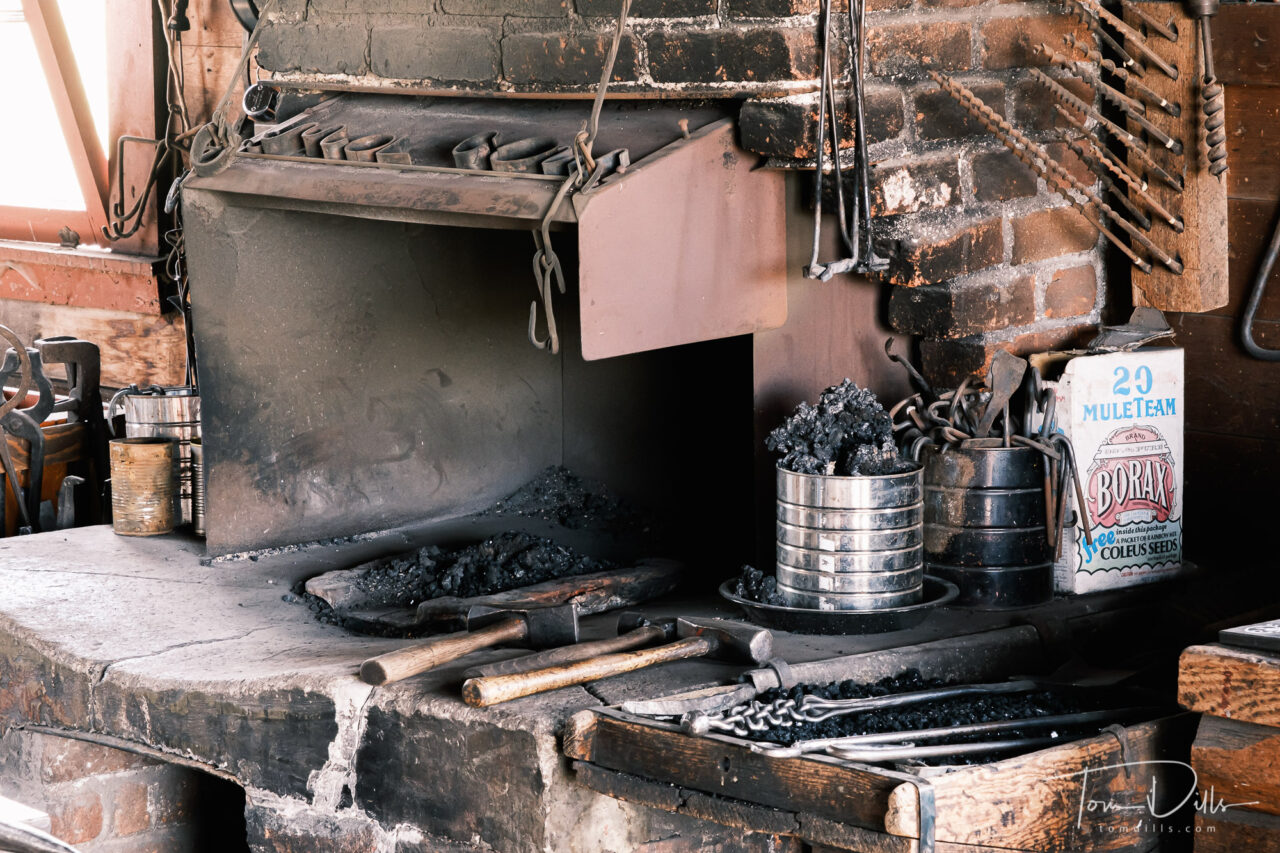
Old wagonBlacksmith shop with a sample of t he G-K brandBranding IronsBlacksmith ShopBlacksmith Shop
Walking around the ranch, I felt like I was experiencing the plains of Montana much like the early settlers saw it. Miles and miles of open range, perforated now by barbed-wire fences but the long range views remain.
Grant-Kohrs Ranch National Historic Site near Deer Lodge, Montana
This was another one of those places we visited where we were able to steer well clear of crowds. The few people we saw there seemed to have been mostly attracted by the proximity to the interstate and the availability of restrooms. 😉 For us it was another piece of western history to add to our knowledge of this country.
Grant-Kohrs Ranch National Historic Site near Deer Lodge, Montana
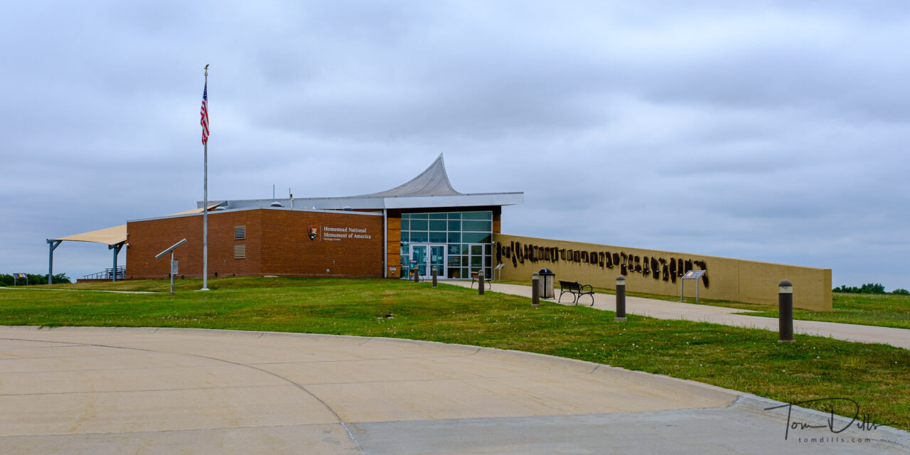
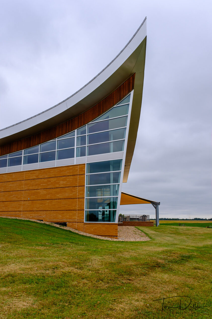
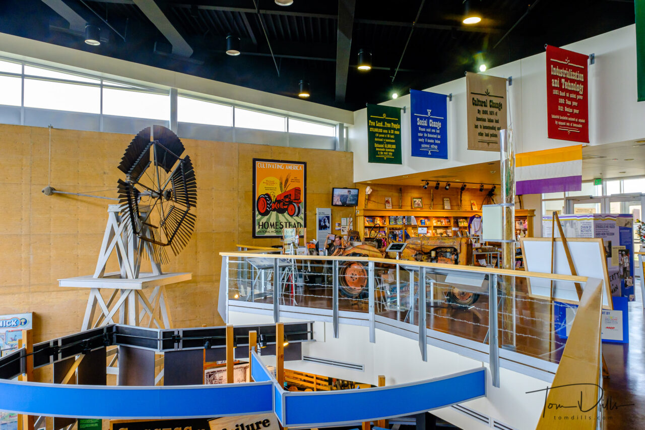
Visitor Center at Homestead National Monument of America near Beatrice, Nebraska
One of the off-the-beaten-path places we visited on our journey westward was in Nebraska. The Homestead National Monument of America is located near Beatrice (pronounced be-AT-riss)Nebraska.
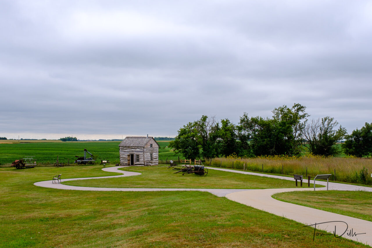
Palmer-Epard Cabin at Homestead National Monument of America near Beatrice, NebraskaPalmer-Epard Cabin at Homestead National Monument of America near Beatrice, Nebraska
From the NPS website:
The Homestead Act of 1862 was one of the most significant and enduring events in the westward expansion of the United States. By granting 160 acres of free land to claimants, it allowed nearly any man or woman a “fair chance.”
Millions of Americans including immigrants, women, and formerly enslaved men and women would make the dream of westward expansion a reality for this country. For over a century these settlers would test their grit and endurance in the untamed wilderness and remote frontiers. Homestead National Monument of America, located in Southeast Nebraska, commemorates this Act and the far-reaching effects it had upon the landscape and people.
It is the purpose of our government “to elevate the condition of men, to lift artificial burdens from all shoulders and to give everyone an unfettered start and a fair chance in the race of life.”
– President Abraham Lincoln, July 4, 1861
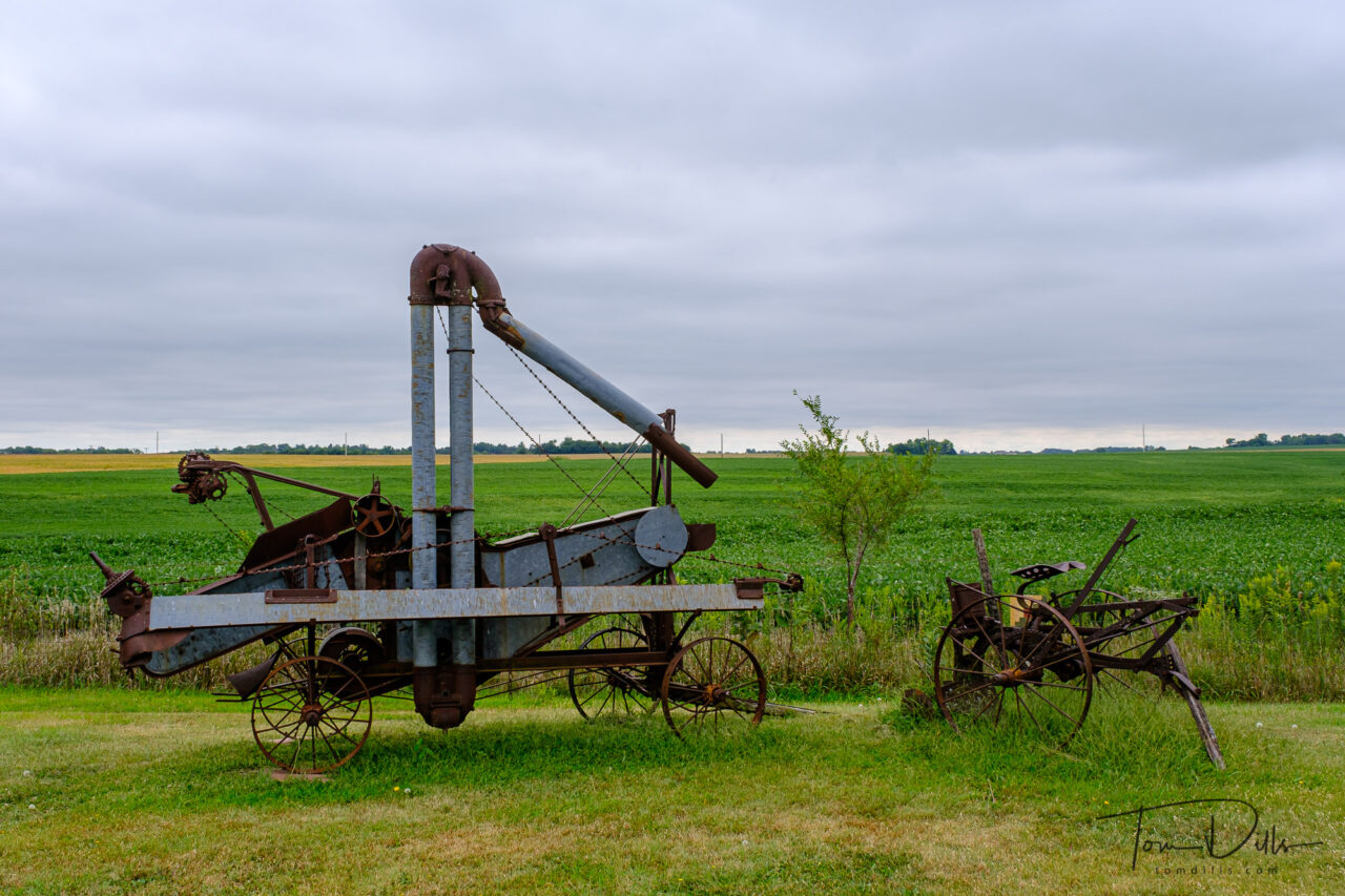
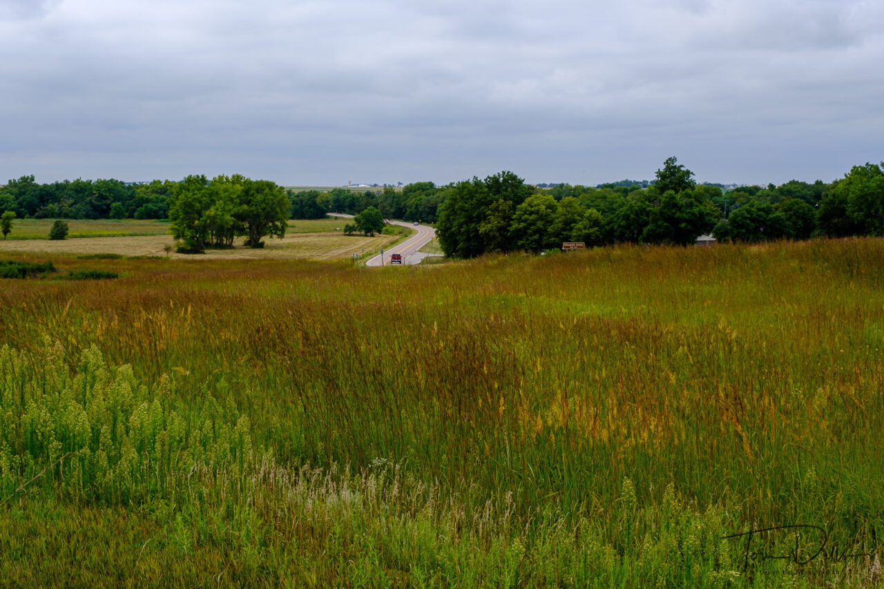
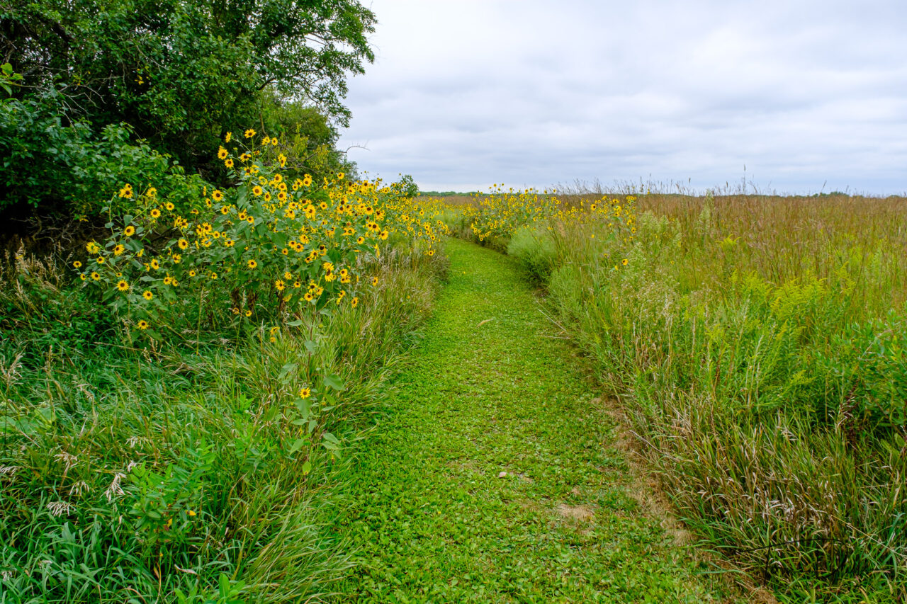
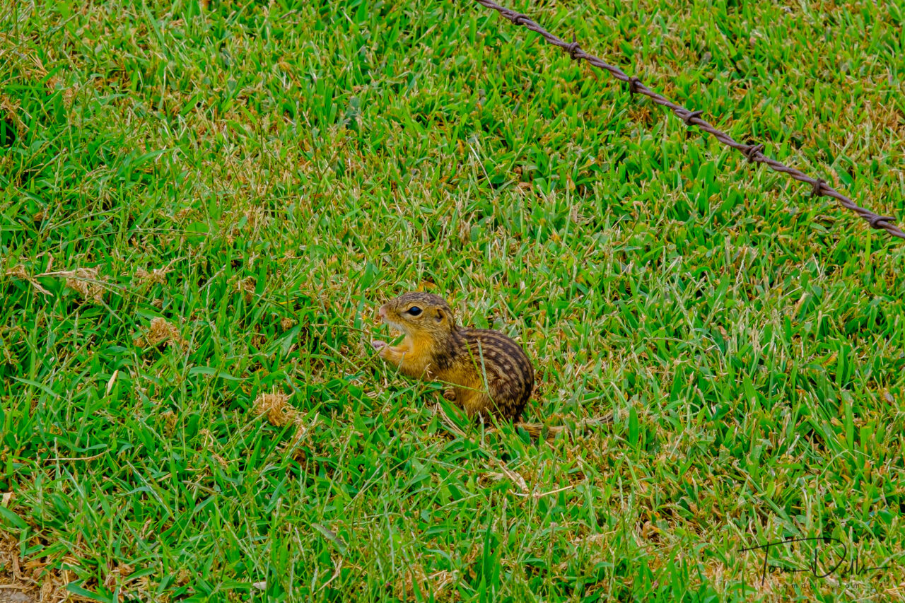
Visitor Center at Homestead National Monument of America near Beatrice, NebraskaVisitor Center at Homestead National Monument of America near Beatrice, NebraskaExample of tallgrass prairie at Homestead National Monument of America near Beatrice, NebraskaExample of tallgrass prairie at Homestead National Monument of America near Beatrice, NebraskaPrairie dog spotted at the Homestead National Monument of America near Beatrice, Nebraska
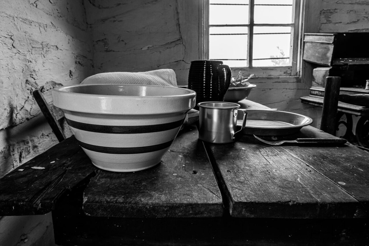
Like most of the other places we visited, this park was mostly deserted at the time we were there. A few rangers working in the building and a few fellow tourists walking the grounds outside were about it. But the park contains some excellent information about the Homestead Act and its impact on the settlement of the west.
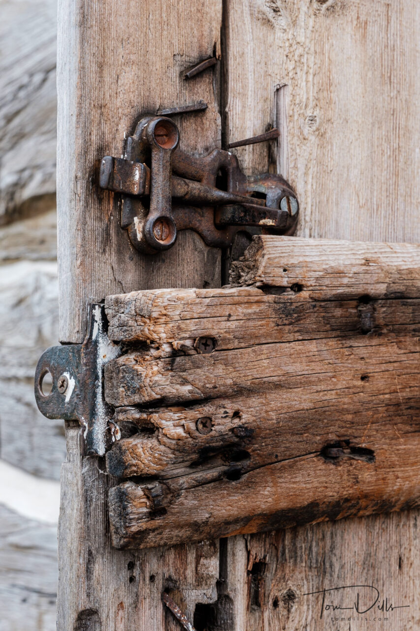
Palmer-Epard Cabin at Homestead National Monument of America near Beatrice, NebraskaDoor and lock hardware at the Palmer-Epard Cabin at Homestead National Monument of America near Beatrice, Nebraska
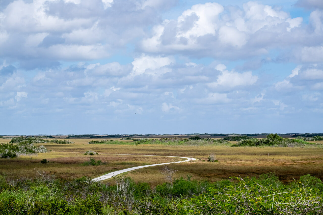
View from the observation tower at the Shark Valley Visitor Center in Everglades National Park
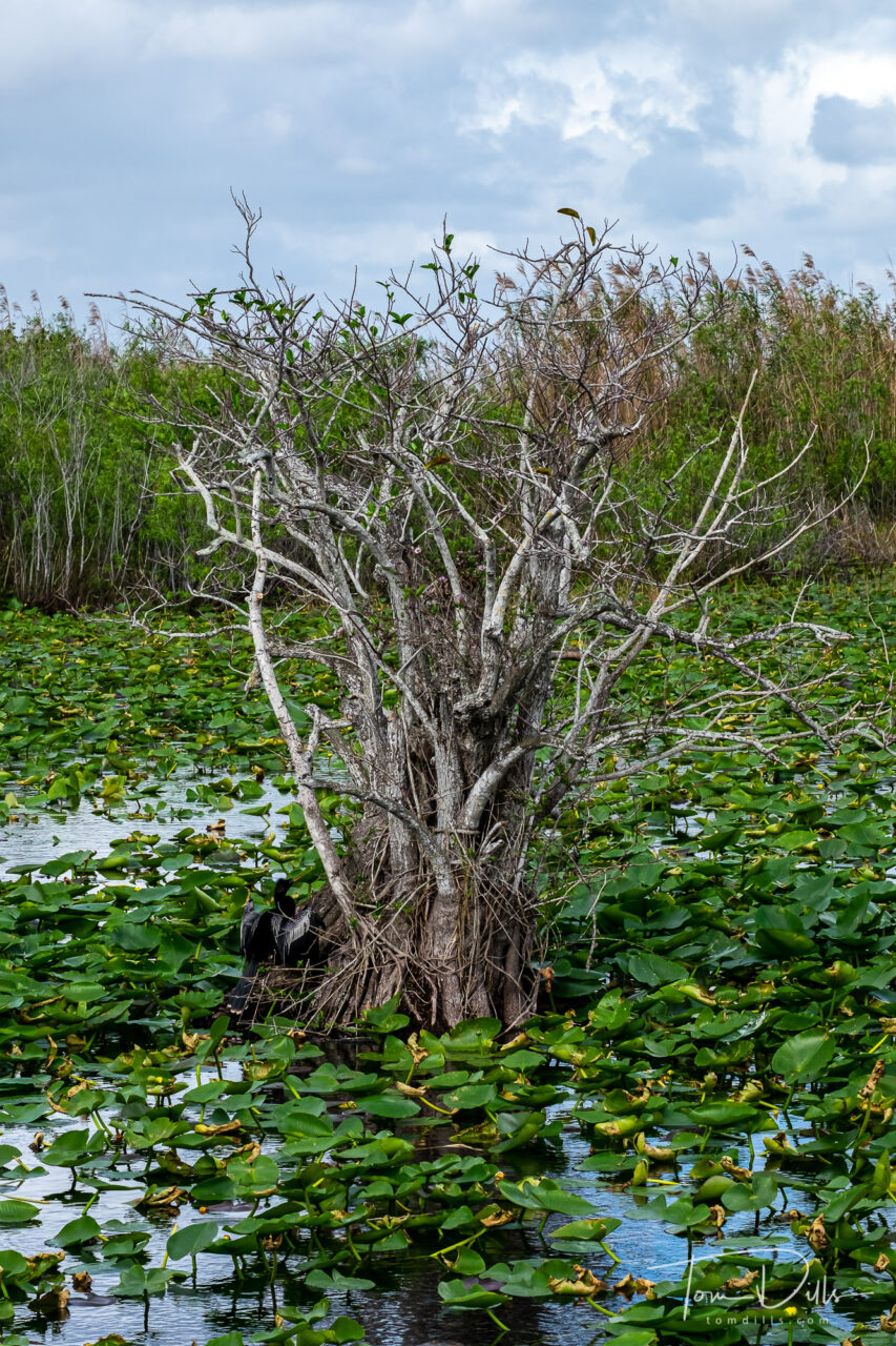
I had always thought of the Everglades as a swamp, but it’s not. While there are swamp areas in and around the park, the Everglades per-se is actually a 60-mile wide freshwater river, running from Lake Okeechobee to Florida Bay, and eventually to the Gulf of Mexico. It is only a few feet deep in most places. Because the water flows across a limestone shelf, there is little or no silt or sediment, so the water is remarkably clear. The flow of water has been greatly impacted over the years by development and diversion of the water to major cities, but recent efforts to stem the loss of wetlands has at least slowed the loss of this ecosystem.
Observation platform on the Anhinga Trail in Everglades National Park
For our visit, we wanted to see as much of the park as possible, so we didn’t really spend a lot of time in any one place. It would be possible to spend weeks in any one area, but to get a good overview we concentrated on three main areas. We stayed in south Miami near Homestead, so we had a good bit of driving to do to get anywhere, especially the second and third areas mentioned below.
Anhinga Trail in Everglades National Park, FloridaThe Gumbo Limbo Trail in Everglades National Park, FloridaAnhinga Trail in Everglades National Park, Florida
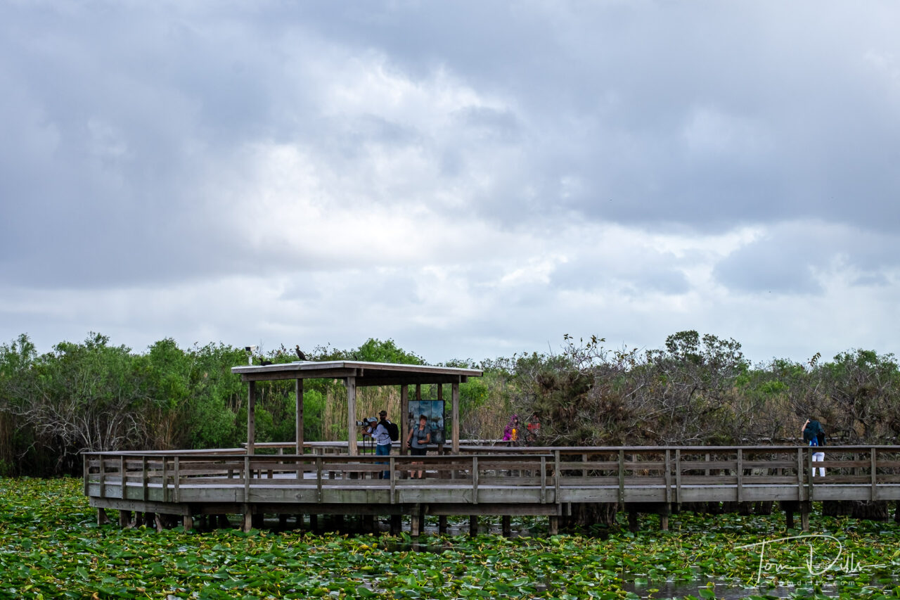
The southernmost part of the park starts near Homestead and stretches from the Ernest Coe Visitor Center down SR-9336 to the Flamingo Visitor Center. We spent time on the Anhinga Trail, which is an easy 0.8-mile path and boardwalk through an area that is home of a large number of wildlife.
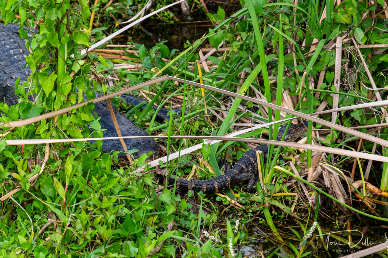
Baby alligators along the trail from the Shark Valley Visitor Center in Everglades National ParkTram tour from the Shark Valley Visitor Center in Everglades National Park
The section that is probably most familiar to visitors to south Florida is the section that is bisected by US-41, known as the Tamiami Trail. Because the Tamiami Trail only borders the National Park on the south side, and only in a relatively small section, this is the place where all the air boat rides, ‘gator rasslin’ places and trinket shops are located. The Shark Valley visit center is probably the most visited center in the park, and unfortunately has the smallest parking lot. It’s not unusual to have to endure long waits to get into the parking lot, with the alternative of parking on the road and walking about a half mile in to the visitor center. That wouldn’t be bad in February, but I wouldn’t want to do that in August! Then again, I want very little to do with south Florida in August!
We were fortunate to have only a relatively short wait to park, then lucked into a tram tour that left about an hour after we arrived. The “loop road” that goes to an observation tower is a 15-mile round trip. Walking it would be the ideal way to experience the trail and the wildlife, but 15-miles is a long way! It’s also possible to bicycle the trail, and it’s possible to rent bikes there. But the tram tour goes slowly enough and stops whenever wildlife is encountered, so for tourists like us it’s a pretty good way to get around.
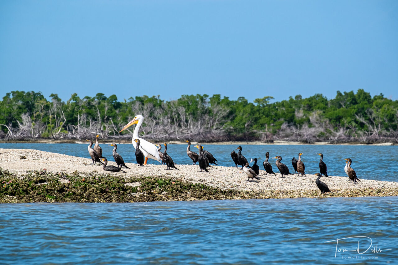
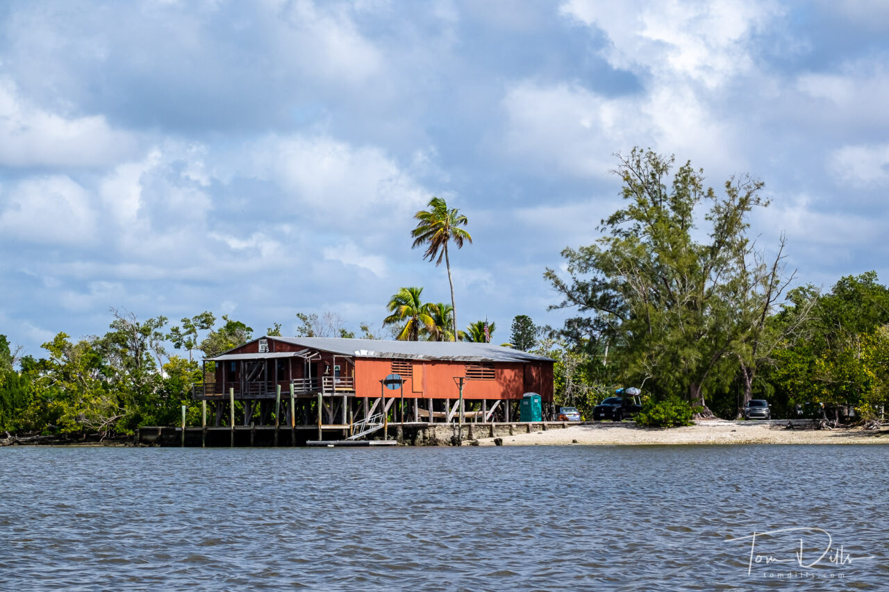
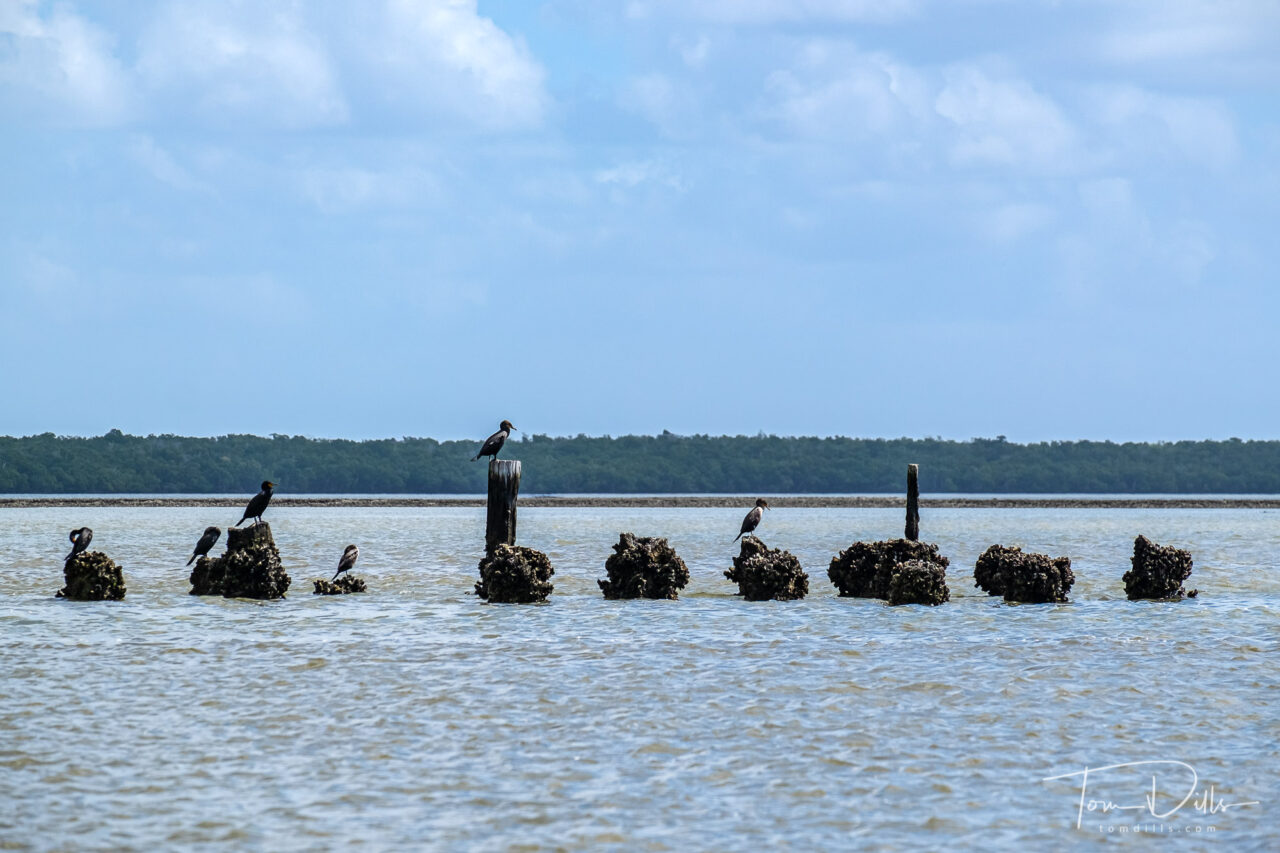
White Pelican and Cormorants during our Everglades National ParkHistoric Smallwood Store on Chokoloskee Island, Florida
The third area, which is probably more a sub-area of the second, is the area around the towns of Everglades City and Chokoloskee. From Chokoloskee we took a boat tour through the Chokoloskee Bay toward the Gulf of Mexico. We opted for a tour in a small motor boat rather than an airboat, since the motor boat is slower and quieter I think we were able to see a lot more wildlife. Airboats are not allowed in the National Park, so any of the airboat companies up along the Tamiami Trail don’t actually take you into the National Park. Not a big deal, but I wanted to experience the park proper, not just the Everglades in general. We lucked out and only had 4 people on our tour plus the guide. Compared to the option of the airboat I think we made the right choice. I’d love to take an airboat ride sometime, but I think of it as more of a thrill ride than a way to see wildlife up close.
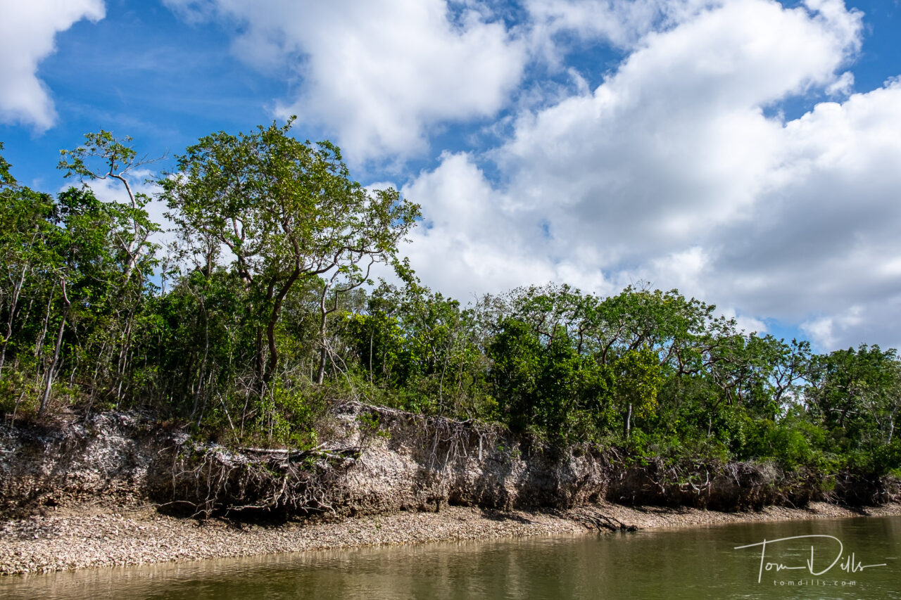
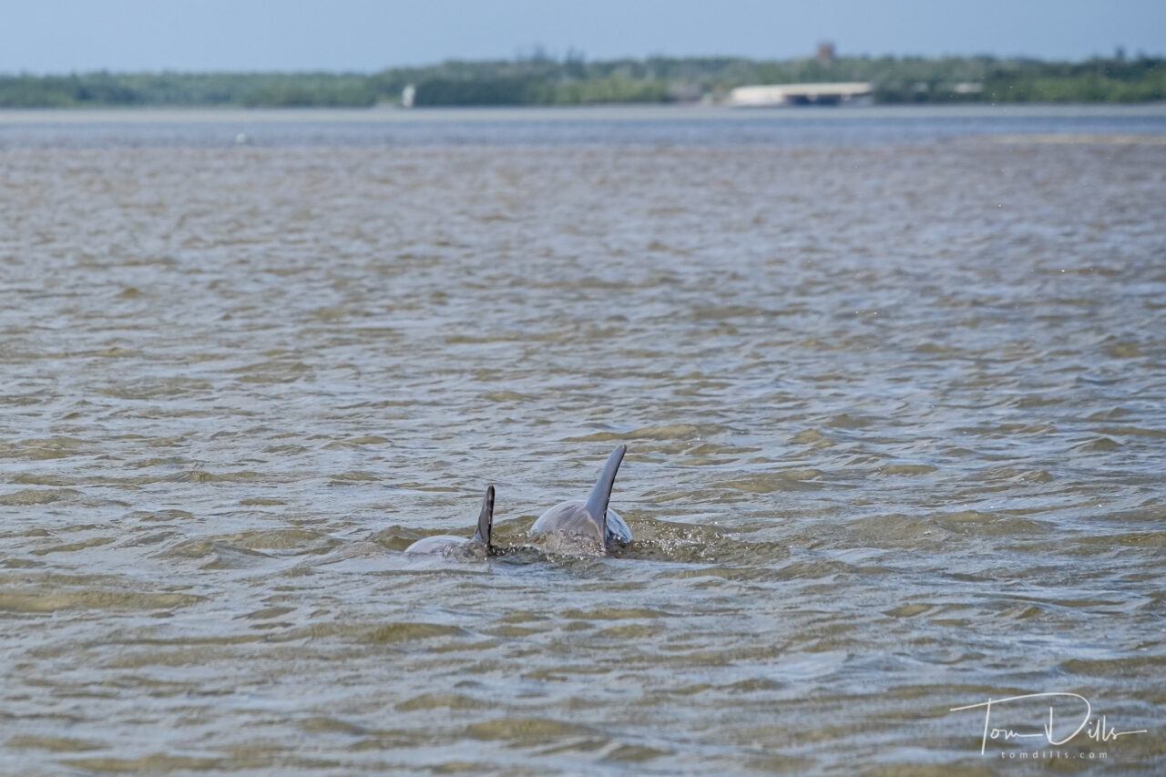
Everglades National Park contains a number of these shell islands that were constructed by the Calusa Indians using only shells. The shell layers are visible along the edges of the water.Everglades National Park boat cruise with Everglades Area ToursDolphins during our Everglades National Park boat cruise with Everglades Area Tours
I’ve got plans for a few more posts detailing some of the highlights from these various areas. I didn’t want to clutter this post up with too many more words or photos, so those will come later.
“The Road to Nowhere” in Great Smoky Mountains National Park near Bryson City, NC
Kathy & I paid a visit today to the so-called “Road to Nowhere” in Great Smoky Mountains National Park near Bryson City, NC. I wrote about this place in a previous post from last October (just a year ago? Wow!). We caught just a little bit of the end of fall color, before the bottom falls out of the thermometer in a few days. We’ll be back home to our toasty house and our gas fireplace by then! 😉
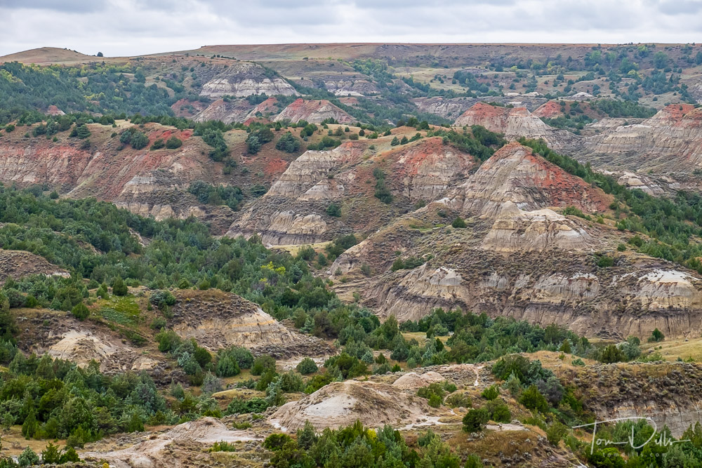
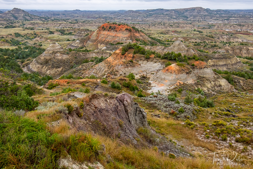
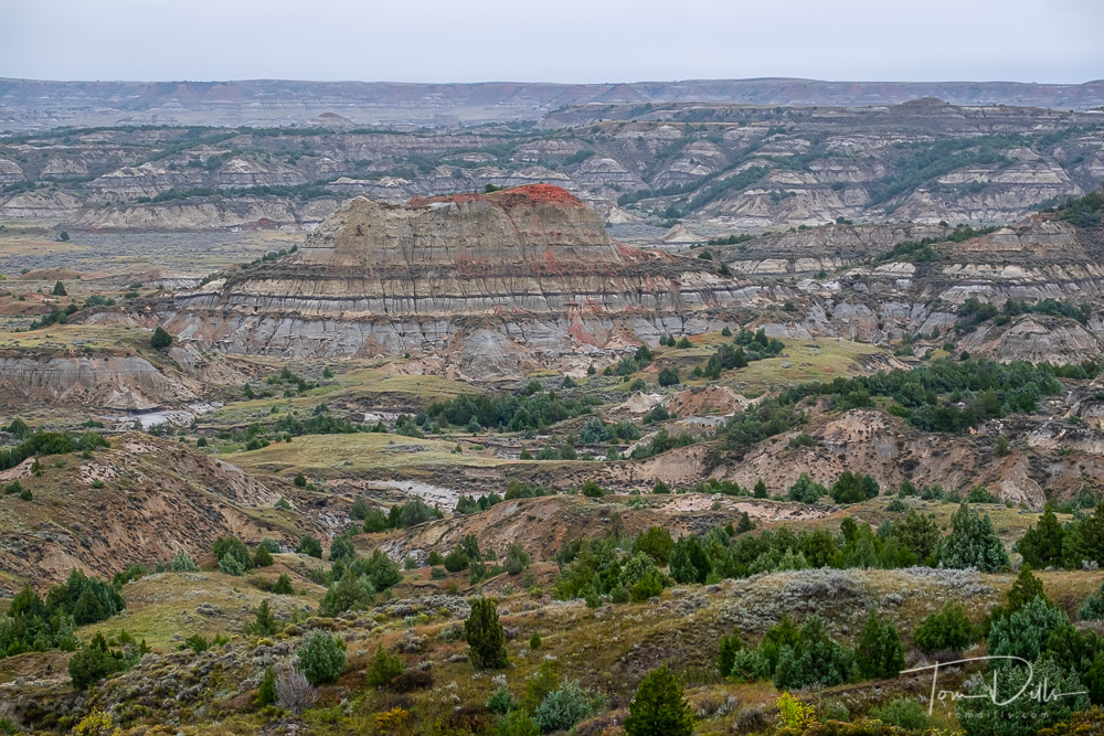
View of The Painted Canyon at Theodore Roosevelt National Park, North Dakota
Our original plan was to stop at the visitor center at for a stamp in Kathy’s Passport book, take a few photos and move on. But even though the weather was iffy when we got there, the scenery was so captivating that we decided to stick around until dark. And we’re glad we did!
Theodore Roosevelt National Park, North DakotaView of The Painted Canyon at Theodore Roosevelt National Park, North DakotaView of The Painted Canyon at Theodore Roosevelt National Park, North DakotaView of The Painted Canyon at Theodore Roosevelt National Park, North Dakota
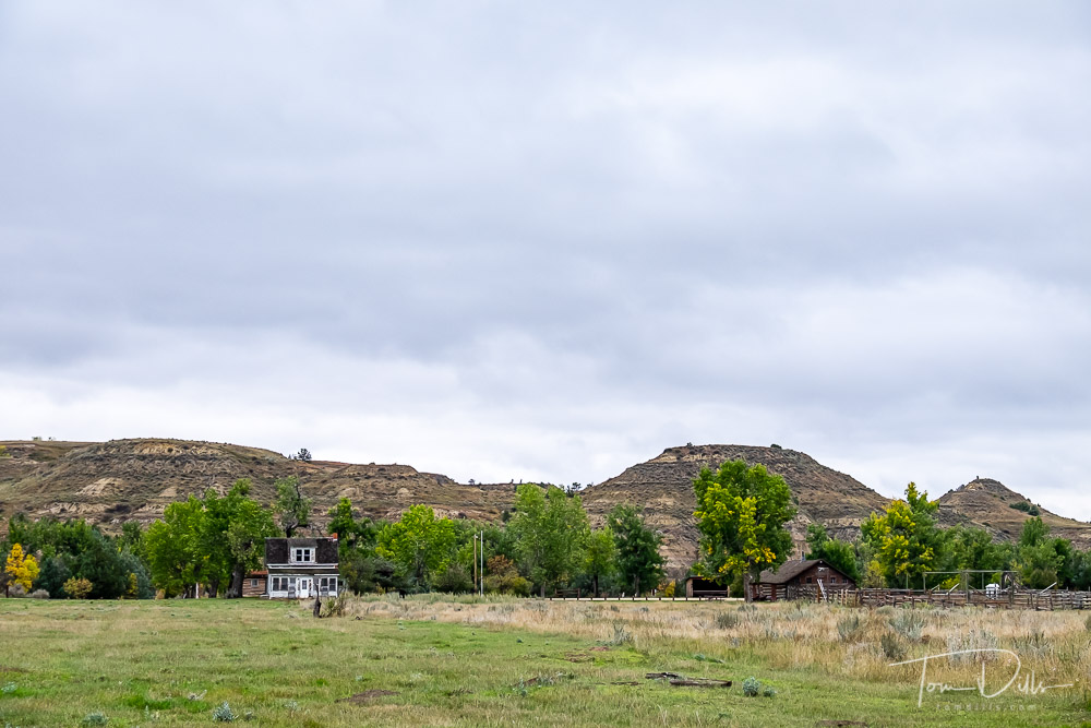
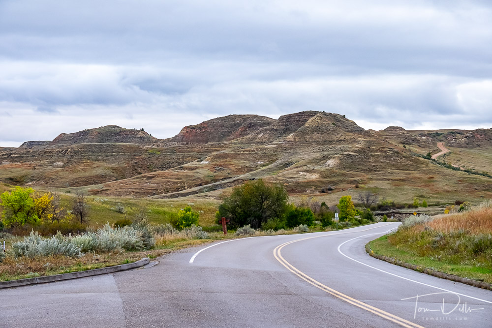
The visitor center is situated at a rest stop along I-94 and is one of the few interstate rest areas where you can actually see bison. We didn’t see any at the rest stop, but did see a lot of them in the park, both up close and from a distance. The best way to see the park is to drive the loop road, which is what we ended up doing.
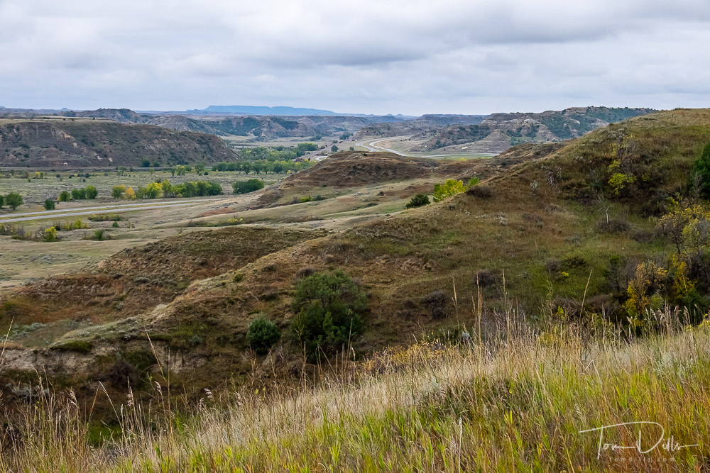
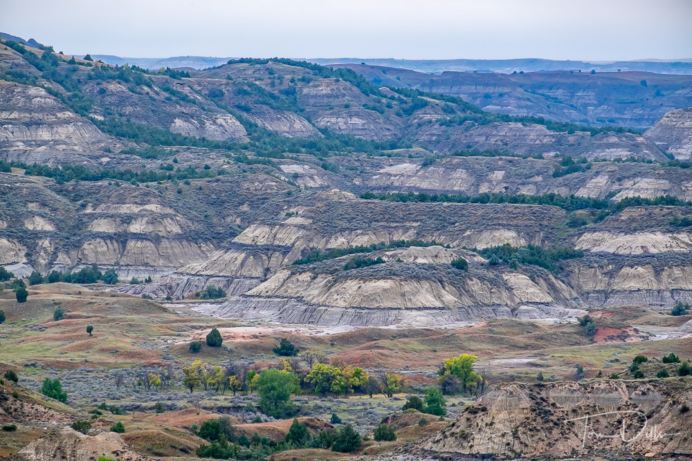
Theodore Roosevelt National Park, North DakotaTheodore Roosevelt National Park, North Dakota
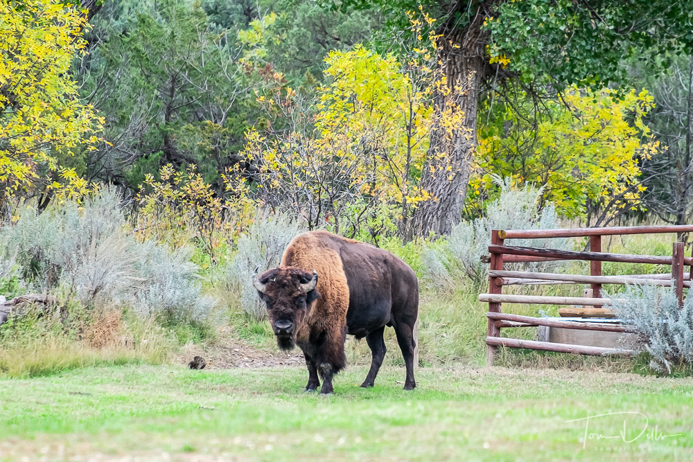
A portion of the loop road through the park was closed due to some aerial spraying being done, but the road was open enough to get some good views from within the park. “Prairie Dog Town” was a lot of fun, with hundreds of the cute little critters popping their heads out of their holes to peek at us. We got a little “up close and personal” to some bison that wandered through a parking area right behind our car. I was very glad to be in the car and not out wandering around with my camera!
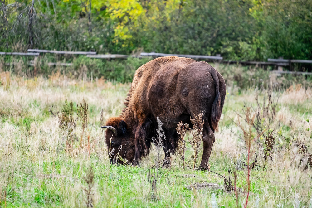
Bison at Theodore Roosevelt National Park, North DakotaBison at Theodore Roosevelt National Park, North DakotaBison at Theodore Roosevelt National Park, North Dakota
Our visit could have been longer had we gotten there earlier or if the weather had been better, but it was longer than we intended, and that is a testament to being open to change and flexible in our plans. It was a worthwhile detour, for sure!
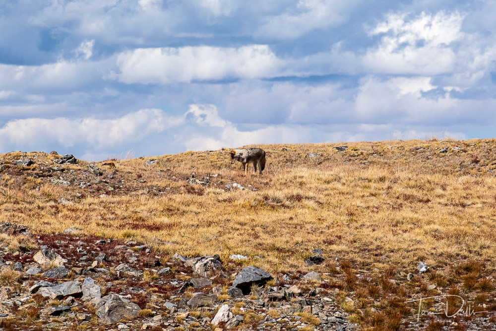
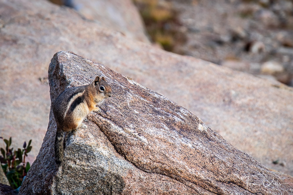
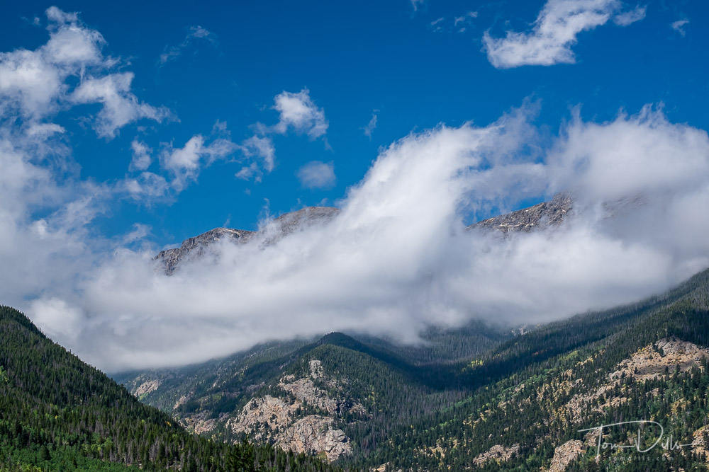
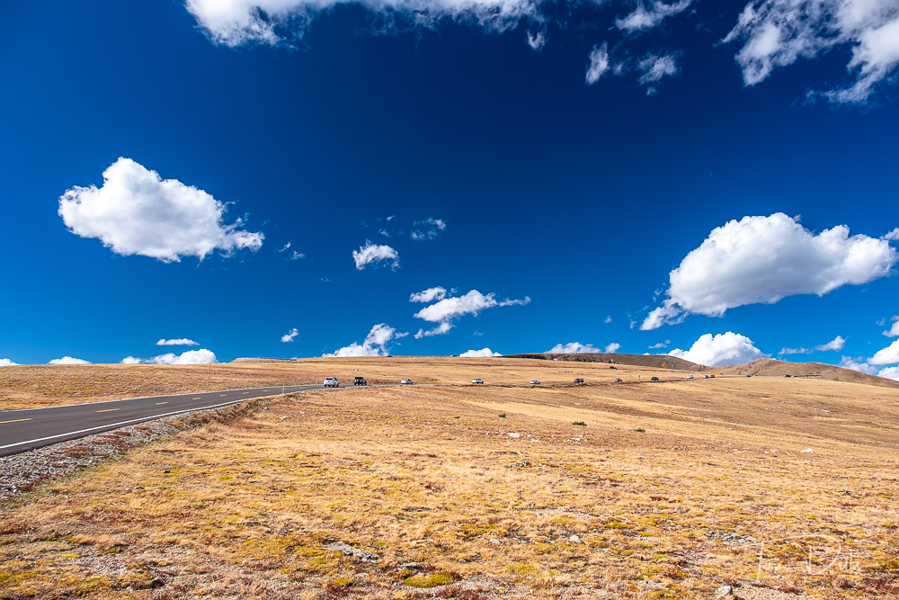
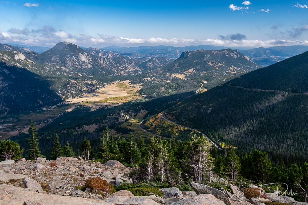
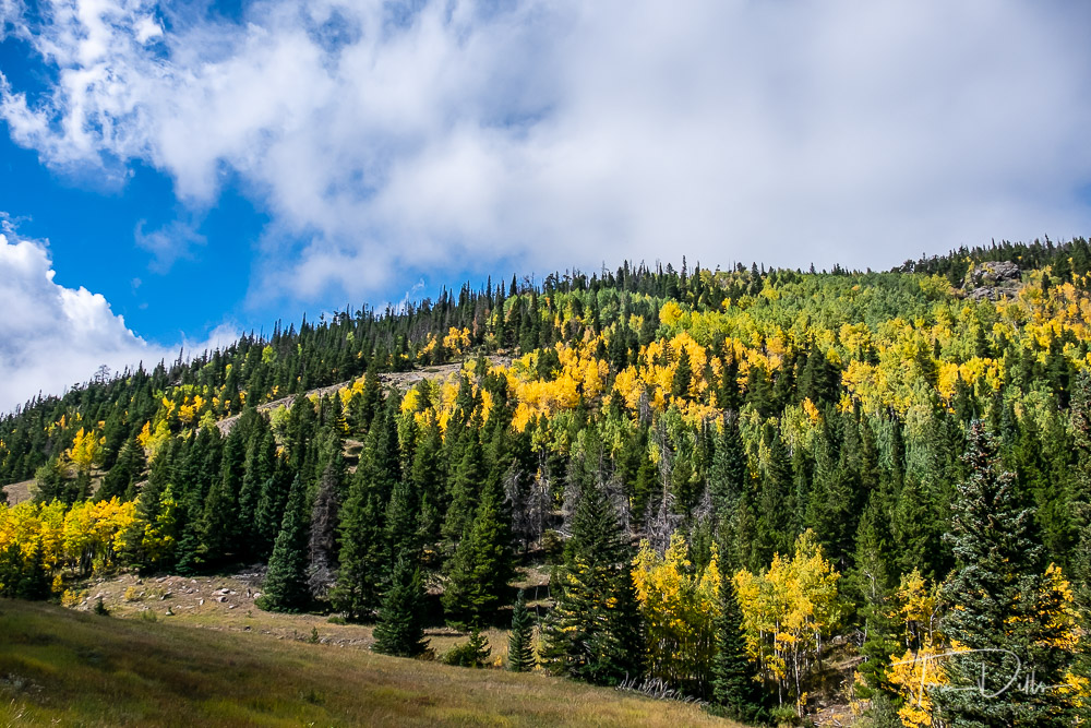
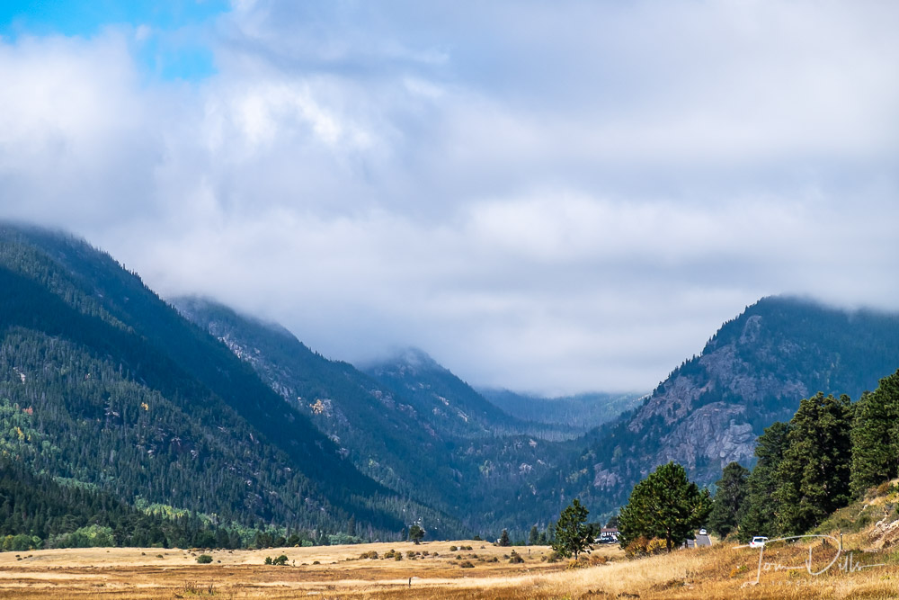
Trail Ridge Road in Rocky Mountains National Park, Colorado
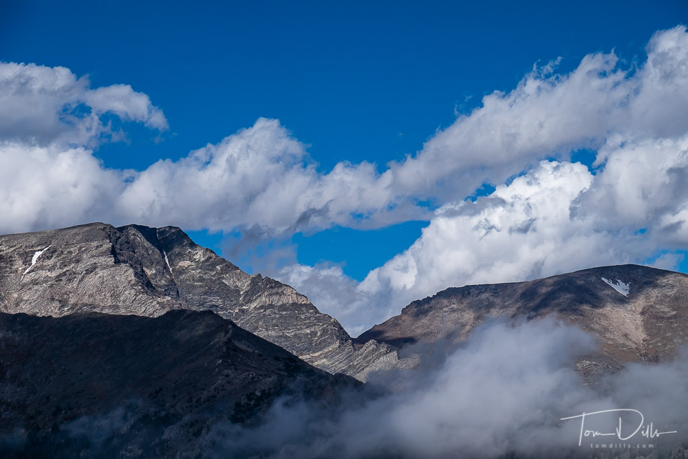
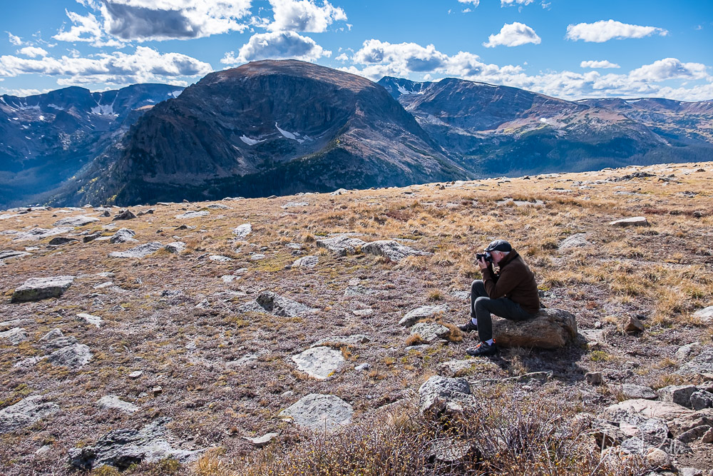
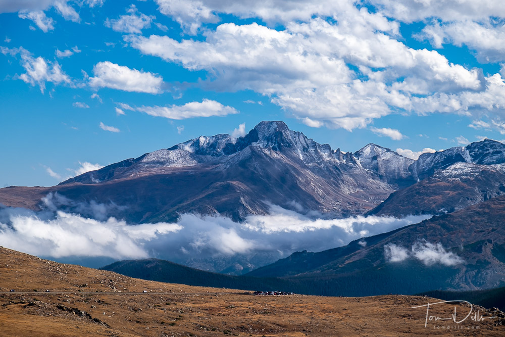
I sent a postcard earlier but have now processed a few of my photos from our visit to RMNP. We were only there for a day, it was a Saturday, happened to be a free admission day and the colors were starting to get good. So we were a little “over-peopled” but had a great time regardless. As much as I love our Smoky Mountains, there is something about this vast Colorado landscape that keeps calling me back. That, and a chance to hang with our good buddy Monte! 😉
Trail Ridge Road in Rocky Mountains National Park, ColoradoLongs Peak from Trail Ridge Road in Rocky Mountains National Park, ColoradoElk along Trail Ridge Road in Rocky Mountains National Park, ColoradoCoyote along Trail Ridge Road in Rocky Mountains National Park, ColoradoTrail Ridge Road in Rocky Mountains National Park, ColoradoTrail Ridge Road in Rocky Mountains National Park, ColoradoTrail Ridge Road in Rocky Mountains National Park, ColoradoTrail Ridge Road in Rocky Mountains National Park, ColoradoTrail Ridge Road in Rocky Mountains National Park, ColoradoTrail Ridge Road in Rocky Mountains National Park, ColoradoTrail Ridge Road in Rocky Mountains National Park, ColoradoTrail Ridge Road in Rocky Mountains National Park, ColoradoTrail Ridge Road in Rocky Mountains National Park, Colorado