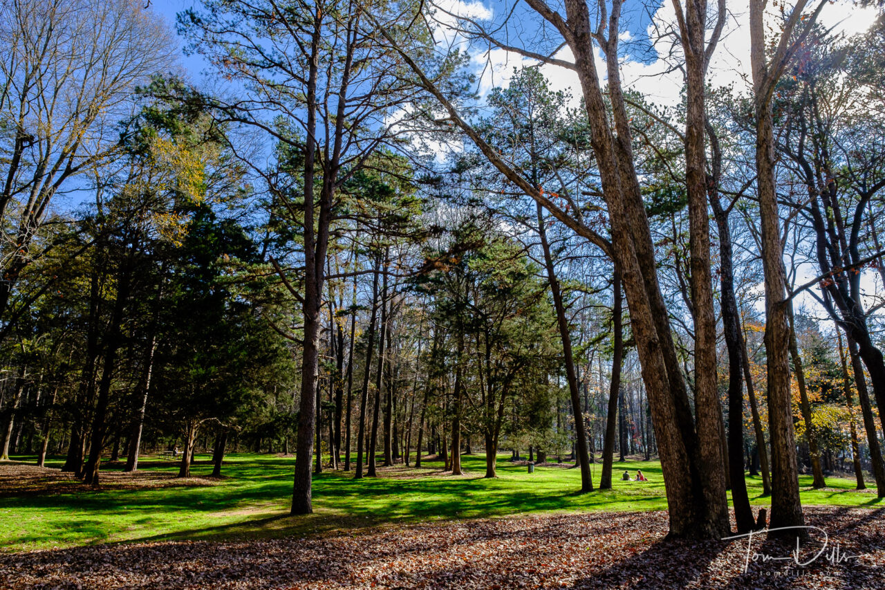
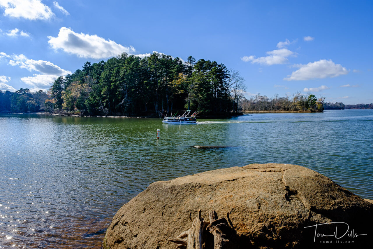
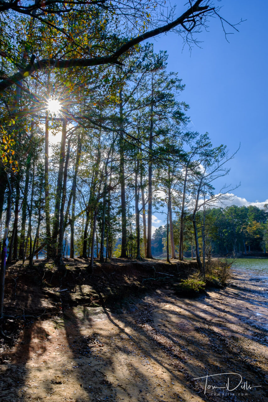
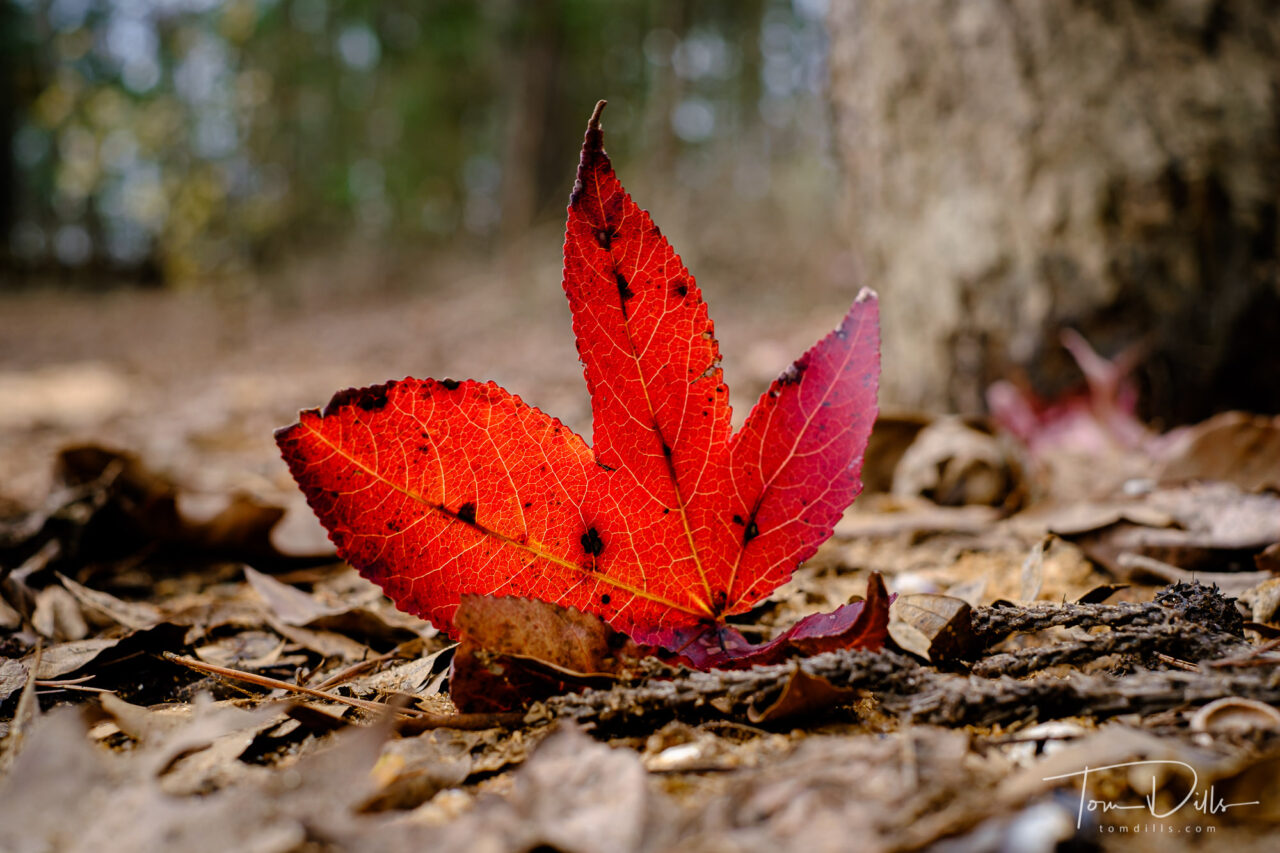
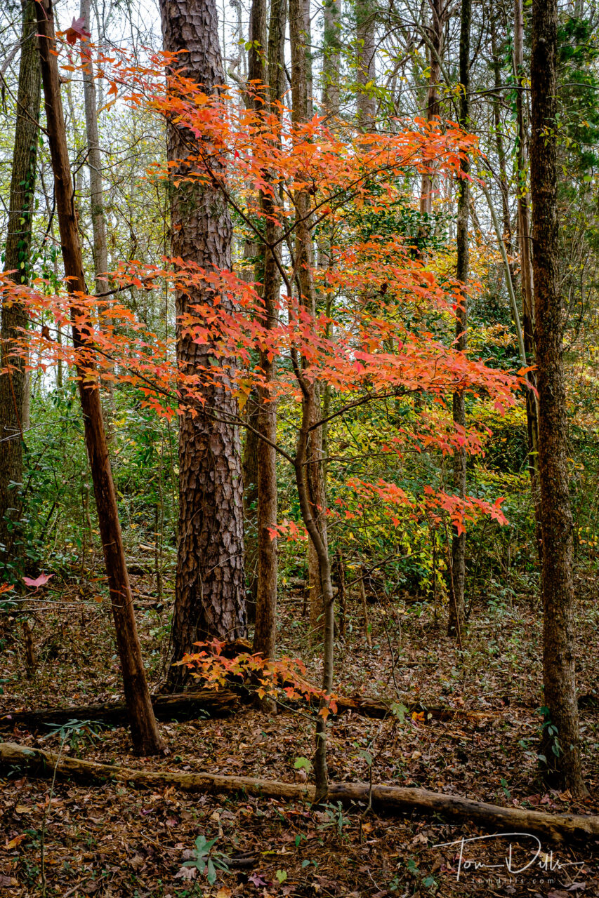
Late fall afternoon at Latta Nature Preserve near Huntersville, North Carolina
Kirk Tuck recently posted about how (paraphrasing) walking around town with a camera taking random pictures of interesting things is “almost like playing scales on the piano.” As a reformed musician that’s a reference I understand. Practicing technique is what allows us to nail the performance.
Late fall afternoon at Latta Nature Preserve near Huntersville, North CarolinaLate fall afternoon at Latta Nature Preserve near Huntersville, North CarolinaLate fall afternoon at Latta Nature Preserve near Huntersville, North Carolina
One of my recurring dreams involves being invited – and accepting – to perform some kind of solo concert. I haven’t touched my trombones – although I still have them – in nearly 30 years but when the day comes for me to play the dream ends. There’s probably some important symbolism there but I won’t try to analyze.
Late fall afternoon at Latta Nature Preserve near Huntersville, North CarolinaLate fall afternoon at Latta Nature Preserve near Huntersville, North Carolina
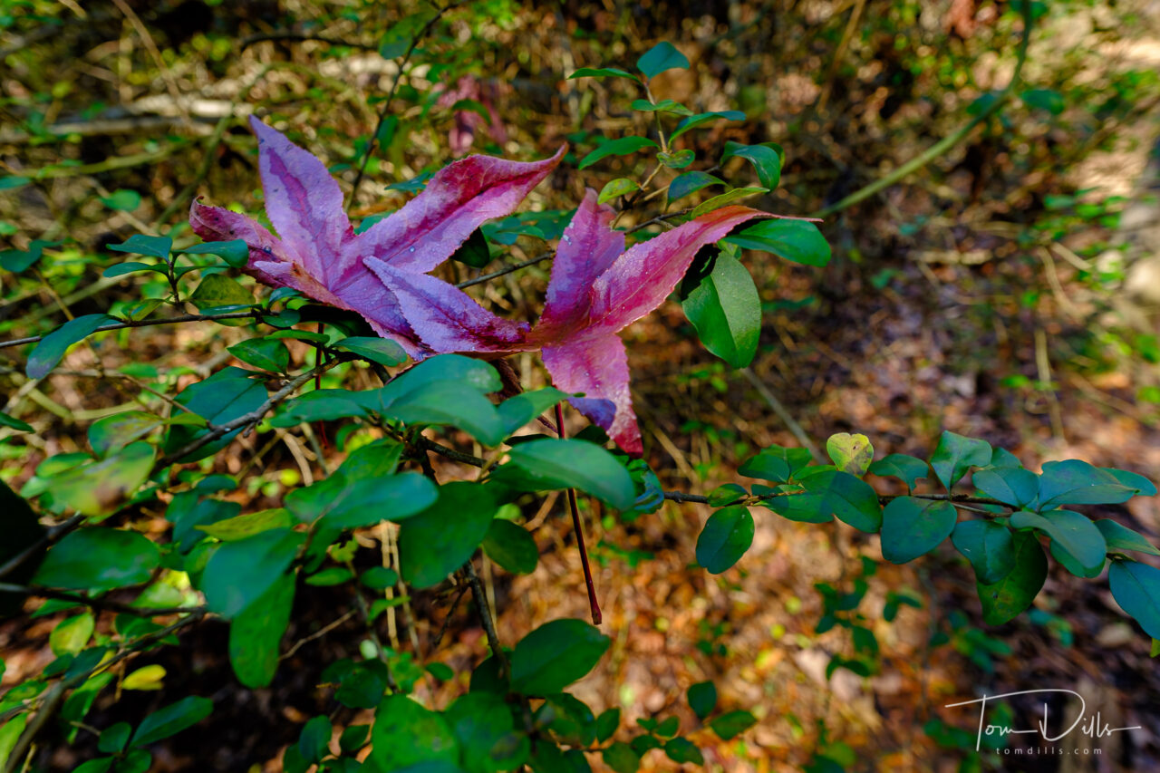
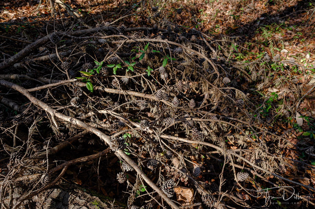
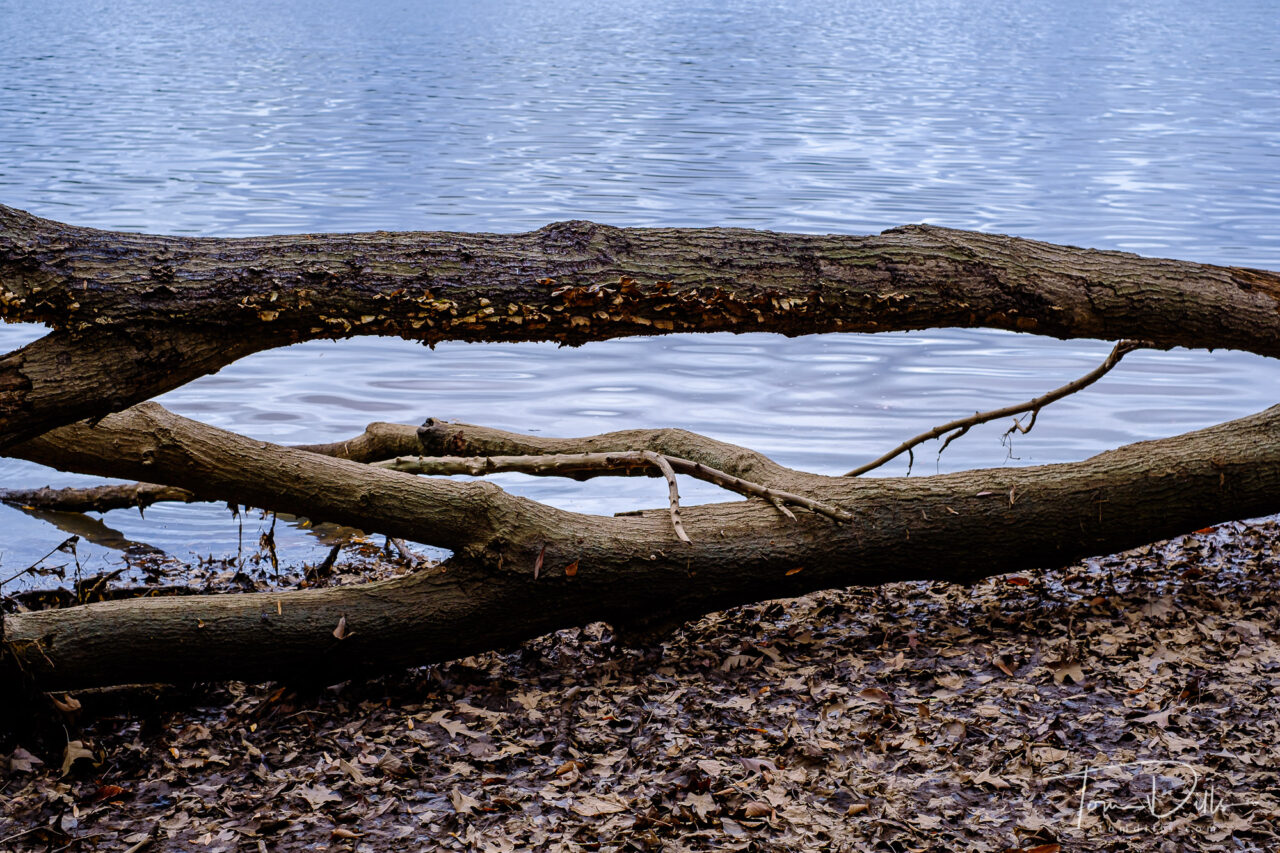
“Winter” or what we know as winter took this past weekend off, so Kathy & I took advantage of the 70 degree temperatures to enjoy the day at Latta Nature Preserve. I took my camera, of course, and took a few photos. To make it a little harder I took only my widest prime lens – the 14mm f2.8 (21mm full-frame equivalent). I don’t shoot a lot with wide angle lenses and it tends to show. While I didn’t come back with anything truly exceptional the idea of practice was my intention. Kathy helps me by seeing things she sees and giving me an “assignment” like the photos of purple leaves and the fallen branches with pine cones below. Now I have a name for the concept – practicing my scales.
Late fall afternoon at Latta Nature Preserve near Huntersville, North CarolinaLate fall afternoon at Latta Nature Preserve near Huntersville, North CarolinaLate fall afternoon at Latta Nature Preserve near Huntersville, North CarolinaLate fall afternoon at Latta Nature Preserve near Huntersville, North Carolina
I was originally planning to title this post “There Is No Vaccine.” But I decided that would be uncharacteristically (and unnecessarily) pessimistic. Why was I thinking that way?
Remember when we used to be able to go to concerts? We would get in line at 6am or earlier for tickets to see Elvis, Springsteen or Taylor Swift (not me!) that went on sale at 10am, only to find out at 10:01 that they sold out online? I’m afraid the vaccine is going to be something like that. Oh, we’ll probably be able to get it eventually, but in the meantime, we can listen to our favorite music on Spotify. In other words, it’s going to be a long wait.
The New York Times has a tool on their website that allows us to estimate when we might have a chance to get the vaccine. Based on my age, location and lack of underlying conditions, my estimated place in line is 268.7 million out of 331 million in the country, 8.5 million out of 10.5 million in the state, and 885,900 out of 1,127,080 in the county.
There are plenty of people out there that need it more than me, and I’m happy for them to have priority. Truthfully, I don’t like to be an “early adopter” on anything for pretty obvious reasons. It’s just frustrating that it is going to be such a slow process for everyone.
I don’t have a lot of faith in our ability to distribute a vaccine efficiently anyway, and since the Powers That Be apparently forfeited a chance to order enough for everyone in the first installment, it sounds like it’s gonna be a while. Since each person has to get 2 doses the initial 100 million doses will only vaccinate 50 million people. Out of 330 million! At this point the Pfizer vaccine is the only hope, and while the Moderna vaccine is evidently in the approval pipeline, no one seems to be saying when that will be approved. The downside of having a surplus of vaccine is what? We get to give it to countries that need it?
While we’re all waiting anxiously to be “saved” by a vaccine, for now I’m just telling myself that there isn’t one. That way, when we finally do get one we can be pleasantly surprised.
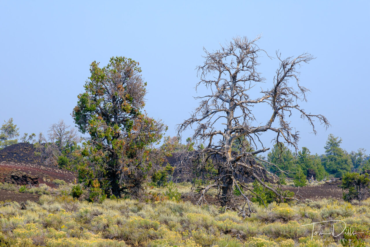
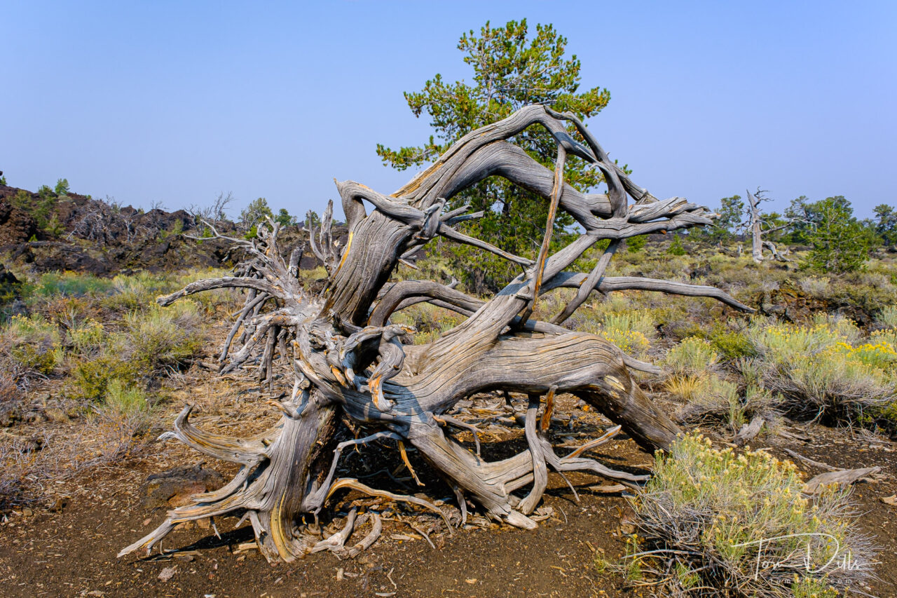
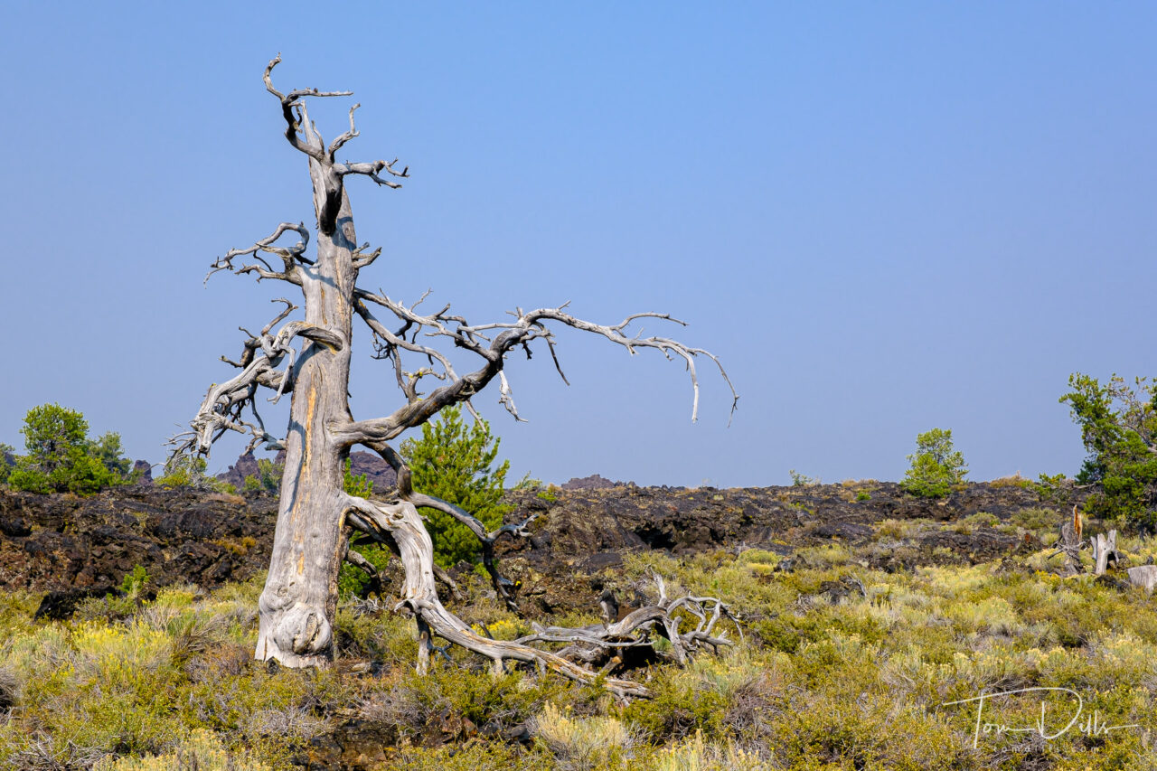
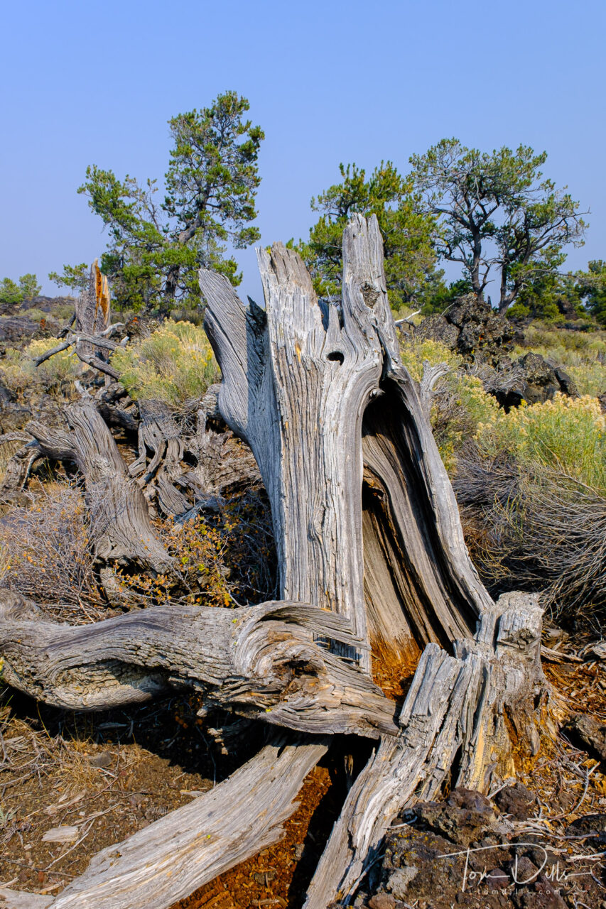
Craters of the Moon National Monument and Preserve near Arco, Idaho
Craters of the Moon National Monument and Preserve near Arco, Idaho
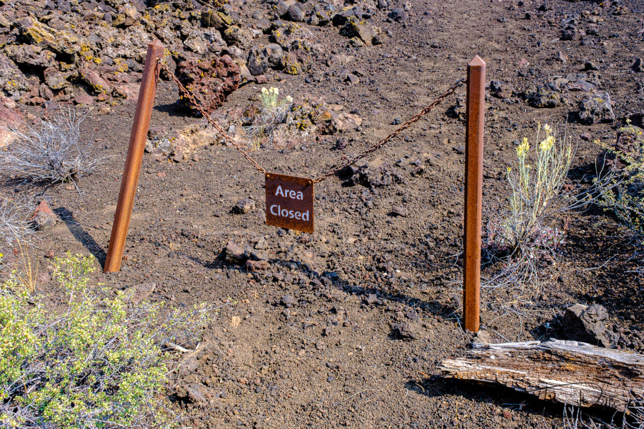
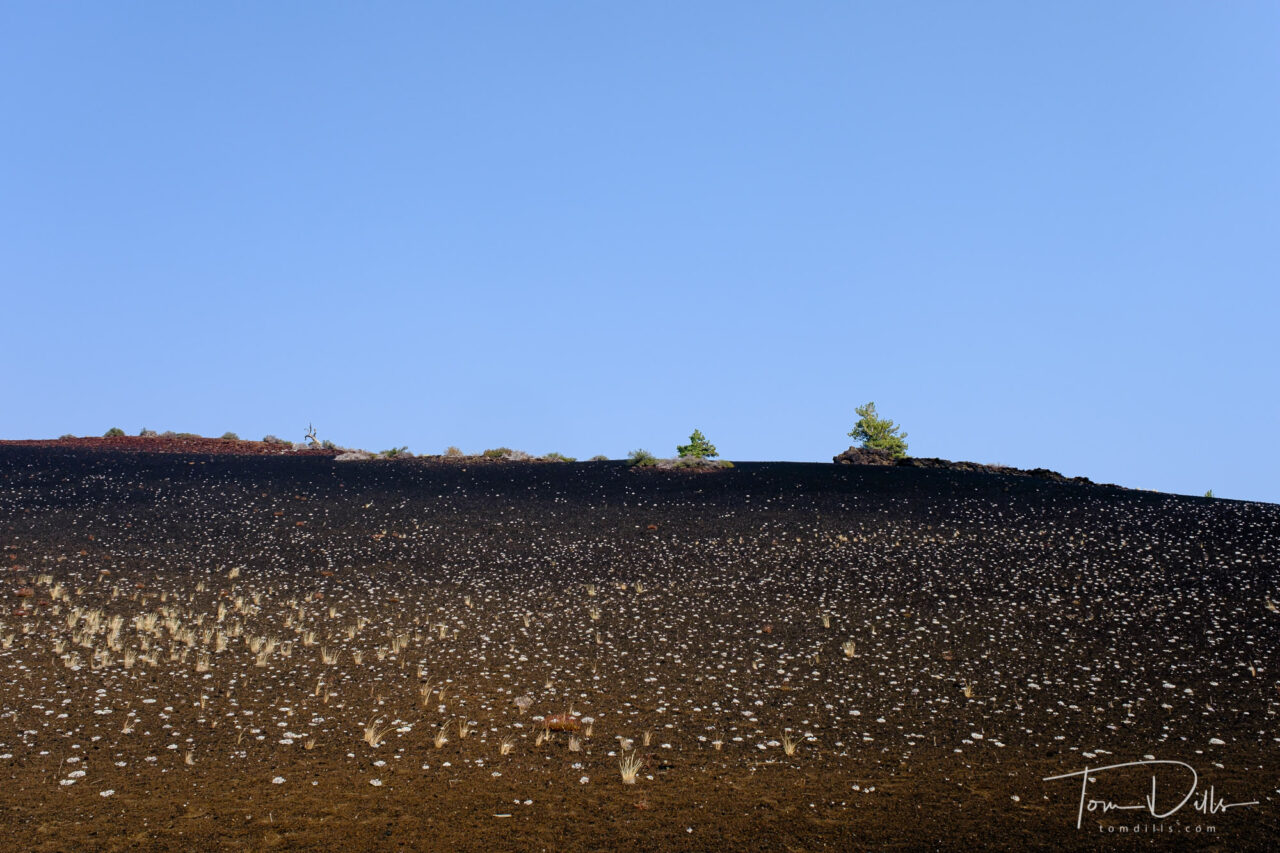
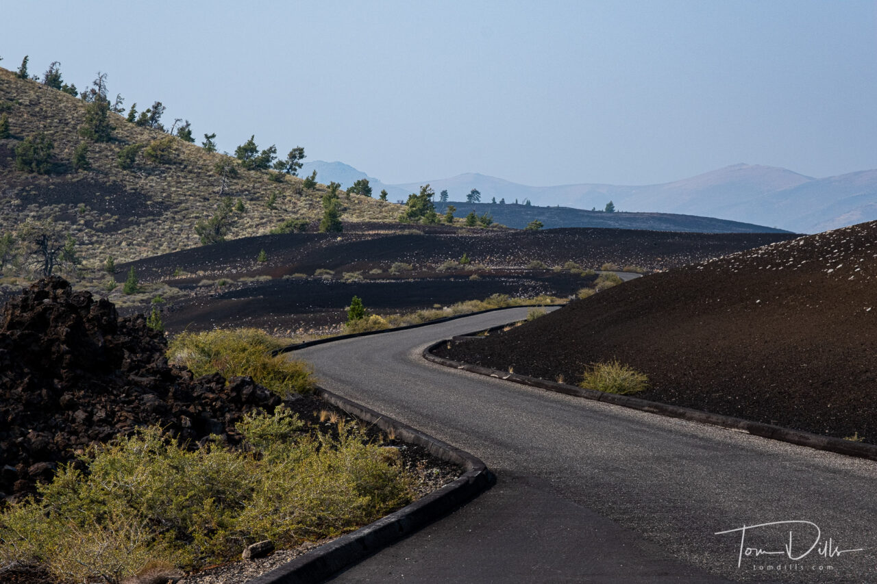
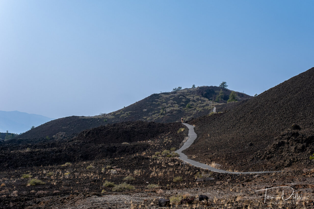
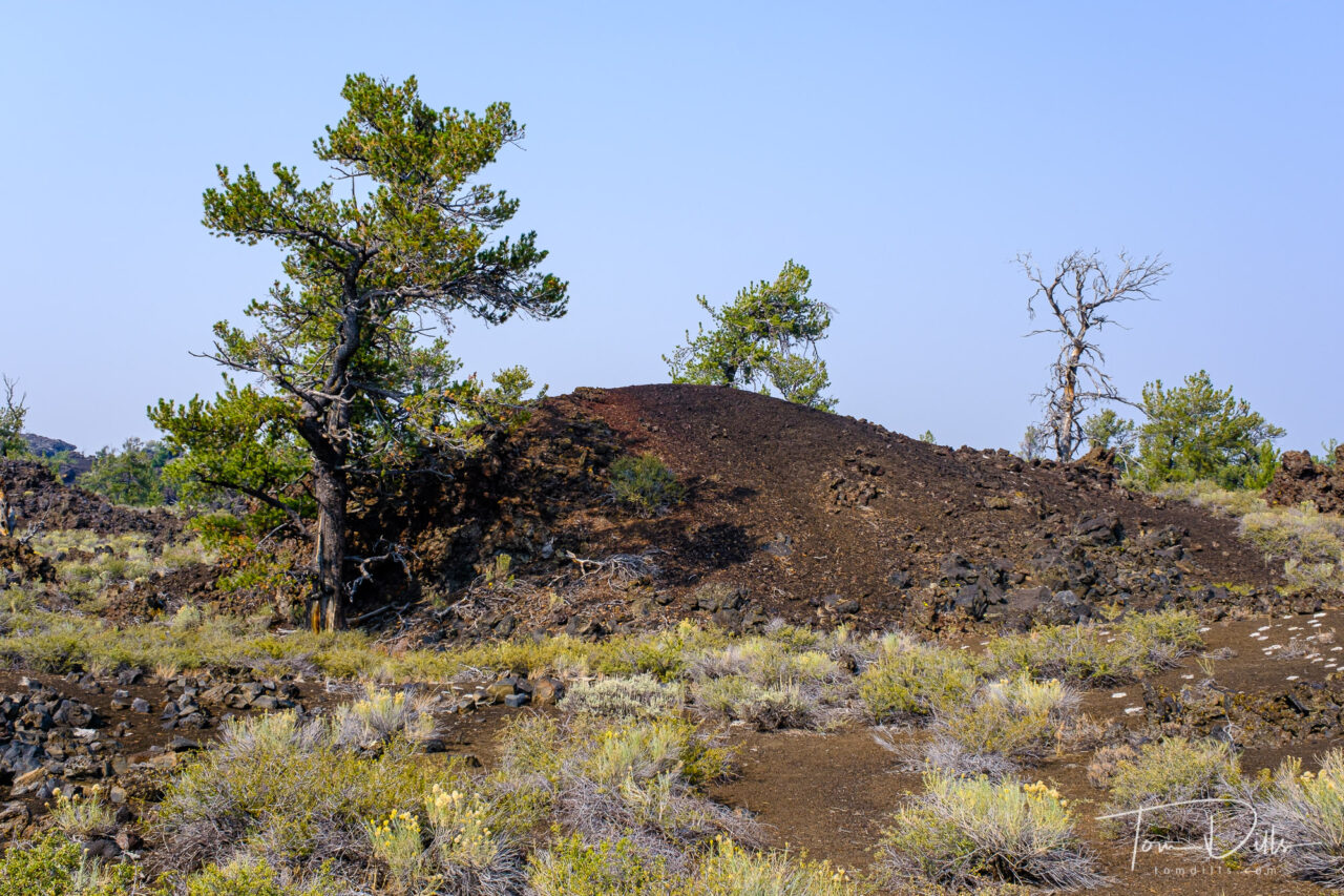
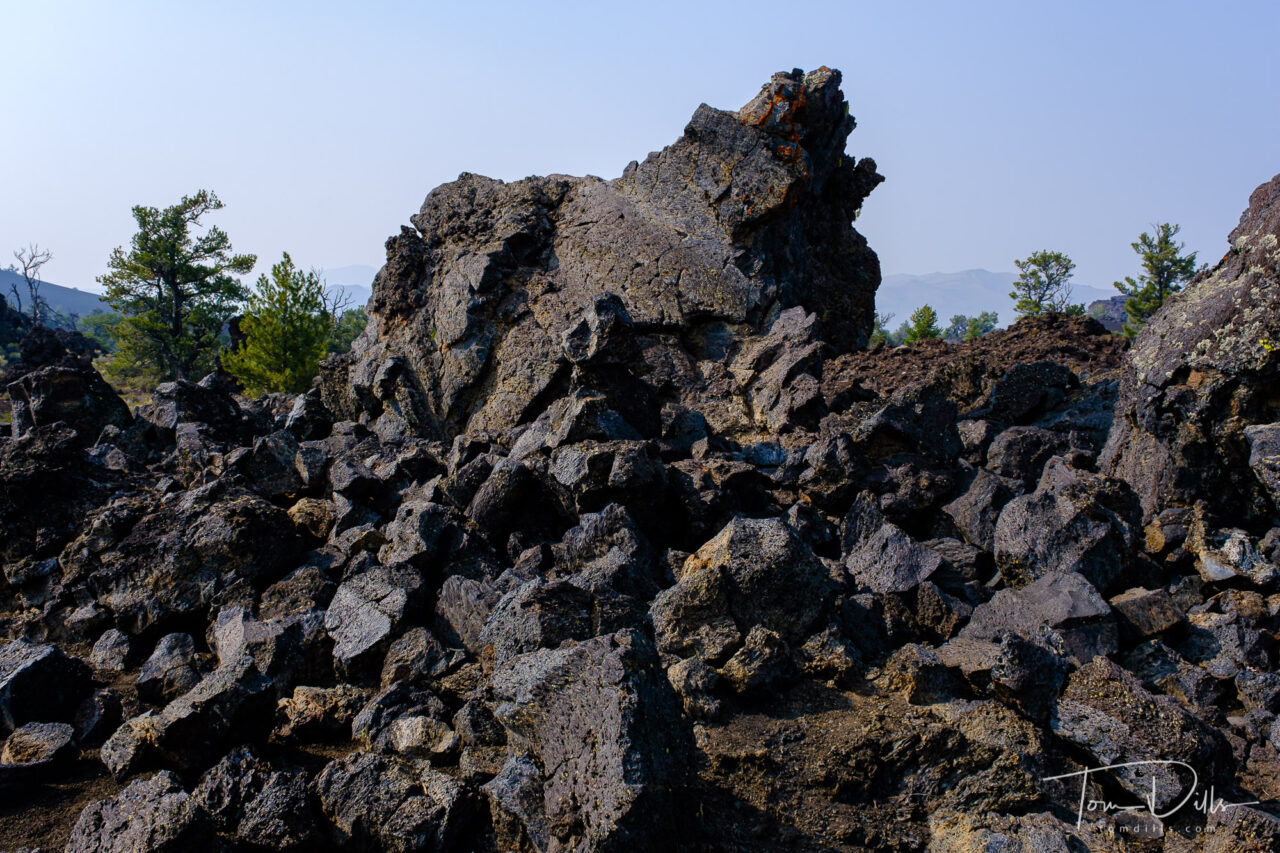
I wasn’t sure what to expect from our visit to Craters of the Moon National Monument in southern Idaho, but I could never have imagined what we saw there. The landscape is covered with fields of lava, from smooth lava domes to fields covered with huge chunks of lava rocks. We didn’t venture too far from the road, but there was plenty to see from just the overlooks.
Craters of the Moon National Monument and Preserve near Arco, IdahoCraters of the Moon National Monument and Preserve near Arco, IdahoCraters of the Moon National Monument and Preserve near Arco, IdahoCraters of the Moon National Monument and Preserve near Arco, Idaho
Craters of the Moon National Monument and Preserve is a U.S. national monument and national preserve in the Snake River Plain in central Idaho. It is along US 20 (concurrent with US 93 and US 26), between the small towns of Arco and Carey, at an average elevation of 5,900 feet (1,800 m) above sea level. The protected area’s features are volcanic and represent one of the best-preserved flood basalt areas in the continental United States.
The Monument was established on May 2, 1924. In November 2000, a presidential proclamation by President Clinton greatly expanded the Monument area. The 410,000-acre National Park Service portions of the expanded Monument were designated as Craters of the Moon National Preserve in August 2002. It spreads across Blaine, Butte, Lincoln, Minidoka, and Power counties. The area is managed cooperatively by the National Park Service and the Bureau of Land Management (BLM).
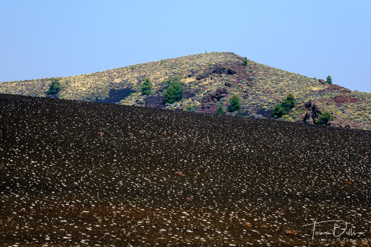
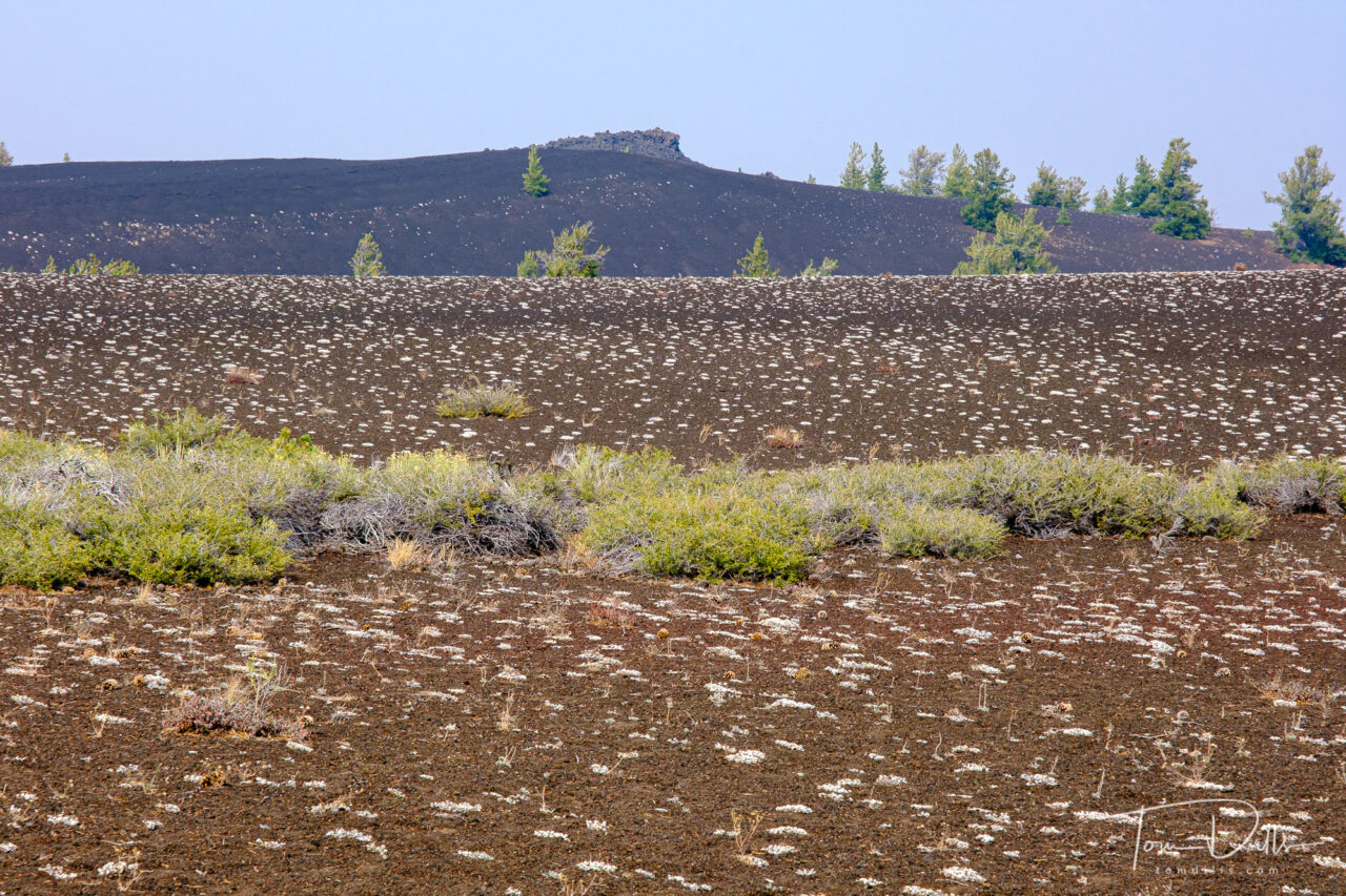
The Monument and Preserve encompass three major lava fields and about 400 square miles of sagebrush steppe grasslands to cover a total area of 1,117 square miles. The Monument alone covers 343,000 acres. All three lava fields lie along the Great Rift of Idaho, with some of the best examples of open rift cracks in the world, including the deepest known on Earth at 800 feet. There are excellent examples of almost every variety of basaltic lava, as well as tree molds (cavities left by lava-incinerated trees), lava tubes (a type of cave), and many other volcanic features.
Craters of the Moon National Monument and Preserve near Arco, IdahoCraters of the Moon National Monument and Preserve near Arco, IdahoCraters of the Moon National Monument and Preserve near Arco, IdahoCraters of the Moon National Monument and Preserve near Arco, Idaho
We had a crystal-clear blue sky on the day of our visit, with very little of the haze and smoke that we encountered in Oregon. It made for some challenging photography, although the blue sky is an interested contrast to the dark and mostly colorless lava.
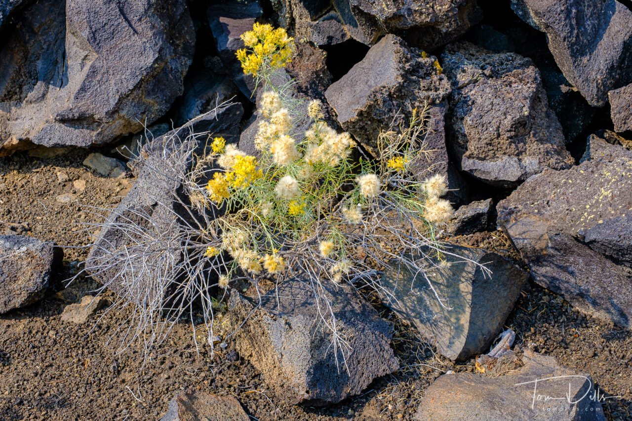
There were several places where there was little or no vegetation, and other places where the ground was covered with various plants growing up from holes and cracks in the lava that had captured more fertile soil over time. Many of the trees are dead, starved of moisture from the overall arid conditions and the inability of the porous lava to hold water. A number of fields were covered in what appeared to be small white flowers, which are in fact small clusters of a form of lichen that grows there.
Craters of the Moon National Monument and Preserve near Arco, IdahoCraters of the Moon National Monument and Preserve near Arco, IdahoCraters of the Moon National Monument and Preserve near Arco, Idaho
One point of interest is that when I went out to the NPS website for the park, the Current Conditions indicates that the loop road is currently “closed due to snow and ice!” We actually saw some ice in the bottom of some of the lava holes, but up on the surface it was very warm.
I’d heartily recommend Craters of the Moon to anyone looking for an interesting diversion from the usual. It isn’t far from Yellowstone and other western parks, and while it was pretty busy on the day of our visit, we encountered very few people up close.
As I’ve been doing, I have added a photo gallery on my Adobe Portfolio website with more photos for anyone who is interested.
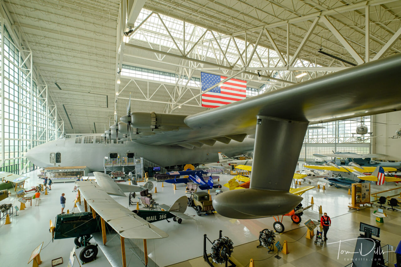
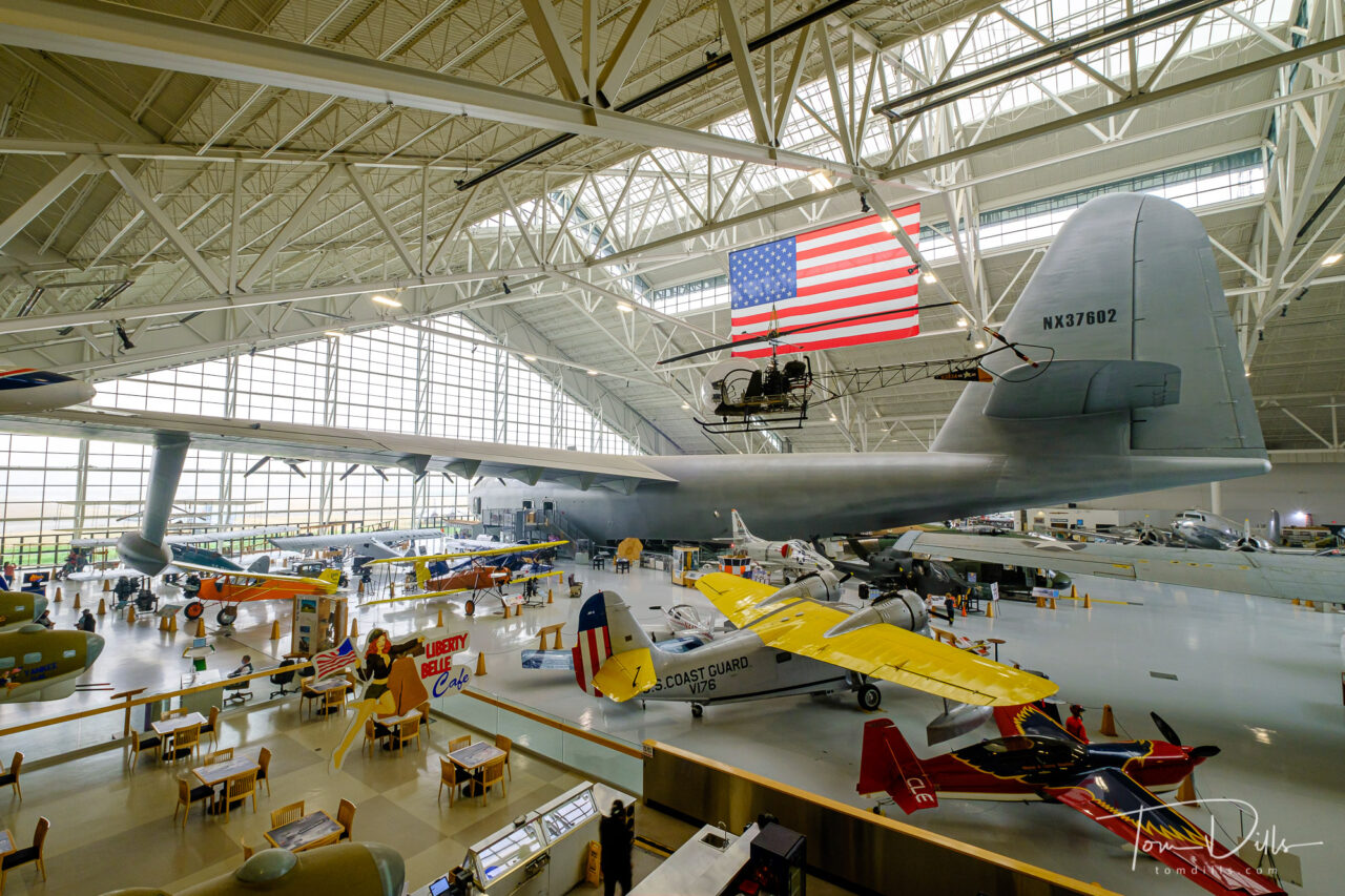
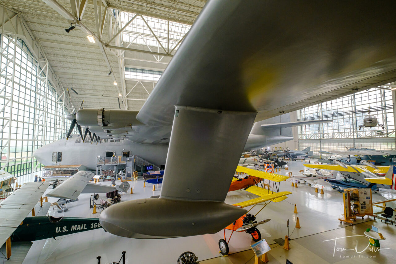
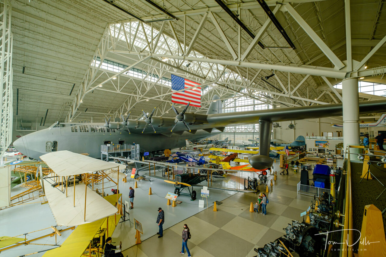
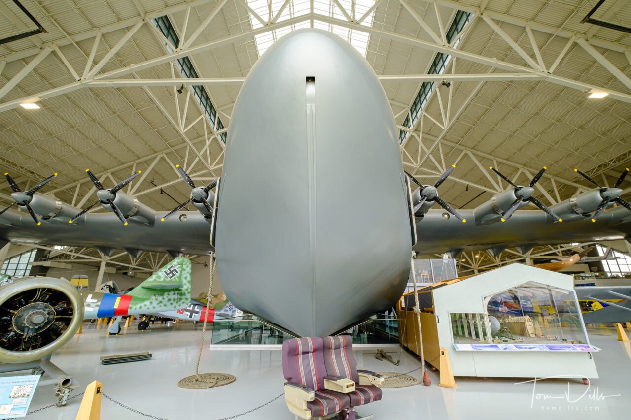
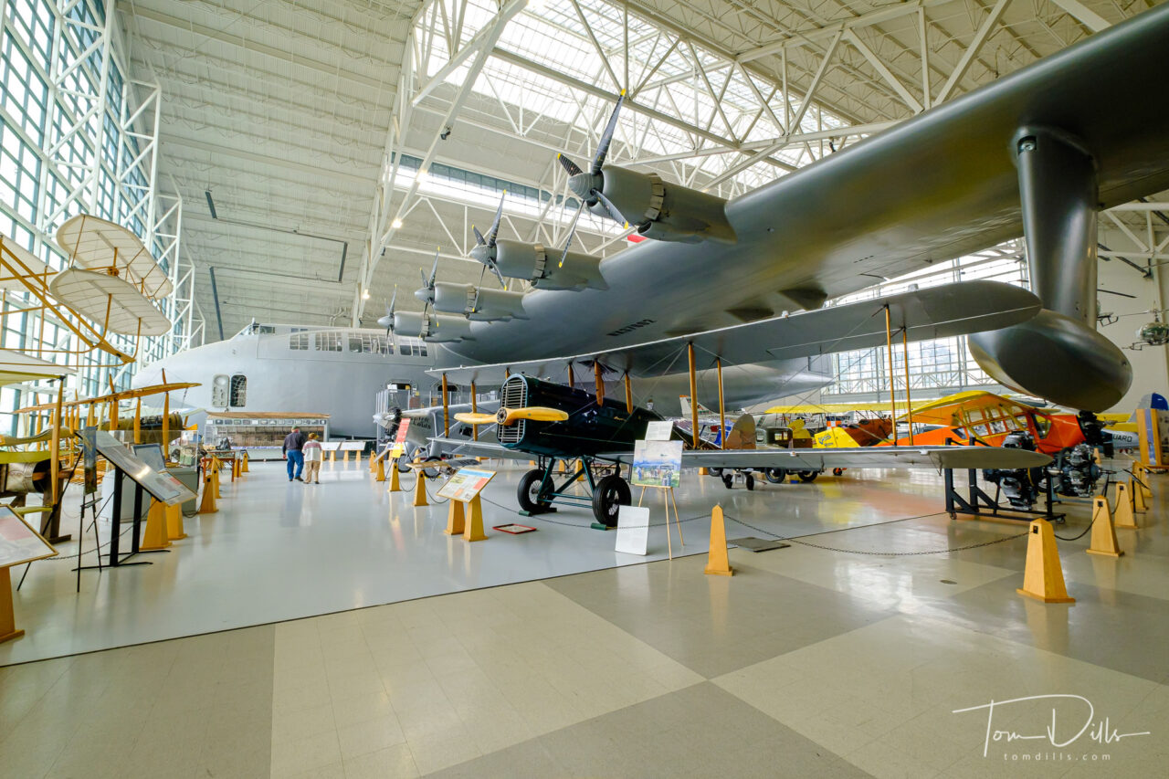
Howard Hughes’ “Spruce Goose” at the Evergreen Aviation & Space Museum in McMinnville, Oregon
Ever since I was a kid interested in airplanes, I remember reading about and seeing photos of Howard Hughes’ “Spruce Goose.” Officially known as the Hughes H-4 Hercules, the Spruce Goose was – at the time and for a while after – the largest aircraft to ever fly. The Wikipedia Page for the plane is a rabbit hole of more information for anyone wishing to delve deeper. After many stops on a long journey, the current home for the plane is the Evergreen Aviation and Space Museum in McMinnville, Oregon.
Howard Hughes’ “Spruce Goose” at the Evergreen Aviation & Space Museum in McMinnville, OregonHoward Hughes’ “Spruce Goose” at the Evergreen Aviation & Space Museum in McMinnville, OregonHoward Hughes’ “Spruce Goose” at the Evergreen Aviation & Space Museum in McMinnville, OregonHoward Hughes’ “Spruce Goose” at the Evergreen Aviation & Space Museum in McMinnville, Oregon
I didn’t realize that the Spruce Goose was in Oregon when we started making plans, but I came across a reference to it during our research. When I found out that we would be very close to McMinnville, a town in the heart of Oregon’s Willamette Valley wine region, stopping there was a no-brainer. Except…the museum had been closed during Oregon’s response to the Covid virus. Fortunately the conditions had improved enough for Oregon to allow museums to re-open shortly before we left home on our trip. Good timing – the state has recently re-entered a lockdown phase the the museum has closed again.
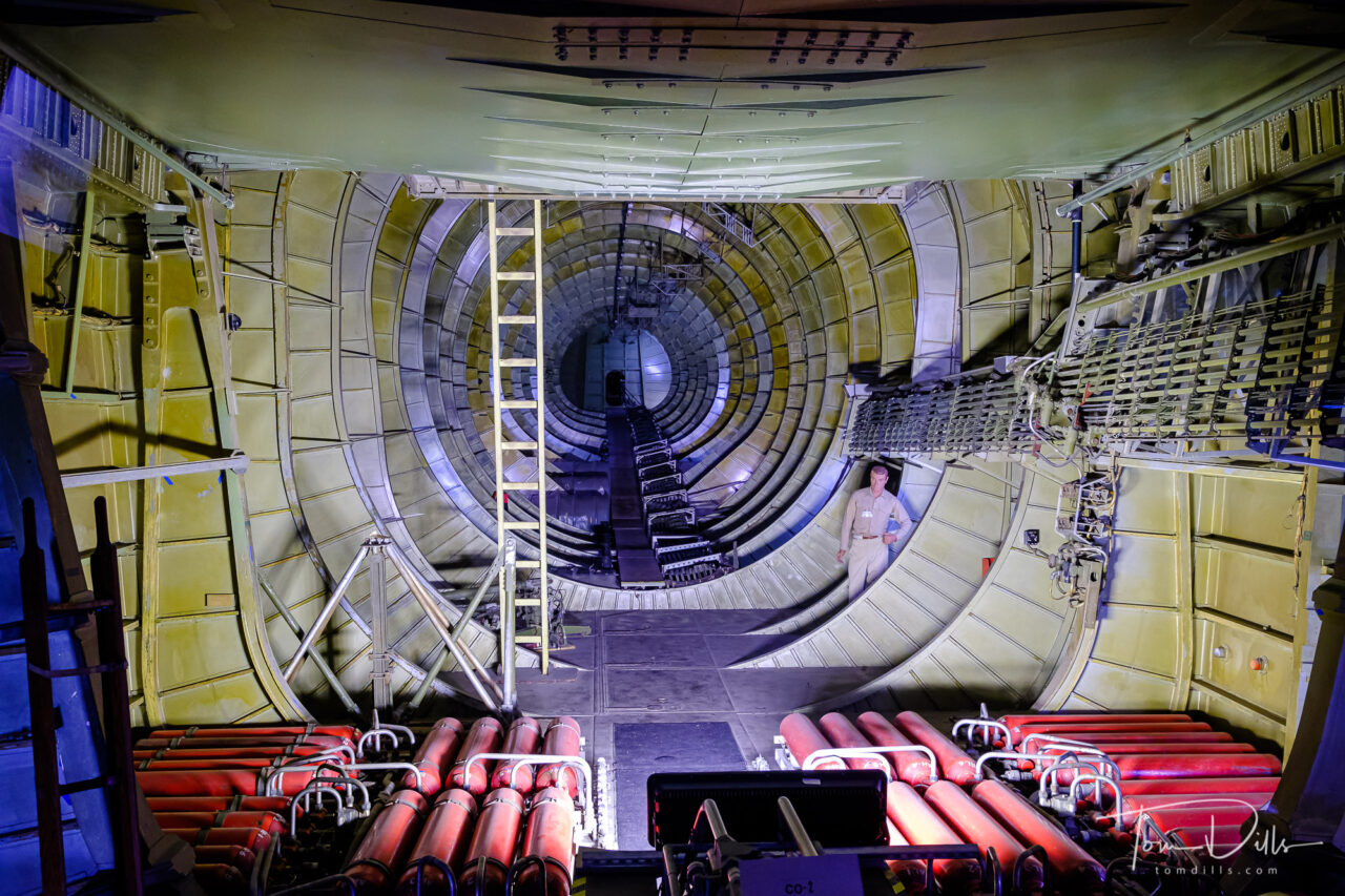
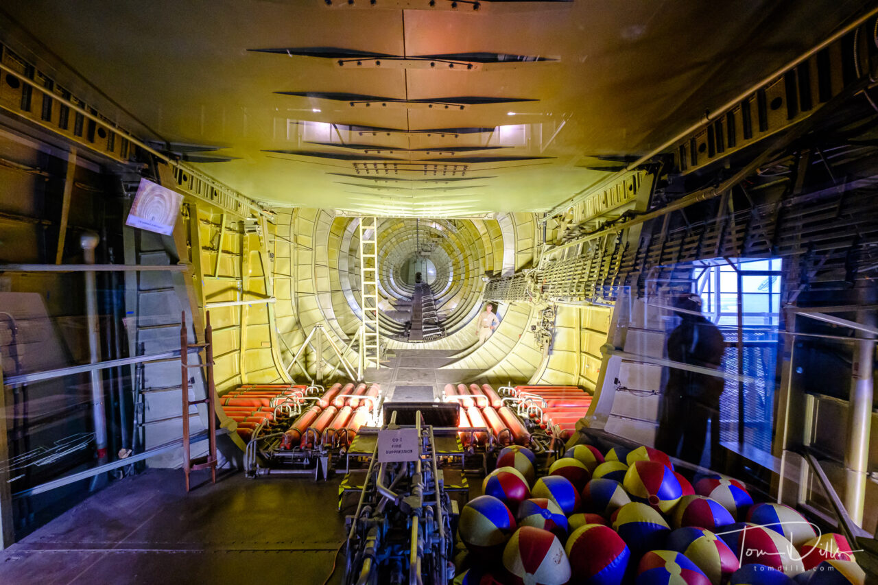
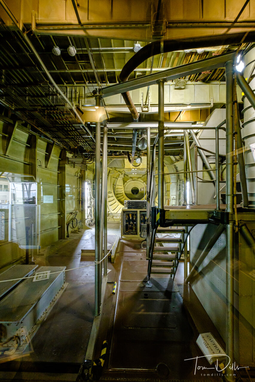
Cargo bay of Howard Hughes’ “Spruce Goose” at the Evergreen Aviation & Space Museum in McMinnville, OregonCargo bay of Howard Hughes’ “Spruce Goose” at the Evergreen Aviation & Space Museum in McMinnville, OregonCargo bay of Howard Hughes’ “Spruce Goose” at the Evergreen Aviation & Space Museum in McMinnville, Oregon
As you can see from the photos, the plane is simply enormous, dwarfing all of the other aircraft in the museum. For even more geekery, check out this article discussing the various calculations of “largest aircraft” along with a size comparison.
Howard Hughes’ “Spruce Goose” at the Evergreen Aviation & Space Museum in McMinnville, OregonHoward Hughes’ “Spruce Goose” at the Evergreen Aviation & Space Museum in McMinnville, OregonHoward Hughes’ “Spruce Goose” at the Evergreen Aviation & Space Museum in McMinnville, OregonHoward Hughes’ “Spruce Goose” at the Evergreen Aviation & Space Museum in McMinnville, Oregon
Seeing the Spruce Goose in person was a real treat. In fact the entire museum is really well done, with two separate buildings – one for aircraft and the other for space related displays. It was especially nice to have a good indoor thing to do, since all that haze you see in the outdoor photos is smoke.
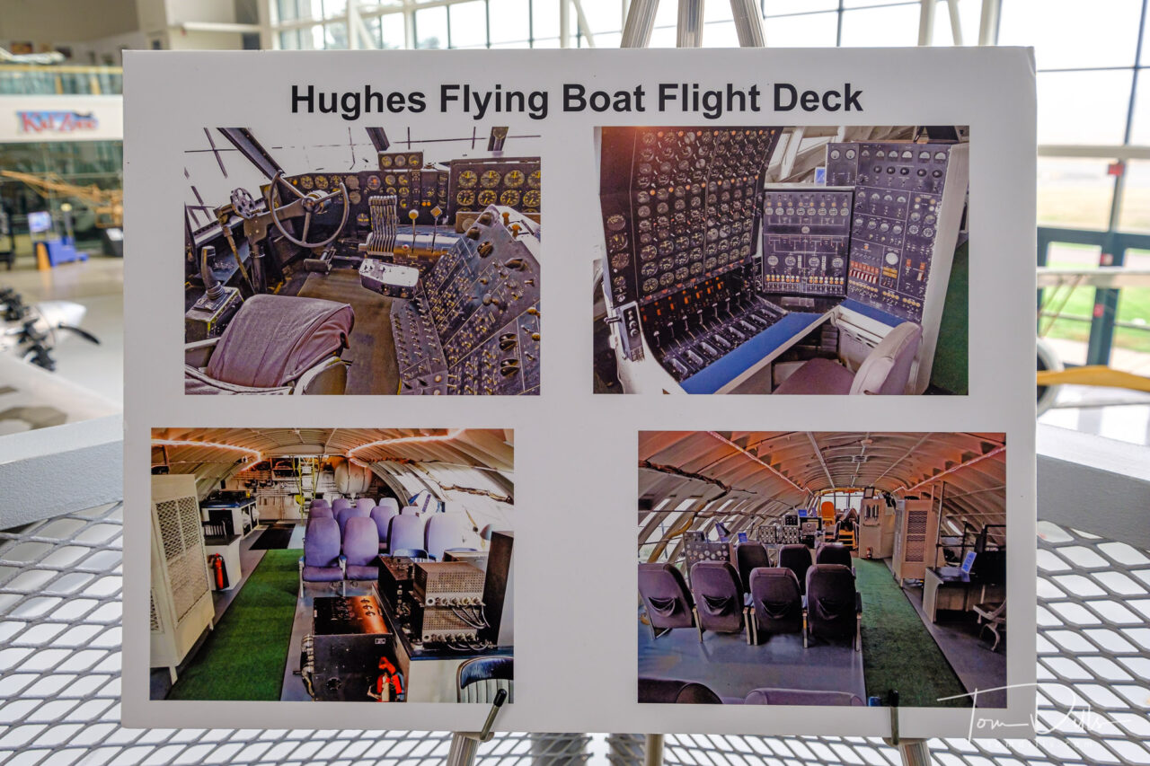
Photos of the flight deck of Howard Hughes’ “Spruce Goose” at the Evergreen Aviation & Space Museum in McMinnville, Oregon
For even more photos from the museum, I’ve created an Adobe Portfolio Page. Check it out!
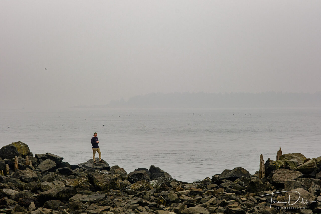
When we left Cannon Beach we headed down the coast, hoping to catch some views of the Pacific Ocean scenery before turning east toward McMinnville, a town in the heart of Oregon’s Willamette Valley wine region. We didn’t get many long-distance views, but we did manage to see some interesting things along the way, including the ferocious prehistoric creature I posted about previously.
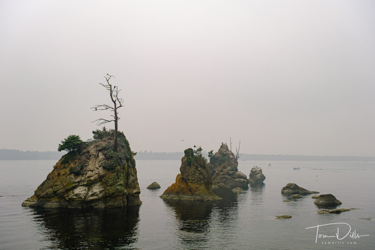
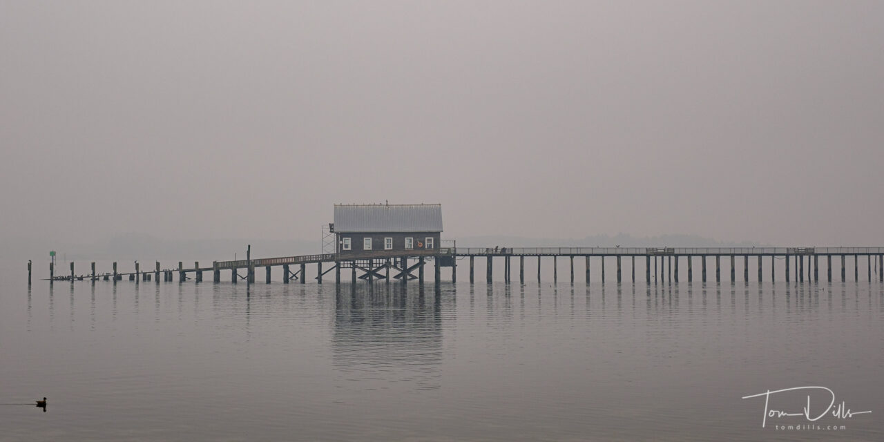
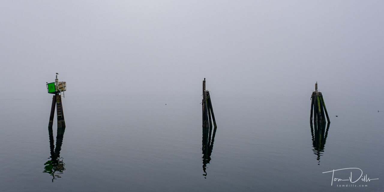
Barview Jetty Park near Rockaway Beach, OregonRock formation known as “The Three Graces” along US-101/Oregon Coast Highway near Garibaldi, Oregon
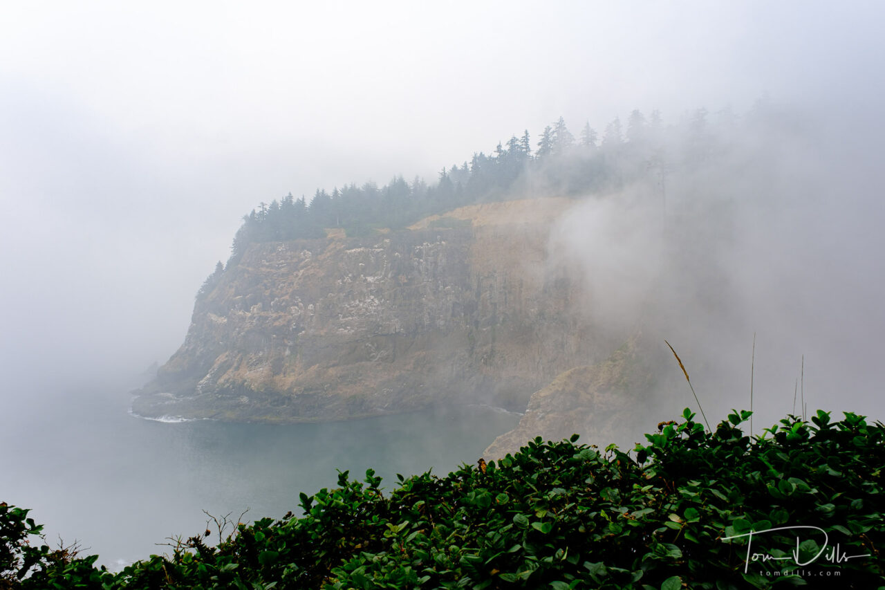
What looks like fog in these photos is a combination of actual fog and smoke from the wildfires farther inland and some drifting north from northern California. Thanks to the magic of white balance adjustment, these look mostly like fog, while the original files have more of an orangey-brown cast to them.
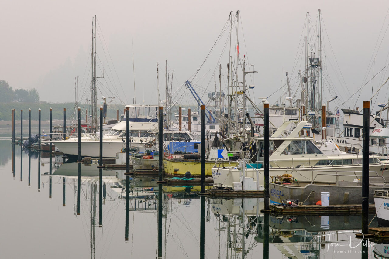
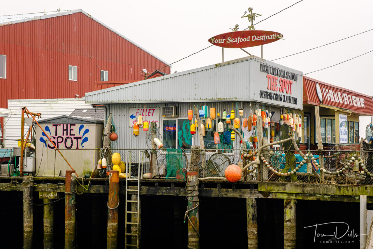
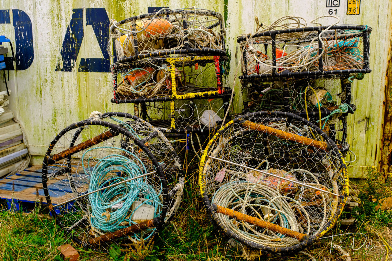
Views of the Port of Garibaldi and Garibaldi Marina in Garibaldi, OregonViews of the Port of Garibaldi and Garibaldi Marina in Garibaldi, OregonViews of the Port of Garibaldi and Garibaldi Marina in Garibaldi, OregonViews of the Port of Garibaldi and Garibaldi Marina in Garibaldi, OregonViews of the Port of Garibaldi and Garibaldi Marina in Garibaldi, Oregon
We spent a bit of time exploring the marina in Garibaldi, a small town of 800~ on Tillamook Bay along US 101. The marina provided us with some visual stimulation, and the addition of the smoke/fog allowed for some interesting photographs. Garibaldi is home to a scenic railway – which was not operating – a maritime history museum, also closed and a US Coast Guard station. It might make for a good destination on a return trip, as there appear to be a number of quaint looking inns nearby!
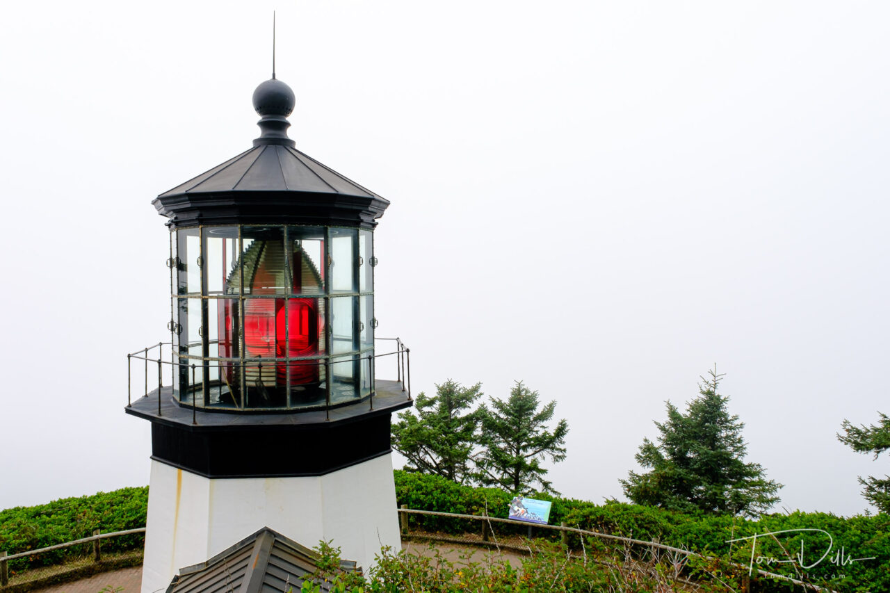
Cape Mears Lighthouse on Cape Mears, OregonFoggy views from Cape Mears, Oregon
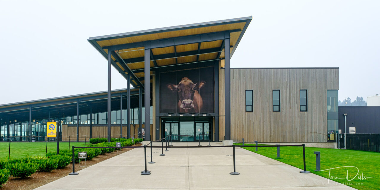
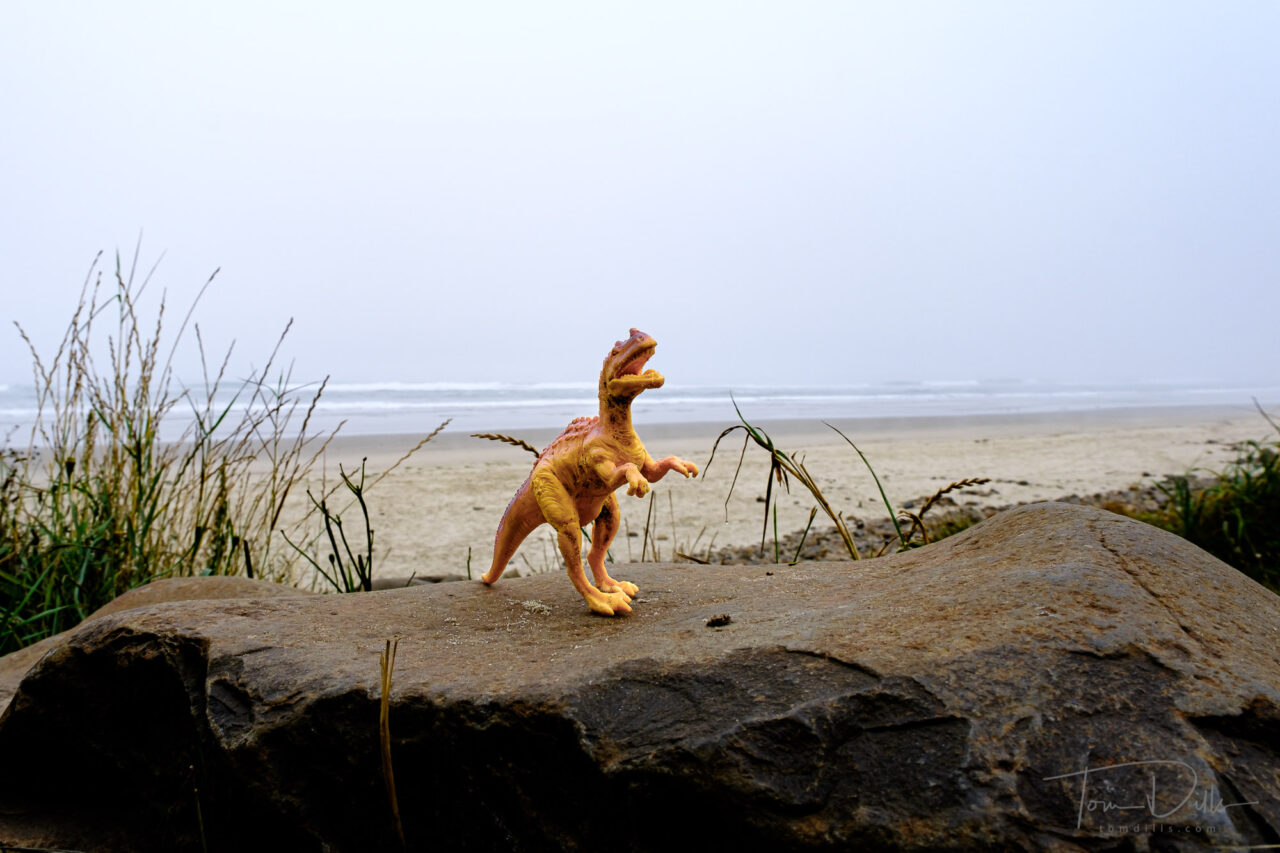
We had hoped to visit the Tillamook Creamery, but it had closed just prior to our arrival due to a combination of the virus and the heavy smoke. So we moved on to Cape Lookout (home of the dinosaur) and Cape Mears to check out the lighthouse before making our way to McMinnville.
Tillamook Cheese Visitor Center (closed) in Tillamook, Oregon
I found this guy on the beach at Cape Lookout State Park near Tillamook, Oregon. No idea what his story was but he looked lost. Maybe I should put his photo on a milk carton. Or a Snapple bottle….
Now that winter has decided to arrive and the temperature has turned colder, I’m starting to get back to the photos from our Northwest road trip. I’ve been shooting more than I’ve been processing, so I’m just a little behind but will eventually get caught up!
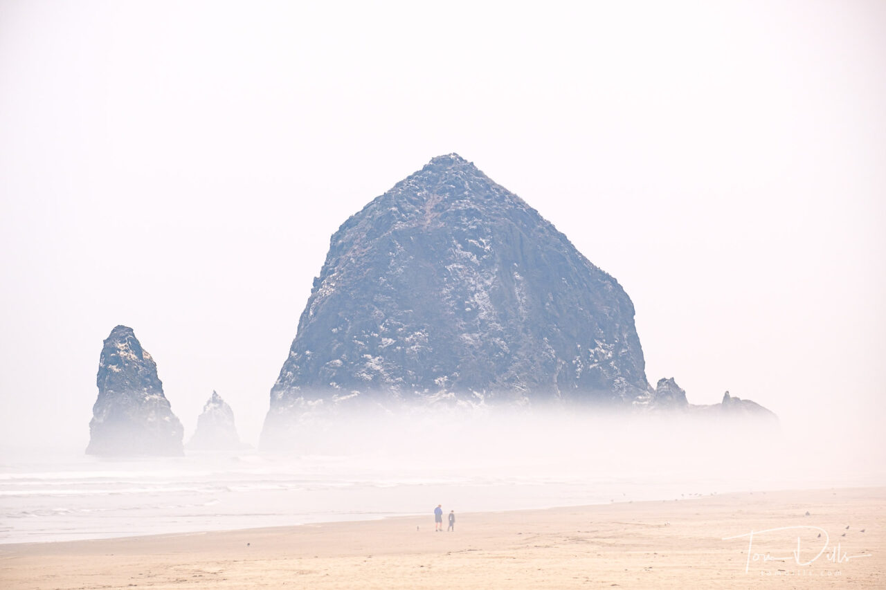
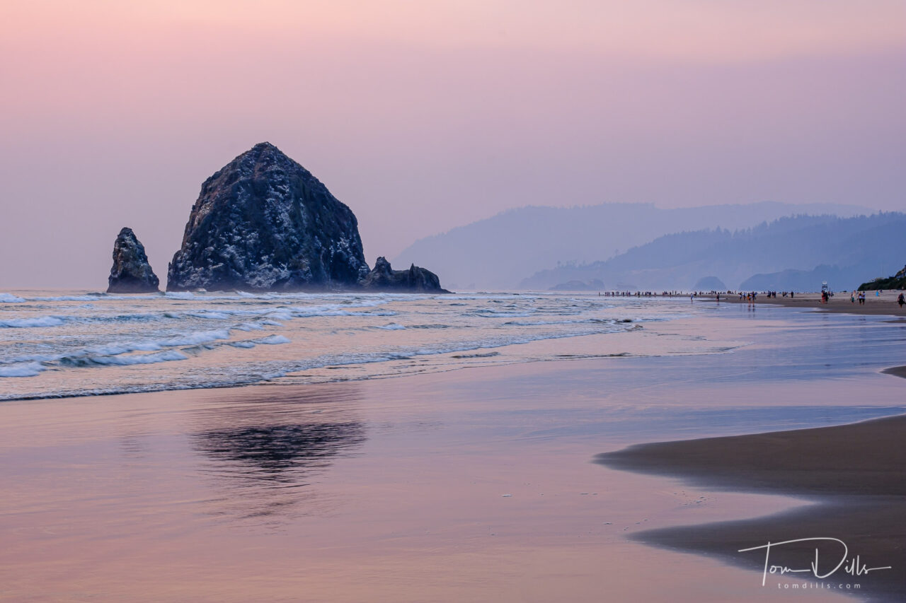
Haystack Rock at sunset over the Pacific Ocean from Cannon Beach, Oregon
Kathy & I spent two nights in Cannon Beach, Oregon specifically to see the sea stacks along the coast. Probably the most famous stack is Haystack Rock, which sits just off the coast and literally in front of “downtown” Cannon Beach.
The size and scale of Haystack is a hard to capture in a photograph, but I did include some people in a few of my shots for scale.
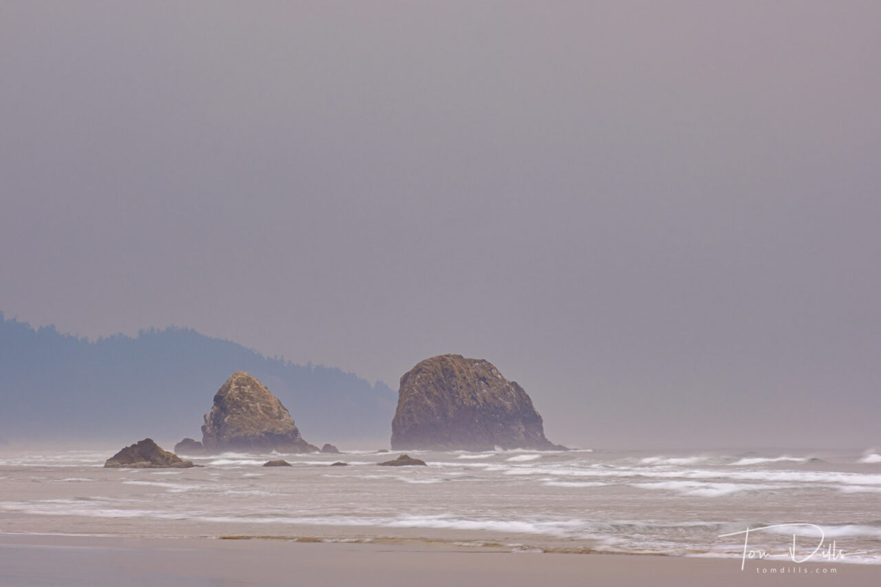
Unidentified Sea Stacks off the coast in Cannon Beach
Unfortunately, despite being there for two nights and nearly 48 hours, the smoke got so thick that when combined with the usual coastal fog, we only got views of the rock formations the very first night and the following morning. After that I “knew it was out there somewhere” but had to be satisfied with the photos I got.
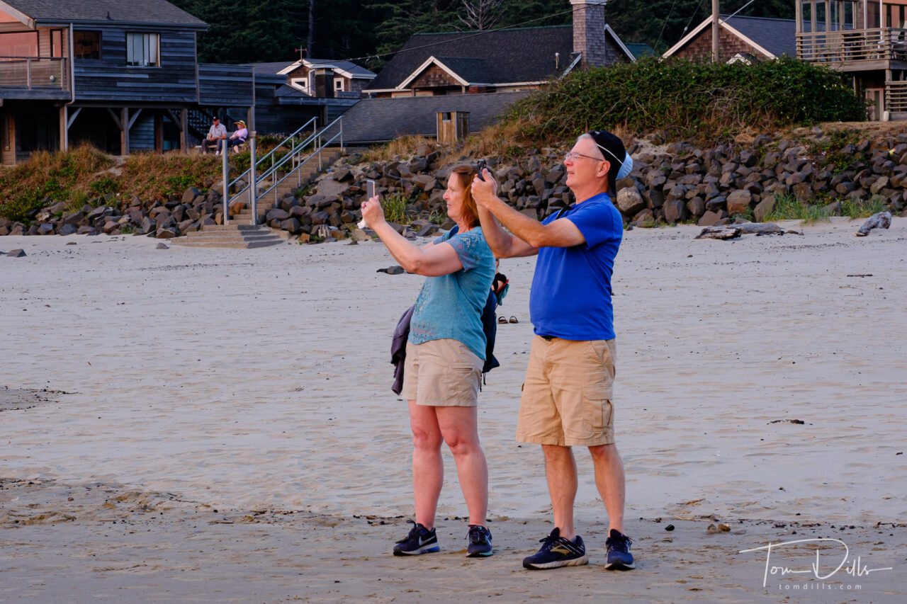
Two Photos Are Better Than One. (Didn’t have the guts to tell him that the mask works best on the front of your head. )
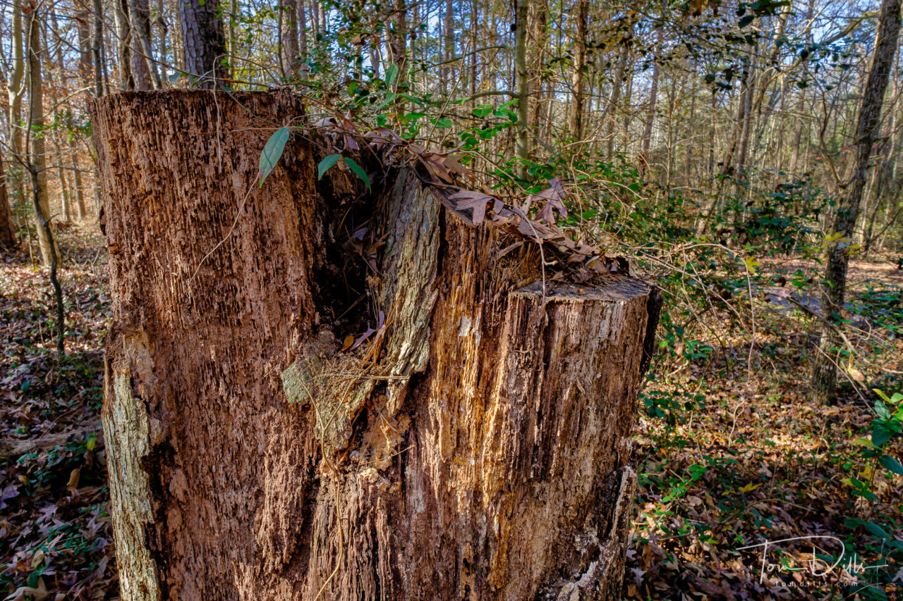
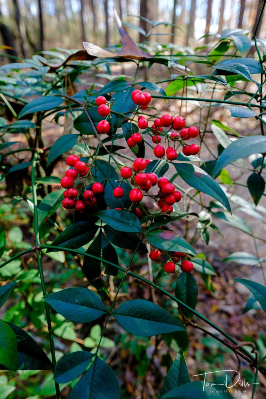
A fall afternoon at Latta Plantation Nature Preserve near Huntersville, North Carolina
It was almost like I had heard Jeff Curto’s words in my head, although I didn’t actually hear them until we got home. Jeff’s most recent podcast talks about it isn’t necessary to travel long distances or to exotic locations to make interesting photographs. Give it a listen if you don’t already subscribe. And you know you should.
A fall afternoon at Latta Plantation Nature Preserve near Huntersville, North CarolinaA fall afternoon at Latta Plantation Nature Preserve near Huntersville, North Carolina
Kathy and I decided to spend a nice late-fall Sunday afternoon at Latta Plantation Nature Preserve, a county park near Huntersville, North Carolina and about 8 miles from our house. We packed a picnic lunch, laced up our hiking shoes and spent a couple of hours wandering the trails along Mountain Island Lake, the lake that we live close to, but not at. It’s not Lake Superior, but it’s what we’ve got.
A fall afternoon at Latta Plantation Nature Preserve near Huntersville, North Carolina
We’ve been to Latta a number of times over the years, and I’ve made lots of photographs there. But it had been a while. There are things to see and photograph at all times of the year, but I have often sold it short since it is – as Jeff alluded to – in our “back yard.”
A fall afternoon at Latta Plantation Nature Preserve near Huntersville, North Carolina
Kathy & I had already decided that we’re going to stick close to home for the next few months, and are planning to get out and explore our own area. I’ve said for years that I like to be a “tourist in my own town” but have never sat still long enough to give it a chance. Sounds like now is as good a time as any!
A fall afternoon at Latta Plantation Nature Preserve near Huntersville, North Carolina
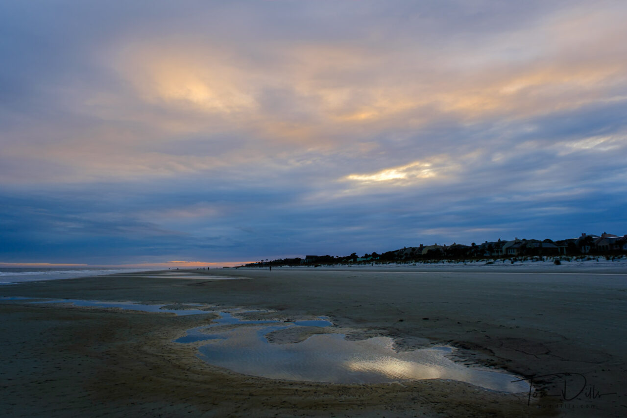
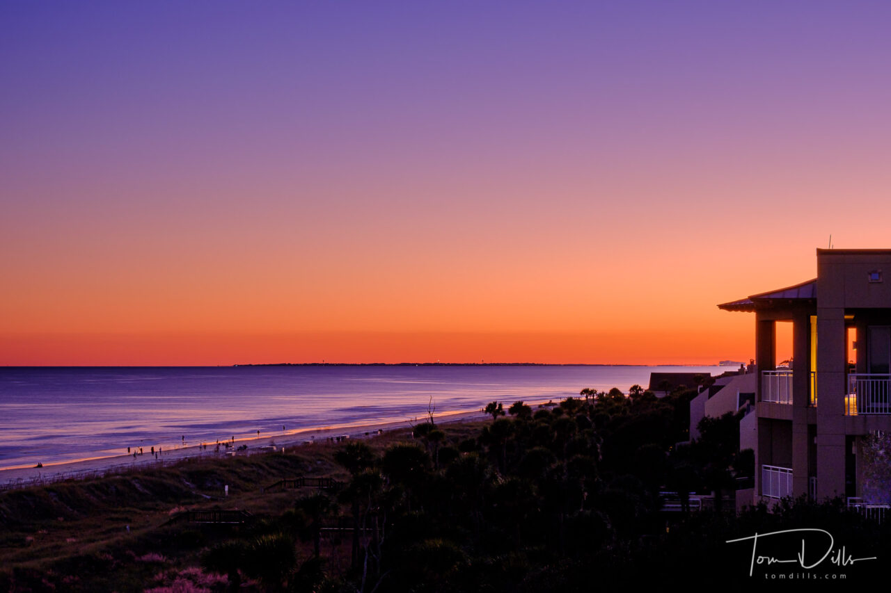
Evening on the beach, Hilton Head Island, South Carolina
I thought we retired….
In the last few weeks, we’ve taken advantage of a “break in the action” to meet up with a few of our key professional people – medical, legal and financial stuff that we need to address on occasion. On top of that we’ve been working on a few home improvement projects. As a result, the calendar has been “full” of stuff. An appointment on Monday, an in-person meeting yesterday, conference call today, more stuff next week. Aye-yi-yi…feels like we’ve gone back to work! I realize that it’s nothing compared to the schedules we kept when we were actually working for a living, but it feels….busy!
Sunset colors looking toward Tybee Island, Georgia from Hilton Head Island, South Carolina
But once we get through next week we’re hopefully pretty much clear sailing through the holidays. Should be more time for important stuff like processing photographs and making blog posts.
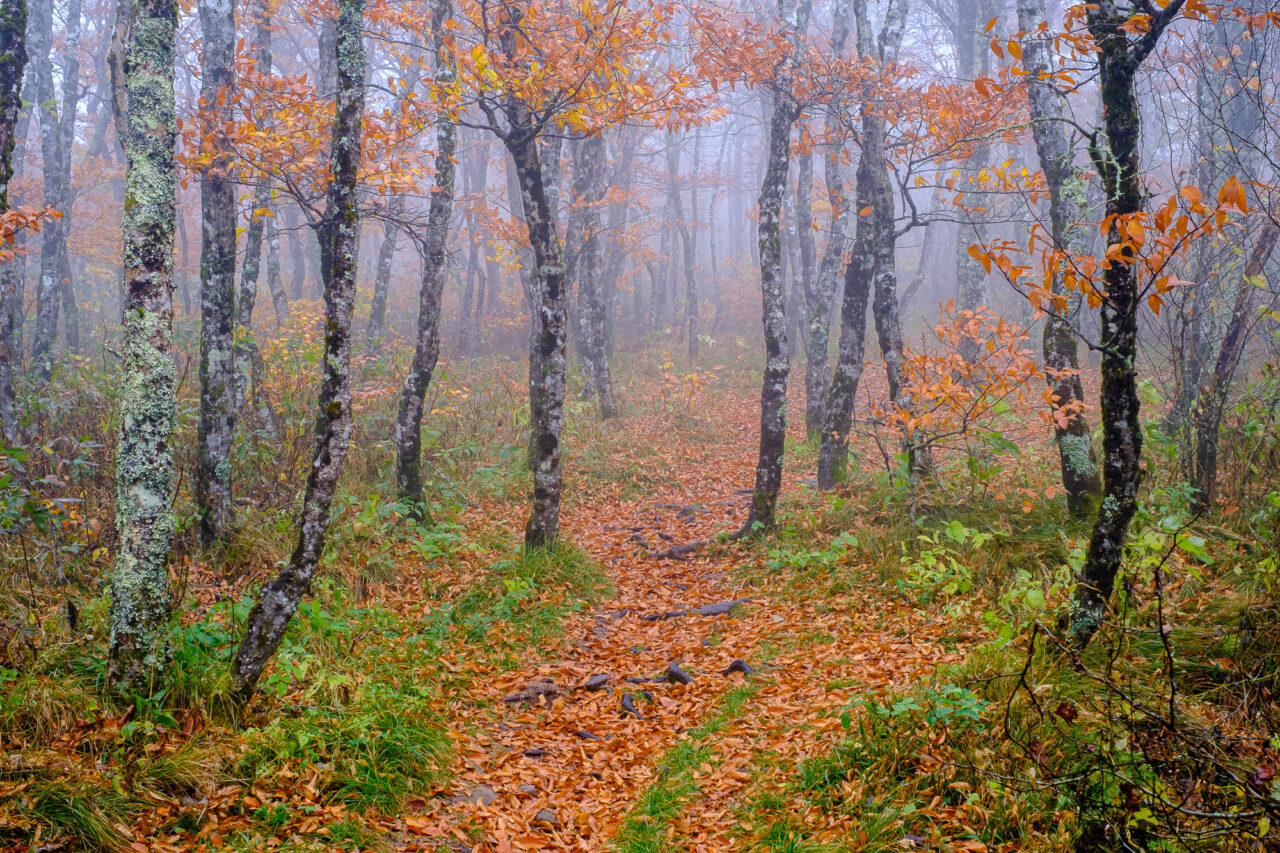
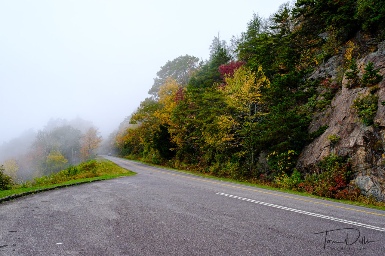
Fall in the “Pixie Forest” on the Blue Ridge ParkwayFall along the Blue Ridge Parkway near Licklog Ridge Overlook MP 349