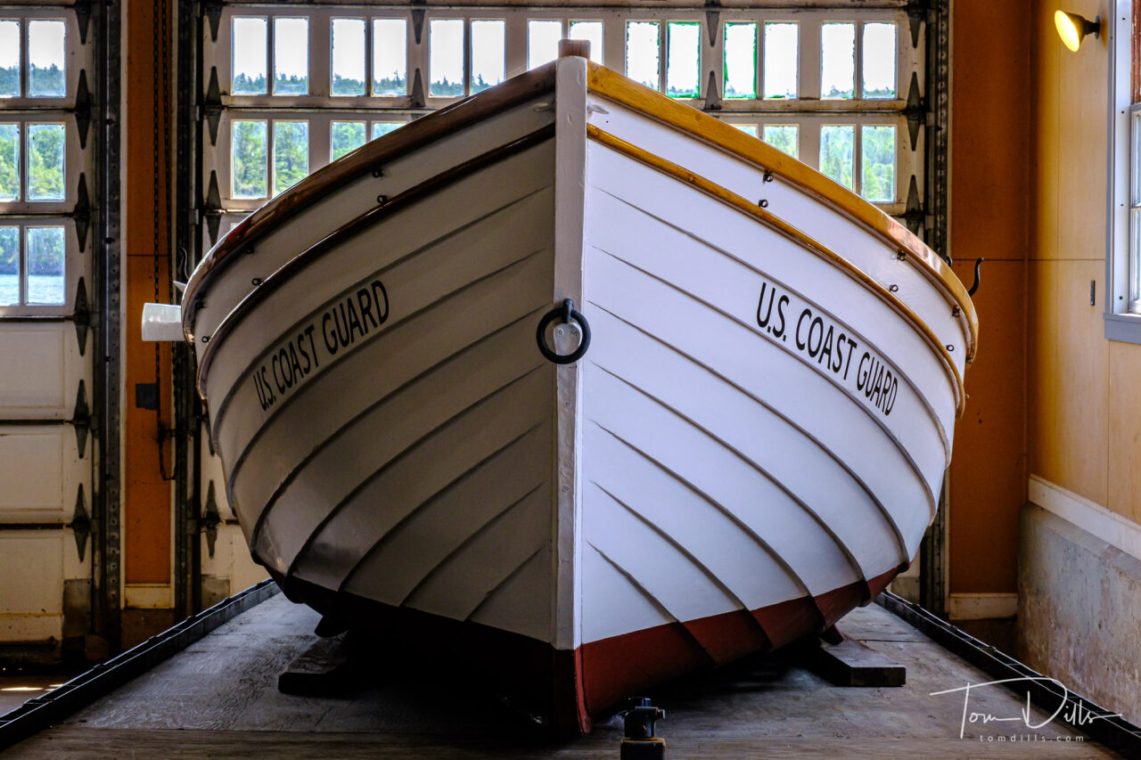
When in Eagle Harbor, MI we visited this former Coast Guard Lifesaving Station that is now a museum of maritime history. Interesting place with some nicely restored boats and restored building.
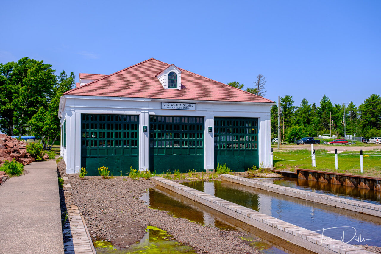
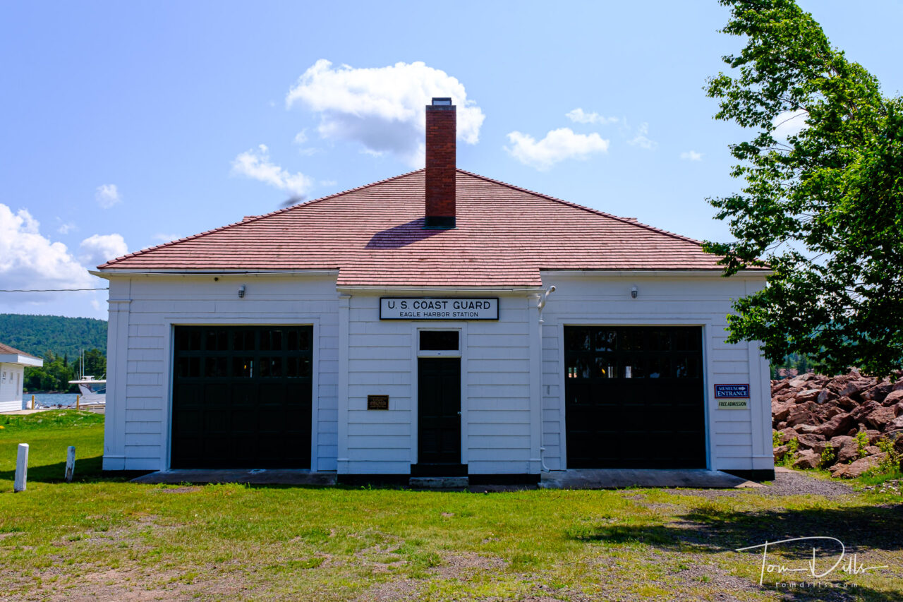
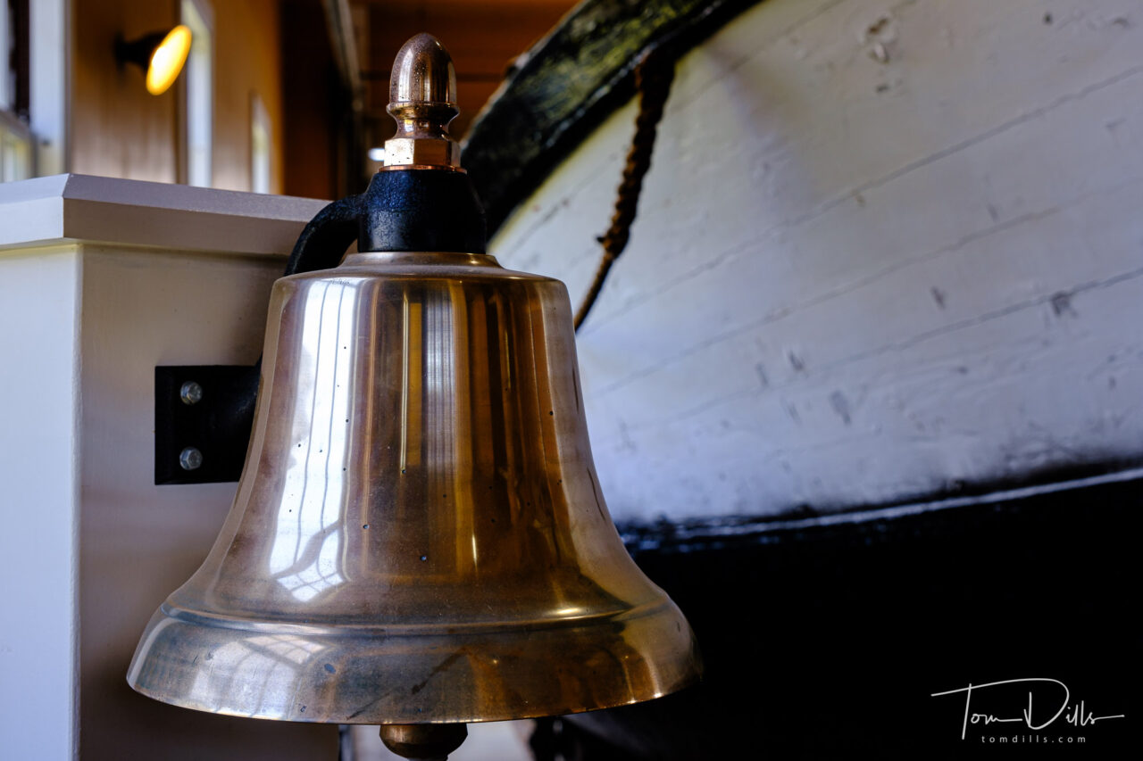
When in Eagle Harbor, MI we visited this former Coast Guard Lifesaving Station that is now a museum of maritime history. Interesting place with some nicely restored boats and restored building.
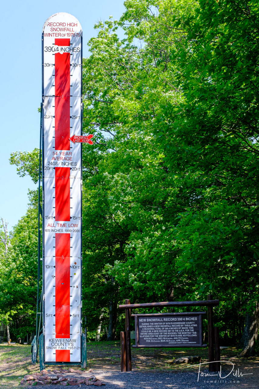
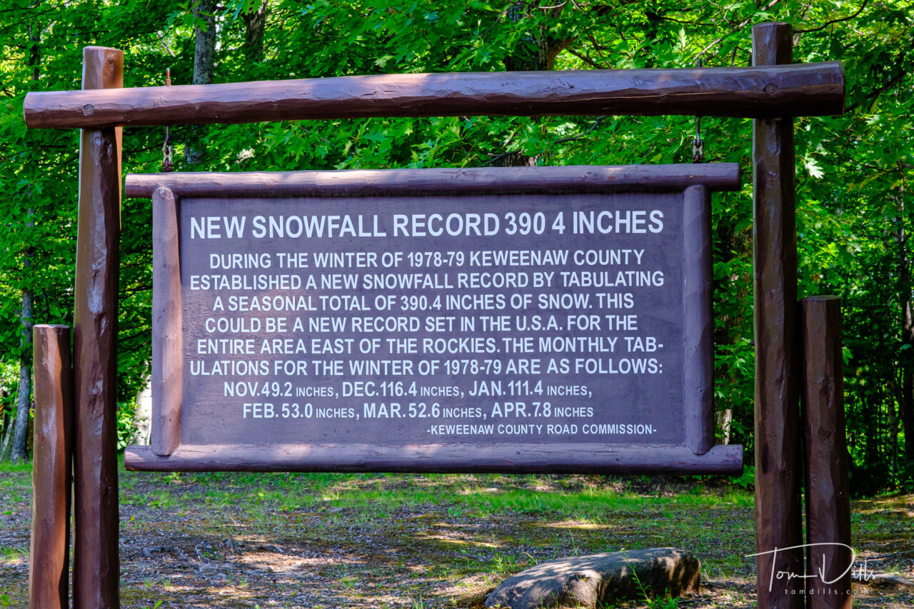
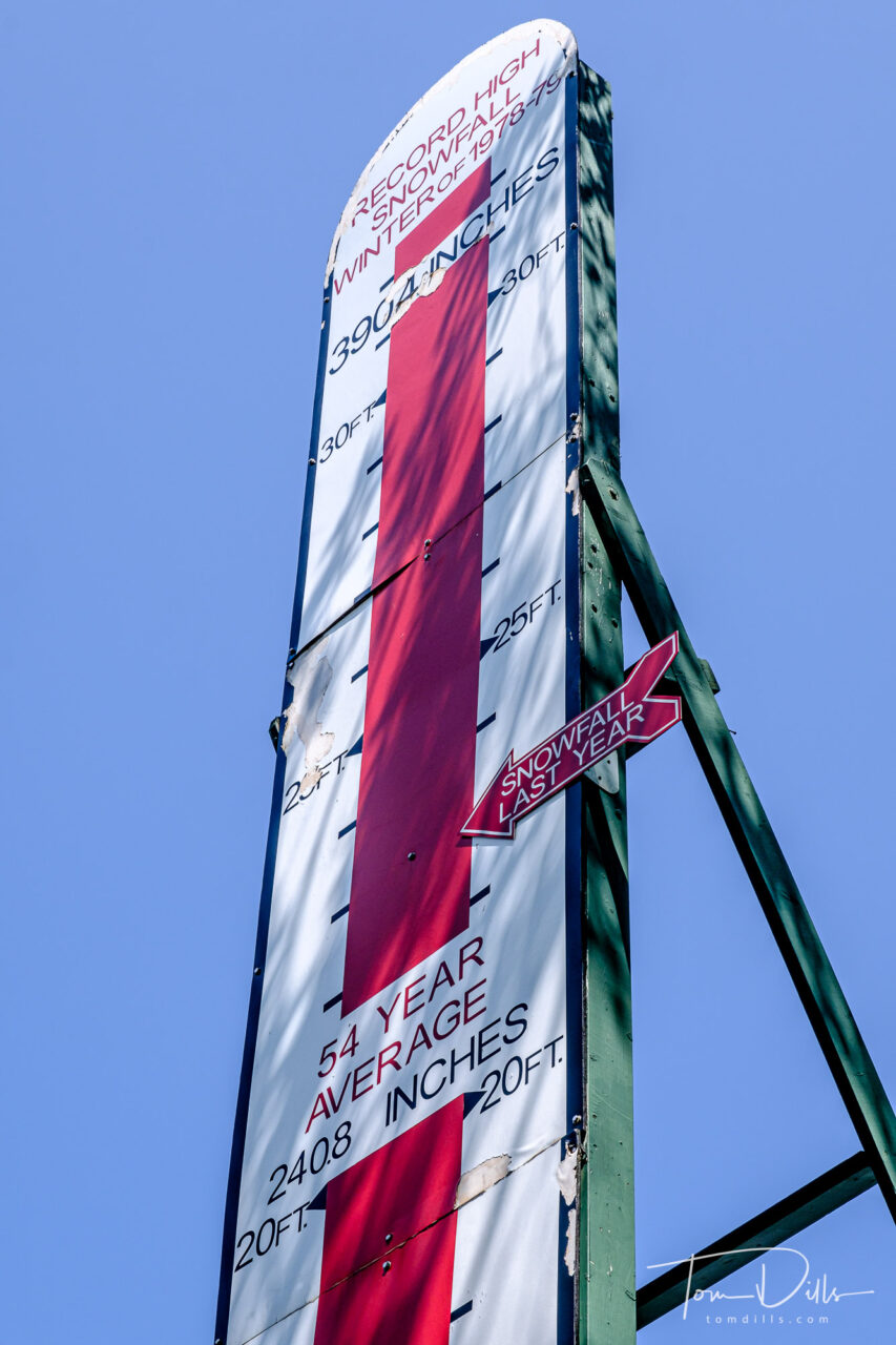
We visited the Keweenaw Peninsula on our recent swing through the U.P. of Michigan, and came across this “snow gauge” commemorating the record snowfall of 390 inches during the winter of 1978-1979, and also reminding us that the most recent winter saw snowfall of “only” about 270 inches. Of course that is cumulative total over the course of the winter, which runs roughly from September to May ( 😉 ), not what was on the ground at one time. But still….
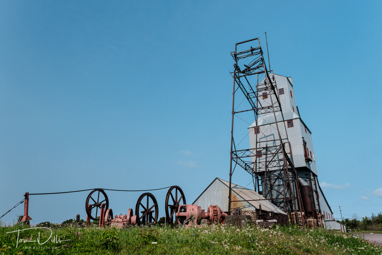
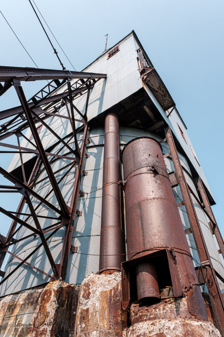
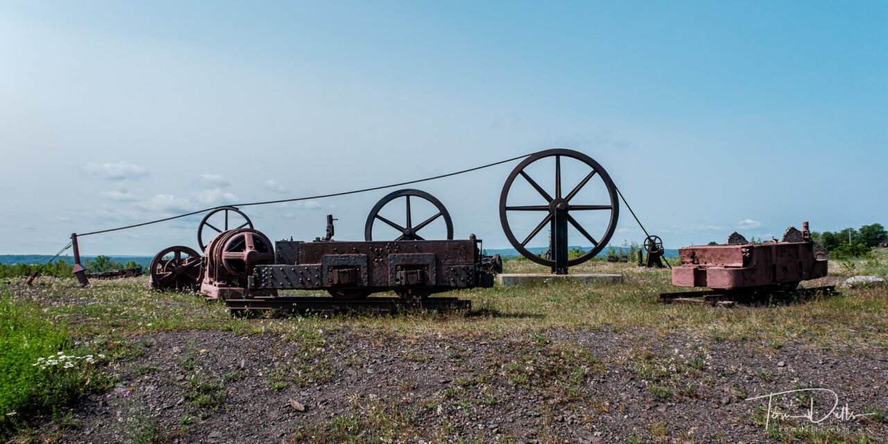
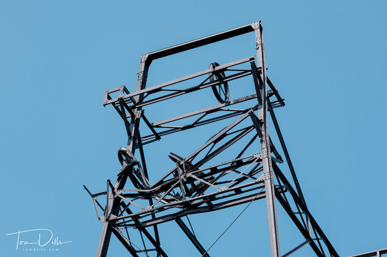
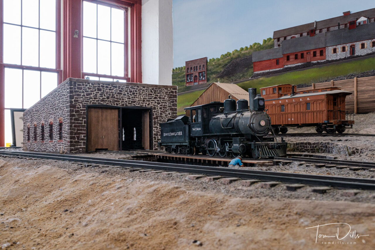
Copper mining plays an integral role in the history of the Keweenaw Peninsula, and there are remains of these mines scattered throughout the land. A few of them have been partially preserved for tourism, including the Quincy Mine, part of Keweenaw National Historical Park near Houghton.
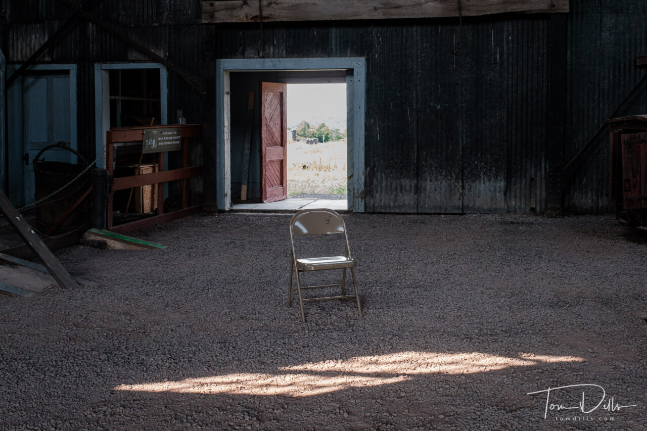
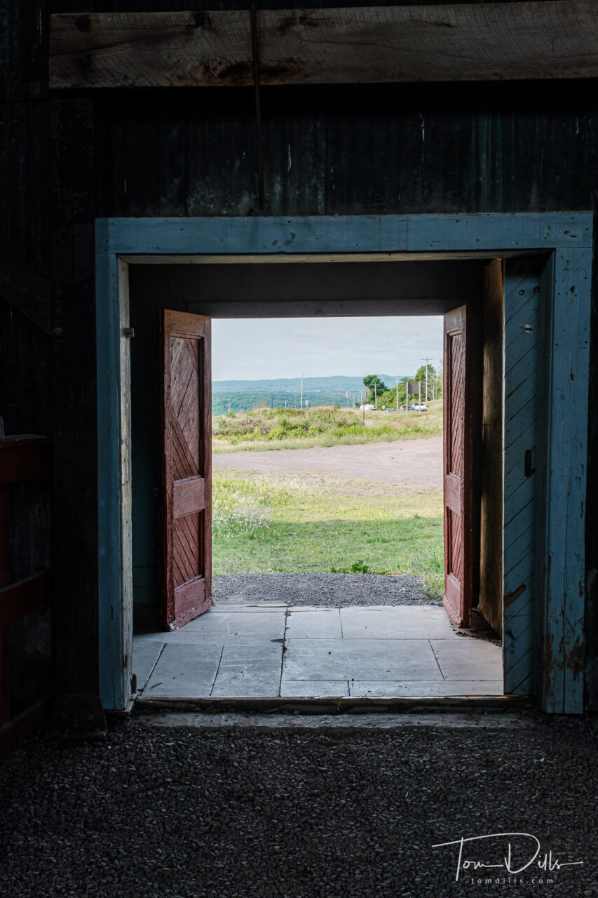
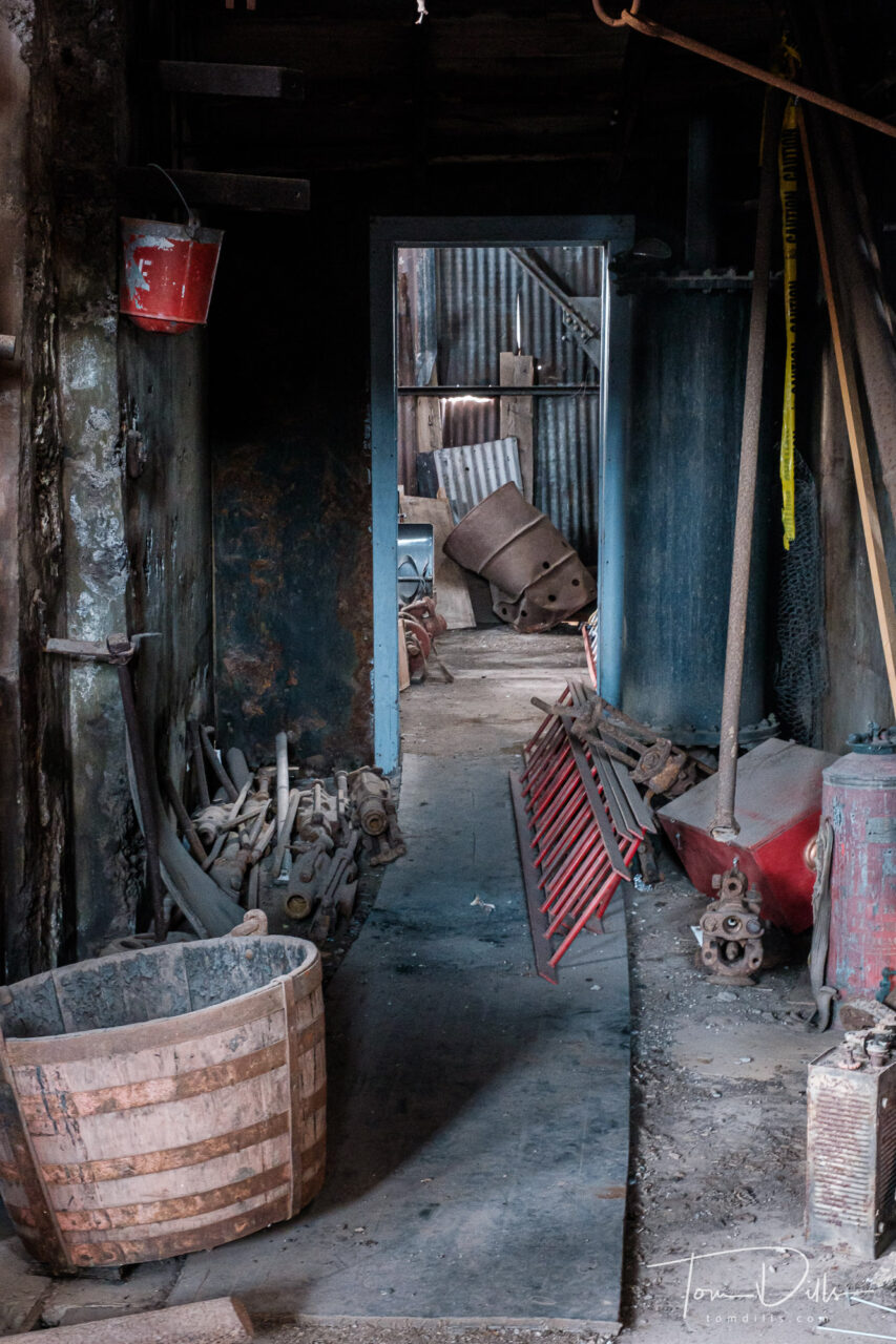
Kathy & I spent a few hours visiting the park and touring the buildings that are open to the public. They offer a tour into one of the mines using one of the former mining cars, but I’m a little squeamish about underground and enclosed spaces so we decided to pass. Perhaps another time, he says…. 🙂
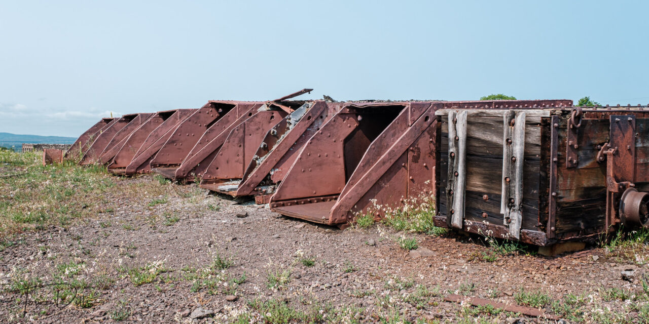
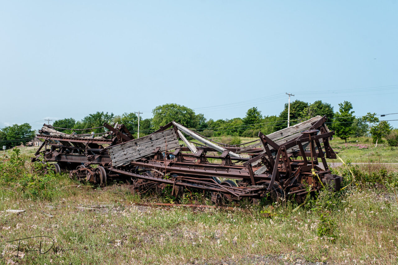
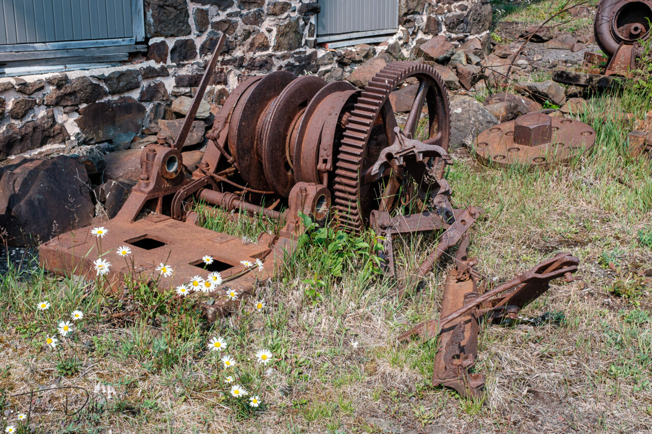
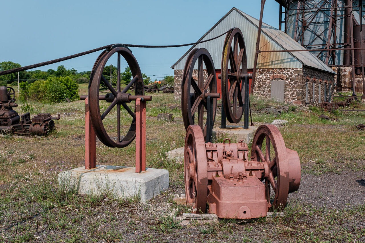
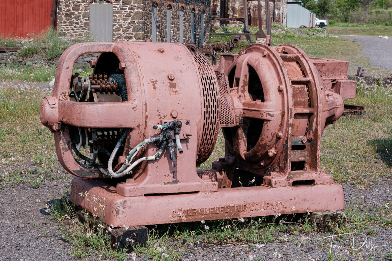
The most fascinating aspect is the size of the machinery that was used to move both man, equipment and materials in and out of the mine. But they produced a lot of copper over the years the mines were in operation. Once the copper ran out, the mines were abandoned and left to the elements. Fortunately there are a few of them still remaining, as reminders of the importance of copper to the area.
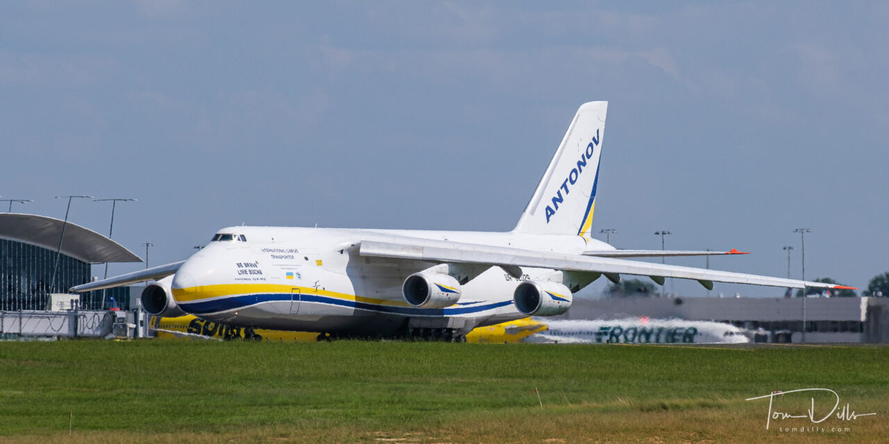
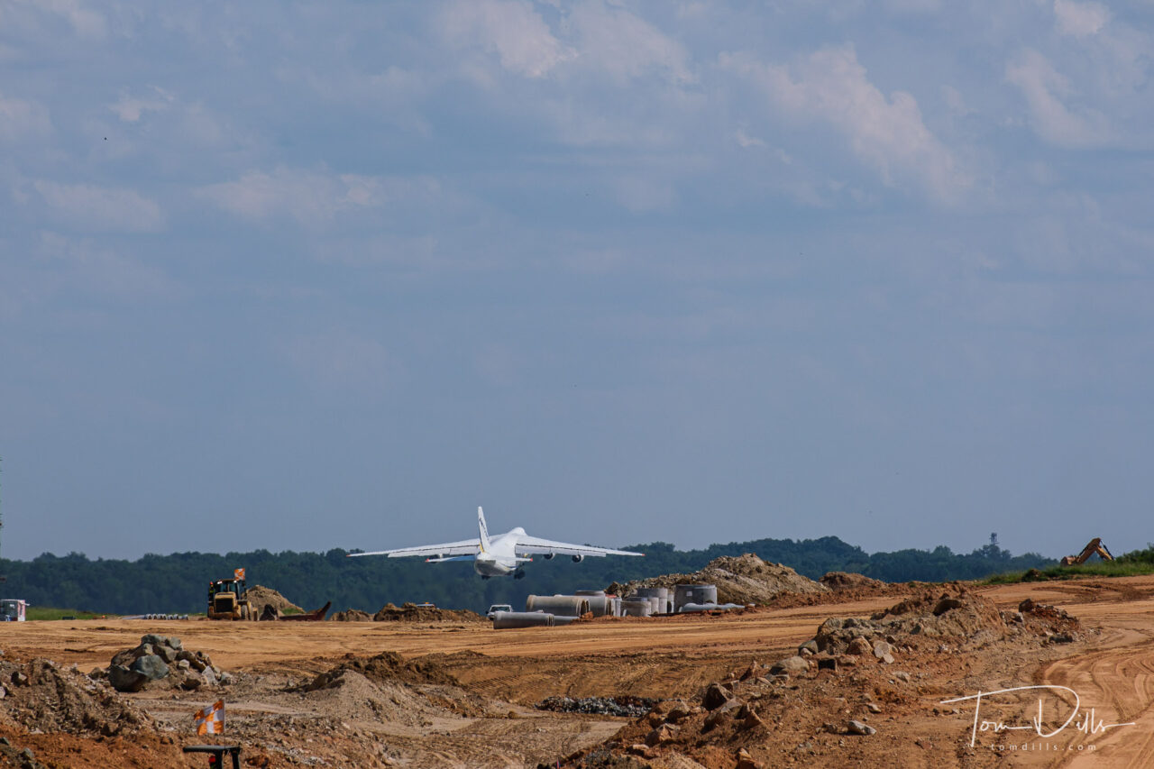
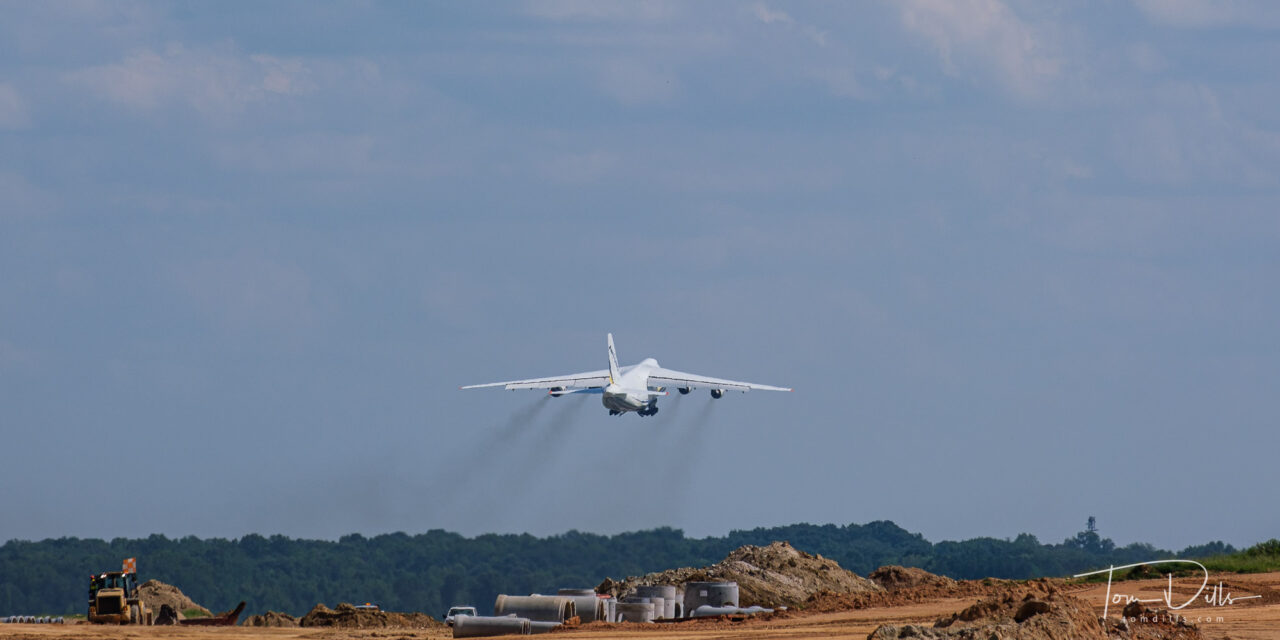
Thanks to our son Scott, Kathy & I were alerted to a somewhat rare aircraft viewing opportunity. An Antonov AR-124 cargo aircraft, currently the largest production aircraft in the skies, had come to Charlotte Douglas International Airport (CLT) to deliver some aircraft parts. It was due to depart this afternoon at 3:40PM.
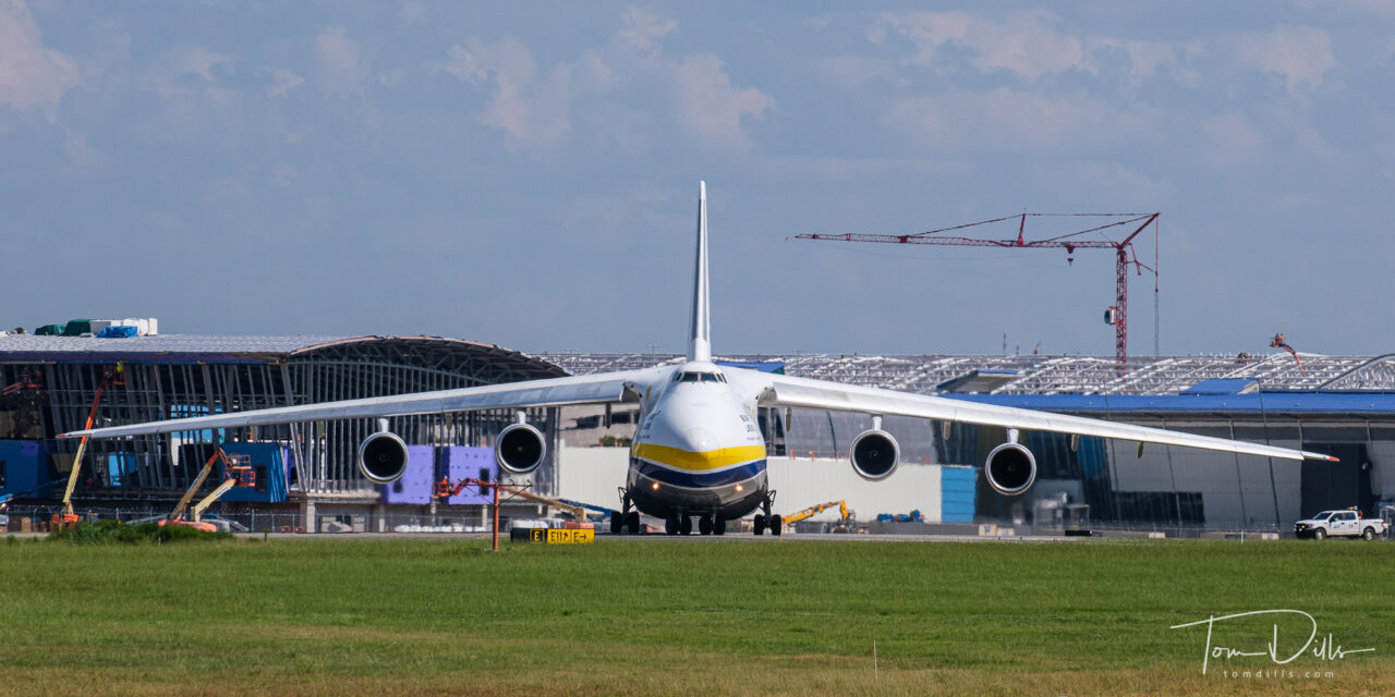
CLT has had an “Airport Overlook” for years, overlooking the center runway, providing views of the terminal and many of the arriving and departing aircraft. The airport is currently adding a fourth parallel runway, so the overlook has been temporarily relocated to a spot a little farther away. Not really a big deal, although I had to crop out a lot of foreground construction clutter, thus the 1:2 aspect ratio. Although it isn’t a bad aspect ratio for the subject matter anyway.
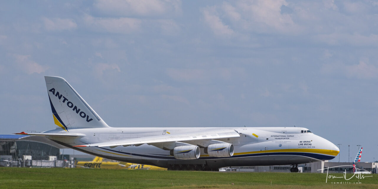
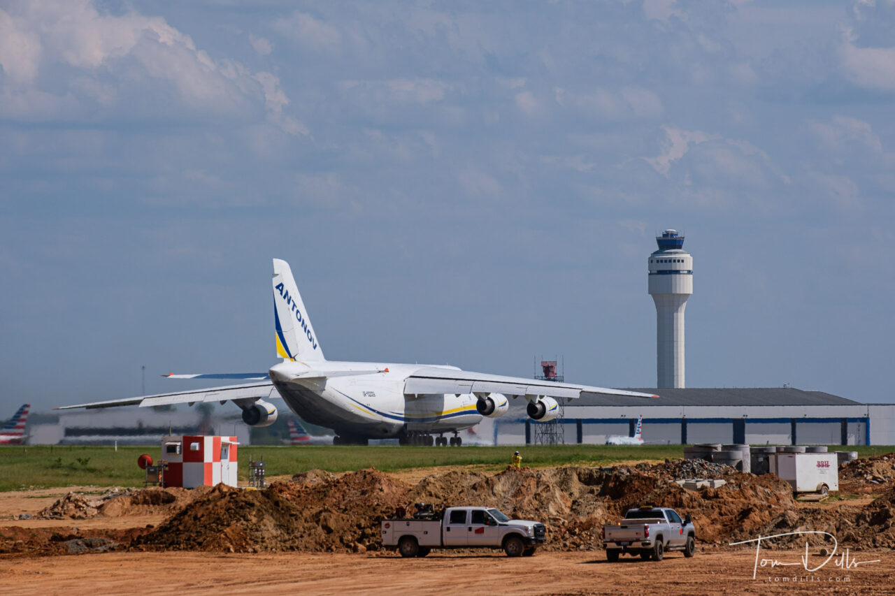
Other than the Air Force Reserve C-17s and the Lufthansa A-340s, and of course the occasional visit from Air Force One, this is about the largest plane we see in lil’ ole Charlotte. It was pretty impressive!
I had seen on the map of Mackinaw City that there were several lighthouses along the lake front. After our time photographing the bridge, we sought a good view of the nearest one, at McGulpin Point. Unfortunately, unless you are on the water it appears the only view of the lighthouse is from the parking lot! I did manage to get my shutter finger synchronized with the light pattern, so I have a few shots with the beacon lit!
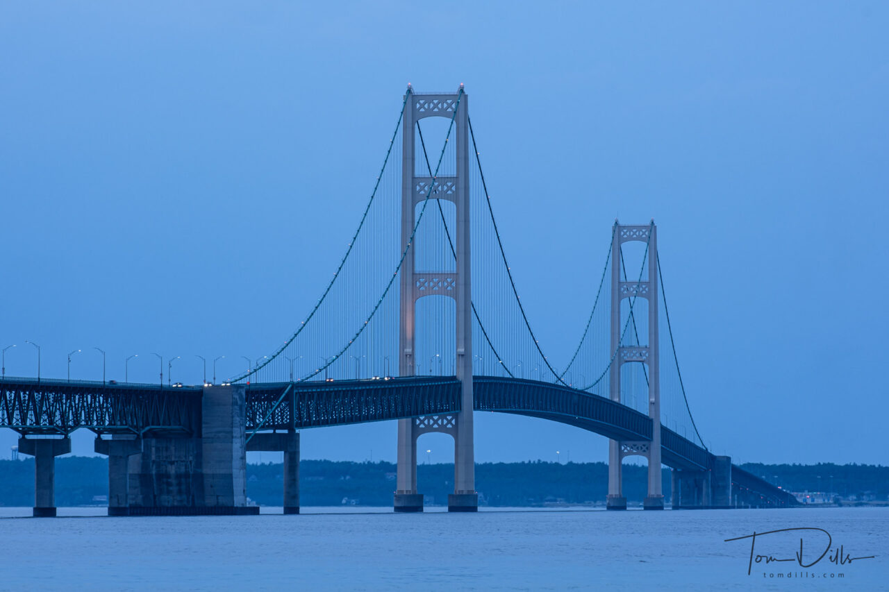
In order to get to the U.P. of Michigan from Ohio we needed to either cross the Mackinac Bridge or drive through Chicago. Easy choice, right? Because our backsides get tired if we try to stretch the drive too far and we also had some other things we wanted to do on the way, we decided to find a place to stop. Looking at our options, it seemed like either Mackinaw City on the south side of the Straits of Mackinac, or St. Ignace on the north side, would be good options. We chose Mackinaw City. Note the different spellings – it can be confusing to use the right one, but they are all pronounced the same – MAC-in-aw.
The Straits of Mackinac mark the dividing line between Lake Huron on the east side and Lake Michigan on the west side.
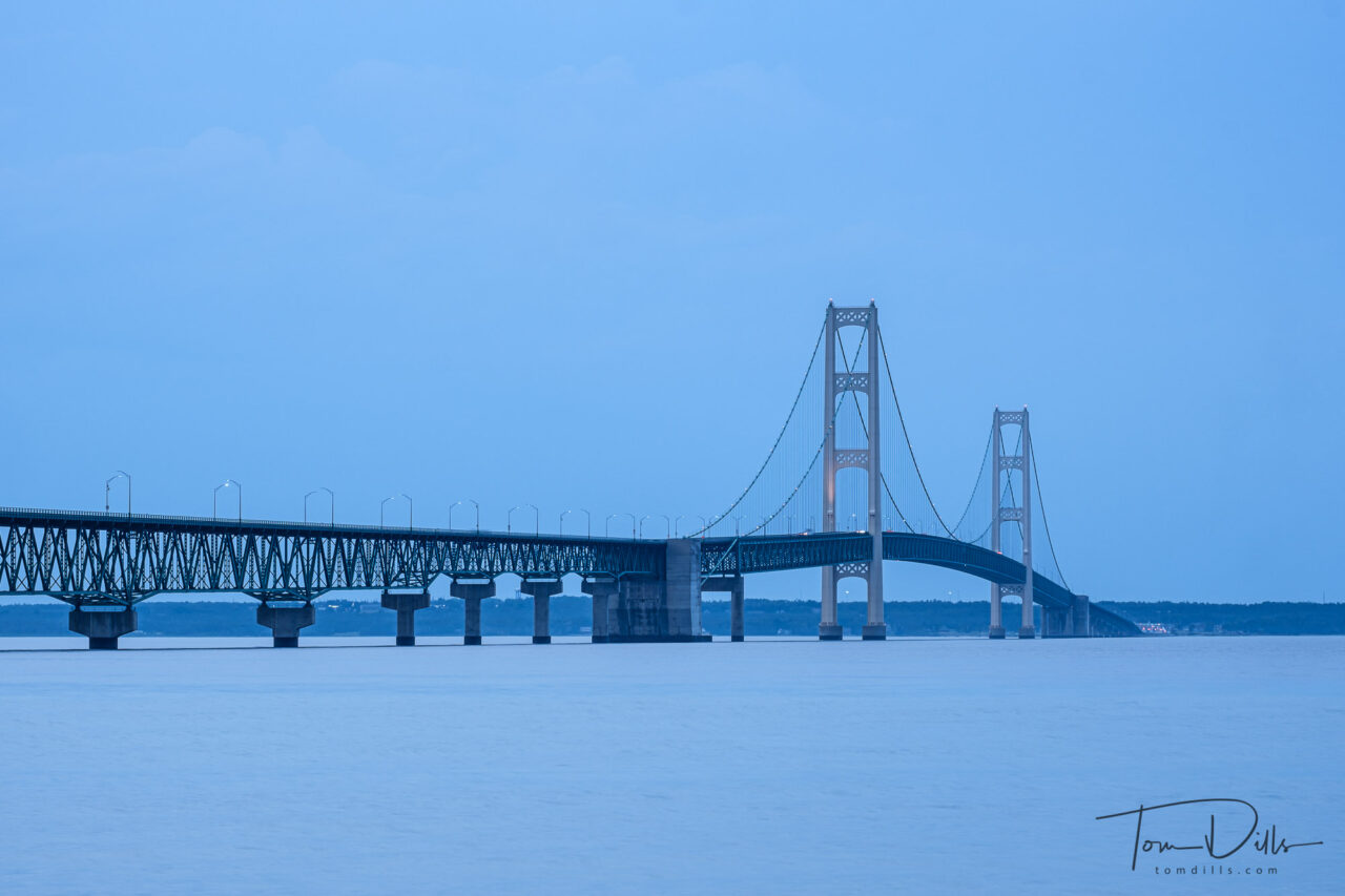
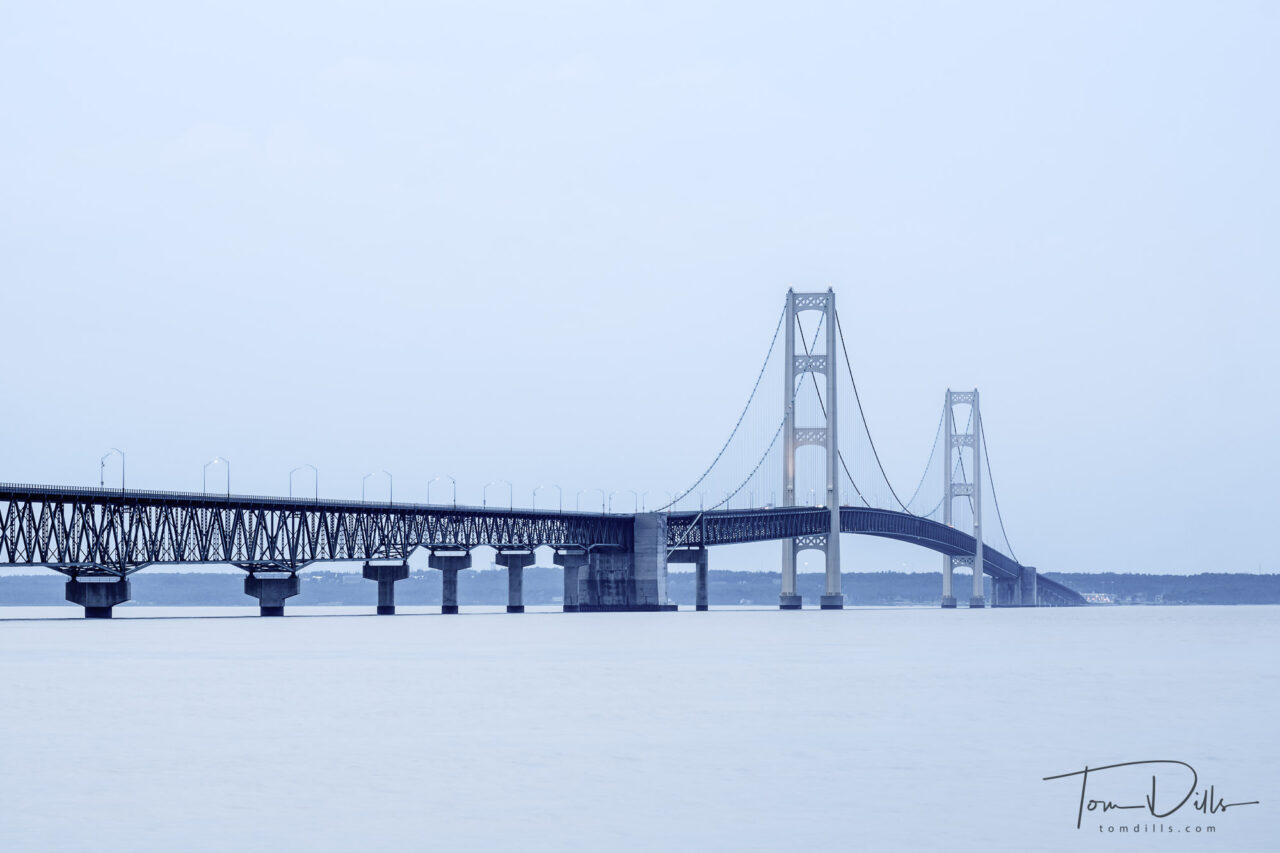
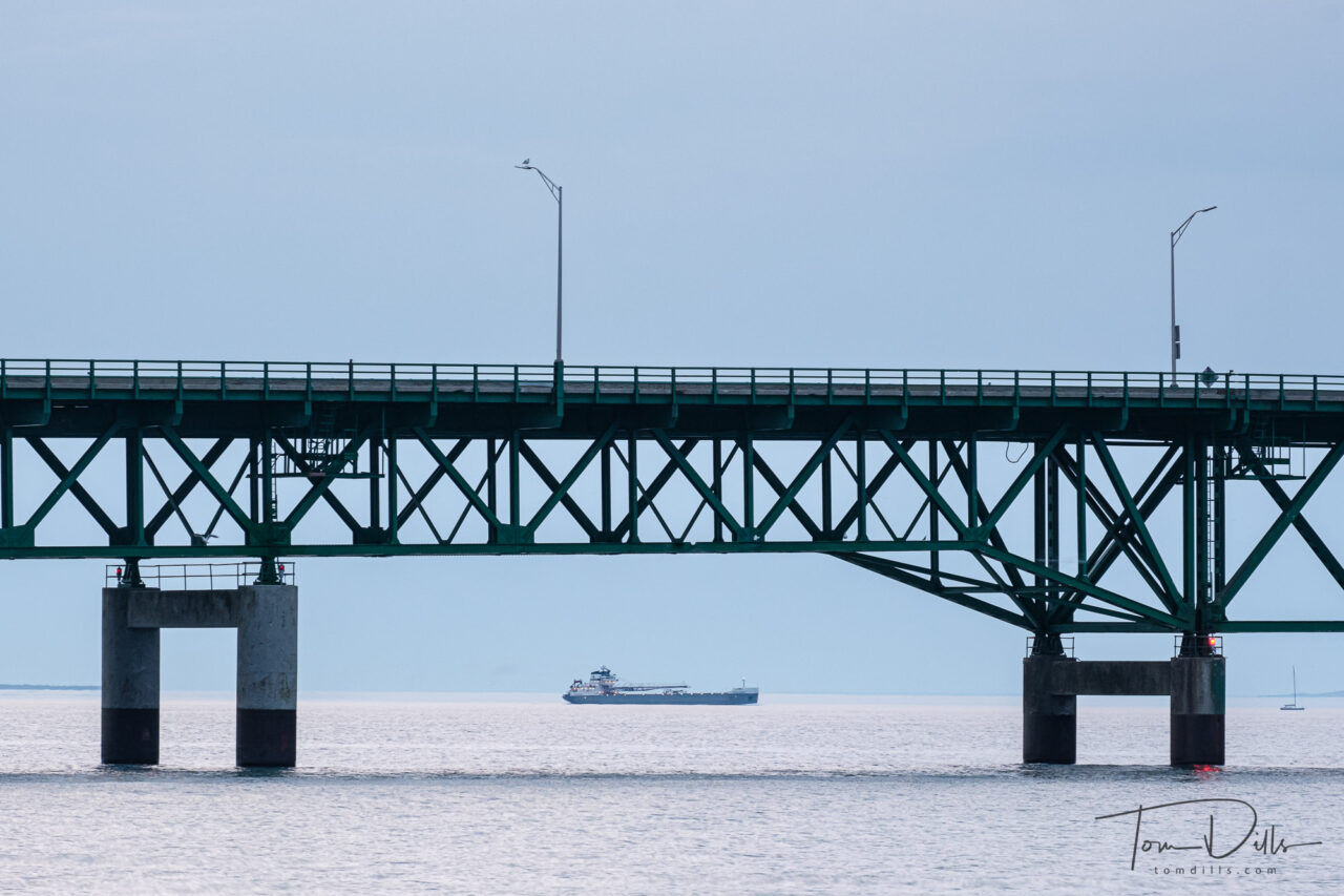
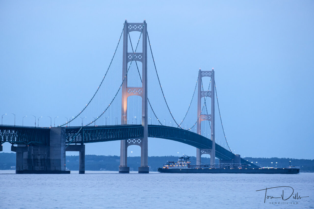
We only had one evening there, and it turned out to be quite cloudy. The light was very flat and blue, but I did with it what I could. It was the first real world trial of my newly purchased tripod, and it appears to have performed quite well. I did have a few cases where the photos are blurry, but they are long exposures where I forgot to turn off my image stabilization. I know the manual says you don’t need to, that the lenses are smart enough to know, but I’ve found that to be dubious.
From Wikipedia:
The Mackinac Bridge, also referred to as the Mighty Mac or Big Mac, is a suspension bridge that connects the Upper and Lower peninsulas of the U.S. state of Michigan. It spans the Straits of Mackinac, a body of water connecting Lake Michigan and Lake Huron, two of the Great Lakes. Opened in 1957, the 26,372-foot/4.995 mi/8.038 km long bridge is the world’s 27th-longest main span and is the longest suspension bridge between anchorages in the Western Hemisphere. The Mackinac Bridge is part of Interstate 75 and the Lake Michigan and Huron components of the Great Lakes Circle Tour across the straits; it is also a segment of the U.S. North Country National Scenic Trail. The bridge connects the city of St. Ignace to the north with the village of Mackinaw City to the south.
Envisioned since the 1880s, the bridge was designed by the engineer David B. Steinman and completed in 1957 only after many decades of struggles to begin construction. The bridge has since become an iconic symbol of the state of Michigan.
The bridge opened on November 1, 1957, connecting two peninsulas linked for decades by ferries. At the time, the bridge was formally dedicated as the “world’s longest suspension bridge between anchorages”, allowing a superlative comparison to the Golden Gate Bridge, which has a longer center span between towers, and the San Francisco–Oakland Bay Bridge, which has an anchorage in the middle.
It remains the longest suspension bridge with two towers between anchorages in the Western Hemisphere. Much longer anchorage-to-anchorage spans have been built in the Eastern Hemisphere, including the Akashi Kaikyō Bridge in Japan (6,532 ft or 1,991 m), but the long leadups to the anchorages on the Mackinac make its total shoreline-to-shoreline length of 26,372 feet — 28 feet short of five miles (8.0 km) — longer than the Akashi Kaikyo (2.4 mi or 3.9 km).
The length of the bridge’s main span is 3,800 feet (1,158 m), which makes it the third-longest suspension span in the United States and 27th longest suspension span worldwide. It is also one of the world’s longest bridges overall.
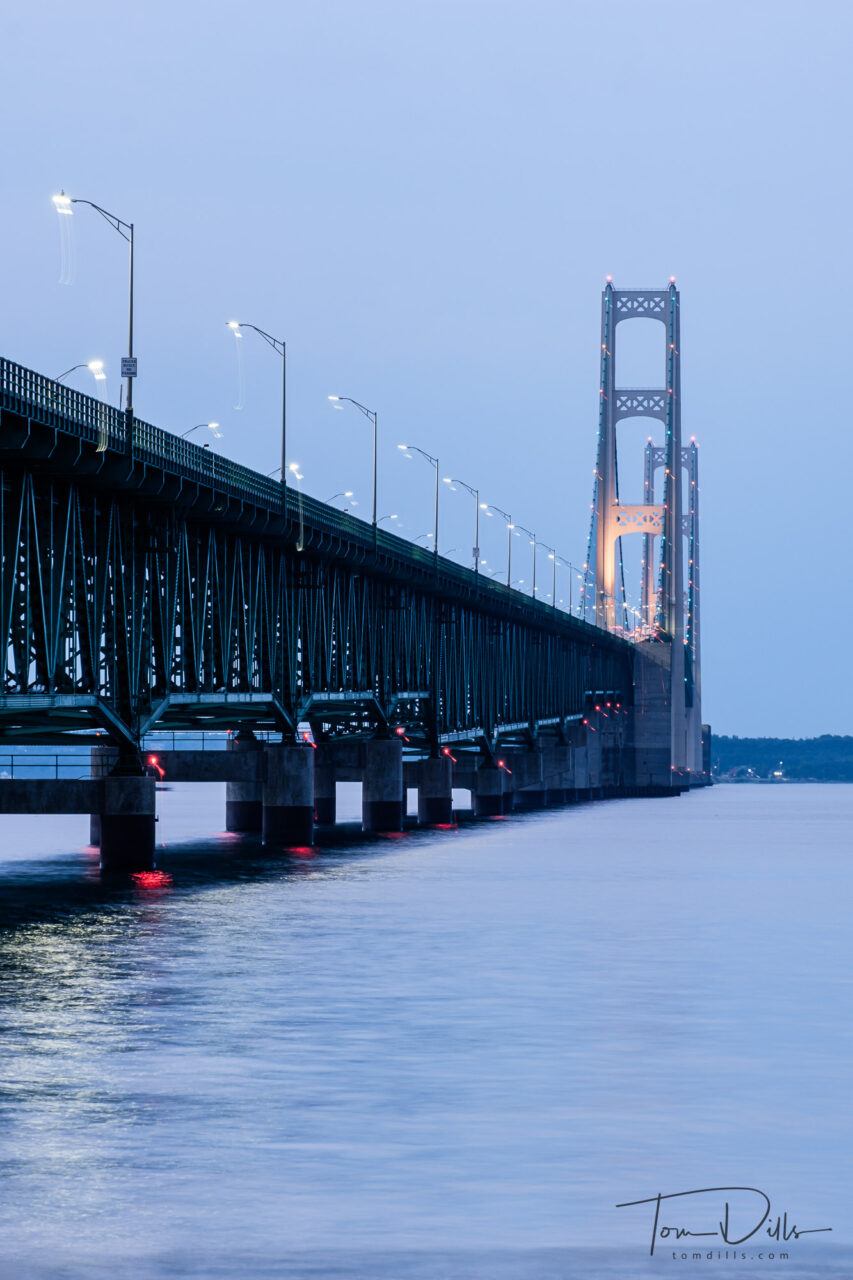
This photo I like very much, but I am puzzled by the trails below and to the right of all the lights. The bridge is in sharp focus, so all I can think is that the tripod must have slipped a little either at the very beginning or end of the 3 second exposure (3 seconds at f11, focal length 134.5mm) .
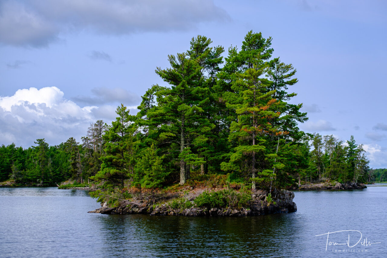
We capped off our road trip with an unplanned visit to Voyageurs National Park in Minnesota. Unplanned, because when I first thought about visiting the Northernmost Point I never even bothered to see what else there was to do near International Falls. Rookie mistake!
When we drove into International Falls and saw the signs for Voyageurs, I did a forehead slap and said “you dummy – how did you not remember this was here?!?!?” We were able to book a boat cruise on Rainy Lake and it turned out to be one of the highlights of the trip. Fortunately for us, Rainy Lake was not rainy on the day we visited, and I got a bunch of nice photos. We didn’t see much wildlife, but we did get to see lots of beautiful scenery. The lake is dotted with thousands of little islands like this one.
I’m posting way out of order, but we have begun our final leg toward home, so I wanted to post one final photo from the road. I’ll have more photos and stories once I get home and am catching up!

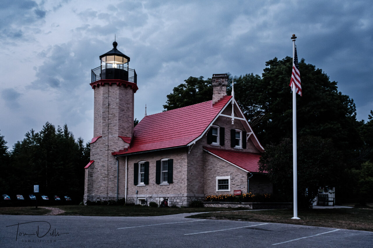
We spent a couple of days sightseeing in the Keweenaw Peninsula of Michigan, and as part of our rounds we stopped at the Eagle Harbor Lighthouse for some photos. The lighthouse is an important part of Eagle Harbor’s history and is a familiar icon for those who visit.
I would typically want to photograph a lighthouse at dusk with the beacon operating, but our timing did not permit that for this trip!
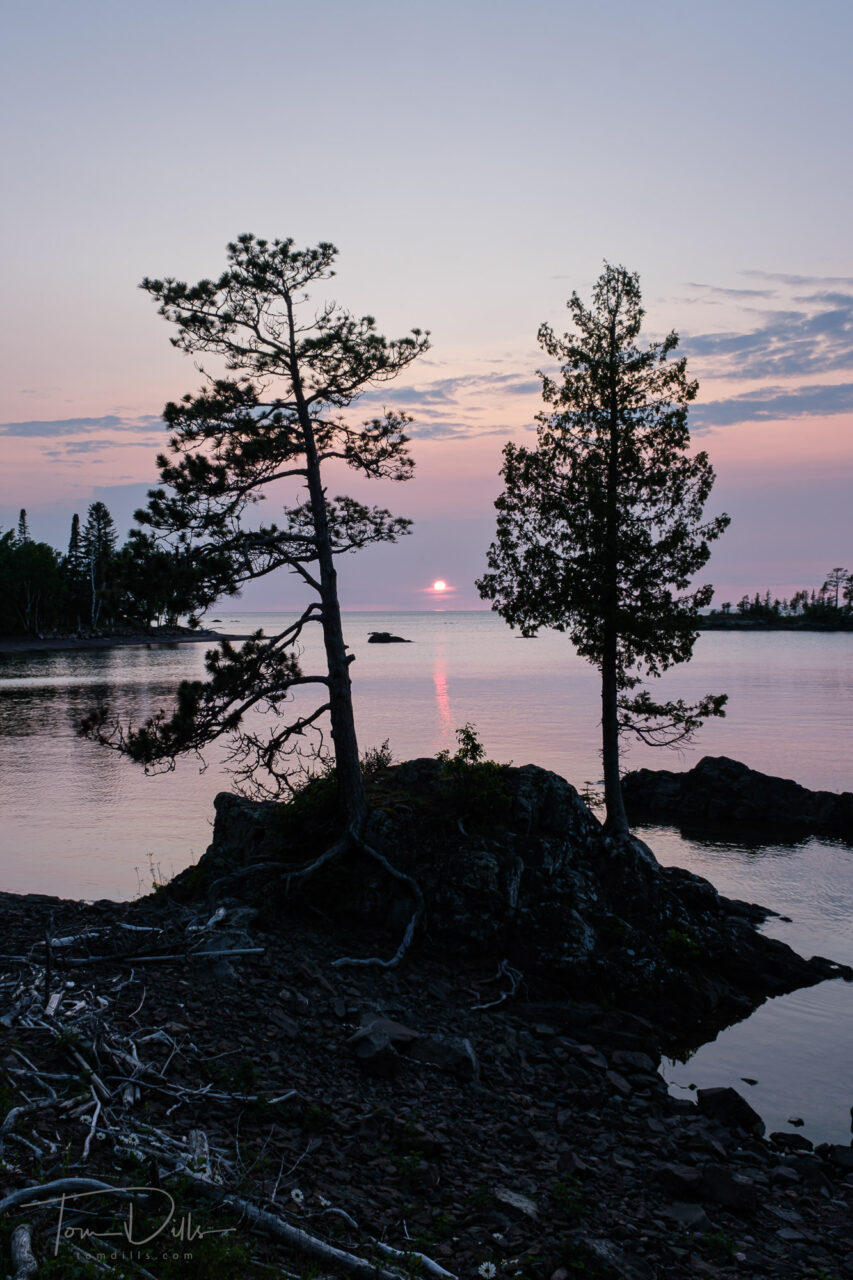
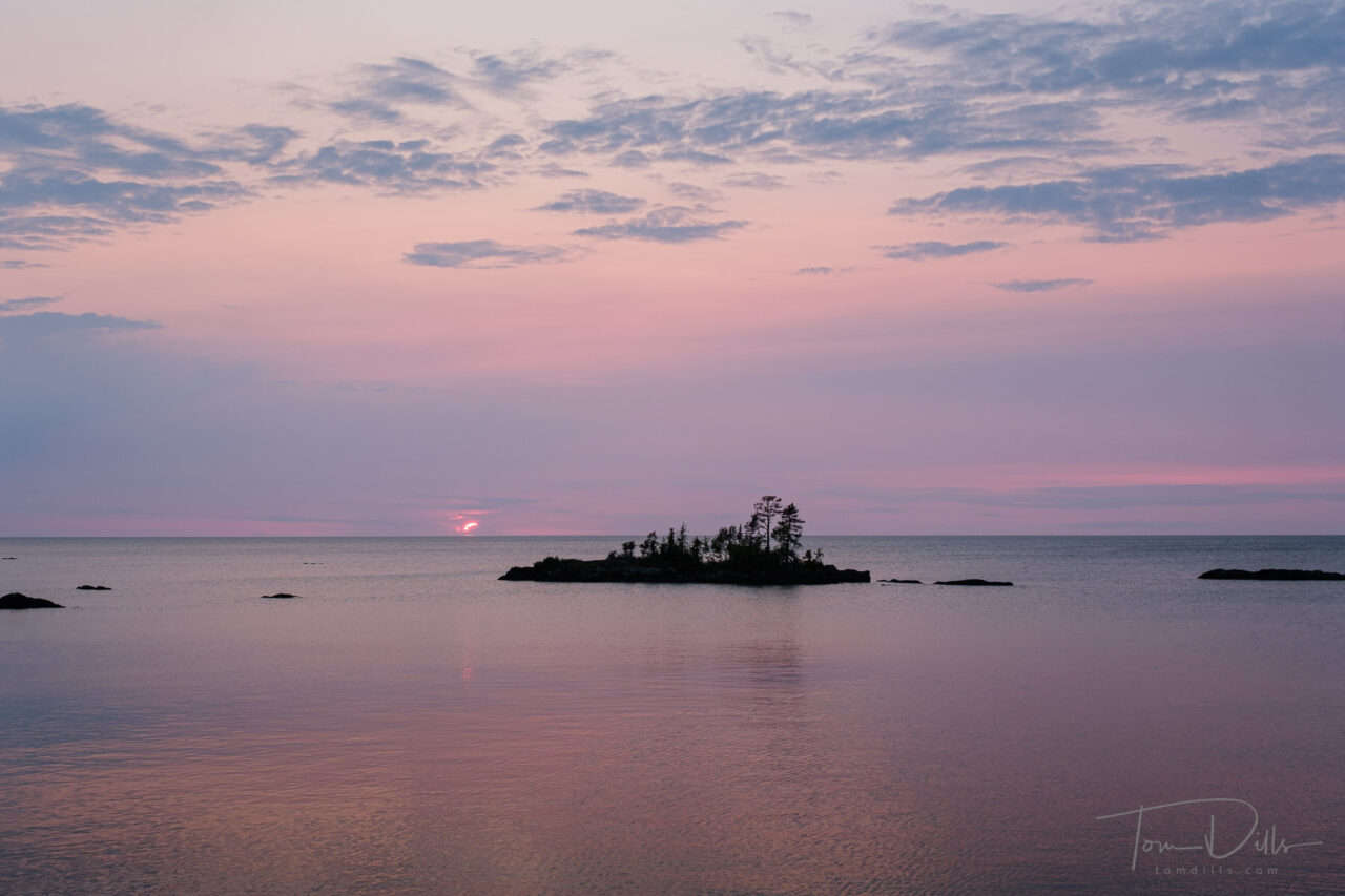
We’ve been visiting with friends Jeff & Mary Pat in Eagle Harbor, Michigan. They are blessed with this wonderful view from essentially their front yard. I braved the mosquitos for a little while to receive a few gifts of a beautiful summer sunset.
A few evenings earlier I watched an even more colorful sunset from the comfort of their living room. That night the friendship, the conversation and the bourbon made it a good place to be simply an observer, but I didn’t want to leave without at least making the attempt at a photograph or two!
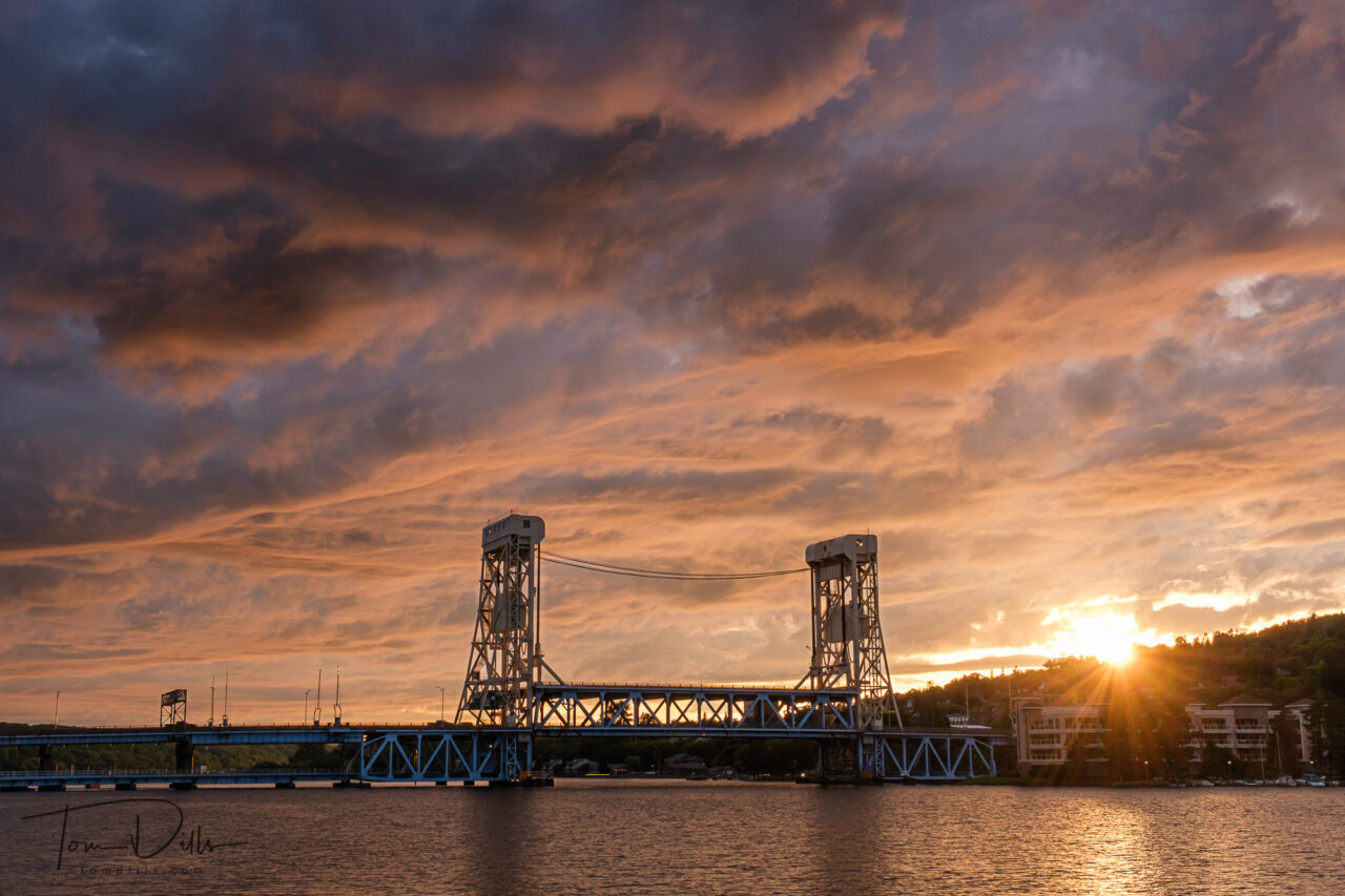
I had the perfect opportunity to photograph the sunset behind the Portage Canal Lift Bridge in Houghton (pronounced HOE-tun) Michigan. Once again the clouds cooperated, and even though there were a few raindrops around, it was a pretty nice scene.