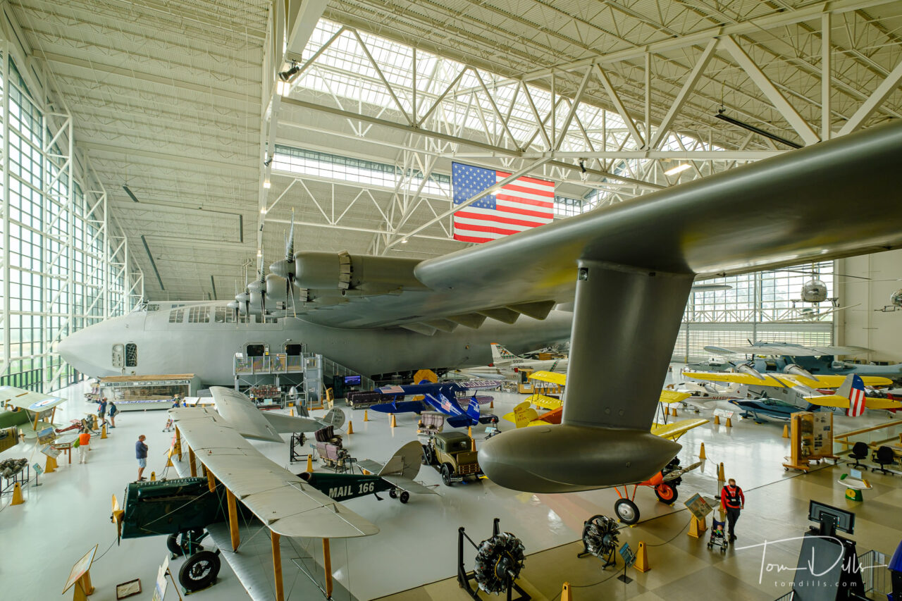
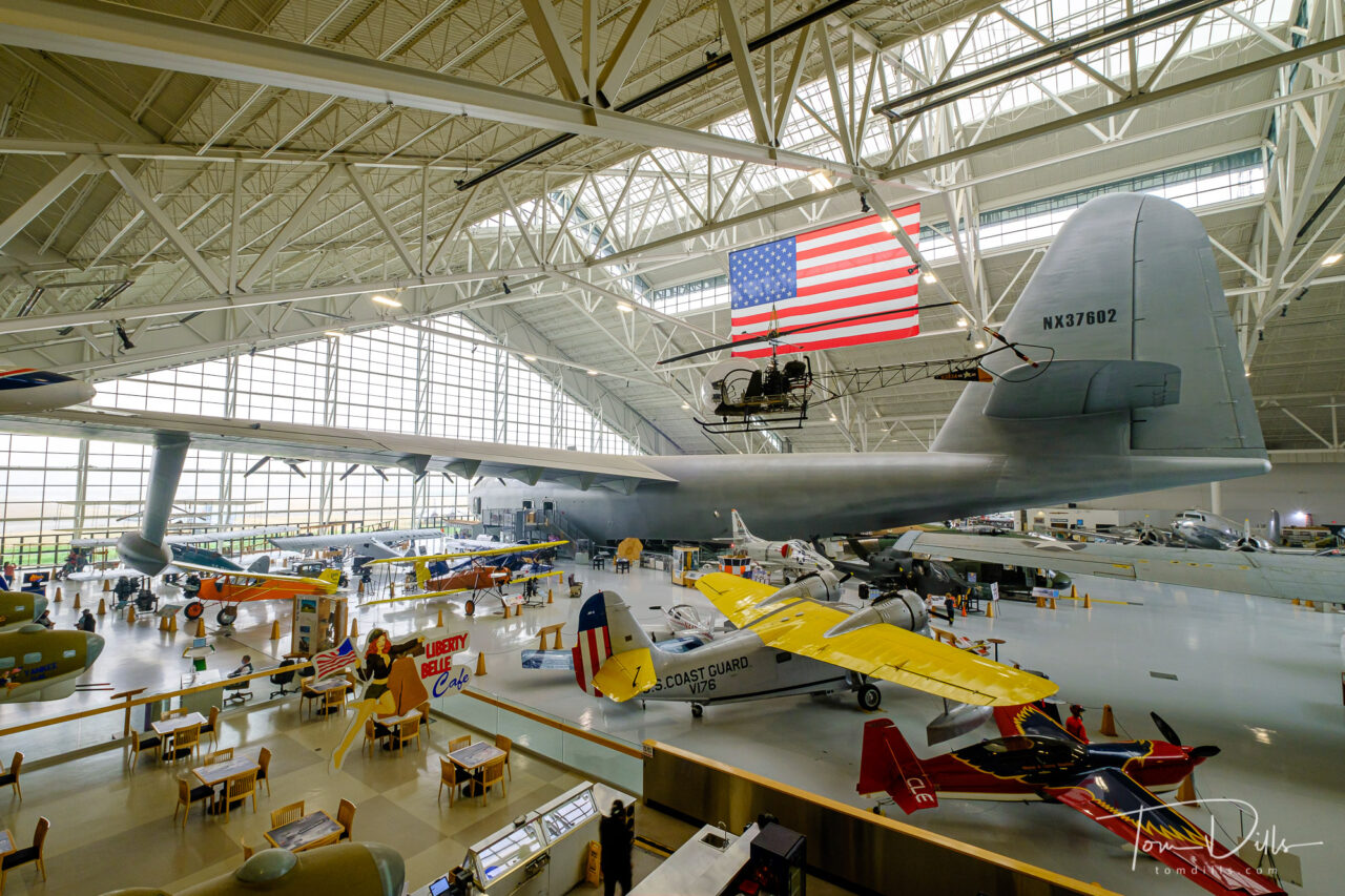
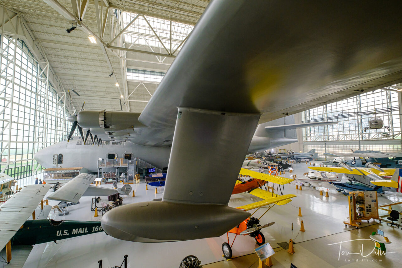
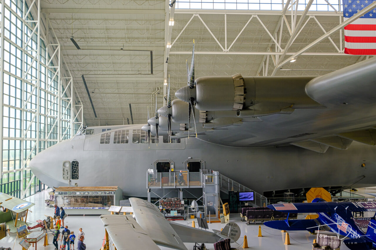
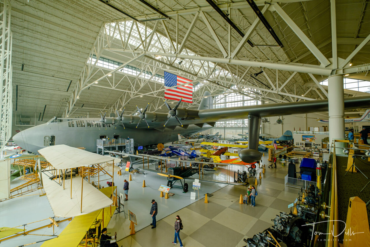
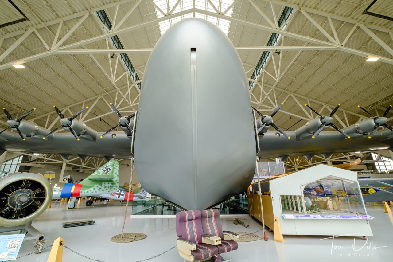
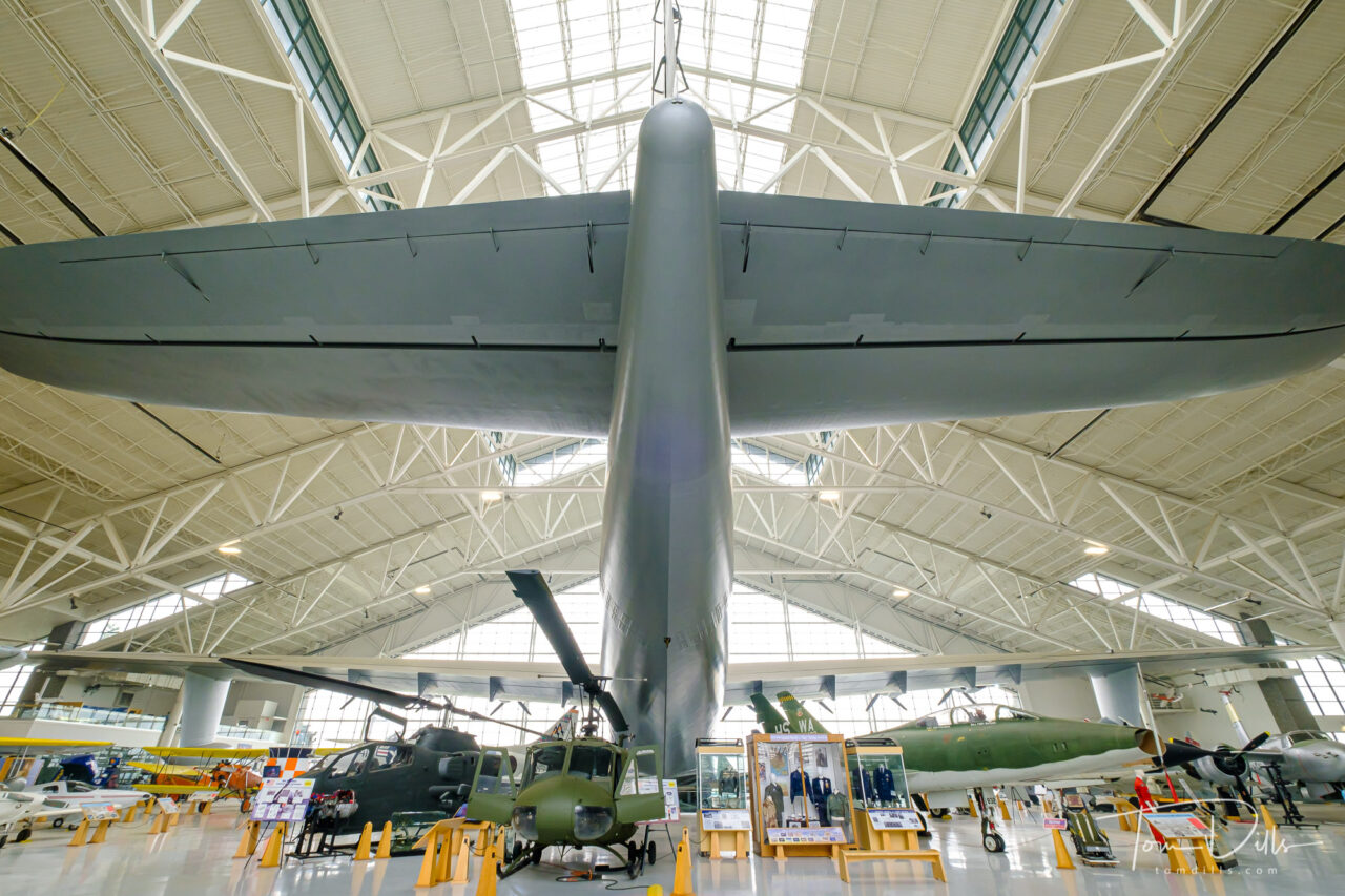
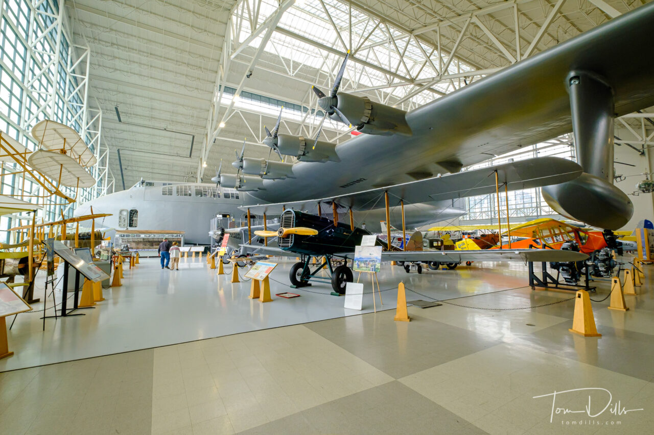
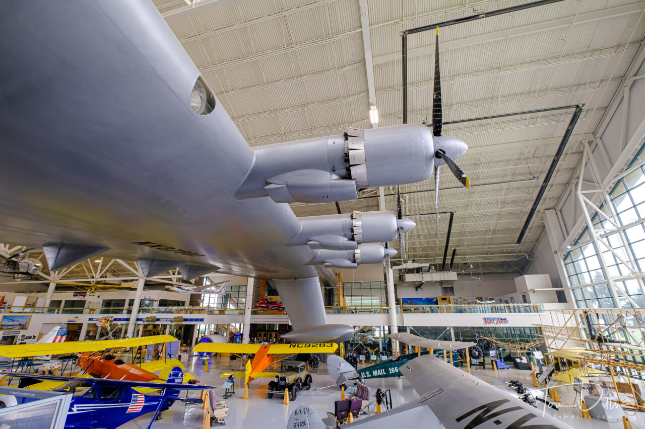
Howard Hughes’ “Spruce Goose” at the Evergreen Aviation & Space Museum in McMinnville, Oregon
Ever since I was a kid interested in airplanes, I remember reading about and seeing photos of Howard Hughes’ “Spruce Goose.” Officially known as the Hughes H-4 Hercules, the Spruce Goose was – at the time and for a while after – the largest aircraft to ever fly. The Wikipedia Page for the plane is a rabbit hole of more information for anyone wishing to delve deeper. After many stops on a long journey, the current home for the plane is the Evergreen Aviation and Space Museum in McMinnville, Oregon.
Howard Hughes’ “Spruce Goose” at the Evergreen Aviation & Space Museum in McMinnville, OregonHoward Hughes’ “Spruce Goose” at the Evergreen Aviation & Space Museum in McMinnville, OregonHoward Hughes’ “Spruce Goose” at the Evergreen Aviation & Space Museum in McMinnville, OregonHoward Hughes’ “Spruce Goose” at the Evergreen Aviation & Space Museum in McMinnville, Oregon
I didn’t realize that the Spruce Goose was in Oregon when we started making plans, but I came across a reference to it during our research. When I found out that we would be very close to McMinnville, a town in the heart of Oregon’s Willamette Valley wine region, stopping there was a no-brainer. Except…the museum had been closed during Oregon’s response to the Covid virus. Fortunately the conditions had improved enough for Oregon to allow museums to re-open shortly before we left home on our trip. Good timing – the state has recently re-entered a lockdown phase the the museum has closed again.
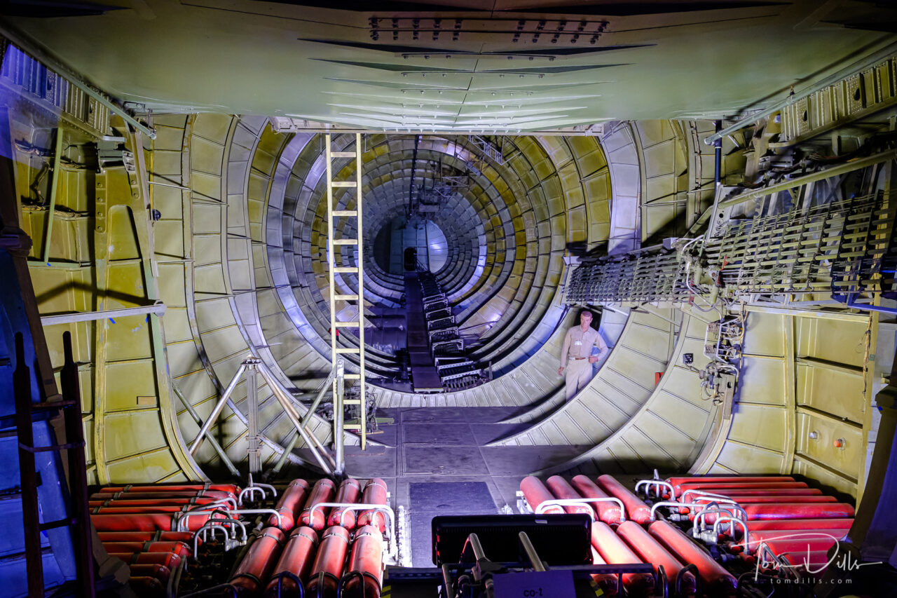
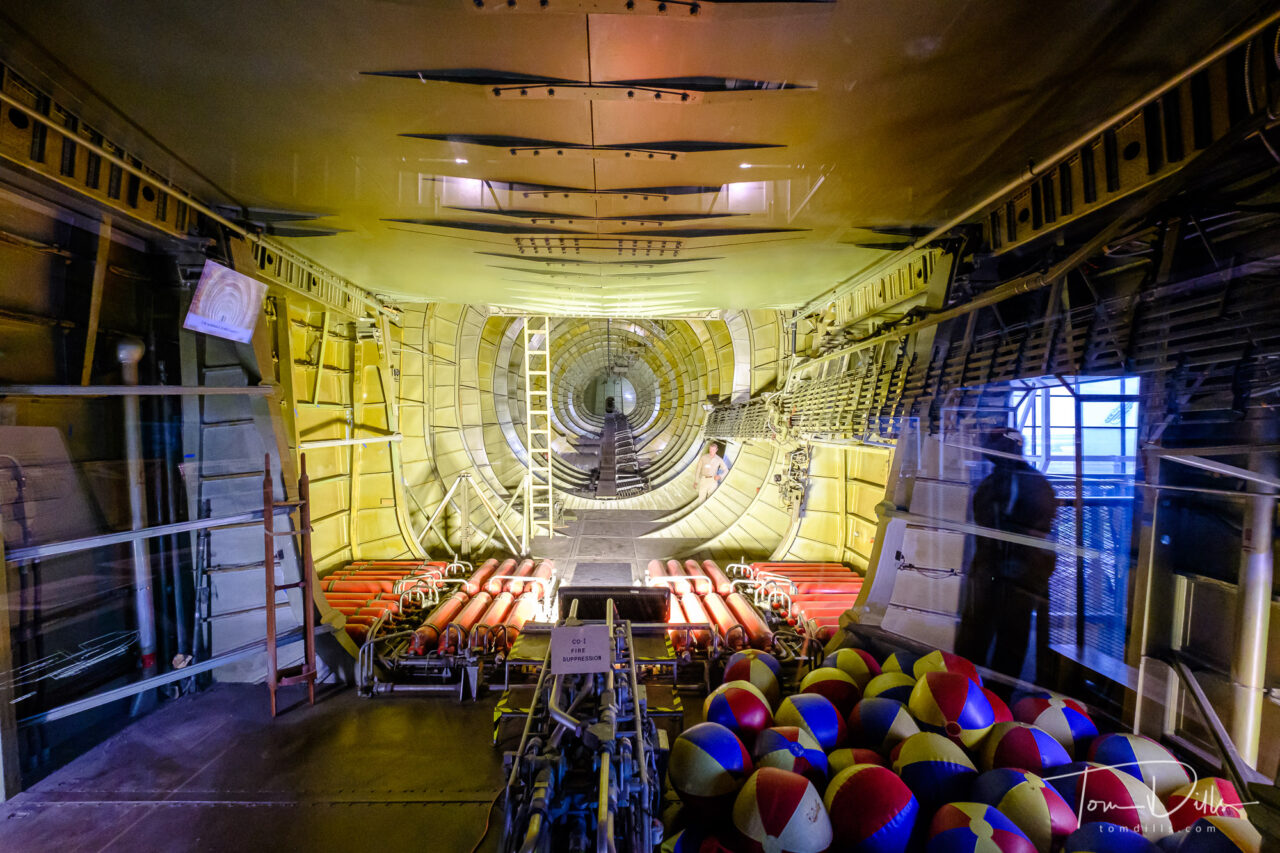
Cargo bay of Howard Hughes’ “Spruce Goose” at the Evergreen Aviation & Space Museum in McMinnville, OregonCargo bay of Howard Hughes’ “Spruce Goose” at the Evergreen Aviation & Space Museum in McMinnville, OregonCargo bay of Howard Hughes’ “Spruce Goose” at the Evergreen Aviation & Space Museum in McMinnville, Oregon
As you can see from the photos, the plane is simply enormous, dwarfing all of the other aircraft in the museum. For even more geekery, check out this article discussing the various calculations of “largest aircraft” along with a size comparison.
Howard Hughes’ “Spruce Goose” at the Evergreen Aviation & Space Museum in McMinnville, OregonHoward Hughes’ “Spruce Goose” at the Evergreen Aviation & Space Museum in McMinnville, OregonHoward Hughes’ “Spruce Goose” at the Evergreen Aviation & Space Museum in McMinnville, OregonHoward Hughes’ “Spruce Goose” at the Evergreen Aviation & Space Museum in McMinnville, Oregon
Seeing the Spruce Goose in person was a real treat. In fact the entire museum is really well done, with two separate buildings – one for aircraft and the other for space related displays. It was especially nice to have a good indoor thing to do, since all that haze you see in the outdoor photos is smoke. 🙁
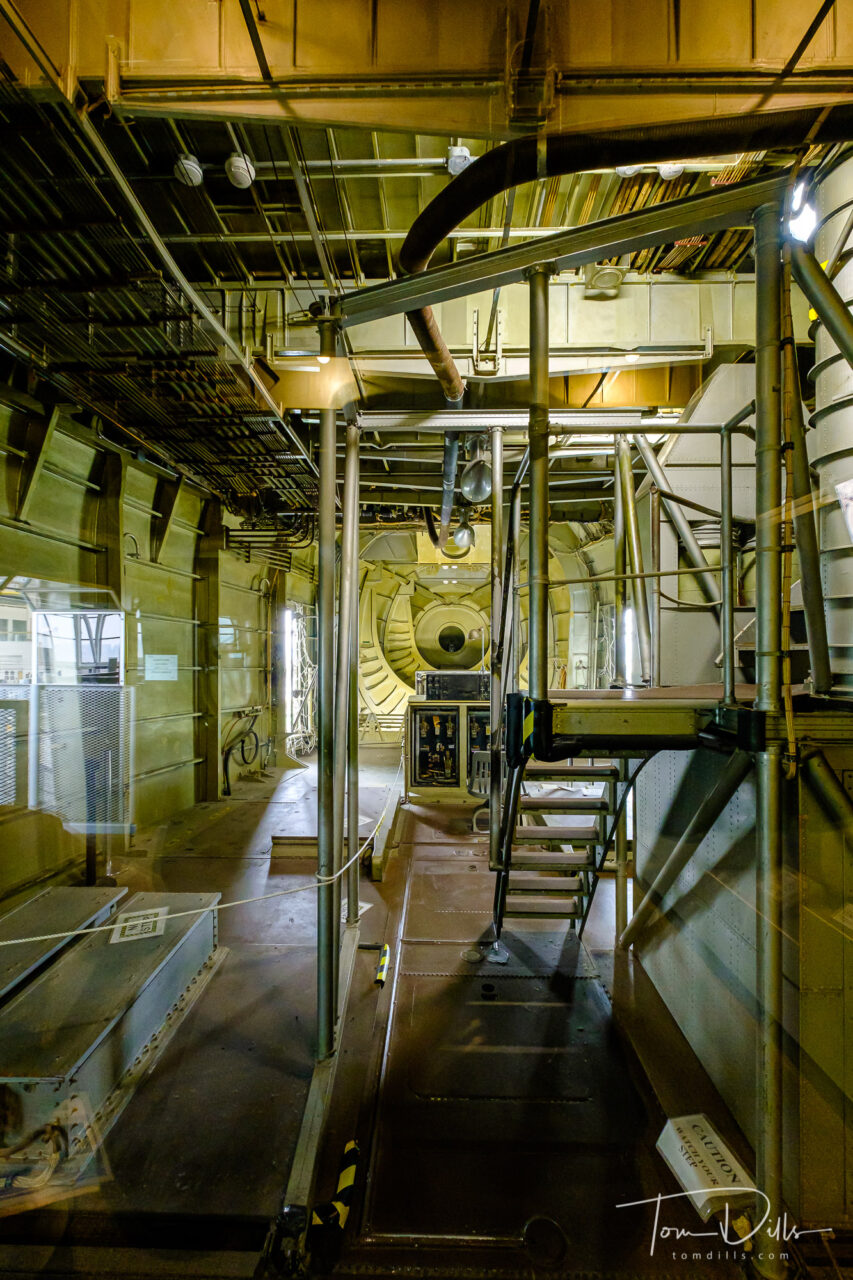
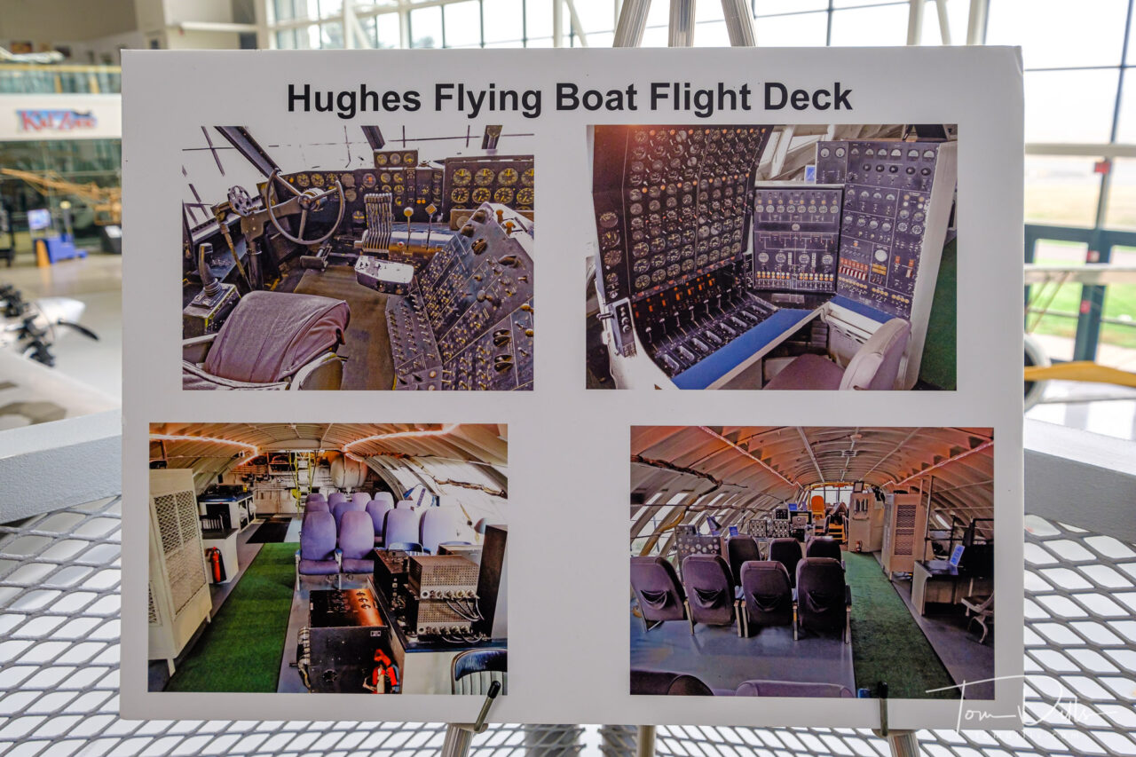
Photos of the flight deck of Howard Hughes’ “Spruce Goose” at the Evergreen Aviation & Space Museum in McMinnville, Oregon
For even more photos from the museum, I’ve created an Adobe Portfolio Page. Check it out!
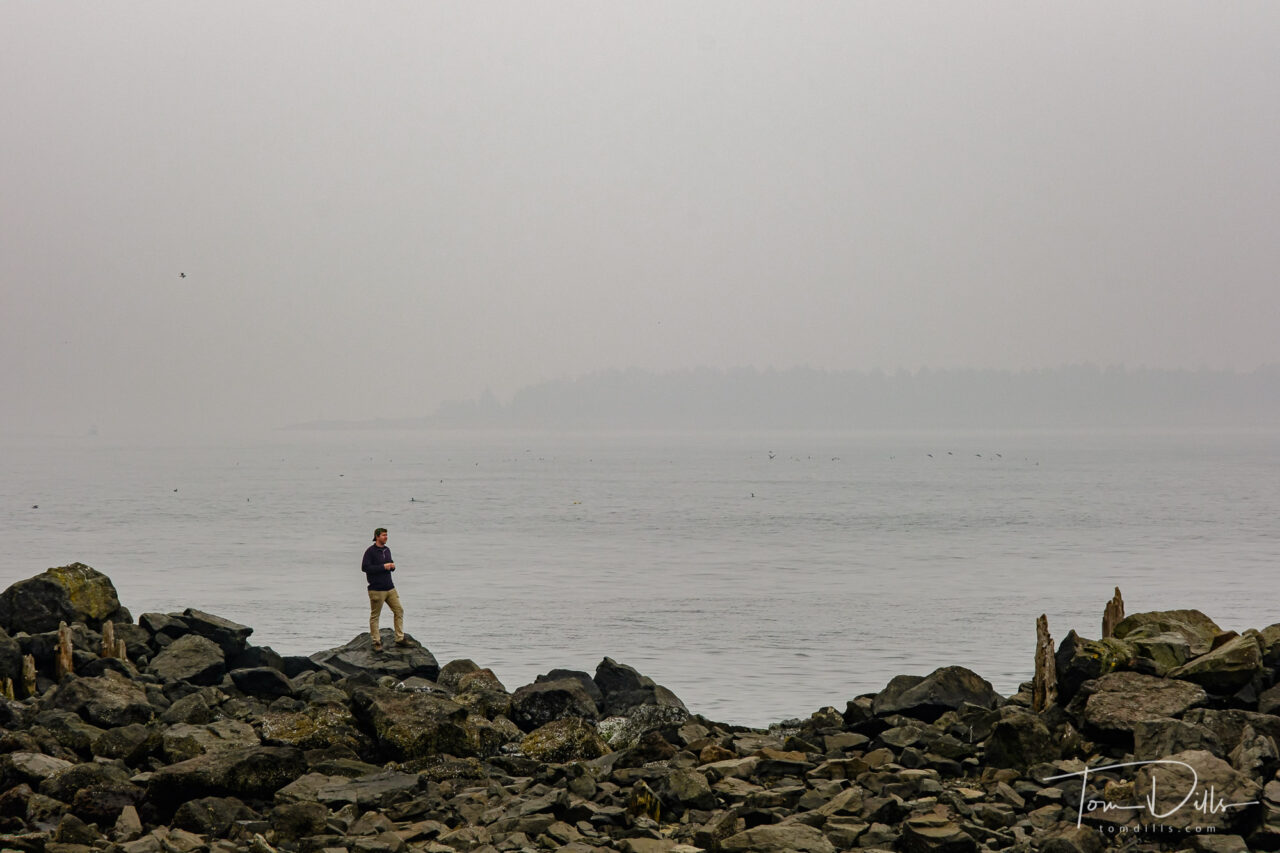
When we left Cannon Beach we headed down the coast, hoping to catch some views of the Pacific Ocean scenery before turning east toward McMinnville, a town in the heart of Oregon’s Willamette Valley wine region. We didn’t get many long-distance views, but we did manage to see some interesting things along the way, including the ferocious prehistoric creature I posted about previously. 🙂
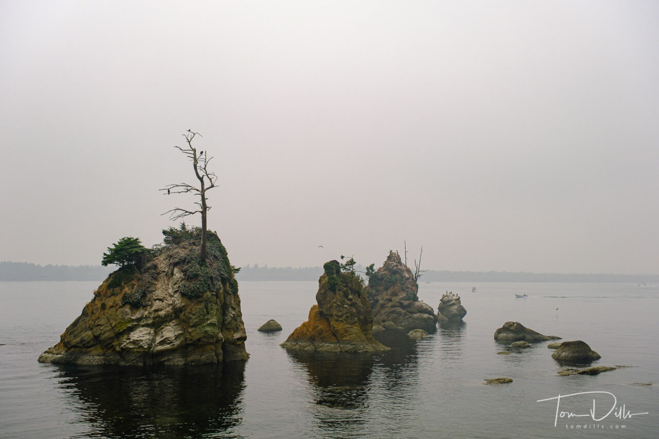
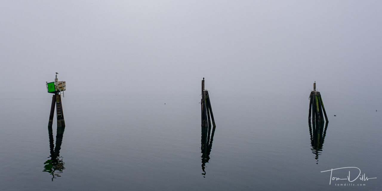
Barview Jetty Park near Rockaway Beach, OregonRock formation known as “The Three Graces” along US-101/Oregon Coast Highway near Garibaldi, Oregon
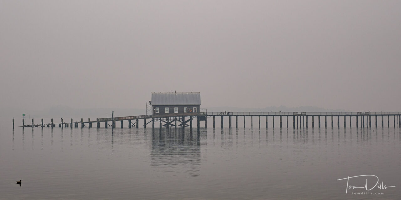
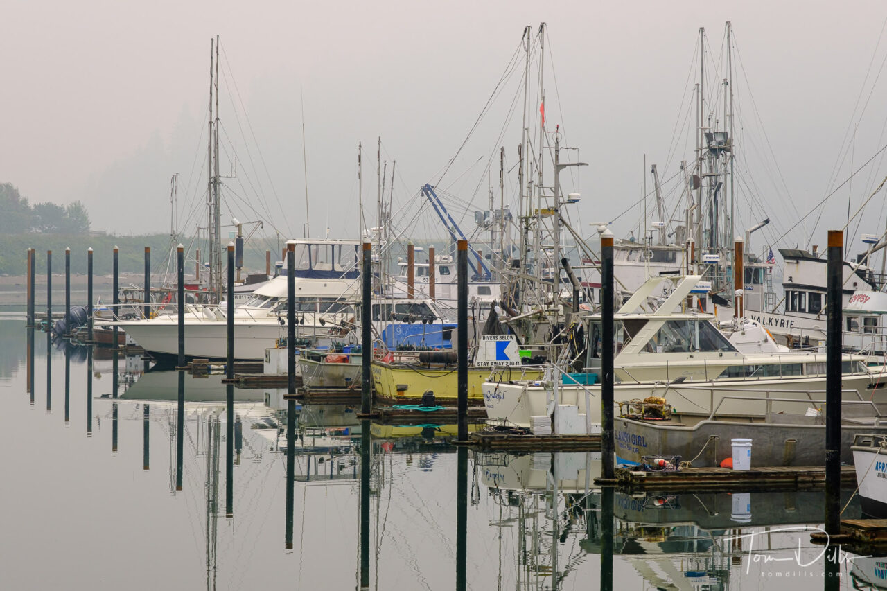
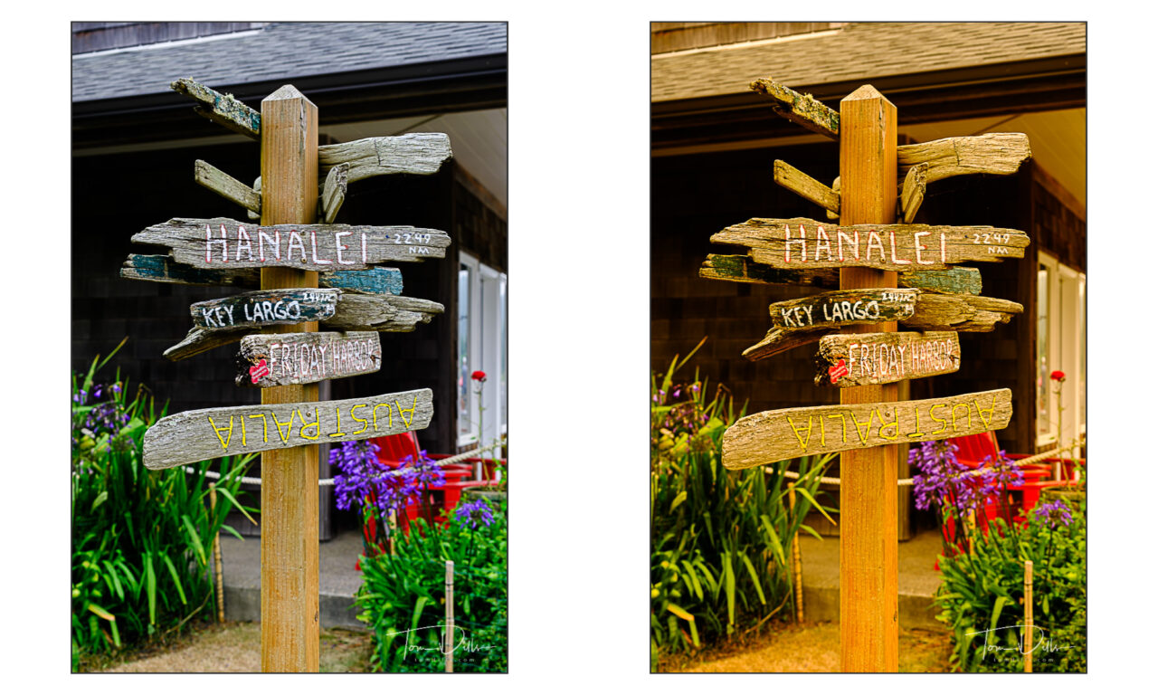
What looks like fog in these photos is a combination of actual fog and smoke from the wildfires farther inland and some drifting north from northern California. Thanks to the magic of white balance adjustment, these look mostly like fog, while the original files have more of an orangey-brown cast to them.
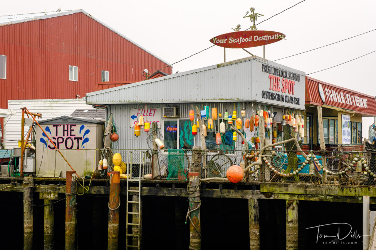
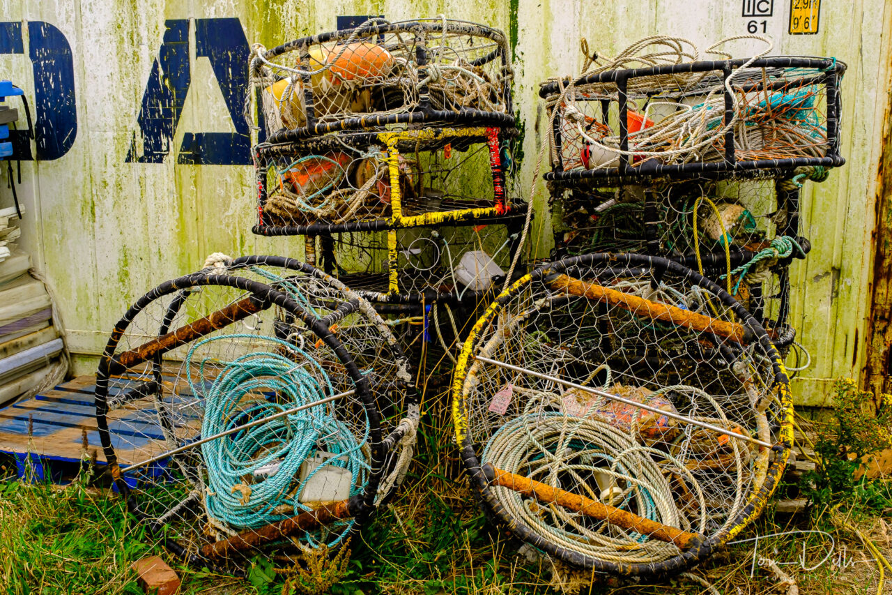
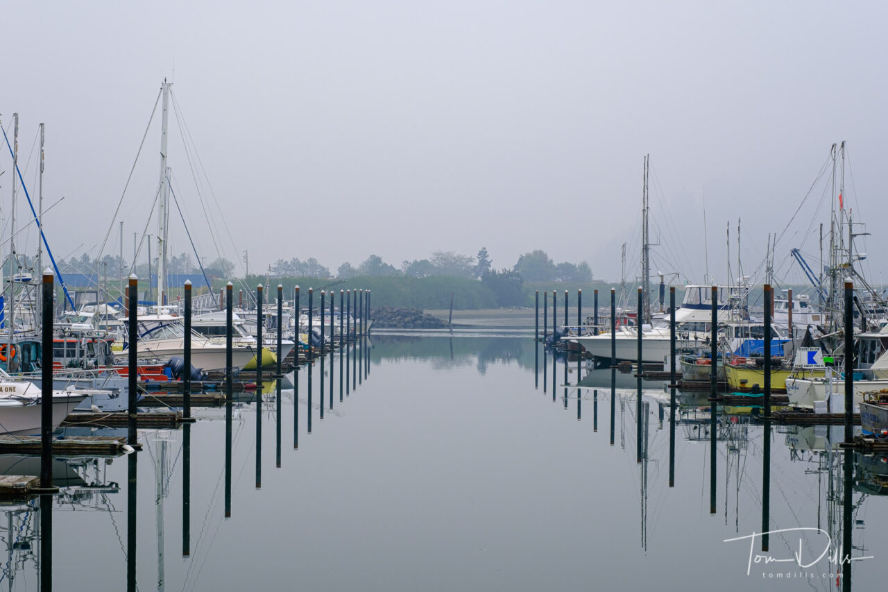
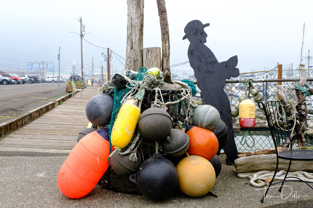
Views of the Port of Garibaldi and Garibaldi Marina in Garibaldi, OregonViews of the Port of Garibaldi and Garibaldi Marina in Garibaldi, OregonViews of the Port of Garibaldi and Garibaldi Marina in Garibaldi, OregonViews of the Port of Garibaldi and Garibaldi Marina in Garibaldi, OregonViews of the Port of Garibaldi and Garibaldi Marina in Garibaldi, Oregon
We spent a bit of time exploring the marina in Garibaldi, a small town of 800~ on Tillamook Bay along US 101. The marina provided us with some visual stimulation, and the addition of the smoke/fog allowed for some interesting photographs. Garibaldi is home to a scenic railway – which was not operating – a maritime history museum, also closed and a US Coast Guard station. It might make for a good destination on a return trip, as there appear to be a number of quaint looking inns nearby!
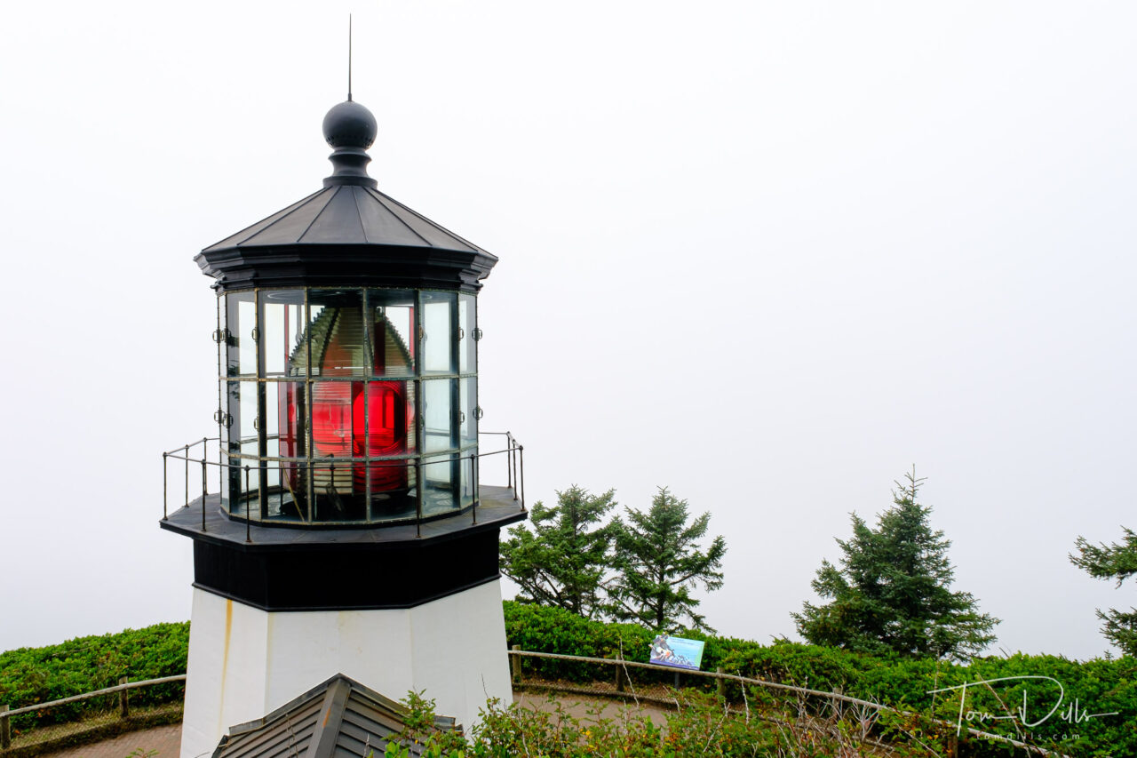
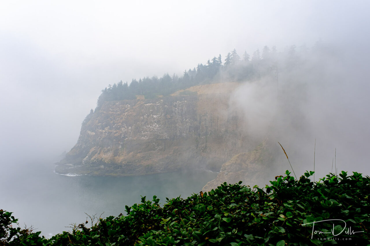
Cape Mears Lighthouse on Cape Mears, OregonFoggy views from Cape Mears, Oregon
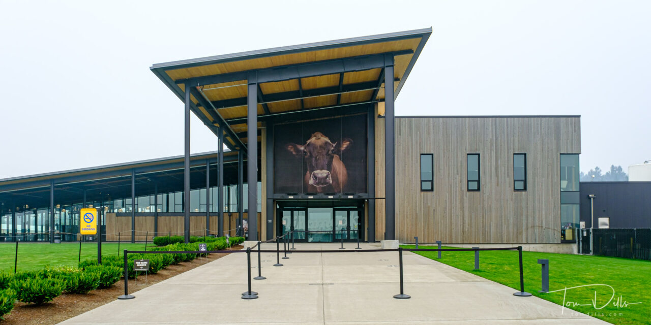
We had hoped to visit the Tillamook Creamery, but it had closed just prior to our arrival due to a combination of the virus and the heavy smoke. So we moved on to Cape Lookout (home of the dinosaur) and Cape Mears to check out the lighthouse before making our way to McMinnville.
Tillamook Cheese Visitor Center (closed) in Tillamook, Oregon
Now that winter has decided to arrive and the temperature has turned colder, I’m starting to get back to the photos from our Northwest road trip. I’ve been shooting more than I’ve been processing, so I’m just a little behind but will eventually get caught up!
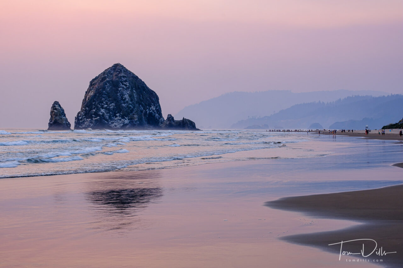
Haystack Rock at sunset over the Pacific Ocean from Cannon Beach, Oregon
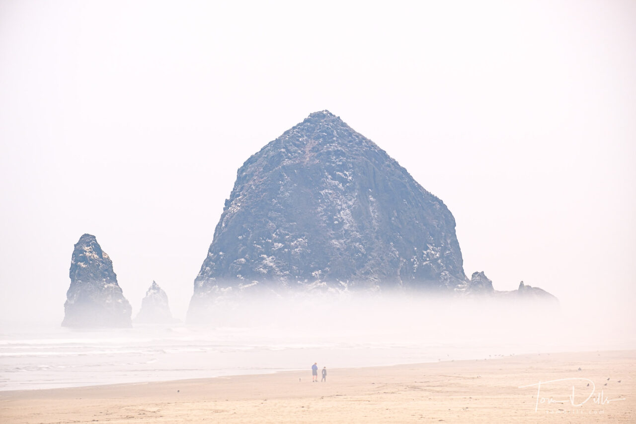
Kathy & I spent two nights in Cannon Beach, Oregon specifically to see the sea stacks along the coast. Probably the most famous stack is Haystack Rock, which sits just off the coast and literally in front of “downtown” Cannon Beach.
The size and scale of Haystack is a hard to capture in a photograph, but I did include some people in a few of my shots for scale.
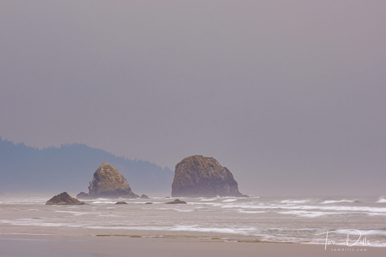
Unidentified Sea Stacks off the coast in Cannon Beach
Unfortunately, despite being there for two nights and nearly 48 hours, the smoke got so thick that when combined with the usual coastal fog, we only got views of the rock formations the very first night and the following morning. After that I “knew it was out there somewhere” but had to be satisfied with the photos I got.
Two Photos Are Better Than One. (Didn’t have the guts to tell him that the mask works best on the front of your head. )
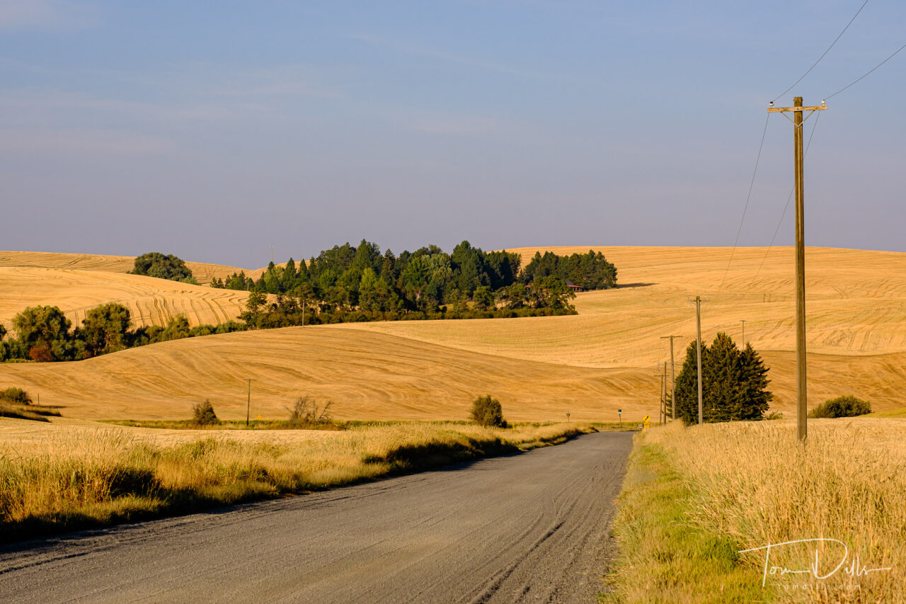
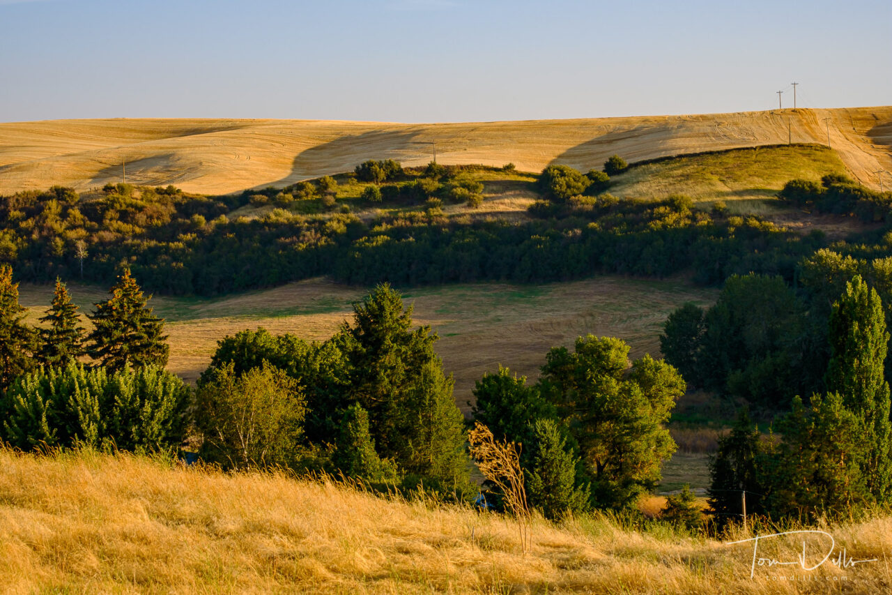
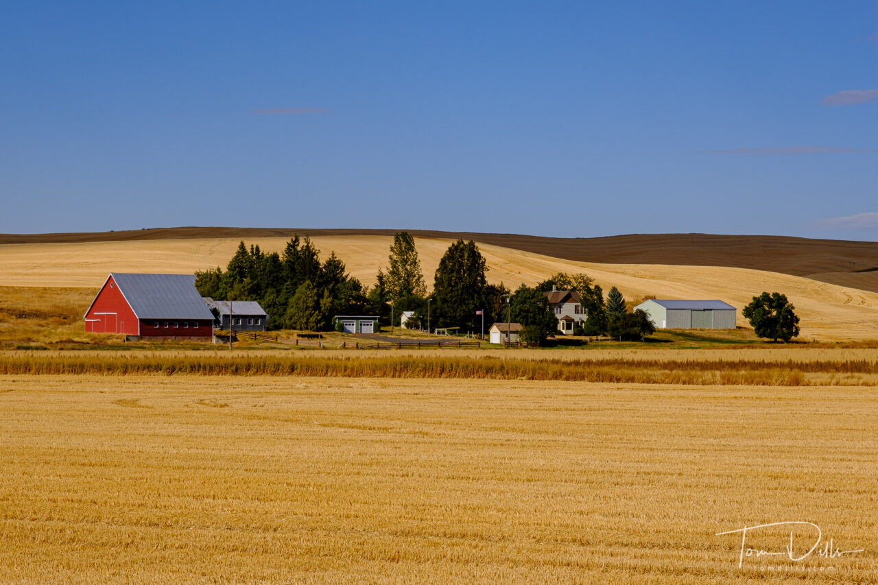
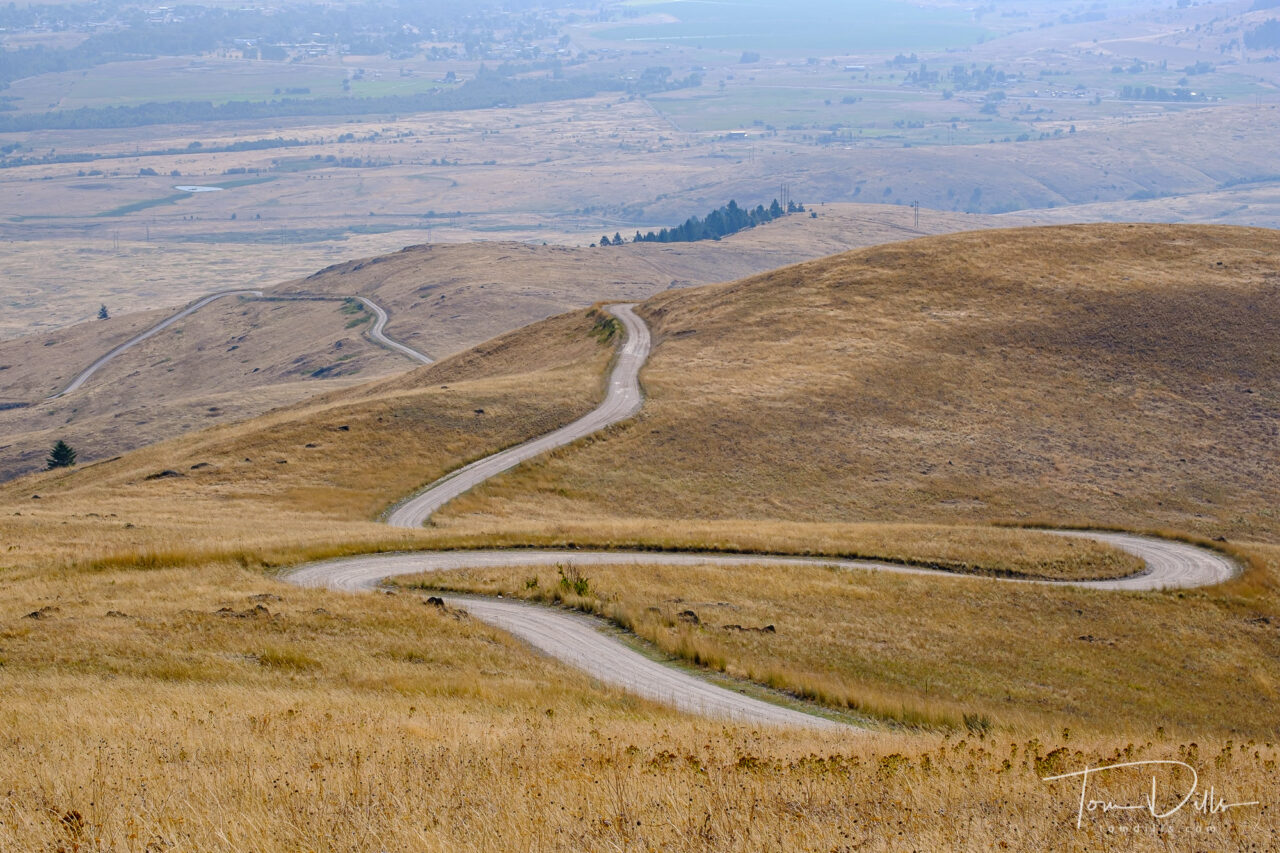
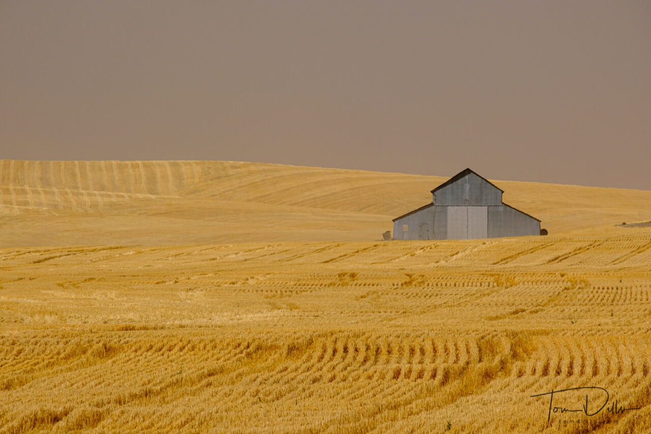
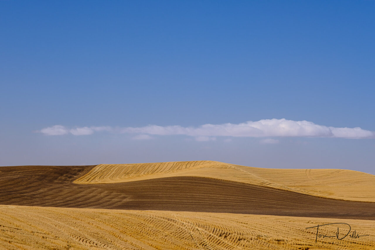
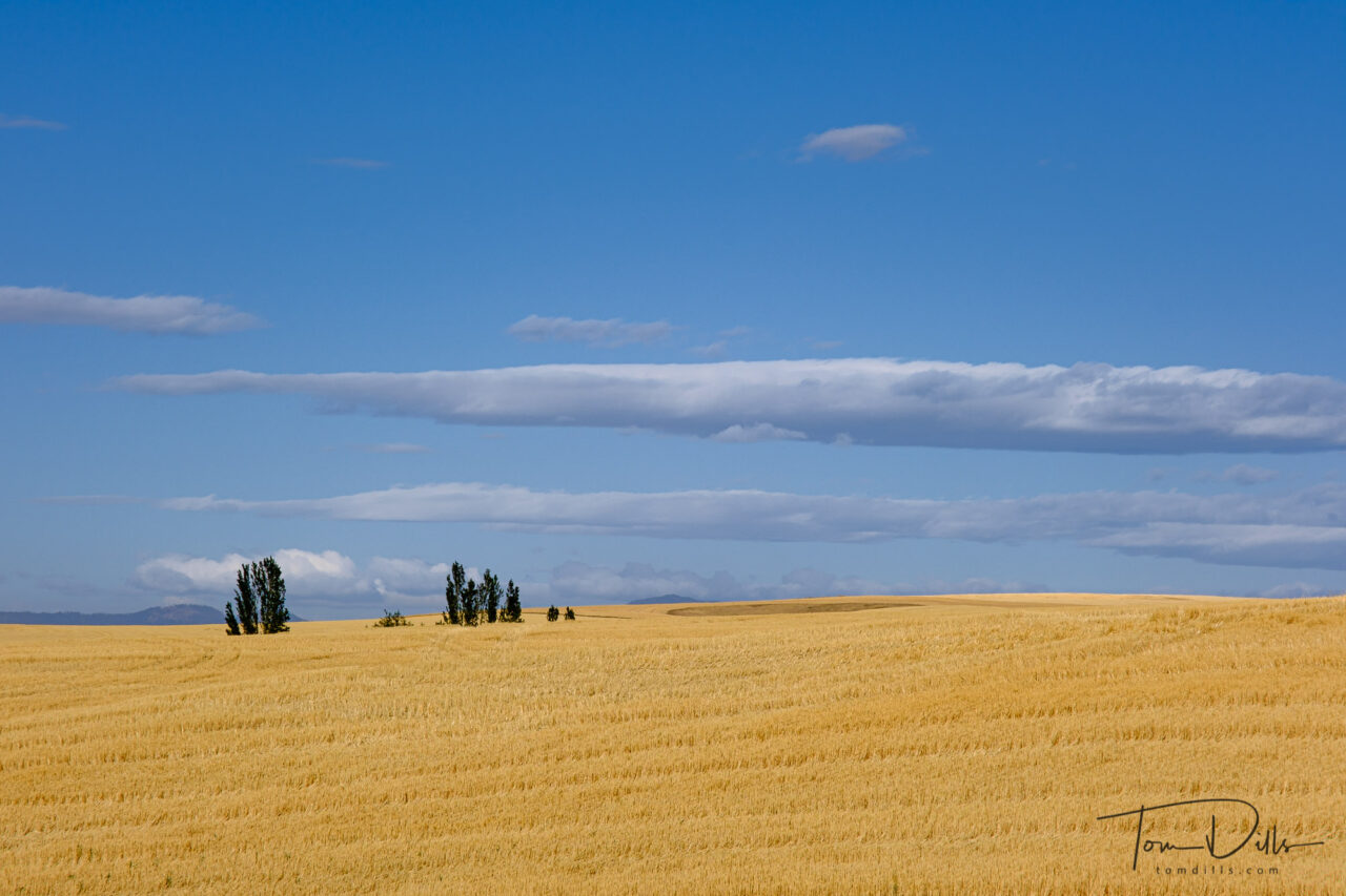
Rural scenery in The Palouse area of eastern Washington north of Pullman
On the day we arrived in Pullman, Washington, the weather service had posted high wind warnings for the following day, with blowing dust, falling trees and all sorts of mayhem. As if that wasn’t enough, when we checked in to our motel we found out that a group of National Guard troops were due to arrive the following day to set up a Covid testing site at the university. Swell.
Rural scenery in The Palouse area of eastern Washington north of PullmanRural scenery in The Palouse area of eastern Washington north of PullmanRural scenery in The Palouse area of eastern Washington north of PullmanRural scenery in The Palouse area of eastern Washington north of PullmanRural scenery in The Palouse area of eastern Washington north of Pullman
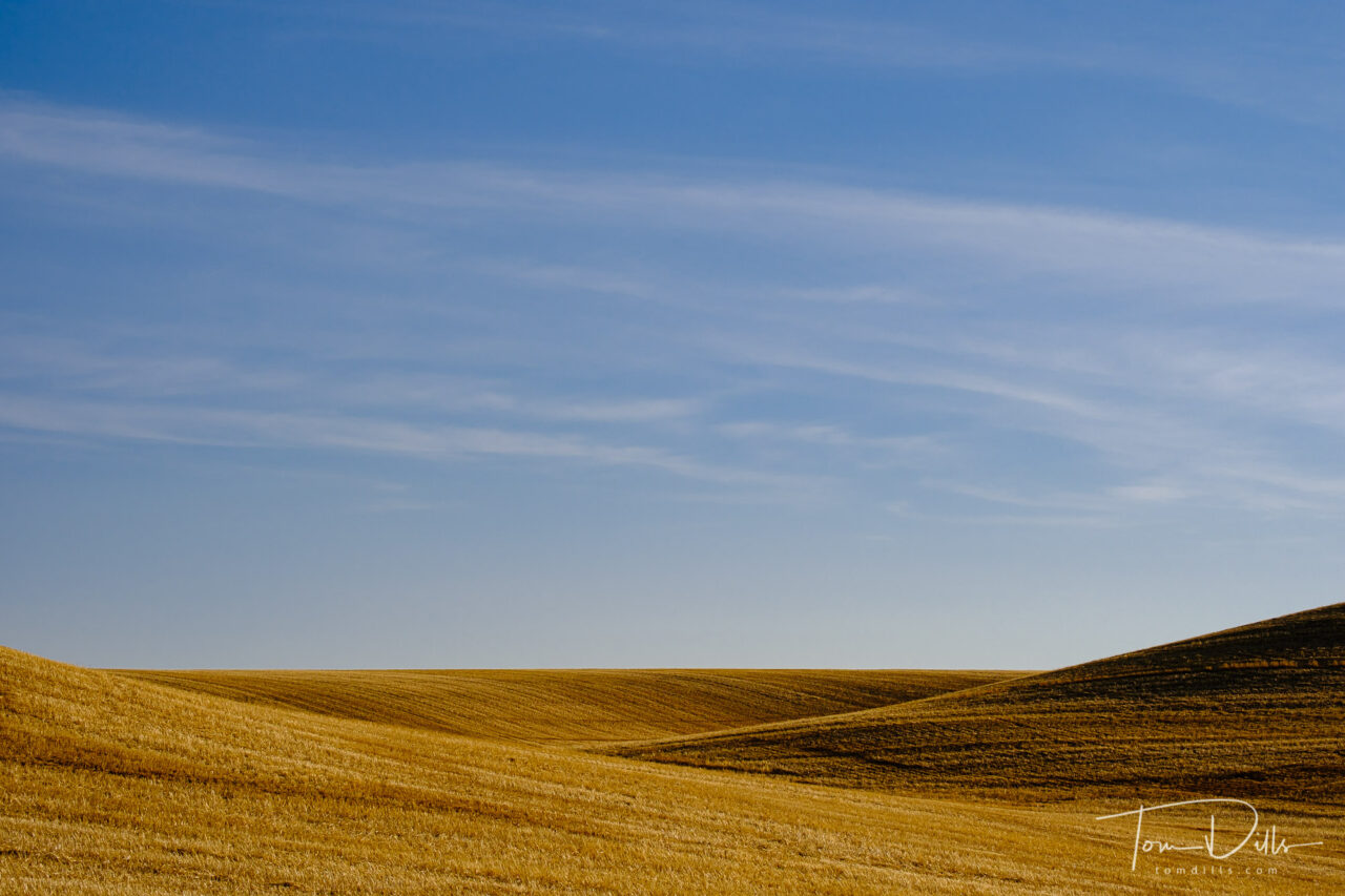
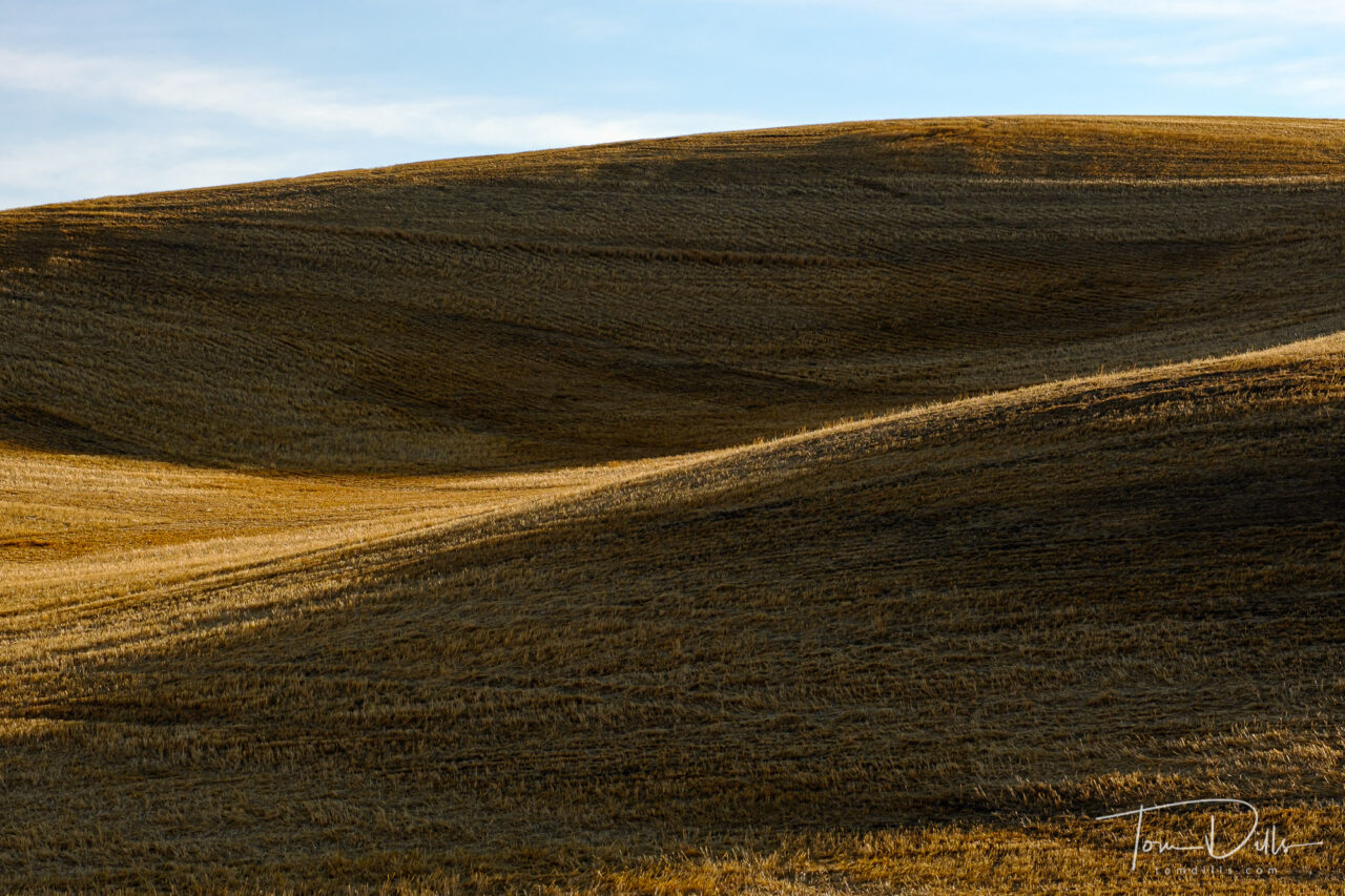
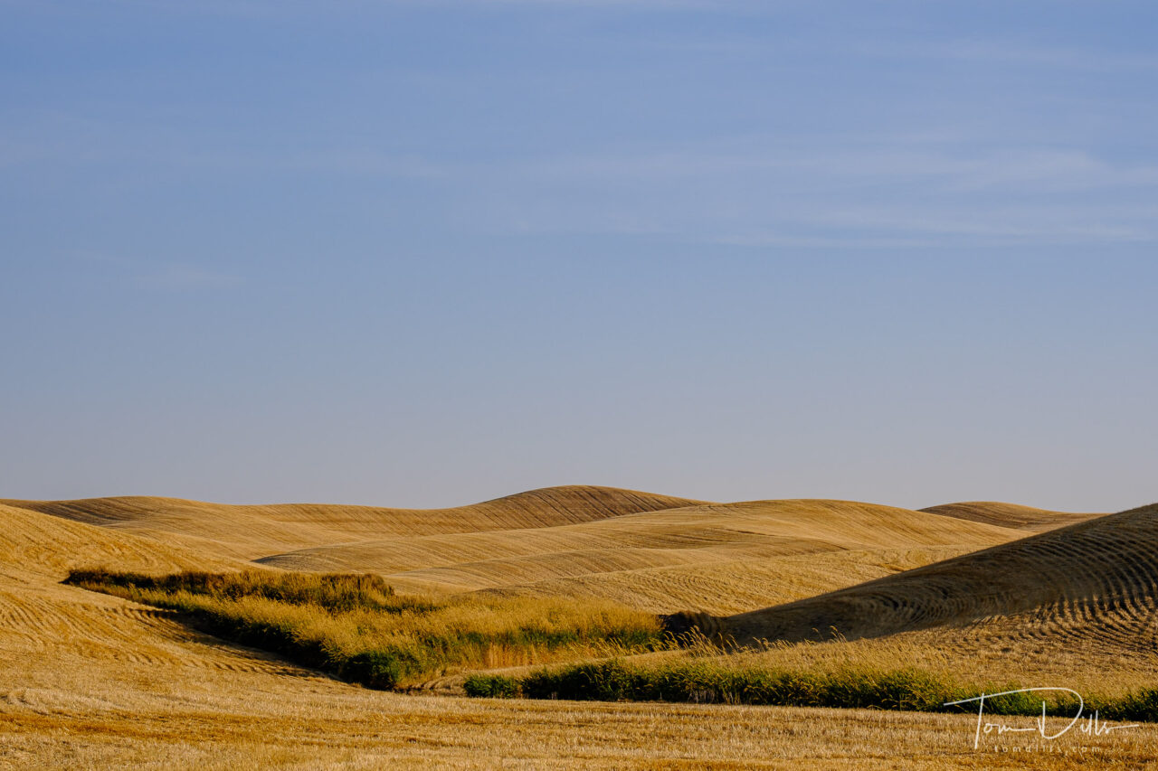
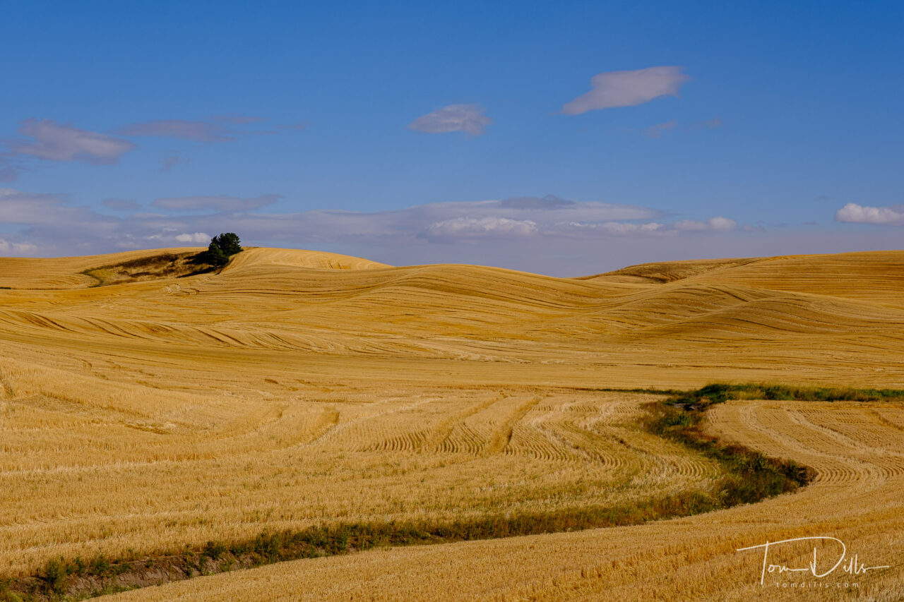
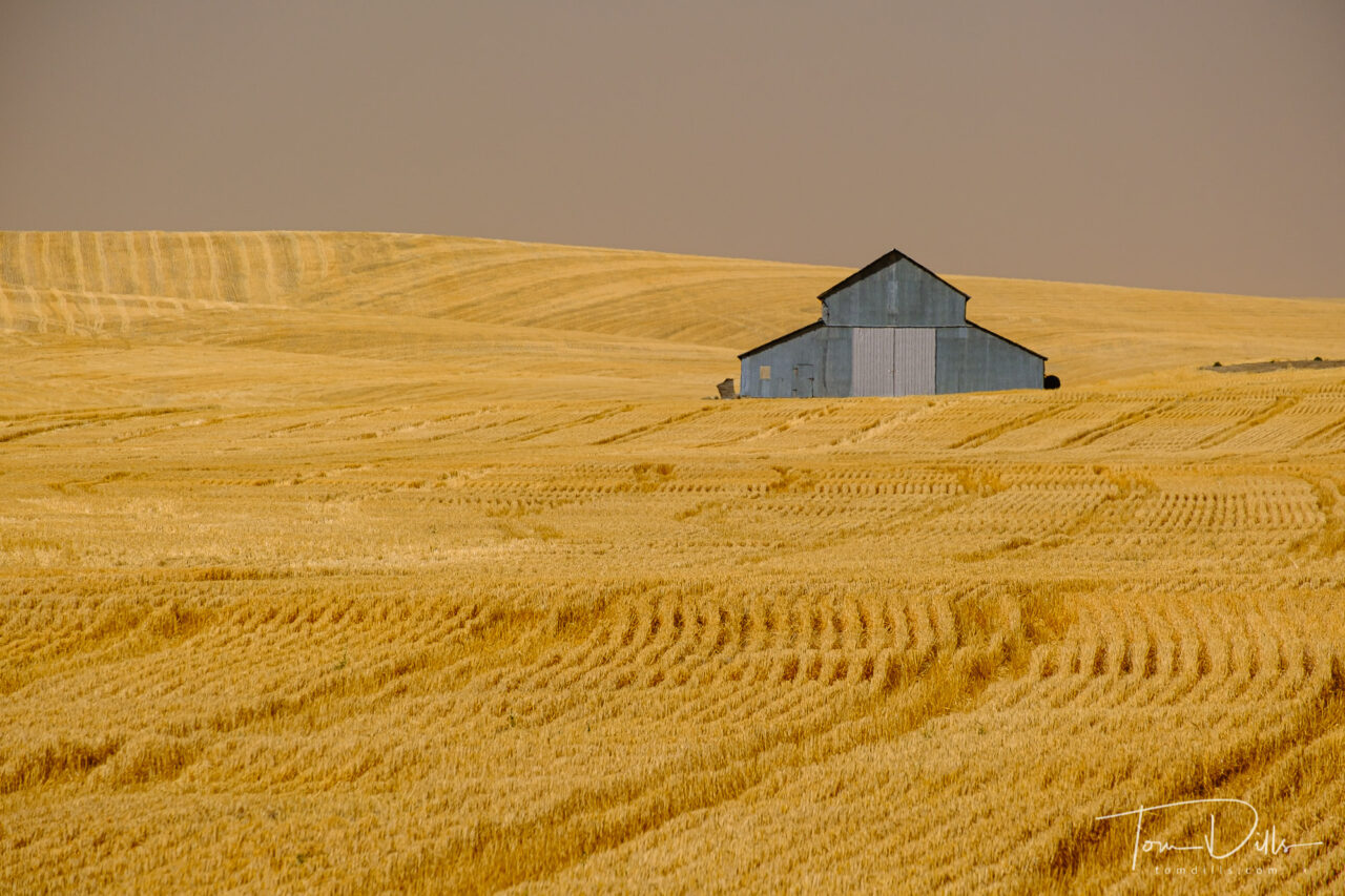
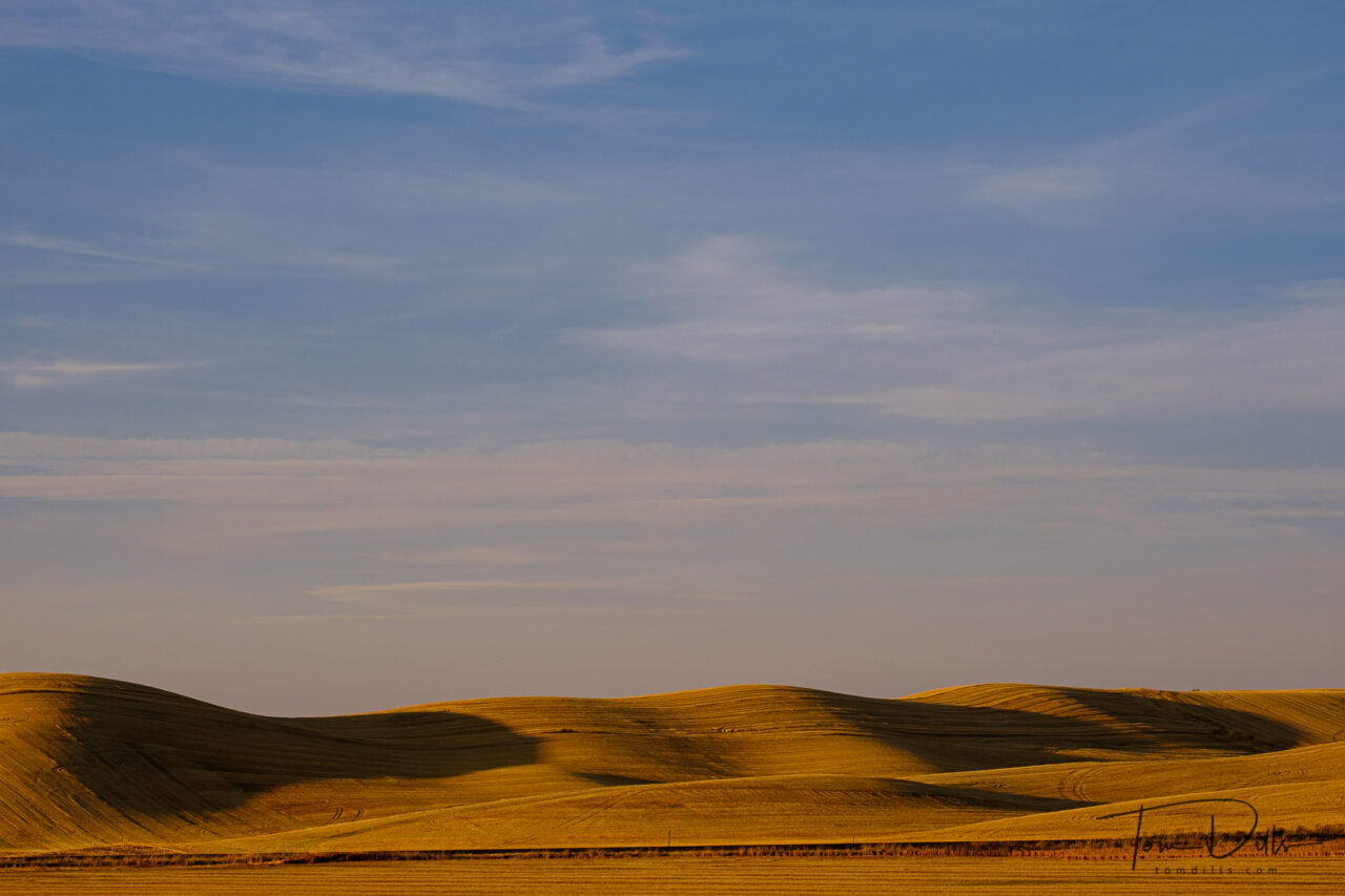
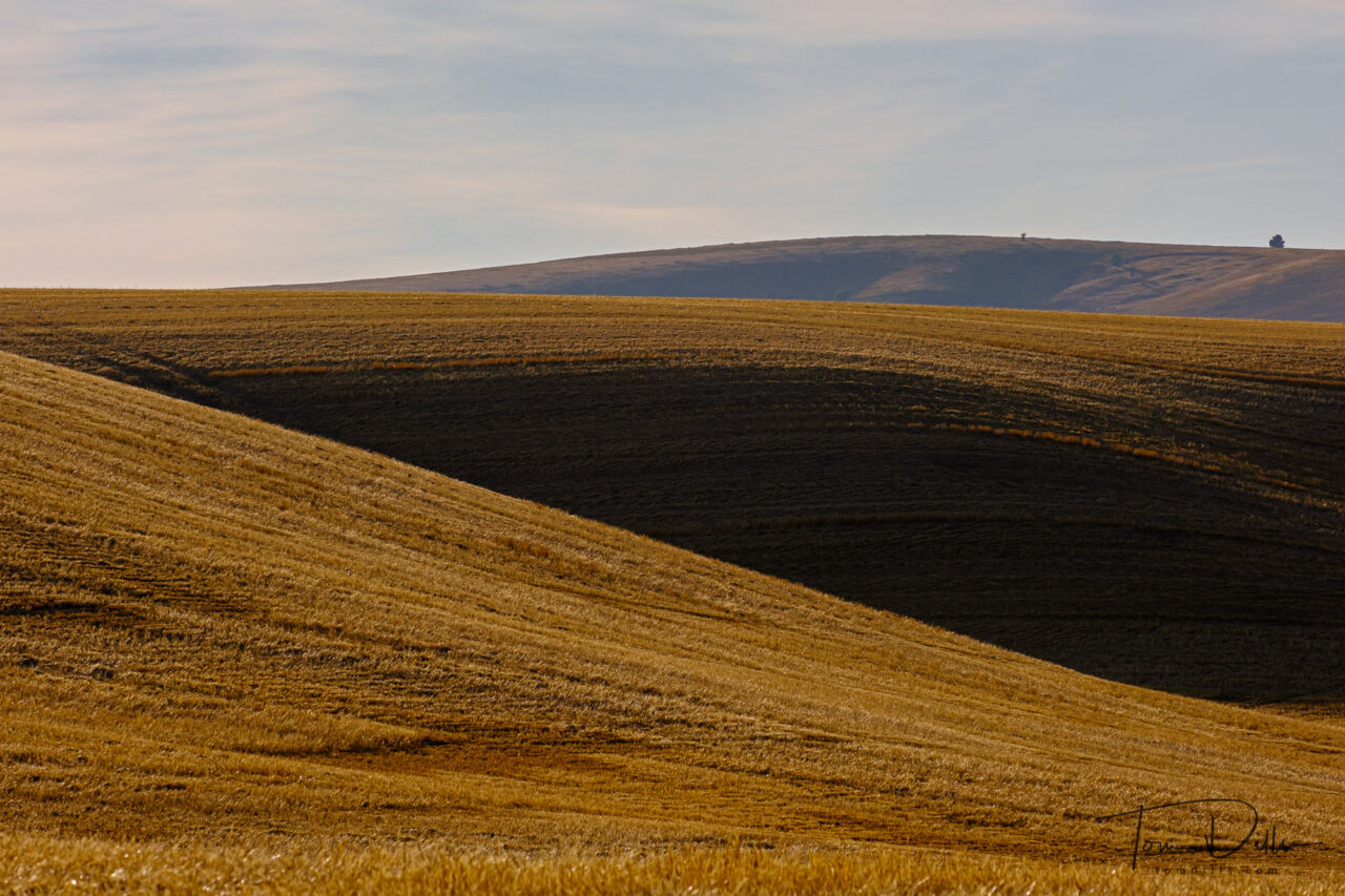
For those who don’t already know, The Palouse is a distinct geographic region encompassing parts of north central Idaho, southeastern Washington, and, by some definitions, parts of northeast Oregon. It has become a destination for photographers from all over due to the rolling hills that come alive in the spring and fall when this fertile land produces a mix of deep greens and brilliant yellows. Our visit was past the peak time, so for the most part we saw fields of wheat contrasting with areas that had already been harvested, so instead of green and yellow we had yellow and brown. It still made for some interesting photographs!
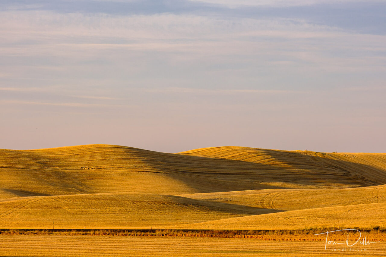
Rural countryside along SR 26 in southeastern WashingtonRural countryside along SR 26 in southeastern Washington
I had dismissed The Palouse as one of those photographic cliches that “everyone” does, like the slot canyons in Arizona or the “Boneyard” in South Carolina. And in many ways it is exactly that. If you are there at the right time and in the right light, all you really need to so is point the camera at something and press the button. But the interesting thing is that it isn’t that easy! In order to make a personally interesting photograph you need to work at it. Yes, I took a bunch of photos, but when it came right down to it I ended up with only a handful or two of truly “special” photos.
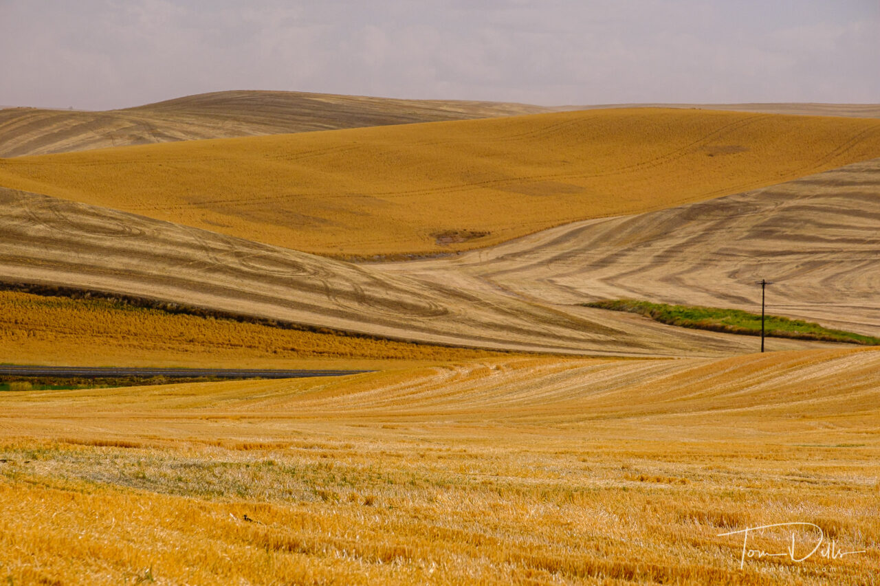
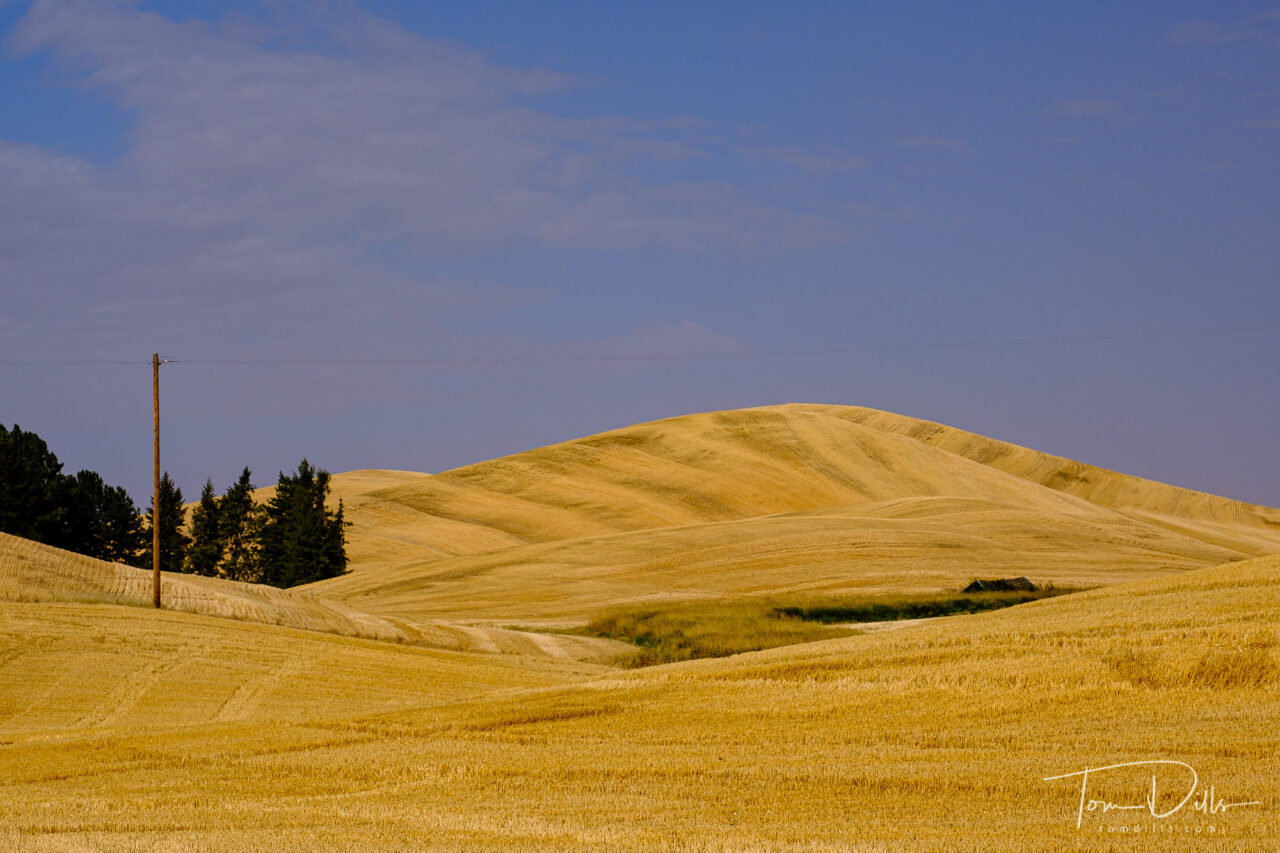
Rural scenery along US-195 near Uniontown, WashingtonRural scenery along US-195 near Uniontown, Washington
We had only planned to spend two nights in Pullman anyway and were prepared to make the most of our time, so we set out in late afternoon of the first day to explore the countryside. We had no difficulty finding photogenic scenery! The biggest difficulty was that most of the roads through the countryside are dirt and gravel. And the dirt is not what we find here in the east. Because the soil is so rich and fertile, the dirt can be more like a fine talcum powder, and it gets into everything. Fortunately I didn’t have to change lenses in the field so I didn’t have that to worry about! The car, however, was a mess!
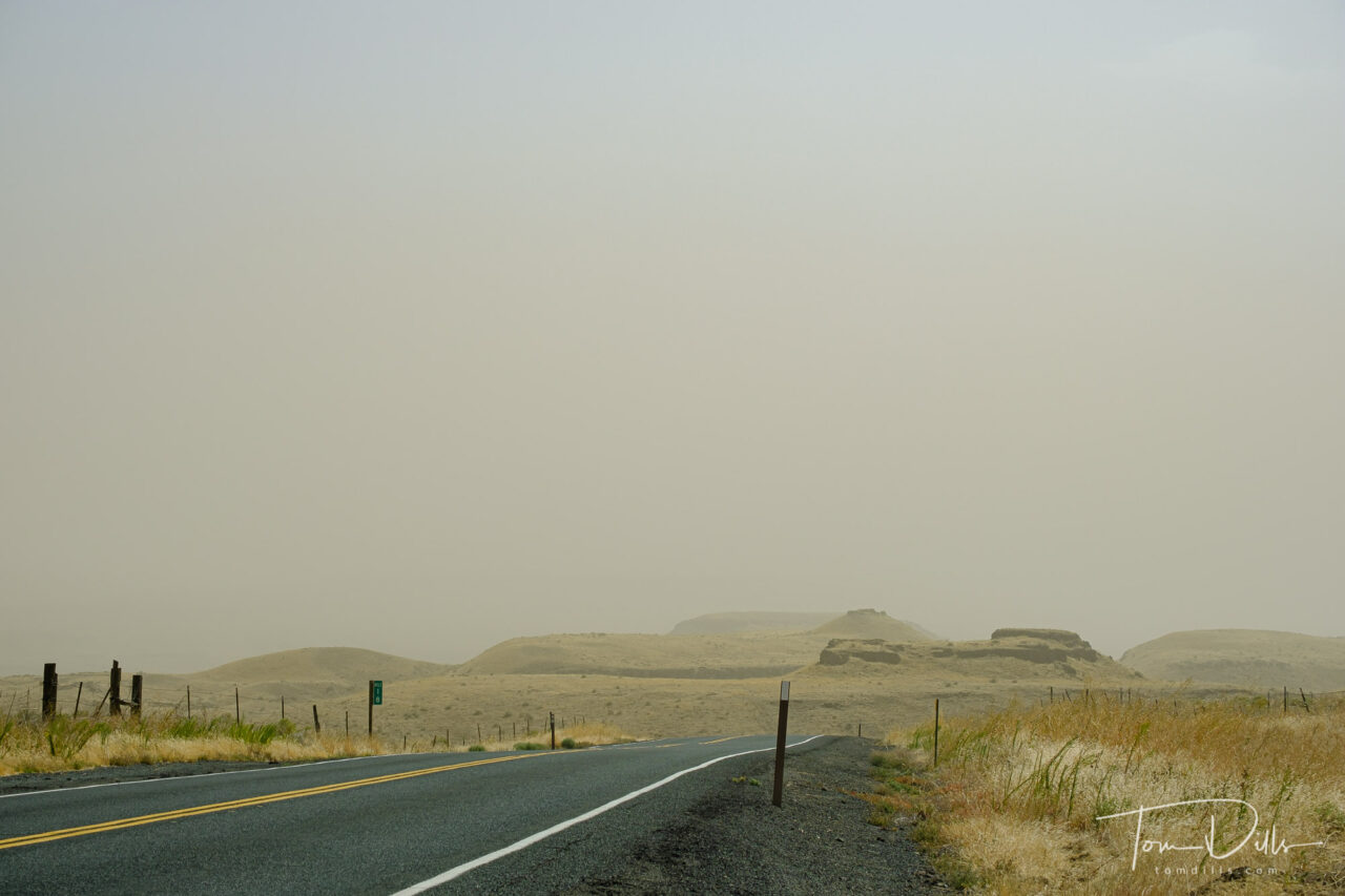
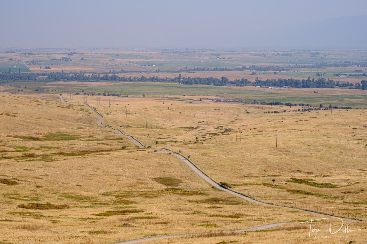
The next day we had planned to head to Steptoe Butte, a state park with a high point that is supposed to be ideal for photographing the surrounding countryside. But when we got up in the morning, the winds had arrived as advertised, so we decided to skip Steptoe, reasoning that the higher elevation would make it a very unpleasant place to spend a wind storm. So we headed west and south toward the Snake River Valley.
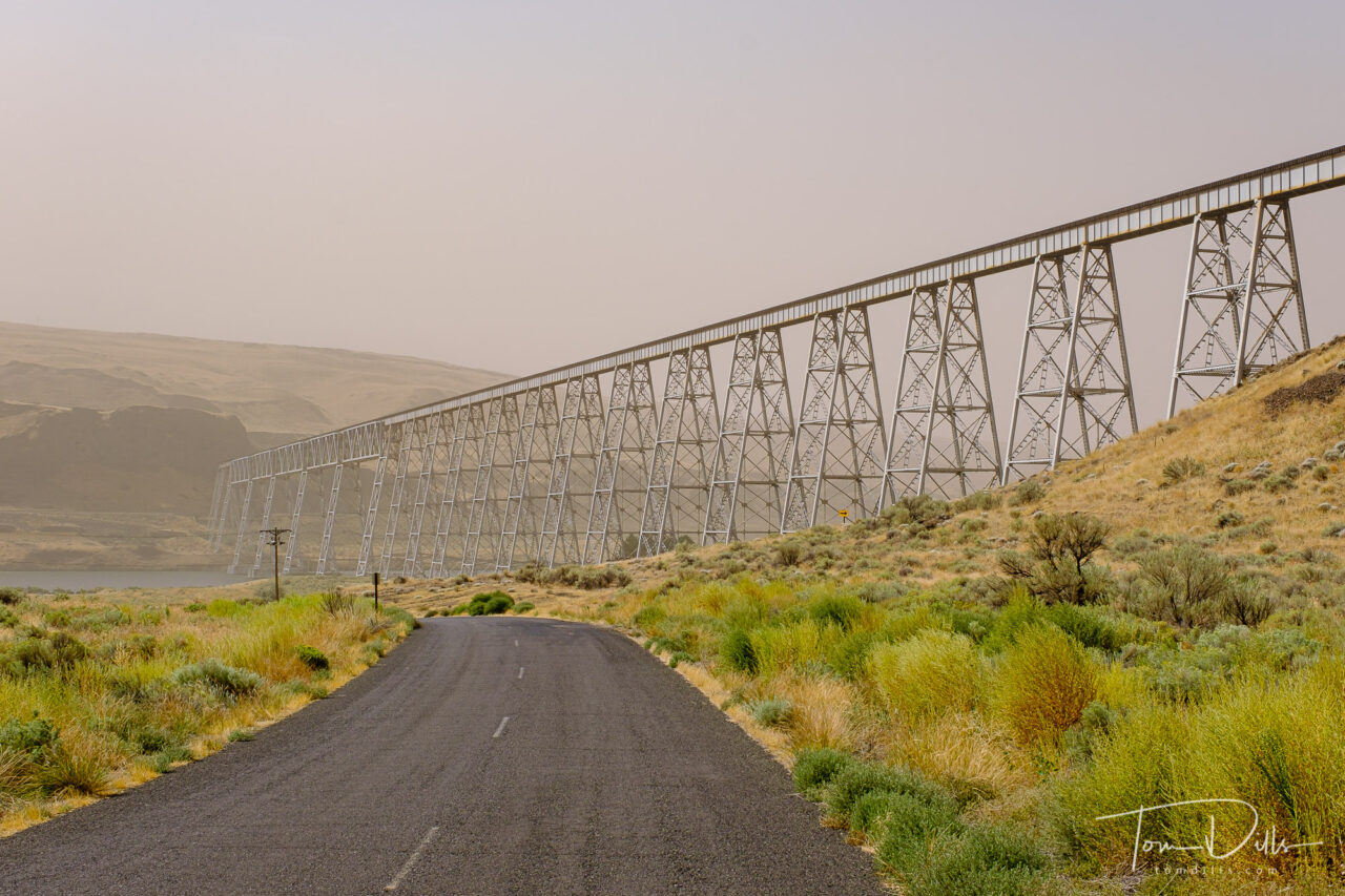
Blowing dust along SR 261 near Palouse Falls State Park in southeastern WashingtonRailroad trestle across the Snake River near Perry, Washington
How windy was it? Well, they actually closed I-90 due to dangerous crosswinds and blowing dust. And on the country roads we were traveling, it got to the point where I had to turn off the car’s anti-collision system, because every time a tumbleweed would blow across the road in front of us the car would slam on the brakes as though it was an object of some sort. Scary, especially if someone had been behind me! Fortunately there was hardly anyone else on the road, so it was no big deal.
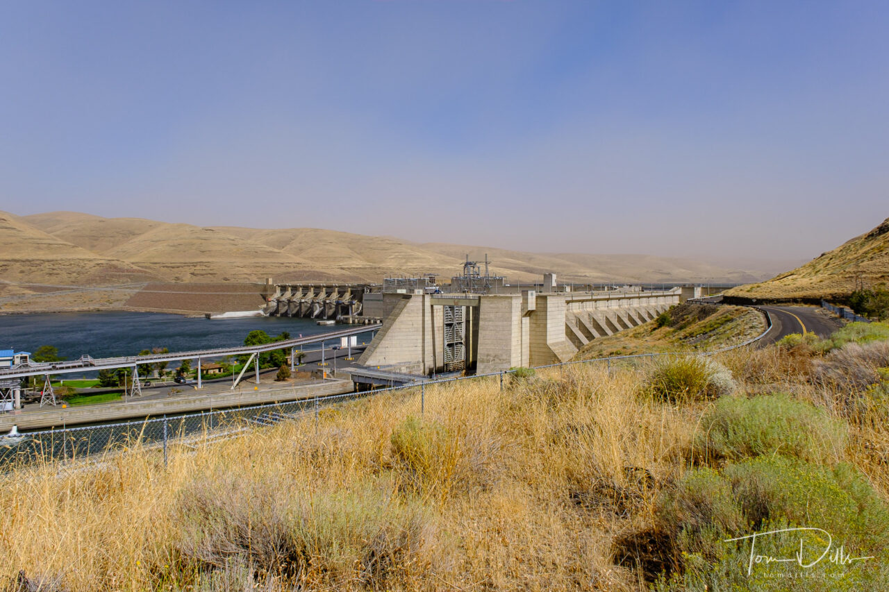
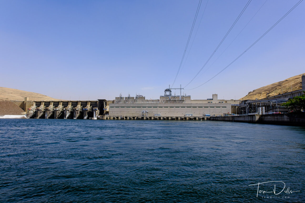
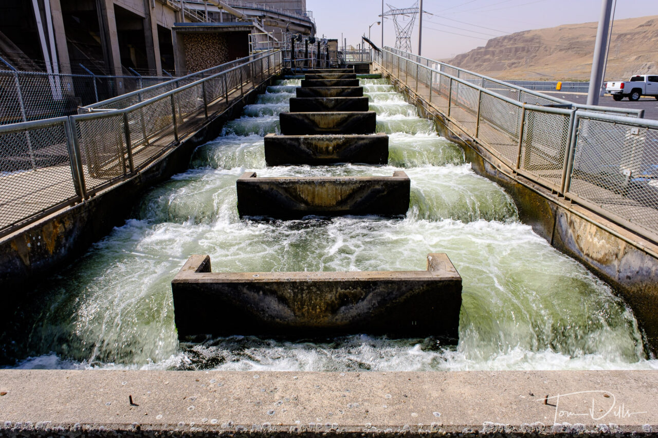
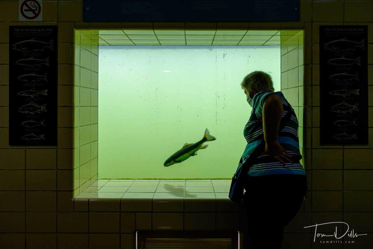
Little Goose Lock and Dam along the Snake River near LaCrosse, WashingtonLittle Goose Lock and Dam along the Snake River near LaCrosse, WashingtonFish ladder at the Little Goose Lock and DamFish viewing area at the fish ladder of the Little Goose Lock and Dam
Down along the Snake River, things were a bit less windy and not so dusty. We stopped at the Little Goose Lock & Dam near LaCrosse, where we talked to one of the biologists there and toured the fish ladder and viewing room. We saw several species of fish, including Chinook Salmon, swimming through.
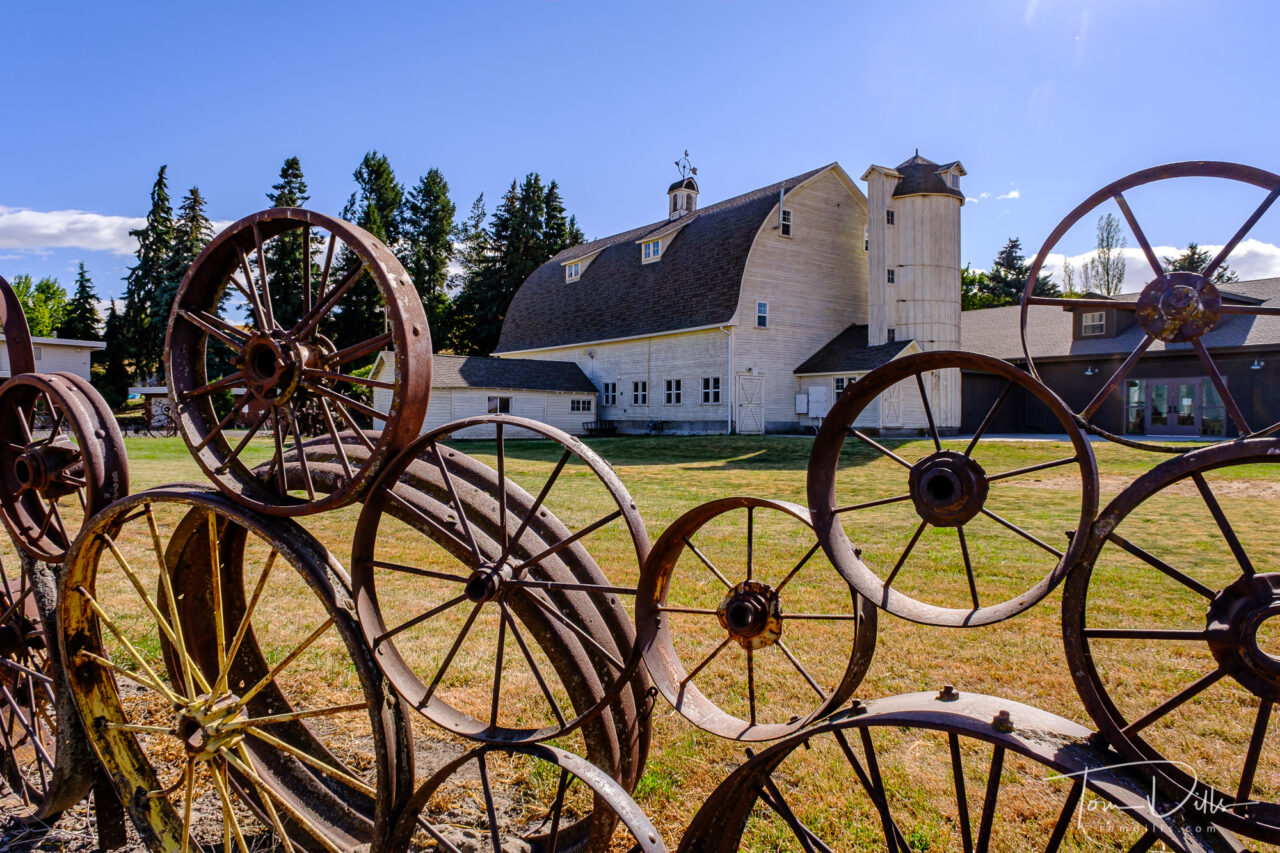
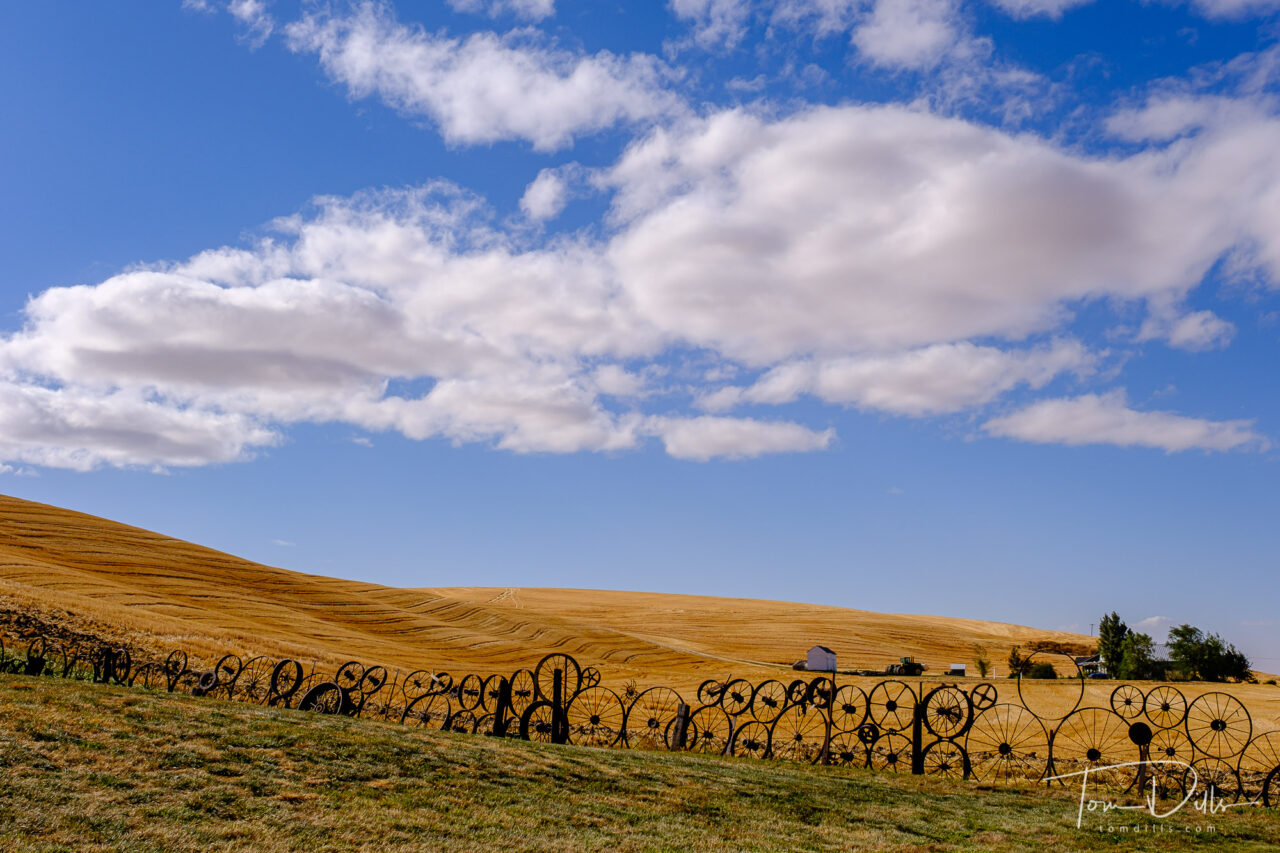
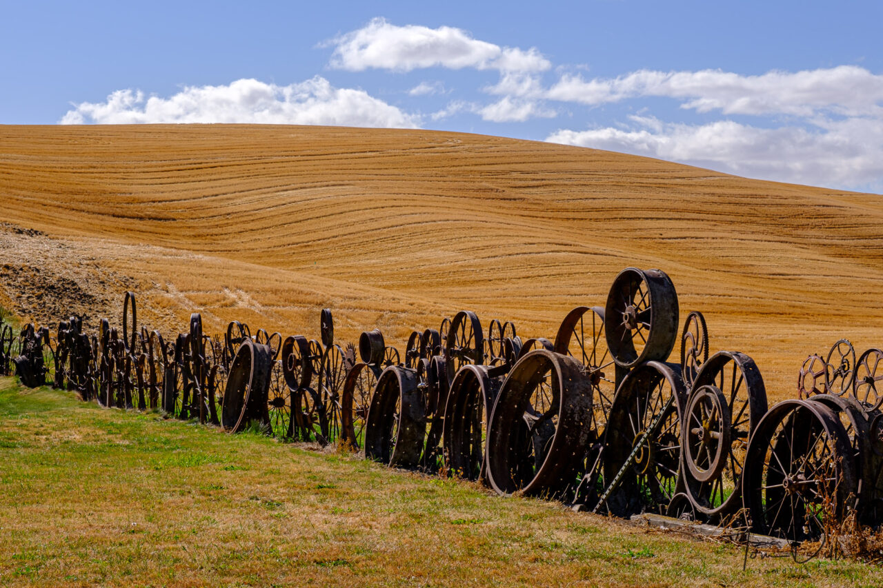
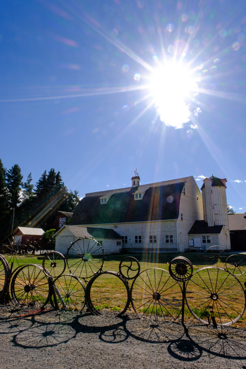
“Wheel Fence” at the Dahmen Barn along US-195 in Uniontown, Washington“Wheel Fence” at the Dahmen Barn along US-195 in Uniontown, Washington“Wheel Fence” at the Dahmen Barn along US-195 in Uniontown, Washington
I definitely felt that The Palouse was worth the time and effort to go there. And I’d love to go back sometime and spend more time out and about. The trick will be to try and find “different” subject matter. There’s nothing wrong with photographing the rolling countryside, but there is a lot more there too. It’s just that the countryside is right there in front of you, and makes it a little hard to look for other things.
Rural countryside along SR 26 in southeastern Washington
Update 10/27/20: I’ve added a gallery of more photos on my Adobe Portfolio site for anyone who wants to see more.
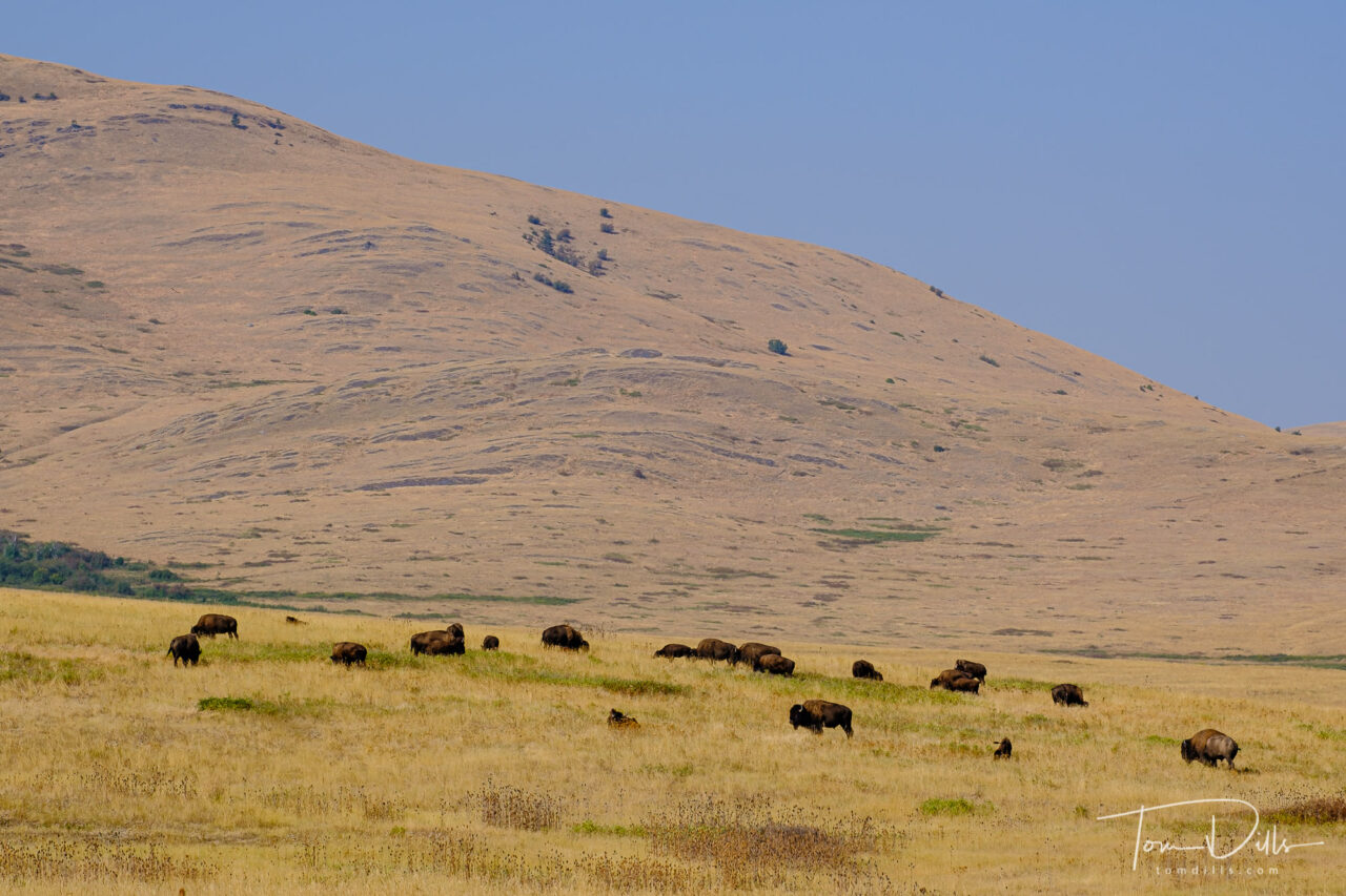
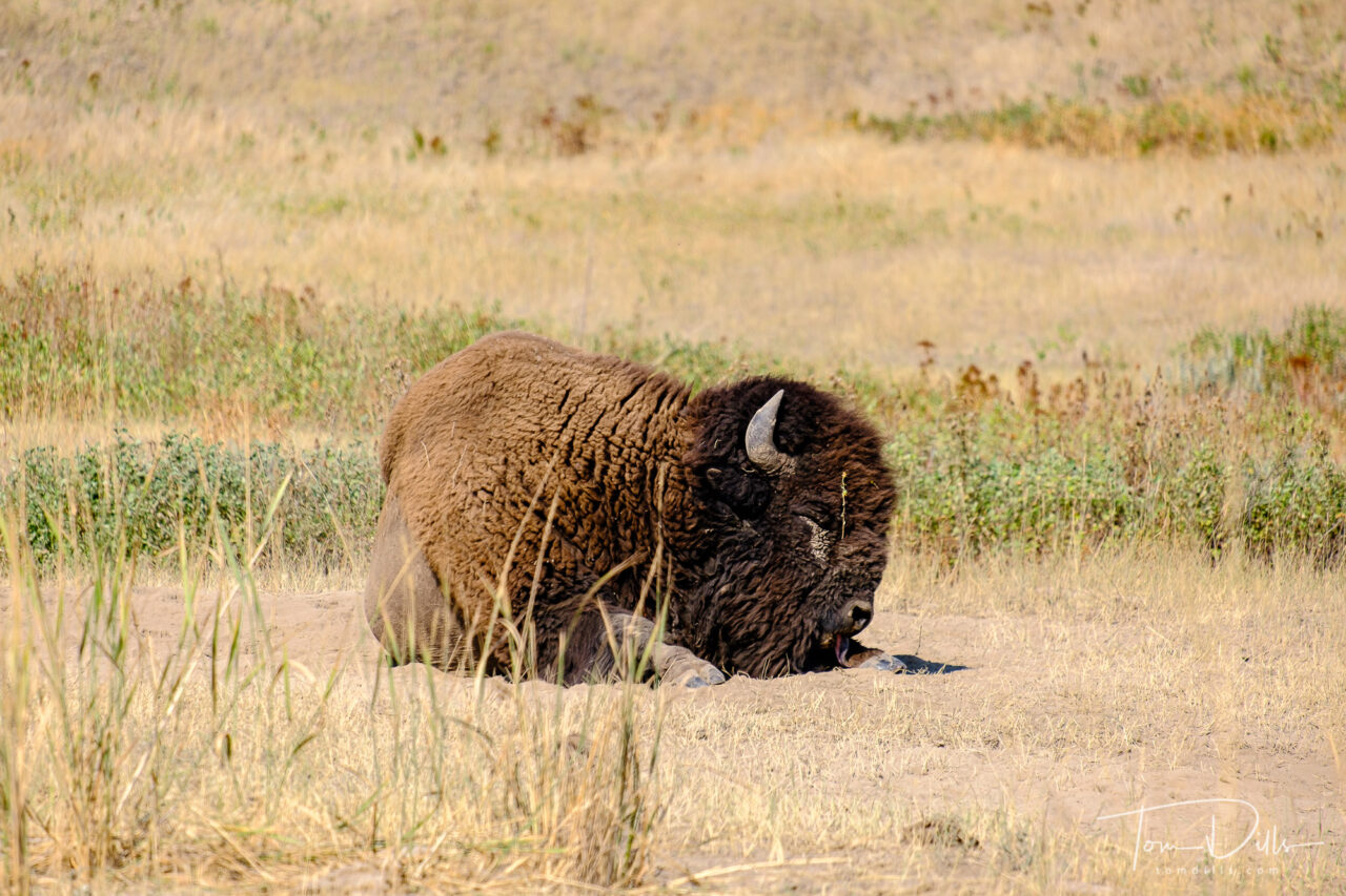
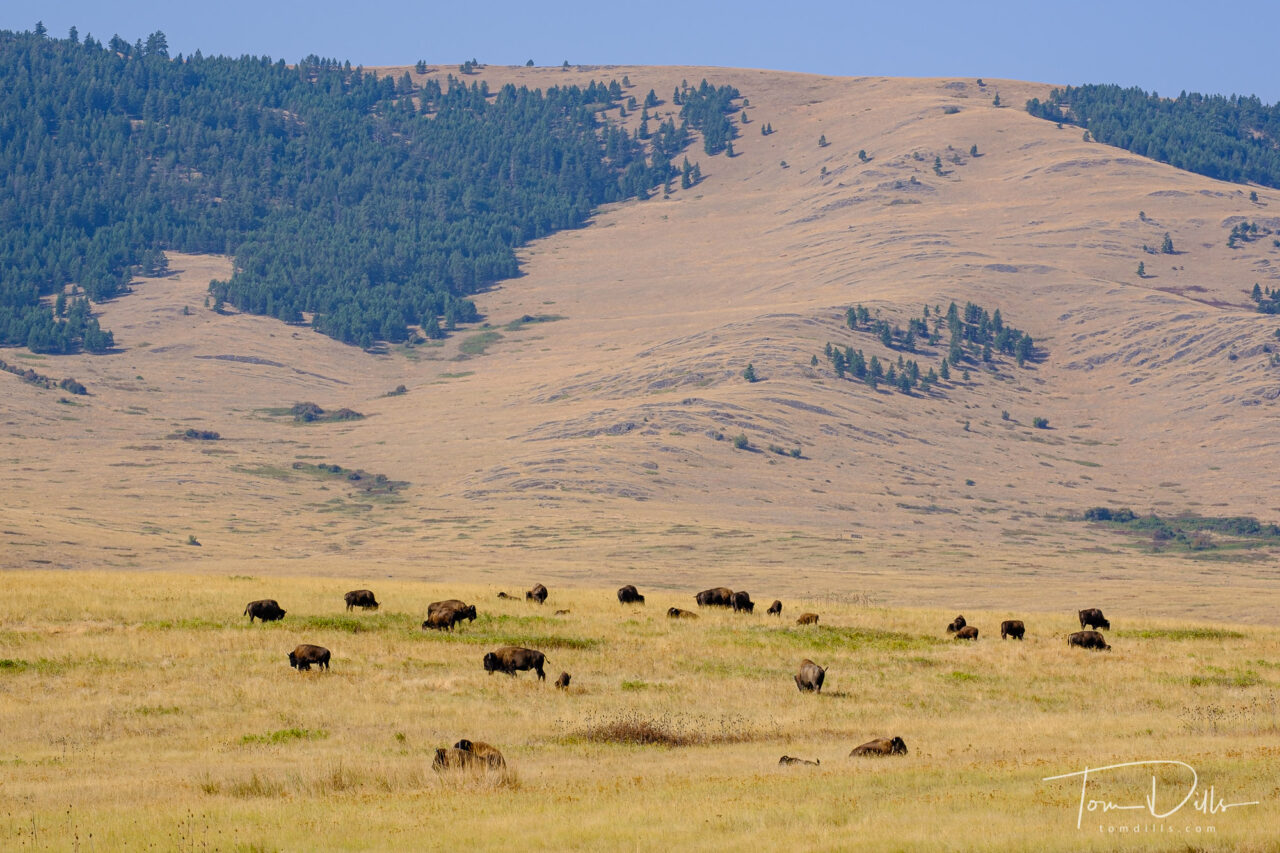
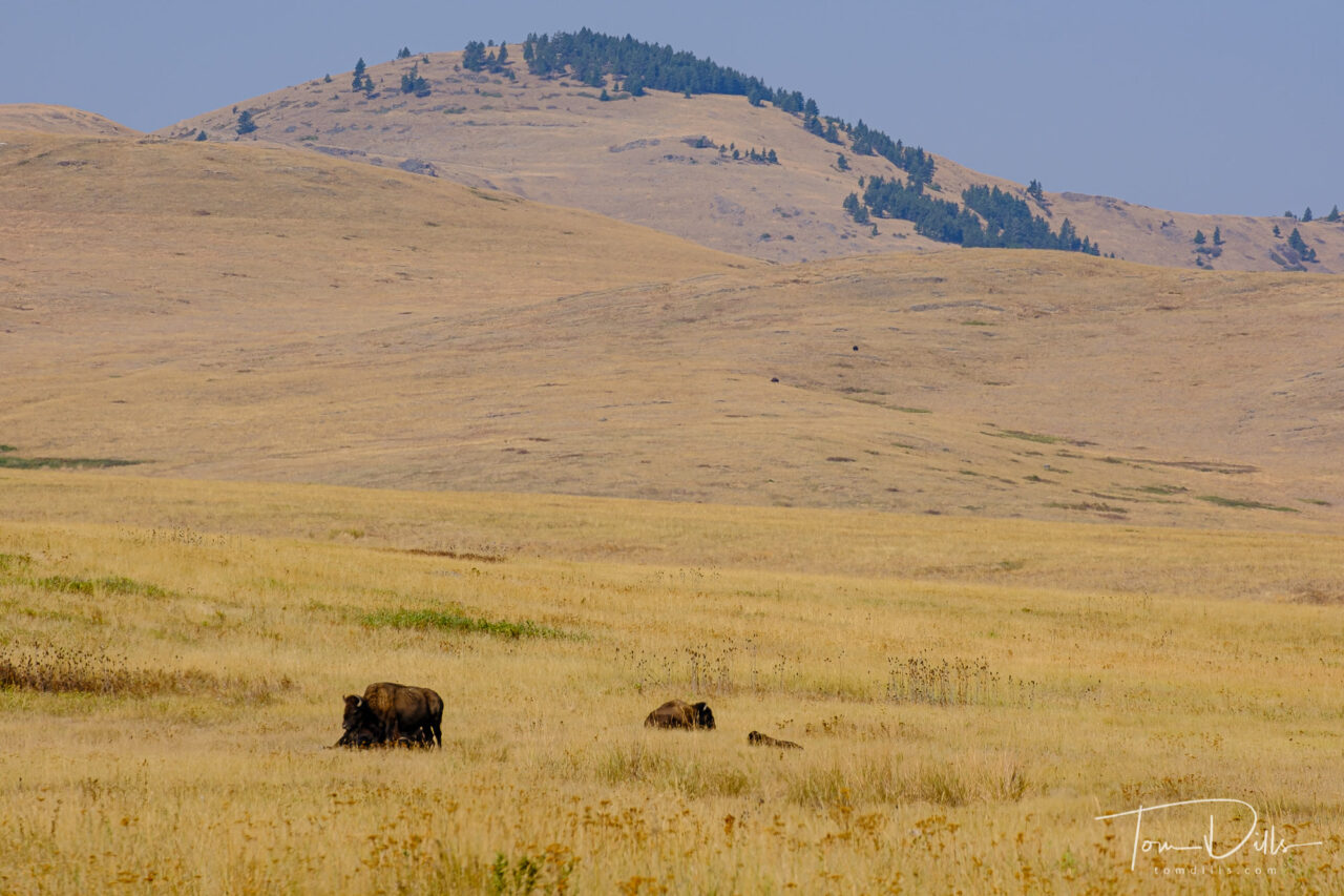
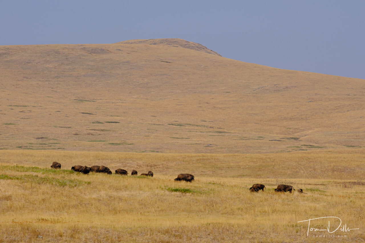
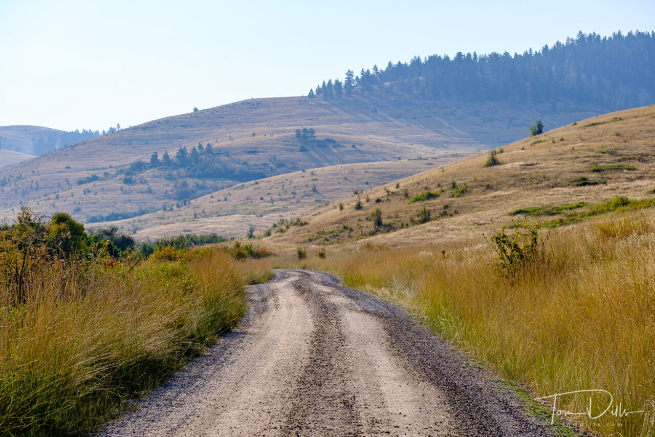
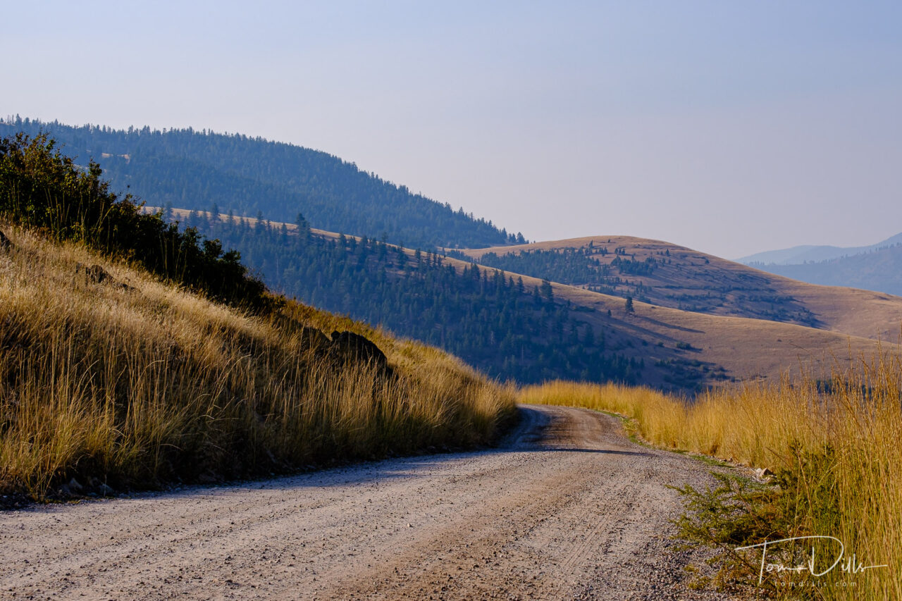
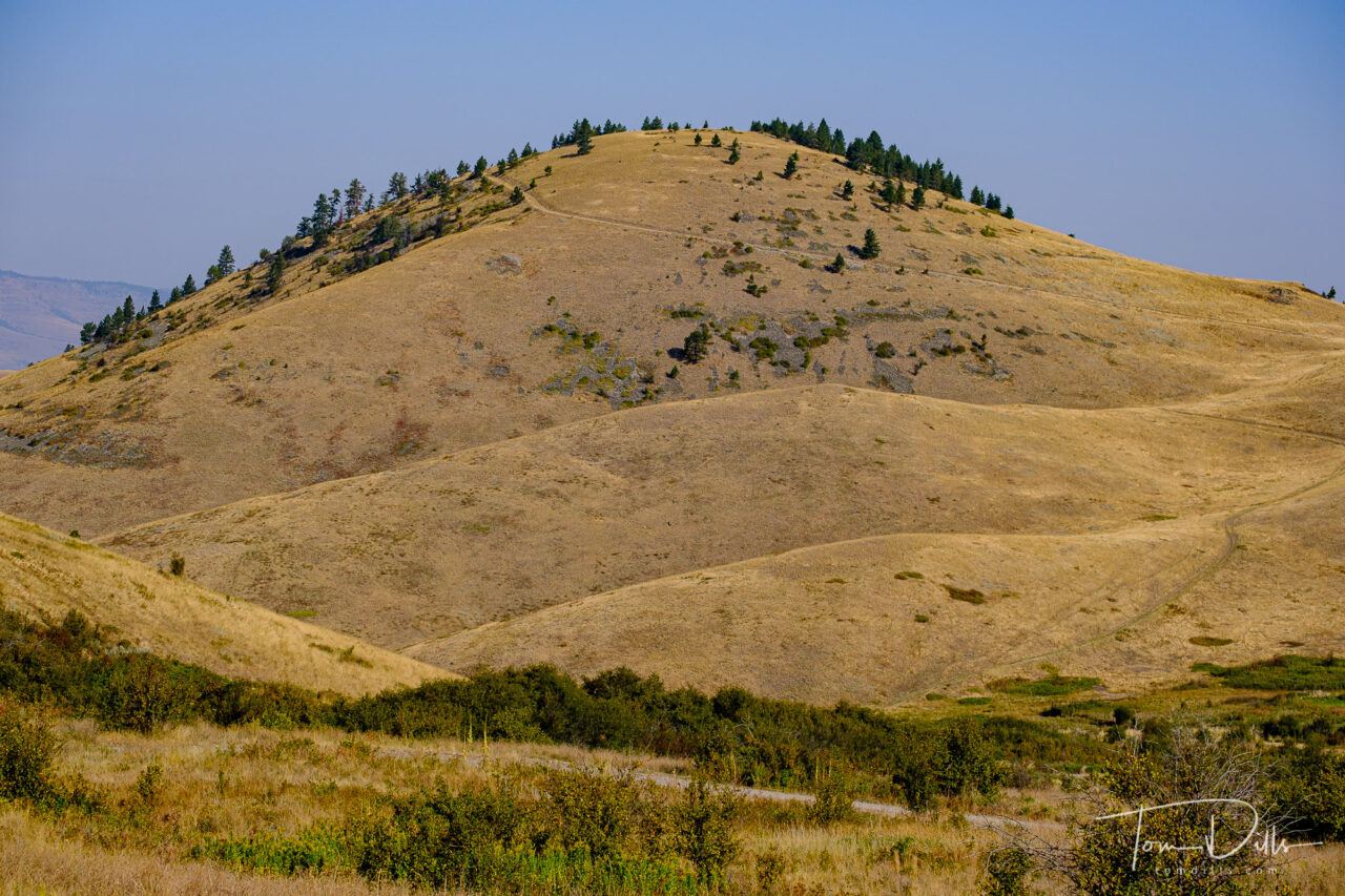
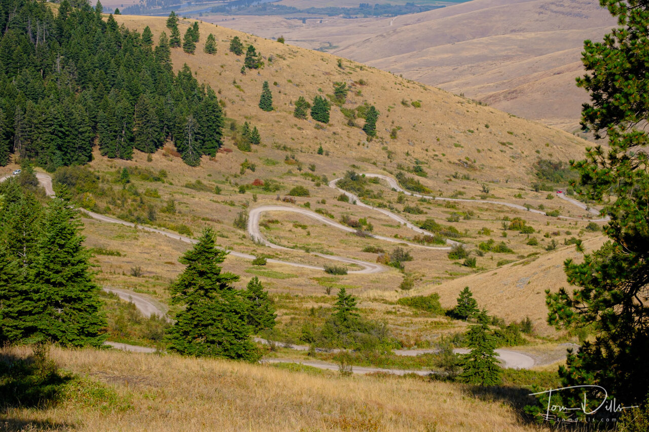
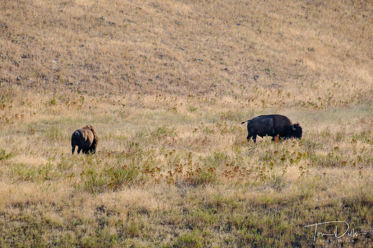
On our drive from Missoula, Montana to eastern Washington we took a small detour to the National Bison Range, near Charlo, Montana. Thanks to Don Brown for making us aware of this place!
National Bison Range near Charlo, MontanaNational Bison Range near Charlo, MontanaNational Bison Range near Charlo, MontanaNational Bison Range near Charlo, Montana
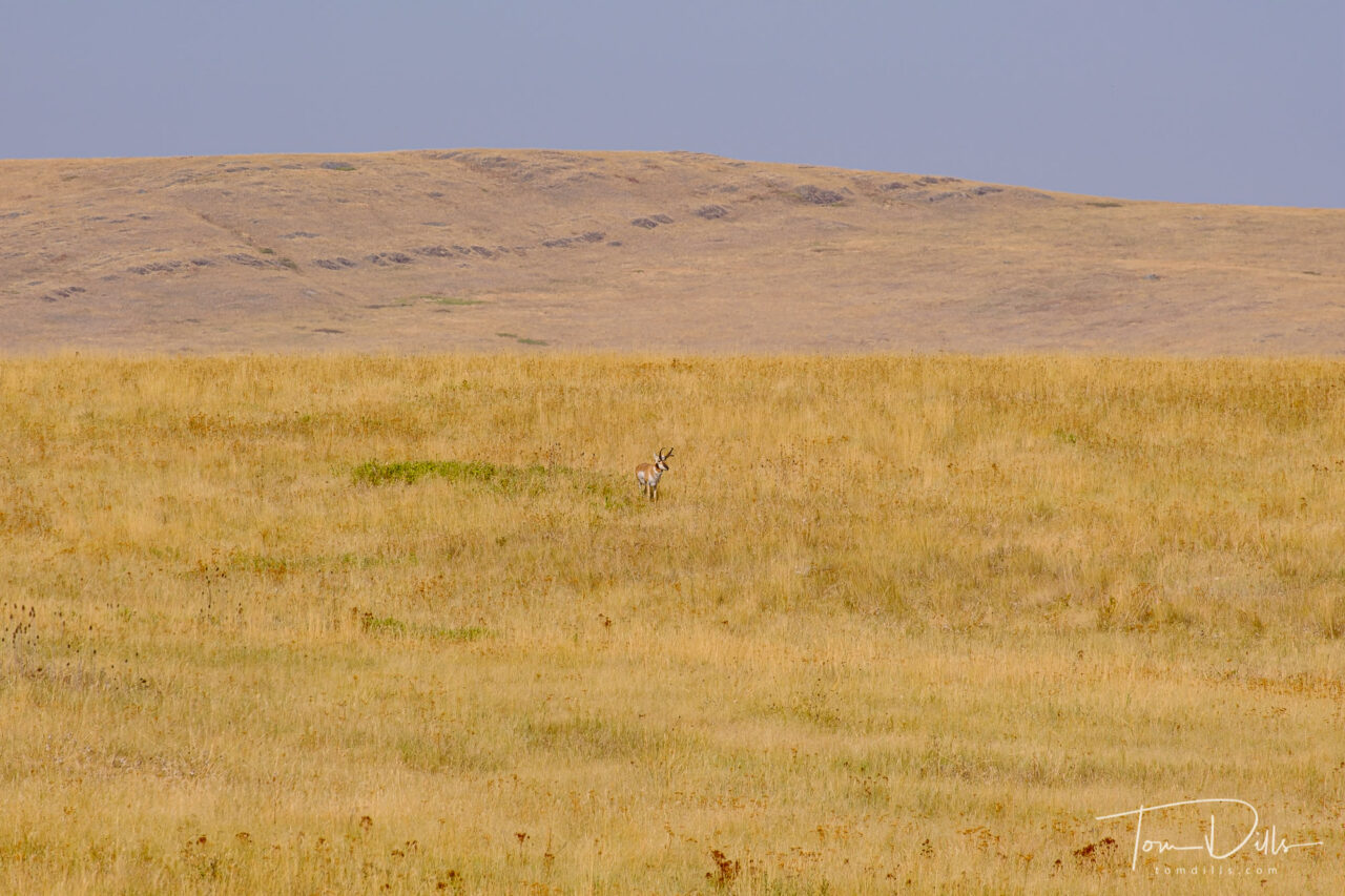
Theodore Roosevelt established the National Bison Range in 1908 to provide “…for a permanent national bison range for the herd of bison….” The refuge is also home for a host of other mammals, birds, plants and many living creatures. The diverse habitats found here provide for the specific needs of many different animals. Today the Bison range is home to 300-400 bison. In addition to herds of bison, it supports populations of Rocky Mountain elk, mule deer, white-tailed deer, pronghorn, and bighorn sheep as well as coyotes, mountain lions, bears, bobcat and over 200 species of birds.
National Bison Range near Charlo, MontanaNational Bison Range near Charlo, MontanaNational Bison Range near Charlo, MontanaNational Bison Range near Charlo, MontanaNational Bison Range near Charlo, MontanaNational Bison Range near Charlo, Montana
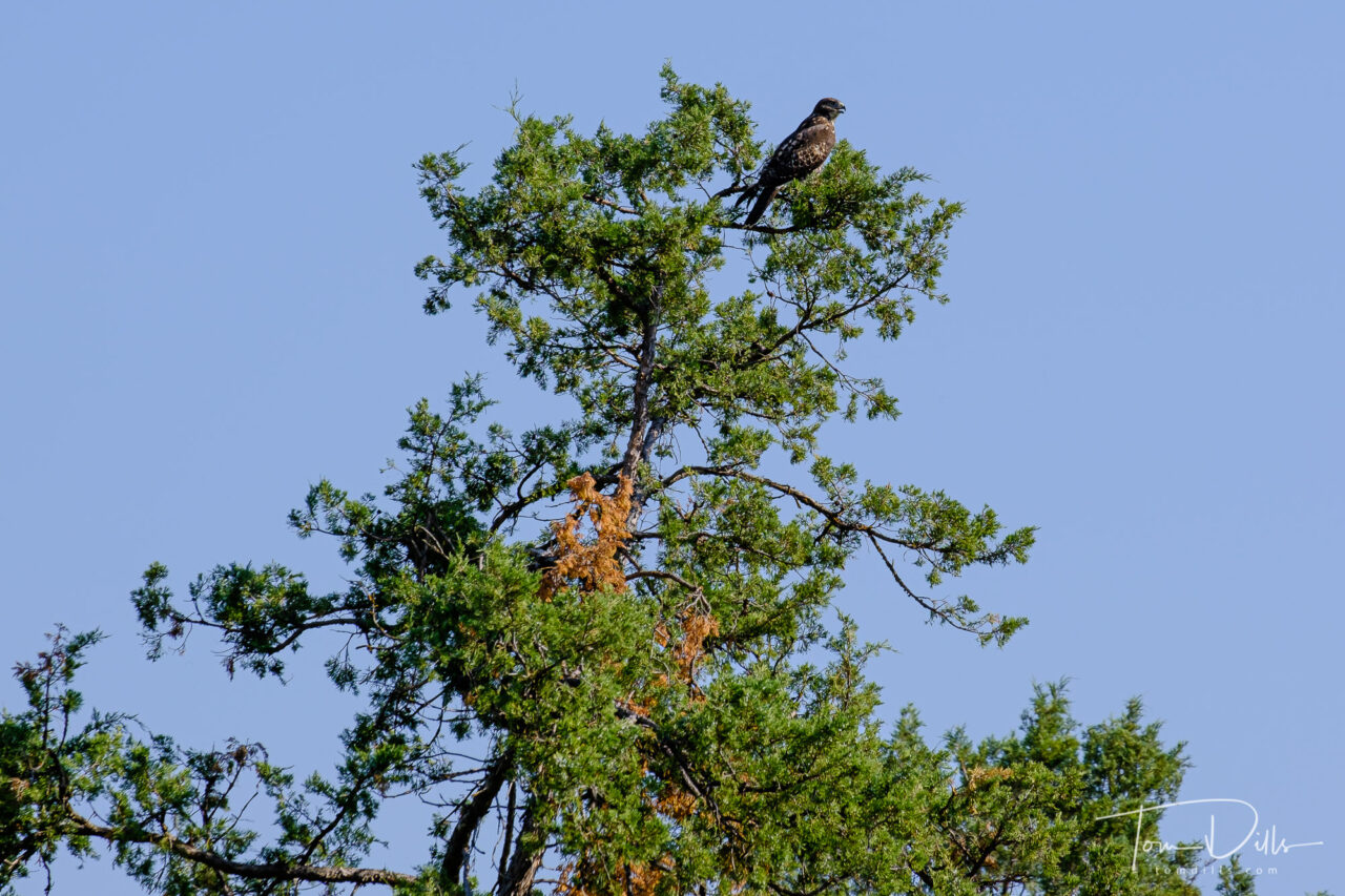
The Red Sleep Mountain Drive is a 19-mile, one-way loop road through the range. The road gains 2,000 feet and there are many switchbacks and 10% grades along the drive. We enjoyed our drive along the route, spotting a number of bison, osprey, antelope and other critters.
Antelope at the National Bison Range near Charlo, MontanaOsprey at the National Bison Range near Charlo, Montana
This is another example of the off-the-beaten-path places that we visited. It is was an excellent and scenic way to spend a relaxing morning before moving on west.
PHOTO GALLERY UPDATE:
For those looking to see even more photos from our trip, I just added a gallery to my Adobe Portfolio page. Click here for 2020 Pacific Northwest Road Trip Part 1. I hope you enjoy the photos!
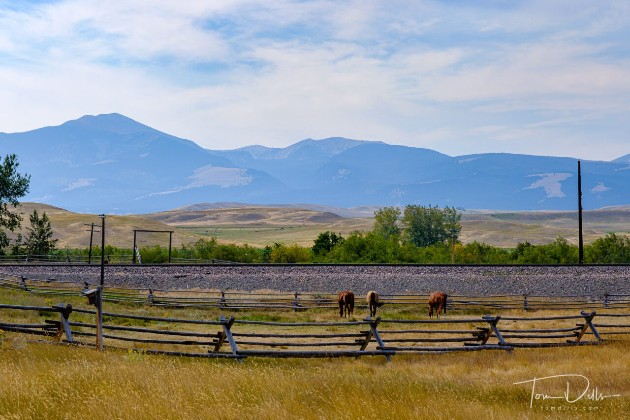
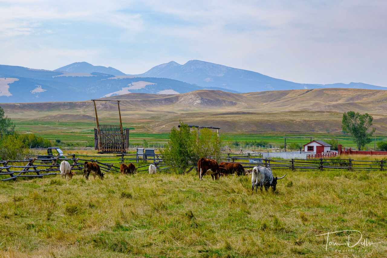
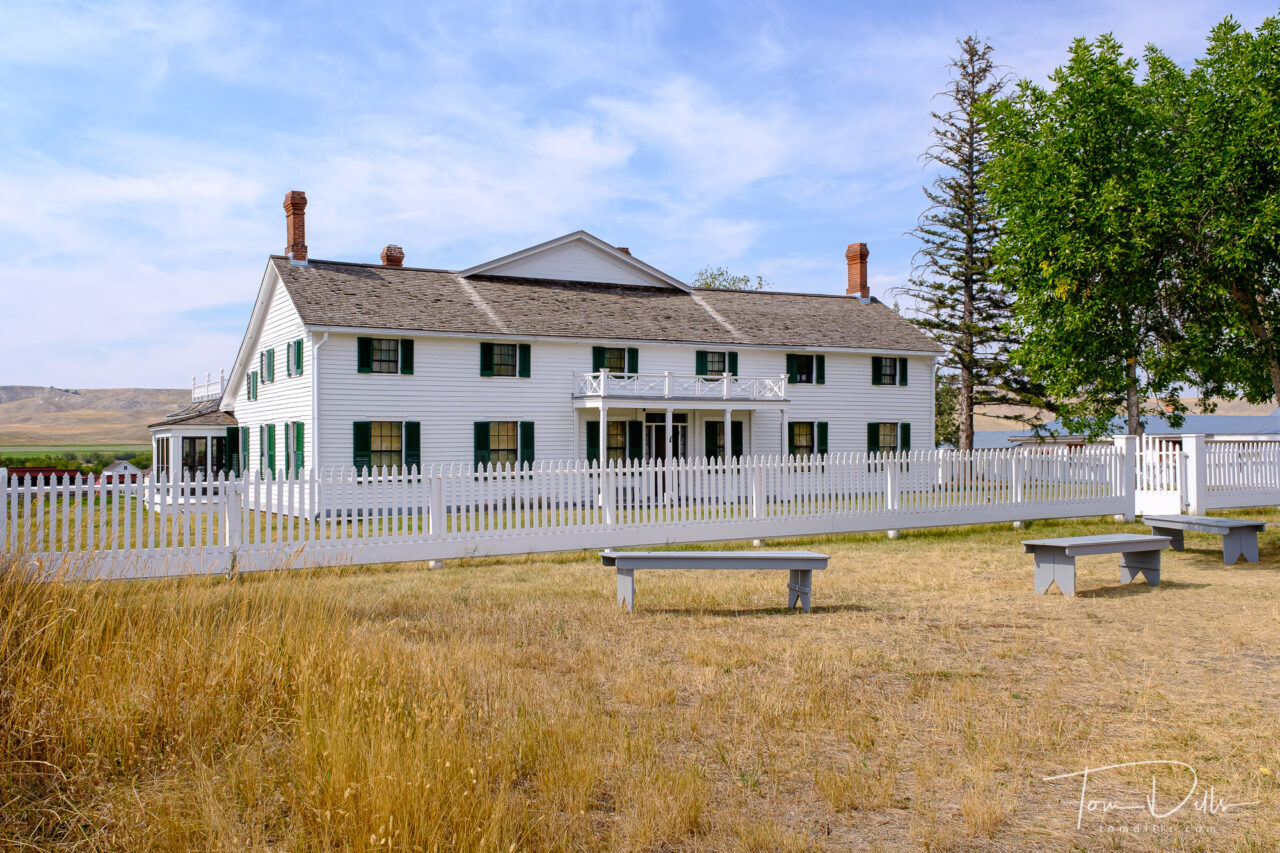
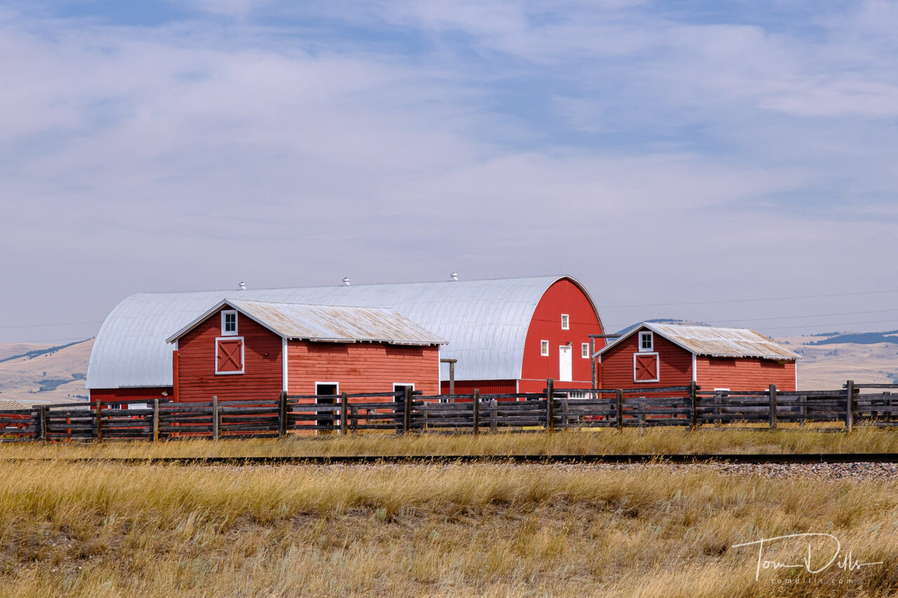
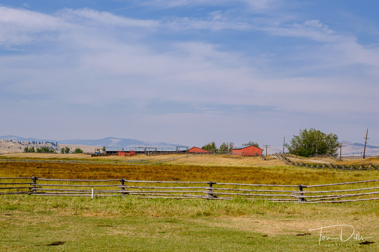
Grant-Kohrs Ranch National Historic Site near Deer Lodge, Montana
I got waylaid in my processing with a few projects around the house, but I’m back in the photo processing groove again and re-living our visit to Montana. 🙂
Grant-Kohrs Ranch National Historic Site near Deer Lodge, Montana
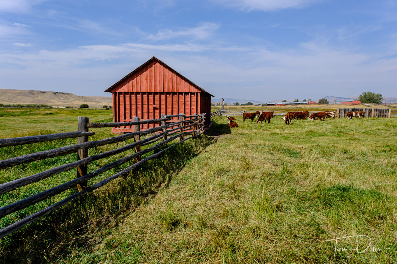
On our drive from Billings to Missoula we stopped by Grant-Kohrs Ranch National Historic Site, near the town of Deer Lodge. That’s not as remote as it sounds, as Deer Lodge lies within sight of I-90, not too far from Helena.
Grant-Kohrs Ranch National Historic Site near Deer Lodge, MontanaGrant-Kohrs Ranch National Historic Site near Deer Lodge, Montana
Grant-Kohrs Ranch has an interesting history, dating to the 1860s when the open-range cattle industry had its heyday. Many of the herds were built through trade with westward-bound emigrants, who gladly swapped two or more trail-worn cows for a single well-fed one.
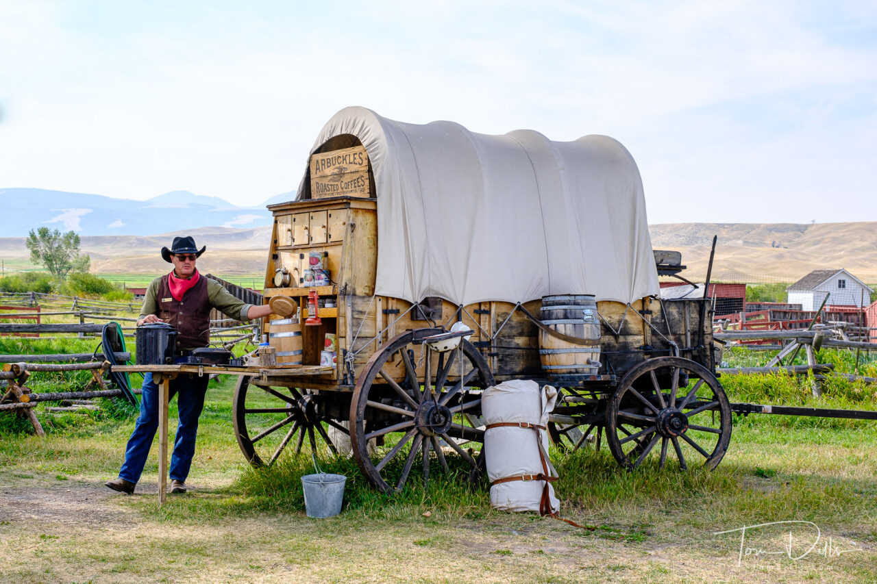
Ranger talks about living and cooking on the range
From the NPS website:
“By 1885, cattle raising was the biggest industry on the High Plains, and foreign investors and eastern speculators rushed to get in on the bonanza. As ranches multiplied and the northern herds grew, there came a predictable consequence: overgrazing. This and the fierce winter of 1886-87 caused enormous losses, estimated at one-third to one-half of all the cattle on the northern plains. Many cattlemen never recovered.
If the snows of ’86-87 foreshadowed the end of open range ranching, the homesteaders, with their barbed wire and fenced-in 160 acre claims, finished it off.
The open-range cattle industry lasted only three decades. Few of its pioneering men and women made their fortunes or are remembered today. But from their beginnings has evolved the more scientific ranching of today, with its own risks and uncertainties. That is the legacy of the Grants and the Kohrs, whose pioneer ranch, complete with original furnishings, is a reminder of an important chapter in the history of the West.”
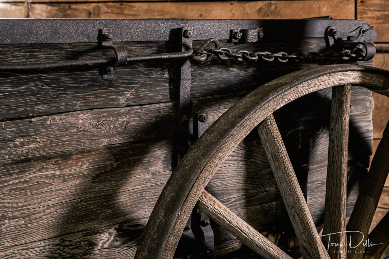
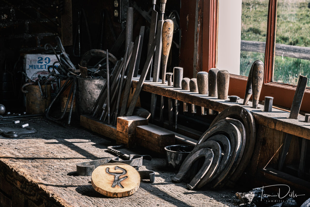
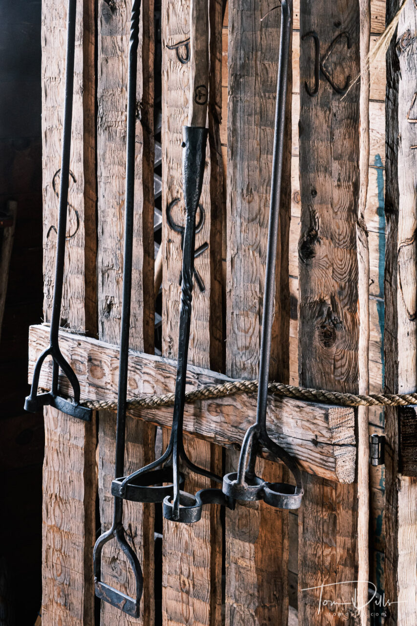
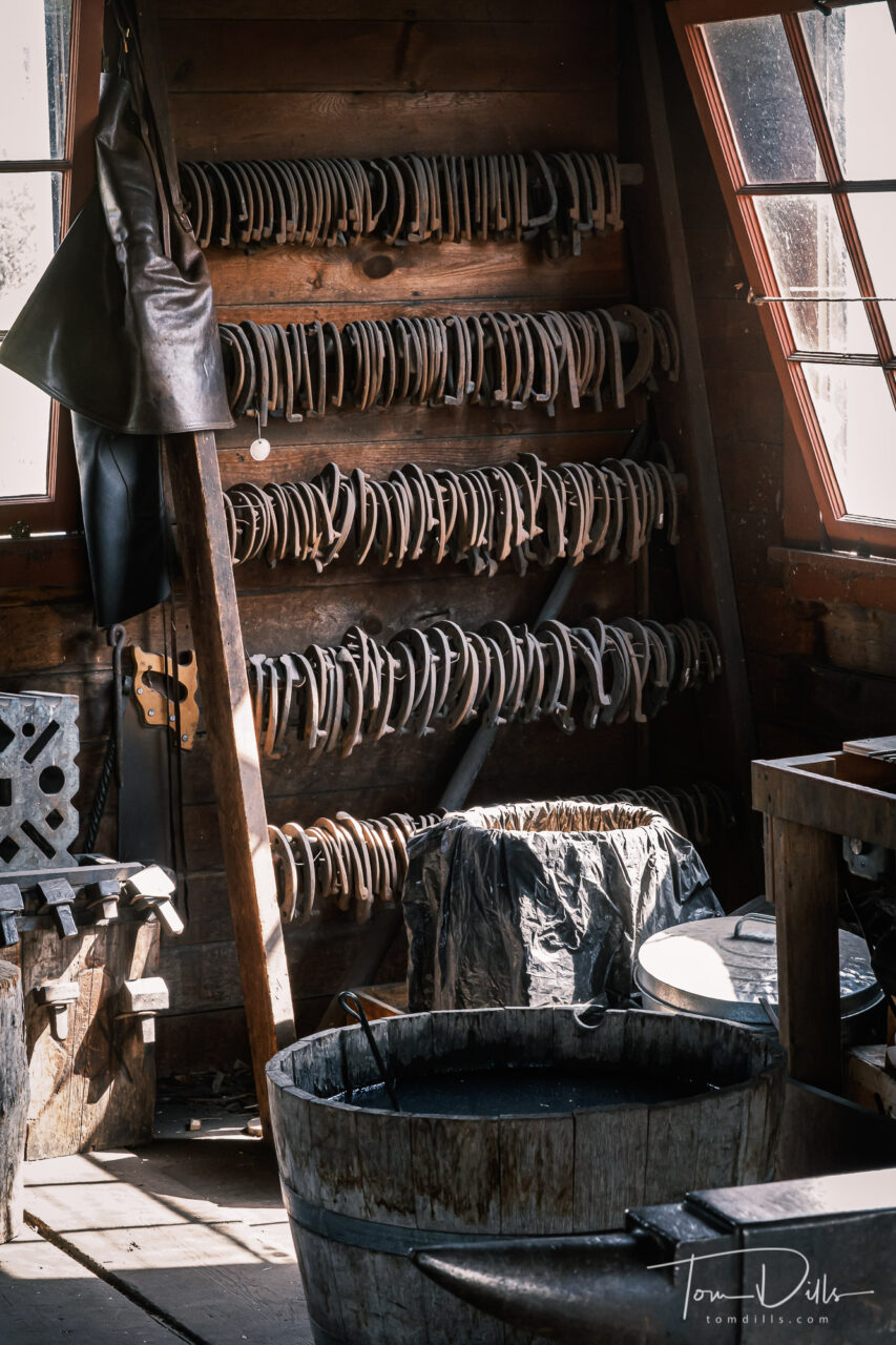
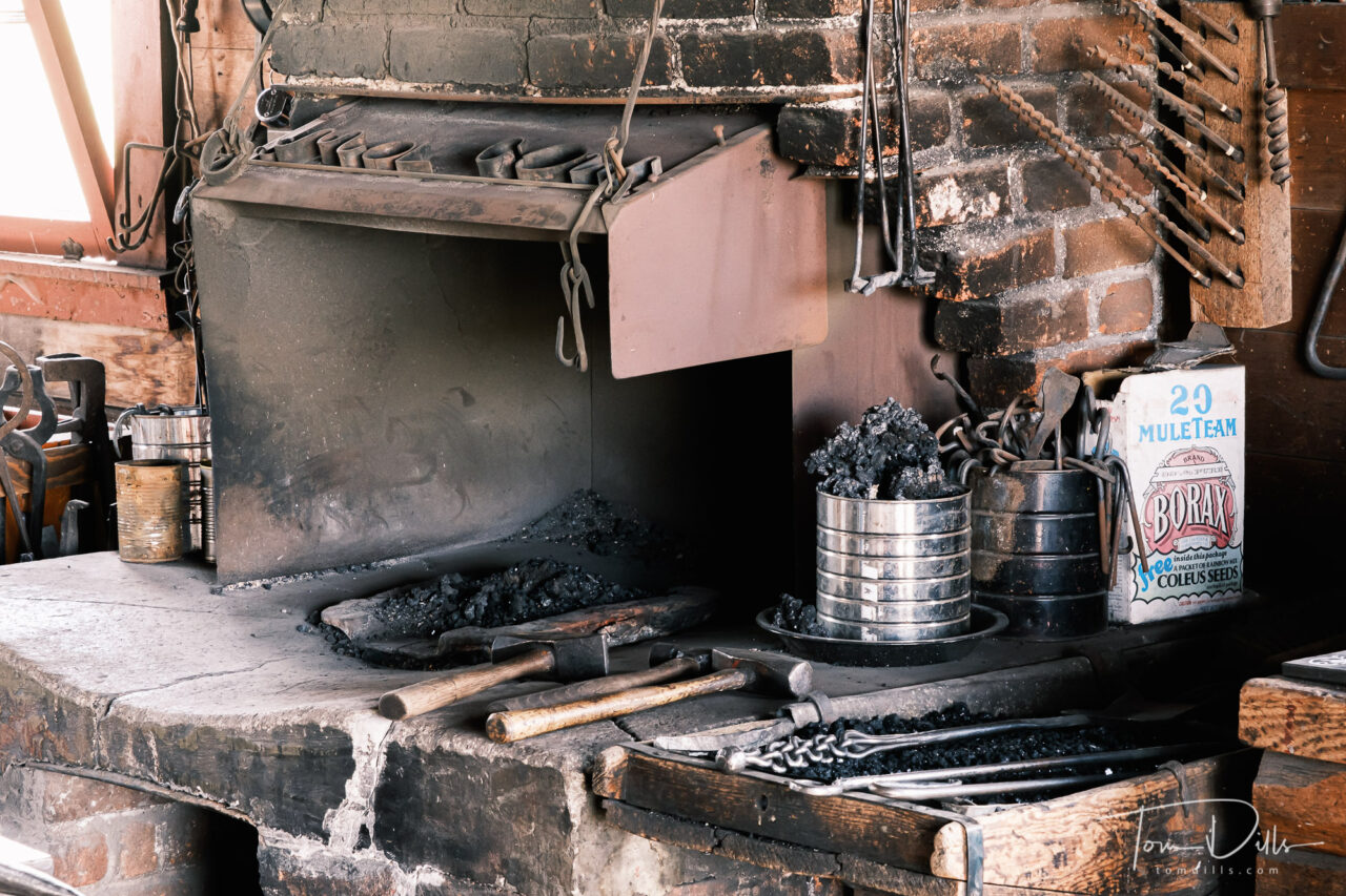
Old wagonBlacksmith shop with a sample of t he G-K brandBranding IronsBlacksmith ShopBlacksmith Shop
Walking around the ranch, I felt like I was experiencing the plains of Montana much like the early settlers saw it. Miles and miles of open range, perforated now by barbed-wire fences but the long range views remain.
Grant-Kohrs Ranch National Historic Site near Deer Lodge, Montana
This was another one of those places we visited where we were able to steer well clear of crowds. The few people we saw there seemed to have been mostly attracted by the proximity to the interstate and the availability of restrooms. 😉 For us it was another piece of western history to add to our knowledge of this country.
Grant-Kohrs Ranch National Historic Site near Deer Lodge, Montana
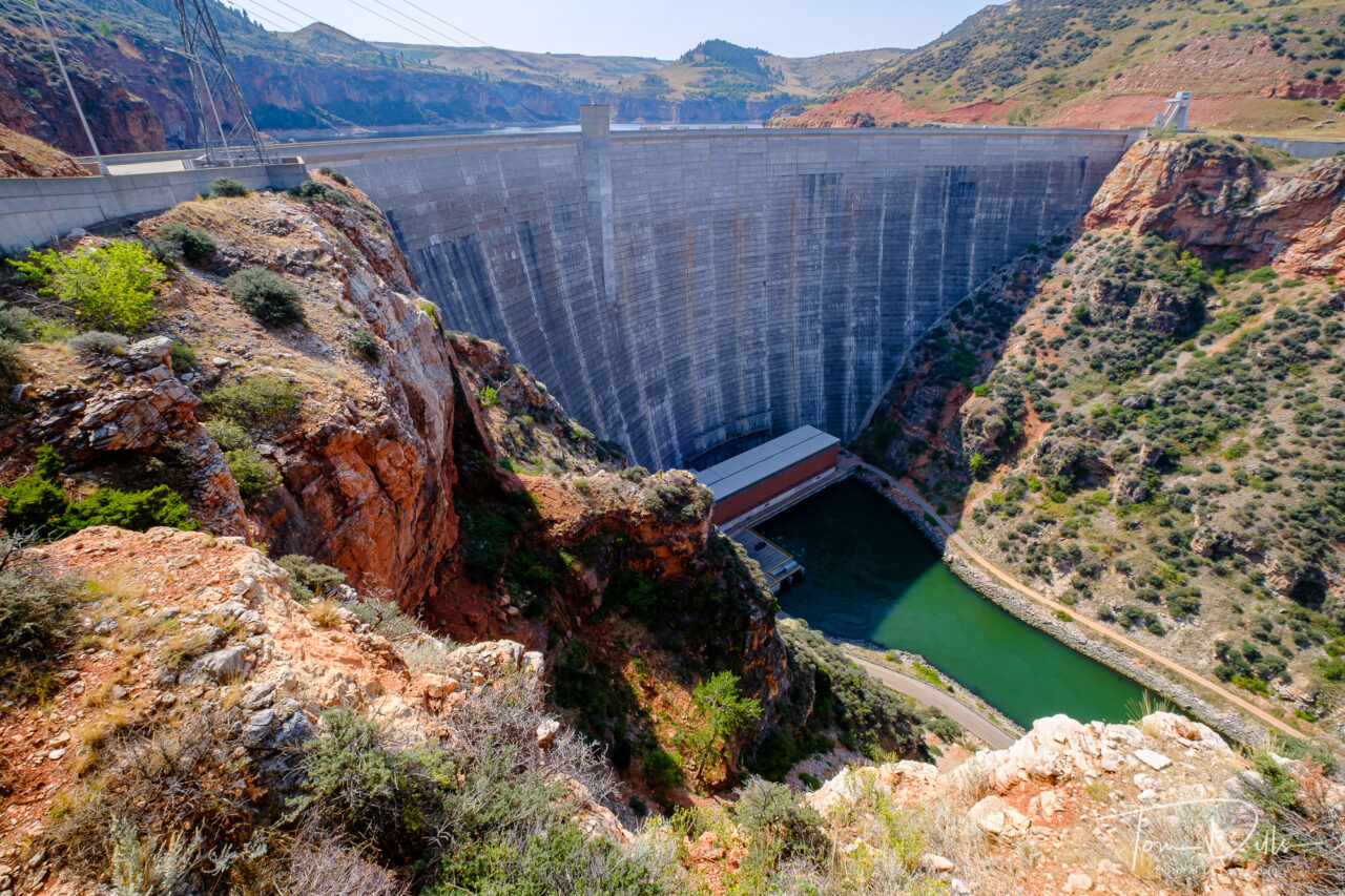
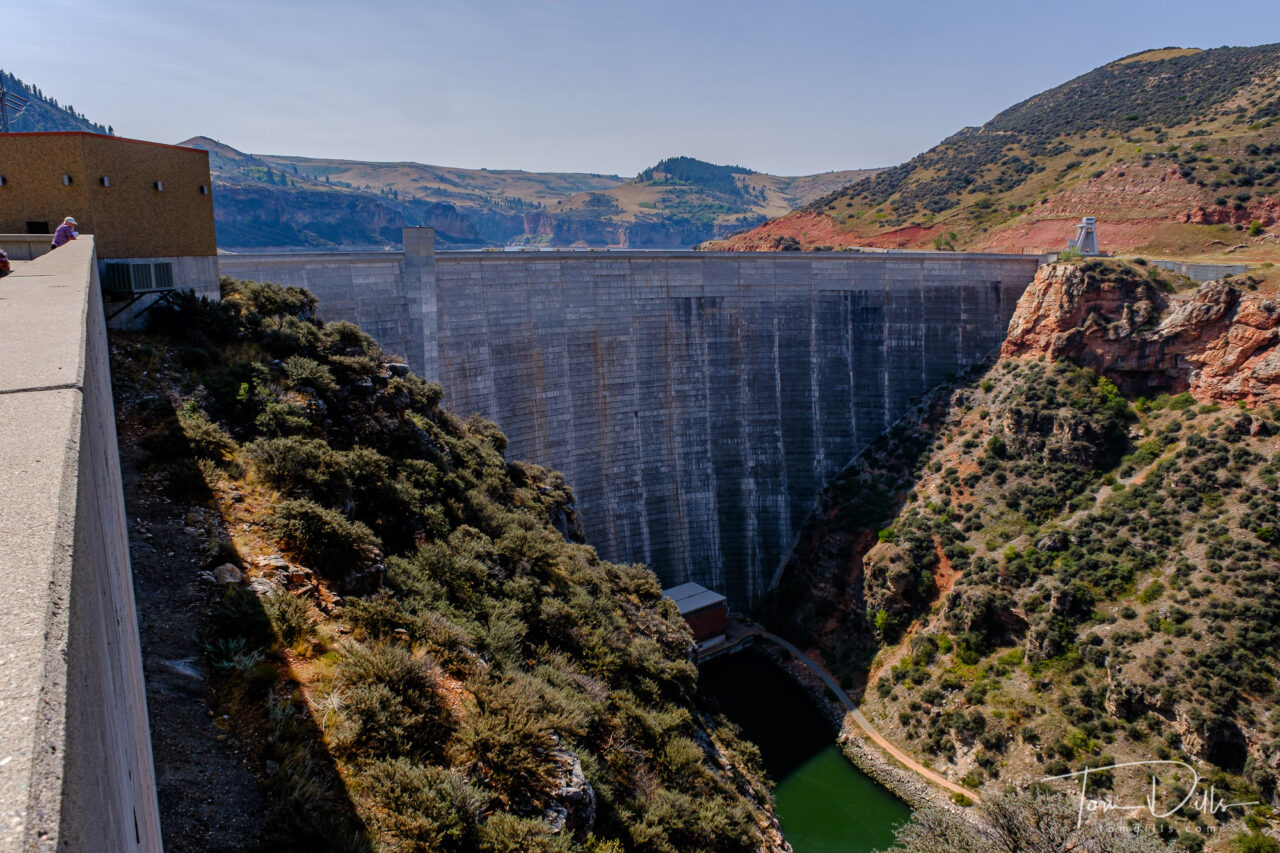
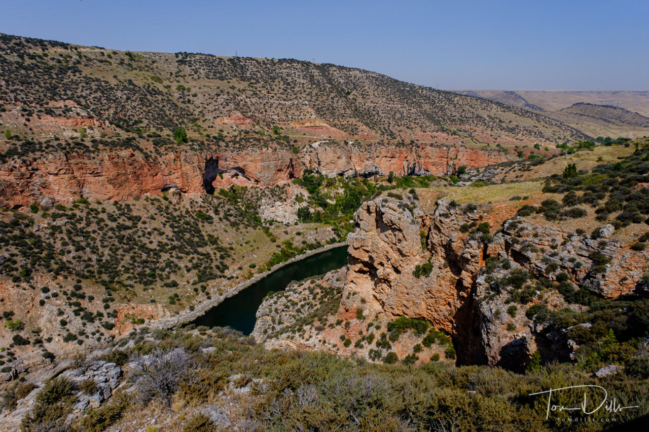
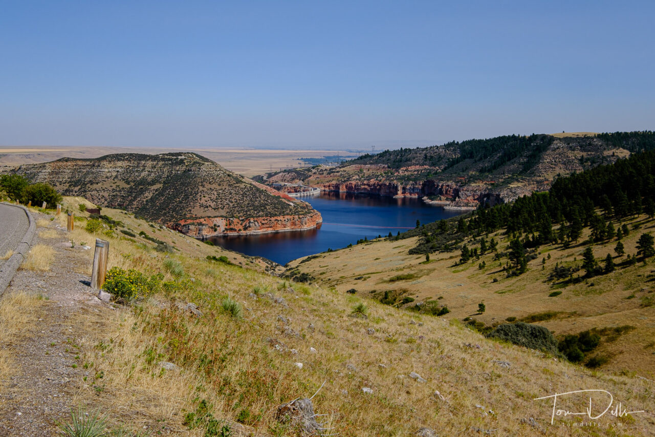
Yellowtail Dam in Bighorn Canyon National Recreation Area in southern Montana near Fort Smith
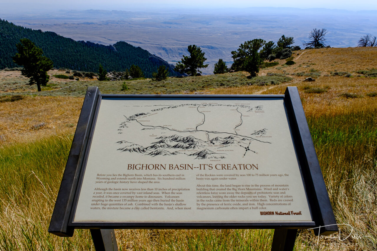
Even though Kathy & I had considered Wyoming and Montana to be “visited” in terms of our 50 state quest, we knew that we had short-changed both states on our previous visit. Since we needed to traverse both of those states on our way to the west coast, we decided to rectify that shortfall with a few more stops. Bighorn Canyon National Recreation fit that bill, as it straddles the border between both states.
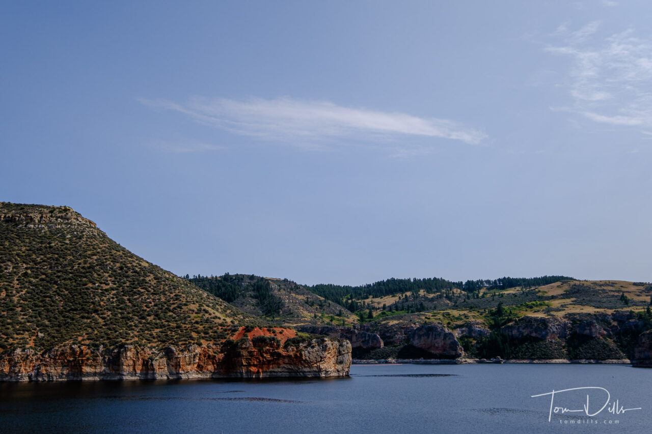
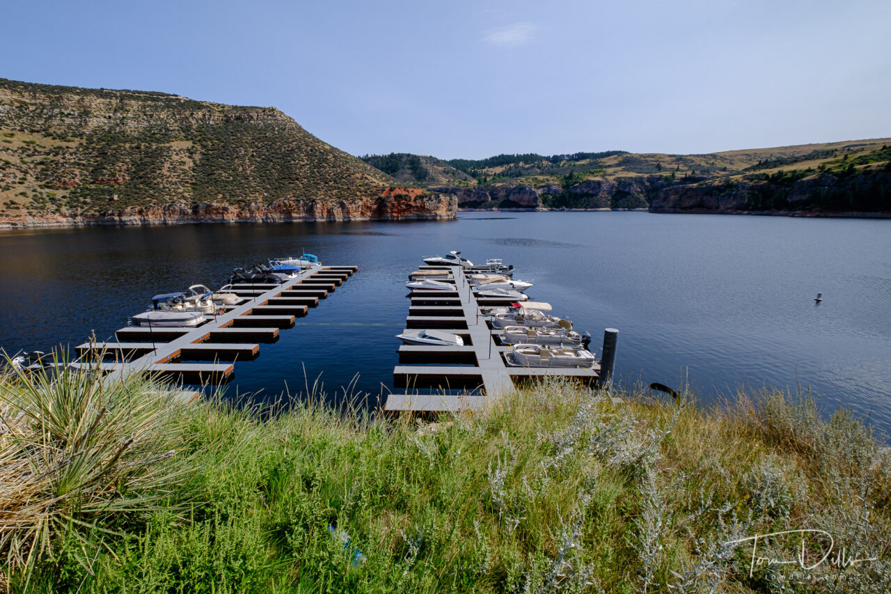
Yellowtail Dam in Bighorn Canyon National Recreation Area in southern Montana near Fort SmithYellowtail Dam area in Bighorn Canyon National Recreation Area in southern Montana near Fort Smith
The southern end of the park lies in northern Wyoming, and was the subject of my previous post. There are more places that we didn’t get to due to time constraints, and we spent the better part of a day on the northern end of the park, in southern Montana.
The upper side of Yellowtail Dam and reservoir.The upper side of Yellowtail Dam and reservoir.The upper side of Yellowtail Dam and reservoir.The upper side of Yellowtail Dam and reservoir.
Yellowtail Dam is another one of those places that you can’t really appreciate until you have seen it. I’ve not been to Hoover Dam or Glen Canyon Dam, but this is certainly the biggest dam I’ve ever seen! An exchange I had on Instagram with Paul Maxim describes the relative size of some of the “famous” dams in the US:
Yellowtail is 525 ft. tall and 1480 ft. wide. Glen Canyon is 710 ft. tall and 1560 ft. wide. So Glen Canyon is bigger (185 ft. taller). But the only dam in the U. S. bigger than Glen Canyon is Hoover Dam, which is 726 ft. tall. All of them, of course, are big. We’ve got nothing in the east that comes close!
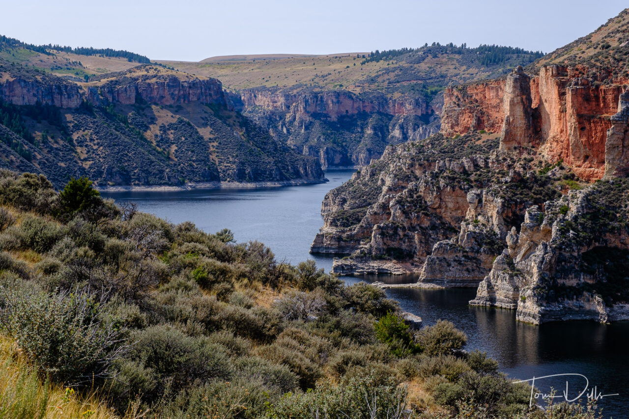
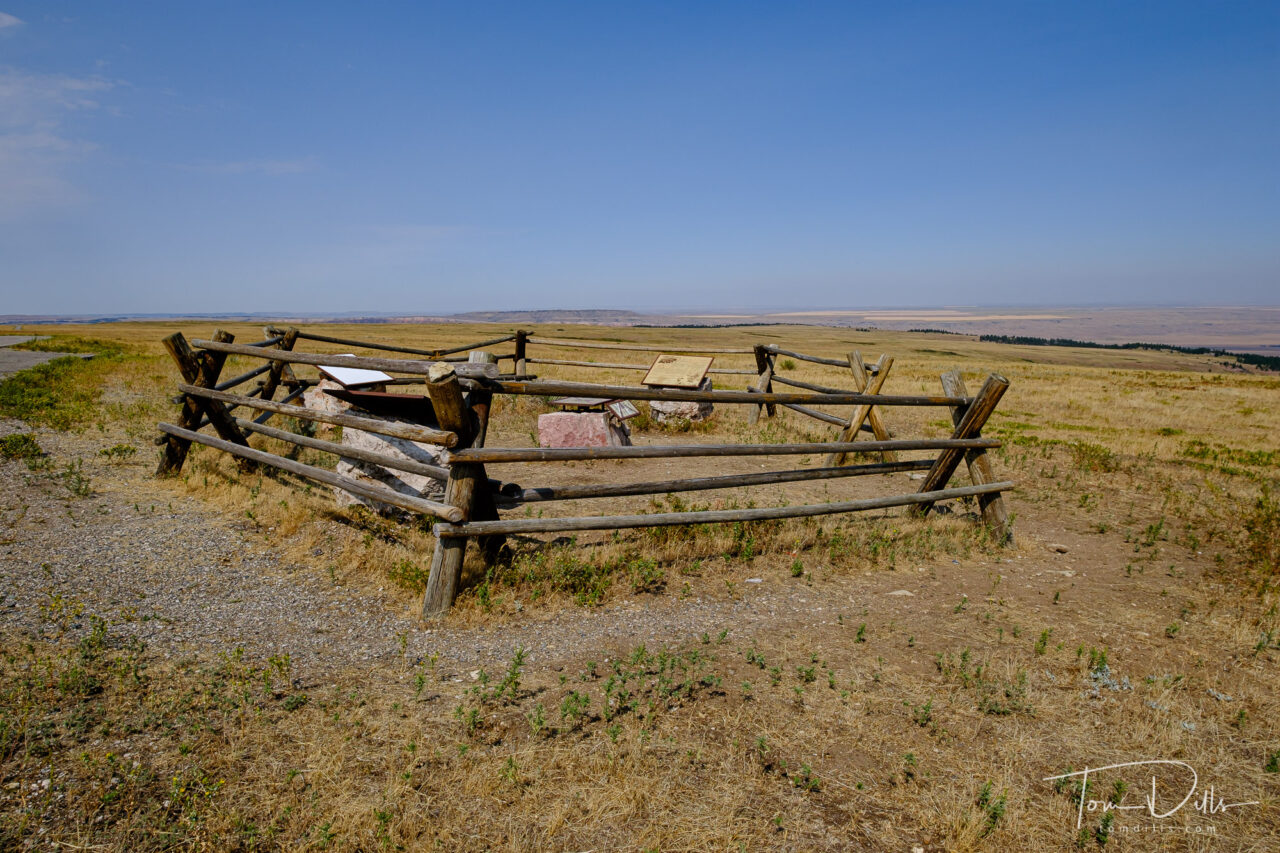
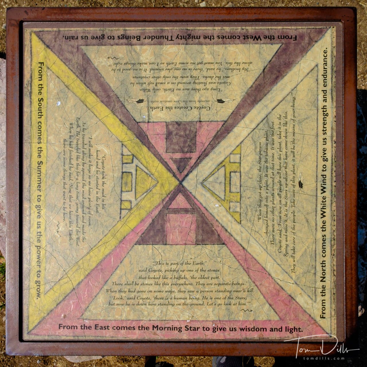
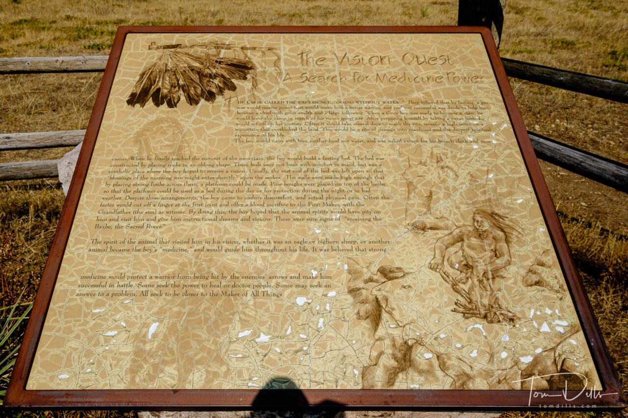
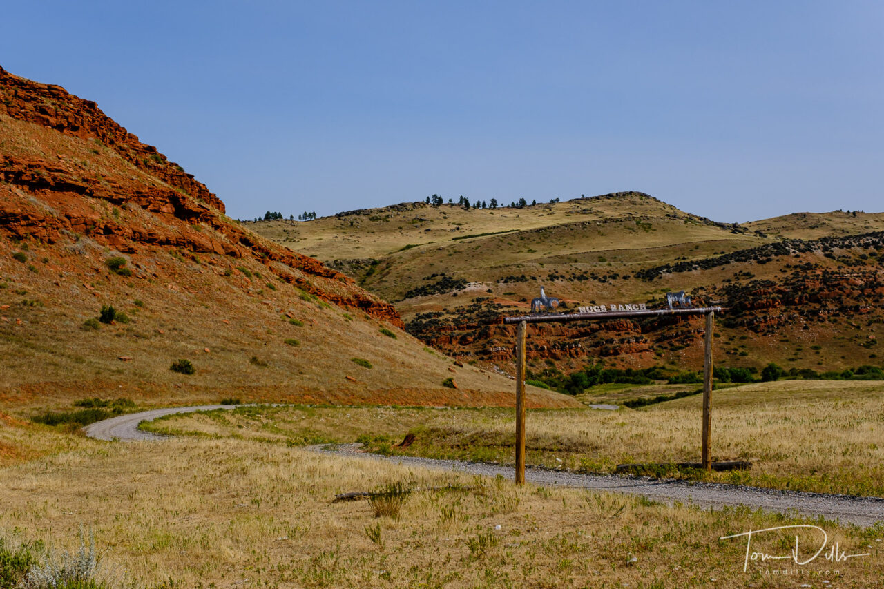
The park is surrounded by Crow Indian land, and there are several references to Crow history throughout the park, including the remains of a medicine wheel that we didn’t get to.
Exhibit describing the role of the medicine wheel in Crow Indian culture and history.Exhibit describing the role of the medicine wheel in Crow Indian culture and history.Exhibit describing the role of the medicine wheel in Crow Indian culture and history.
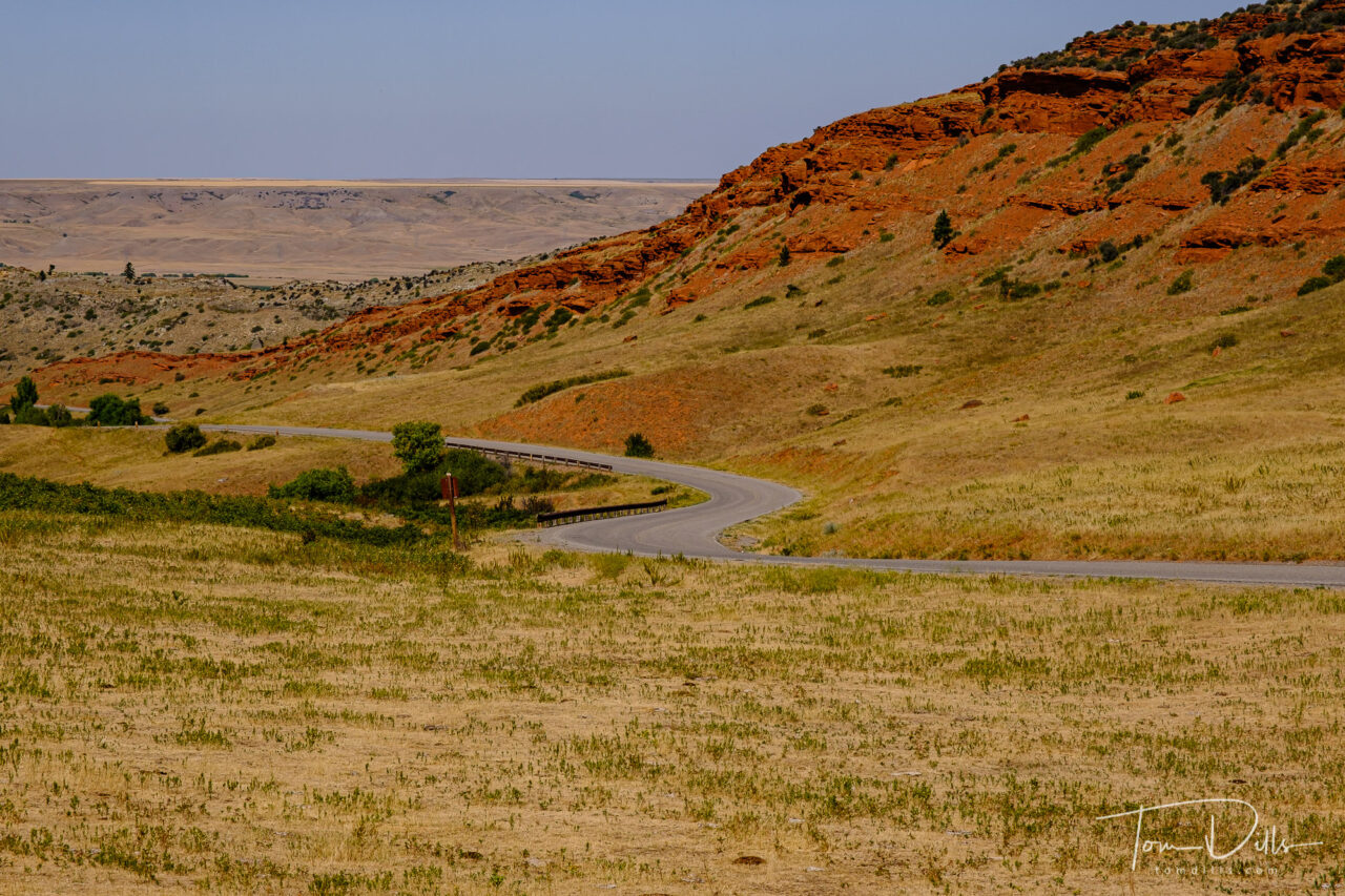
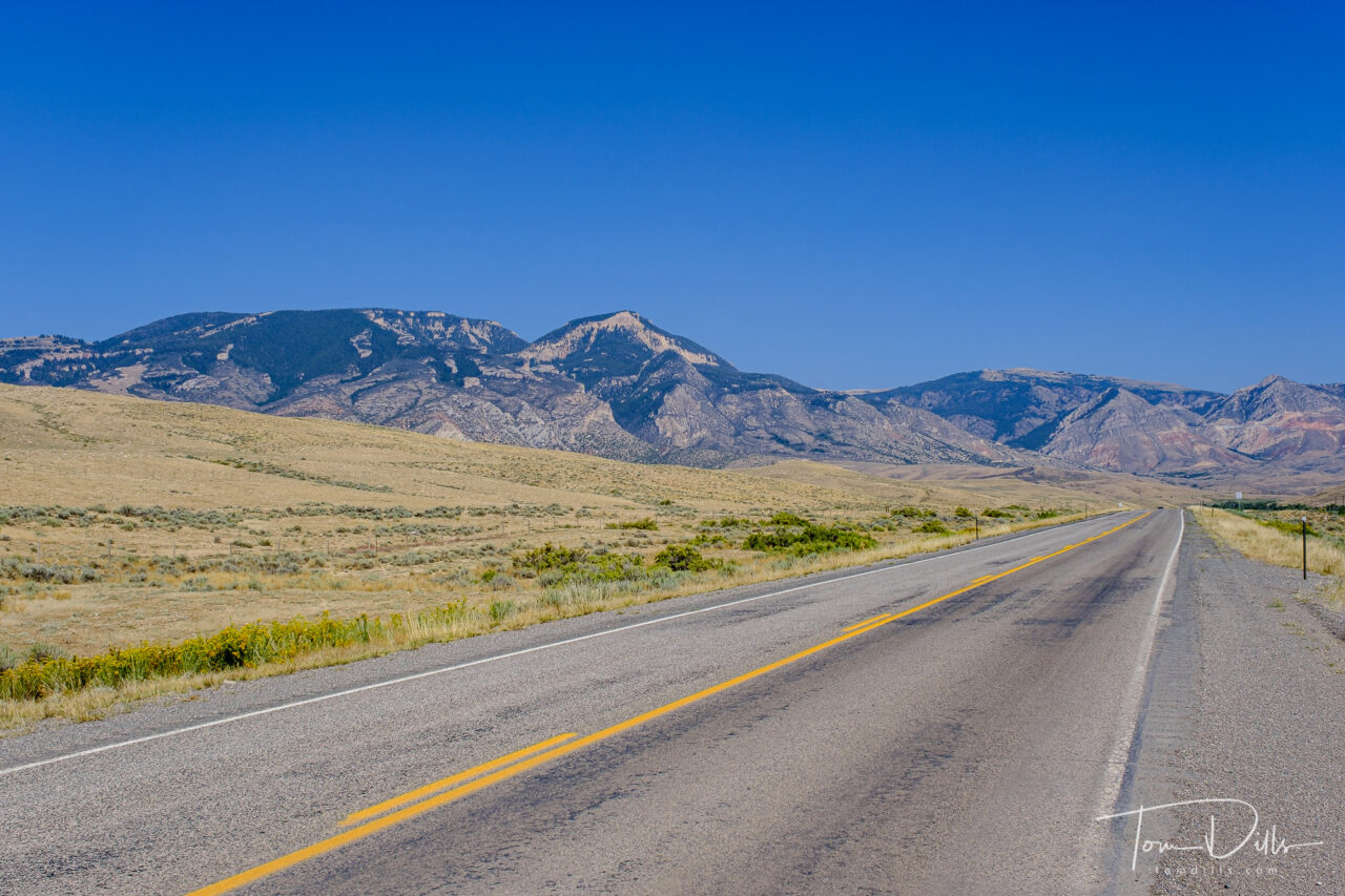
It is rugged and scenic territory, and with all the red rock and lack of trees, far different from what we see in the east, or even in other parts of Wyoming and Montana. Another example of how unique but also how uniquely beautiful the different parts of our country can be.
Yellowtail Dam area in Bighorn Canyon National Recreation Area in southern Montana near Fort SmithYellowtail Dam area in Bighorn Canyon National Recreation Area in southern Montana near Fort SmithYellowtail Dam area in Bighorn Canyon National Recreation Area in southern Montana near Fort SmithYellowtail Dam area in Bighorn Canyon National Recreation Area in southern Montana near Fort Smith
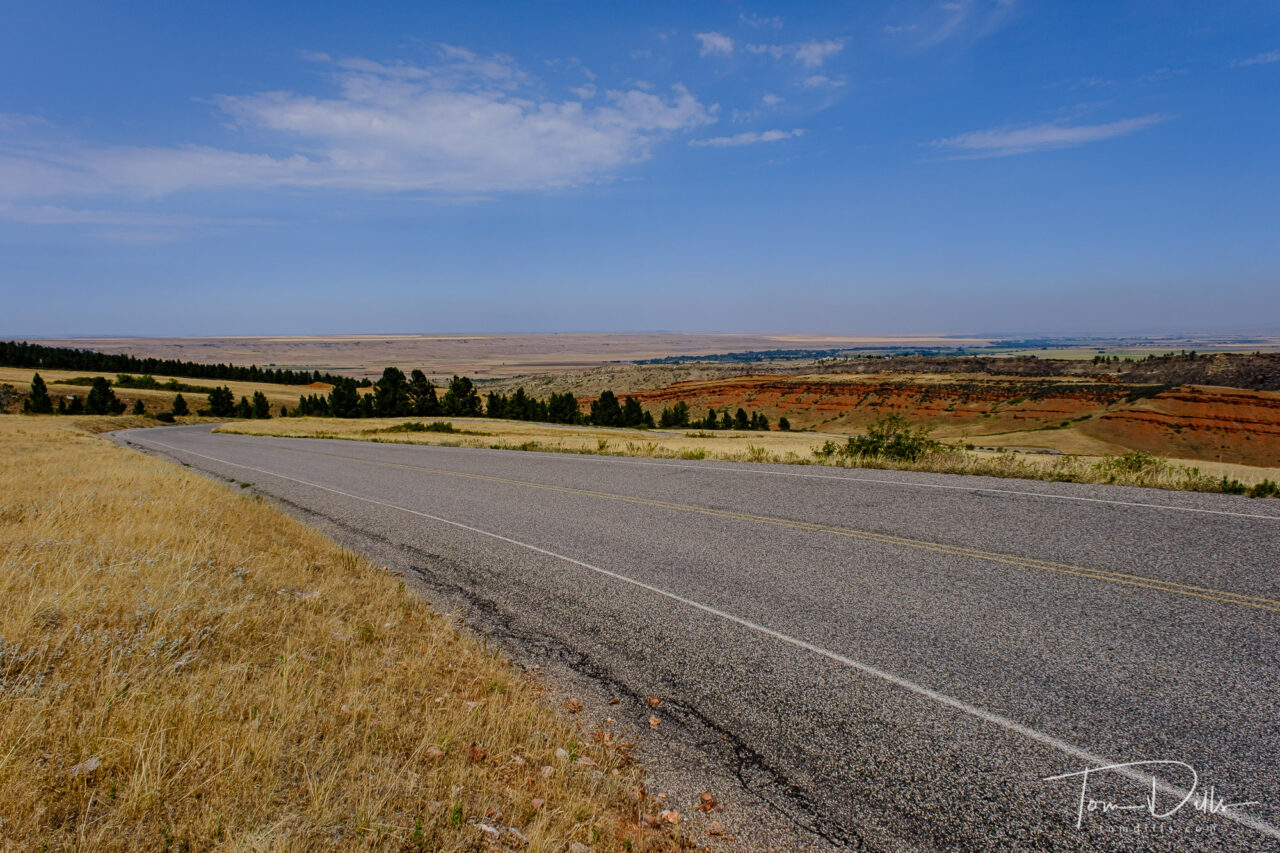
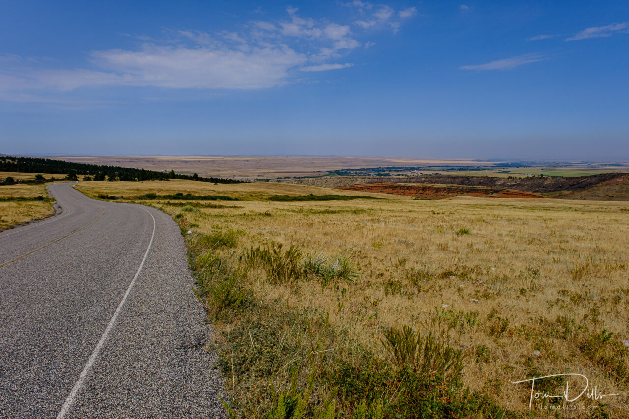
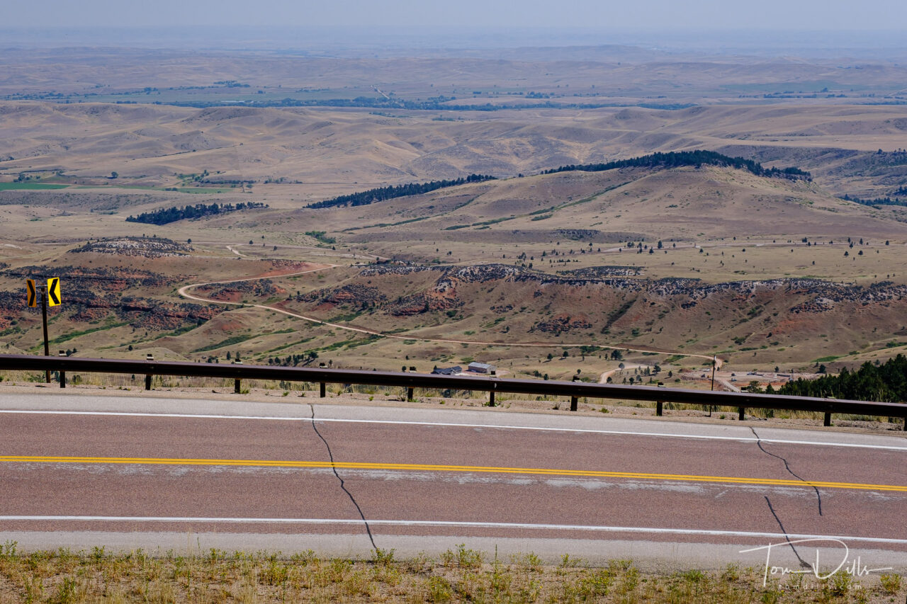
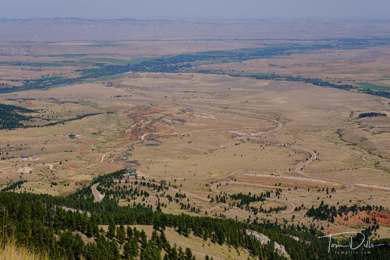
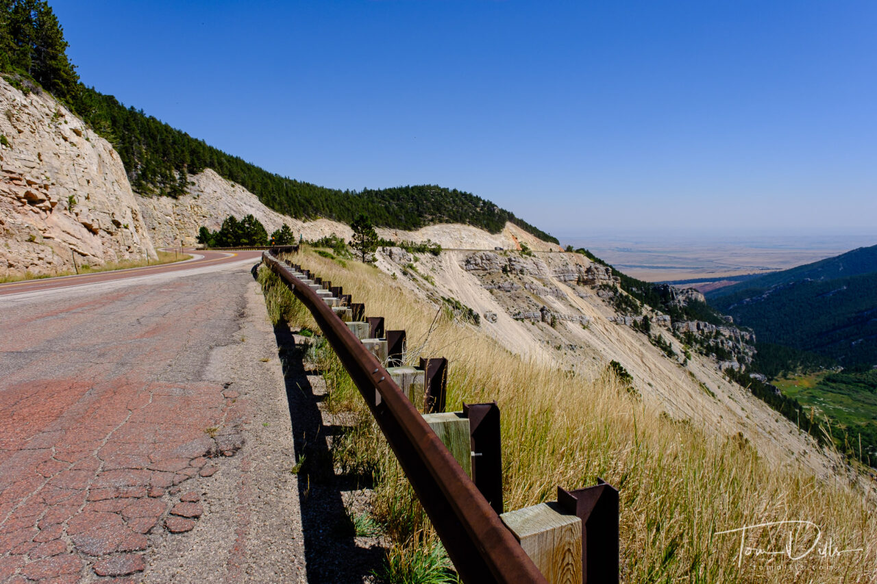
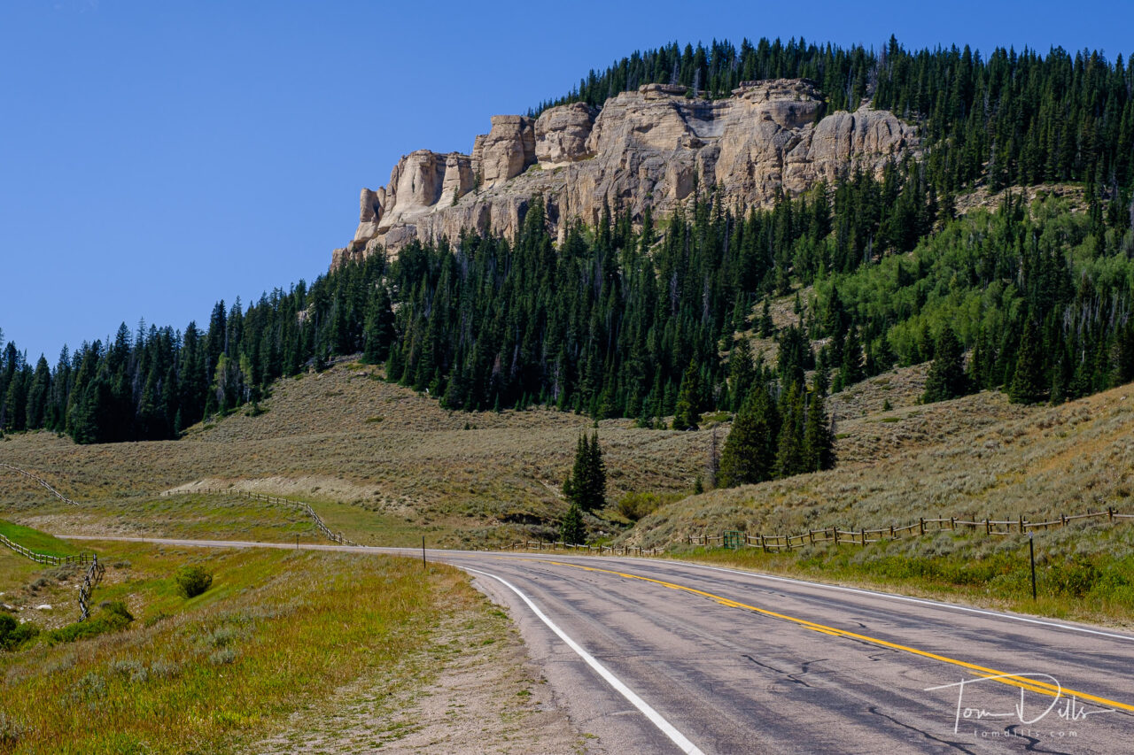
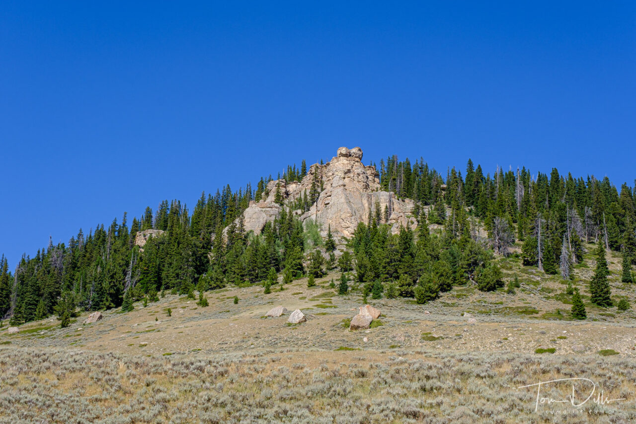
Scenery along Alt US-14 through the Bighorn Canyon National Recreation Area in North central Wyoming
One of the things that maps don’t always tell us is what the terrain is like on a given road or in a given town. We’ve been surprised by this numerous times when we get to a place and it is either hillier than we expected or not hilly at all. One such place came up on our drive through Bighorn National Forest in Wyoming.
Scenery along Alt US-14 through the Bighorn Canyon National Recreation Area in North central WyomingScenery along Alt US-14 through the Bighorn Canyon National Recreation Area in North central WyomingScenery along Alt US-14 through the Bighorn Canyon National Recreation Area in North central Wyoming
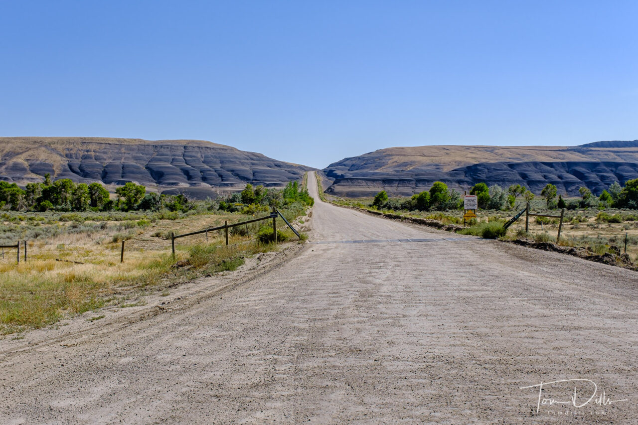
We had spent the night in Rapid City, SD and wanted to get to Billings, MT via Lowell, WY in order to see the southern section of the Bighorn Canyon National Recreation area, which stretches from Fort Smith in southern Montana, where the Yellowtail Dam is located, to Lowell, WY, the southern end of the reservoir. That route took us on 60-ish miles of Alt-US 14 – known as the Bighorn Scenic Byway – through Bighorn National Forest, from near Sheridan, WY to Lowell. And I have to say that it was one of the most stunning drives of any I have ever taken, including Trail Ridge Road in RMNP. The terrain was rugged and beautiful, the road was wide and smooth, and the views were amazing. In hindsight, that might have been a bigger highlight than Lowell, but at the time, who knew?
Scenery along Alt US-14 through the Bighorn Canyon National Recreation Area in North central WyomingScenery along Alt US-14 through the Bighorn Canyon National Recreation Area in North central WyomingScenery along Alt US-14 through the Bighorn Canyon National Recreation Area in North central Wyoming
How rugged is the country in Bighorn National Forest? The road is closed in the winter, as the elevation reaches 9,033 feet at Granite Pass. That’s getting up there, as the highest point on our side of the Mississippi is a “mere” 6,684 feet (Mount Mitchell in NC). By comparison, the elevation difference between the valley near Dayton, WY to Granite Pass is nearly that whole amount – almost 6,000 feet!
Scenery along Alt US-14 through the Bighorn Canyon National Recreation Area in North central Wyoming
I hadn’t paid much attention to this area before, but now that we’ve been there I am anxious to get back. There are a lot of interesting things to see and do in the area. Perhaps a few days in Sheridan on our way to or from Yellowstone or Grand Teton, when we decide it’s time to visit that part of the country again.
Scenery along Alt US-14 through the Bighorn Canyon National Recreation Area in North central Wyoming
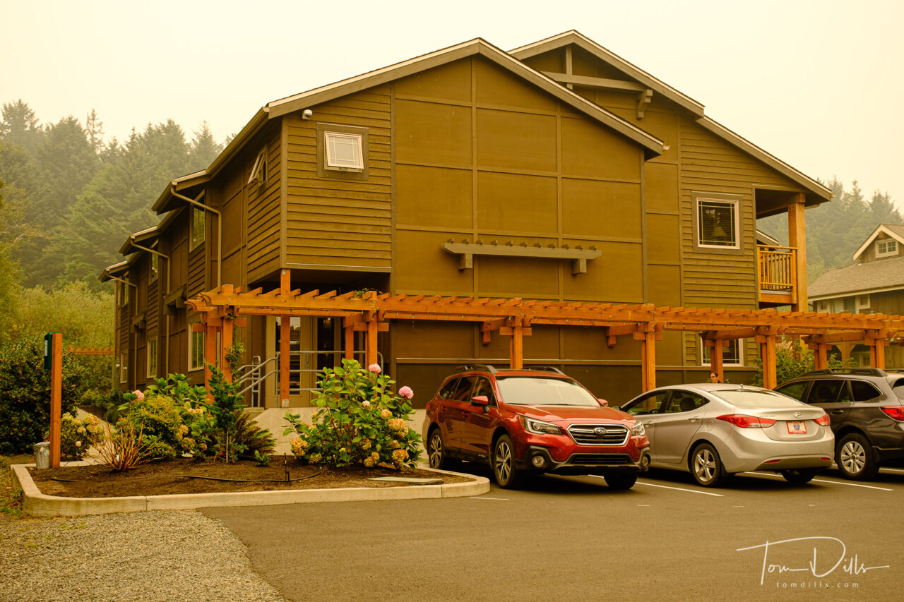
Inn at Cannon Beach Hotel in Cannon Beach, Oregon – photo pretty close to how it looked
Smoke gets in a few other places too, yikes!
Before & after comparison of color corrected white balance and original, accurate color
Several folks have expressed concerns about our well being, and I thought it would be best to assure you that we are carrying on quite well, thank you very much. I haven’t posted for a couple of days, but we’ve actually been quite busy. I’ll catch up with some Postcards shortly but wanted to give this short update.
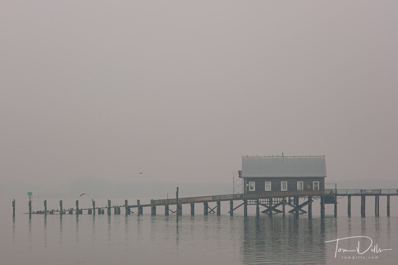
Port of Garibaldi and Garibaldi Marina in Garibaldi, Oregon
While we were in Cannon Beach, Oregon, the smoke moved in with quite a vengeance. And it stayed with it throughout our visit to McMinnville in the Willamette Valley. But other than keeping us from seeing a lot of the beautiful Oregonian scenery, it hasn’t slowed us down much. Tonight (Sunday 9/13) we are in Bend, Oregon. While still in the smoke a bit, we aren’t anywhere near the flames. Rest assured that while we probably passed within 25-30 miles of some of the fires, there is really little danger here unless you are actually close to the fire. The rest is mostly an aggravating, stinky fog, and pretty easy to fix with the right white balance setting in Lightroom! 😉
Port of Garibaldi and Garibaldi Marina in Garibaldi, OregonPort of Garibaldi and Garibaldi Marina in Garibaldi, Oregon
Monday 9/14 we head to Elko, Nevada where the forecast is for sunny skies, with perhaps a little sun but temperatures in the low 90s during the day. We can put our long pants and sweaters away for a few days!
Port of Garibaldi and Garibaldi Marina in Garibaldi, Oregon
Rural scenery in The Palouse area of eastern Washington north of Pullman
There are some places you can go where the secret to making decent photographs is simply being willing to stop the car. The Palouse region of eastern Washington state was such a place for me.
I tend to steer clear of photographic icons for the simple reason that it is hard to do anything original there. That plus the fact that standing at an overlook with a bunch of other photographers isn’t my idea of a good time. But on this road trip we are concentrating on doing our own thing.
Rural scenery in The Palouse area of eastern Washington north of Pullman
We only had two nights devoted to the Palouse, staying in the town of Pullman, WA. When we arrived at our hotel we were informed that a group of National Guard personnel were due to arrive the following day to assist with testing of University of Washington students because the campus – surprise, surprise – had become a hotbed of Covid cases. Swell – so much for distancing.
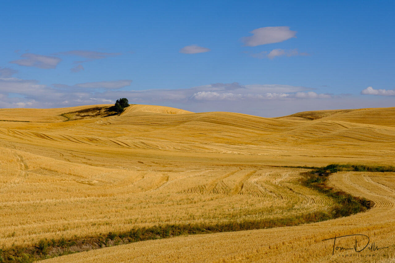
Rural countryside along SR 26 in southeastern Washington
We limited our public stops in Pullman to two mostly empty restaurants and a grocery store. We drove the first evening on mostly deserted back roads, got the car filthy dirty but saw some nice scenery. The second day we awoke to the forecasted high winds and dust storms, so that limited our activities that day. But in 200+ miles of driving around the area we went from places we weren’t willing to get out of the car to places that were clear as a bell, just windy as heck.
“Wheel Fence” at the Dahmen Barn along US-195 in Uniontown, Washington“Wheel Fence” at the Dahmen Barn along US-195 in Uniontown, Washington
One of the meccas for photographers is Steptoe Butte, a high spot overlooking the undulating valleys. We had planned to go there but nixed the idea due to the high winds and dust. So instead we did the sensible thing and sought out a small local restaurant with excellent food and wine. The photos can wait for a return visit!
Rural scenery along US-195 near Uniontown, WashingtonRural scenery along US-195 near Uniontown, Washington
I think I did a pretty decent job of finding “my own” version of the Palouse region. I have hundreds more shots but this is a sample of my initial favorites.
Rural scenery along US-195 near Uniontown, Washington