Our first overnight stop on the return home from Wisconsin took us to the town of Jasper, Indiana. We chose Jasper primarily because it was just about the right distance for the day, but also because it looked like it had an interesting downtown area for us to check out.
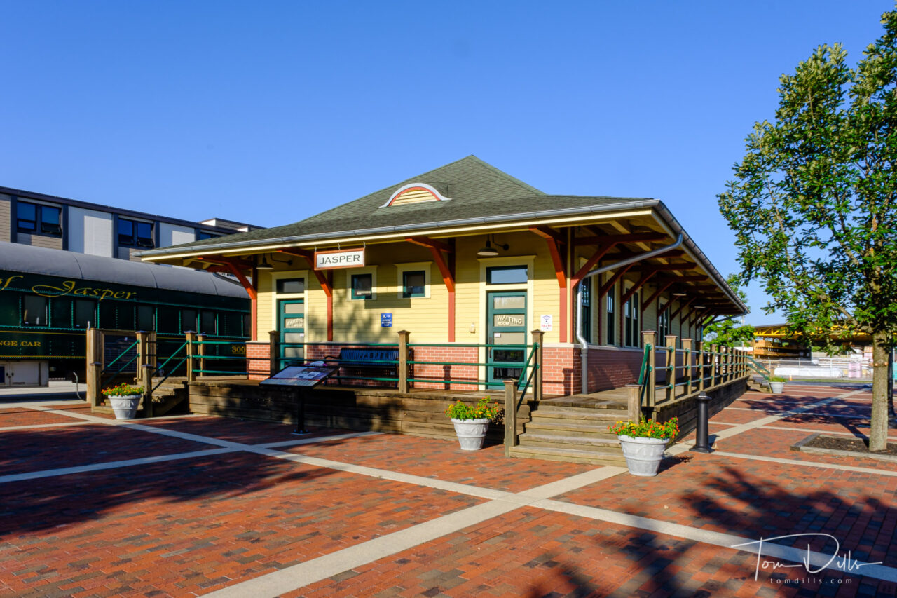
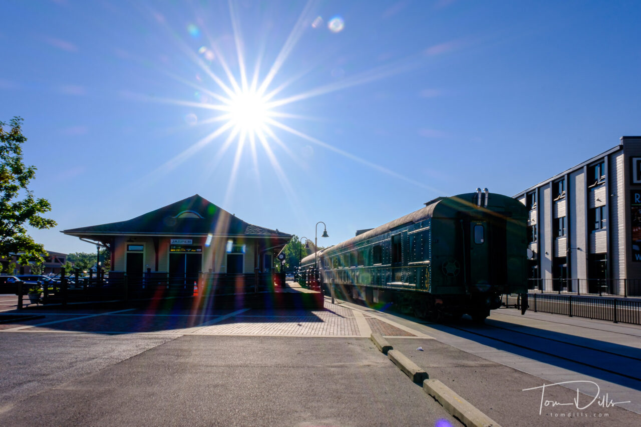
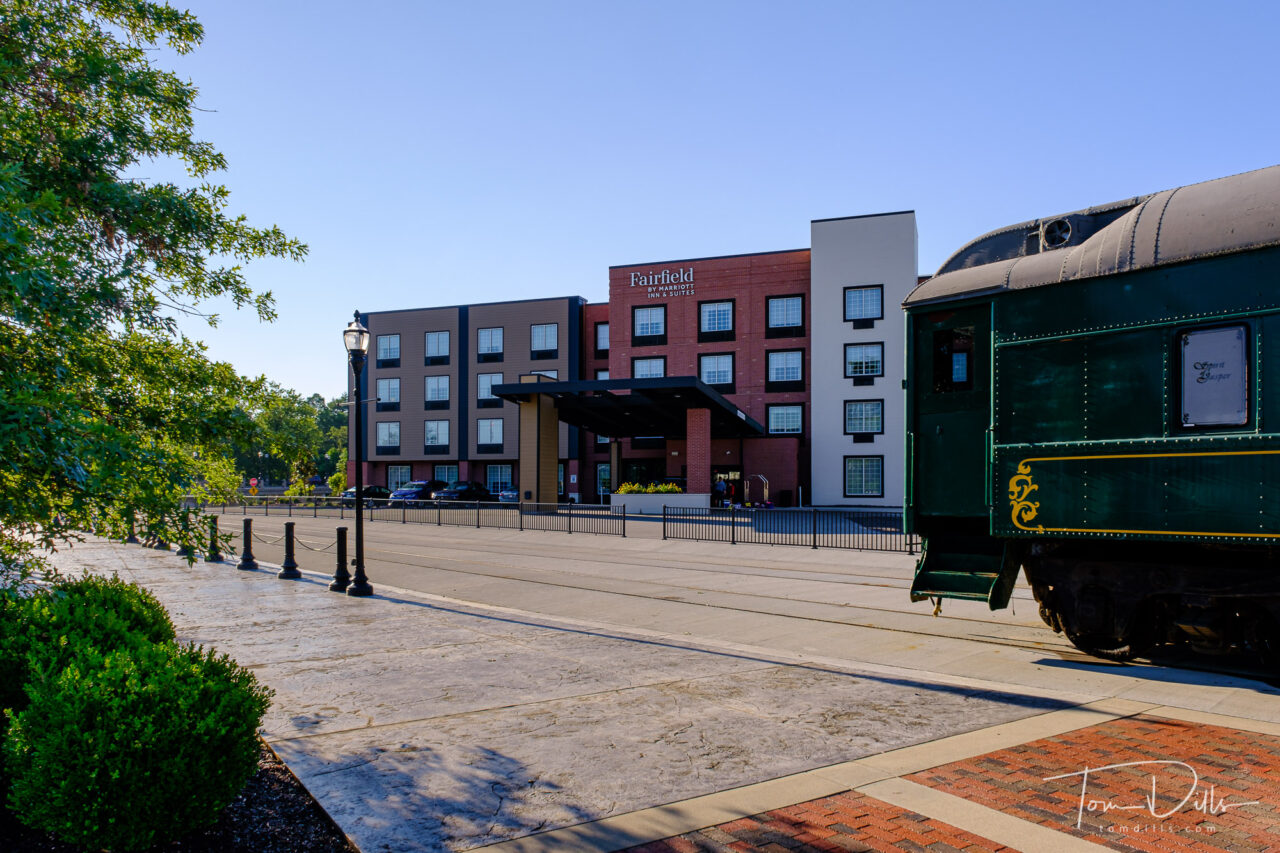
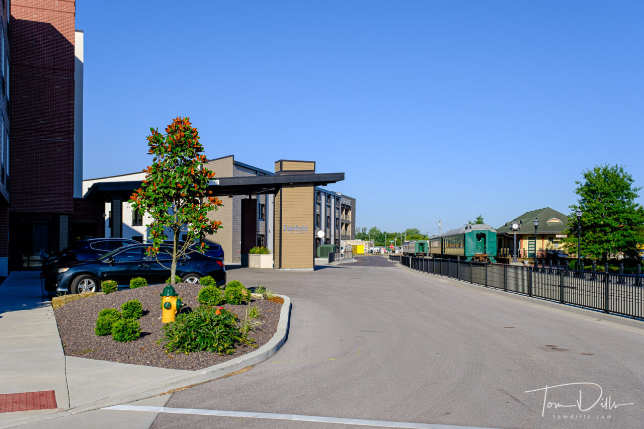
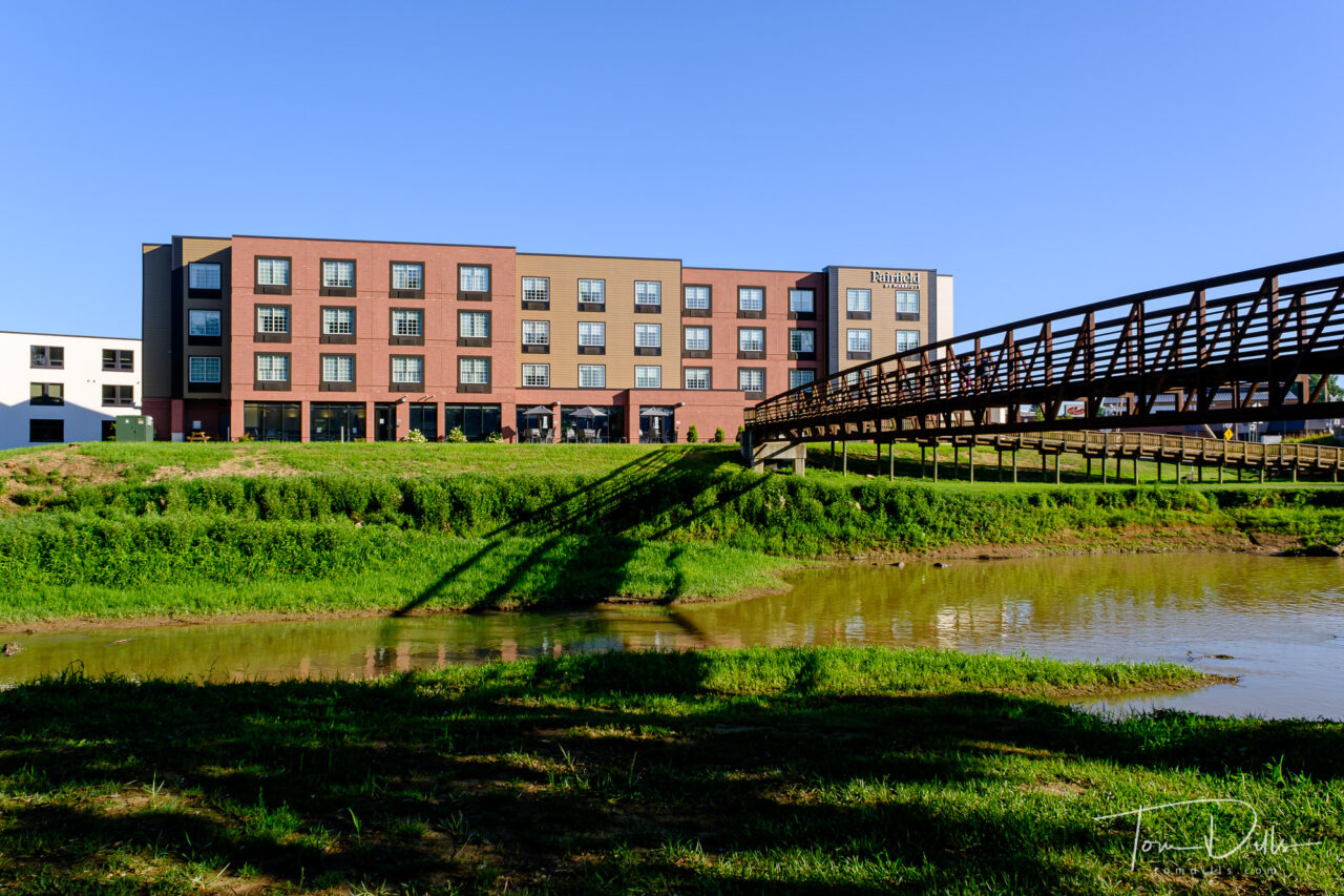
I was initially attracted by the fact that Jasper has a train station, but we noted that the train station was an anchor for a new mixed-use development called River Centre. A brand new Fairfield Inn sits along the Patoka River and is connected to the Jasper Riverwalk, a 4.5 mile multi-purpose trail that connects several businesses and restaurants, and winds through a scenic section along the river.
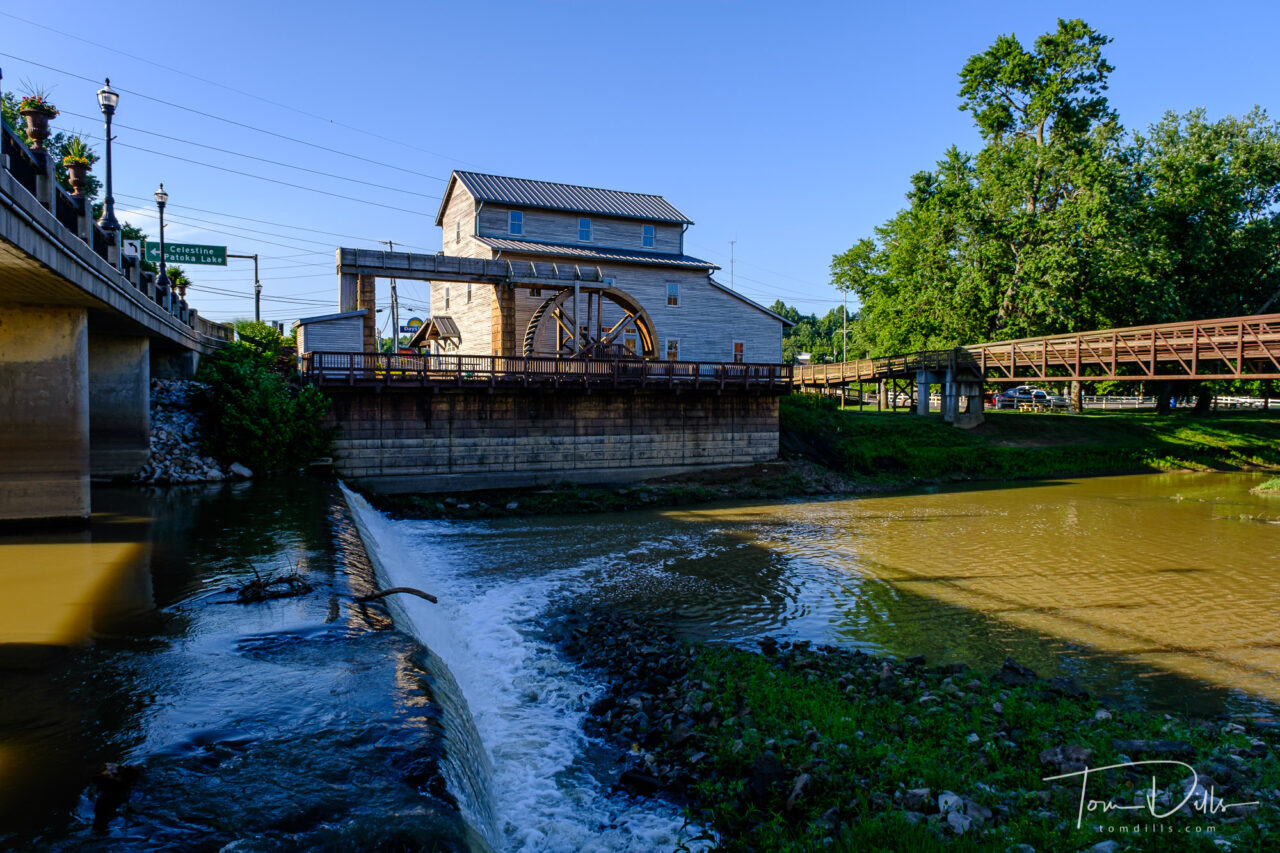
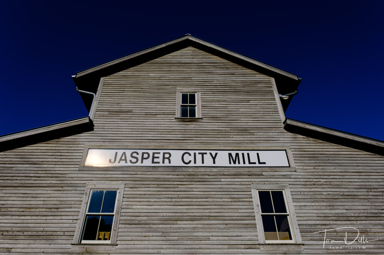
Across the river from River Centre and connected by a very nice steel bridge is the historic Jasper City Mill. The current mill building is a replica of a mill that was established on the site in 1817 and was in operation until 1933. Among the customers of the mill is said to have been Thomas Lincoln and his son Abraham Lincoln, who bartered goods for corn meal in 1828.
We got into town late and left early, and it was a Sunday so not too many businesses were open. But we got a good look at the town – enough to determine that it would be worth a re-visit. It is “on the way” to a lot of places we hope to visit, so we will be sure to add Jasper to the itinerary on a future road trip!
Nice looking town. Did you remove all the people in post or was it simply that empty? 🙂
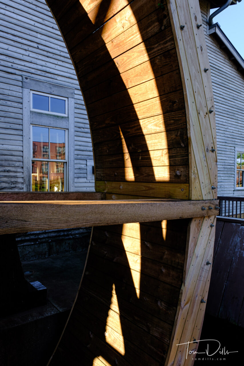
BTW, the last photo of the mill really grabbed me. Very captivating. The light of course and the mix of straight and curved lines, muted colours, all makes for an excellent graphic image.
Ha – that’s my secret! Well, it was about 7:30am on a Monday morning (even though the clock says 6:45am), and since it seemed most of the other occupants of the hotel were members of a girls’ softball team that spent most of the night running up and down the halls, everyone else was still in bed! 🙂 Also, most of the other buildings in that complex were/are still under construction.
I also liked the shadows with lines and curves of the water wheel. Looks good in black & white, too.
Great use of the light and shadows! Yep, it looks like a neat town to visit. Interesting to know how you two choose these locations. By the way, what do they use the Mill for now? Business?
The mill wasn’t open when we were there, but looking through the windows it appears to contain a lot of the old mill equipment. It looked like it could be a working mill, and it looked like they had corn meal and other products for sale.
We start our trip planning by using Google Maps and the “Avoid Highways” option. Then we check out towns along the way and use websites like Roadside America or Atlas Obscura to find points of interest. If there are railroad tracks through a town we look for train stations, and some states have a website listing all the stations, usually organized by county.
A recent addition to Google Maps is an option to show Points of Interest. We haven’t had a chance to use it yet and it seems to only come up occasionally, but it might prove to be another resource.
Interesting as I seldom use Google maps unless I’m lost. Seems to offer a lot more than I thought.